Probably …but it’s only December 2nd. ![]()
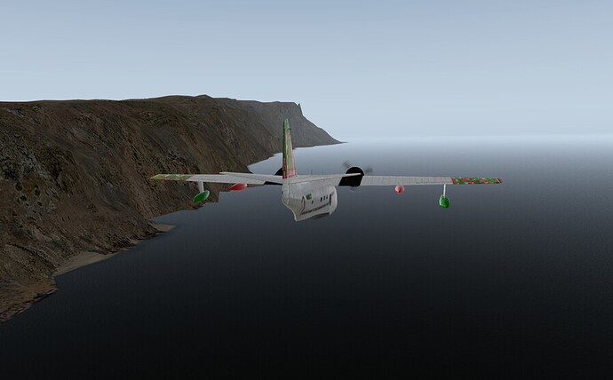
LOVE. the paint scheme! LOL… And an amphib is a great idea in case your fuel calcs end up wrong… lol
Leg 4: MSLP El Salvador to SEGS at Baltra, Ecuador (Galapagos Islands)
First sight of land in a LONG TIME, the Galapagos Island named Pinta…
Swinging around the north end of Isabela, hoping to see into the caldera named “Wolf”…
We didn’t have enough energy to climb above the scattered clouds in time to see Wolf, so the next opportunity was “La Cumbre”…
Not satisfied, but now with enough altitude, we returned to “Wolf” …and what a view we got…
Heading back toward the airfield, we rounded the island called San Salvador…
On short final into SEGS with an 18-knot breeze from just off the port bow…
We’re now just over the Equator and into the Southern Hemisphere…
Very nice! I considered taking it up in my route but decided it was a bit far off in the end. What will be your next destination?
Leg 5: SEGS Baltra to SEST Puerto Baquerizo Moreno to SPUR Piura, Peru
Passing Santa Fé enroute to the Galapagos Island of San Cristóbal…
Imminent touchdown at SEST Puerto Baquerizo Moreno on San Cristóbal to spread some more joy (and cavities)…
Feet dry in Peru, we flew over SPYL Capitan Montes Airport serving Talara…
Turning for the short final into SPUR Piura’s runway 19…
We made a lot of progress today, with a huge amount of assistance from our mutual friend Otto…
I’m a bit late for this, and at a disadvantage being in Vancouver, as that’s quite a way to get that far South!
The first year we did this, I took it slow and steady and chose this as my steed for the North Pole:
It didn’t work out that well, and had to finish in a hurry with this. It ended badly:
Since X-Plane 11 is out in beta, time to make up some miles I guess. Let’s pick something quicker than the Wright Flyer this time.
Hmm, not a great view, so angular. Needs a plant or something.
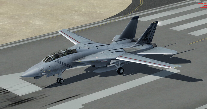
I feel the need…
Light her up! CYVR, cheerio!
I have no idea what I am doing. First thing to work out is a quick experiment to see how far I can get on a tank of fuel, given that I can’t in-flight refuel like a real SR-71 (even if stock XP11 could, I probably couldn’t)
Have about 2 seconds to get that gear up.
Noise abatement procedure on YVR8 SID suspended I guess?
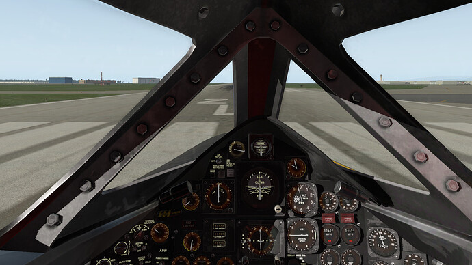
A quick look around the pit, time to train on the job as I go. Just like a real USAF Colonel.
Ooh, an autopilot! That could be handy. Let me dial in 60k and eat my lunch. I have a juice box too, so those dampeners look good right now.
Going up fast now!
Shame the engine spikey things (tech talk!) don’t work, although I think they are moving on there own. Not sure, but nearly all controls in the pit are off in the XP11 beta.
Not very environmentally friendly. Sorry Seattle.
Uh, I mean, sorry Astoria (that was quick!)
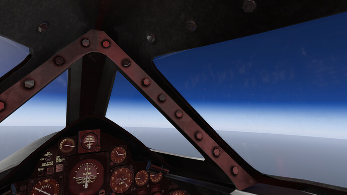
Getting dark at midday up here.
Ok, nicely stable at a comfortable Mach 2.8 angels 60. Nice to see the RSO hasn’t ejected yet. I need him to do that radio thing near LAX when we hear a F/A 18 talk to center.
South Pole here we come!
Will there be some sort of anti-Santa there, perhaps with a goatee?
Ok, I’ll finish the test flight and see what sort of mileage I got. Unfortunately I don’t think fuel use is being modelled correctly, so this might have to be aborted, but fun so far. ![]()
You’ll get some awesome recon photos on the way too…!
MacMurdo Station is about 9,242 miles from Vancouver, BC. I could probably crash there and live as it’s a long ice runway.
![]()
Mach 2.8 is 2,148 mph. Range of a SR-71 is said to be around 3,337 miles. Maybe three hops then.
I have no idea (yet) whether this is of any value, but I plotted the default and add-on air facilities that I found for X-Plane onto a Google My Map.
- Grab-and-drag the map below to scroll it South and reveal the points pinned.
- Tap/Click on a pin to expose its identity.
- Tap/Click on the upper-right corner frame icon to view in a new browser window.
There were a few more places available from x-plane.org, but they were strictly fictitious and I thought that there were enough real sites.
As far as the quality of these destinations, we will hopefully see some screenshots of some of them in the days ahead.
Well, I kicked off with a leg from Austin, Texas (KAUS) to San Diego (KSAN). I figure I will start this in X-Plane 11 Beta and get as far as I can. My work schedule is going to interfere over the next few weeks so we will see how far I get.
I chose the MD82 as my trusty steed, however there seems to be a few quirks with it, so this could be interesting ![]() .
.
The planned route has us flying over El Paso, Tucson and Yuma before arriving at San Diego.

I used real weather, which matches up quite well with what I see out the window… Here we go, departing off 35R at the Austin Bergstrom Airport into the rain and murk.
The layer isn’t very think though, and it isn’t long before we break out on top…
LR did a nice job with the cockpit on the MD82. I am looking forward to flying it in VR at some point.
Something you don’t see every day in the skies over Texas…
Passing over El Paso. You can see the cultivated land that marks the course of the Rio Grande stretching off towards the right (North). This is a pretty good representation of how it looks from the air.
As we proceed West, we fly over Tucson. Here we are looking down at the Davis-Monthan AFB, famous for it’s desert boneyard, and the smaller Tucson International Airport to the right.
In our descent now, we are starting to see some mountainous terrain as we leave the desert. In the background is the Salton Sea, a saline lake that is a great landmark when flying in this area.
San Diego comes into sight!
Spending too much time gazing at the scenery from different angles resulted in a less than stabilized approach ![]() .
.
But all’s well that ends well as they say…
Lots of pics this time, but the next leg to Kona will just be a lot of ocean until we hit Hawaii, so I will just post a few of the takeoff and landing.
@Sine_Nomine I cannot tell you how XP v11 will behave with legacy add-on scenery, as I have not tried it myself …I’m currently using XP v10.51r2.
Leg 6: SPUR Piura, Peru to SCAR Arica, Chile
Beat the Sun back into the air…
The weather was initially clear with a bit of variable wind…
That changed South of SPEO Teniente, when the clouds dropped in and forced us to 1,000 feet…
Passing one of the precious VORs (despite our intentional VFR). This one is SLS Salinas…
Eyeballing SPJC Lima. Pretty nice detail for a default X-Plane airport.
Approaching SPSO Pisco, the weather cleared up (although I witnessed several occasions of XP unlatching the real-weather toggle, which is typical of models with built-in water wave-height suppression)…
A fine vehicle for coastal crawling …and South America has got one (make it two) darn long coastlines.
Welcome to Arica Airport. If your legs still work after sitting for nearly seven hours, feel free to disembark.
Next stop: Santiago and/or Concepción.
Lima looks like it has enough runway for @fearlessfrog to squeeze his SR-71 into if he needs it!
Tuesday I flew my first leg of this (KTKI → MPPA). I’ve just been dragging my feet on posting the pics.
A mostly accurate depiction of the route taken.
Sitting on the Runway at Collin County Regional, waiting to begin this great endeavor.
P3D seems to think Texas in winter looks like a desert. Ironically enough it’s the greenest I’ve seen it in a while currently, go figure. Anyhow this is looking west towards Dallas proper.
Weather picks up on the way to Houston.
Like, really picks up. Notice the drift corrected FPM glued to the left HUD limit.
Feet wet over the Gulf.
Noticing that no one but perhaps the occasional mermaid lives out here, I elect to push the throttles all the way forward and see what happens.
nice
That seems vaguely Spanish sounding. Progress!
The downside of Mach 2 is that it has a nasty habit of draining fuel tanks rather quickly. Luckily I’ve been tasked a tanker for this trip. We RV forty-ish miles off the Yucatanian coast. The winds have also abated, so this should be relatively easy.
Getting some gas.
GIBBO snapping some picks. We’ll need, or rather, want to tank again on the far side of the Yucatan. So for now we’re keeping the tanker company.
Is the opposite of scud running cirrus surfing?
Random Yucatan countryside.
We tank once more over Belize, then I bid our tanker buddy adieu as I accelerate ahead towards Honduras and Nicaragua.
Honduras.
Nicaragua passed without comment. Of worry are the increasing number of rain showers as I approach Panama.
I penetrate the deck to race along the length of the canal. Pictured here are the Pacific locks.
Landing at Panama Pacifico (ex- Howard AFB) isn’t pretty in the weather, but nothing broke, so there’s that.
Sitting on the ramp, shutting down the jet with Panama City (the real one) in the background. My GIBBO and I are discussing how much of a head start we can throw on before the tanker gets here.
Damn, even Panama looks like a desert in FSX.
Noice! And also very courteous of you to fly into Central America unarmed…lest they think they are under attack.
Ish, lol. I’ve got a full load of cannon I can’t figure out how to dispense of short of arming and holding down the trigger. I’ll call it defense against unruly penguins.
![]()
Very nice posts guys! I am getting off schedule not only with my flights but also with following your posts ![]()
This was my Hop no. 2 from Arcata KACV to Buchanan KCCR.
I was inspired by this FlightSim review (I also own this Piper for FS9) and fired up my FS9 = Loaded it onto USB an runing it on the laptop. Not bad performance I would say ![]()
Weather at KACV was not ideal. But it was VOR to VOR flight on AP so no worries

But it cleared bit around San Fran

I decided for KCCR because it has nice VOR approach. It is quite simillar to NDB approach I would say but little easier with the DME on board

As lot of you guys are flying via americas so I decided to catch an airplane at KSFO and return to EU. I will continue down from old continent via africa ![]() at least thats my actual plan
at least thats my actual plan
Leg 7: SCAR Arica, Chile to SCVM Vina Del Mar, Chile
Airborne at 0545 to continue southward down the long Chilean coastline…
Six hours and 900 miles later we make our arrival into Vina Del Mar…
Next stop: Balmaceda, Chile
Next next stop: Antarctica!
Paving the way!


