How so?
Cobra stated on Reddit yesterday that the release is “definitely” coming in 2022. Maybe referring to that?
3 Likes
I might be in the minority, but I would be perfectly okay with a basic, not super detailed Vietnam map. Even half-scale, if it ran well (not like the Marianas).
6 Likes
Yeah, they put so much ‘clutter’ in there. At least clutter to me. Looks great yes, but at least give me the option to remove all the Tactical Umbrella’s, reinforced lawn chairs, and other things. Those that like that stuff can turn it on. Who knows, maybe it’s something else.
I’d want a full-sized SEA map personally. If it’s a period-specific one then it’s 99.98% trees, right? A quick polygon area check shows something the same area as the current PG map would be about enough.
1 Like
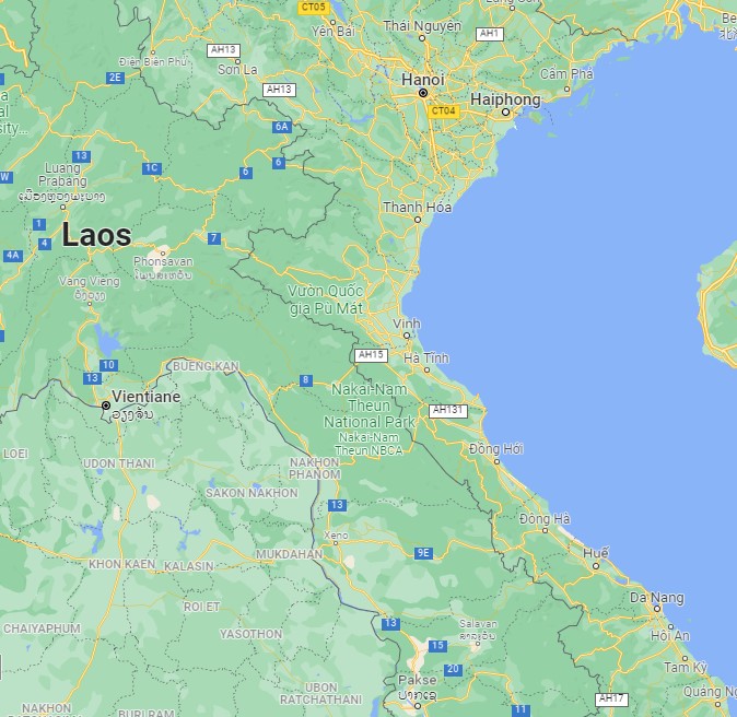
I’ve thought about this a bit. To get most of the targets up north, Hue, Da Nang, Ubon, Udorn, Udon Thani, Dien Bien Phu, Tchepone, Laos, a large portion of the Ho Chi Minh trail, the Thanh Hoa bridge, Khe Sanh, and Yankee Station, this would do nicely. I do worry that it would be a too much to take on. That is if it’s not underway already. Hanoi to Da Nang is 375 sm / 604 km.
6 Likes
Vietnam is just the wrong shape for a game map!
I propose a rule that from now on, all potential wars shall only be conducted within neatly defined square or rectangular boundaries.
6 Likes
That’d be great, but they also promised F-14 in 2017 “Unless loss of life or limb.”
Fingers crossed, though.
3 Likes
still waiting for that early F14A ![]()
Without at least one base in Thailand, that map aint complete…
With my toddler level knowledge of geography I oughta stfu lol.
5 Likes
Back in the days of paper charts (maps), we swore that wars only started in an area where there was at least 3+ chart edges.
…so you would have to paste them together with rubber cement…and try to match up the Lat/Long lines…now I’m getting all nostalgic .
12 Likes
That plus the fact the teaser appeared to be all CGI without anything actually DCS in it has me quite worried about that release estimate.
“Artistic License”, perhaps? Hopefully ![]() <— lets start something new: “EOD” - Emoji Of the Day. Me first.
<— lets start something new: “EOD” - Emoji Of the Day. Me first.
3 Likes
I found a more period correct map at the Library of Congress that makes it much easier to locate the POI. Airfields are in red. The forum software reduces the resolution (rightfully so), but if you download it, you should see POI more clearly.

6 Likes
The face definitely is, but I dunno about the actual airplane. It could just be DCS bathed in a load of post in like Adobe Premiere.
Almost every airport I’ve ever been based out of has been at one of the upper corners of the sectional, so I feel your pain. Thankful for electronic charts and iPad wizardry now.
Just got the book… but… but…
…there ain’t no pictures!
Looking forward to reading it!
5 Likes
It’s not that kind of book ![]()
![]()
3 Likes
The algo thought I might like this. Works here:

6 Likes