Wow. Guess it didn’t take long to damage the tires and landing gears to the extent releasing the breaks didn’t matter any more. Wonder how people felt on board
I’m just amazed that Airbus - Masters of Automation, didn’t have some sort of logic on that system that was tied to a squat switch that says something like “Hey…no weight on wheels, Parking Brake is engaged, but we aren’t going to let that happen and will instead default to MAX auto braking or something…” It must just run straight logic from the parking brake switch/handle to the brake hydraulics with nothing in between. Ouch.
that’s a nicely done awesome video, and great flight! I do love the music with GeeBee
Thanks for the family history @Sine_Nomine.
Wheels
Edit
Replied to the wrong post. Was intending to reply to Cygon_Parrot’s post.
https://forums.mudspike.com/t/macrobertson-air-race-2019/8273/494?u=wheelsup_cavu
Leg 17: VTSP to WMKP via [no available NDBs]
Aircraft: Carenado Beachcraft Bonanza F33A w/ SimCoders Reality Expansion Pack;
Addon: FSFlyingSchool 2019 for X-Plane 11
Addon: ActiveSky XP;
Addon: UltraWeather XP;
Date: 22 May 2019
Weather: Historical 22 May 2019 @ 07:45 UTC (14:45 local)
Takeoff: ~ 08:00
Leg | Total | |
---|---|---|
Planned Distance | 207 nm | 6711 nm |
NDB Beacons Tuned | 0 | 67 |
Weather ‘Situations’ | 0 | 6 |
Duration | 01 H 38 M | 43 H 00 M |
Location: Food Court Airport, Arrival, Sungai Tiram, Permatang Damar Laut, Barat Daya, Penang, 11900, Malaysia
Briefing Notes:
This is the first leg where I did not have an NDB beacon to tune to help me navigate! I have had segments of my previous flight plans out of sight of the helpful NDB system but never had to rely on visual navigation up to this point. Lucky for me I didn’t have to head far off shore to try to cut down on the flight time! A series of islands and coastal features, along the way, would provide ample navigation references and allow me to not stray too far from shore or overshoot my intended destination.
I was having a hard time finding a good window to head down the coast, however. I think that because I was on the west side of the land mass, I was running into semi-regular periods of rain and thunderstorms that may just be regular to the region. Either way it left me a limited window to attempt the segment.
Other Media and Notes:
Uneventful startup and taxi. Using LittleNavMap was nice because, with it, I could plan my destinations around airports that had some decent scenery; or maybe the scenery is this nice all over the map and I am convincing myself to accept my own convenient lie . Either way, whenever I find an airport that has it’s parking spots displayed in LittleNavMap, I have been getting some good terrain.
Yup. I am actually heading uphill on this taxi.
Of course, not uphill to that hanger, at any rate. Wonder what power setting I would need?
And departing…
I do appreciate the weather graphics as well.
And the VFR navigation opportunities around those clouds.
My alternate, should things go sideways.
I guess I am holding my camera out the window? Probably not a good idea. Wonder what the terminal velocity is for a DSLR?
Downwind
I guess you can call for a fuel truck in X-Plane and it will, literally, show up. And park a tad close for my taste … but I guess it is only a $40 module and not an expensive real-world airplane
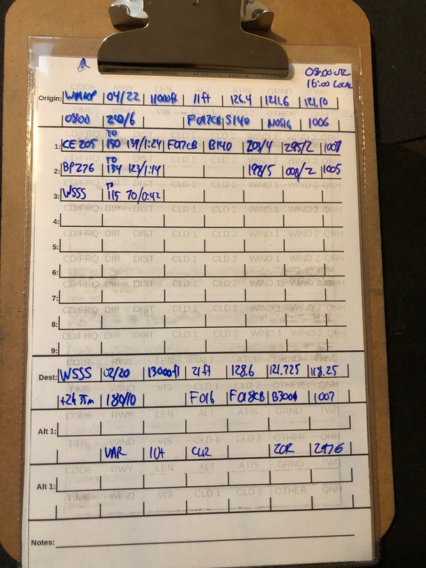
Leg 18: WMKP to WSSS via CE, BP NDBs
Aircraft: Carenado Beachcraft Bonanza F33A w/ SimCoders Reality Expansion Pack;
Addon: FSFlyingSchool 2019 for X-Plane 11
Addon: ActiveSky XP;
Addon: UltraWeather XP;
Date: May 26, 2019
Weather: Historical May 26, 2019 @ TIME UTC (TIME local)
Takeoff: ~ 08:20
Leg | Total | |
---|---|---|
Planned Distance | 333 nm | 7044 nm |
NDB Beacons Tuned | 2 | 69 |
Weather ‘Situations’ | 2 | 8 |
Duration | xx H xx M | 45 H 21 M |
Location: Airline Cargo Road, Changi Airfreight Centre, Loyang, Kampong Ladang, Southeast, 819480, Singapore
Briefing Notes:
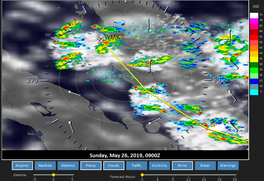
Straight down the coast from WMKP into the loving, safe arms of the CE NDB. It makes navigation so easy it is cheating (literally, for the time period that we are simulating) :-). Couldn’t be easier, right? Just have to find a suitable weather window on the west coast of the thunderstorm magnet landscape.
Turns out to be correct. I have some rain in the area and that translates into thunderstorms. In hindsight, ActiveSkyXP is set to generate these thunderstorms whenever it sees CB in the METAR - which means, and correct me on this if I am incorrect, that I have been experiencing more thunderstorms that actually happened because each potential thunderstorm cloud was converted into one. Oh my.
Out of the gate:
And the destination, if I end of being faster than my planned airspeed, which I usually am, will have something similar. If I wait, it gets worse at the start, but better at the end.
Other Media and Notes:
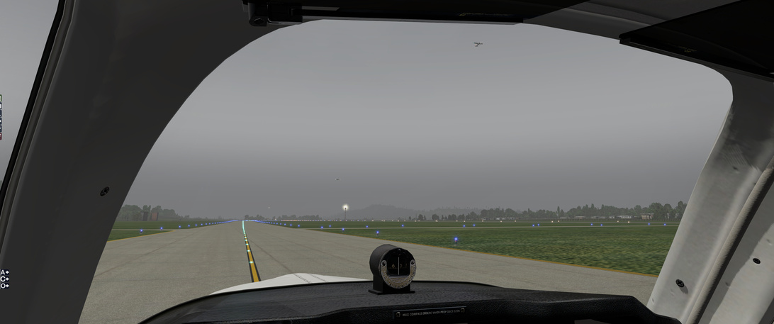
Ominous skies with the odd lightning strike. But … no one else seems to mind it, so I can’t back out now, can I? Of course in the real world, I would have tied the plane back down and left it for another day
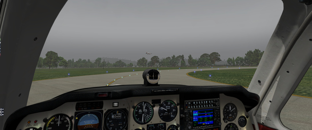
They don’t seem too shaken up…
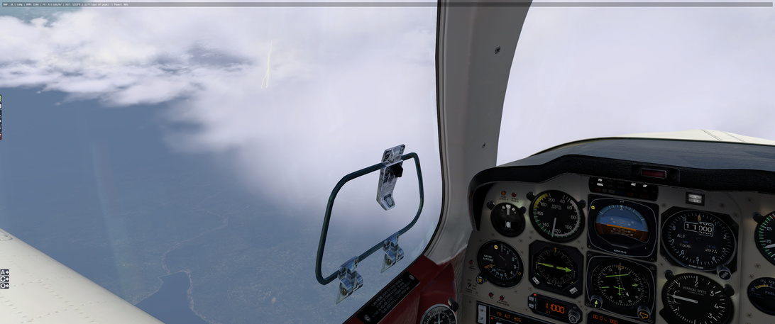
Lightning in the distance on the climb out.
And I run into it. So much so that I end up stalling and plummeting back to mother earth. I tell you what is scary, trying to pull out of a stall/plummet in IFR flight.
But I manage to do it without too much altitude loss. So there is that. I may need to get a new seat however. So, add 1 to the ‘weather incident’ column for this flight
Shortly after I am out of that nasty weather and back enroute.
Scenery in the area is, again, very good. Much better than I expected, but I tend to not fly X-Plane a lot (this trip has multiplied by flight hours in X-Plane by a lot).
Trying for some fancy shots … and a beautiful model by Carenado of the Beachcraft Bonanza F33A.
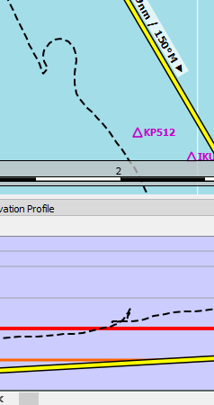
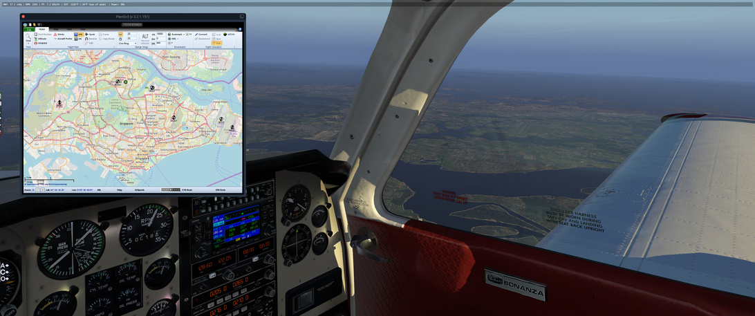
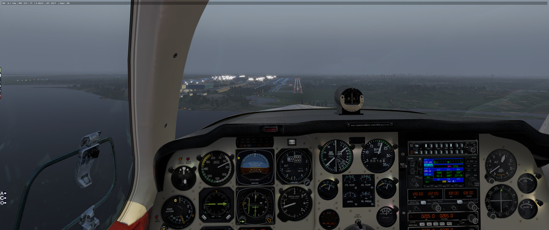
Planning ahead as I come up on Singapore. I plan on following the water and counting the airports on my right … should be 5th one as I circle in from the coast.
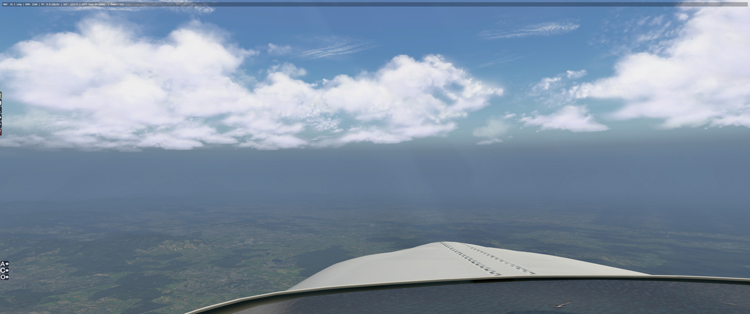
And then the weather drops in on me. One minute, clear skies, the next I am being thrown around like a rag doll. I think I have my ActiceSky XP settings finally figured out but on this flight, it went pare shaped in a hurry. I will point you to this post for the video details but moments from the previous picture I went to this:
Note the sudden onset of a negative vertical speed But I was able to persevere, in spite of mother nature twice trying to end my virtual life.
Looking at the clouds, it is easy to see/pretend/imagine what I ran in to, I just wish I could have seen it coming
But, yeah. Gonna need a new seat
Leg 19: WSSS to WIOD via TI, OI, ND
Aircraft: Carenado Beachcraft Bonanza F33A w/ SimCoders Reality Expansion Pack;
Addon: FSFlyingSchool 2019 for X-Plane 11
Addon: ActiveSky XP;
Addon: UltraWeather XP;
Date: DATE
Weather: Historical DATE @ TIME 01:00 ( 08:00 local)
Takeoff: ~ 08:20
Leg | Total | |
---|---|---|
Planned Distance | 354 nm | 7398 nm |
NDB Beacons Tuned | 3 | 72 |
Weather ‘Situations’ | 0 | 9 |
Duration | 02 H 30 M | 47 H 51 M |
Location: Buluh Tumbang, Bangka-Belitung Islands, Indonesia
Briefing Notes:
This is the first leg in a long time where I seem to be operating in overcast conditions. There were low cloud layers in France, which made things interesting and there were thunderstorms and cloud fronts scattered all over but this is one of the few -RA conditions that I have hit. Luckily, I have NDB’s along the route so I do not have to rely on visual identification of land features.
One different ‘by design’ route feature will be when I hit the OI beacon, I intend, instead of driving down it transmissions, to cut across it to the left by 20 (20ish) degrees to intercept the 110 radial to ND and the WIOD airfield.
So as soon as the OI NDB needle becomes active, I turn left 20° until the NDB needle reads 110 degrees away … which would put me on the 110° radial out of the NDB … I think. Not sure if that is clear but the picture above likely makes it more confusing :-). Above, I was looking to see which radial/direction inbound to NB I would need to cut the corner at OI. I am probably using the wrong terminology.
Put another way, I would be travelling 152° from TI (off map north) to OI. When the OI needle becomes active, if I turn to a course of roughly 130° I should be able to pick up the NB NDB between the 110° and 130° radials.
This will shave some distance and time off of my flight. Here is how the track played out:
That may make it clearer than my description
Weather looks acceptable. Nothing ‘significant’ in my way.
Other Media and Notes:
Wheels up at WSSS
I get a glimpse of an island off my right and it looks like the one I would see as I cross the equator. This is a momentous occasion as it is the first time, that I can remember, where I am flying in the southern half of the globe. I have switched from summer to winter
Other than that, this is what my view looked like for most of the flight.
or
Trying for a dramatic bank shot but it’s not great. I am turning the 20° left of my 154° course after the OI needle comes alive.
Another one where I am turning to a course of 110° just as the NB NDB needle becomes active as well, putting me right on that 110° course to ND.
Just before this I had some strange lights below me on the water. The appeared to be stationary, forming a straight line. The first one is just behind the left wing, with the other two out in front.
No idea what they were.
Landing was uneventful. Little cross wind from the left, a bit under the published value for crosswinds for this aircraft. Nothing else to report
Hi team! Well, I’ve emerged from my work-toddler-sleep-work hole for a quick flight - I needed it, so had to make it happen!
Not least because of this lady:
I had to take her on a maiden flight and what better way to do it than finally get out of Karachi.
I had a bit of interesting drama at the airport. The starboard engine decided to shut down for no apparent reason as I was taxiing. I checked all the obvious reasons, but nothing made sense. I restarted the engine, which worked out fine…but the RPM needle was moving really jerkily. Almost as though the sim was stuttering…but the sim framerate was fine and the left engine RPM needle was moving smoothly.
I did a runup and turned off each magneto - that fixed it. Unsure if that was a bug or something simulated. In real life I would not have taken off with that engine…but it would have been a bit of a lousy return to my journey if I taxied back to the hangar. So off I went. It was really hot at the airport, over 40 degrees…but the Duchess didn’t seem too sluggish to accelerate, which was nice.
Visibility at Karachi was about 6km - not great.
I didn’t have much of a flight plan so I just headed out to sea and figured I’d turn East once I’d climbed a bit and figure out where to go.
The visibility got a lot better as I climbed. I fiddled the mixture and the props to something resembling cruise and got the map out.
In the end I decided to fly to Ahmadabad (VAAH), some 250 NM away in the East from where I’d ended up while reading the map. It was relatively easy to figure out my location, as the Bhuj VOR DME was within range.
Arriving at VAAH.
Leg time and distance 342NM, 2:08.
I’m excited about flying the Duchess more, although interestingly the Turbo Arrow flight model feels a lot more ‘alive’ - but it could be that the Duchess is just more stable.
Nice! I have her in my hanger and looking forward to flying her.
I readily enjoyed the history lesson. It is not a location that I have invested much time in, so it is good to read these stories! Nice job!
yet you write them so well. I like these diversions. You should have done them at the other sites as well
It was a good read on a subject unfamiliar to me. I always enjoy those types of side bars as much if not more than the actual AAR’s
Wheels
It will be talked about around the dinner table for years
Back onboard ‘Valhalla’ - heading towards Allahabad from Ahmedabad via a couple of VORs.
Planned route:
Weather looks good on my route on ASXP and through the windscreen too:
The winds are quite variable along the way, by the looks - I’m not going to be so lucky with the tailwinds as I was around the Mediterranean. There is a bit of thunder and bad weather further South around Hyperabad and off the coast of Bangladesh, but that’s a little way away.
There are some high pressure things happening further North, but who knows what that is all about. I don’t think I’ve ever seen pressure maps look like that in New Zealand, maybe it is to do with the mountains:
Either way, all is rather boringly well at the moment, which is good - I don’t have a lot of time (just Eva’s nap) so might as well try to make some drama free headway.
Turning at the Pratapgarh VOR to fly out radial 080 towards Khajuraho VOR:
The weather stayed mostly good through the flight, with a little bit of local low cloud now and then.
Allahabad airport in sight…and I started my descent way too late again.
There was an easterly breeze at the airport so I joined downwind for runway 12.
Red over white, you’re all right…
Better keep going while the going is good. I’m heading towards Calcutta.
Weather looks a bit interesting. I’ve just left Allahabad and the weather is fine here, as well as on the three weather stations ahead along the route. Things might get interesting close to Calcutta, however. The forecasts show potential thunderstorms, which is confirmed by Windy data:
Further East at Chittagong the TAF looks even worse with a long list of worrying abbreviations. As of right now though, all is well with the weather. The river Ganges is keeping me company, making pilotage easy and life is good.
Edit:
I have just crossed the Sone river, pleasingly right at the predicted location over the Sone and North Kone river fork. The weather still holds, although some of the forecasted cloud has started to form.
This part of the route has a comforting pair of airfields both in the North and the South, should I develop any serious trouble. I’ve dialed in both VORs and tower frequencies, just in case.
A bit more cloud forming as I push on. I climbed to 12500 ft to get over the clouds and get a bit more fuel efficiency.
That weather warning is drawing a bit close for comfort, though:
90NM out, now a solid undercast beneath me. This could get interesting yet. Current Calcutta weather is still manageable, although not easy with 5km visibility, haze and a few layers of scattered could.
The forecast is for thunderstorms and rain, though. I hope I can get there before the weather closes in completely. My alternate is not looking great either, but there are some airfields a bit further north that might work if all else fails - it looks like the weather is worse the more south you go.
…and then I got socked in and rattled around a bit. I descended down from 13,000 to 10,000 feet and found a bit of calm air between dark cloud layers. I’m now 40 NM out and maintaining a 500 fpm descent through the cloud, IMC. Winds are 070, so there will be a crosswind component. If the conditions allow, I’ll pursue to land on runway 1L.
The weather was awful on the way down. Turbulent air, very little visibility. Thunder cracking somewhere uncomfortably close. The VSI was going up and down like mad and it was all I could do to hold on and try to maintain a steady descent and to stay within the green airspeed range.
I decided to see if I could land with a little help from the VOR DME and ADF equipment onboard. I was approaching from the West, but I wanted to land on runway 01, so at about 20 NM out I took a SE heading and circled around until I was on radial 190 (an agonising wait as I was getting bumped around constantly by the weather). I also tuned in the ADF needle for additional SA for the exact heading of the airfield.
At 2500 feet barometric I could make out the ground.
It was slightly unnerving to watch the skycrapers emerge from the muck…I just hoped that the visibility wouldn’t get any worse.
It was a true relief when at 6 NM distance to the airfield I could make out the lights and knew that I was where I thought I was.
In the end the crosswind was quite light, so the landing itself wasn’t too challenging.
What an exciting flight and what fun! I knew that I took a bit of a risk heading into that forecast, so it didn’t come as a surprise…but that certainly didn’t take away from the excitement.
Good luck man, may the force be with you
They might still charge you for ATC services! Better not link your Paypal account!
Leg 20: WIOD to WARR via ND and BA NDBs
Aircraft: Carenado Beachcraft Bonanza F33A w/ SimCoders Reality Expansion Pack;
Addon: FSFlyingSchool 2019 for X-Plane 11
Addon: ActiveSky XP;
Addon: UltraWeather XP;
Date: 07 June 2019
Weather: Historical 07 June 2019 @ 01:00 UTC (08:00 local)
Takeoff: ~ 08:20
Leg | Total | |
---|---|---|
Planned Distance | 421 nm | 7819 nm |
NDB Beacons Tuned | 2 | 74 |
Weather ‘Situations’ | 0 | 9 |
Duration | 03 H 10 M | 51 H 01 M |
Location: Terminal 2, Jalan Ir. H. Juanda, Gedangan, Betro, East Java, 60900, Indonesia
Briefing Notes:
Snuck in a flight last night while doing chores and unwinding from the work week. This one is going to be a leap of faith across the Java Sea to Surbaya. Figure if I head out from the NDB on the island of Billiton, I can make the leap across the sea and cut some time off the track.
All (90%) of this route over the sea will be out of NDB range so I have to try and pay attention to the wings at the crusing altitude of 9000ft, hoping to not get blown off course - but it should not be too bad as I can likely regain my bearings near the BA NDB.
Granted, this only works if the weather is good, and the mechanics along the way have been keeping the engine and air-frame in top shape. There are no good landing positions other than the surface of the sea for 336 nm - and the sea, she can be a harsh mistress.
Lucky for me the weather seems to be ideal.
ActiveSky XP doesn’t seem to want me to enter my own flight plan … so in the above picture, its’ version is wrong.
Other Media and Notes:
Takeoff from WIOD was uneventful - which is good
and shortly thereafter went ‘feet wet’ for the long sea voyage.
About 70% of the way along that stretch I ran into the islands of Karimunjawa. Looks like I am a little off to the west. I corrected my course to aim at the large island, from which I will return to my roughly 138° course.
Passing over WARU, I set me VOR course needle to point along my course and give me a quick ‘go-to’ line if I run into mechanical problems for most of the rest of this sea run.
A short time later I see Mount Muria loom out in the distance. While I should stay on course to pass it off my right, while I do not have some of the history of this area as @Sine_Nomine does with his engaging WWII references, I can at least enjoy a bit of scenery. I divert south to check it out.
Interesting. Wikipedia tells me that this volcano, now dormant, use to be twice it’s height. Weather and gravity have slowly eroded away most of its structure into the land surrounding it (a story familiar among the other volcanoes along the coast) but it is easy to imagine its once former majesty. Google Earth has it’s peak at 5256 feet, meaning that if it was double that height in it’s prime, I would have to go around
On the other side it is time to get back on course. The BA NDB offers to guide is to the general vacinity of WARR and the weather stays in top shape
I actually had planned for this leg as part of the race, which I more took as an incentive to fly somewhere. But skipped it when I passed Calcutta. The entire detour would be too much. It’s just D-Day 75th anniversary the day before (did it yesterday). This was a different theater of WWII, but thought it’s still appropriate, and should do at least the flight .
Flying the Hump (wiki). From Chuabua, India (VECA) to Kunming, China (ZPPP). 454nm, 2:51.
From the Wiki page:
"The operation began in April 1942, after the Japanese blocked the Burma Road, and continued daily to August 1945, when the effort began to scale down. It procured most of its officers, men, and equipment from the AAF, augmented by British, British-Indian Army, Commonwealth forces, Burmese labor gangs and an air transport section of the Chinese National Aviation Corporation (CNAC). Final operations were flown in November 1945 to return personnel from China.
The India–China airlift delivered approximately 650,000 tons of materiel to China at great cost in men and aircraft during its 42-month history.[5] For its efforts and sacrifices, the India–China Wing of the ATC was awarded the Presidential Unit Citation on 29 January 1944 at the personal direction of President Franklin D. Roosevelt,[6] the first such award made to a non-combat organization.[7]"
"The official history of the Army Air Forces states::
The Brahmaputra valley floor lies 90 feet (27 m) above sea level at Chabua. From this level the mountain wall surrounding the valley rises quickly to 10,000 feet (3,000 m) and higher. Flying eastward out of the valley, the pilot first topped the Patkai Range, then passed over the upper Chindwin River valley, bounded on the east by a 14,000-foot (4,300 m) ridge, the Kumon Mountains. He then crossed a series of 14,000–16,000-foot (4,300–4,900m) ridges separated by the valleys of the West Irrawaddy, East Irrawaddy, Salween, and Mekong Rivers. The main “Hump”, which gave its name to the whole awesome mountainous mass and to the air route which crossed it, was the Santsung Range, often 15,000 feet (4,600 m) high, between the Salween and Mekong Rivers. East of the Mekong the terrain became decidedly less rugged, and the elevations more moderate as one approached the Kunming airfield, itself 6,200 feet (1,900 m) above sea level."
Shortly after takeoff from Chabua, still close to the Brahmaputra River. The mountain range should be the Himalaya’s at the north side of the Brahmaputra valley.
The southeast side of the valley. Mountains are closing in.
Appears to be in the Namdapha National Park, which I assume not existed during the war.
If I am not mistaken, that ridge is the Patkai Range as mentioned in the Army Air Force description above, borderline of India and Burma (Myanmar). I am not entirely sure. The ranges / valleys mentioned seem to be further south to my route.
Does feel like a wall… the other side would be Burma
Passing my first waypoint, Putao, which lies on the north end of a huge valley referred to I think as Chindin River valley. The Chindin River appears to be further south. But the valley is vast and continuous, and appears starting at this point.
Into mountainous terrain again.
A snow capped range can be seen in the horizon. I had climbed to 16,000 ft. This altitude gave me no trouble passing all the mountains. I had set the weather to be of June 6 at first, but it’s very cloudy. I changed it to manual / clear.
Closing in…
I think this is the Hump -
Down below is the Mekong River (?)
As described in the Army Air Force statement, the terrain became less rugged to the east, into the China side. Relatively. This is Er Hai, a huge lake to the northeast of the city of Dali. At this point, I turned to 104 degree towards Kunming.
Arriving at Kuming. The city is also neighboring a huge lake, Dian Chi. It’s hard to miss. The altitudes of both lakes are about 2000 meters / 6000 ft.
At the threshold of the runway, I crashed… Didn’t get into a good descend slope. Adjusted throttle quite violently. The plane slowed down rather quickly. Guess I didn’t pay enough attention. After so many landings in previous legs, I thought I’d make this one. The weather was clear. There’s no wind… Simply poor lousy flight. Oh well, no goodies this time.