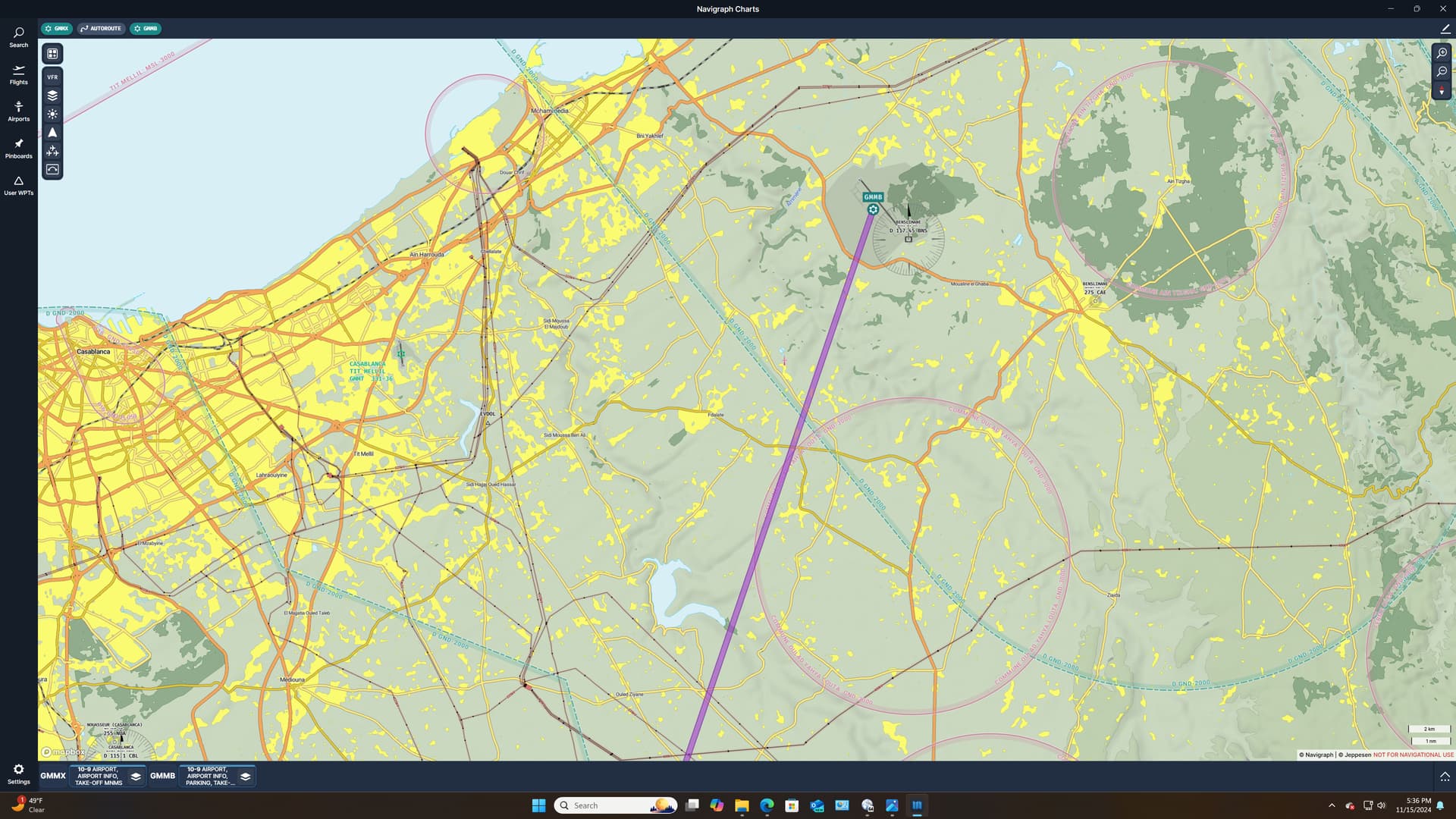
LEG 17: Marrakesh Menara Airport, Marrakesh, Morocco (GMMX) TO Ben Slimane Airport, Ben Slimane, Casablanca-Settat Region, Morocco (GMMB).
Alright, the easy part is over. Time to earn my pay.
I actually got a little ahead of myself in saying that I had 2500NM to go to ENSB. Turns out it’s more like 2850. That depressing realization out of the way, I realized that I’d better kick the tires, light the fires, and get my empennage out of Dodge.
After the last few legs, 130NM between Marrakesh and Casablanca feels a bit less than heroic.
But, as a consolation, there was plenty of excitement at the end to make up for it! 
Filed under the heading of not leaving myself with a thousand miles to go and only a Cub to do it with, I decide to cross Boo Boo off my list early!
My plan was pretty simple. I knew that there was a major roadway connecting Marrakesh and Casablanca. As long as I could lean a bit west and keep the highway in sight, I could follow it all the way to the outskirts of Casablanca. From there it didn’t look to be too difficult to find GMMB.
It was a decent plan.
As far as plans go.
In my case, it went about 60 miles. But that comes later. 
And away we go!
After a quick turnout, I set my initial heading and passed over the city of Marrakesh.
The dust and haze probably weren’t going to help me much. But, provided I could find the highway, I figured (incorrectly), that I’d be ok.
Man, I’m setting this up like an episode of Colombo!
There’s the railroad yard.
And there’s the highway junction a little north of the city.
What could possibly go wrong from here?
I pass the town of Sidi Bou Othmane on my left. Still feeling pretty good about where I am.
And here’s where I get too smart by half. The highway diverges from my plotted course just north of the town. I don’t have a ton of gas for this leg, and I didn’t really want to spend any more time weaving back and forth than I had to.
The visibility had improved considerably (for the moment). This tempts me to try to follow my original course and leave the road to shadow me to the west. There’s a reservoir further north that should limit me to the east.
So, with more confidence than was probably justified, I let the road slide off to the left.
Lots of interesting stuff in the desert. I wonder what this is… 
Looks like the launching platform in When Worlds Collide.
Did I miss an important newscast?
And here’s where my plan got up and went.
Off in the distance is the reservoir. I feel as though I’m safely sandwiched between the highway to my left and the reservoir to my right. But the VFR chart I’m using doesn’t show that there are many more secondary roads in the area which aren’t depicted.
The chart also kind of oversells the prominence of the main highway. I’ve flown a lot in the US desert southwest. The terrain is barren and the main roads really stand out.
Morocco is considerably different in this regard.
All this to say that, in the embarrassment of roads down here, I apparently have crossed over my limiting feature.
I don’t know this at the time.
In part because I realized that all these extra roads might pose a problem for me and in part because I have no good limiting features on my eastern side once I pass the reservoir, I return to hawking my heading with a little lean west.
I can barely spot the coast in the distance and I know that I should be able to see Casablanca along it at some point. At this point being too far west is better than being too far east.
I am wildly successful in that regard! 
I have only two (more) concerns:
and 2.
I hadn’t really gnat’s assed either the fuel or the sunset, and now I was reaping what I sowed.
Well, I don’t fly these things to be boring!
My first visit from the clue bird came in the form of spotting two largish towns off to my right.
There really are only two towns of any size along my route, Setta and Berrechid.
I was expecting them to appear off to my left as I still didn’t think that I had crossed the highway.
But, my mom didn’t give me these eyes to hold up my glasses…or something like that!

That meant that the main international airport, Mohammad V, should be just past that second town.
I nudge the Cub over in that direction.
And there she is.
Problem solved. Right?
Right?
Well, not exactly.
If you’ll recall, I had been concerned on the last leg that the apparently fair weather away from the local METAR sources might lead me astray as to the weather at the field.
So, as I set up my best guess heading for GMMB, the clear desert skies turned into this.
And then this.
Cleverly, I had also arranged to arrive at the field right at sunset. And I got to hand it to MSFS; because they captured how the Sun hitting a haze layer at low angle reduces forward visibility to Jack squat almost perfectly! 
And that’s how I found myself with the Sun going down, the fuel gauges going down, and almost zero visibility.
I had only one ace left up my sleeve. There was a second, in my mind distinct, lake just to the southwest of the field.
If I could find it, then I’d have a pretty good idea where the airfield lay.
That was not going to be easy.
Remarkably, I do manage to pick it up off to my right.
Now I just need to point my nose at where I think the airfield is, and pray.
I stopped looking at my gas gauges…I hate depressing news!
Finally, I get a break…and I was counting on it. I knew that, worse came to worse, the highway and city lights would come on eventually, which might help me spot both the city and the field.
It’s a bit of a cheat as I swear that in real life the field is usually in the blackest hole in the cityscape, but who am I to complain at a time like this? 
I spy what I’m guessing is the road bend just southwest of the field, and I point for the other side.
And out of nowhere, I finally spot the field!
Well, less of a cheat than I thought. I don’t think there’s any lighting on that airfield!!!
And I decided to pass up the international airport because…
Yeah, the circumstances did not make this easy. And by circumstances I mean me!
And, with a whole big mess of slipping I set up for my now signature arrival…
to plop her on the ground in such a manner that I was thankful that it was dark. 
Yeah, thanks Mr Follow Me truck, where were you about 30 miles ago!
Well, that was pretty entertaining and a nice diversion from flying the magenta.
Of course, had I done almost any planning at all, that would have been at least a little easier. But the way the environment changed and challenged me over the course of the trip was a great reminder of how things can go down the Hell Hole in a hurry!