Official 2019 Mudspike Christmas Flight - AAR thread

Post your progress here!

5th Annual Mudspike Christmas Flight description is HERE!

4 Likes

Sunday Sept 29th, 2019
Leg 1
next report

Last year, I was still not allowed to fly because I was under investigation due to the events of 2017.

This year, I am finally ready for some difficult terrain STOL flying after a very rigorous training programme. Thanks to a voucher from Santa, I got to fly with the German Marineflieger in Innsbruck, doing that tight LOC/DME approach and with the Dutch Coast Guard and US Navy, re-enacting the times when The Netherlands flew S-2 Trackers from their own carrier.


A 3-wire is when you stop with your tail above the third wire, right?

I saw the red-nosed reindeer again last week and was promised a new mission and a fitting aircraft.
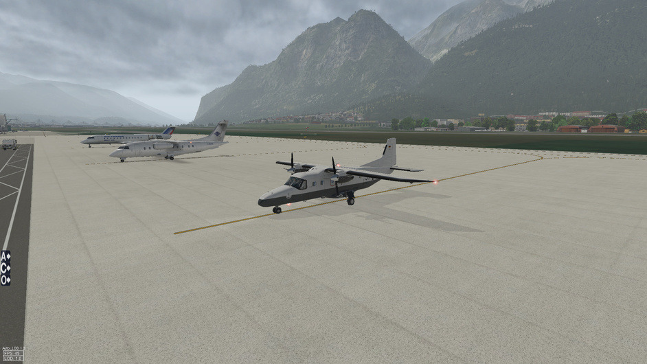
Those elves somehow perfectly recreated the trashy tail art I painted on my previously entrusted aircraft in Southeast Asia. And I cannot fathom where they got a vintage Do 228-100 from.
For the first part of the journey, I am taking tourists to see the Faeroer Islands.

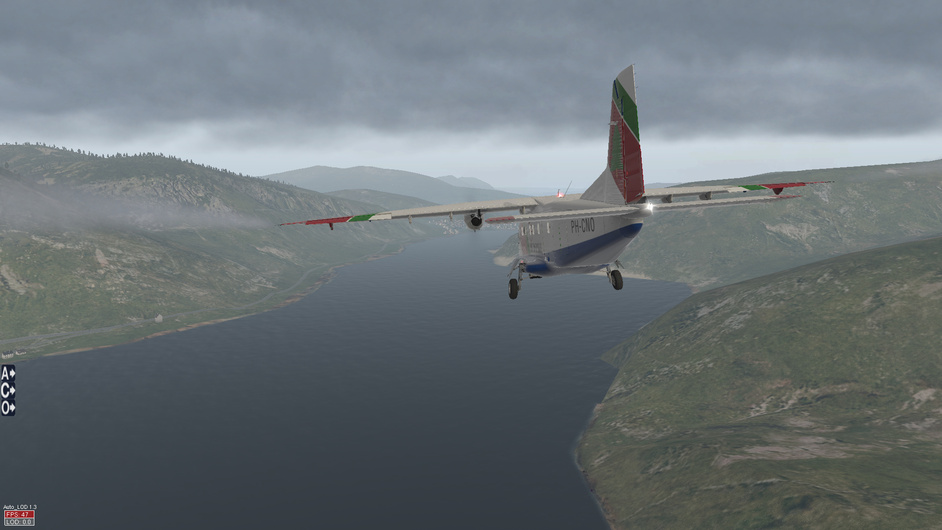
Today is a rainy day with lots of wind. Luckily, at our destination (EKVG, Vagar, Faeroer Islands), the weather is not as bad as it can get over there: a meagre 16 knots of oceanic wind and 8°C. Most importantly, the wind direction means we can do the LOC/DME approach to runway 13. Fun fun fun!

I leave Schiphol via BERGI, then proceed to ASKAM at FL150 (the maximum this aircraft is allowed to fly, as there is no pressurization system). We are taking 14 hikers with us for a total weight of ~1400 kg.


“I would like to invite our adventurous passengers to take a last look at the Dutch dunes, where you can take wonderful short winter walks without extreme cold and winds.”

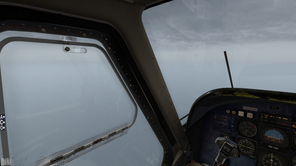
Over the North Sea, we first have clouds below us,then below and above, then just above and finally only below us again. I am no meteorologist, but I think we may have passed a front there.


I did spot a rare occurrence today: a part of Scotland not covered by cloud. It was a part of the Orkney Islands.

It was around this point I noticed that the 760nm range with with 1400 kg load was not as tight on the fuel as I thought it was: I had been a factor 2 off in my in-flight estimations, since I forgot we have 2 fuel tanks. Thus I went full power for customer satisfaction, with no regard for the environment. Like an Italian cab driver. Except with a few mm more clearance between me and other traffic.

Continuing on, I verified that the winds at our destination were still good for the LOC/DME to RWY13, and let the X530 calculate my top of descent.
The autopilot had held well, as there was not a lot of turbulence.

I decided to let the AP do the final turn to the LOC, to then take control during the turn. However, the bank limit was still engaged so I ended up overshooting and having to correct. The training in Innsbruck with the Germans paid off, as I was quickly established on localizer and ‘glideslope’.

Initially I considered those hikers crazy, wanting to go to such a cold and wet place. I thought of my hiking holidays to Scotland and Sweden, where I had been lucky with the weather. Better not to push my luck by taking a multiple days hike here. Besides, I had a mission from Santa. Still, with 1400kg of luggage, I did bring along those extra 15kg of my own backpack. If nothing else, the pack would be a welcome addition in case of an emergency over Greenland.

When we emerged from the low rainy clouds, I immediately longed to be between and on top of those mountains, walking for days with just a backpack with everything I need.

Needless to say, the runway was a bit on the long side for my Dornier. We parked between the big aircraft and I decided to take a close look at my flying schedule to see how much time I could spend here.

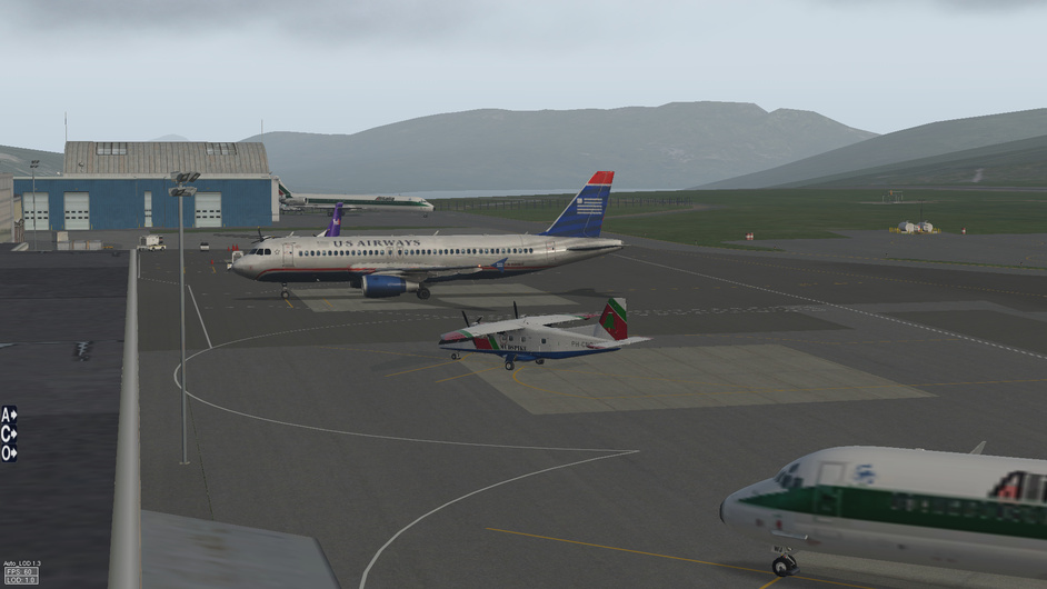
P.S. I downloaded the Ortho for Vagar, but forgot to link to them in my Custom scenery folder, so this is still stock X-Plane 11 terrain you see around Vagar. Airport is stock too, the aircraft is by Carenado. The skin is a Mudspike Christmas variant of the Dutch Coast Guard (Kustwacht) livery that I made last time I participated in the Christmas Flight.
EDIT: the Dutch scenery is the stock Aerosoft Schiphol, terrain is Orthophotos, with HDMesh v4 used for overlays

8 Likes

Awesome first leg. Love that little Do 228 - it can get into any field. Nice to see the old US Airways livery in sims still. I still miss US Airways since the American merger.

1 Like

Thanks. The metallic skin on that liner does look great.
I think it is a substitute for the A320s used by Atlantic Airways, the Faroer airline.

Here we go…!

First leg for me will be a short hop from my nearest airport - Gastonia, NC (KAKH) up to an interesting airport that I was close to buying the farm at over two decades ago - Elk River, NC (NC06).

My one and only brush with Elk River airport was as a dim-witted copilot in a Citation II, pretty much just along for the ride at my experience level. We headed up to Elk River to pick up passengers and it was both the PIC’s and my first time there. It is a one way in/out airport with high terrain in all quadrants. Unbeknownst to us, it had also just been resurfaced with an asphalt sealant that was still wet.

My ride for the Christmas Flight is going to be the venerable X-Aviation Mitsubishi MU-2 Marquise - the very first complex aircraft I bought for X-Plane many, many years ago, and it still largely holds up even after all these years.

I went to fly the leg earlier this morning, but the weather (low ceilings) would have prevented getting into Elk River (there are no instrument approaches), so I set about getting familiar with the MU-2 and went over the checklist items. It is a very simple aircraft to get up and running…which will be a bonus on this long trip to Attu Island.

Thanks to some help from AVSIM user “Skrimps” and “Ither”, they got me fixed up with a GTN 750 integration to give my MU-2 a bit more capability…

Getting her cranked up for a test run of the cold start procedure and checking out the avionics…

By mid-morning the ceilings had lifted enough to make the short trip up toward Beech Mountain and Elk River…

The latest version of the MU-2 has most of the kinks worked out, even with XP11. I found that having the props a bit into beta range helped with taxi speed and kept me from having to use the brakes very much…

The “Moo” is a twitchy little beast and likes to roll quite a bit even on the ground…perhaps it is all the weight out in those tip tanks. I remember it being a pain-in-the-butt to fuel as a line person…

Powered up we are soon airborne…to the great relief of everyone on the ramp and nearby neighborhoods since the Garrett engines are absolutely obnoxious…

Turning on course toward Elk River…

I think the MU-2 is one of the prettiest turboprops ever built. In XP11 there is the visual artifact of streaming vortices from the wingtips…not sure how to get rid of that…

Crossing over the Blue Ridge Parkway…looking for @Magnum50 on his motorcycle down there…

A short flight up to Banner Elk / Elk River…coming across the field we will cross over, fly a bit to the northwest, then come back down the road valley on a slightly offset course to land on runway 12 - the only landing option available. It pays to get a bit dirtied up early…

Coming back around to the offset final approach course…

So the runway sits just beyond that crotch ahead where the road passes through. Back when I had my real life run-in with Elk River, my very experienced PIC just didn’t know enough about the airport to know that the normal approach is offset and through the cut between the two hills. Instead, he opted to go straight-in to 12, over the hill to the right. This was a problem because we had our nose pointed down, fully dirty, speedbrakes out, and couldn’t get slow enough to maintain Vref. We ended up high, hot, and landing a good bit down the runway…which had just been resurfaced with a sealant that made it slippery. Fortunately, the strip is not ultra short, and has a very significant upslope which helped us stop. The anti-skid system vibrated for the entire landing run…the reversers were at full cry…and we just barely stopped before going off the end. I looked at the PIC and I was obviously not looking very confident in what we had just done…and he said to me “Were you scared?”…to which I said “Yes”…and then he (an ex-Army helicopter pilot that had been shot down three times in Vietnam) roared to me “THEN WHY THE HELL DIDN’T YOU SAY SOMETHING!!!” Haha…

The correct path into the airport…descending over the road…

On with no problems…

First leg in the books!

So here is a great video of a Falcon 10 landing at Elk River that gives some good perspective on the approach and landing. These guys know what they are doing:

14 Likes

Gorgeous scenery, of one of my favorite areas of North Carolina!

2 Likes

That was some mean AAR-ception stuff going on in this post.

I love to read pilot stories here on Mudspike.

3 Likes

He’s good at dropping the microphone, isn’t he.

LEG 2

Short little hop here - definitely an indulgence hop between a couple of my favorite North Carolina airports. Elk River is a one way in / one way out airport, so we depart downhill to the northwest on runway 30. Immediately after liftoff we’ll bank slightly to the right to avoid the rapidly rising terrain, and fly out through the notch that the road passes through…

Our hop today is a mere 28nm or so to the southwest, to Mountain Air airport (2NC0), a community in the sky with an exclusive golf club and nifty strip carved out of the side of the mountain. The steeply sloped runway is no joke, and the VFR only approach requires careful study and execution.

Mountain Air Pilots Manual is HERE

Have I mentioned how much I love the RealityXP GTN 750? It’s awesome…

Funny since the ortho almost matches what the NC mountains are starting to look like with the higher elevations starting to change colors on the trees as the leaves turn in the Fall…

Just off to the left there are the Black Mountains and Mt. Mitchell at 6,684’ - the tallest mountain east of the Mississippi if you are in the continental United States…

Putting an eye on the airfield…we will now enter a sweeping and descending right hand turn to stay on the northeast side of the airfield. The strip is on the side of a mountain, in a bowl of higher terrain, so the approach is important to get right…configure early!

On the upwind leg, starting the long oval 360 pattern that will take me into that valley behind the aircraft, aiming to come over that small ridge just beyond the airfield in this screen…

Keep the airfield in sight and stay at around 6,000’ to prevent yourself from being too high or low during the circle…

Downwind - we’ll take a right turn soon and fly up that valley to the right keeping the small ridge off our right side before turning final…

Finishing the continuous base to final turn. Watch out for the sloping runway illusion that will cause you to be too low because you perceive you are too high based on the sight picture. The strip is only 2,875’ long, but that uphill slope will help you stop quickly…the other end of the runway is 46’ higher than the approach end of runway 32…

On speed…and lineup is obviously important here…

Touchdown should be prior to the two white ticks halfway down the runway…that is a warning that your are floating and eating up runway. If you aren’t down and braking by then, you’d better pour on the power and get out of there…

The MU-2 only uses about 2/3 of the runway and requires some power to climb the hill to the parking area. This awesome freeware scenery by Hapet is fantastic:

And a real MU-2 doing the approach to Mountain Air…

9 Likes

Today’s destination was even more scenic… And we were lucky with the weather too! I will send a full report later, but for now, let me share this picture I just took after the passengers and baggage had left the plane.

P.S. I am using the User Location Map which was originally intended for the MacRobertson Air Race to display my Christmas Flight position.

6 Likes

I’m too embarrassed to look at that map. LOL…

Can’t wait to see your pics of the Do-228…that is a great bird in both P3D and X-Plane…

4 Likes

Now that I have figured out most of the airport libraries issues, I am getting ready to start. I’ve got scenery files for KPHF through KJAC and then the Orbx Washington HD for the last two. Again, staying away from huge airports but still need a runway that can take a 727-200F. Stay tuned. :slightly_smiling_face:

1 Like

Well…according to that map you are in Baghdad…some special secret op that you aren’t telling us about?

Is the ruscenery thing solved?

Yes, I think so. Based on what you said, I tried looking for a newer version. I couldn’t find a newer complete library but found a library index text file that said it was a fix for older ruscenery. I re-downloaded reinstalled the library folder. I ran it again to make sure I was getting the same error message before I replaced the text file, and I didn’t get the error message…go figure. I guess something wrong with the original download.

Thanks for the help. :slightly_smiling_face:

No worries. Was at a wedding yesterday and never got around to looking.

You Northeast USA guys might want to hold off starting your legs for the next few days… :smiley:

I’ve got racing (sailboat) tomorrow - looking at 20 knots sustained. :grimacing:

2 Likes

The Chesapeake Fastnet Force 10…

1 Like

On my way from Mountain Air, NC (2NC0) over to Hot Springs, VA (KHSP)…short, one hour hop to an interesting airport…

http://xfsd.ansorg-web.de/fsdmap/

2 Likes