Official 2019 Mudspike Christmas Flight - AAR thread

Did you say VOLCANO ? :slight_smile: I have one in my way right the next leg.

Dukono volcano news & eruption updates

Dukono Volcano Volcanic Ash Advisory: CONTINUOUS VA OBS TO FL070 EXT SW AT 13/1130Z. to 7000 ft (2100 m)

So here is the previous leg. Kaimana WASK to Eduard Osok WASS

Playing with AP modes, hover hold for the pic

Long final to WASS

6 Likes

That’s awesome @komemiute . You really caught the character of the Caribou there! :grinning:

1 Like

Moving onwards! Adak (PADK) Island to Shemya (PASY)…

Taxiing out I can’t help but notice that much of the snow has evidently melted since yesterday…


Breaking out on top… one of the things that just never gets old.

Mt Moffett, Adak island.

A weather anomaly, here we are at 180°W/180°E…


And as I crossed into the Eastern Hemisphere, the opposite effect.

In the descent, it looks like a pretty solid layer. I switch on all the anti-ice systems and grab my iPad to find an approach chart.

Light snow was shown on the Metar, and sure enough…


Fully configured and on the glideslope…

Visual contact with the ground…

The snow covered runway in sight. Nice of ATC to not bother turning on the runway lights… :face_with_monocle: And yes, there is a pretty stiff crosswind!

Hmmm… I have drifted to the ‘amateur’ side of the runway… correcting.


Touchdown was just to the left of centerline despite me trying to correct… but I’m down…

Parked near the tower.

So, just a short 34nm hop and I will be at the final destination!

9 Likes

For the final leg, I thought I would fly something a little different… the jet powered Cri-Cri :rofl:

The weather had cleared up considerably since arriving earlier today in the Caribou.

Heading West…

The Cri-Cri gives you excellent visibility…


That ocean looks cold! At this point I glanced at the fuel gauge and was startled to see that I had already used up 75% of it…

I throttled back and hoped for the best. At least the island of Attu was getting closer. Is that a light at the coastline straight ahead? I think it is!
Almost there! A quick flyby of the old Coast Guard station…
Final… once again, there is a bit of a crosswind.

Touchdown!


Rollout
and taxi back


One advantage of the little Cri-Cri is that you can park it anywhere. No sooner had I parked than the engines flamed out…my tanks were dry.

It’s been a fun trip. I would have liked to have completed the trek in the Chipmunk but Austin to Juneau was a pretty good run in a 100 knot airplane.

Merry Christmas Everyone!

15 Likes

Congrats @PaulRix! And Merry Xmas also to you :slight_smile:

1 Like

Congrats @PaulRix, it sure was a great trek and a beautiful series of reports!
Merry Christmas!

I just finished leg four of my flight, Khatanga (UOHH) to UHMM (Magadan Sokol)

I used real weather again, but not real time. Instead I started 07:30 local time.
Flight plan: UOHH SID ORTEM B954 SALAK A812 LANAR STAR UHMM (very close to direct btw. But I need practice with the FMC. :smiley: )

Starting up. I embarassed myself by not switching APU bleed air on and then wondering why the engines didn’t start…

Here we go! The bumpy runway wasn’t a problem on takeoff.

The weather was… not great.

Wtf, this looks like a scene from Star Trek.

At least this plane climbs like hell. It only took three minutes to 14,000 feet.

Woohoo, no clouds above me anymore!

Hello Sun!

Reached my cruise altitude, FL420.
But suddenly: a yellow light comes on. Something was wrong with cabin pressure. I ignored it for a bit because that’s a documented bug of the plane (the cabin altitude sometimes doesn’t change fast enough), but shortly before I took this shot it was near 10,000. I switched pressurization to manual, started to descend a bit, cycled both bleed air valves and the ram air. That made it stop there, but as y’all know this is not something that should be OVER 9000.

Since I could not find out what to do against it I decided to lower my cruise altitude to the point where the value drops below the warning threshold.
So I continued my flight at FL360. The ATC complained and forced me to file a whole new flight plan… grrr…

This was a cool sight. Flying out of the bad weather.
Well… technically I was above it anway, but it is still nice to see the ground.

A lake among the mountains. Actually a river called Kolyma.
Fun fact: between those mountains there is a lake named after Jack London.

Descending. I am getting used to those spoilers.

Ok, this is sketchy. I am already down at 4500 feet and the airport chart tells me that those mountains are 3600ft high. I probably won’t follow that order by the ATC to descend down to 2000ft…

Crossed the mountains at an altitude of 3700. Far too low already.

Quite humid here.

And that’s it.

Landed. Next leg will be the last one, most likely UHMM → PKK → LUMES → PAAT.
Only the last ~220 miles will be outside of Russian airspace. Russia is big!

Parked next to a big girl, getting ready for the last leg.

10 Likes

Leg 3 of Keets heads toward where everyone else is headed, roughly west

EGAA (Belfast International) → EKVG ( Vágar Airport, Faroe Islands)


Starting up at Belfast


Climbing away

AFE/Moody George was again sulking and refusing to speak, I read a fix somewhere and forgot to perform this before takeoff. Never mind. We’re underway and the weather looks good at the destination, always a bonus when flying to Vagar.


The Scottish highlands

We’re soon beyond the Scottish coast and a long slog across the sea. I amuse George with some travel games… “I spy with my little eye, something beginning with S” he’s less than impressed. Sperry engaged and I go off and do some man chores.


Sea


Sunset

Returning to the cockpit with a cup of tea, George bobs around excitedly and seems to indicate we’re not too far away from descent. Checking the location on the Garmin, I can see its time to begin our descent into Vagar.

Its getting very dark now, but I can see the lights on the Faroe Islands and am happy with the approach.


The sloped runway of Vagar

It was about 5 seconds after the above picture I realised I’d selected the wrong approach and was coming in from the wrong end of the runway with no ILS at this end. I was wondering why I hadn’t picked up the localiser and thinking the autopilot should be descending when I checked the approach plates.

Disengaging the autopilot, flaps down throttle reduced telling George to go through the descend checklist quickly, I pushed the nose down trying to lose height.

Nowhere near enough time to lose the altitude, I decided I wasn’t going to make it down and cleaned the aircraft up. What I should have done was follow the missed approach, but the frantic nature of the previous two minutes and an overwhelming desire to get down, didn’t give me enough time to check what I was going to do.

Vagar is surrounded by hills, it was pitch black with the odd car headlight in the distance. I’d overshot the runway at around 1000ft, so I knew I was below the safe altitude. I thought from previous visits, I could remember there was a slight space past the runway, possibly enough to get round. Staring into the darkness I flew as tight a turn as I could to bring me back to the runway.

Fortunately I didn’t hit the mountains and the runway came into sight and I made a very grateful touchdown.

Awful flying. Totally dangerous and I didn’t deserve to get away with it. Next up Keflavik.


Lucky boy

9 Likes

Actually… I am going east.
And if I am not mistaken that should actually be the shorter way from where you started, too.

But then: I understand why you are going west, I also thought about it. Russia is a tad less exciting than Canada I guess.

Nice report of your third leg! :slight_smile:

1 Like

I am heading mostly North :compass: :slight_smile:

1 Like

I think the main reason I went west was due to participating, and failing to complete, in the Mac Robertson air race.

I’ve not checked if there any Ortho for Russia and do agree that I think Canada may be more interesting. :slightly_smiling_face:

1 Like


At the ramp of Port Alsworth… Guess who also found a shiny Warbird in Alaska @PaulRix ?
A full report will be filed later.

5 Likes

Nice looking airplane! I need to add that one to my virtual hangar.

It certainly is. And it’s tons of fun to fly.
Go ahead, it’s free:

Downloading now! Thanks @Freak .

1 Like

Leg 4 of Keets heads toward where everyone else is headed, roughly west

EKVG (Vágar Airport, Faroe Islands) → BIKF ( Keflavik International Airport, Iceland)

After the scare in the last flight, I was looking forward to a relatively straightforward hop over to Iceland.


The route


Moody early morning start at Vagar. No salted puffins in the cargo this year.


Leaving the Faroes

The scenery of the Faroe islands is stunning, climbing out and clicking in the autopilot, I looked at the mute George, still refusing to talk to me.


The ever quiet George and a grinning idiot

Leaving the Faroes, the transit across the sea provided some time for trying to understand the fuel tanks. PMDG were supposed to be releasing a final lesson which was to cover this, but seeing as they’ve now abandoned the DC-6, experimentation of playing with the levers and looking at the consumption has given me enough confidence to know what’s what.


Iceland in sight.


Brrrrrrrrrrrrrr

Crossing Iceland and looking at the very cold looking landscape, I’d not made the same mistake as I did at Vagar airport and was approaching Keflavik from the west. Picking up the localiser and ILS, I switched the Sperry to approach.

No dramas this time and a safe touchdown was made. I’m not sure what was going on, whether it be a clash with the Keflavik airport I’d downloaded, or I’d arrived at a hippy retreat, but the colours were very odd.

“I only want to see you landing at purple Keflavik, purple Keflavik…”

Making good progress now, if I can make Canada, I might have to seriously think that I might complete the journey.

8 Likes

Another leg in. This one was back last Sunday. Trying to stay low-altitude through the mountains for the scenic is proving challenging - weather windows are proving somewhat hard to come across. I had, what looks like, an hour or so of clean(ish) air to the west and decided to make the attempt.

2019-12-08 20_08_03-Window

Plan remains the same. Below is the ‘straight line’ version but the previous VFR flight plan remains.

2019-12-08 20_08_23-Window

Preflight is still fun!

Takeoff and climb out was nice.

Weather in the gap just south of the lake … was marginal but I was able to keep tabs on the scenery and within a few minutes, it cleared off.

Turning south down the valley. I need to take the second right - and it isn’t shown in the screenshot below.

The right turn I am looking for is there, just around the corner.

Continuing on, the sun is now looking like my adversary. I have a feeling that I am going to lose the light pretty soon and being in the dark valleys is not what I want.

In the real world, I would not have pushed this far into the valley as the twilight would have robbed me of most of my depth perception and detail for all of the features that I need to avoid.

Sure enough. After the above turn that puts me within a visual reference of Revelstoke …

Darkness falls :slight_smile:

Ahead, the valley was widening out and the road lights kept me oriented. I kept the VFR map up to keep an eye on the topography threats around me.

I was able to make out the runway below … and the dark shadows of trees on the runway? Yeah. Trees.

Was able to s a short field landing and stopped just in front of the trees. I need to do this more because keeping my speed low on the descent was a challenge. Last picture is the taxi back to the end of the field :slight_smile:

EDIT: Forgot to add the final path map, so you can see the route.

2019-12-08 21_32_25-Window

11 Likes

Fridge if you would have gone CYLW - CYXC I could have bought you dinner and a beer. :grin: :sunglasses:

2 Likes

Leg 12
Dec 15th, 2019
PAGK Gulkana Airport - PALJ Port Alsworth
Previous report | Teaser

So there I was, at Gulkana Airport, with a broken propeller and a probably broken engine. And the time was ticking away. 1460 nm in a straight line to Attu, and I wasn’t going to be flying a straight line. I needed something significantly faster than 100 knots, but I didn’t have the money on hand to buy a turbine-driven plane.
Of course I had been keeping up with the reports of other Mudspikers, one in particular who had somehow managed to pick up an old but shiny warbird in Alaska, ‘in a sale’, whatever that may mean … Garage sale?

So I started asking around the airport if anybody had an old (by which I meant cheap) but reasonably fast airplane that they were trying to get rid of and was eventually sent to a hangar in the corner of the airport. There I found Gérard, a grumpy old man from Quebec who treasured such a pride in his language as I had only seen in Belgians. He happened to have owned a reasonable amount of aircraft, and had moved to Alaska to enjoy the mountains and be able to fly more freely, away from controlled airspace and boring flat lands.

He offered me an unusual aircraft for this region: an old French Dewoitine D.520, a fighter aircraft from World War II, roughly comparable to the early Spitfires and Bf.109s, but with an automatic prop pitch setting governor. His passion for everything French, which I shared, was the reason for its presence on this side of the Atlantic.
He was trying to sell it to a Russian buyer, but had trouble finding pilots who were crazy enough to fly such an old aircraft to Russia this time of year.

Needless to say, my offer to take it to Attu was greatly appreciated.


Take-off around 11:30 local time (actually this was my second take-off, after X-Plane crashed)

When I saw this river, I went to take a look up close. This is lots of fun at ~550 km/h, much faster than the Cessna!

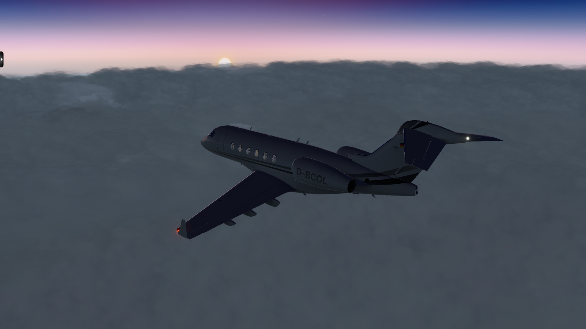
Weather got worse - you don’t want to get stuck in a cloud bank without an ADI, so I dove under the clouds.

Halfway between Gulkana and Anchorage, I decided to stop for lunch along Glenn Highway

After lunch, the weather had cleared, so I took off and after playing around some mountain peaks, climbed to a comfortable cruise altitude of 9,000 m (30,000 feet).


You can see I am over the Anchorage region in the above picture by the amount of airports in this view. I can count about four (sorry for the resolution, I only took my shitty backup mobile phone with me on this trip and couldn’t really keep it steady under this angle)

And then the clouds appeared again, and although I optimistically remained at altitude, it eventually dawned on me that it would not be wise to stay above a layer of overcast in a plane this ill-equipped when flying into a mountainous region. I had not really planned for a destination airport, expecting to land around Anchorage, but wanted to push on a little bit further now. I should have at least 2 hours of fuel remaining.
So I dove down, built up some speed and tried to keep a steady hand as I blasted through the overcast.
I looked at the map and decided to try and follow the Tlikakila River valley towards Lake Clark. There I would be able to find a place to land, and if not, I could always continue to Iliamna.


The overcast remained sufficiently above the valley floor, and although the visibility deteriorated just before Lake Clark, I was confident in the turning ability of this dealy French dancer that I pushed onward. On the south side of Lake Clark, I found this cozy-looking airport called Port Alsworth and that is where I am now.

Just a few more legs to go, and although the Dewoitine is a much faster machine than the C172, I will still have to up my tempo a bit to make it to Attu before Christmas!

12 Likes

The bar is open at Attu Island. I’m doing a sterling job of propping it up, but I’m looking forward to having some assistance when you get here!

4 Likes