The official 3rd Annual Mudspike Christmas Flight - 2017 Edition

And final leg. I decided to do a one fuel stop however.

From tropical paradise Sabang WITN, along the coast of Indonesia WIMG Tabing to the cold sounding Xmas island YPXM :slight_smile:

Everything looks good, I eventualy turned on the alternators now

So long…

Closer to the refueling stop I made a small detour to visit lake Maninjau and mount Marapi with its little brothers

Then back to the coast and made a touch-quickrefuel-andgo.
Note: you can notice me quite far off the coast. I was looking for some NAV aids and was actually confused by looking into FSW, FSX and SkyVector at the same time :slight_smile:

With tanks full lets move on

This part of Indonesia around Tabing airport was really nice. Notice also Tabing was not only strip in the jungle as many other airports around here

I believe somebody from the devs is probably from here. In a climb I did catch something weird on the left side. UFO? I zoomed in and it was pair of birds of pray
2017-11-14 21_49_07-Dovetail Flight Sim World

Heading south and again I noticed something strange below my plane. This time cursor of my mouse :wink:

Planned arrival was evening, but with the setting sun and still some 600nm in front I was aware that the night will be there sooner than me

As I was cruising at 5000ft I was wondering about my approach to YPXM… will there be lights?.. good that at least VOR is there.
So simultaneously I watched educational videos about G1000 on youtube.

It paid off actually as I was able to dial in the YPXM VOR approach and let the AP fly it for me

In some distance I disconnected the AP and landed by hand.
Parked at the ramp and was surprised that nobody is greeting me with cold beer. I was later informed by the locals that @Chuck_Owl already left for home after some nervous call from his girlfriend :wink:

Whatever, more beer for me till the rest of you will arrive. I will wait for you!

6 Likes

Cheers but it feels like a quick hackjob, I’ll write something better that takes the reader through a full flight in about an hour? Deal? :wink:

1 Like

If @TheAlmightySnark is amenable - I’d like to convert it over to a main-site article - whaddya think?

3 Likes

Sounds good! But I do still insist on a little re-write, and perhaps go a little more indepth on the other features simulated. It’s really quite a respectable little trooper!

1 Like

Most definitely…! It is a great write-up on a cool system. I was actually considering using the B-727F for the Christmas flight, but I’m not sure I want that level of management and complexity at this point.

1 Like

the 727F also supports X-FMC. It’s really easy to learn, I managed to learn it in about an hour, and I’ve never really used a FMC system in a simulator.

1 Like

HOLY SH…mollies! Now THAT’s a proper guide. :slight_smile: Well done!

1 Like

Still trying to outrun @NEVO and @TheAlmightySnark

Leg 2 of Chuck’s Return to Montreal:
YPLM (Learmonth) - YNWN (Newman), Australia

It’s a short leg (a little more than 320 nm), but this time I’ll be using the PMDG DC-6B with the Canadian Pacific livery.

My goal for this flight is to NOT use the automated flight engineer (AFE) at all and to manage everything by myself. The workload will probably be high, but it’s nothing I can’t handle.

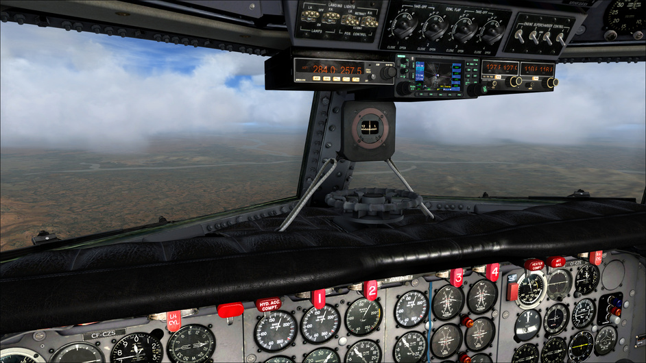
The cockpit is what I’d expect from a 1940’s airliner: full of gauges and old school systems.

Oh god… that overhead panel is so cluttered!

Circuit Breaker panel behind the flight deck

A Sperry A-12 autopilot system… now THAT is old school!

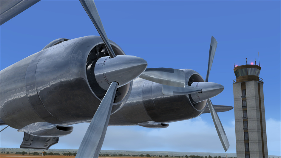
Time to crank up the engines!

Number 3 engine… Ignition!

This will be my first flight ever using the Garmin GNS 430 GPS. The flight in itself isn’t quite complicated: fly to waypoints WYLOO, PBO, then straight to YNWN with a cruising altitude of 12,000 ft.

I struggle for about half-an-hour, trying to find a way to create the whole flight plan without inserting an automatically generated one using the FSX “Flight Planner”, but for some reason I can’t seem to be able to add more than one waypoint. This is what I get using the automated Flight Planner:
image

Still, I’m not happy with that. Time flies as I burn fuel and start baking under the australian sun while cursing against the Garmin Gods and their cruelty. In the end, I decided to simply enter manually WYLOO and use the Direct To button to set it as my active waypoint, Once I’ll get there, I’ll just change the Active Waypoint manually and so on and so forth.

I eventually taxi to the tarmac. I babysit the engines all the way to Runway 36.

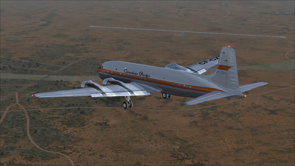
I slowly throttle up. The instrument panel starts shaking as the radial engines slowly rumble to takeoff power. With two notches of flap, I finally leave the ground with about 11000 lbs of fuel. This should be plenty.

Off we go!

I cross the eastern shore of the Exmouth Gulf towards WYLOO.

As I enter a thick cloud layer during my initial climb, I engage the carburettor anti-ice and prop de-icer systems.

I eventually level off at 11000 ft and very carefully line myself up with radial 104 to line myself up with WYLOO. This time, Then, I set my autopilot mode to GYRO using both the autopilot master mode selector and the gyro switch in order to maintain my current attitude, and then I engage the autopilot master lever.

As I use my autopilot trim switch, I am in an adequate attitude to engage the altitude mode of the Sperry. To my surprise, the autopilot responds well and I can finally maintain a constant altitude and attitude. That wasn’t so bad, now, was it?

Using my CDI (Course Deviation Indicator), I now set my autopilot to track the WYLOO VOR.

I’m a bit off-course, but the autopilot seems to line me up correctly on the radial that I set previously.

After two minutes of crossing fingers, the Sperry finally lines me up on the GPS path. Hurray!

More desertic landscapes

As I cross WYLOO, I observe the salty Lake McDonald to my right.

Looks a bit dry, doesn’t it?

Mount Sheila in the distance

Lake McDonald goes a looong way

Cloud overcast stretches quite far

Quite a bit of wind too

Flying over PBO (Paraburdoo), which strangely enough is an aboriginal word for ‘white cockatoo’.

The clouds cover thins out as I cross the Karijini National Park. Ah, more green, at last!

After disconnecting the autopilot, I start my descent 30 miles from Newman by setting my throttles at 26 in of manifold pressure. That DC-6 really does NOT want to slow down… I have to maintain a descent speed of almost 240 kts, which is probably too fast but still manageable. The engines are still in the green.

Newman Airport is on the Eastern side of the river, separating it from Newman city.

I drop my flaps to about 15 and lower my landing gear, which slows down the aircraft to a much more reasonable 140 kts. However, the wind makes the whole aircraft a bit difficult to fly straight as I need to compensate considerably with my rudder.

Left Downwind

Right Downwind, dropping my flaps to 50. The aircraft gets very heavy, yet very floaty too. With 40 passengers and 3000 lbs of cargo on-board, I don’t want to mess this up.

On Final, I drop my speed to 120-110 kts.

The landing is a bit tedious since I need to compensate for the crosswind with my feet, push the nose down with my stick while crabbing and gun my throttle to make sure my airspeed doesn’t fall too low or too fast.

Almost there!

Seconds to touchdown

I almost veer off the runway but a last minute hail-mary correction brings me safely to the ground. Phew!

As the passengers hop off the aircraft and inspect my engines to see if I managed them correctly, I have a chat with the maintenance guys.


PMDG implemented a persistent engine state, which is pretty cool.

Looks like the engines are fine after all. That’s quite a feat, especially since I watched over these engines all by myself without the automated flight engineer, with the most realistic engine damage model active, during almost 3 hours. I need to refill my anti-ice fluid, but apart from that… No shock cooling, no overheat… good as new! Just a bit oily…

I’m not gonna lie, that experience with the DC-6B was amazing. Flying an old airliner and living to tell the tale felt amazing. The only annoying part of this flight was that I couldn’t set up the GNS 430 like I wanted (maybe it’s a bug on PMDG’s part?). Having to enter each waypoint one at a time instead of being able to enter them all manually is a tad annoying. If I get an answer from the PMDG Support forums, I’ll make sure to post it here. The GNS 430 is the only thing preventing this bird from being an absolute masterpiece. :slight_smile:

Now, time to plan my next leg to Darwin.

6 Likes

You mean… I left some beer? That cannot be! I’m gonna have to swing back to finish the job once I’m done touring Australia! :smile:

1 Like

Good grief that is a good looking aircraft and virtual cockpit. The detail level is just insane… Love em’ or hate em’…PMDG knows their stuff.

I’ve also struggled a bit using the P3D GNS 430 after using the XP11 version. When on the FPL page, I couldn’t figure out how to add another waypoint either. That should have been a no-brainer for LM to add that functionality.

I thought there was only an X-Plane 10 version… did PMDG update it to XP-11 already?

Not yet me thinks. But perhaps my mistake. I assumed that you were using the PMDG DC-6 for FSX/P3D, and therefore encountering the same problem that I had recently trying to use the P3D Garmin (maybe the 530 clone). Regardless, the XP11 default 430/530 seem to work really well. If you are using the DC-6 in XP11, then it very well could mean that you’ve found an issue with the XP10 version of the aircraft being used in XP11. The Cloudmaster is not in any of my hangers unfortunately. She sure is a looker!

I think this issue with the DC6 might have something to do with the fact that the GNS 430 that comes with the DC6 is the default FSX/P3D one, which appears to be somewhat broken/incomplete.

https://www.avsim.com/forums/topic/524341-fsx-dc6b-gns-430-fpl-question/#comment-3750191

This GPS is not coded by PMDG, it is simply the default GPS gauge and one of its many limitations is the incorrect implementation of the direct feature. You are better off removing it and using VOR.

1 Like

I feel flattered! And funny that you say that, I’ve been wanting to write about the CIVA for as long as I have it now(which is a year :stuck_out_tongue:), no better motivation then to write on request I suppose!

Thanks! If someone knows a proper guide from… Something else then it’s you! :wink:

Roflmao you’re way too modest.

I was wondering for the classic airliner lovers among you… did you ever try the Coolsky DC9 for FSX? I think that one only has VOR-to-VOR navigation available and I heard that it has pretty darn deep systems simulation.

1 Like

Leg 03: Memphis to Wichita (KMEM-KICT)

Alas, our beloved Beech 1900D began acting up again in route to Memphis. So we decided to reluctantly leave her with a recommended shop for further inspection. Arrangements were made to pick up our company bird on the return trip.

Plan B was to locate a twin with enough cargo capacity to carry 1445 lbs of beer kegs, 500 lbs of middle-aged pilot brewers, make 200 kts true, and get us as far as Wichita. Once in Wichita, we might find something with a bit more legs. We decided on a rough looking, but very solid C404 Titan. The paint was curious. Not quite “our customers are wearing black camo stick” gray, but a fairly ambiguous off white that was just one buff brighter than primer. We said goodbye to Memphis, my brother’s wallet quite a bit lighter and black guitar case added to our manifest.

Back on the road again.

True, the C404 Titan has not had a update for XP11. But with a small edit of the .acf file, her 430 will track a flight plan. Unfortunately, I’ve had to drop back and punt with regards to a weather engine. X-Enviro has suddenly become dissatisfied at my latest update to 11.10b7. SkyMax Pro doesn’t seem to mind though. And while it doesn’t have the overall dramatic impact as X-Enviro, as we will see shortly, it can represent some situations better.

WX observations reported 1200 over, and sure enough we got in the soup quickly. But 8 thousand feet later we eased out of the fluffy stuff on the way to our cruising altitude of FL200. To the west, things were looking decidedly better.

Our route today. Our airspeed turned out to be a bit optimistic.

KMEM-KICT_route2

Once at our planned cruising altitude, I was somewhat concerned that the airspeed didn’t quite accelerate like the scolded dog the Titan had portrayed on the ground. Deferring to the POH, we decided on a setting of 31" at 1900 RPM, which should have given 201 KTAS.

performance-chart

With the needle straining to get past 140 KIAS, I pulled out my 30 year old ASA CX-1. She is well worn and the interface could be better. Heck, there’s probably an iPhone app that dances around this antique. Just die will you! I enter the data and am pleasantly surprised that at 204 KTAS, we are within a few knots of what was expected.

asa_cx-1

One of the things planned for this leg is to checkout the differences at altitude between the stock XP11 scenery and that overlaid with US Orthophotos. The planned route so far…

As we approached southeastern Kansas, the change in scenery was obvious.

Notice in this screen where the Neosho crosses from Kansas into Oklahoma how the winding river appears far less convincing on the default scenery.

Along the way we tracked our progress with an external moving map, and confirmed that we could use pilotage far more effectively with the Orthophotos.

Leg03-xp-map

As we reached west, the sky began to take on beautiful shades as the sun slowly moved towards its eventual hiding place.

One couldn’t help but pause and be thankful that we had chosen to earn our wings.

The vistas being what they were, I completely missed our TOD and pushing over, made like a Peregrine after a field mouse. Brother Bill began squirming a bit as the VSI approached -3000 fps and the Titan soon reached a bit too near overspeed. Exceeding personal minimums was I. Tempering my enthusiasm, I took us 15 miles north of Wichita, then back to the East for a visual approach on 32.

Poor bastages just released from the salt mines :slight_smile:

Flatter than a pancake out here.

While we taxied toward our hole in the wall, we spied some very interesting aircraft on the ramp.

As we neared the hanger, I was surprised to see on the KICT AD that Lear occupies the buildings just beyond. We’ll have to give them a shout tomorrow to see if they would be open to a visit. Maybe swap beer for sim time. :slight_smile:

LearJet

Let’s tuck her in and call this a wrap.

I guess girls could be called Titan. I know one named Titus.

8 Likes

Great looking bird that 404. I used to work on the ramp at an FBO that had a fleet of 402s they hauled freight in (Ramp 66 - KCRE). That clamshell top half of the back was always popping open during takeoffs. Funny story:

One day, one of the pilots (who now works with me at my current job) was running some freight from Myrtle Beach to Charlotte. Well, he took off from MYR and was enroute to CLT and got a call from ATC.

“Hey Nine One Golf, you uh…apparently left some boxes on the runway back at Myrtle…”

So he looks back over the piled up freight and cargo net, and sure enough, that back top clamshell had popped open and some boxes (which were usually packed to the ceiling) had fallen out. Well, you can’t scramble over the net to close it with no autopilot, so it stayed open all the way to CLT.

When he landed, the Airborne Express manager was furious, going on about how he’d be responsible for the value of the packages, blah, blah blah. So as they are unloading the freight, they start weighing it. At the end they come up with some number on a slip and hand it to the pilot. “He’s like…uh…well, according to the weight slip your guys gave me back in MYR, I gained packages on the way here.” (They never actually weighed anything I don’t think…it was all a WAG). With that, the Airborne manager decided to just shut up.

4 Likes

I haven’t, but it reminds me that I need to get the Rotate MD-8!

Leg 3 of Chuck’s Return to Montreal
YNWN (Newman) - YPDN (Darwin), Australia

This time, I take the TFDi Boeing 717 in Prepar3d V4! The name says “Boeing” but the interior of the cockpit screams McDonnell Douglas.

I spawn at 3:00 AM local time. The flight should be approximately 900 nm to Darwin. Below, we can see the very nice TFDi RealLight technology implemented in the cockpit.

The Electronic Flight Bag is also a pretty nice feature since it includes a number of checklists. The resolution of the jpg could be improved since at the moment it’s a giant page that can be zoomed in or out.

I fire up the engines and taxi to Newman’s runway. I plug in the flight plan in the FMC, nothing too difficult so far.

Once again, the lighting effects are stunning.

I throttle up and off I go!

So far so good. I climb to 2000 ft and start my climb to 32,000 ft.

I still can’t get over how nice that cockpit looks.

As I reach 20,000 ft it’s still pitch black outside.

The sun rises

The sky looks like it’s in a strange limbo between night and day

6:15 AM, rise and shine!

I need to use sun shade panel in order not to get blinded. Quite a useful feature.

As I cross the Karlamilyi National Park, more clouds clutter the airspace

Arriving next to KU waypoint. The town of Kununurra is located among the scenic hills and ranges of the far north-east Kimberley Region, having an abundance of fresh water, conserved by the Ord River Diversion dam and the main Ord River Dam.

Lake Argyle, Western Australia’s largest and Australia’s second largest freshwater man-made reservoir by volume.

I approach Darwin as I cross the Joseph Bonaparte Gulf, named by French explorer and naturalist Nicholas Baudin in 1803.

The Keep River and Victoria River drain into the gulf in the Northern Territory, the former close to the Western Australia - Northern Territory border. The Ord River, Pentecost River, Durack River, King River and the Forrest River drain into the Cambridge Gulf, another gulf within the southern part of the Bonaparte Gulf.

Thick cloud cover will make this morning’s approach more interesting.

ActiveSky at work

Going in the soup

Rain droplets shown here are the result of the TrueGlass technology developed by TFDi. It’s pretty neat!

Wipers doing their thing

Now that’s a lotta wind and a lotta rain

Approaching the Cox Peninsula, starting my descent at 250 kts

Bleeding off some speed with the airbrakes

The STAR makes me swing around Darwin towards the ocean, then circle around the town and land northwards on runway 29.

Landing on runway 29. Time to try out that Autoland system. I perform my approach at 140 kts (I took a VREF of 135 + 5 kts according to my FMC performance calculator for an approach at flaps 40). Once the localizer and glide slope are captured, the rain stops and the wind suddenly drops, which makes it much easier for me.

On final approach to Darwin

Short final

Touchdown is quite gentle

The thrust reversers slow me down quite effectively

Aaand… we’re there!

TFDi did a nice job with that 717. That was some unexpected fun!

4 Likes