2nd Annual Mudspike Christmas Flight AAR Thread

Recife → Ministro Pistarini Airport Buenos Aires (SAEZ)

I’ve been prepping for this for a few days, Its almost double the distance I’ve flown before and with all the Christmas stuff going on, trying to fit this in was going to be tricky. I’d wanted to give it a crack without resorting to time compression As such it was going to take the best part of 5 hours.

I’ve been using Skyvector for planning, but for some reason P3D didn’t like the route and picked some slightly different waypoints. I tried to amend the route in P3D, but was spending too much valuable Dad flying time so went with P3Ds route. To all intents it was the same as the one I planned below.

Departure was around midday and the airport was busier than I’ve been used to. It took ages to get a gap in ATC to ask for clearance to depart.

I’d used a freeware Recife scenery downloaded from VATSIM and got more chance to see this on the departure. Not sure what the default looks like, but this looks nice.

A moody sky in the background, fortunately no rain and it looks like its clearing as we head south.

On our way up to FL350.

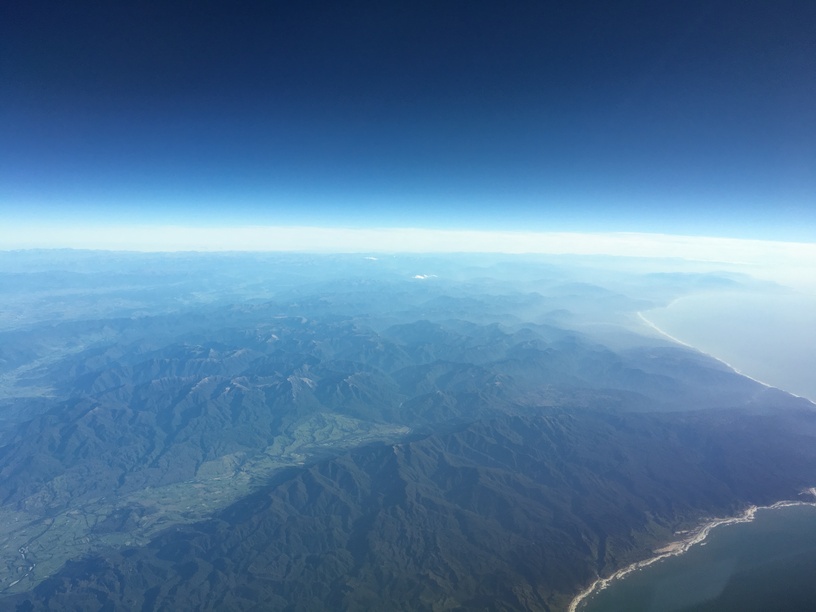
We leave the coast behind as we’re heading further south, Brazil streaches on and on.

Despite what the manual says, the A400 didn’t feel happy at 35,000ft, so we settle back down to FL300. With very little to do aside I have a quick check of George and the instruments and its time to take the dog for a walk.

When I get back things haven’t changed much in scenery, we’re 40 minutes further, but there’s weather about with lightning flashing between the clouds.

ETE 1:33 Auxiliary wing tanks dry. Still plenty of fuel. Total burn should be just over 40,000Kg with 50,000kg capacity there’s plenty.

I’m making preparation for decent and have a look outside. I can’t believe what I’m seeing, overcast. Real thick stuff as well. Typical.

The wind has picked up aat this alt and is gusting between 360 and 70 degrees, causing the a/c to be chucked around.

Fortunately 30 minutes out, the overcast clears and we start talking to approach. I’m hoping our fully liveried RAF aircraft wont be a problem and we’ll get a nice welcome from the Argentinians, it was 34 years ago after all. :stuck_out_tongue:

We’re given clearance to land on Runway 35, I then realise I’ve set up for the other runway. A quick dog leg left and we’re on finals to land.

All my attention is on the PAPI lights but the odd flash just before the piano keys is drawing my attention as we get closer. I’m at about 600 ft, nicely on the glideslope when ATC asks me to go around. As we get closer I realise why…

Narrowly avoiding an international incident, I clean up the aircraft and go around listening for air traffic to give clearance to the a/c sat on the threshold.

We’re soon given clearance to land, this time without any issues.

A quick taxi to the gate and shutdown on what is now my longest distance flown in a single trip.

Despite my best efforts I have to confess to using time compression for a while as I was concerned I wouldn’t get this finished.

One further leg to the Falklands, then a quick stop and hop to Antartica and we’re there.

5 Likes

Wow…those are some great screens. The weather and that A400M are a match made in heaven. And I love that HUD…

Eh, no trouble at all!

1 Like

LOL…I’m still trying to figure out if I actually have that third engine running or not. From what I can tell, there is a small jet engine mounted on the aft end of the right engine which is supposed to give some extra thrust. I have an axis mapped to it…but I don’t know where I read the power off that or if there is any…or what altitude it is good to. Or anything. I might not have even started it…LOL…

Maybe it’s the APU? If so, maybe that is why the APU wouldn’t light off…because the start-video I watched implied the APU had to be at 10%…and my Engine #3 axis probably was not…

“Instead of simply discarding the engine, Tumanskiy engineers redesigned it into a combination APU/booster engine, the “RU19A-300”, with a thrust of 2.16 kN (220 kgp / 485 lbf).”

“While early An-26 production featured the PSBN-3N radar, later production has the more advanced Groza-26 radar. Later production also featured the intake for the RU19A-300 APU/booster moved from the right side of the engine nacelle to the bottom.”

Well there you have it: SOURCE

1 Like

Unfortunately I ran out of time and was unable to complete the challenge but here is my Mudspike Christmas Flight AAR with a twist…

My trusty steed for the trip, a Global Express XRS. Here we are, all ready to go on the ramp at KAUS…

It was a chilly, windy day in Austin Texas. Our first leg takes us to PHKO, Kona on Hawaii’s Big Island.

I’m in the right seat for this leg, which means I am going to be busy with the checklists, radios and extra paperwork that goes hand in hand with an oceanic flight.

Takeoff was uneventful. We climbed through a low layer of stratus and soon broke out into the brilliant sunshine. Breaking out on top never gets old, at least for me.

The first part of the flight has us flying across Texas, to fly over El Paso. When flying over El Paso it always strikes me that Texas is a huge piece of real estate! It takes about 50 minutes flight time before we cross over the border into New Mexico.

From there we continue West to our coast out point near Los Angeles. Along the way we pass Tucson, Phoenix and Palm Springs.

While flying over the desert, I had plenty of time to get my plotting chart ready for the oceanic phase of the flight…

Despite being equipped with GPS and 3 IRS’s, we still plot our position along the way just in case everything goes dark on us. We also plot Equal Time Points between coast out and coast in airports for various scenarios such as a medical emergency, loss of an engine and cabin depressurization.

Here we are crossing the coast just South of Los Angeles:

At this time I get busy checking in with San Francisco Radio on HF, obtaining a SELCAL check, checking the FMS position against VOR/DME position and logging onto Oakland Center via CPDLC. We also check the indicated fuel and fuel used to this point against the flight planned figures.

The crossing itself takes about 5 hours at M0.85, FL430. Not much to see out over the ocean but sea and clouds. For this flight, it turned into a solid undercast of cloud for most of the flight.

Some time later we get a message on CPDLC to contact HCF Center on VHF. Once voice communication is established and they have us on radar, things get back to normal. We are given clearance to descend and soon find ourselves on the ILS for Kona’s runway 17.

Once on the ground, we help our passengers get on their way and then get the airplane cleaned up and ready for the next leg. We were also treated to a nice sunset, and a double rainbow…

Leg 2 to follow…

7 Likes

Leg 2: PHKO-NZQN.

After a good night’s rest, it was time to head back to the airport for the long trek down to Queenstown on New Zealand’s South Island.

The flight will take just under 10 hours, which is a good thing as over 10 hours requires an augmented crew under Pt135 regs (i.e. an additional pilot).

The route is pretty much a straight shot.

Here we are about 40 minutes into the flight. The FMS tells us we only have 8 hours and 58 minutes to go! We should land with a very comfortable 7800 Lbs of fuel.

For several hours there is literally nothing to see… just cloud and the ocean far below us. Eventually we start to see some weather up ahead that I have found to be a good indication that we are approaching Samoa. Every time I have flown from Hawaii to New Zealand there have always been CB’s over the islands.

After Samoa there are a number of islands to look at, but unfortunately they were covered by an extensive cloud layer. The next land we saw was New Zealand itself.

Our route took us right over Auckland and then along the West coast of the North Island.
Near the waypoint LAKAR on the map above, is Mt Taranaki (aka Mt Egmont). This is the “Lonely Mountain” from the Hobbit movies. We could see it on the horizon even before we coasted in at Auckland.
We had a great view as we passed by…

A short time later we are now over the South Island and thinking about our approach into Queenstown. The terrain is much different on the South Island from that of the North Island. Think of the North Island as being the Shire and the South Island as being the Misty Mountains, Mordor etc etc.

As Chris described in his PC Pilot article Challenging Airports, Queenstown is, well, challenging. It is nestled between some impressive terrain next to a lake. One look at the approach chart will tell you that this is an airport that needs to be treated with a lot of respect.

Fortunately the weather was good, and so a visual approach was possible (for the most part following the course of the RNAV approach shown above).

Down safe and sound.

A shot of Queenstown airport taken from the side of the mountain just to the South…

A couple of days later, we were tasked to hop over to Christchurch, so you could say that the virtual Christmas presents were delivered to the US Antarctic Program for delivery to McMurdo, but that’s as close to Antarctica as I am ever likely to get.

9 Likes

Close enough! Wow…Kona, Queenstown, and Christchurch all in a matter of a few days - you are living life in the fast lane my friend…! I recognize that JeppView format… :smiley:

Happy Holidays and thanks for participating Paul - we enjoyed it. Have a great New Year!

5 Likes

Outstanding report Paul and another beni to MUDSPIKE membership, getting reports from RL flight crews. That jet is really interesting as well. My route stopped on the North Island at NZAA, but my screens don’t look quite as authentic :slight_smile:

3 Likes

Uh, guys…which one of you did this?

http://www.news.com.au/technology/science/satellite-spots-massive-object-hidden-under-the-frozen-wastes-of-antarctica/news-story/dfdc58ee88bde178ceb611782185f39a

1 Like

Thanks Chris, it has been quite a trip. Happy New Year to you too!

@Sine_Nomine, lol. I will have to talk with our mechanics about installing a selfie stick so that I can get some cool shots ;).

1 Like

I hoped, but no chance for my last hop to Antarctica tonight. See you there in 2017.
Will spend new years eve in Port Elizabeth, SA.

Happy new year to all of you!

3 Likes

Nice! I’m always leery of any “Plan B”…LOL… But given the stench of Plan A…by all means!

On a personal note - the Falklands is on my personal bucket list. I would LOVE to visit there. The history of the place is fascinating.

1 Like

1 Like

SAEZ → EGYP (RAF Mount Pleasant Airbase)

Probably like most of the UK, prior to 1982 I had no idea where the Falkland Islands were. I was more interested in Star Wars action figures and reading stories about Spitfires and the Battle of Britain.

As a child, The Falkands conflict was the first war that I really remembered. The BBC coverage was unprecendented at the time and covered the war thoroughly. Initially I thought this was just another boring news story and it was only the footage of the task force leaving the UK and my Dad telling me “we’re at war” that I started to absorb what was happening.

Ever since then I’ve had an interest in this small overseas territory and partly one of the reasons I wanted to give this flight a go.

I couldn’t get P3D to accept an airways plan for the flight. I spent a good hour messing about with the in game planner trying to amend the direct route manually to resemble what I planned in sky vector. This adventure has shown that I don’t know enough about the flight planner or planning and need to RTFM. In the end, after much swearing, I gave up. Direct GPS VFR it would have to be.

Lining up on the active runway I asked for permission to take off. ATC told me to taxi and hold short of the active runway. Remembering the airliner that was on the runway when I came into land before I thought maybe there must be a line on the runway somewhere which would trigger the right radio command.

As I rolled forward, the tower told me that I didn’t have permission to move and to hold on the taxiway. Then the radio commands didn’t change. Time was getting on, so flicking the V’s at the tower, I pushed the throttles forward and got out of there as fast as possible.


“… you do not have permission to take off” - yep whatever.

With a direct route it didn’t take long before we were crossing the coast. Looking round it felt like we were about to fall off the end of the world. The coastline sprawling south and a deep blue sky above.

The Falklands is only 300 miles from the Argentinian coast at the closest point, but its about 90 minutes on our route. I’d run out of buttons to press so amused myself by trying to work out how to properly program destinations into the FMC.

Eventually the islands came into view through broken cloud.

I’d loaded some Falklands scenery and an “RAF Mount Pleasant” airport. As I roughly knew where things were, I decided that I may as well have a bit of a tour.


Dropping down below the cloud I worked out where we were using the FMC.


As we approach Falkland sound we run through a rain squall.


Running down San Carlos water where the initial landings took place. This was known as Bomb Alley during the conflict. Over Darwin and Goose Green, I run out down Choiseul Sound and turn towards Stanley.

As we flew low across Stanley airport, I was a little disappointed not to see the scars from the stick of 1,000lb bombs that were dropped by Vulcan 607, but its not photo scenery that I’ve loaded. However, I did see a bright red Twin Otter parked by the hanger. :stuck_out_tongue:

The weather was now closing in and turning this big aircraft round like a fighter was making the engines run hot, so set up the approach to Mount Pleasant.


Lining up on runway 28, there was a 30 knot wind coming from 250. With the aircraft set up for landing the approach seemed to take an age.


Slightly off the centreline and a bit high.


A bootful of rudder on touchdown there’s a squeal of tyres and we’re down. Looking forward to that cup of tea and a nice pint already.

My ATC woes continue as we’re told that we need to vacate the runway as quickly as possible, so take the first exit I can. Unfortunately this is into a dispersal made for a Typhoon, not an A400.

As the ground crew push us back, a red Twin Otter flies overhead heading south.

4 Likes

Great report. I had a guy “tdg” do a custom scenery for X-Plane that featured the Port Stanley airport as it was at the time of occupation by the Argentines. The reason was that I was writing a two part article on the airfield for the magazine and I was writing about the very interesting 737-200 operations that Aerolineas Argentinas conducted to that very short, wet runway. The second part of the article featured the incredible engineering the Royal Engineers did after retaking the airport, extending the runway, and providing just barely enough room to operate their F-4 Phantoms. The entire story of the airfield is incredible.


4 Likes

Thanks Beach, that looks amazing. Much better than what I saw on the overflight. I can see that I’m going to have to give X-plane a go at some point.

The second part of the article featured the incredible engineering the Royal Engineers did after retaking the airport, extending the runway, and providing just barely enough room to operate their F-4 Phantoms.
I think it still exists like that today, though they’ve shortened it for main use.

The six craters to the lower left of the airfield was the tail end of the bomb run.

2 Likes

I’ve made it, just in time. My destination (Marambio Base - SAWB). AAR later.

Happy New Year all.

6 Likes

Well it’s been like three weeks. I should finally post my final leg.

Myself and Gibbs sit attached to the catapult on the Nimitz, waiting for the signal to take off. The weather has not improved in this part of the world, and we’re soaked after clambering up the tall side of our mighty cat. I’m moderately concerned, considering our destination, that it won’t dry before we get there. Hypothermia is a stupid way for a pilot to die. Making things worse are the poopy suits we’re now wearing, heavy great survival gear that will allow us to survive 30 minutes instead of 10 in the freezing Antarctic ocean.

I’m somewhat eager to get away from the boat. Last night, in a subtle form of revenge, myself and the Junior Officers of VFA-154 hosted the first, and only South Seas Tomcat Ball. A brilliantly executed plan saw us break into the booze Gibbs and myself had been carrying for McMurdo (sorry scientists), and share it with our fellow naval aviators in the dirt shirt mess. Nothing got too rowdy, there isn’t room enough in an F-14 without travel pods to carry enough booze to seriously effect a fighter squadron, much less a Navy one, but still I directly flaunted a (stupid) established naval law, and word gets around on ships fast. I don’t regret it, I’m childishly gleeful I got back in my own way at the ship’s captain for his terrible seamanship, and Gibbs and I made a number of professional contacts.

But still, It’s harder to properly punish me if I’m not on the boat.

The shooter gives us the go sign, and I tense in anticipation of what comes next. Gibbs and I are shoved back into our seats as the steam catapult on the Nimitz flings us off the waist off the ship. Helped by our twin GE’s, the plane decides that it accepts this new state of being, and we promptly climb away.

I pull the throttle out of burner, and begin a spiraling climb to meet the tanker orbiting over the carrier. We’ll fill our tanks up here, and then begin our long trip down to McMurdo.

The rejoin goes without drama, and we strike out on our own.

The eagle eyed amongst you might have noticed that the “tunnel”, the four (technically eight) pylons located between the engines are not empty as they’ve been for our previous hops. Today we’re carrying a DTARPS pod, or Digital Tactical Airborne Reconnaissance Pod System. It’s the ultimate form of a system originally created in the 80s when the Navy needed a replacement for the venerable RF-8 Photo-Crusaders that were then retiring. The DTARPS has a number of high definition black and white as well as thermal imaging equipment that can even be linked back to a ground system in real time. The system was cherished more than gold during Desert Storm, Yugoslavia and Kosovo where it proved more capable and flexible than the aging RF-4s.

You might also notice the Mk-82 on the forward pylon. I’m assured it’s not live (I asked, repeatedly), but this is done for balance. Heavy loads aft of the CG on the Tomcat are a no-no for a number of reasons. Traditionally balancing this out would have been done by either a dummy AIM-7 Sparrow, or later using two Pheonix pallets, one loaded down with a jammer, the other with a metric crap ton of flares and chaff.

We’re carrying this down so that we can do a number of runs to measure the ice, and other such sciency things.

After a few hundred miles, Gibbs excitedly points out he can see ice burgs through breaks in the weather.

We see more the further south we go.

We’re a couple hundred miles out. We’re not fuel critical yet, but it’s something to keep an eye on. I ease the throttles back a hair just to be sure.

Land Ho!

We’re still 147 miles out, but I can see Ross Island in the distance.

Feet Dry… Ish? This is all ice-shelf, I’m not technically sure what the nomenclature here is. Feet Cold?

Compression ridges off the north side of Ross Island.

Fuel has become an issue. We’ll make it, but I’m not comfortable dallying.

Descending over the south end of Ross

Antarctica proper in the distance.

Buzzing the nerds at McMurdo. Sorry about your Booze guys.

McMurdo Field

Our turn through the pattern is hasty, but otherwise uneventful. I land a little long, but I want to be absolutely sure I don’t do something stupid, and I’m extremely reticent about this ice runway. I do two things I’ve never done in a Navy Jet before. First. I flare, and feel strange for it.

Second, I keep replaying the tragic fate of Commander Hank Kleeman in my mind. He was one of the Tomcat drivers in the 1981 Gulf of Sydra Incident. He unfortunately passed a few years later after his Hornet rolled after hydroplaning on the runway at NAS Miramar. I’d rather not do something similar. So I aerobrake, attempting to re frame from using my actual brakes until the last possible moment.

The Tomcat stops in it’s time, and we back taxi to the improvised “tarmac” (a large square cleared area). We pass a snow blower keeping the area clear.

We park as directed, and begin shutting down the aircraft.

I’m quite frankly disappointed. It’s cold, yes, but at a relatively balmy 32 degrees Fahrenheit, it’s not the balls-shlurping-inside-you cold I had been steeling myself for the whole trip. We disembark, and somewhat uneasily make our way towards the welcoming committee. We’ve made it to Antarctica.

6 Likes