DCS Mission Preview: Fire Cube

As mentioned in the Spring 2021 thread - @Franze has worked out an inital test of this somewhat bold new mission idea that takes a new direction in design far into the procedural area of flight simulation and makes the consideration and understanding of some real-world air power tactics & strategy both interesting and essential. This is still an early idea so we may make a lot of changes still to refine the concept, but the early tests have been pretty good!

Original reference here for a concept overview:

So without further delay - screenshots are in order!

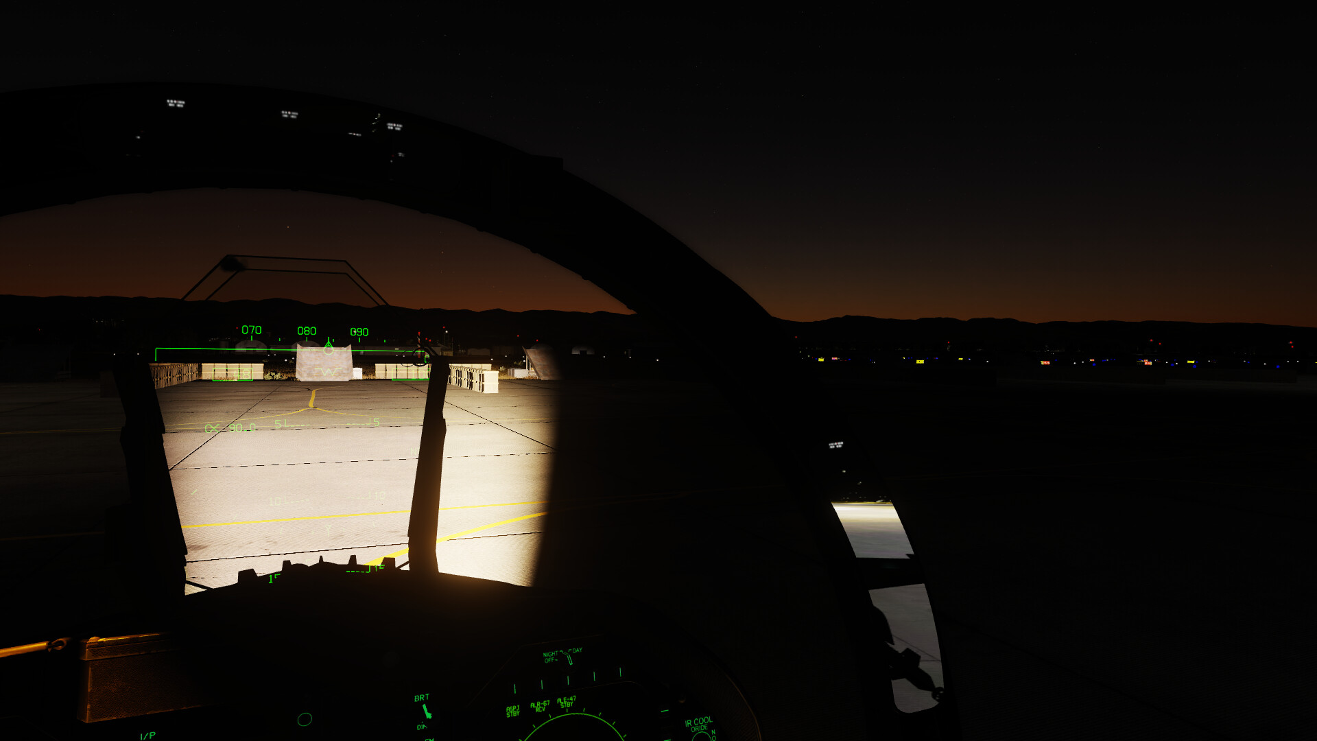
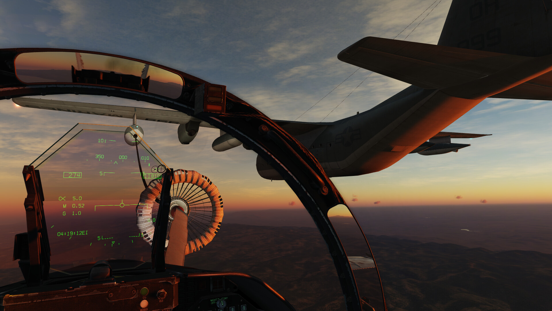
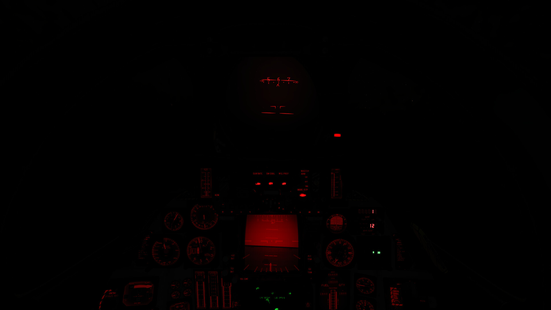
@Franze flies at roughly 40,000ft as the sunlight begins to wash over the horizon. Mission Start time is 4:30AM leaving about two and a half hours of darkness. Moonlight fades away as dawn draws closers. Instrument flying and sensors are key at mission start.


.
.
.

Cockpit view from the F-14.


.
.
.

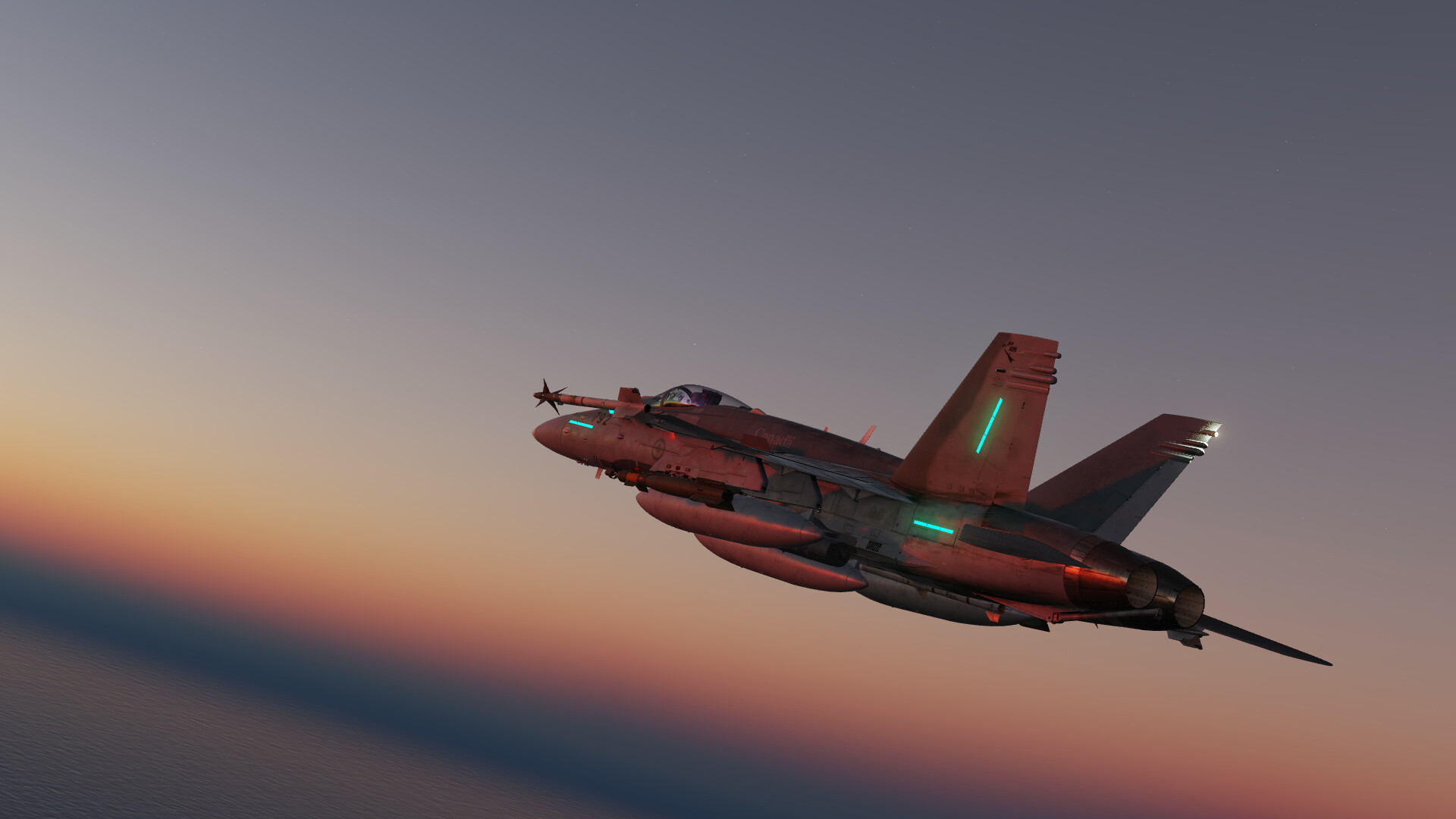
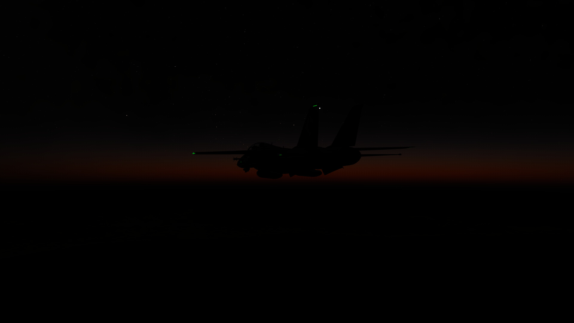
External view before initial sunrise.


.
.
.

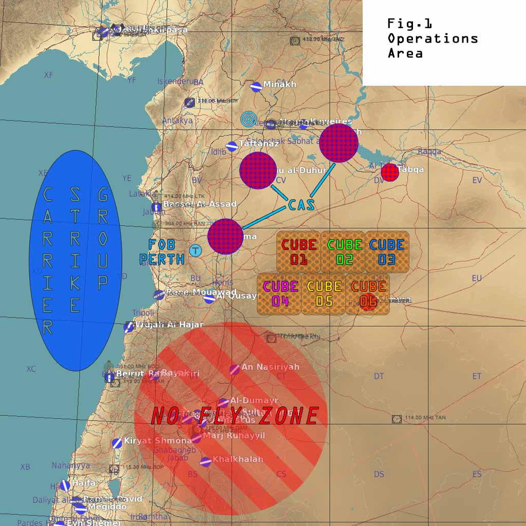
The OpFor is pretty lightly armed, with vintage equipment - although harder to find. There is no F10 indications when you are flying. F10 is Map Only. CAS aircraft such an A-10C and AV-8B have waypoints near front area objectives - they don’t have too much searching to do. The jets however, are in for a trip. This mission may also randomly feature a Panzer of the Lake!


.
.
.

The opposition air power is few and far between, but should not be discounted.


.
.
.

Learning the navigation systems of the aircraft can be a huge benefit. Here I taught myself to add a second waypoint sequence to my Hornet, creating a box on the HSI/SA with a series of waypoints that enclose the kill-box area, keeping me in the right area and making searching without visual reference easier.


.
.
.

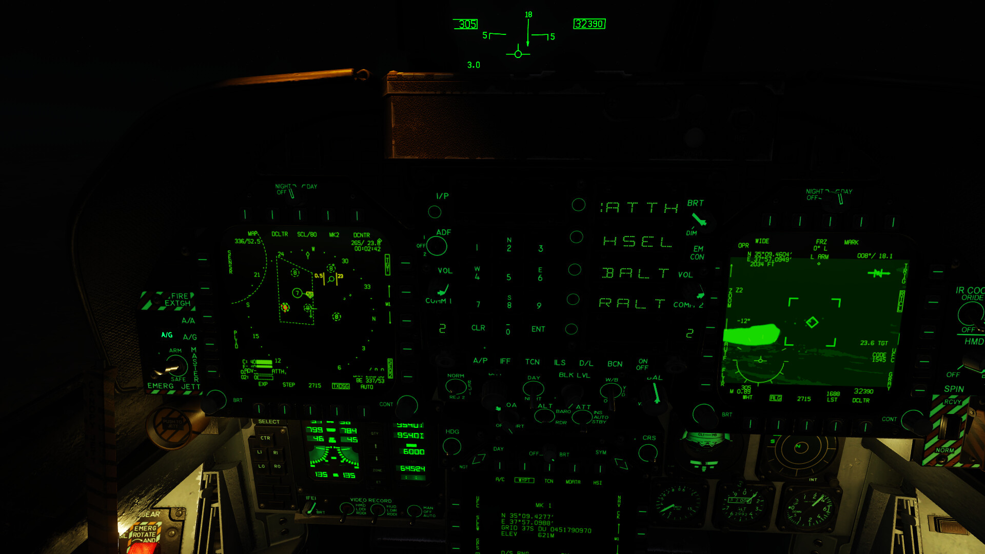
Another seemingly boring cockpit capture with a lot of information present:

Right DDI: TGP view of a discovered target in the Kill-Box region.

Left DDI: SA Page view showing the Kill-Box waypoint sequence, my A/A waypoint “bullseye” #7, and the location of @Franze in an A-10CII after I passed him target coordinates. SA let me verify he was on-course. He would work over the target after I dropped the two GBU-12 I carried. Three drop tanks was needed for this as I didn’t make a tanker stop.

MPCD: HSI Markpoint Data, allowing me to see MGRS Grid coordinates for the target. MGRS is much quicker to pass across the radio. Typically you only need to send the rightmost two letters and ten digits - 12 characters, or 15 for the full string. Long/Lat Decimal format would be 16 characters and Long/Lat Min/Sec/Decimal is 18. This doesn’t include calling directions for lat/long and elevations (all modes).

Let me know what you think - I’ll add some of the briefing information and overview when I am back at my home PC.

11 Likes

Some of the Briefing Slides:

Figure 1: Operations Area.

Figure 2: Front Lines, Tanker Tracks, Allied & Enemy Airfields.

Figure 3: Kill-Box “Cubes” - up to the FAC(A)'s to work out who works where between them if there are multiple.

BACKGROUND:
During OIF, Coalition Air Operations Command (CAOC) mission planners devised the Fire Control Support Line system (FCSL). The intent was to reduce blue-on-blue events by leveraging air power under the Joint Force Air Component Commander (JFACC) beyond the FCSL while putting them under control of the ground commanders up to that point. General Franks opted for a “deep FCSL” strategy as OIF took off, allowing army or marine divisional commanders to control joint fire out to 100 miles beyond the FCSL. CENTCOM created the killbox system, allowing the JFACC to leverage operations beyond this point. Areas of roughly 18.5 square miles were divided up by the ground commanders, wherein air power was allowed to search and destroy until they were closed off by the arrival of friendly troops.

Additional:

  • Joint fires includes Jets, Helicopters and Artillery units.
  • CAS Aircraft working near the front line area should coordinate with ground commanders to verify targets as friendly troops are in the vicinity and if in active use by a player, likely be in danger-close conditions.
  • I have yet to find the definition for danger close for aircraft based attacks, however gun type attacks I have seen as low as 600m to friendly troops for mortars and artillery, 750mm for 5in naval guns, and as far as 2000m for MLRS rocket artillery.
  • Combined Arms players are presented an F10 Fog-Of-War type view, only able to see units that the game considers they can “see”. CA Players can use the F6 camera.
  • Player aircraft are MAP ONLY - meaning you cannot see your own position. External views are available, but the map only mode disables the F6 ordinance camera.
  • The BDA tool will also be disabled, you’ll have to verify damage yourself.
  • During OIF Coalition forces targeted fiber optic cable repeater vaults to cut off C&C communications and force them to switch to radio based comms, which could then be jammed. These underground concrete vaults were only visible from the air by a manhole size concrete cover on a small mound in the desert - but were laid along major supply routes - highways, although they were off-road by a hundred meters or so. These are simulated by ground TACAN beacons placed in a similar manner as they are equally small.
  • Targets within the kill box area are static (to avoid AI pathing issues), do not respawn (it will take long enough to find them) and are random (there are dozens of targets in the mission, but a random subset is spawned each mission load) so a replay will not yield predictable target locations.
  • With multiple players you will want to choose to be either a hunter or a killer, but you will need both.
7 Likes

6 Likes

If it helps:

From here:

https://www.trngcmd.marines.mil/Portals/207/Docs/TBS/MCWP%203-23.1%20Close%20Air%20Support.pdf

5 Likes

That’s perfect! Perhaps more detail than we may use day to day for DCS, but I’d rather have the data than not.

The statement about aiming ricochets away from friendlies makes total sense and really puts purpose to the requested final attack heading in 9-line engagements. It was somewhat obvious that direction was to reduce fratricide risk and/or collateral damage risk but again, a specific written reason is great!

Thank you for the reference material!

2 Likes

Anytime!

Final Attack Headings at also important for lasing considerations, since we can all think of an example where the Lasor and the Lasee were confused by an equal opportunity missile. :wink:

Oh, and gun-target lines. You don’t want your front door suppression suppressing you.

1 Like

Yea, laser potential is another big one. Similarly the laser doesn’t magically make the target a radioactive style energy source from all directions so if I laze the side of a tank you won’t spot that from the other side.

Do we have any idea how big the laser “spot” is? Would be interesting to know.

It would depend on the emitter which, like a Radar, would have a dispersion expressed in mils. So, the farther the slant range, the bigger the spot. This is one half of the “foot to mil”consideration.

The other half is the angle which makes a spot
light throw a circle when a wall is illuminated 90 deg on but an ellipse when viewed at an angle.

You’d think a laser spot would be tiny, but not always. :thinking:

I think there’s some of that stuff in the manual I linked.

3 Likes

All good stuff! Closely resembles all the missions I’ve built in the last year or so. Makes sense; I used similar sources, going back to '91. Kind of an ‘amalgamation’ of things from the Air Force, Navy and Marines - annoy them all equally in the end :slight_smile:

2 Likes

Beautiful read!

I have to get my poo all worked out for this! That looks fantastic!

We’ll be flying a test run with a small group tomorrow on Hollo Pointe North with SRS as well.
Estimated start time is 2021-02-13T00:30:00Z.

1 Like