EPOCH Master Pilot Air Rally 2015

Caution: You’re gonna need to refill your Mudspike Morning Turbine Fuel Mug for this longish read…

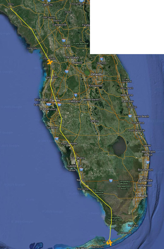
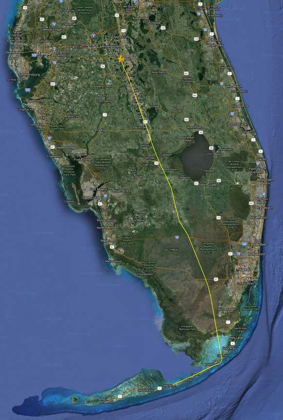
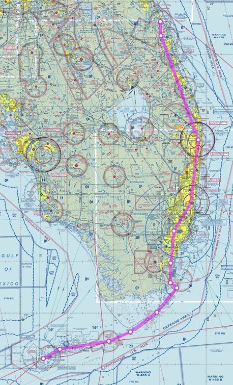
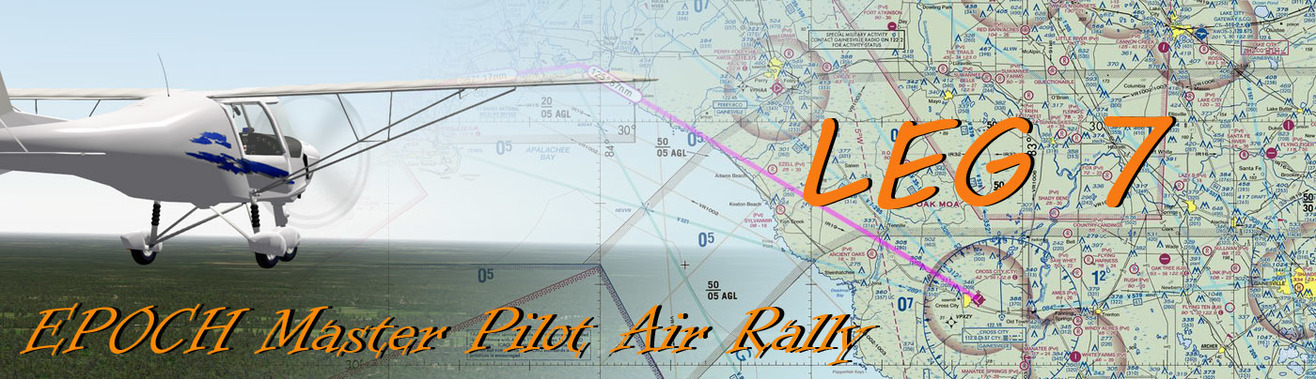
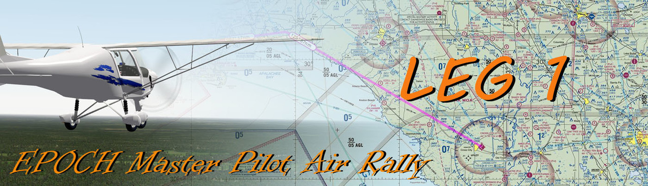
So I kicked off the first leg of the nine leg EPOCH Master Pilot Air Rally yesterday after a bit of puzzling and planning. The rally will crisscross Florida from the Panhandle, down to the Keys, up the center of the state, then back down the east coast to the rally end point in Key West (Duval Street…here we come!). The very rough map with the general route was created by -bc- to give an overview…

HOWEVER - there are some important rules that really make the trip fun and challenging. In an interesting trip, the entire rally will be split over nine flights, in different aircraft classifications, with a maximum of one hour of fuel endurance for each leg. The aircraft categories are:

  • Ultralight / AULA5
  • Single or Twin Turboprop GA (General Aviation)
  • Light Sport (LSA)
  • Single Engine Helicopter / Gyrocopter
  • Single Engine GA Piston
  • Prop Airliner (piston or turbine) with >20 seating capacity
  • Twin Engine GA Piston
  • STOL-capable BushPlane on wheels
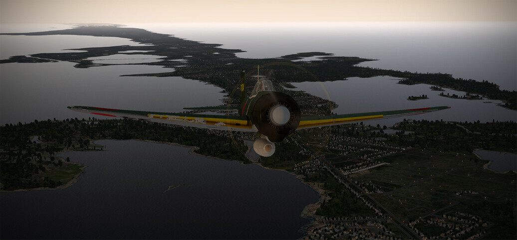
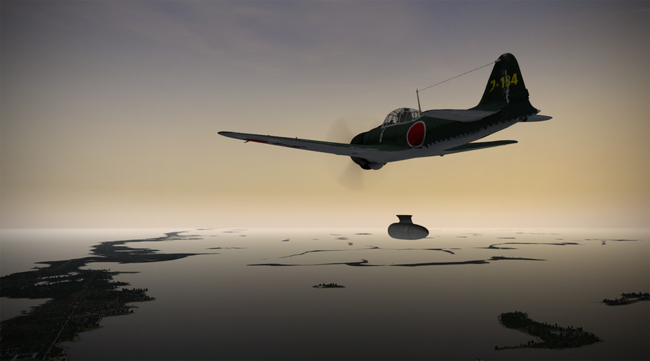
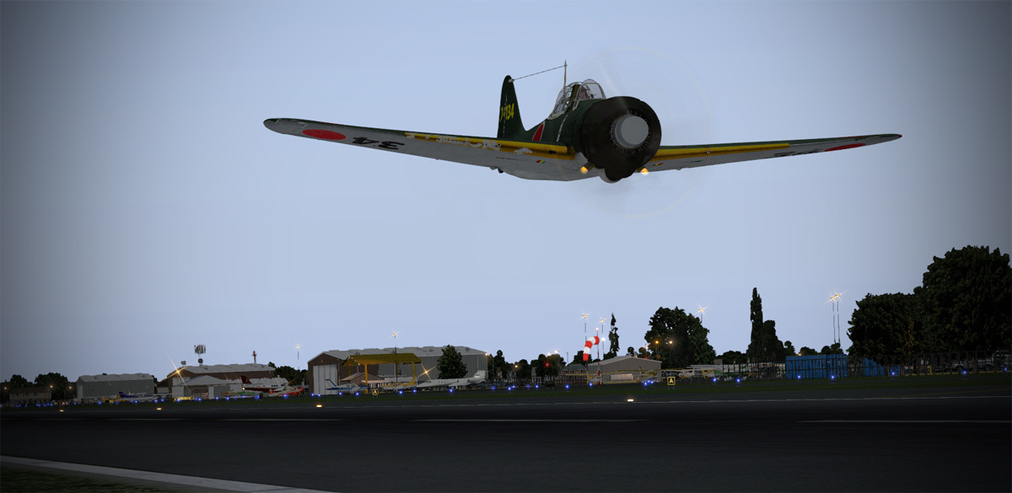
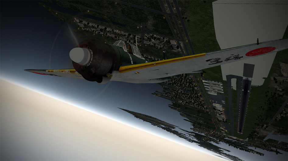
  • Military Single Engine Prop Aircraft from pre-1946 era

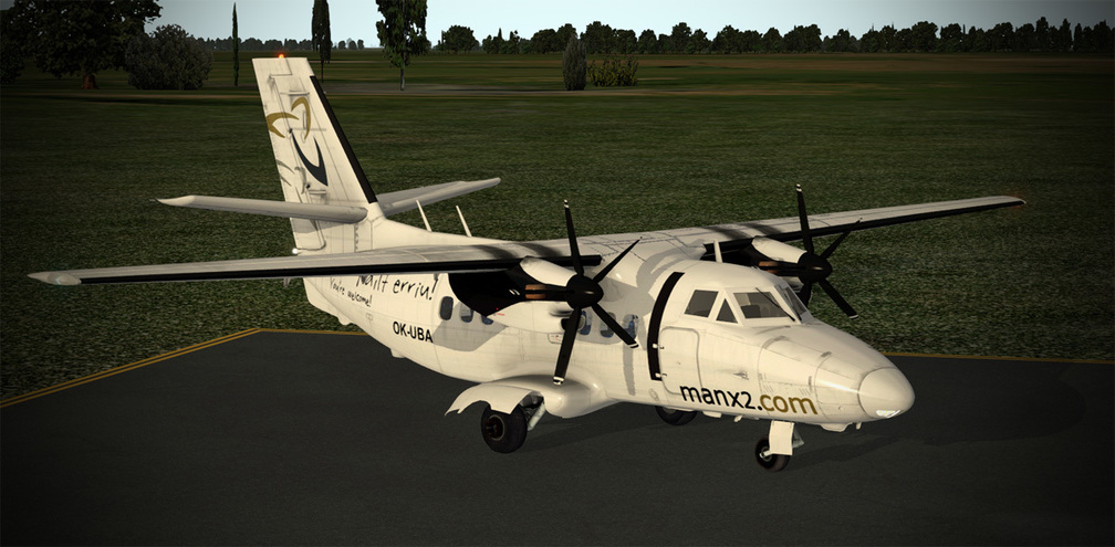
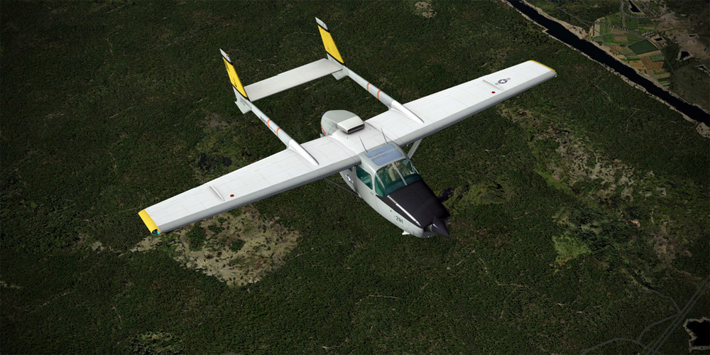
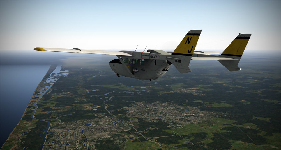
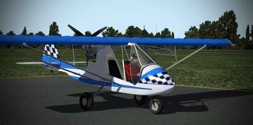
Now, this made for some fun research and introspection. You see, you have to complete all of the nine legs using one aircraft from each category, so you have to think carefully about the distance you can go in one hour, the availability of airfields, the suitability of airfields, and a whole host of other things. Is the weather bad? Will you need an aircraft with an ILS? If you land in the LSA, can you take off from the same airfield in an airplane that requires more runway? The puzzling over this list was awesome fun. Either payware or freeware aircraft can be used.

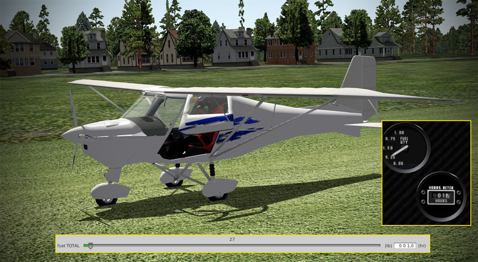
The one hour fuel load is from a cold and dark state as well (or, you can take a five minute fuel penalty and load the flight with engines running). So at least some proficiency with the aircraft is useful so that you aren’t wasting your hour of fuel trying to bring the beast to life. Also, there is an unknown factor that can throw you for a loop since we are just setting the X-Plane fuel slider to = 1 hour. There is no telling if that means 50 minutes or 1 hour and 20 minutes of cruise, high speed cruise, or economy fuel setting. Leaning, power setting, course, winds aloft, and altitude all combine to make the 1 hour of flight a bit of a mystery and continuous monitoring and calculating is necessary. I have to say, my first two legs were quite dynamic with me pounding the calculator to see if I could make it to my planned destination, and having a few backup plans in my pocket just in case. For those that poo-poo civil flying against combat simulation flying, I think you’d be surprised how tense and exciting a challenge like this can be!

There are a couple of rules to the rally that must be kept in mind.

  • Must stay within 1nm of land (with a couple of exceptions around the Keys)
  • Real date / real weather
  • Ramp start / cold start or you get a five minute fuel penalty for each if you choose to runway start / hot start

As well, the three major overall segments (up and down the peninsula) have some specific rules such as staying with 10 or 15nm of the coast (but not more than 1nm from land - so we are mostly talking inland deviations) on two of the segments.

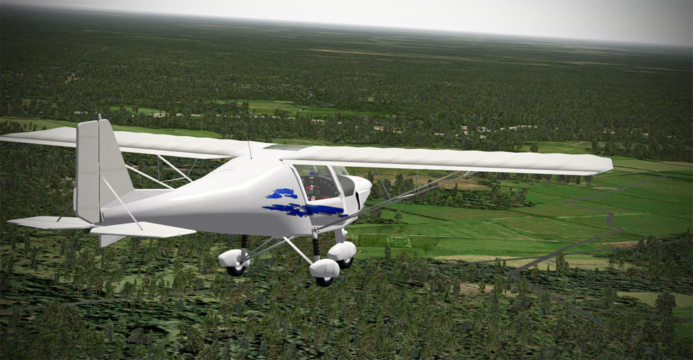
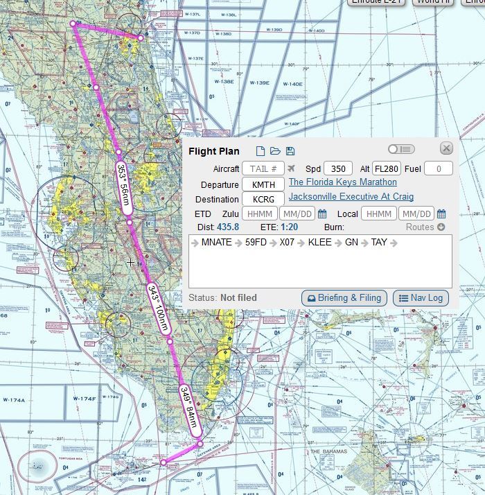
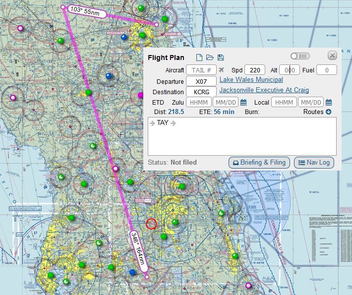
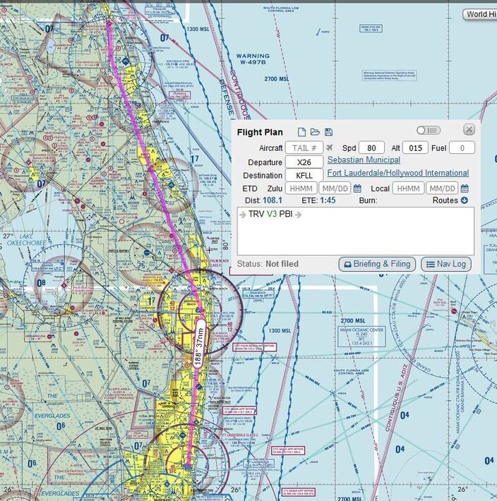
Armed with the rules and sitting down with Sky Vector for the evening and a sheet of paper in front of me, I dove into the planning. First, I needed to come up with a list of aircraft to fly that met the criteria for each of the nine legs. I’ve only settled on a few so far, again, weighing their performance, complexity, and suitability to each leg. You probably don’t want to take a 70 knot cruise ultralight into a 30 knot headwind - so there is some puzzling to do over the selections for sure.

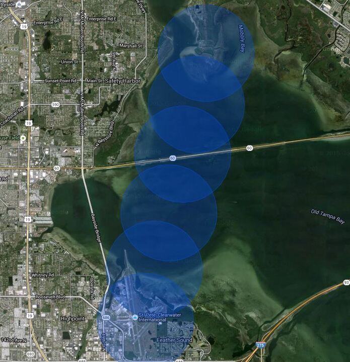
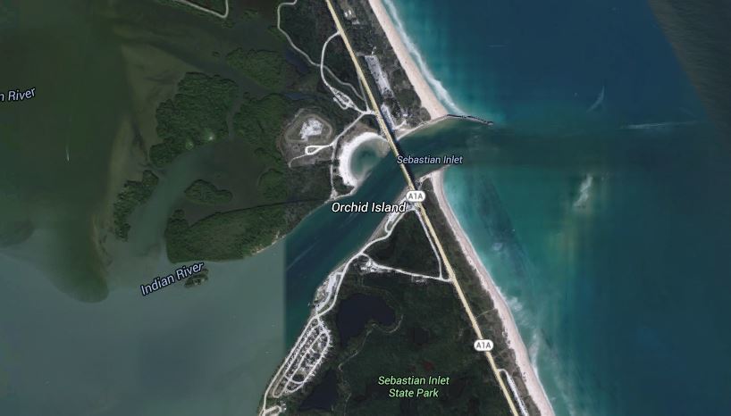
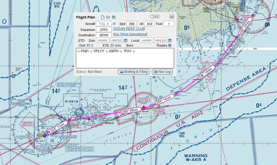
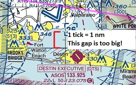
The route planning seems straightforward at first, but on the first major segment down to the Keys from the Panhandle, you have to make sure you are never more than 1nm from land and you also have to make you don’t wander more than 15nm from the coast. So while direct routes are the most efficient, they may not meet the requirements of the rules. So map in hand, one starts researching the route, taking into consideration crossing water bodies and spending some time zooming in on the map to make sure they are legal. Essentially, you cannot cross any body of water that is more than 2nm wide since at the mid-point you will be 1nm from either shore.


I found an excellent planning tool that allows you to input a circle radius and plot it on Google Maps: HERE!

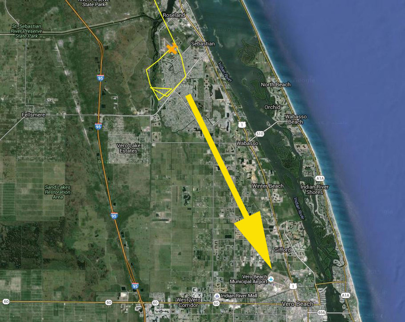
It is super helpful at visualizing just how far from the coast a proposed point might be - but you still have to take care. For instance, this proposed stop in Cross City, FL would keep you legal on the airport, but any flight pattern to the northeast of the field would take you out of the 15nm from the coast rule!

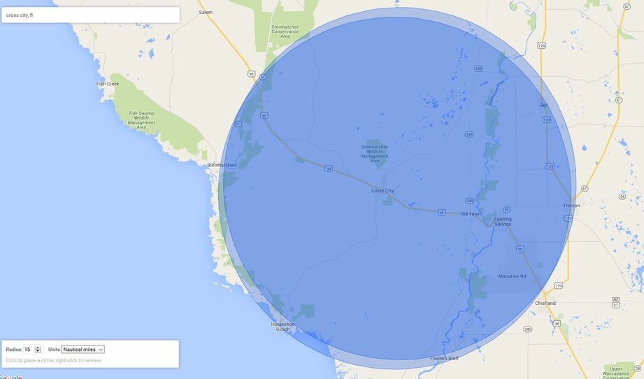
The final approach courses to the northwest/southeast runway, however would be fine…

A 2nm diameter circle plotted on the chart tells me this crossing near Port Charlotte will be within the rules…

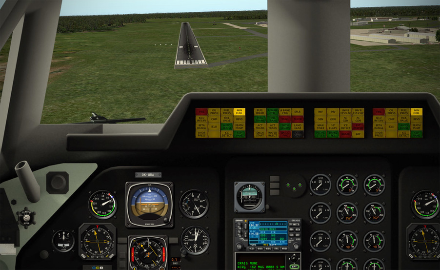
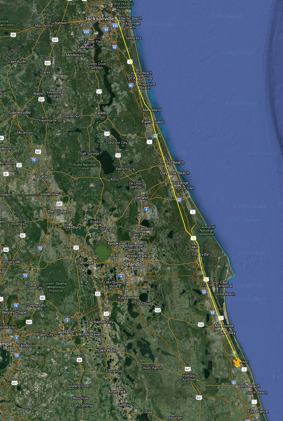
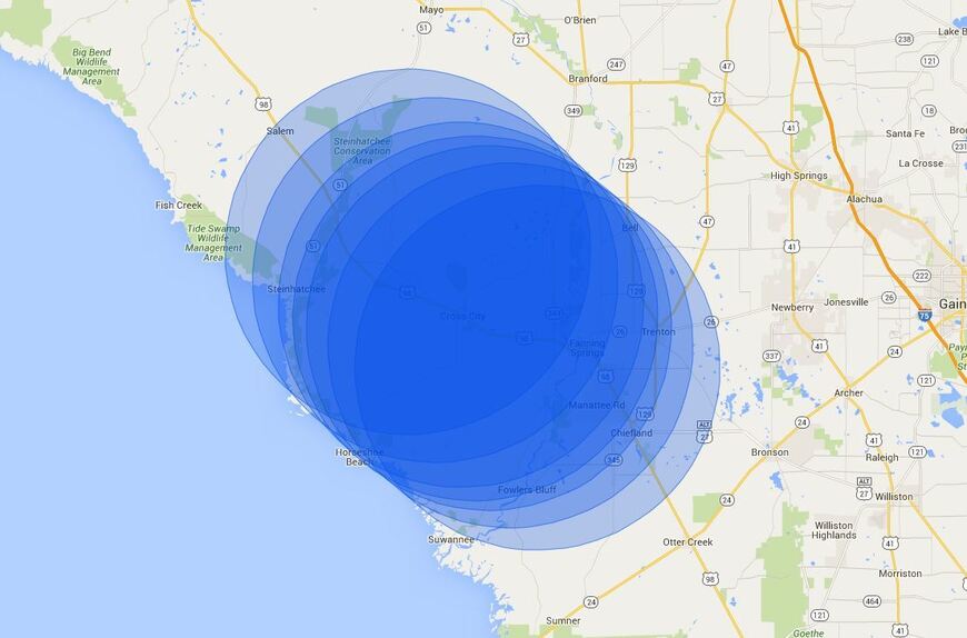
Planning and maps are something I revel in, so this challenge was tailor made to my interests. After a bit of zooming and panning and measuring and plotting - I came up with what I thought was a solid plan. Probably not the most efficient, since it doesn’t take advantage of exact straight lines between points, but it is important to balance efficiency with the ability to navigate the route, not get lost, and not inadvertently break a rule. It is particularly challenging in aircraft with no autopilot and limited avionics (throw in some weather - which to this point has been very good - and you can imagine the chaos!)… (click to enlarge map)

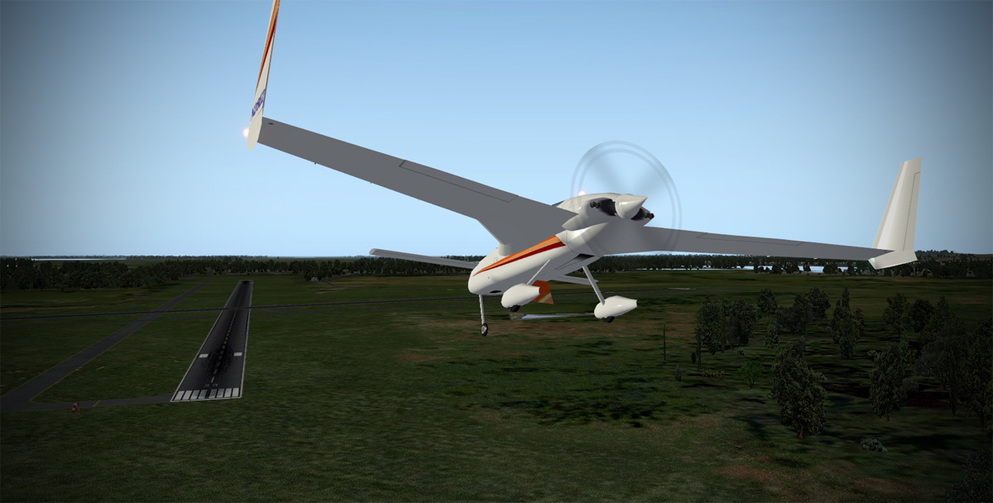
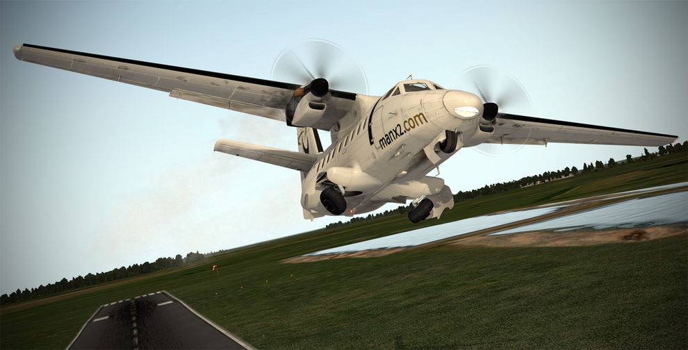
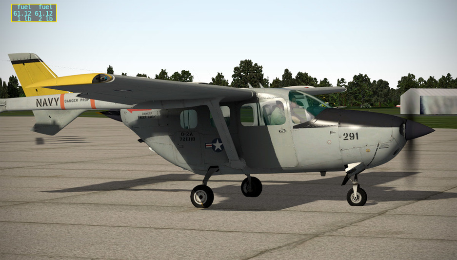
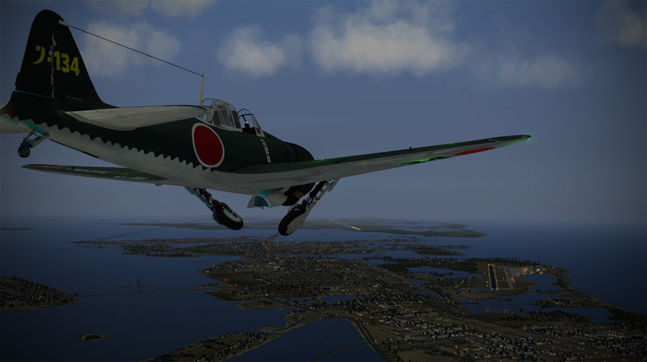
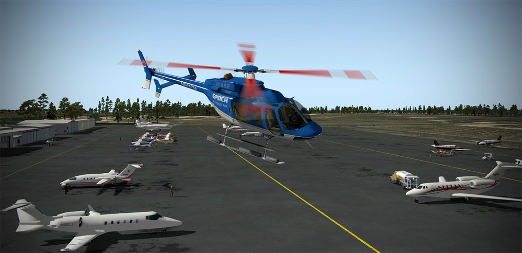
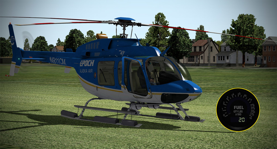
The first category aircraft I chose was the Bell 407 for the Single Engine Helo category. Remember, once you use a category, you cannot use it again. Since the conditions were solid VFR with a slight tailwind, I figured I’d better use up my less capable aircraft first. Diving into the POH for the 407 came up with roughly a 130nm range based on the anticipated fuel burn.

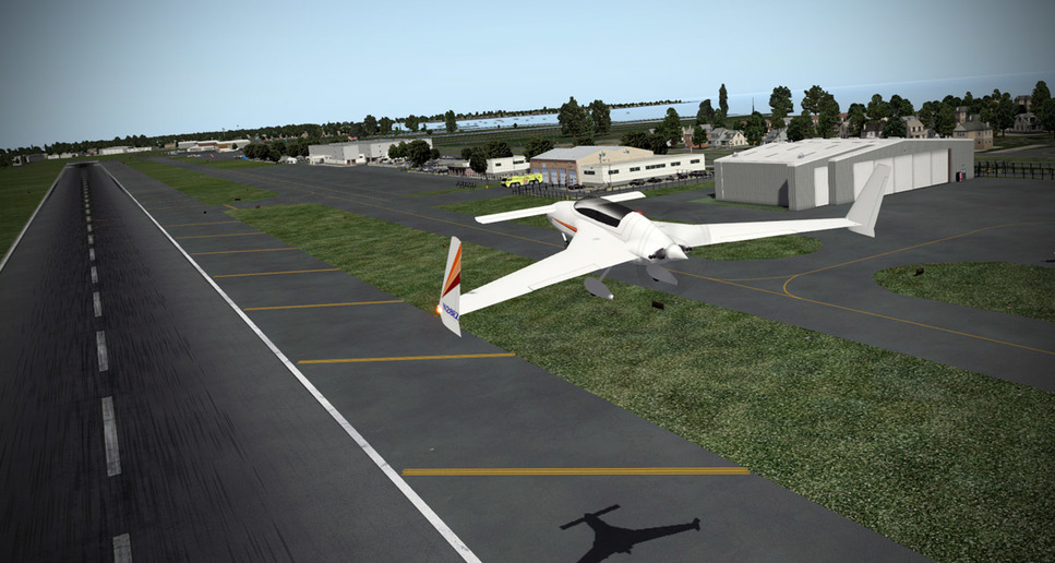
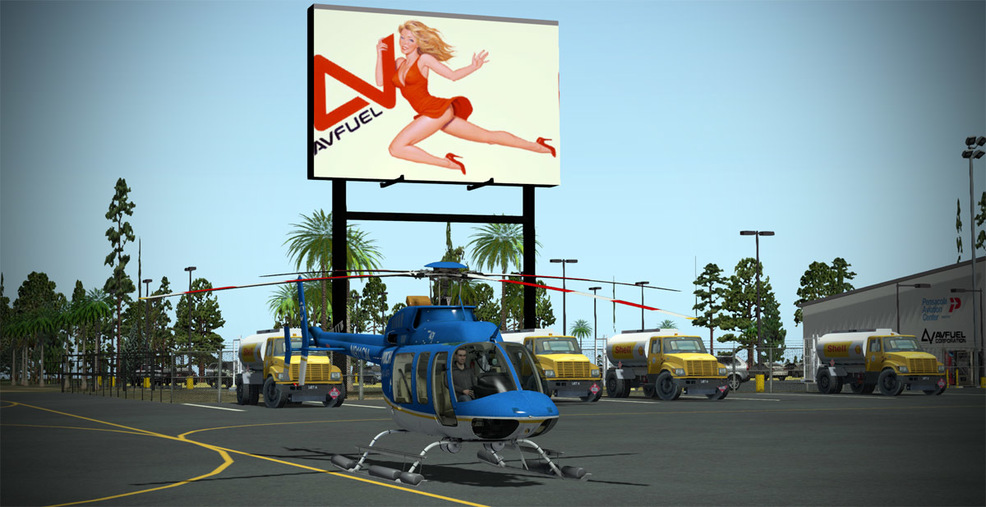
On the ramp at the Rally starting point, and start point for Leg 1 - Pensacola, FL (KPNS). Hey…my helicopter is down there on the bottom you pervs!

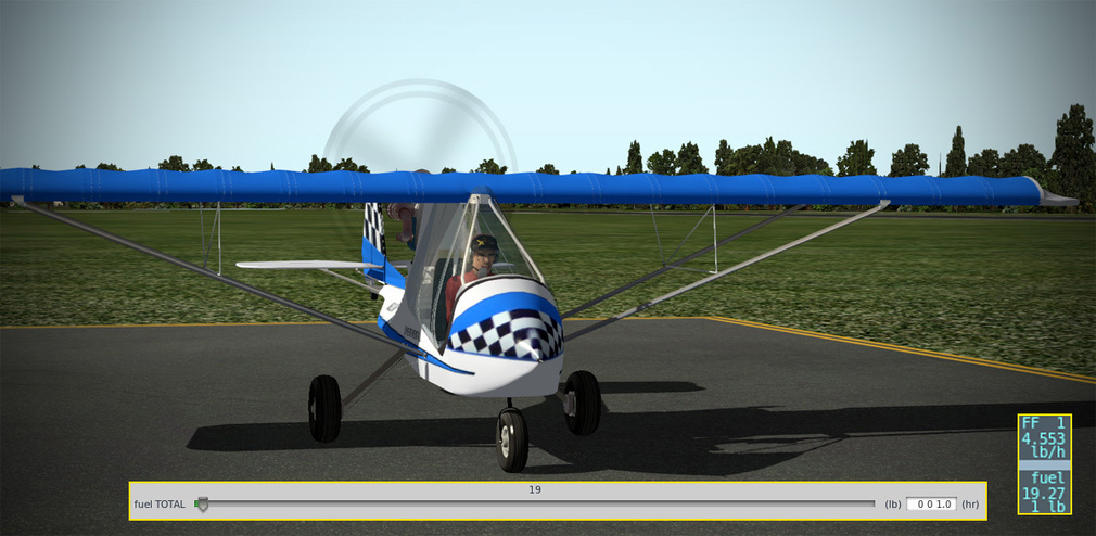
I move the slider to 1.0 hr. of fuel which equates to 277 pounds in the beautiful DreamFoil Bell 407.

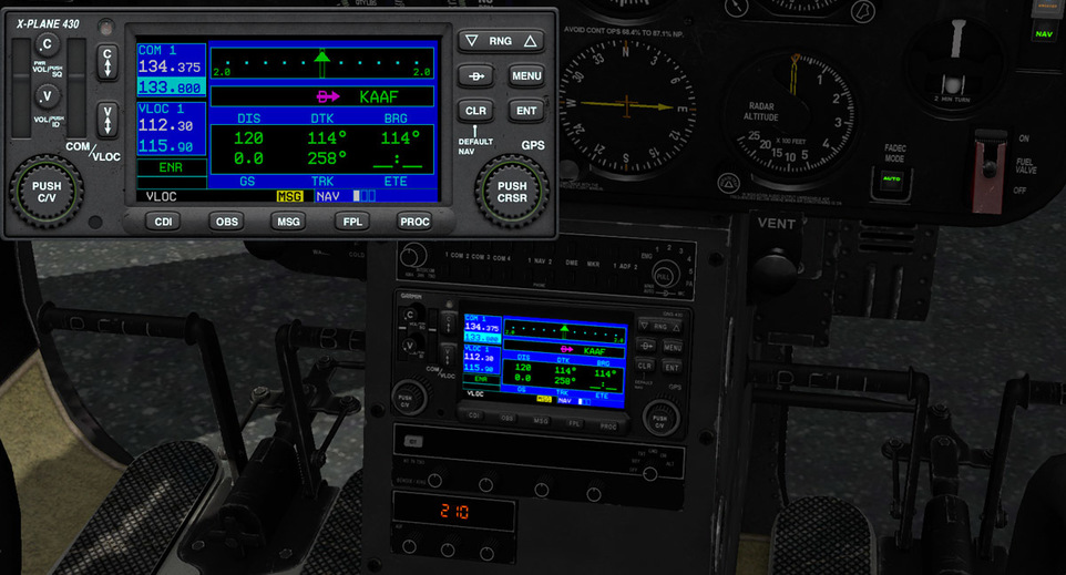
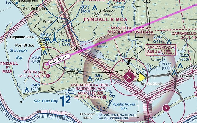
I actually practice a few cold start procedures before embarking on the official leg since time spent on the ramp idling is just eating into your 1 hour of fuel. I get the 407 up and running, and plug my destination (Apalachicola - KAAF) in the GPS…

Off we go…push the nose over…set near maximum torque, and run her up to redline for maximum speed…

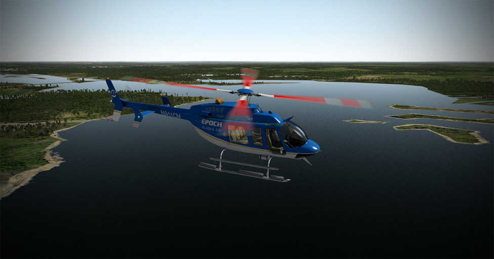
Leaving Pensacola behind…

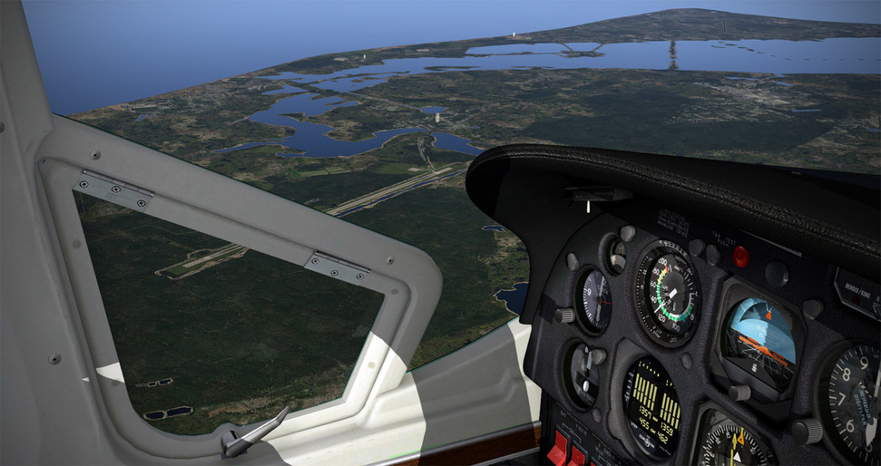
Just leaving Pensacola has some challenges since you have to navigate around Pensacola and Escambia Bays to adhere to the 1nm from land rule. Attention to route planning and positional awareness are paramount during the rally…


Watch out for cell towers when flying low altitude!

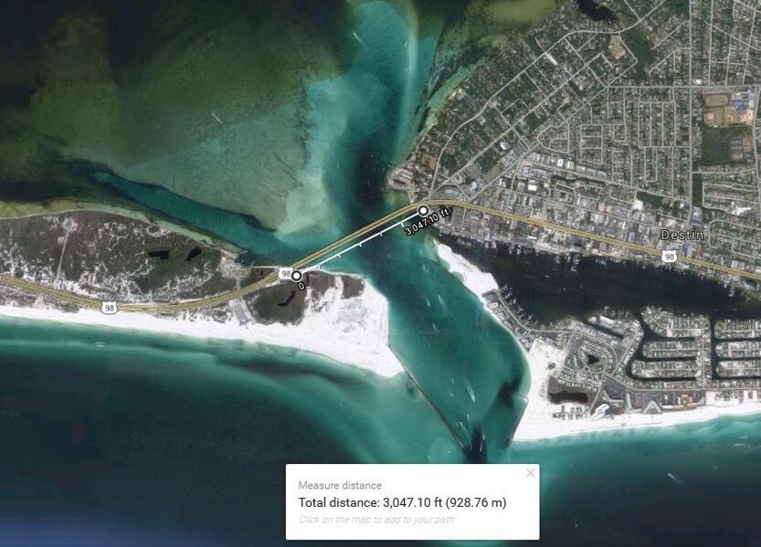
The coastal barrier islands generally work as long as there are not more than 2nm gaps between subsequent islands - here we are headed toward Ft. Walton Beach and Destin…

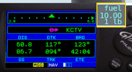
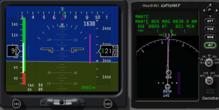
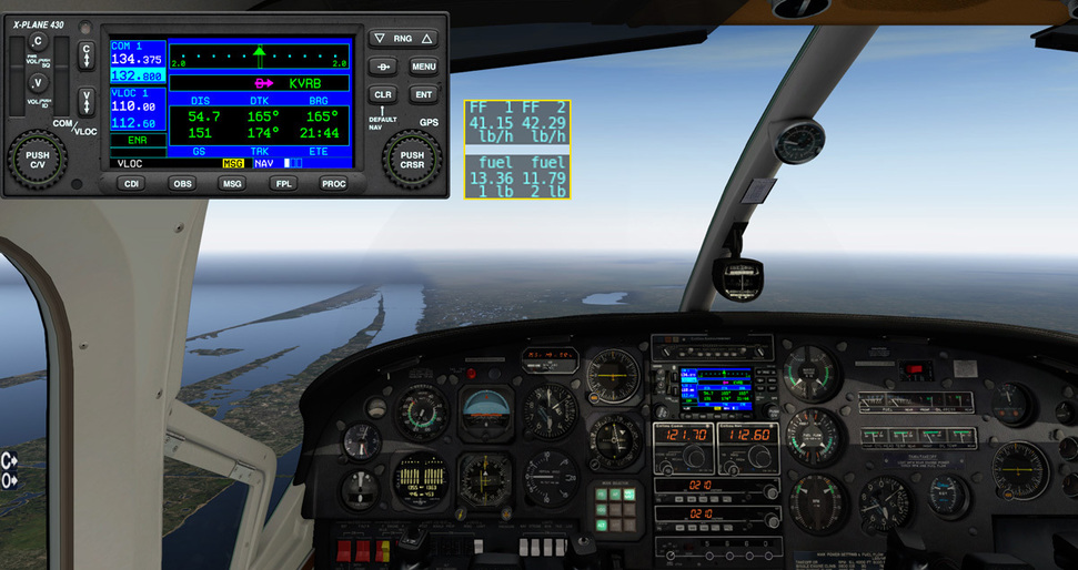
Once the flight settles in a bit, it is time to start comparing the GPS time enroute data to fuel burn. Establishing a baseline fuel burn early (within the first five minutes) is essential to planning further down the line. With such slim fuel margins, you don’t want to pass a bailout point on the route and find yourself stuck between airports with not enough fuel to go forward or retreat. With my timer and my eye on the gauge, I come up with a fuel burn for the 407 of 10 lbs. of fuel every 2 minutes and 5 seconds. So with some simple maths…it is easy to calculate remaining endurance based on the fuel gauge alone. Here we have 108 lbs. @ 10 lbs. every 125 seconds = 1,350 seconds or 22.5 minutes of fuel remaining. Unfortunately, my GPS shows 21:50 to my planned destination. Hmm…

I monitor the situation nearly constantly. As I pass by Tyndall AFB I have to crunch numbers hard. I have 68 pounds remaining = 14 minutes and change of fuel remaining. The GPS is now showing 14:27 to Apalachicola. This is way too tight. Searching frantically for a closer airport I spy the tiny strip of Costin (A51) a bit closer which will give me a bit more breathing room on the fuel. But I have to keep in mind whether it is suitable for the next leg of the rally - can I get my next type of plane in and out of there? Sure - I still have lots of small aircraft to use - but later in the rally I won’t have an inventory of 8 other planes to fall back on, so you can see how the planning will have to tighten up as the rally commences…

I peer through the windscreen and steal glances at my fuel gauge…it seems like forever before the tiny strip comes into view…

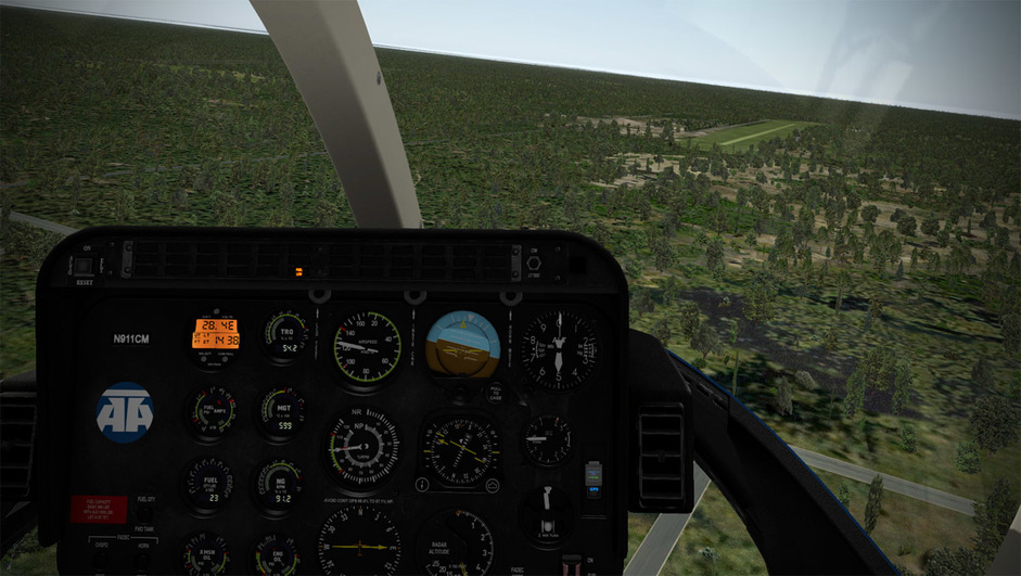
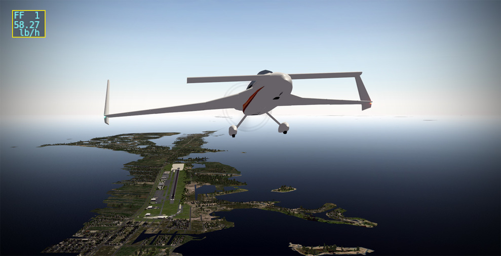
Down safely with 20 pounds of fuel remaining (4 minutes and 10 seconds remaining). Whew! That was stressful…!

My x-IvAp realtime flight log…

Though Apalachicola was only a mere 10nm more distant…at 120 knots that is still five minutes…so with 4 minutes and 10 seconds of fuel (and no reserve time for the deceleration and hovering approach)…I doubt I would have made it. And helo engines generally aren’t much more fuel efficient at lower torque settings…the turbine is pretty much running near 100% all the time anyway…so unlike a piston or turbine fixed wing, I couldn’t really fly much more efficiently.

Wow - what a fun rally this is going to be. It isn’t too late to join - the rally runs until December 14th and there is plenty of time to fly a couple legs a day to catch up. All of the details can be found HERE! Thanks to -bc- for coming up with the concept and all the friendly fliers at EPOCH as well as the rally sponsor X-Hangar.com.

Stay tuned for Leg 2…!

BeachAV8R

2 Likes

Helicopter? What helicopter? I only see some sweet, sweet … fuel trucks. Look at ‘em just sittin’ there!

2 Likes

Your fetish is…disturbing…

Fridge’s browsing history: LINK!

1 Like

With the first sweaty palmed leg in the books, it is time to turn to leg #2. With the weather still looking good, and with light winds, I elect to mount up in an aircraft that will knock out the Light Sport Aircraft (LSA) category. For the trip I’ve chosen the very nice freeware Ikarus C-42 by Barry Roberts. Though it is named an “ultralight” - I’m not so sure that it meets the U.S. definition, so I’m using it in the LSA category. Loaded with me (200 lbs.) and 1.0 hours of fuel (27 pounds)…

My proposed route - (again keeping in mind the 1nm from land and 15nm from the coast rules) - will take me out of Costin (A51) up over the north side of Apalachee Bay toward Wakulla Co.(2J0) and then southeast along the coast toward my proposed destination of Cross City (KCTY). Total mileage for the route weighs in at around 126nm. I actually don’t even know what I was thinking since the specs for the Ikarus indicate a best economy speed of 83 kts. @ 2.8 gph. But the math on that means one hour at cruise comes out to 16.8 pounds while the 1 hour slider gave me 27 pounds…so I was thinking I could stretch that one hour of fuel.

The Ikarus is a nice, easy start. Flip a couple switches, hit the starter, and off you go. Easy peezy…

No autopilot though…so this is a hand-flown leg again…which explains the sometimes not straight as an arrow ground track. I plug 2J0 in as my intermediate waypoint to give me some steering around the north coast of Apalachee Bay…

I settle on 1,500’ enroute and pull the power back on the engine to maintain listed best economy of around 83 knots. I can’t find a leaning knob for the Rotax engine…so I don’t know how that works…

Since all I have is a little hard to judge fuel gauge, I elect to output the fuel remaining data to the screen (nice feature of X-Plane - you can output nearly all data to the screen or txt file or other things…). I figure if I really owned an Ikarus, I’d have the benefit of knowing the fuel burn better…so this concession to realism I think is understandable.

This is most definitely not Alaska! I think the mosquitoes are even passing me!

The low level flight is scenic though…

So after a bit into the flight I pull out my calculator and start crunching fuel burn numbers. At my econ cruise setting I’m burning 1 pound of fuel every 2 minutes + 35 seconds. With 13.8 pounds remaining I have 35.5 minutes of fuel left and a glance at the GPS confirms that Cross City is a bridge too far with nearly 54 minutes to go. So once again I scramble to find an alternate that is both suitable and pushes the distance. I mean, you don’t want to give up distance since every mile counts toward reaching the end of the 9-leg rally. It would suck to come up short on leg 9 by five miles because one of the early legs wasn’t flown far enough.


At 10 lbs. of fuel the confirmation is complete - 25 minutes of fuel remain and 42 minutes to Cross City. Proceed to alternate…

I divert to 40J - Perry/Foley which has adequate runways for my next leg aircraft and it will leave me with enough wiggle room on gas…

As the airport comes into view I’m looking at around 2.5 lbs. of fuel remaining = 6.5 minutes of fuel in the tanks. Close enough…


Land with 5 minutes of fuel…

Log and track…(click to enlarge)

Nice second leg in an enjoyable aircraft…and it is good that the weather is holding up. Now I need to sit down and crunch numbers and performance for Leg 3.

So far I’ve knocked out 220 nm of the 1400 nm rally and used up 2 of my 9 aircraft and legs. Obviously, the more high performance airplane should start to take bigger chunks out of that remaining mileage (hopefully!)…

BeachAV8R

You’re doing just fine Beach! Others have been hotrodding down the coast but their time will come when they try and squeeze the fumes out of their ultralights when facing miles of causeway leading to KEYW :wink:

I’m only at Cross City myself, but looking to push hard this evening with a twin turboprop. Used up the LSA and SE-GA already!

Cheers, bc

2 Likes

So for Leg #3 of the first segment of the rally - it’s time to put up some distance. This time we’ll be flying an airplane out of the Single/Twin Turboprop (General Aviation) category. With the one hour fuel limitation, I knew I had to pick something that was both fairly straightforward (easy) to operate, and efficient. One turboprop immediately came to mind: the Beechcraft Starship 2000. An aircraft that was ahead of its time (and perhaps too efficient and competitive with Beechcraft’s other aircraft), the Starship is an icon of the 80s and 90s. Designed by Scaled Composites, of Rutan fame, you can bet the Starship is a model of aerodynamic efficiency.

The beautiful Beechcraft 2000A Starship v4.1 in X-Plane is the perfect aircraft for maximum distance vs. fuel. Loaded with one hour of fuel (961 lbs.), we are ready to depart Perry-Foley (40J) for the long distance flight to Marathon, FL (KMTH). The fuel panel shows fuel in two tanks - pressing the button shows fuel quantity for the second tank (654 lbs. + 308 lbs.)…

The rules of the rally require careful map study and this leg was exceptionally hard to plan. The requirement to not be further than 1nm from land, nor more than 15nm from the coast means planning for this leg can take quite some time. Given that I’d be flying a high performance, high altitude aircraft on the route, I had to carefully gin up a flight plan that I could plug into the FMS to allow the plane to follow the route since I would not have enough positional awareness at high altitude to avoid breaking the rally rules. I used the radius tool on Google Maps to make sure the route remained within 15nm of the coast, and even explored some crossing around Tampa Bay that looked tempting and within the 1nm from land rule.

I also used portions of Victor Airways but had to ensure they met the 15nm rule as well…

And some routes that LOOKED technically feasible (because, for instance, this causeway is built on reclaimed land) sometimes fell short (you’ll notice one of those blue circles does not touch any land - thus breaking the 1nm from land rule)…

The planning was a lot of fun - and eventually I came up with a solid route that I put into an online flight planner which churns out an FMC file that can be loaded into your X-Plane GPS. A 368 nm haul that I wasn’t sure the Starship could make on a mere hour’s worth of fuel. My bailout plan was to divert to Naples (KAPF) if the fuel numbers weren’t working out.

The flightplan…

With the plan set - I hopped in the Starship, cranked up the engines, and with minimal delay, took off on the route…

The Starship only has a 2D panel (it would be awesome if someone would make a payware version of this plane!) but it is functional and looks nice.

During the initial climb, I used the recommended POH climb profile of 140 knots diminishing by .5 knots for each 1,000’ of altitude. I was horrified to see the fuel flows at around 660 lbs./hr. per side initially, but knew that would quickly drop off as we clawed into thinner air. Having flown PT6 engines for over two decades now, I can attest to how fuel efficient they are at altitude.

I kept on the profile and let the autopilot manage the lateral navigation while we flew in FLC mode to control the airspeed. In about 18 minutes, we were at FL370 with a TAS of 304, and a right crosswind that was almost neutral as far as helping/hurting at 260 at 51. The book recommended cruise power setting yielded a nice 356 lbs./hr. per side fuel burn.


The shape of the Starship is just gorgeous…

Hitting one of the FMS waypoints, the autopilot tracks the course with a precision I would not have been able to maintain.

Coming up on Tampa Bay one has to be careful of the rally rules. My flight plan should avoid any penalties…but it only takes a minute of lapse of concentration to allow the plane to do something it shouldn’t.

Here we are paralleling the coast even though it doesn’t look like it. Our crab angle into the wind gives the illusion that we are going to track off the coast, but the winds have picked up to 247 at 78, requiring quite a bit of right crosswind correction.

After some consideration, I decide to bump up to FL390 and the fuel flow reduces to 310/side, but the winds almost negate any fuel efficiency gains.

Soon we are coming up on Naples and I’m calculating furiously. The good news is we are at FL390 with only about 10 minutes of flying to cross the Everglades and Florida Bay to Marathon…and we have a ton of free energy to use in the descent. With only around 50 lbs. of fuel remaining, I push over to a 3,000 fpm descent, pull the throttles back, and maintain redline as we drop toward the Keys. Fuel flow settles in to around 40 lbs./hr. per side at idle power…nice!


As we continue descending on a high left downwind to the east runway, I’m way high, with too much energy, so I have to extend my downwind, do two 360s, and some S-turns on final to bleed off altitude.

Come in to land at Marathon…


After taxiing in to the ramp we shut down with 22 lbs. of fuel remaining. Awesome!

368 nm on 939 lbs. of fuel (138 gallons of Jet-A) is really efficient…

Great to have that long leg out of the way and good to have the first major segment of the rally down. Now I need to prepare for the second segment of the rally - the “Up the Middle” where I’ll have to pick a few more airplanes from the available categories. I got very lucky that the Bell 407, Ikarus C42, and Starship seemed to add-up to just the right amount of fuel to get down to Marathon. The good news is, the helo and LSA are two of the shorter range aircraft in the lineup, so I’ve gained the ability to use longer distance aircraft in the remaining two segments of the rally.

BeachAV8R

The next major segment of the rally is the “Up the Middle” portion. The rules for this segment are pretty straightforward - take off from Marathon, proceed up the geographic center of the peninsula until reaching Taylor VOR, then head east to land at Craig on the east coast. Rally participants much remain with 10nm of the center of Florida (not including the Panhandle in the estimation) so you basically have a fairly forgiving 20nm wide corridor to fly up the middle. To better envision it, and to plan my route, waypoints, and possible airport stops better, I used the circle tool on Google Maps with circles that approximated the width of the peninsula, plus I added smaller 20nm wide circles within those circles to approximate the centerline of the route.


So the entirety of the “Up the Middle” is plotted, but now I need to settle on a strategy to use up my remaining aircraft categories. I elect to stick with the fuel saving expertise of Rutan and go with the Long EZ with the smaller IO-235

Renowned for its fuel efficiency, the Long EZ is a nice little aircraft with a basic altitude hold and heading autopilot, but the GPS is a point to point only box, so I can’t load a flight plan into it. Instead, I’ll have to rely on quickly inputting the waypoints as I pass over the previous one, and holding that track to maintain the planned course. I set the slider to 1 hour of fuel and it gives me 35 pounds to work with.

The 2D cockpit is nice - simple and straightforward, which is just what I’m looking for during this rally.

The 35 pounds is split between the left and right tanks, so I’ll have to switch back and forth during flight to drain them equally. I startup and taxi out for departure from Marathon…


On initial climb-out, the full power setting shows a massive fuel flow of 58 lbs./hr. and one starts to wonder if this is going to work at all. I know it is only a temporary phase though…and as I climb on the Long EZ climb profile of 90 knots, I start aggressively leaning the engine and it starts backing off…


At 15,500’, I push the nose over, continue to tweak the leaning, and pull the power back to the max economy RPM setting of around 2,300 netting a fuel flow of just 12.66 lbs./hr.!


The winds at 15,000 are not helping or hurting really…fairly light and variable…

Soon we are over the mainland and heading up the corridor…

Somewhere near Alligator Alley…

After an hour or so, the wide open expanse of the Everglades starts to give way to more farmland and rural areas…

I had determined before this leg that I’d just fly up the corridor as far as I could and just calculate the fuel on the fly. There are plenty of airports to land and divert to as long as you are careful to remain within 10nm of the centerline of the route. After about 90 minutes of flying, I started running the calculations and the fuel looked like it was going to give out just south of Winter Haven, so I picked an airfield (Lake Wales / X07) that would work for my next leg and entered it in the GPS.


Passing west of Lake Okeechobee…

With a little under 4 lbs. of fuel remaining, I spotted Lake Wales and started the idle power descent, remembering to enrichen the fuel mixture as I came down…

Turns out I needed S-turns and speed brakes to make the field…

On the ground safely after a bit over 2 hours in the air…the stats are pretty cool:
Start 1 hr. slider = 35 lbs.
Shutdown = 3.3 lbs.
Elapsed time = 2 hrs. 2 minutes
Distance covered = 217nm on 5.28 gallons of fuel.
Average speed = 106.7 knots


That Rutan sure knows how to build efficient aircraft! Time for a short rest, then I need to contemplate what to fly for the next leg - I should have an aircraft in the inventory that can make Craig non-stop.

BeachAV8R

1 Like

Outrageous you didn’t have to follow the HWY1 to Marathon - start again! :wink:

CSI:Frog, starting this Spring

1 Like

Enhance that.

BeachAV8R

1 Like

1 Like

After the successful Long EZ flight, it’s time to notch up another leg and scratch out another aircraft category. This time, we’ll be taking a flight in the beautiful, freeware Let-410 that has been evolving over the years. While still only equipped with a 2D panel, the plane is really nice on the outside and handles like an over-sized Mu-2. I take a liberal interpretation of the Prop Airliner Piston/Turbine >20 Seats category of the rally and say that the 19 seat capable Let-410 + 2 pilots = 21 seats.

I set the fuel slider to 1 hour and the result is a touch over 700 lbs. of fuel…

The very basic 2D panel is good enough to get the job done. I sure hope that a payware quality 3D panel will be made for this aircraft someday. The advantage of the simplified systems is that it only takes a couple of minutes to get the engines up and running and set the navaids for the flight.

The plan is to take the aircraft the rest of the way “Up the Middle” until reaching Taylor VOR (TAY) and then taking a big right turn to Craig outside of Jacksonville. We’ll be departing Lake Wales (X07), staying up the center of the peninsula as much as possible. The 218 nm leg should be right about at the range of one hour of flying in the Let-410.

Soon we are screaming down the runway and pointing our nose northbound. Of course, the fuel flows right off the bat are atrocious (860 lbs./hr.), but you just have to keep the faith that altitude and throttle setting will soon moderate the fuel use…

Clean it up and get it on course and climbing as quickly as possible…


The further we climb, the better the flows get. As I climb, I’m thumbing through the Let-410 POH to determine the best climb rate and power settings and the fuel flow starts to creep down…

Empty boat…

In cruise we are showing about 11 minutes to TAY VOR, burning 510 lbs./hr. with 298 lbs. of fuel remaining. So some quick math on the calculator says I’ll burn 93.5 lbs. getting to TAY leaving me with around 200 lbs. for the remainder to KCRG. Further pounding on the calculator shows at a groundspeed of 193 knots, I’m eating up 3.2 miles per minute…thus after the turn to Craig it should take me about 17 minutes to fly the 52 miles. 17 minutes at 9 lbs. of fuel per minute = 152 lbs. of my 200 lbs. remaining. Easy peasy! I should have at least 5 minutes of fuel left over KCRG - and that isn’t discounting the fuel burn for the near idle descent… Math for the win!


But just in case…I ease the power back a bit and bring the fuel flows down even more…

Soon Craig pops into view. Again, I’m reminded that these tight fuel legs would not be possible in IFR conditions since shooting approaches would eat up much more fuel. The great weather over Florida for the entire week has made this rally a bit easier to fly that it could have been!

Real low fuel flows in the idle descent…


Down safely at Craig with about 40 lbs. of fuel in the tanks…


Track up the middle…with the turn over TAY VOR per the rules…

One more leg in the books! Five aircraft/legs down - four to go!

BeachAV8R

1 Like

Well, with the second major leg complete (“Up the Middle”) to Jacksonville/Craig - it’s time for the final dash to the finish line as we slide downhill on the “Right” coast of Florida, bend around to the west along the Keys and turn our eyes toward Key West (KEYW). Rules for the “Down the Coast” are straightforward:

  • Stay within 10nm of the Atlantic Ocean (I think I broke this rule)
  • Must stay over land

Now, the route I plotted I looked closely out…but perhaps not close enough.

I wanted to fly out over Cape Canaveral and see the sights…but I couldn’t figure out how to meet the letter of the law with regards to staying over land. Because if you go out over the Cape, you have to cross Sebastian Inlet or some other bridge to regain the mainland. But my route, on further examination, puts me 12nm from the Atlantic Ocean at the Cape since it is the Indian and Banana Rivers that lay between the mainland and the ocean proper.


So I’m not sure what the ruling will be on that… :grimacing:

For the first leg of the Down the Atlantic Seaboard" leg, I did some number crunching and came up with a nice 170nm leg that I thought I’d take a crack at in the gorgeous (as in drop dead!) Carenado C-377…

Loaded up with 1 hour of fuel gave me 122 lbs. of fuel…

Again, one of the challenges is that you have to know the aircraft well enough to get her up and running in a minimal amount of time lest you waste your precious fuel. I practiced bringing the C-337 to life a few times just to make sure I was being somewhat efficient.

And programmed the GPS ahead of time for the flightplan…

Cranked up with 61 lbs. of fuel in each wing…

Taxiing out of Craig…

And on the way…

Just seems wrong taking off with needles bouncing off the bottom of the gauge…

High initial fuel flows during the climb of around 180 lbs./hr. combined…

Climbing out at around 90 knots with a nice climb rate…

The beautifully modeled cylinder head temperature gauge in the Carenado C-337 makes leaning pretty easy…and is required on these max economy flights. Pull the mixture back until the temperature peaks, then roll it forward about 50F. You can see the difference in fuel flow between the leaned front engine and the rear engine which I hadn’t leaned yet…

Looks like I should be marking targets with Willy Pete…!

Keeping a close cross check with visually flying the coast and the VOR needle…

Charted power for economy is actually about 16" of manifold pressure over 2,400 RPM…but this is working out pretty good…

Quite a bit of crab into the easterly winds aloft…

Starting to crunch numbers and it is looking very tight…


Coming up on Cape Canaveral and the aforementioned divergent paths…

While I’m sightseeing I come close to tracking over the water and catch it at the last minute…

That’s a long runway!

Launch towers and I think a SpaceX on one of the pads…

With the shaving as close to the coast over with…I plug in direct to Vero Beach and the news isn’t good. Nearly 22 minutes to go while burning 83.5 lbs./hr. and only 25 lbs. of fuel remaining. The math isn’t working out this time…

But I do have some stored up potential energy I can convert and ease back on the fuel flows…

Looking ahead I only have 25 miles and under 9 minutes to go. I can see Sebastian Inlet breaking the barrier islands…can I stretch it to Vero Beach??

4.7 lbs. remaining…and the aft engine wing tank is a few pounds lower due to later leaning and just slightly different power and mixture settings…

As I pass over Sebastian - the rear engine coughs to a stop… Only ten miles to Vero Beach, but I can’t trust just the front engine to get me there - not when there is an airfield directly under me…


Not knowing too much about the C-337, I elect to put the gear down. Pretty sure it is an electrically activated, hydraulically actuated system that does not need engine power…but I don’t want to be stuck struggling if the front engine runs dry…

I have plenty of airspeed and actually have to make two 360s over Sebastian to lose altitude. I probably could have actually made Vero Beach given all the energy I’m having to dissipate over Sebastian…but there is no changing my mind now…


Down safely with a couple pounds in the tank feeding the front engine…

Well that was interesting. The closest I’ve come to having to make a dead stick landing during this rally. Total distance flown about 160nm - just 10 shy of what I needed, but that 10 shouldn’t make any real difference over the remainder of the rally.


My near navigation error that almost put me over the water…

Distance I ended up short of Vero Beach…I think I could have made it actually…

My two 360s over Sebastian (X-Ivap only updates the track every 15 seconds or so I think…)…

Total flight track…

So thus far we’ve flown six legs and eliminated six aircraft categories:

  1. Ultralight - ???
  2. LSA - Ikarus C42
  3. SE GA Piston - Long EZ
  4. ME GA Piston - Cessna C-337
  5. SE or ME GA Turbo Prop - Beechcraft Starship 2000A
  6. SE Helicopter - Bell 407
  7. Prop Airliner >20 Seats Piston or Turbine - Let-410
  8. STOL Bush Plane on Wheels - ???
  9. Military SE Prop 1946 or earlier - ???

So the three remaining aircraft only have to haul me about 250nm - that should present no problem…

BeachAV8R

1 Like

So 250nm left to the end of the rally - and three categories of aircraft left: Ultralight, STOL Bush Plane, and Military SE Prop prior to 1946. With winds generally tending to come out of the west, I elect to take an ultralight on the next leg just in case the winds pick up later in the rally. No sense sacrificing the groundspeed flying into a headwind component. For this leg I’ll be flying with 1 hour of fuel in the Quad City Challenger II, technically an LSA by U.S. ultralight standards.

Our route will take us about 108 nm further down the coast with Fort Lauderdale (KFLL) as our destination on this hop…

On startup - we are showing 19.27 lbs. of fuel…

And away we go into another beautiful Florida day. The weather for the duration of this rally has been exceptional. Considering we are flying in real-time conditions, this rally could have been even more challenging if a different weather pattern had been in place. Fortunately, Ma’ Nature is smiling down on us…

For this leg I’ll stay at around 1,500’ and in cruise I lean the engine out until I’m burning about 12 lbs./hr. - so it looks like I have almost an hour and a half of fuel to play with…

The GPS gives me some planning information as far as ETAs are concerned, but navigation is as simple as keeping the Atlantic Ocean off our left side…


A slight inland diversion around Jupiter Inlet…

And coming up on Palm Beach…

Soon enough, Ft. Lauderdale comes into view and I head down to land and rollout on 27L to pull up at the SheltAir FBO…


Arrived alive with 2 lbs. of fuel onboard…plenty of fuel…

x-IvAp live online track…

With the rally winding down, there is no time to waste, so I immediately hop into my next leg…

With two of my longer range aircraft left in the stable for the final two legs, I have the luxury of already knowing I have plenty of gas. In fact, I could probably make it to the rally finish with just eight legs, but I want to use up my allocation. So for this leg, I’ll knock out the Bush/STOL Wheeled category by flying the very odd freeware Antanov An-28 on a short, 48 nm hop down past Miami to Ocean Reef Club at the start of the Keys…

Starting out with 1 hour of fuel - which comes up to about 524 lbs. of fuel split across four tanks. I don’t even bother with fuel calculations on this leg though since it is only a 20 minute or less flight…

The An-28 would have been payware quality just a couple of years ago - and it is extremely complex and detailed. I actually had to download a freeware FSX version by another author and use the checklist from that model in order to learn the basic steps required to get the airplane started. All of the switches and gauges are in Russian, so things were not very intuitive. Fortunately, the FSX checklist got me through enough steps to bring the beast to life…although I was faced with an awful lot of yellow lights and uninitialized systems. But what the heck…if the engines are running, the hydraulics are on, and the flight controls work - who cares for such a short VFR flight! A plane is a plane…

What do all these buttons do? Starters…that I know…

Well, we got at least one started…!

The An-28 is unique in that it has really nice pop-up 2D panels, something you don’t often see in X-Plane aircraft.

I don’t know what any of these do. Inverters, converters, oscillators, generators, alternators…it’s all…well, Russian to me…! I’ll just turn them all on…

I find the switches to align the gyros and off we go… Lots of lights still flashing warnings that I can’t read, but who has time to read an entire 100 page POH?


She flies just fine…!

With no ability to navigate with the radios (ARKs?) - I just follow the coast and look at the map…

Approaching Biscayne Bay - I think I see Don Johnson down there in a speedboat…!


Past the nuke plant south of Homestead…

I follow the coast until I pick up the causeway between Barnes Sound and Card Sound that leads out to Key Largo…

Heading a short distance northeast bound up Key Largo…

Moment later, Ocean Reef Club comes into view…we get dirty and prepare to land…

Nice Ocean Reef Club airport scenery by Ralf M…

Down safely. It wasn’t pretty…but we made it…!


And this is is…! The culmination of many days worth of flying, pinching fuel, sweating headwinds, and leaning like a madman. I have just under 100nm to go to the finish line at Key West, and I have my last remaining category of aircraft to fly - the WWII Prop. I’ve been waiting for this leg with anticipation.

I hop in what is arguably one of the nicest and most detailed freeware X-Plane offerings to date: the Mitsubishi A6M21 Zero by Mr 3D.

With a cockpit on par with any payware aircraft, the Zero requires some careful study and fortunately features a really unique and nicely done instruction manual that isn’t too heavy…and is very entertaining to use.


The startup process if fantastic…and this is one of those great X-Plane aircraft where if you forget something…you can have a frustrating time scratching your head trying to figure out what you’ve done wrong. These big bore radial engines require some finesse and love to get running…and taking any shortcuts will end up with problems. The sound effects of the Zero starter motor whirring followed by the coughing and sputtering to life are just incredibly well done.

With an hour of fuel onboard…roughly 256 lbs…I taxi out for departure from Ocean Reef…

Fuel checked, tailwheel locked, cowl flaps open, flaps down…it’s time to go flying…

The engine growls…then settles into a beautiful whine as we rocket down the runway…and liftoff…

I leave the canopy open and take in the salt air…turning to the west-southwest to follow the chain of islands toward their termination point…Key West…


Fuel flow settles in around 350 lbs./hr as I lean out the engine. I could go for better economy by throttling back…but I have plenty of fuel for this short 100nm hop…so I “let the big dogs eat”…

Conditions are perfect as we fly into the setting sun…


I drop my external tank over the water to get a bit less draggy…probably an FAR violation (and EPA…)

A bit past halfway to Key West we approach Marathon, the destination on the first stage of the rally. We receive permission to do a low approach…


They must have moved my Starship 2000A into a hangar…

Departing with a flourish…

I lean forward on the throttle and the engine responds…popping and spitting flames from the exhaust stacks…glorious!

旭日旗 into the setting sun…


At long last - Key West…

Rolling in on final…


Gear down, flaps down…

Touchdown…

This ramp looks like my kind of people…other EPOCH pilots no doubt…waiting with a Key West Margarita…

It’s over. With a sigh…a mixture or relief and sadness that it is over…I flip the switch to turn off the electrics…

Over 1,400nm, hours and hours in various cockpits, pounding the calculator, consulting POHs, stressing over winds and fuel remaining…and we are here. What a great adventure. Aircraft used in order:

  1. SE Helicopter - Bell 407
  2. LSA - Ikarus C42
  3. SE or ME GA Turboprop - Beechcraft Starship 2000A
  4. SE GA Piston - Long EZ IO-235
  5. Prop Airliner >20 Seats Piston or Turbine - Let-410
  6. ME GA Piston - Cessna C-337
  7. Ultralight - Quad City Challenger II
  8. STOL Bush Plane on Wheels - An-28
  9. Military SE Prop 1946 or earlier - A6M21 Zero

I’d like to thank -bc- for putting together such a special event. It takes a lot of planning, organization, time, and not a little dedication to the hobby to put on such an event. I have over three decades of simming under my belt at this point, and this rally will be near the top of the highlights for the unique nature of the flying and nail biting legs within. Some of these legs compared in tension and intensity to the most memorable combat flight sim moments I’ve flown. Don’t knock it until you’ve tried it! Also thanks to the other EPOCH pilots who participated, shared their strategies and results, and laughed and cried with the rest of us. As well, thank you to the talented freeware and payware artists that created the aircraft and scenery we used along the way - what a great community.

BeachAV8R

6 Likes

Congratulations - and thanks for sharing the journey!

2 Likes

Had a real flight to Jacksonville today (JAX though, not CRG) and the weather wasn’t nearly as favorable as we had…lol…windy. cloudy, stormy. When I was getting in my plane, I saw this weird aircraft next to me…and I laughed…it almost looked like I should be hopping in that one (it even looks a bit like an An-28…!) EDIT - Oh…it’s an An-38… LOL…


BeachAV8R

2 Likes

Remember - just 1 hour of fuel :wink:

2 Likes

Apparently I “won” the rally… LOL… I get a free airplane from X-Hangar!

3 Likes

congrats, you flown it just great, I read through it yesterday, thumbs up

I was thinking (before reading actually) something similar for the ‘inaugural xmas flight’. I will just die bored to fly some plane with full tanks :smiley:

also thumbs up for the organization of such exciting challenge (even for the readers :smile: )

1 Like