I am sure that when MSFS came out with a new technology streaming Bing Maps, many would say “Wow” and then immediately “Pity it does not use Google Maps”.
Well, in case you want to replace the Bing Maps by Google Maps in your MSFS installation, you can. Though do so on your own risk (see below).
A user called derekhe released on GitHub and flightsim.to an application that allows just that. The latest version is pretty much “unzip’n’execute” so I gave it a shot out of curiosity.
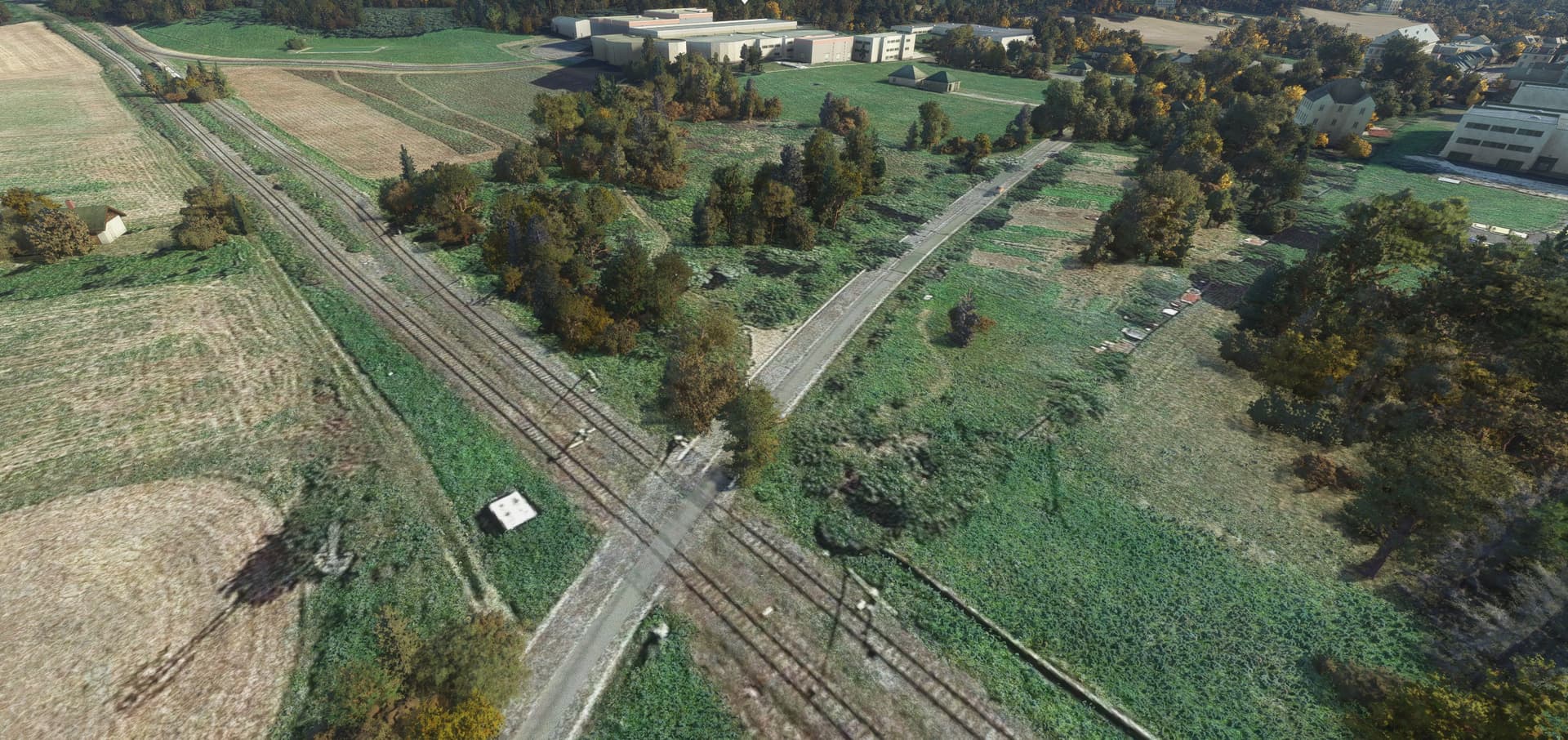
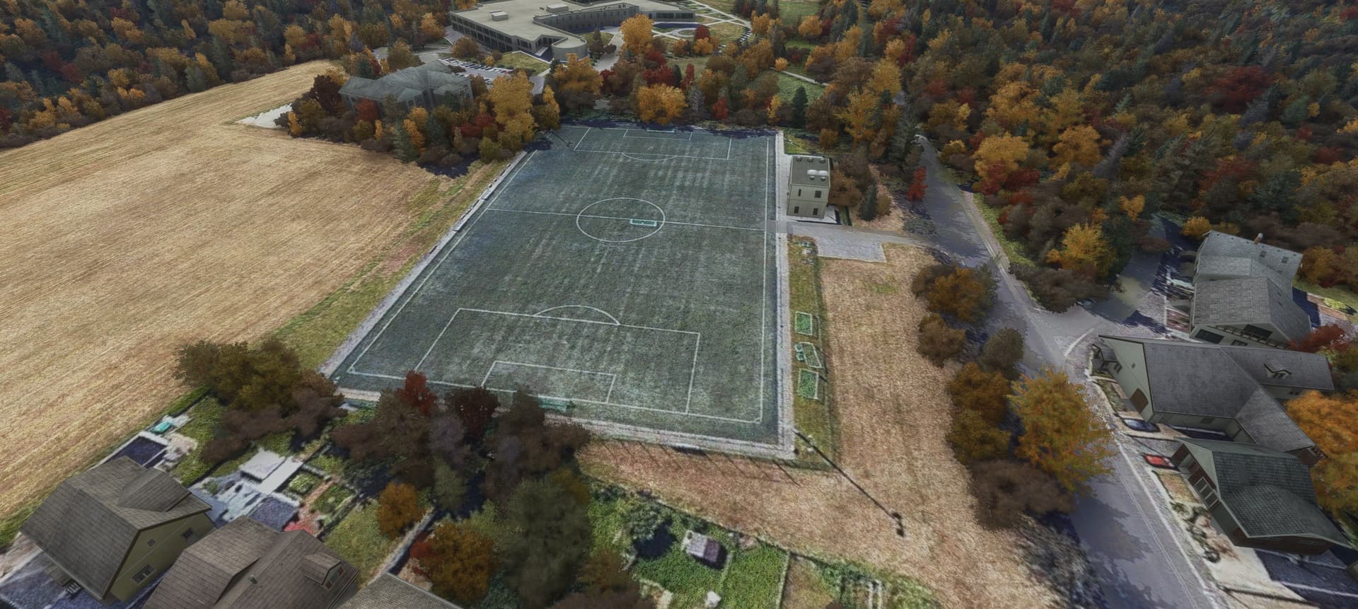
I mean, the default Bing Maps and the tech created around them IS already impressive. But the Google Maps sometimes just have better resolution. Check this:
Higher resolution is one thing. Another thing is that it seems that while the sim limits the maximum zoom level of the Bing Maps streamed to MSFS (to limit the bandwidth perhaps?), this is not the case when replacing them with Google Maps.
Check the detail in the gardens and on the road for instance.
Pros
much higher detail overall (no limitation of the zoom level in the sim); great for low’n’slow and helo fliers
provides satellite imagery in some places which are not covered by Bing Maps
autogen trees and buildings are preserved as are custom objects and Bing photogrammetry
procedural grass follows the patterns on the Google ortho
sometimes better colours (=not so greenish; though check the Cons for the flip side)
easy installation
just works
Cons
Google Maps are not meant to be streamed to the sim; the author of the tool actually says it is for “research and learning purposes” only
after shutting down the tool and re-launching the sim, sometimes it fails to stream Bing Maps; it usually gets sorted on its own after some time but I have warned you in case your MSFS installation gets broken
there are no trees (or only very few) in places not initially covered by Bing Maps; buildings are fine though
apparent colour imbalance in places (Bing Maps in MSFS are re-coloured to give more homogenous visuals); this is the case also when zoom level changes in climb / descent as the different zoom levels have slightly different colouring
Verdict?
Amazing piece of tech if you ask me. I am happy I gave it a try and I am also happy my MSFS installation still works fine
Will I use it? Yes, occasionally when bush flying low and landing into the open terrain. Most of the time I will stick however with the default Bing Maps just because the sim is built around them.
One way we could fix this would be we just write out the copyright in big letters on the ground to match the sim.
I suppose in theory google could IP block you for hammering at their map tile locations at https://mt1.google.com (it does break their ToS of course), but then they do leave them open (Bing requires a key for map tiles).
I tried this mod for the first time tonight and think that it is a pretty nice enhancement to MSFS. The author has continued to update it and perhaps fixed some of the issues in the early release. For instance I see trees where they should be. I haven’t flown in many areas yet, other than my home airport and around London Heathrow, but so far
My experience with this mod varies from “wow” to “meh”. Quite understandably though as it is an aftermarket solution.
If you like it, enjoy till it still works Any mention of this mod is deleted immediately from the MSFS forum and some years ago Google knocked down Tile Proxy (do you remember this tool? ).
So it gives some hints what might happen to the Google maps replacer. Not surprised, honestly as the mod probably goes against some terms of use on both sides (Google and MSFS).
While this mod gives us a flavor of how it feels to have great detail of terrain imagery (at places), it has a lot of issues (e.g. unbalanced colouring, slow loading times meaning you can outfly sharp orthoimagery into a blurred mess…).
I would be happy if MSFS offered hi(gher)-res ortho as a payware addon (say to zoom level 18/19 instead of the current 16). I would get it in a split second
These are very good points, and I have to say I was skeptical of MSFS, Asobo and Microsoft when I first learned that the scenery was to be streamed. Here we are 18 or so months later and it is pretty much the only sim I fly these days. Hopefully the sim will generate enough revenue to keep the lights on for the foreseeable future (or until something better comes along). This is why I make a point of buying some stuff from the MSFS marketplace from time to time. I will also be buying the air racing addon to support the cause more than anything else. Talking of which, I guess today is the day for that one.