No, it uses current weather, but manually set time. Basically all you are doing is changing the sun position in the sky while retaining current weather, not archived weather.
Arrived San Sebastian - 2+10 leg or so…some stressful moments of diminishing visibility and lowering ceilings, but it all worked out in the end…


2 Likes
Leg 1 down. Already managed to get lost for a minute, well not lost really. I knew that Rhine was to my right, but it was supposed to be to my left. Since I wasn’t traveling N, I knew I’d pick up an NDB eventually (or hit the Mediterranean).
Take off: 0738 local
Touchdown: 1131
Distance: ~580 NM (planned was 510 NM)
Average Speed: 149 knots
Total Flight Time: 3:53
Total Distance: ~580 NM
Average speed: 149 knots


I got a little over confident with how well NBD navigation was going, and decided to cut the corner near Frankfurt and just head due S to Basel. I managed to stray out of visual range of the Rhine and radio range of all the NBD’s. I probably could have just used dead reckoning to keep going until I got in range of the next NBD, but I didn’t feel like risking it this early in the air race.
My ride for this inaugural leg, was the Boeing 221A Monomail. The Boeing 220 Monomail was built to compete for the fledgling airmail routes that were being privatized. For it’s time it was very advanced, and the 220 was built as a prototype. The second prototype constructed was the 221A which stretched the forward mail compartment a bit, and added windows and furnishing to turn it into one of the first airlines. It served briefly with both examples being retired by 1934.
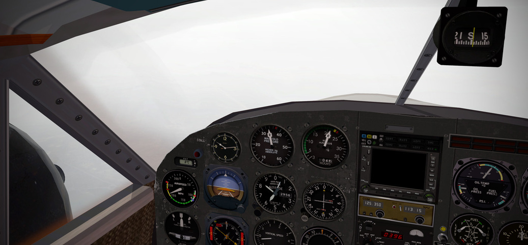
The actual 221A had a fixed pitch prop, and not near the navigation suite this version has. I deactivated the GPS in the panel, but I couldn’t get Nav 1 to turn off. I tried to tune it to dead freq’s but apparently there are quite a few VOR’s in this part of the world, so I mainly just twirled the knob so I could cleary read the ADF arrow.
April 5th
Associated Press Wire Service
Taking off from a Royal Air Force based in southern England, the first man to make it to Melbourne Australia is the Winner! Follow along on our coverage of this sure to be thrilling event, as we follow contract pilot Jenrick as he flies for various concerns along the 10,000 nautical mile route!
With the magic of photography, gaze in wonder at the actual aircraft our intrepid pilot will fly, navigating over the spinning globe. Our photographs are hand colored to bring you true to life views, and printed on the most advanced presses available! Marvel at the colors of Europe in the spring, the harshness of the deserts of Arabia, the mysterious jungles of Asia, and the endless seas!
The United States based Texaco oil company, flush from it’s success in South America, and now rapidly expanding east of the Suez canal with Standard Oil launches it’s most audacious advertisement yet. Texaco introduced today “Sky Chief” gasoline, a high octane gasoline, the first to be commercially available to the motoring public. To mark the occasion, as well as Texaco’s recent expansion into Australia and the middle east, Texaco has commissioned a special livery for entry into the MacRobertson Air Race.

Texaco’s celebratory livery on the Boening 221A Monomail, the flying technological laboratory that led to the Boeing 247 and the P-26 Peashooter
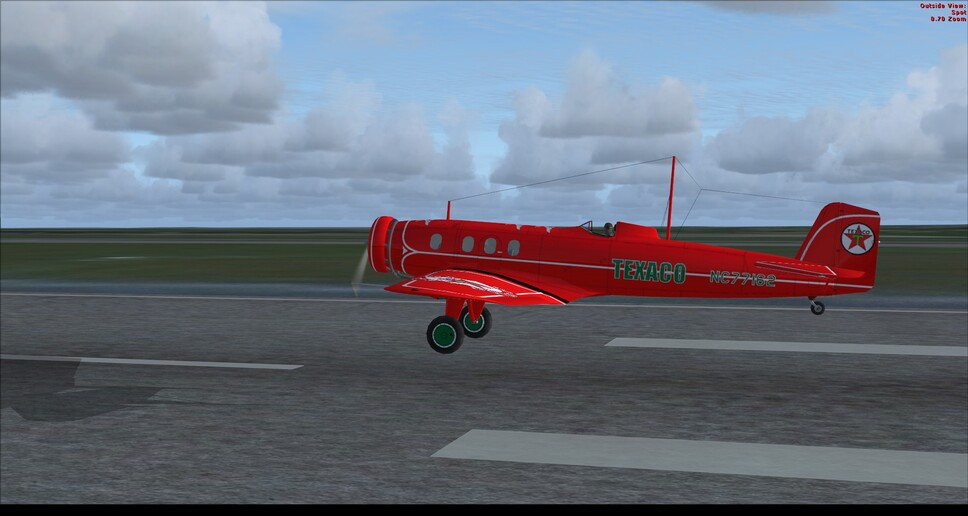
With 575 HP the Monomail leaps into the sky!

The most advanced technologies in the world, makes air travel safe and sure!

The luxurious cabin, features picture windows, to allow for unfettered views of the amazing miracle that is flight!
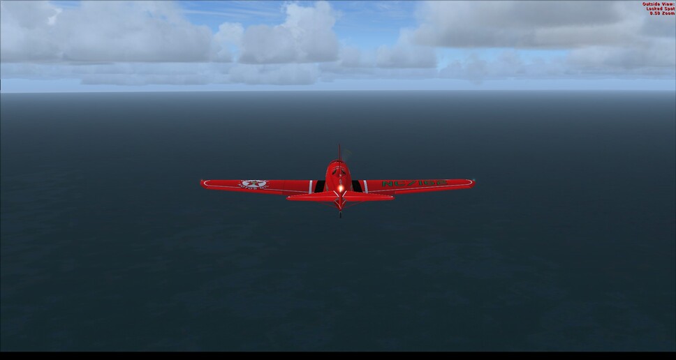
The cold waters of the English channel rush by


Three view series of the Texaco liverly

Making landfall over Europe


The German Airport of Basle in sight


An artists rendering of what the feature of commercial aviation might hold!


The route was planned to be navigable easily both with straight pilotage and with radio navigation (I wasn’t sure what AC I was going to fly for the first leg). It was a good refresher, and I have to say that the ortho tiles worked outstanding. FSX didn’t want to sync realtime weather, so I picked an OrbX theme of low clouds and possible thunderstorms. I got lucky and things cleared rather than getting worse for the flight, I’ll take it. If I had stuck to my original plan of simply following the Rhine I could have shaved some time and miles off, but the important part is I made it to my expected landing airport in one piece with plenty of fuel.
6 Likes
Well I can’t seem to get off the starting line yet. Last night was busy and today I am supposed to have visitors … but they are not showing yet and I do not want to pause the sim, and have the weather jump to an ‘unfortunate’ instrument only state ![]() Maybe later? Maybe?
Maybe later? Maybe?
3 Likes
My big hitch is generating the ortho scenery for the next leg. Probably another couple of hours at a minimum before I can get up again. Good luck on getting started though!
2 Likes
So you do get night weather even if the sun is in the sky. Or morning weather in what looks like an afternoon.
I’d think weather and sun position are very much interconnected. Morning fog, the sun burning through the clouds, the way the wind changes at the coast during day and night…
In real life, yes. The sun makes a big difference. Still, real time weather is better than just flying with canned weather as it adds plenty of variety. You can of course choose to fly at the correct time of day, but for a trip like this, a lot of us would end up with a lot of night flying.
2 Likes
Leg 1: EGUN (RAF Mildenhall) - LFQA (Reims)
Due to last minute decisions on aircraft, I didn’t manage to get away from the start line until this afternoon. Looking at the various aircraft in my virtual hangar, I had the Stinson AT-19 Reliant which nobody seems to have picked. Its not the quickest pre-1939 aircraft so we’ll have to see how it goes. I need to take out a few newer Nav aids as well.
A quick stop at the mechanic workshop to rip out the GN430, a stop at the paintshop and with no time to work out how the radios work, decide the ORBX GB is good enough to wing it. We’ll worry about the other side on the way.

We’re off…
It was a bit gloomy as I set off, though soon after the weather cleared nicely. As I’d ripped out the autopilot I was having to keep hands on, set a SE course and looked for the next town.

Bury St Edmonds in all its glory
Hitting Bury St Edmonds, I realised I was slightly south of track, I assume because of the wind or my poor airmanship. I corrected slightly and made for Colchester.

Colchester football ground, it even has the sponsors names correct in the seats. Well done ORBX.

Heading SSE, looking towards Southend
As I was crossing the Kent coast, I corrected again making for Dover.

Over Dover, Over.
Checking the map, I could see I wasn’t far from another famous landmark in the area.

Battle of Britain memorial - Capel le Ferne
Turning onto a heading of 150 over Capel le Ferne, heading for Boulogne. As I crossed the french coastline, the sense of disappointment at the autogen shows how spoilt I was with the ORBX GB South. I suppose I’d better try and work out this NDB Radio.
I’m not sure if everyone is having this issue, but I was struggling at first to find NDBs. Finally I found something that the ADF could pick up, the Albert Bray NDB (is it an NDB or VOR -aaaaagghhh!!)
This got me on the right heading. I could see the next NDB was way south of Reims, so entered it into the “thing” and listened to see if I could pick it up. - Nothing.

Its starting to get dark and I know approx where I am, but not how far.
The fuel situation was becoming a concern, I’d got just under 30 minutes flying time left. I started to doubt myself and think I may have to land on a flat road and hope for the best.
A group of lights which looked like it might be a large town started to come into view just off my 10 O’clock, I decided to turn towards it, though still hadn’t picked up the other NDB.

Passing south of “is it Reims?”
Checking google maps I was trying to make what I could see fit. This could be a fatal mistake. Circling south and where I think the airport should have been I was dipping the wings peering into the gloom.

I missed this completely, only spotting the runway due to the airport looking buildings.
I still wasn’t sure if this was Reims, but it was a runway. It would have to do.
Taxying to a full stop, I checked how much fuel I had left, 23 minutes… and I had arrived at the right airport, more by luck than skill.

Take off: 15:52:16
Landing: 18:25:57
Flight Time: 02:33:41
Total Flight Time: 02:33:41
7 Likes
Yes. I know there are such thing as long range NDBs, but I’m not sure if X-Plane models the different power output of NDBs…they all seem to be fairly short range so far in my experience though. Had some panicked moments earlier today when I was trying to find something, anything, in range to give me a position. Fun stuff.
Ironically FSX does model different ranges of NDB’s. That has been very helpful with route selection.
Leg 2 is plotted and ready.

Switzerland has the Alps, I’ll be flying a naturally aspirated engine. This is going to be interesting. East to Lake Constance on the border with Germany and Austria, and then SE through the Alps eventually setting down in Venice. Hopefully the mountain rescue teams are on stand by.
<.scribble scribble> so It would be nice to scrape weather data, aggregate and keep it for about 12 to 24 hours so you get the right weather for the hour-of-day and place you are flying…
Segment 1 (Mildenhall - Baghdad) - Leg 2
EGJA (Alderney, Channel Islands) - LESO (San Sebastian, Spain)
EGUN (Mildenhall, England) - EGJA (Alderney, Channel Islands)
381 NM
Leg Time: 2+15
Total Race Time: 4+17

Stuck with the plan of keeping France on my left (more or less) as we headed down the coast.

A beautiful morning…climbing out after departure…

FYI - I’m using the nice and handy Global Photoscenery IFR which comes in two parts, covering the entire world with low resolution ortho. These are low resolution orthos that just give a sense of the landscape from mid to high altitudes. They are blurry due to their low resolution, but that keeps the file size down to a more manageable level. Higher resolution or custom airports will trump the Global ortho if they are placed higher in the scenery ini file.
The download is pretty enormous (but not nearly as large as if you’d use higher resolution ortho tiles) and it took nearly 12 hours of computer time to convert the JPG files to DDS files. Global Photoscenery Part 2 (which covers the hemisphere with the full race route) weighs in after conversion at 370GB (!) with an additional 5GB of overlays. So this is not for the bandwidth challenged.


Still figuring out some of the operating facets of the STMA Beech 18. I would have figured I could fully close the cowl flaps in cruise, but temps start to creep up, so I have to keep them cracked about halfway open…


While headed across France during the initial portion of the flight, I saw some lower clouds ahead which drove me down from my cruise altitude of 9,500’ to eventually just 2,000’ in an attempt to stay visual…

Probably can’t see it in this screen…but I’m just barely able to keep sight of the beach and follow it south. Wherever I can, I tune in NDBs and try to get fixes, but the short range of the beacons means there are large gaps where I’m just hoping to fly into range of one down the flight path…

At one point I got lost (you can see it in the flight tracker map where I turn to the northeast) and had to reestablish contact with the beach. I knew in my mind that my estimated ground speed (no GPS - so no readout in the cockpit) over the distance to be flown shouldn’t have had me but about halfway, but I couldn’t fit what I was seeing (barely) out the window with what I knew to be true. The large islands off the coast were throwing me off a bit - when you see land on your right when you think it should be on your left you start to wonder if you are pulling a Dumb and Dumber move and getting on the freeway headed in the wrong direction!


With my bearings regained, I took up the correct course again and found some good beacons and scenery to match up to my VFR map…and the weather improved!

It was with great relief that I spotted the very, very long stretch of near straight beach south of Cazaux which points like an arrow toward my destination area…


And I was very relieved that the weather held up approaching San Sebastian since I knew there were some hills in the area - a low IFR approach without any plates handy would have been a problem…


Pulling on to the ramp…I had to say I was relieved I wasn’t flying an AN-2 on this journey! ![]()

Fun leg with some exciting bits when I was lost-ish. I’d like to research a bit the X-Plane NDB ranges…not sure what they are set at or if they are variable.
I did break down and use the autopilot HDG and ALT functions on my Beech 18 on this leg. I had some other work to do on my computer in another window, so I flipped back and forth constantly, but couldn’t really trust the trimmed state of the airplane to keep me upright and out of the ocean. Again, since I’m using a Beech D18S anyway…I’m kind of out of the Air Race class anyway due to it being a variant of the Beech 18 that was produced after 1939.
8 Likes
Oh, I see what you were getting at (apologies - I’m dense)…yes, you may get what might be non-characteristic weather for the wrong time of day in that case (morning fog, afternoon thunderstorms), so yes…I see what you are saying. It would be nice to use an archived data set that matches up to the in-game simulator time…but alas, the best we can do is enable real-time weather and adjust our time to make it daylight so the legs are a bit more interesting for those of us that are in it for the scenery.
I’m waiting for the event that someone does in the back seat of a trainer with an IFR hood on for the entire flight. The screenshots will all be the same:


1 Like

Is he taking the polar route?
2 Likes
Going to try to run a long-ish segment from San Sebastian (LESO) over to Corsica (LFKJ). Depending on weather, it could be an easy leg…just keep the mountains on the right side of the plane right?? The water segment could get more interesting of course…I might bias the course a bit northward toward St. Tropez prior to making the crossing to Corsica. Live flight tracking here, but I’m on call tonight, so if I suddenly drop off, don’t call out SAR! ![]()

2 Likes

Feet wet! Now just gonna do a time / distance run…should be 90 minutes over open water at 200 mph for a distance of 266 nm… At least I had a good initial fix over Perpignan prior to heading out. Worst case scenario, I miss Corsica and hit Sardenia or mainland Italy. It’s a win/win/win scenario… ![]()
3 Likes
I don’t see your track on here - http://xfsd.ansorg-web.de/fsdmap/
Are you meant to supply a parameter like ?beachAV8R or something?
I think it takes several minutes to populate perhaps? I had minimized the window when I started X-Plane and it appears to have drawn the whole track:

A bit of a jog near the end. I was just flying a heading and time and as soon as Ajjacio NDB starting to come in I turned toward it. Then I spotted the island visually but mistook the bay just north of Ajjacio for my destination. I should have trusted my ADF… Once I realized my error I flew a bit further south and found the proper bay…

3 Likes