Copy-pasting this from my post on the ED forums:
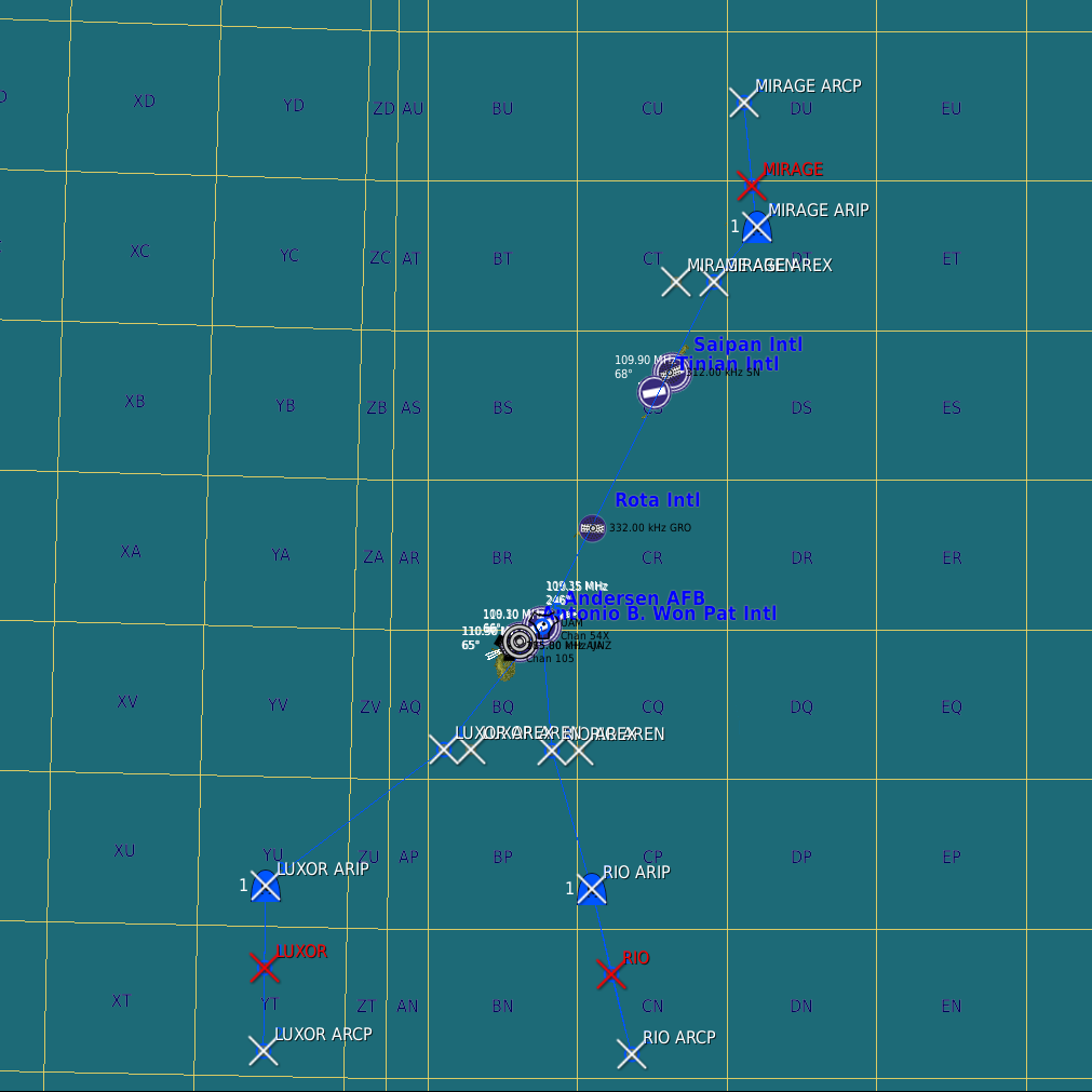
Using the 36th Wing publication 13-204, I’ve tried to recreate the three tanker tracks around the Marianas according to the diagrams, navfix coordinates, descriptions, and frequencies from pages 88-90. The navfixes are represented by trigger zones. I have also added three tankers starting from their IP points, on station for 2 hours at FL200/270KIAS, using the real world freqs when possible. I have not tested the freqs/beacons, but everything else works. These aren’t exact, as I don’t know how far the tanker’s turn radius goes. Freqs and callsigns are in the briefing.
The three tanker tracks are:
LUXOR ~160nm Soutwest of Guam
MIRAGE ~15nm North-northeast of FDM range.
RIO ~120nm South of Guam
Explanation of trigger zone names:
AREN - Air Refuel Entry (point)
AREX - Air Refuel Exit (point)
ARIP - Air Refuel Initial Point
ARCP - Air Refuel Control Point
LUXOR / MIRAGE / RIO - (denoted in red) Advanced Waypoint Action “Orbit” begins

Marianas Tanker Tracks.miz (9.5 KB)