Another leg in the books! It gets dark early so high up north, but I managed to land in daylight again! This time using real-world time!
Report to follow (hopefully not a week late again)
Another leg in the books! It gets dark early so high up north, but I managed to land in daylight again! This time using real-world time!
Hilarious! Oh man what a riot! too soon?
Man, what a conversation!
Just another reason why I detest Google
Monday 21 October - Leg 1: KPHF to KCHA
Technically…this was my second attempt at Leg 1 - there were some flight model issues with the first attempt…see the non-AAR thread if you want to be really bored by the details.
Anyway, with (hopefully) enough fuel on board I was ready to try again…as you can see I had all the essentials…killer computer rig, Rift-S headset, yoke, throttles, pedals, a real airliner pilot’s seat, a real 727 manual (Eastern airlines) and of course a Mudspike mug full of java!
All the pre start and start up procedures went well enough. Got the route entered in the FMS. Double checked the fuel on board and “lit the fires”…and closed the door.
Saturday Oct 19, 2019
Leg 3
previous report | teaser shot | next report
Where to go next? I need to get up north as far as possible, and the most northerly airport known is Alert. But flying straight there is not an option: apart from the terrible weather forecasts that I found and the lack of approach charts or ILS info, it is a bit too far. There is no airport on the direct route either as far as I can find, so I will have to go around. I am not anticipating taking many passengers for this hop, it will have to be cargo only, filling the compartments to the full 330 kg limit and then maybe a single passenger in the cabin or some more cargo stuffed between the seats. This means I can stretch the range a bit.
After spending some time pondering this question, I had a dream, or vision, one night:
The morning after this jingly experience I filed a flight plan to BGTL, secretly hoping to find a sign from the great giver around the halfway point. I plugged in the coordinates into the FMS as a pilot-defined waypoint: seventy-five-o-five-fifty-nine north, forty-two-eighteen-fifty-nine west, name: ICEST
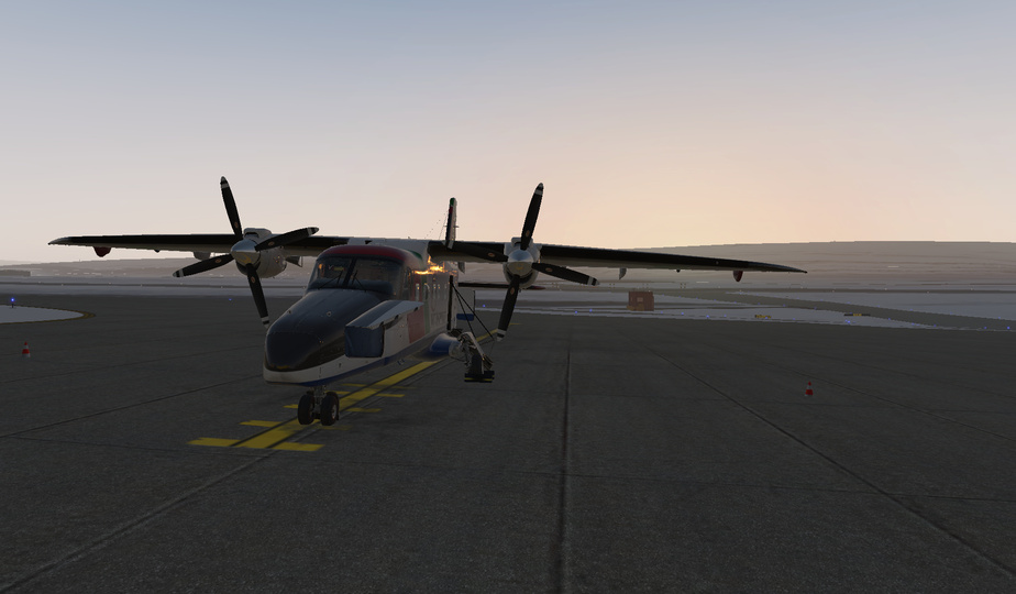
The plane was filled with 400 kg of cargo, and the fuel tanks were filled to the brim, with 1886.5 kg of fuel on board. I started the plane at 10:51 local time, and moments later I took off.
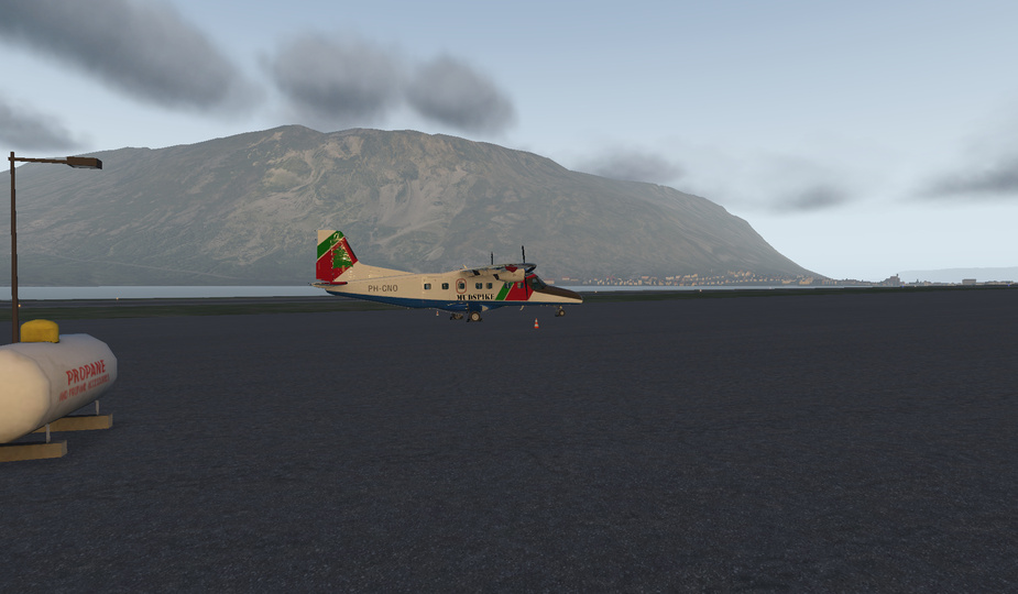
I was lucky to go feet dry above a multitude of glaciers:
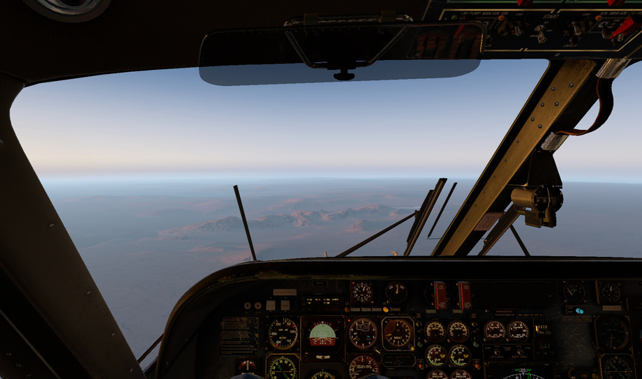
Above Greenland, the clouds were intially low in the valleys…
But as I neared ICEST, the low clouds were gone and replaced by a high layer of overcast.
Until the moment when I got within visual range of the waypoint and started flying a search pattern. It was right around those coordinates that I encountered another strange weather phenomenon:
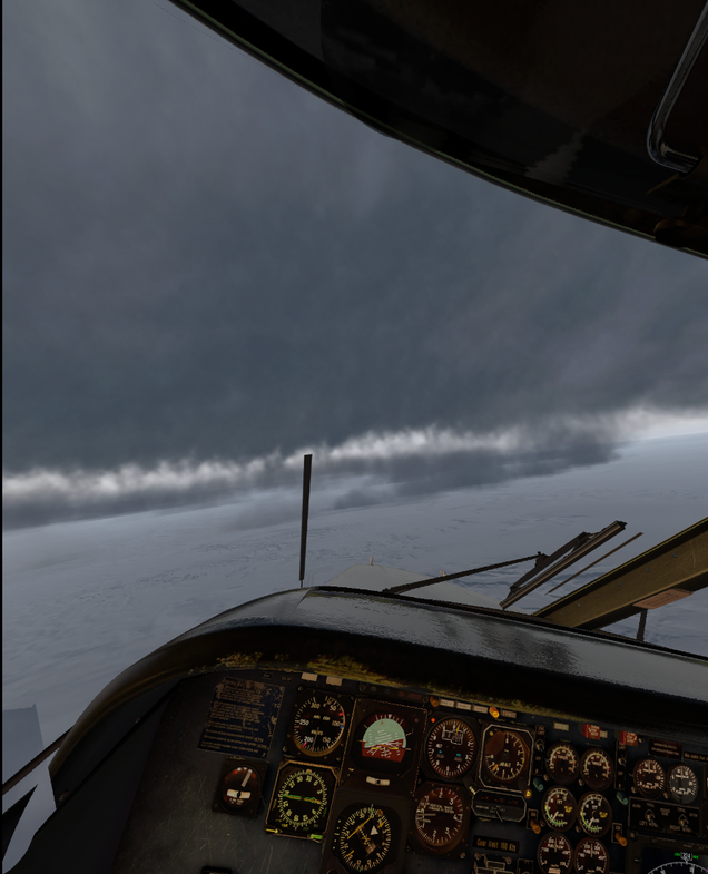
And no sign of a landing strip or settlement. Maybe it was all just a fever dream, and maybe it was obscured by this weird cloud screen… I will never know for sure.
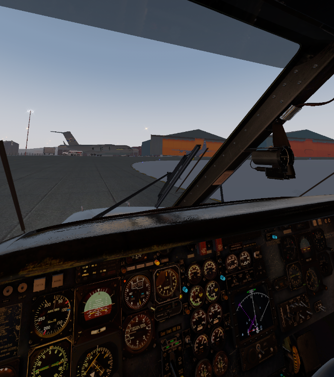
Anyways, I continued on to BGTL: Thule Air Base / Pituffik Airport
I followed the MARTIN approach, with a nice DME Arc. I used the actual DME for this of course, GPS is for losers. And people who get too close to the magnetic north pole.
I was very glad to be able to land still in the sunlight, 1040 nmi from the departure airport, well within the pole circle now.
Approaching the hangars, I saw some of @Victork2 's crushes, and decided to park appropriately next to the other high-winged STOL turboprop beast.
Swooooon.
Got my first leg down. KPDK (about 15nm north of KATL) to NC06. I did it with fseconomy assignments, and stopped at 4A4, which is 44nm west to Atlanta, to pick up a few passengers heading North Carolina. I took off at 16:30, thinking that would leave me enough time to get to Elk River while there’s still light…
My initial thoughts about what aircraft to take on the “Keets heads toward where everyone else is headed, roughtly west” were tempered a bit by reading here that the DC-6 is unsupported in XP11. I bought this aircraft in 2017, having moved from FSX during the Xmas flight to Antarctica and was flying back to the UK. I think I used it for the final leg.
It was far too complicated at that time and it took me a few months after the event before I flew it again. Like most people, I have too little spare time, so prefer to fly things in the few hours I have that I can just get in and fire up/fly DCS I still prefer the A-10 as I can cold start it. I’d love to have the time to learn the Hornet and/or the Harrier for example. Fortunately @Sine_Nomine put my mind at rest with his due diligence of checking things. There may be something not right in numbers, but I’m never going to notice.
Choice made, on to leg 2.
Leg 2: EGFF (Cardiff International) - EGAA (Belfast International, Aldergrove)
The first thing I’ve noticed compared to XP10 with this module is that my co-pilot, lets call him George, is a bit moody. Sometimes he happily tells me about the tasks he’s performing within the Auto flight engineer, other times he sulks and says nothing and just performs his tasks. I have no idea why he’s co-pilot with attitude, but I prefer him to talk to me.
Firing up the engines, I looked at George and asked him what was going on with the balloon hands? He reminds me of the autopilot in airplane.
Moody George or Balloon hands
Having started the engines in silence, a quick load of the flight plan into the Garmin and we’re off…
Cleaning up the aircraft, everything seems ok and I engage the Sperry autopilot.
The flight north was pretty uneventful. I kept checking things, but we happily cruised along at 12,000ft. Descending over Dublin, the weather started to deteriorate.
As we’re approaching the airport and I’m thinking the weather is “filthy” so it is, I can’t help myself and run through some Father Ted for George… He’s not impressed.
Getting closer I switch the Sperry to approach and we begin to descend, hitting the glideslope its all looking good.
After the doubts I had about the DC-6 and whether it would be ok, it seems to work ok so far, even with the co-pilot not doing things verbally. I’ll dig around and see if I can find out why, though its not a biggy. Having purchased this module on XP10, I’d still buy it in its current state.
Well then.
I guess I am doing this event as well? I mean, it should be easier, right? Just across Canada and up the west coast through Alaska … piece of cake.
First thing that I want to do is try to improve my scenery choices. I was disappointed by the default India and Australia scenery, so for this event I am going to try and prepare ahead of time for scenery in places where I might want a little more umpfh.
For that I dug into @fearlessfrog’s Ortho4XP thread, figured out the bits and bobs. I plotted a course, for the first half of the trip, that would take me through most of the major cities in Canada and into Victoria on the West coast: Fredericton to Ottawa, Thunder Bay, Winnipeg, Regina, Calgary ending the first half in Victoria. I can rely on the OrbX Washington scenery for the middle stop on my journey to our chosen ‘Holiday Island’ for 2019 but for the others it is off to Ortho4Xp to generate some detail around the airports.
Its going to look something like this:
I want to get there this year and unless I take a bunch of time off of work, I can rule out helicopters. I enjoyed the Carenado Beachcraft Bonanza F33A w/ SimCoders Reality Expansion Pack from the Air Race, but I want something with a little more range and a little bit better speed - to make those jumps between cities a little easier.
I also want to stick with prop aircraft, and not graduate to jets just yet. And I want to choose wisely, so that as I go up the coast from Victoria, through Alaska, I can take advantage of some smaller airfields as necessary.
I was hoping to find a X-Plane module that would be a little 11.40+ future proof, one that is relatively new so that I can, hopefully, rely on it later.
In the end I chose the Aerobask Velocity V-Twin. The Aerobask Diamond DA-62 was in the running, as were the various Pilatus PC-12 (and similar) aircraft. I am a little hesitant of the Carenados - though good, they leave a little to be desired with the fit and finish and I had licensing issues the Bonanza . There is a pretty sweet SOCATA TBM module but it is $65 USD and that’s a little much for me right now.
The Velocity V-Twin is a kit-built plane with twin Lycoming IO-260s, the Dynon Skyview screens and the Garmin 750/650 devices. It boasts a 1400nm range (probably under good conditions (I will be a bit conservative) and a 170knot cruise speed (again, probably under good conditions). It lacks an ADF (I think) but t does have 2 NAV Radios, allowing me to make use of those VOR navigation sources with a GPS backup.
I flew the first leg on Tuesday evening. One of the benefits of heading West instead of East is that I can often fly real-world weather and time without having to adjust much to avoid fly in the evening. It is not as much of an issue with the current event technology limitations (there are none I believe) but the Air Race had me hunting for good weather days
The first leg sees me flying out of CYFC at 1532 local (19.32 UTC) on 22 October 2019. Here is the flight plan (with wind barbs at FL150 - which is above my FL120 plan):
That is some … heavy wind. I was not expecting that bit, I have the time and I feel confident in the plane and instruments and such. I mean I shouldn’t feel confident in the plane as I have not flown it more than a lap around the airfield the day before but this is a simulation. What can go wrong?
Weather looks ok. No insane turbulence or thunderstorms and such to deal with, just a weather system moving through from Ontario to the Maritimes (I will deal with that rain on Wednesday ). There is a ‘clear’ landing window at Billy Bishop airfield, also knows as Toronto Center Airport (CYZT).
I wish I had purchased the scenery for Billy Bishop airfield during one of those shoe sales but I didn’t and now I regret it. Oh well.
Winds aloft are looking … interesting. Head winds from roughly 10/11 o’clock at between 17 and 54 knots. That will certainly slow me down. The filed flight plan is for 567 nm, so I am going to take a large balance of contingency fuel just to be safe.
Take off is uneventful. I taxi out to runway 09 behind a large people mover, wait my turn and take the active. I gently pulling back on the stick at 70-80 knots to get the nose up, let the speed pick up and let the wings fly her off the surface. Don’t want to pull too far back and strike those props. I am trying to use the X-Plane IFR ATC and it does a decent job so far.
Up off the airfield and turning toward my course and the scenery generated with Ortho4XP is absolutely amazing!
I recognize all of the areas. Next one is Fredericton off to the right:
I am pretty happy with the results! In the next one you can see the glacial features that are characteristic of New Brunswick’s geological past:
Nice! I posted these in the Ortho4XP thread as well.
Anyhoo. Back to the flight!
The weather was good on the way over Maine, toward Montreal and Toronto. I think that I am still in Ortho coverage at this point.
I encountered the TCAS system as well. A bit of a surprise, I pulled up the X-Plane map up to see if it was accurate and, yup, all the aircraft around me show up as diamonds on the Skyview display and on the map display (where there is also a number (ex: -10) that represents the delta in altitude in hundreds of feet).
Here, I am back over X-Plane default terrain. At this altitude, I am not missing too much. ActiveSky XP and UltraWeather XP are doing their job nicely!
Looking back, you can see the start of the Ortho scenery in the distance.
Weather started to deteriorate and soon I was cloud surfing.
And, shortly after, I was under the weather, so to speak.
I started to run into a weather related event shortly after this screenshot. You may notice above that my nose has crept up somewhat. I was experiencing a loss of lift among the clouds and the autopilot was struggling to maintain my altitude without sacrificing speed and nose position. After some monitoring, when the airpeed dropped to 80 knots (and the stall speed is around 70ish), I decided to take over. I cleared my IFR following, so the ATC wouldn’t keep bothering me to get back to my planned FL120, and dropped down to FL100 to see if that would help. It kinda did. I was able to get the speed back to around 120/130 knots IAS, though I had to increase the manifold pressure and set the throttles to 100%. It was a longer flight at that speed with that 30 knot headwind!
Soon enough I was approaching CYZT. I set up the ILS frequencies but was unsure if I had ‘enabled’ it, so I augmented my approach with a GPS approach to runway 26.
My speed was back up as I exited the major weather and began to hit the clearer air over Toronto. Descending down, I was able to make out Billy Bishop airfield in the distance.
Somewhat lined up with runway 26, the wind kept pushing me off to the right.
And that is the end of Leg 1!. Each leg after this will mean more time in daylight as I move farther West but remain flying from an Eastern time zone :-)!
That’s a really nice plane!
Resistance if futile!
Those are some nice Ortho tiles…! Great job!
My assumption is airframe icing? Not sure how well X-Plane represent that…but sounds like it…
Oh! That could be it! I was curious about that as the temperature was just under 0 Celsius. I could not find any anti-icing switch to toggle, so I assumed that it might not have it. I will have to pay attention to this from here on out and stay out of the clouds. I can’t see the temperature going up for the duration of this event
Yeah…I’m not sure what kind of anti-icing and/or deicing capability that aircraft has. I don’t see any boots on it, so it may have nothing. With some light research, it seems that ThermWing was planned as a mod for it, but I don’t know if was ever applied…
Now that missile has style!
That’s a great look…a friend of mine landed a Bonanza once with that much ice on it it. He had to reach out through the storm window and scrape the ice off with his fingernails…
LOL. Per FSE, I have one additional crew. When I passed that hill and desperately tried to land, I kept hearing in my head him/her yell “brace for impact”.
Thanks for the explanation of Vmca and Vmcg. I checked the actual L-410 flight manual that was included in the free mod download. Seems like It does not specifically mention these speeds. In the emergency procedures section, it provides minimum speeds to maintain when engine(s) fail during takeoff or missed approach. These speeds appear the same as the minimum takeoff speeds under different flap settings. The airspeed indicator does not have any blue line either…
I don’t recall in particular that I applied much rudder. Using a twist joystick probably have made me even less conscious of it. How the airplane in XP behaves obviously depends on how well it’s modeled. I am interested in this because of the dispute over single engine vs twin engine safety.
Coincidently just the other day I saw a YT video about a Malibu and icing.
posting just the link