Official 2019 Mudspike Christmas Flight - AAR thread

This is his how I’m treating it. I’m currently at Keflavik, yet to write the reports for the last two legs and taking each flight as a bonus. I’ll try and tget to Canada and may then switch to something else so I can update XP.

I’m gutted they decided to abandon the aircraft, not just because of the price I paid, it’s nice to fly and I was starting to learn.

You crack on @Sine_Nomine, stay safe. I look forward to reading your tribute to the DC-6 as and when you can write it.

3 Likes

Excellent description @Sine_Nomine! Thanks for that! I appreciate learning new things and you are great at describing them!

Stay safe! If there is anything that can be done to help, please let me know.

4 Likes

Saturday Nov 9, 2019
Leg 6 CYEU Eureka - CYEV Inuvik
Previous report | Next report

I prepared a few days in advance to get the FMS to agree on the route. We are flying CYEU - YSY (the NDB at Sachs Harbour), then landing at CYEV, using the DME arc approach to runway 24 if the weather doesn’t change. (Found on page 135 of this document).


Ready for take-off, 07:40 local time


After the rain… and a month of darkness


Comes the sunshine.


Descent becomes sunset, around 11:46 local time. It’s not so much the sun that is setting, as it is the Hercules that is setting here.

And down at Inuvik Airport! Those Cessna’s look interesting…
Next report

7 Likes

Stay safe, best of luck navigating those ‘situations’ and thanks for the explanation!

2 Likes

For me, no apology necessary. Sometimes just typing it all out helps…sort of arranges things in your brain. That said, I saw the aforementioned “Wall O’Text” and said to myself, “I think I’ll read that later when I have time.” LOL - So I guess I missed it. :hushed:

Regardless, you have my best wishes for success in whatever you are working through. :slightly_smiling_face:

2 Likes

Same here. Sometimes a deep dive into something like that helps free my brain up for the other things in life … like a short term brain reset button. Plus, it was very informative.

3 Likes

I believe everything will turn out OK for you @Sine_Nomine.

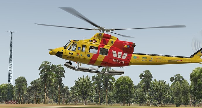
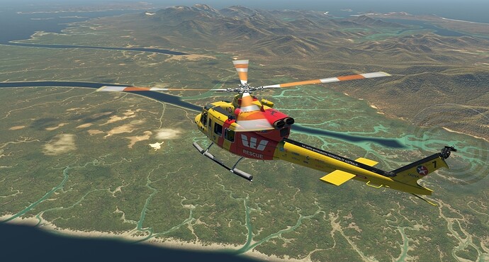
I am moving along the coast. From North Solitary Island to Fraser Island.

Had to do a short refueling stop at Grafton airfield as there was no fuel on North Solitary Island

And proceeding further

Some hilly terrain in the way

Welcome to Gold Coast ! :slight_smile:

And landing on Orchid Beach, Fraser Island

Here some RL landing footage

9 Likes

I was there!

5 Likes

Fraser Island to Long Island then back to Hamilton Island.

Really nice places, but even ortho cant give them all justice sometimes…

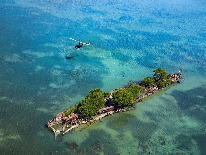
…and sometimes it can be nice from above

Townsend Island passing underneath

Smaller islands are not that great in detail. One such example was my original destination for this flight - Long Island

I didnt find there helipad and not even place to land. So headed little back to Hamilton Island where I found at least good looking airport :slight_smile:

7 Likes

Thursday Nov 14, 2019
Leg 7 CYEV Inuvik - CBA4 Midway
Previous report | Next report

Add-ons used:

After landing, the C-130 crew guided me to the FBO, where I was given a gift paper-wrapped package of forms. An early Christmas present: A brand-old Cessna 172 with Tundra tires!
I thought to myself: ‘this is the part of the world where a C172 is still a utility vehicle, and not just an expensive hobby I should find a job.’ … and as I entered the cockpit, I promptly discovered that a job had found me already. There was a hard to read note that said something about bringing goats to Midway. At first I thought this was a joke: Midway is an atoll in the Pacific, and how should I transport one, let alone multiple goats in this tiny airplane? It was probably a language thing: ‘chèvre’ in French can mean both goat and goat cheese. The cabin certainly did smell of the creature. Or the cheese. The smell is the same too (at least to me).
Luckily, at the bottom of the note, it said how much weight of ‘goat’ the plane was loaded with, and a map with ‘Midway’ marked on it, with location and elevation: 1594 ft.


The plan was starting to form: fly to McPherson Airport, by flying a heading of ~190 magnetic, homing in on the ZFM (373 kHz) NDB at Fort McPherson Airport. Then it is simply a matter of IFR (I Follow Roads) into the foothills, and I should end up right at Midway.

Let’s see if the weather is sufficient for a visual landing at the destination.


There is no METAR station at CBA4, but the report at CZFM looks like there is a reasonable chance I will make it with ~600 feet between Midway and the clouds. Probably good enough. If not, I can always land at CZFM, and inspect the load to see if it will last for a few days without care.

I take off around 13:00 local time (at MTOW with 300 kg of ‘goat’ and about 3 hours worth of fuel), and climb above the clouds.

No icing so far:

After about 20 minutes, I descend so I am already below the clouds before I reach CZFM and the hills.
A few minutes later, I fly into the forecast light snow, and find the airfield in an opening between the trees. (it was easier to see than in the picture)


Following the road south-south-west, then the ferry across the river:

In the hills, it starts to get tight between the clouds and the ground.

But then I find Midway, literally in the middle of the road.

Due to the crosswind and the heavy load, I decide to make a landing straight into the wind, using the space that is available (and the tundra tires).
A man in a Toyota Land Cruiser approaches me after I land.
‘Merci pour le chèvre!’
– De rien, est-ce que vous pouvez me dire si c’est l’animal ou le fromage? (Animal or cheese?)
'Le fromage, bien sûr! Sinon, j’aurais écrit ‘LA chèvre’! (The cheese of course, otherwise I would have said LA goat)

Afterwards, we taxied the plane into a simple garage-hut-like cover, loaded the 300kg of goat cheese into his truck, and went off to his hut. Conversation in French was difficult for me, and I couldn’t understand why he needed the cheese, but at least I earned some money and have a place to stay. Maybe he will even give me another job.

Next report

Edit: added list of add-ons used and updated Event Map location to approximate new location

9 Likes

Las Vegas to Mammoth, California…

Leaving Las Vegas McCarran International, turning out after departing from 19R.

The Las Vegas Strip behind me as I turn North West…

Forkboy’s terrain still looks good, although not at the resolution of the Grand Canyon HD scenery…

Creech AFB

Following I95 towards Beatty NV.


I was intending to land at Beatty, but I still had plenty of fuel, so decided to push on.

Crossing into California, Forkboy’s Nevada scenery ended, but I soon came up to the border for OrbX’s True Earth NorCal scenery released in the last few days… True Earth scenery ahead of us all the way to the Canadian border! :heart_eyes:

Stunning!

Crossing a saddle, the famous Owens Valley comes into view


Bishop, CA up ahead…

Looking South along the Owens Valley.

Bishop.


Following the Owens River North until we get to Lake Crowley…

Lake Crowley in sights, and beyond it, Mammoth airport.

The next leg should be pretty spectacular as we fly over the Yosemite National Park…

10 Likes

Hamilton Island to Magnetic Island

Departing

Nice weather all the way

So it is time to njoy the ride as a passenger

Reaching Magnetic Island

And landing at Nelly Bay heliport

9 Likes

I didn’t realize the border with Canada was so definitive!

8 Likes

I mean, you’ve seen the border between north and south hemispheres, right?

2 Likes

Mammoth to Petaluma, CA…

After a quick bite to eat, and topping off the tanks, it was time to press on from Mammoth.


Heading North along the Eastern edge of the Sierra Nevada range towards Lake Mono.

Lake in sight…

Lee Vining Airport (O24)… this marks the point where I turn left to follow Tioga Road (State Route 120) into the mountains…

Turning into the mountain pass, I start to question whether this is such a good idea…

In we go…

Beautiful, but potentially deadly terrain…

As I follow the road deeper into the mountain range, it looks like I will be ok.

Half Dome 12’o’clock…

As I approach Half Dome, I descend into the Yosemite Valley…

That’s a big lump of rock!


Finally out on the Western edge of the Sierra’s.

Pushing on, I find myself over Modesto…

And then Livermore. The San Francisco Bay can now be seen beyond the ridgeline up ahead.

Looking off to the left, Moffett Field with it’s famous airship hangars…

Close to Oakland, looking across the bay at SFO.

San Francisco, the Bay Bridge, Alcatraz Island and of course the Golden Gate Bridge… Just below us is the former NAS Alemeda, which was closed in 1997.

This little strip of grass along the bay front is now known as Marina Green. It was once an airfield and has an interesting place in aviation history…

The iconic Golden Gate Bridge…

Heading North from the Big Red Bridge…

Petaluma ahead. Petaluma is a town I have to visit from time to time. The company I work for has it’s headquarters there. It’s a nice town to visit.

Downwind to land…


On final…

That was a fun, interesting and visually stunning leg. Sorry for the volume of screenshots, I’ll try to keep it under control on the next leg or two :wink: .

9 Likes

Looked like exactly the right amount to me :slight_smile:

5 Likes

I blame you @PaulRix

Petaluma wiki page —> led to Historical Figures: William Eddy —> led to Donner Party. And I sat and read about the Donner Party for 30 minutes. :fork_and_knife: :bowl_with_spoon: :skull:

3 Likes

Sounds like an interesting story… I’ll have to read that article too. :crazy_face:

On the move…Hot Springs to Huntington WV…

http://xfsd.ansorg-web.de/fsdmap/

1 Like

Yep, I agree with @Fridge about the screenshots @PaulRix.

Wheels

1 Like