I… I can’t decide if that is cool or incredibly sad.
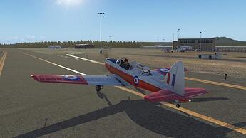
An uneventful leg from Carrizozo. I just puttered along taking in the view. Crossed the border into Arizona, eventually flying over Winslow. I still had plenty of fuel left to press on to Flagstaff.
Departing Carrizozo…
Taking in the view. I don’t know why I held out in getting ortho scenery for so long. I think OrbX spoiled me with their True Earth products. Regular texture tiles just don’t cut it for me anymore. I can see an additional large capacity HDD is in my future…
Winslow…that famous corner is down there somewhere… A quick check of the fuel gauge and we press on towards Flagstaff.
Flying from Winslow towards Flagstaff, it is pretty much impossible to miss the famous Meteor Crater…
The terrain gets a little greener and mountainous as we approach Flagstaff.
Base to final.
Safely shut down.
I don’t think I will be able to continue before Friday, but the Grand Canyon beckons…
Stunning shots! The natural beauty of northern Arizona never fails to surprise and delight me, and that scenery and your pics have captured it really well.
Go with cool…although they are missing the “girl why Lord” in the flatbed Ford.
Living vicariously through your AARs! (evidently 3 to 5 more weeks in the neck brace).![]()
Just like the one winged dove
Sings a song
Sounds like she’s singin’
Whoo-whoo-whoo
![]()
Sunday Nov 3rd, 2019
Leg 5 CYLT Alert - CYEU Eureka
Previous report | Teaser shot | Next report
After shutting down the engines, I put on all of the clothing I had and went outside in the -20 degrees Celsius air at Alert. I noticed one of the hangars had a bright red light in front of it, as well as my nosehair freezing solid.
Is this creative writing 101? Click this spoiler tag if you want to see my lousy dialogue writing again
I heard a neigh as I walked past, it sounded somewhat like a horse. Must have been a husky or some Arctic animal. I opened the door and stepped in.
Inside the hangar, I was greeted by a big man in red snow coat and pants. He had lots of white grey hair, a marvelous beard and some wrinkles. He wore reading glasses, but had a lively colour to his cheeks and eyes that twinkled with joy. He put down his glass of dark brown liquid on the side of the sleigh he was sitting on. As he plonked it down, bubbles rose to the surface and made a hissing sound, while he started a hearty laugh.
S: So you made it this time, and you’re still dry!Thanks for delivering the plane.
F: Thank you, mister Claus. Glad to meet you again. First time since the Galactic Empire’s invasion of the Caucasus, if I remember correctly. This was an almost as incredible journey, though it took a bit longer. I’m glad I finally did it, and also glad that the Dornier had provisions for a tiny galley with a microwave. If I may be so bold to ask: Why did you fund my training?
S: I needed you to learn the plane properly so you wouldn’t crash it again on your way here. And I thought you would enjoy it.
F: I definitely did!
S: And do you remember how I know when you’ve been good or bad? Those same elves who report on all that also spied on all your training, so you won’t have to worry about knowledge transfer.
F: Okay, so you also know that the LOC has to be set to true heasibg, though the rest of the HSI is magnetic, and that the ADF has to be set through the FMS?
S: Of course.
F: But why do you need this plane? Why not just a local Twin Otter?
S: As for the plane, I need it for two reasons: the first is its efficiency and STOL capabilities: it fills a gap in our logistics chain between the large-scale transport and the ‘last kilometres’ chimney delivery system. Of course, Twin Otters are easier to find around here but I need to put in some effort to get the most efficient plane. And that smooth one-piece wing really works to cut down on fuel usage.
F: Why is fuel such a concern?
S: Have you seen the water, this high up north? And have you heard that Swedish girl in New York? Young people want everyone to do something about the climate, old guys love the gauges and parts. So I do something for the climate, as is my duty, to please the young crowd, while at the same time creating some great unique jobs for older mechanics and pilots who love the steam gauges.
F: Sounds great. But what do I do now? Is this it?
S: Well, that is a very difficult and general question many people face often. My best response to that would be: what do you want to do?
F: What I really want to do… I want to fly fun old style airplanes on dirt strips in mountains and not do much with regards to ATC and controlled airspace. And I would like to meet my Mudspike friends in Casco Cove.
S: We’ll get you on one of the CC-130s that is flying in that direction. It will make a few stops at some of our Northern Canada packing and distribution centers. What, you didn’t think I actually did the full North Pole to chimney delivery process all on Christmas Eve? There’s a whole logistics operation behind all of that. Anyway, you don’t have to worry about it. Just tag along on the C-130 flight, and you’ll be guided to an appropriate airplane when you reach the mainland so you can start living your dream. Have fun, and don’t forget to send my regards to my cheerful helpers at Mudspike staff!
I thanked him for everything, and enjoyed a few days’ stay with the local Canadian and Christmassian forces.
I left Alert on a Hercules flight on Nov 3rd 2019.
Packages used:
- Default C-130
- Free mod to provide a 3D cockpit
- The flight was so dark that you can’t tell I actually did not yet use the free Canadian skin for the Herc
- I fly this high up north, thanks to the payware Grand Arctic Scenery v3, which is still on sale at the time of writing
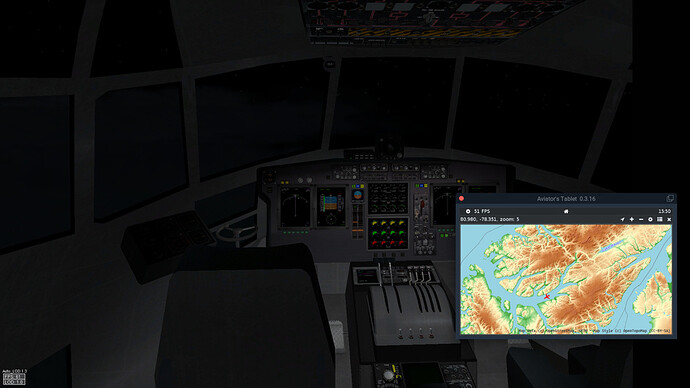
- And of course, AviTab. Not just for the charts, I did use the moving map this time.
I was unsuccessful in removing the discontinuities from the FMS plan. It wouldn’t accept any of the arrivals and didn’t want to plot a simple direct to either. So I chose to fly the autopilot ‘manually’: dial in VS, ALT, and HDG as required. Use AviTab GPS for positioning and adjust HDG as required (there is quite some variation in the magnetic variation along the flight path).
climbing out (edited some to take it up from being just a black rectangle)
Looking into the cockpit from the galley, checking that the autopilot is still behaving well
Descent was performed over water, to not risk flying into a mountain.
Eureka! Time to disengage the autopilot and land this beautifully floaty cargolugger.
Touchdown at 09:35 local time.
Later that morning, I realized I had forgotten my tablet in the cockpit, so I went back inside
This was around 12:00. I can almost see the sun from up here!
Flagstaff KFLG to Grand Canyon National Park airport KGCN.
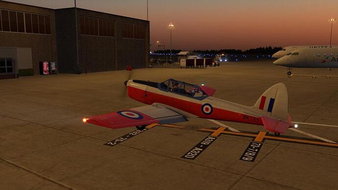
Early morning, on the ramp at Flagstaff…
Dawn takeoff!
Flagstaff streetlights…
Heading North from Flagstaff with the Sun rising to the East…
A ridgeline catching the morning sun…
I’m seeing some canyon-like terrain…
Approaching the Grand Canyon…
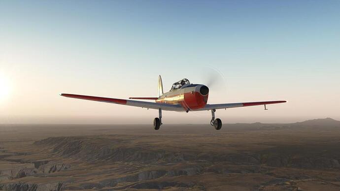
The Scenery is stunning, and the little Chipmunk has a lot of Character…
Grand Canyon National Park airport…
Time to grab some breakfast before pushing on…
Lovely plane, stunning scenery! Must have been hard to choose these screenshots
It really is a nice little airplane. For $20 I think it is a steal. The scenery is amazing. I am really glad I made the effort to try out Forkboy2’s work.
Ok, moving onwards… KGCN to KLAS.
Off into the wild blue yonder !
I’m not sure I would want to live that close to the edge… I guess the view is stunning though.
There now follows a lot of Grand Canyon shots. I couldn’t help myself… enjoy.
Eventually, I reach the Western end of the canyon, and find myself back in the desert… we are now in Nevada!
Lake Meade…
This is all looking kind of familiar…
Sin City in sight!
We can now see the Las Vegas Strip and McCarran International (KLAS).
And here I have to stay for the next week or so (real flying is getting in the way of my sim flying, lol)…
Part of it is national park, most of the rest IIRC is on Native-owned reservation lands. I do think I remember reading that folks did sometimes accidentally go over the edge in this book:
Ranger Confidential: Living, Working, and Dying in the National Parks Amazon.com
Second leg for me. Gabo Island to … not so island but peninsula … Little Bay area.
Weather wasnt great down here …
… but no sign of fatigue, you see !? ![]() All the AP holds [ NAV, ALT, IAS ] are really handy. Pilot looks like almost sleeping
All the AP holds [ NAV, ALT, IAS ] are really handy. Pilot looks like almost sleeping ![]()
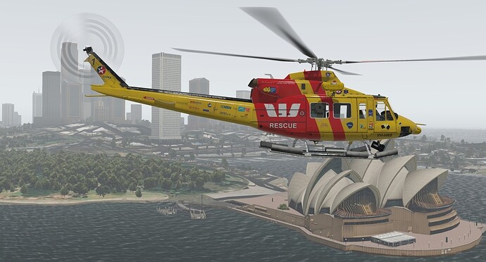
Reaching our dest - Westpack Lifesaver Helicopter Base in Little Bay area, Southern edge of Sydney.
The kind people of AUS decided to buy XMas Flight Bonds to donate Westpack SAR helo for the rest of the flight North along the coast [ they were quite concerned to see me flying over water without floats ] ![]()
She is ready for next leg
Thats the way we like it ! ![]()
Time to leave good folks at Westpack Lifesaver Helicopter Base and head for North Solitary Island.
Hazy weather. But we saw Opera House, we can leave Sydney now ![]()
Further North its getting better…
…soon enough going back to where it was
Sometimes one wish for custom scenery. Even ortho with HD mash doesnt cut it - North Solitary Island
Landing on helipad wasnt possible so found a suitable spot near the coast
One can only dream - North Solitary Island
South Solitary Island
Managed to complete Leg #3 last night: Thunder Bay (CYQT) to Winnipeg (CYWG).
After watching the icing video, I figured that I might be in for a tough time crossing the Canadian prairies and the frigid early winter that they are experiencing. Luckily, as I was peering at Windy.com, I noticed that the cloud tops appeared to be in the FL100-FL120 range at about mid-day local time (11 Nov, 2019, 13:00 local time in Thunder Bay, 18:00 UTC) with live, real time weather.
Ceiling on the left, bottoms on the right:
It looked like I had a corridor above 10,000 feet to 12,000 feet, if I could make it up to that area, through the clouds and freezing temperatures and, hopefully, no icing.
Here is a sample station enroute.:
Now I think that, according to the icing video, what I was doing was an ‘illegal’ flight plan: traveling through a cloud in temperatures that were cold enough for ice. But, I am a little confused, because as far as I could tell, the dew point was not close enough to the air temperature … so maybe I was ok?
So here were the facts:
- Aircraft with no anti-icing systems;
- Cloud cover from FL020 to FL090;
- Freezing temperatures from the ground up (-11 C at CYQT and -30 C at FL100);
- Dew point of -19 C at CYQT;
- No freezing rain in the immediate area but I would be traveling over a few freezing rain, snow-shower areas enroute;
- Winnpeg (CYWG) looked clear(ish) for landing;
I think that items #2 and #3 should have kept me grounded but I feel like item #4 was balancing that out? I am sure you aviation professionals can point me in the right direction ![]()
The weather briefing from ActiveSky never indicated icing … but I am not sure if ever does indicate icing.
Here’s the ActiveSky map for the route as well. I don’t think that there is a way to get cloud heights from this system. Is there?
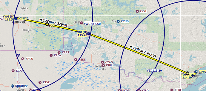
Anyway. It is a pretty straight forward route via YQT, VBI abd YWG VORs. I elected to make use of the IFR flight following up from CYQT until I was established at FL100. If the clouds were an issue, I would put on the oxygen mask and head up to FL120 to cross over.
Taking off from CYQT, I opted for a new paint scheme to ‘explain’ the separation between flights. I mean this isn’t a race but … new paint! Shiny!
Climbing out from Thunder Bay was as expected. Closeup view of clouds.
Soon enough I was coming out on top of them.
I ended up filing for FL090 as the weather briefing had broken clouds from YQT to VBI (BRK100) and I thought to stay below that later if I could.
After some time into the trip, it appeared that the clouds were clearing…
But that didn’t stick around. The ones above me gave way, but the ones in front rose up, forcing me to don the oxygen mask and make my way to FL120.
Coming up on Winnipeg, I started to see the good scenery below, so I filed in in-flight IFR route from where I was to YWG, on to a destination of Winnipeg. Unfortunately for me, Winnipeg is on the north end of the scenery tile and I did not realize that I should have padded it out.
Following a Baron in, I consulted an external tool to see it’s callsign and then listened on the radio to make sure I was properly de-conflicted. It was interesting to not only listen for my calls but to listen and try an interpret the calls for the Baron. The TCAS system helped ![]()
Down and parked. Not an eventful ride, but that’s how we like them ![]()
In the real world, intentionally flying into ‘known icing conditions’ in an aircraft not certified for it could get you into trouble but more importantly it could kill you. So it would not be a smart thing to do… but, this is a sim and so anything goes! In fact it could be argued that doing things in a sim that you would never do in real life, is a great way to learn about the potential consequences (assuming the sim models it correctly).
Here is an interesting article…
So flying through those low clouds at a temperature below zero carries the risk of icing and in the real world, I should have delayed my flight until those conditions no longer exist. Right?


