Official 7th Annual Mudspike Christmas Flight 2021 - Discussion and AAR Thread

Welcome again to our annual Mudspike Christmas Flight – 2021 Edition! For our seventh year running, we will deliver packages, hopes, (beverages), and spread good will across the globe as we make our way from our homes to our target location.

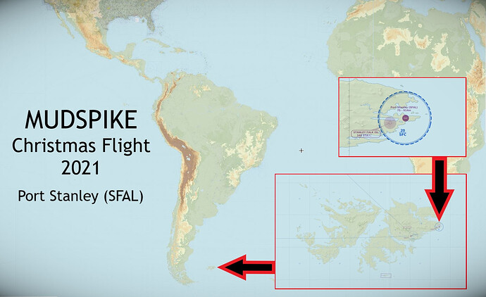
This year, by general consensus, we have decided to head for the historically significant, brutally windswept Falkland Islands and the famous Port Stanley airfield.

Operational Navigation Charts (ONC) (though dated) can be found: HERE

Rules

  • Fly the sim of your choice (FSX, X-Plane, P3D, MSFS).

  • Fly any aircraft you like on your “mission” – fighter, transport, seaplane, helicopter – it’s up to you!

  • Take off from the airport closest to your home location with a load of gifts.

  • Fly to Port Stanley (SFAL)

  • Encouraged to use real time weather to make things interesting.

  • Fly as much of the route as you like, time accel if you want, or just do the takeoff and landing – there really are no rules – just have fun!

  • Flights can be flown at any time up to New Year’s Day.

  • Post your flight progress in this thread.

In the interest of being inclusive, your flight does not have to be a “Christmas” flight – instead, celebrate the New Year, or Hanukkah, Festivus, or whatever you feel represents the spirit of the event.

SkyVector.com – Great online general flight planning tool with maps and enroute charts (you’ll have to find individual country IAPs along your route though)

METAR/TAFS – Quick METAR/TAF information for many international airports

Global Winds – General wind patterns for the entire planet

AWC International Flights – Oceanic Winds Aloft

With the release of MSFS - obviously you have scenery for almost all of the world.

X-Plane users can generate their own Ortho or perhaps use a lower resolution package such as the EOX Global scenery package (bring a some HD storage!)…

MSFS Port Stanley scenery:

https://flightsim.to/file/18320/sfal-port-stanley-falkland-islands-uk-new-version

For those wanting to take a deeper dive - Think Defense has an absolutely superb article on the history of Port Stanley with many historical photographs and detailed information about both pre-invasion, invasion, and post-invasion Port Stanley. It is a fascinating read that may require a few days and a few cups of Mudspike coffee to complete:
12 Likes

I think Ascension Island may be an appropriate starting point, now I just gotta figure out the tanking support.

… Slightly dark humor aside, should be fun! I’ll be happy to do it this year in MSFS in something with a bit longer legs than the TBM, at least for some of the flights.

7 Likes

(post deleted, moved)

reserving this space for first track report, lol

Planning has commenced.
This will be the overall route:

Here’s our bird for the job, nicely prepared at the buffer (Delta platform).

Our vintage Douglas DC-6 in classic Transavia Airlines colours.
Aircraft Technical log shows no outstanding maintenance items. She received her tire and oil check a few hours ago.

Cargo manifest showed a few noteworthy items; initially all cargo was planned in the aft cargohold, but that would shift the centre of gravity dangerously close to aft limits. Instead we agreed that part of the cargo would be loaded at the back and the rest would be brought into the cabin and be secured there by means of seatbelts and improvised netting.

Signatures were placed, doors closed and we contacted ATC to receive clearance to commence on the very first leg of this great journey.

Weather conditions at EHAM (and most of Western Europe for that matter) were excellent:
EHAM 210755Z 20004KT CAVOK 13/08 Q1030 NOSIG

The temperature already reveals summer is coming to an end here. Not long until we’re dropping below the 10 degrees centigrade soon.

Pushback, engine start and takeoff went uneventful. Gently climbing out to FL100 and turning to the south to pick up our filed routing.

Brilliant sunshine made for an enjoyable ride toward Rouen (LFOP) (211000Z AUTO 04011KT 010V070 CAVOK 16/07 Q1030 NOSIG) to end the first leg of our trip in 1hr and 20m.

Parked her at the ramp and handed her over to the maintenance crew, who will prepare her for the next leg!

To be continued…

4 Likes

So with only 96 days till Xmas, and 5324.1 nm as the crow flies, I figure I should get started.

I’m a bit conflicted on what sim to fly this in. My FSX hanger is massive, and full of A/C that I enjoy, however the default textures for FSX absolutely reflect it’s age. MSFS on the flip side is basically global ortho scenery, but there are very few AC in the hanger that really call to me. I think I’m going to do MSFS for anything over land, and FSX for any long over water legs (as in that case I’m not really missing anything). I’m trying to keep the legs to about an hour or 2 hours to avoid burnout, and to work around real life.

Leg 1 - Austin Bergstrom to Valley International in Harlingen Texas
237.4 nm

Our starter leg is going to be with the MSFS default Bonanza. I really don’t like the glass cockpit, but I’ll work with what I’ve got. It has plenty of legs, and reasonable speed to make the trip in my preferred time frame.


Here we are crossing over US183 and SH45 near Seguin. MSFS really is a pretty sim.


Here we have Goliad NOLF, which interestingly enough was built in the 70’s by the Navy, sold to the public in '99, and repurchased by the Navy in '11.

As you get closer to the border the windfarms appear and they are everywhere.


And we’re down. Leg 1 in the books for 2021.


Weather was outstanding which is the usual for Texas, and no real surprises on the trip. I’d have much preferred to be flying the A2A V tail Bonanza, but I’ve got to admit MSFS is beautiful.

Leg 1 - Valley International in Harlingen Texas to Nuevo Dolores in Mexico
136.4 nm

For this leg I purchased the Blackbox Simulations Britten Norman BN-2 Islander. I like cargo twins, I like steam gauges, and the range and cruise speed match up well with my desired leg lengths. It’s priced at 29.99 USD on the MSFS marketplace, which might be a touch high.


After takeoff we climb out to 6000’, and settle down to cruise. Max continuous power on the islander is the same as max power (around 25" and 2700 RPM) so there is no real risk torching an engine (and I don’t believe that is modeled anyway). I settle on 22" of manifold, and 2500 rpm on the props for a cruising speed of around 120 KIAS, and 127 KTAS. The Islander features the King Bendix autopilot I’ve been using in various iterations of FS for decades, so no surprises. The Garmin seems full featured, but I’d have to download a real world manual to know for sure if it works correctly.


Valle Hermoso off the nose, indicating we’re right on track.


Las Alazanas lake is directly west of our destination which is adjacent to the town of Abasolo. The runway at Nuevo Dolores is a grass strip, and it took a couple of passes to figure out exactly where it was. It is scrapped into the edge of a field, and apparently double as a 1/4 mile dirt drag strip, which is pretty cool.


As I couldn’t for the life of me figure out how to pause MSFS with a keyboard short cut, a screenshot already on the ground will have to suffice.

11 Likes

Congratulations on completing the first legs of this year’s trek!

I might have to pick up the Islander. It looks pretty good.

It’s decent, there are plenty of rough spots on the texturing (particularly switch labels), and the systems modeling seems to be MSFS standard complexity. If they clean up the texture issues, I’d put it on par with anything Iris or Just Flight ever released for FSX. I’d love to see it get the A2A/PMDG treatment, as it’s certainly a versatile A/C that really does brush flying well in the real world. Overall recommendation if you have an extra $30 laying around go for it. If you’re a little more cost conscious I’d wait till it’s on sale for around $15-$20.

2 Likes

Leg 3 - Nuevo Dolores to La Simiente
112 nm

Once again we will be in the Islander, this time with about 90% max takeoff weight, which she handles with aplomb.

On the horizon we can see the Sierra de Tamaulipas, so I know I’m headed in roughly the right direction.


Passing over Gonzalez, so still on track.

In the far distance we can see Laguna Marland (the large lake), or destination is just N of it.


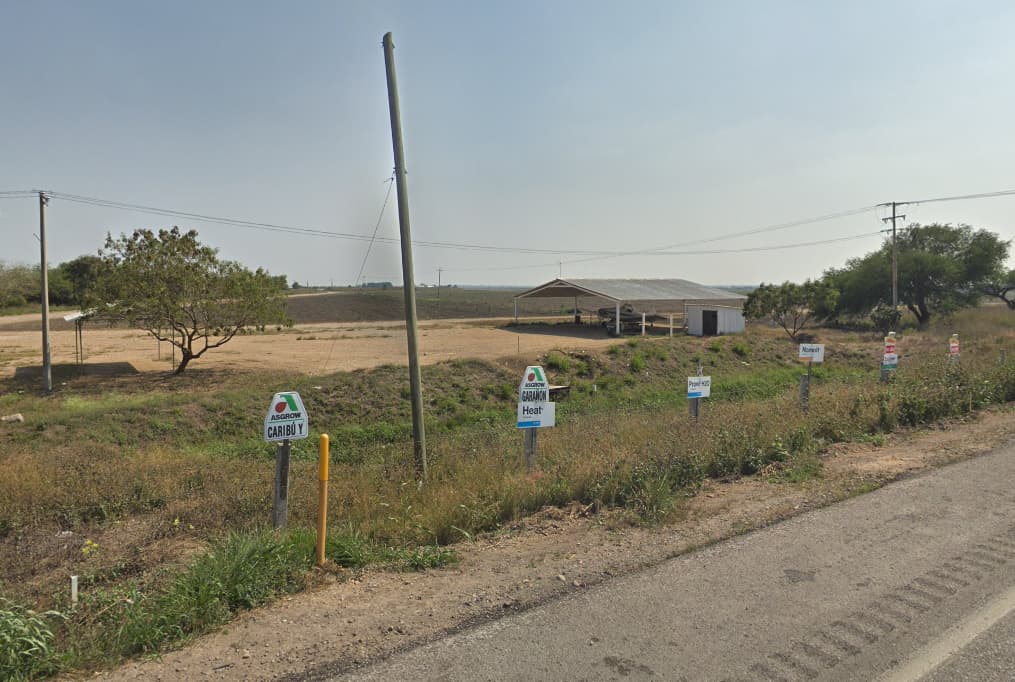
And the real world view


Leg 4 - La Simiente to Pista de Jalpan
81.8 nm

We immediately loaded back up, restarted and took off. Ground time makes no money right? For something a bit different I deiced to head over to the Reserva de la Biósfera Sierra Gorda, and get a bit of mountain flying in.

The Islander turns very well on the ground, past a certain point the nosewheel free casters meaning you can rotate on the mains with the engines. Very handy to be able to turn around in small spaces.


A brief detour to check out the Planta CEMEX near, The town of Tamuin

And the remarkably large ridge that runs behind it. I assumed it was an elevation error, nope it’s a 1000’ (2000’ along parts of its length) almost sheer ridge.

Here we can see the start of the Sierra Gorda range.

After getting into the mountains, I decided to follow some valleys and crest a few ridges lines to keep it interesting.


And down, with 2 more legs finished.


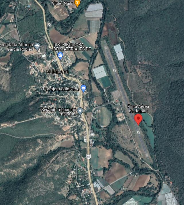
Realword view

13 Likes

99 bottles of beer on the wall…!

3 Likes

Wow, and the last year I thought the Mudspike Christmas Flight to CAPT was a long one :slight_smile:

My preliminary planning is about 8090nm long and I decided to divide it into 13 legs about 1h00-1h30 each. It will take me to some scenic / challenging destinations which just happen to be along the route :slight_smile: e.g. San Sebastian, Gibraltar, Madeira, Rio de Janeiro, Sao Paulo, Buenos Aires and Ushuaia (this one is not exactly along the route but well worth a deviation I think).

As I will need some longer legs for this Christmas Flight, I will go at first for the default Cessna Longitude but it also looks like a good occasion to finally learn the WT Cessna Citation CJ4 on the go.

I did not make it on time the last year so I will get the ball moving a bit sooner this year I hope :slight_smile:

5 Likes

Perhaps we can fly a few legs together! I will be flying almost the same route.

1 Like

That’d be fun :grinning: :+1:

I plan to depart from Ramstein, so your flight plan is great for me! I’m still a bit puzzled on which plane to pick, as I have not much time in FS2020 so far. Starting from a military airport, I’d prefer a military transport plane, but I guess they are scarce for FS2020?

Well, I’ve made a start, despite the weather! It’s a rainy afternoon here in Auckland, but I didn’t let that stop me.

I could have driven to the nearby Whenuapai airport, as that’s strictly speaking the nearest runway…but why bother, when there’s a perfectly good floatplane in MSFS and a wharf not 2km from my house! (actually I had to fly the Cessna from Whenuapai to the wharf, as you can’t start a flight from water as far as I know…but we imagine that we did!)

Here I’m looking over towards the inlaw’s house…well, it’s somewhere there, in the rain.

I took off into the skies, narrowly avoiding an unplanned landing at Greenhithe and safely clearing the Upper Harbour Bridge with many feet to spare.

I followed the Auckland coastline along the Eastern Transit corridor North, towards North Shore aerodrome, my first stop. Visibility was not great…

I found my way to NZNE and did a lower than usual pattern to keep out of the worst of the cloud.

That was dodgy! But we are on our way. I’ll come up with a flight plan in due course, but the first few flights are simply up the North Island towards Kaitaia…once we get there, we can actually start planning some proper hops.

10 Likes

Now that I had an actual runway to work with rather than just a wharf, I thought I’d test out a few more of the MSFS default planes - I haven’t bought the DC-6 yet and once I start buying aircraft, I will probably forget about the default planes, so might as well give some of them a go before I go down that route.

The Diamond DA62 looks pretty sleek and while I am not a huge fan of the glass cockpit, the navigation aides are actually kind of handy, because the weather continues to be pants this afternoon.

I took off from NZNE with a flight plan to Whangarei, the next major airfield up the coast.

This time, rather than scud running the coastline at 300ft, I kept climbing until breaking through the clouds at around 6000ft. Hello, sun!

Goodness me, I am starting to see what the fuss is about with MSFS. It’s looks nice. I wasn’t thinking about the cockpit and the aircraft I was flying, I was looking out thinking how nice it was above the clouds.

The displays showed some stuff.

After a short cruise, it was time to get dunked back into the peasoup and work out where Whangarei was.

I hadn’t punched in any proper approaches, so things were going to be a bit exciting…but I know the area somewhat, so as long as I could get under the clouds, I’d be able to work out where we were.

There was a patch of clear air just as I was about to overfly Whangarei Heads and Ocean Beach. Unfortunately the airfield itself to the West appeared to be shrouded by thick raincloud.

It was pretty neat - I knew exactly where we were, that’s how close to the real thing the default graphics were.

Here’s a picture from a hike we did in this location earlier this year - you can see the coastline and the little island matching closely:

It really wasn’t great VFR landing weather, though. I lined up with the runway basically visually using the virtual cheat display thingy, as I’m ashamed to say nothing was set up properly.

The Diamond in MSFS is a very benign aircraft, though, so setting down on the wet runway was easy.

(Is there a way to make those gauges go away from the external view without using the showcase view?)

I parked up for a little coffee break and a chat with the local meth heads…I mean, ground crew. Whangarei doesn’t actually have a raging drug problem, I promise.

Then it was time to continue on to Kerikeri, our second last stop on home soil. The weather stayed rubbish.

Above the clouds. This time I actually loaded an RNAV approach to get some use of all the displays that are taking up all the space in front of me.

I started seeing glimpses of Bay of Islands as I descended through…

…and then, incredibly fortunately, there was a clear patch right over some of the prettiest parts of the coast!

Bay of Islands is a very affluent holiday location - the creme de la creme of Auckland tends to take off with their helicopters and head there for a round of golf in the summer months whenever their busy schedules allow.

I continued on to Kerikeri, a little ways inland. There was a decent crosswind on the final.

Yup, bit of a crosswind.

Track made good so far, there or thereabouts. Around 120 NM done.

8 Likes

I think not at the moment :frowning: There is something on flightsim.to but these are just FSX converts with the default Asobo 747 cockpit bolted to it.

EU as starting base will work also for me. But I started in XP, so no MP for me

did only short hop in Carenado B58 from LZTN to LZPP like 16NM

was quite excited by the performance in VR so went little low to enjoy the speed and hit the ground with right propeller. Single engine landing went well fortunatelly

4 Likes

One more flight for the evening to get to the northernmost paved airfield in NZ (to my knowledge), Kaitaia (NZKT). Not much to show, as it was dark.

Departing from Kerikeri.

After a short cruise (Kaitaia is only 33NM from Kerikeri), I listened to ATC and came in for a visual to RW 18, a shorter gravel runway, as told…seemed a bit odd but ah well.

Well, that runway didn’t have any lighting, so that wasn’t so great. Thanks ATC. I turned around and landed on runway 12, the one with lights.

After the landing, I shut down the aircraft and headed to the pub for some fish and chips and beer - my next meal would be something more exotic!

5 Likes

Well, after I said I wouldn’t fly any further last night, I wanted to see what other birds there are in the default hangar and decided to try the Citation Longitude - make it to Norfolk Island before bedtime.

Another glass cockpit - bit of a rocket ship, this one. I kept overspeeding, even on the climb - clearly I was too conservative with my climb angle.

I finally went to bed after a smooth landing. Ok 3 wire, if I say so myself.

…it’ll buff out.

I’m starting to form a bit of a view on how I’ll do this. I have a long way to go, because I didn’t want to just take a tubeliner and head to Hawai…and the Antarctic route in the default sim isn’t much to write home about. So that’s going to be about 19-20 thousand NM…

So - I’m going to take the opportunity to try out the default MSFS planes when I don’t have much time to fly…and when I have a proper evening to spare, I’ll break out an XP11 full detail module to play with and do things properly.

Once I’ve tested out a few aircraft, I’ll get the DC-6…might be somewhere in Alaska, which would be perfectly fitting.

Norfolk Island - Isle of Pines

The weather at Norfolk Island in the afternoon was very pleasant. My ride for the day, the Citation CJ4, was gleaming in the sunlight.

My next stop on my South Pacific tour of former penal colonies was Isle of Pines (or Île des Pins as the French colonists called it), a small island in the Archipelago of New Caledonia, about 400NM north from Norfolk Island.

Better get going!

It was a nice day and I had the skies to myself. No passengers in the cabin to bother me with their pesky coffee refill orders…

Breaking through the clouds was quite lovely - the island is nicknamed l’île la plus proche du paradis (“the closest island to Paradise”).

I’ve flown approximately 1,030 NM so far…so I’m like 5% there! Getting there!

9 Likes

That is a very, very long way! :crazy_face:

4 Likes