… and Deacon’s not expressed one ![]()
3 Likes
Today’s flight is sponsored by Berocca.

After a heavy night, it was time to continue.

A last minute stop in the bakery to pick up some Icelandic pancakes to add to the stash of gifts.
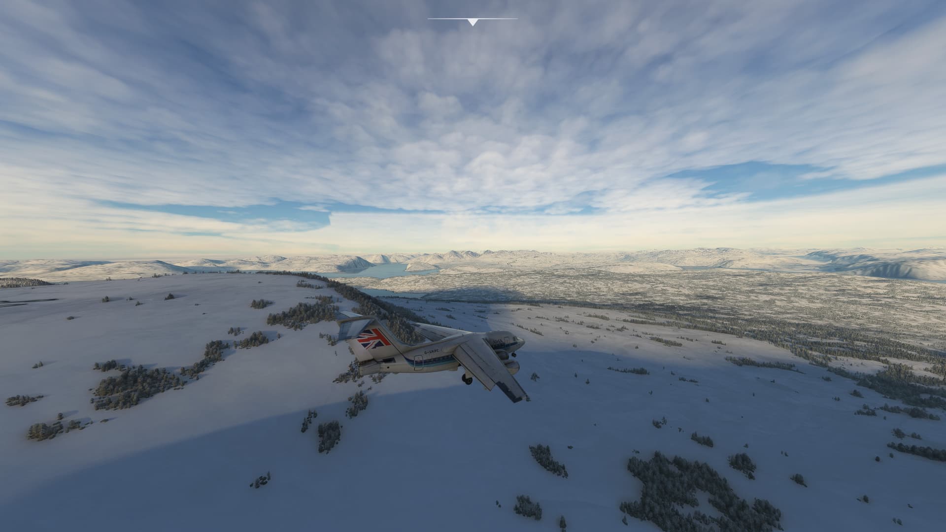
Leg 5: BIKF → BGBW Narsarsuaq Airport
Nice day for it
For some reason I found taxying round Keflavik a nightmare. Checking the Jepperson chart, I couldn’t work out where I was, even with the outside views. In the end I spent about 10 minutes going up and down taxyways, eventually finding the right runway for departure.

The elusive runway 10

Nice climb out
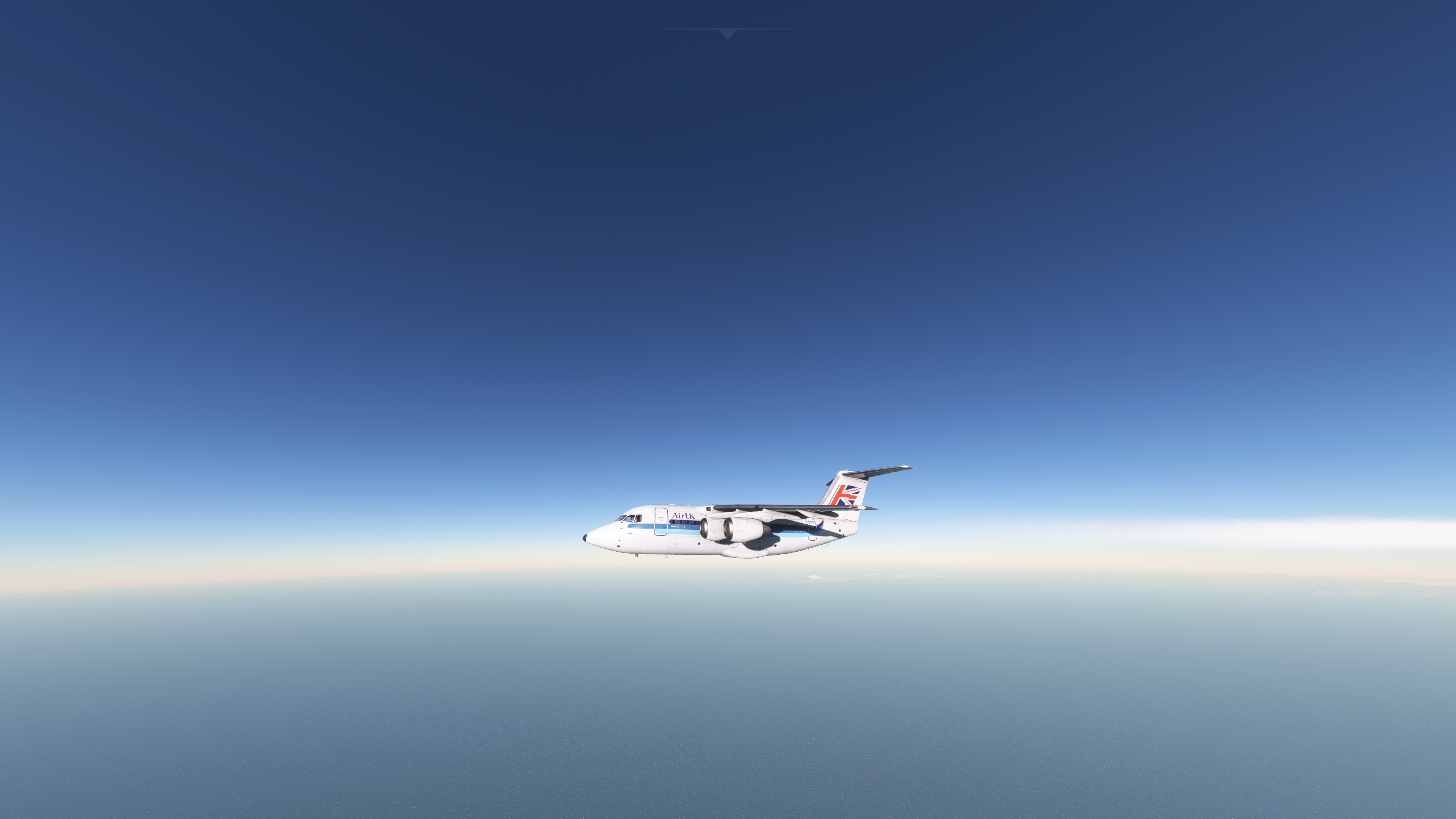
En route to Greenland
The flight was again a long sea crossing, eventually land came into view.
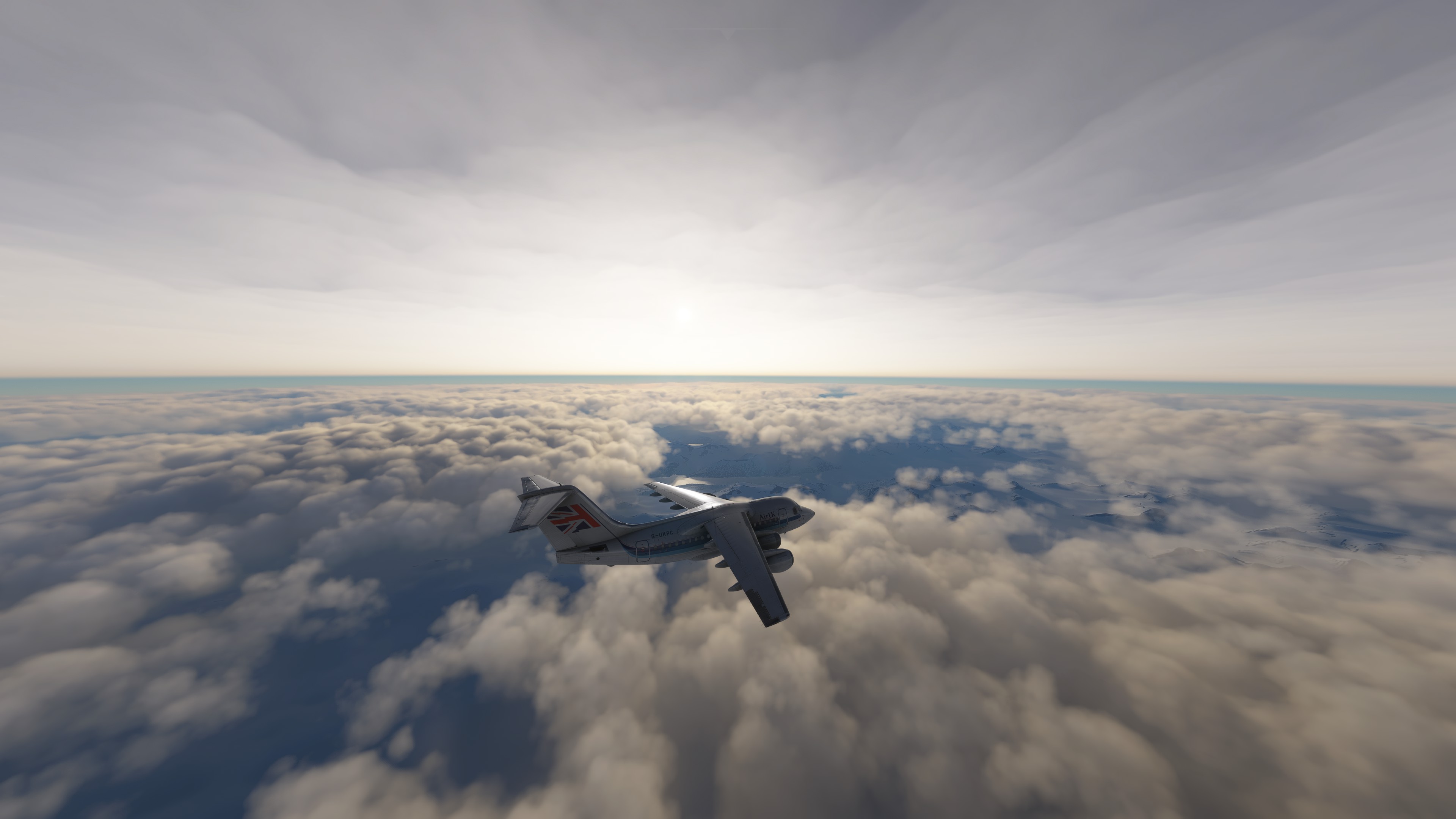
Greenland ahoy
Checking the charts, I needed to stay about 7,500ft. As we got lower many mountains were around.

Not so Greenland
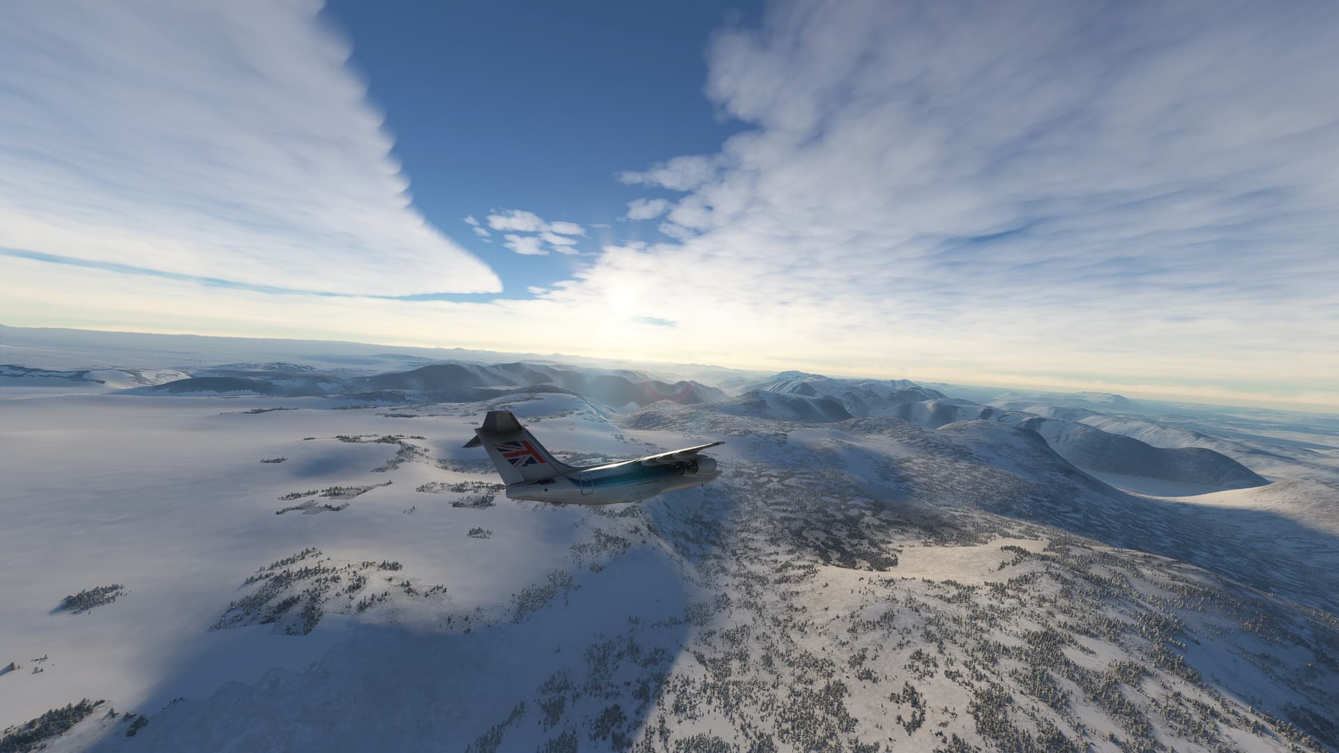
Some greenery poking through
Just after the above turn was completed, we got down to 7,500ft but the view I had was a bit disconcerting.

Are we going to clear that?
The optical illusion of the mountains looking to be at the same height really made for an uncomfortable few minutes. The radar altimeter said we had a clearance of around 1500ft, so I guess that’s ok.

Stunning landscape
The new configuration of “sync” button to disengage the autopilot was again working a treat and we descended nicely on the RNAV approach.
Airbrakes out, flaps and gear down

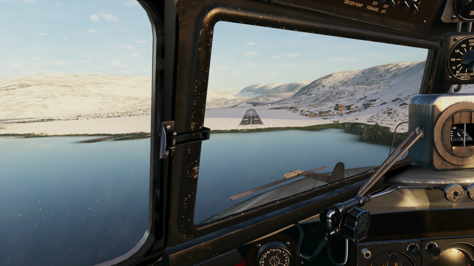
Looking good, though the runway is hard to see

Touchdown. Spoilers out…

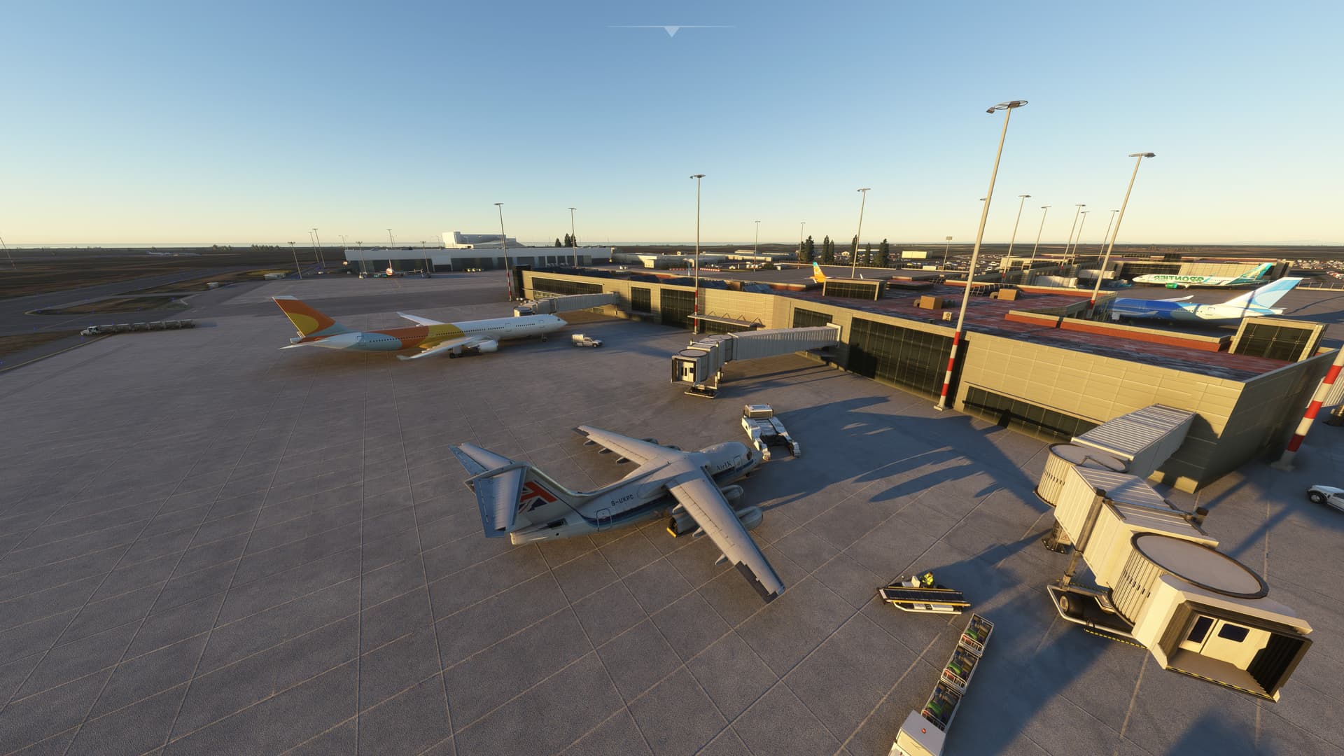
All parked up next to another 146 in Narsarsarsarsarsarsaruaq.
12 Likes
Do you fly with real weather?
My next leg is from Kulusuk to Narsarsarsarsarsarsaruaq and with real weather the ocean is frozen miles away from the coast ![]()
2 Likes
I’m flying real weather and I get a good ice sheet pretty far out in some places here.
2 Likes
Vara to Sumburgh…
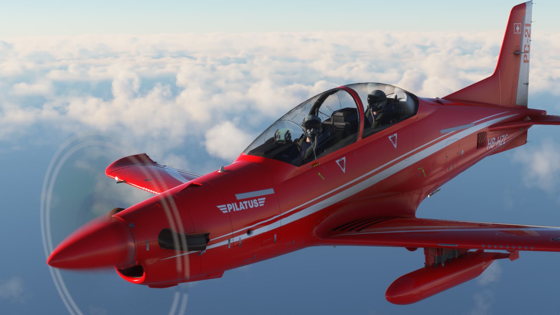
The weather wasn’t so great at Vara as I lined up on the runway in the IRIS PC21…
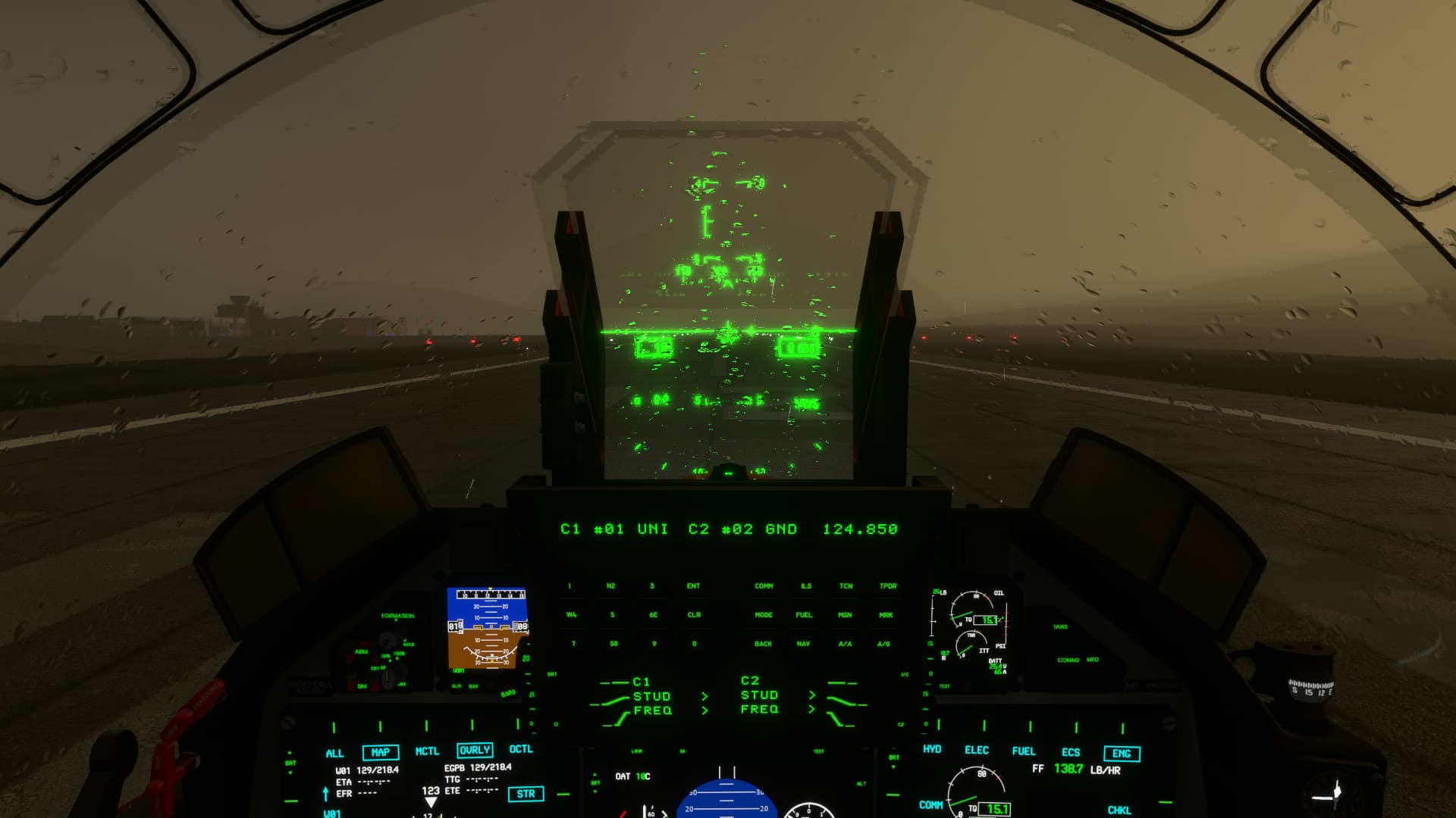

Up into the murk we go!
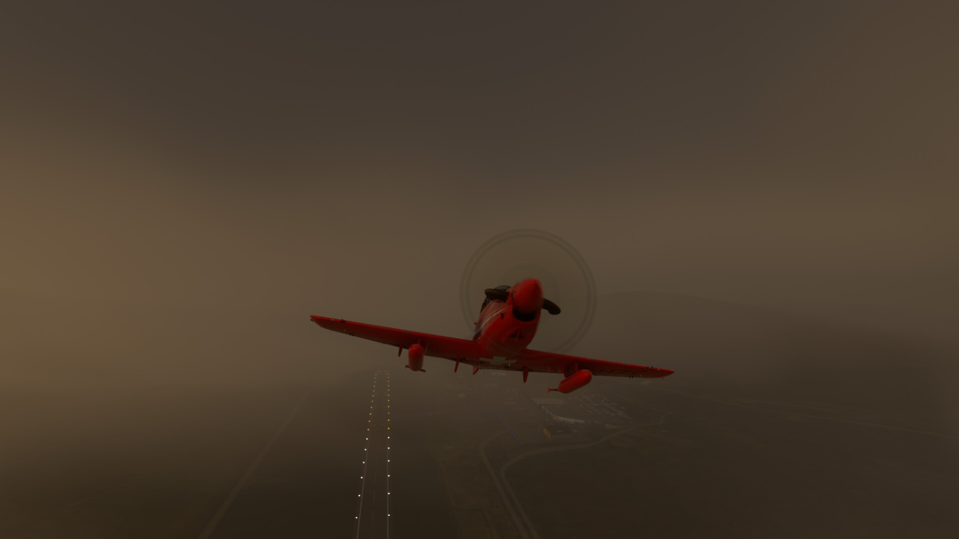
Fortunately the worst of the weather was right over the airport, and I was soon punching out into much nicer conditions.
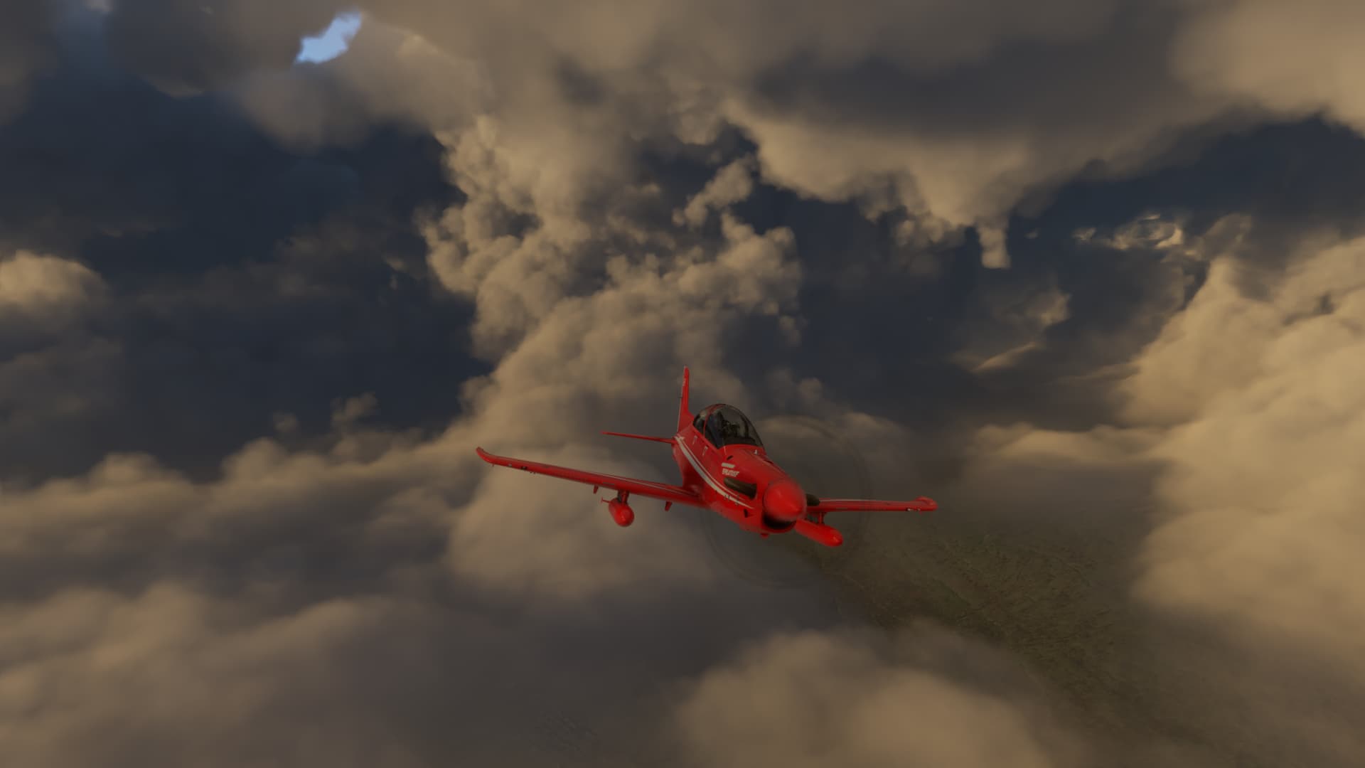

The PC21 is just a nice looking airplane…
This was a short hop and soon I was descending on the approach to Sumburgh.

There was a pretty stiff crosswind…

But I got it down in one piece…

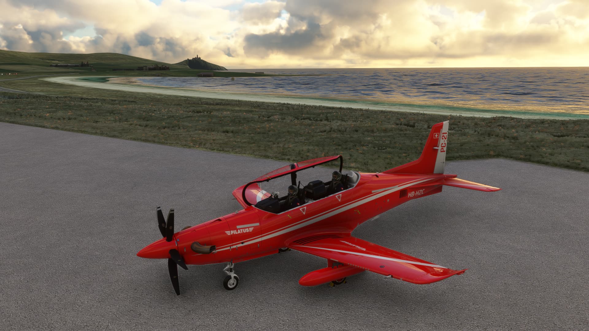
Done for the day…
11 Likes
Yep, I’m using Rex Weather Injector as well since leaving Scotland, so not sure if that makes any difference.
3 Likes
Going now from Kulusuk to Narsarsuaq in Greenland. Due to a little ‘sub-optimal’ depiction of frozen areas in the sim with real weather, I decided to switch to a weather preset instead.
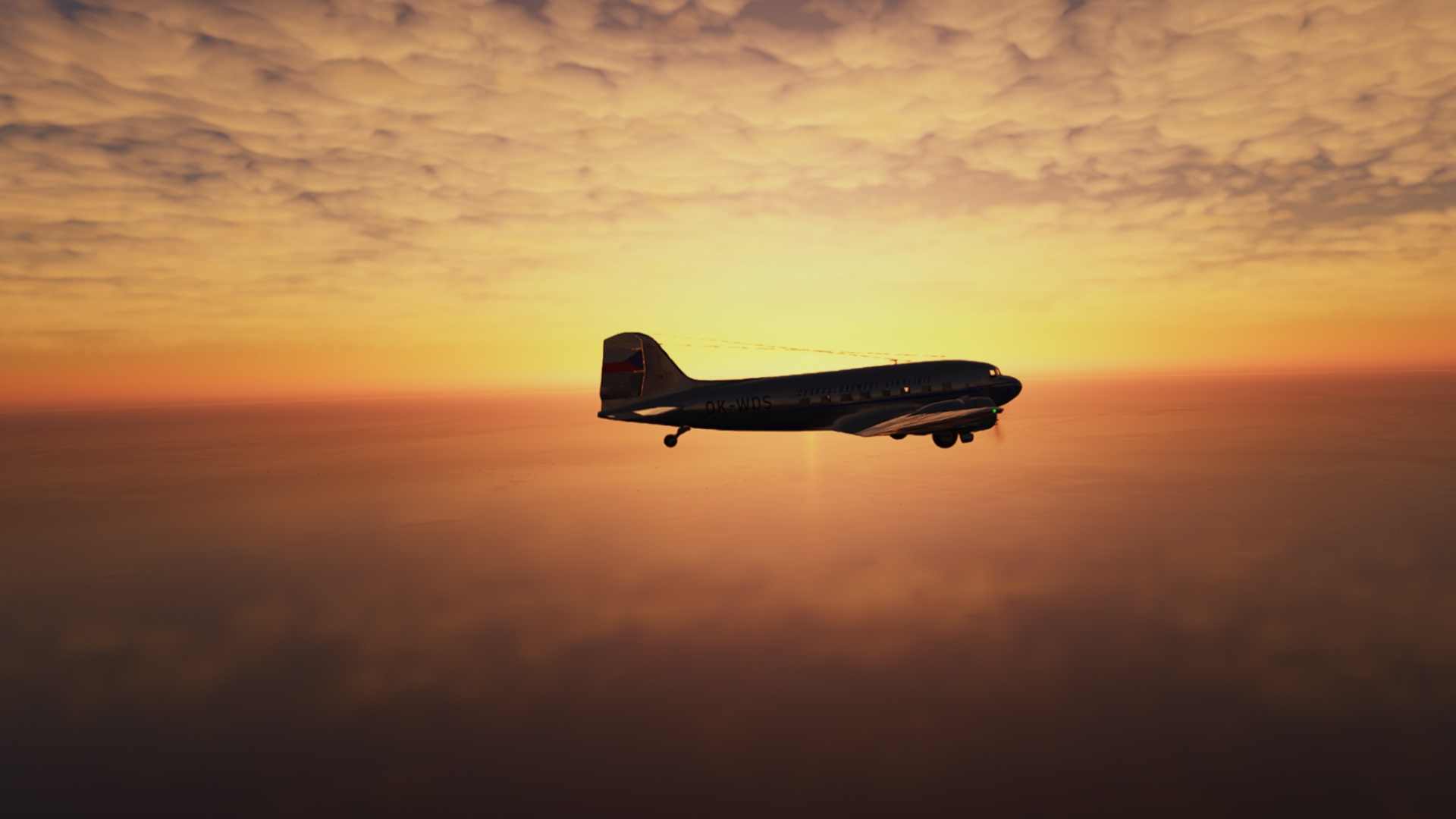
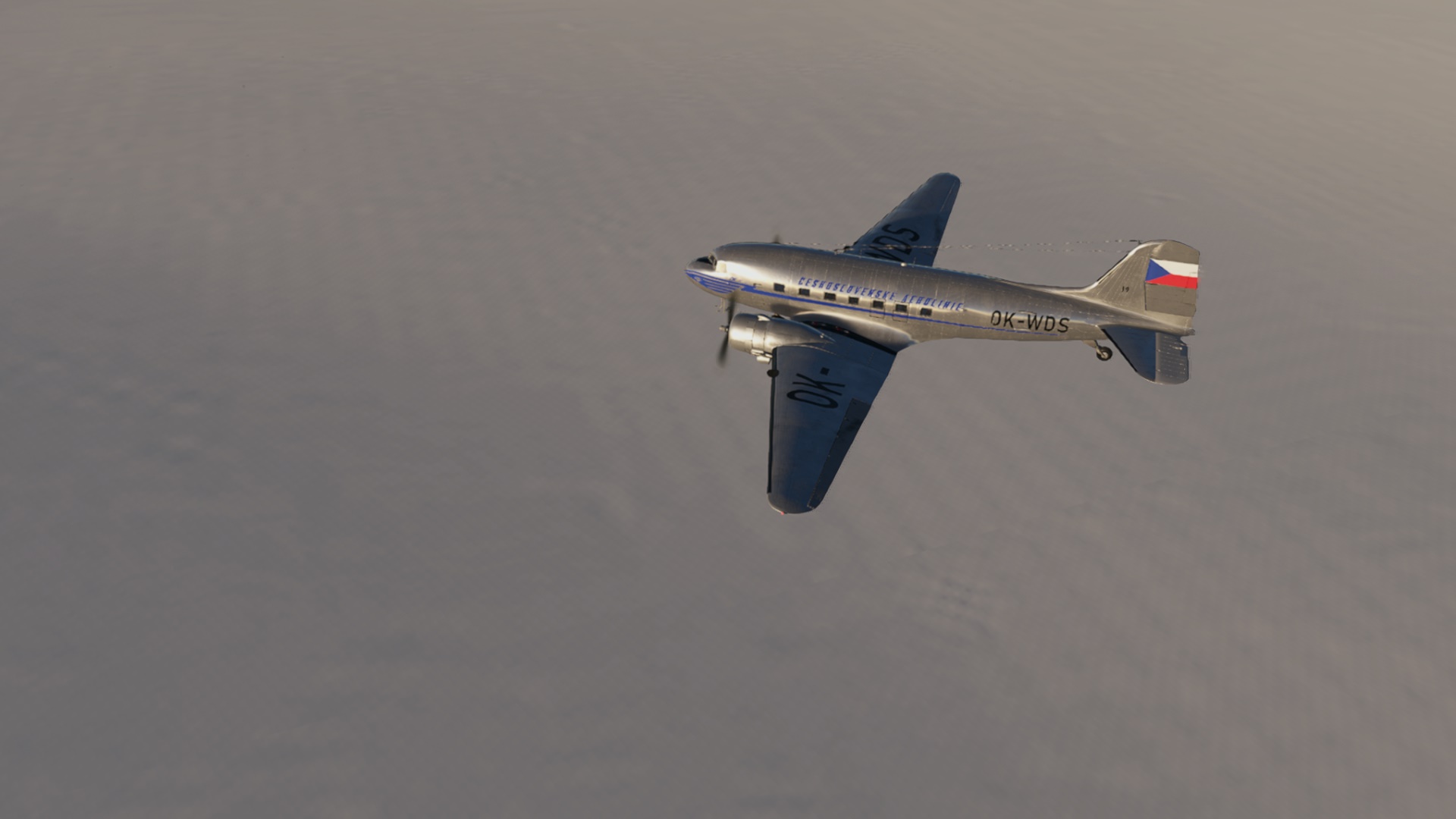
I am sticking to a DC-3 as I want to put little more hours on that airframe, only I have a new paint ![]() And as the DC-3 is an old school nav aircraft (I am in the classic variant), I found this approach plate most appropriate:
And as the DC-3 is an old school nav aircraft (I am in the classic variant), I found this approach plate most appropriate:

A little dark in the cockpit at first but ready to get rolling a minute later.


Departing Kulusuk and turning left to 246M.
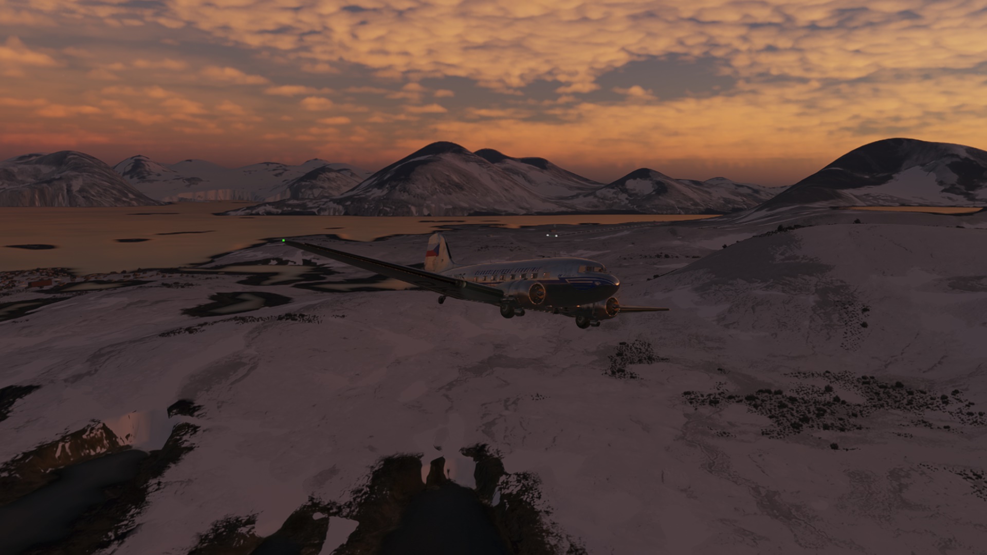
The following screenshots are just some moody pictures taken on an uneventful way towards Narsarsuaq. Nice to just sit back and relax for a change ![]() I even forgot to play my favorite podcast as I usually do.
I even forgot to play my favorite podcast as I usually do.


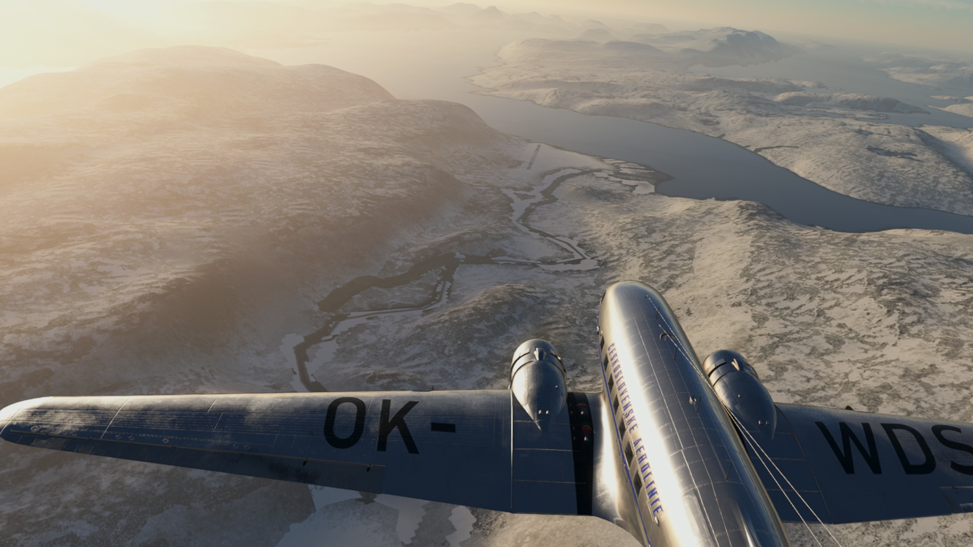
One might think that Greenland would be a flattish low-land country but the opposite is actually true. I was cruising at 10k ft and the hills below me soon reached to some 8k ft. The highest peak in Greenland is Mt. Gunnbjörn (3694 m/12120 ft).


Looks like the pilots are twins…

…and they forgot their passengers in Kulusuk.

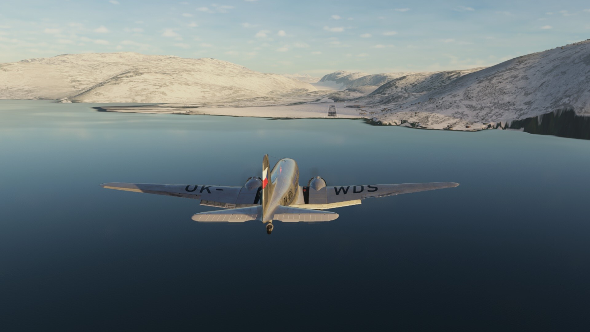
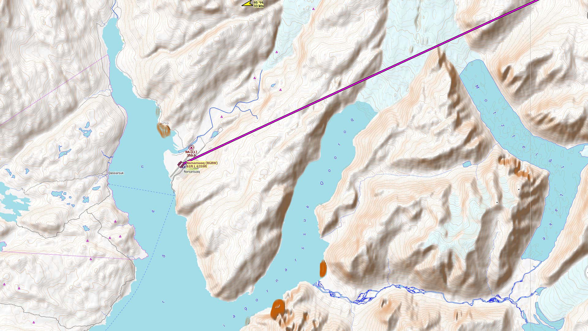
Anyway, let’s stop cheap jokes and get serious again. Our destination is below. The plan is to fly a NDB only approach since the DC-3 has no DME (sadly). But with some mental math and this visibility, I should not get lost ![]()

I did not make a whole lot of screenshots during the approach since this bird is a little unstable at low speeds. Sorry!

Down safely. The landing was good. The roll-out not so much. It looks like @keets has swapped aircraft ![]() Perhaps I can catch him in the bar later to listen to a first hand account of his arrival to Narsarsuaq.
Perhaps I can catch him in the bar later to listen to a first hand account of his arrival to Narsarsuaq.

Next leg: Goose Bay. Not very original, I know but a good occasion to dust off the DC-6!
9 Likes
Leg 33 Keflavík Airport, Iceland (BIKF) TO Narsarsarsarsarsarsaruaq, Kujalleq, Greenland (BGBW).
Ugh, my aching head! At least now I know why Mums go to Iceland. ![]()
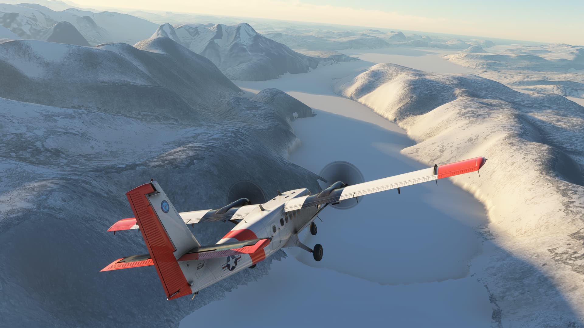
Starting my long trek back down towards the more temperate Latitudes. For this leg, I decided to dust off the Aerosoft Twin Otter in US Navy CIRPAS livery by Jankees.
Although, in this light, you’d be hard pressed to tell! Taxiing is indeed a nightmare. Nothing seems to lead to anything here! ![]()

A very scenic low cloud deck looms over Kef for my departure.

649NM as the horrifyingly hung over crow flies.

I wave goodbye to Iceland and notice the fresh tattoo…
“Who the Hell is Vigdis?” ![]()

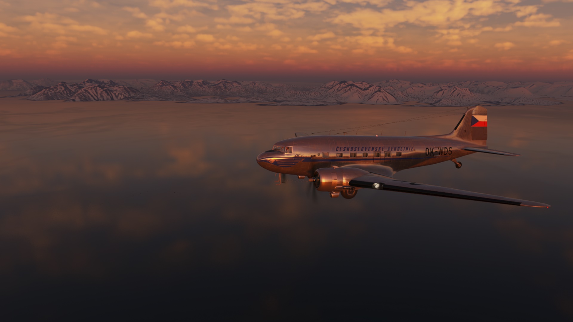
As @keets said, not much to see over the water. But what a beautiful dawn.

At least, for awhile…

Well, that’s disconcerting.

(Though I forgot about that, didn’t you?)
I get tossed around in here pretty good. Solid Moderate at least, if not a little more. I mean really good, ol’ fashioned, tail swinging, wish they hadn’t served soup, Moderate.

My mind turns to that fermented fish I ate last night…

Several hours later…
I break out the coast of Greenland, just north of
Naposorsq…
Napasursqi…
a fjord…


The snow just looks thick here, doesn’t it?

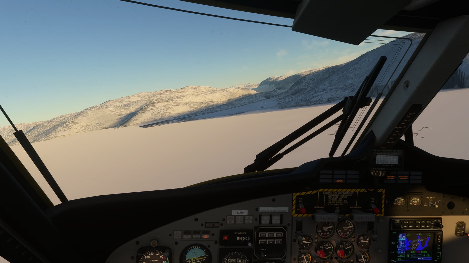
The clouds (and turbulence) break up here finally.
Which is good. Because there’s a lot of “stuff” (aviation term) around here that you wouldn’t want to meet in a dark alley, especially in an IMC dark alley.
Like this.

Alright, here’s the lowdown. I don’t have a chart handy, but it’s VMC so I’m planning to shoot down the, sigh, Niagornarssuk Qooroq…
Why do I feel like the cartographer fell asleep on his keyboard here?
and then hook back around up the Skovfjorden to reach the field over the ice flats.
This is a, self-appointed, Great Idea™…just as long as I have no intention of going around.
At all. ![]()
Alright, here’s the, you know, thing with all the consonants…
And back around up the…thing with slightly fewer consonants.
To find the field in the shadows because, reasons.

And, a goodly crosswind landing later

And I’m here. Narsarsarsarsar…well, you get the idea.

Seriously, I’m certain that all these names have a very sound and reasonable etymology.
But, trying to pronounce them keeps making my copilot treat me for some kind of condition! ![]()
Anyway, I’m here.
OK, I need 5 quarts of oil, and a pallet of aspirin! Stat!

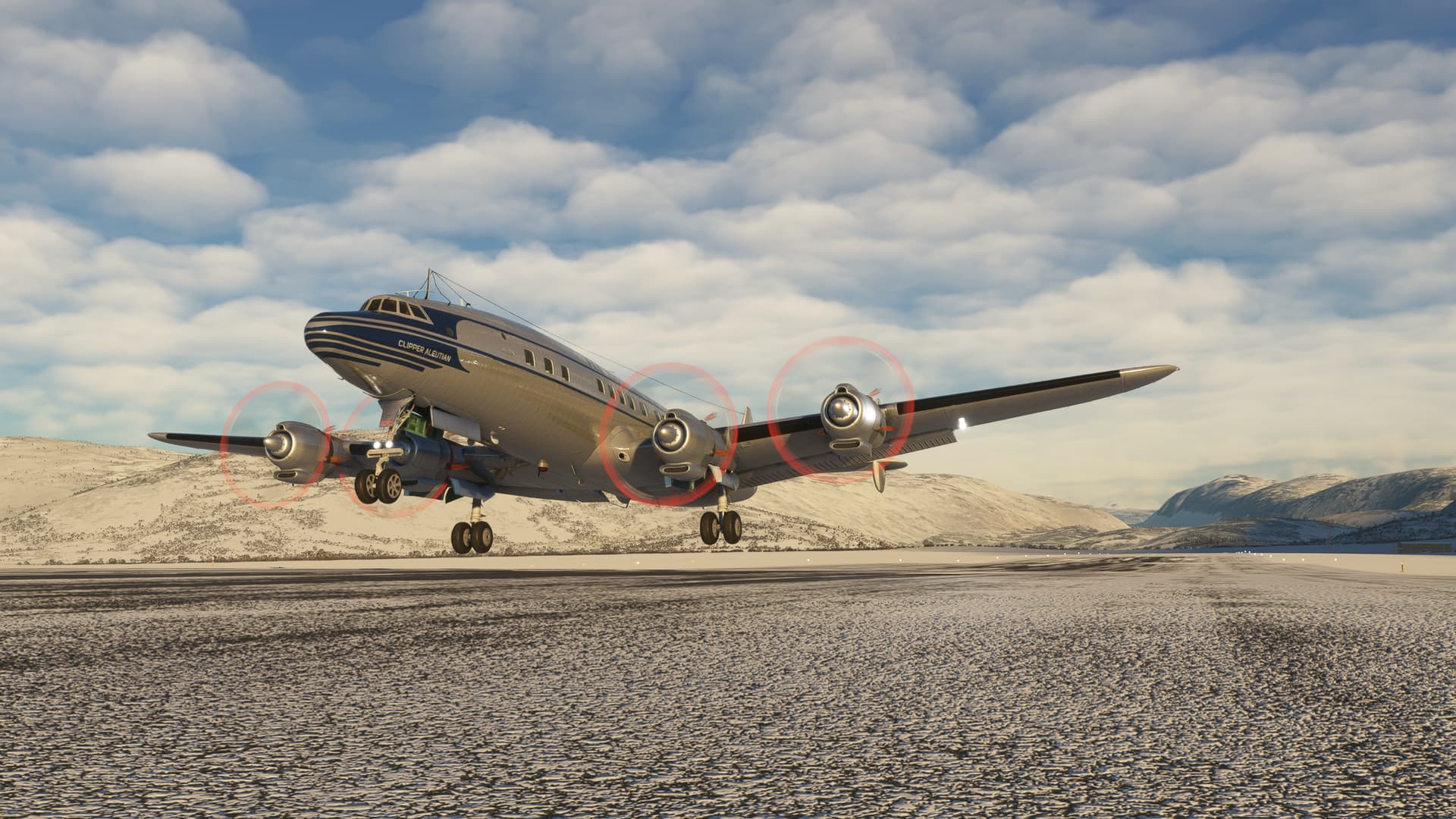
Leg 34 Narsarsarsarsarsarsaruaq, Kujalleq, Greenland (BGBW) TO CFB Goose Bay, Happy Valley-Goose Bay, Newfoundland and Labrador, Canada (CYYR).
OK, after my aspirin, and soooooooooo much water, I feel refreshed, reinvigorated, and resplendent.
I am ready to return to North America.
For the sake of time, I’m going to two leg it to my next Spiker.
675NM today, as the, vows never to do that again, crow flies.

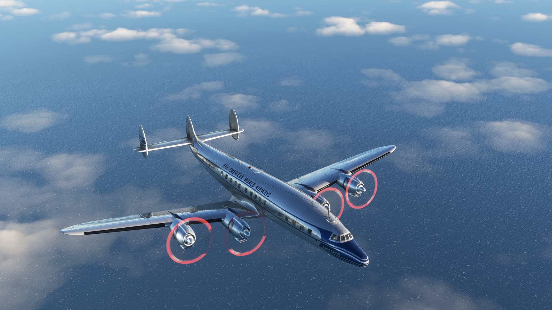
Back to the Redwing Sim Connie for this leg. Originally, I had found a very nice Trans Canada livery, but I think it fell into the ninth circle of Zip File Folder Hell.
So, I chose instead a Pan Am livery by tpapenhove. It’s a curious combination of pointy nose with no tanks. I wasn’t able to find a picture of this particular variant online, so I don’t honestly know if this skin is accurate.
But it sure is good looking, and sometimes, that’s enough!

I run into the classic problem here. I have to choose between a good strong quartering tailwind and a takeoff into the mountains. I’m not super familiar with the takeoff roll of a heavy Connie, nor with the climb gradient.
I’m just going to have to choose one and take my chances.
In the end I figure that, I can scrape the fjord all the way out to sea if need be. I just need to get off the wheels before my shoes get damp.
Which I do…baaaaaarely.

In retrospect, I think that I made the right decision, even without the real possibility of popping a can on the way out.
That high terrain climbs pretty steeply off in the other direction.

And, with a very gentle climb, I weave my way down the flow.


With most of that behind me now, I set course for Goose Bay.

There’s Nunarsuit off to the right as I leave Greenland behind me. Open water from here on out.
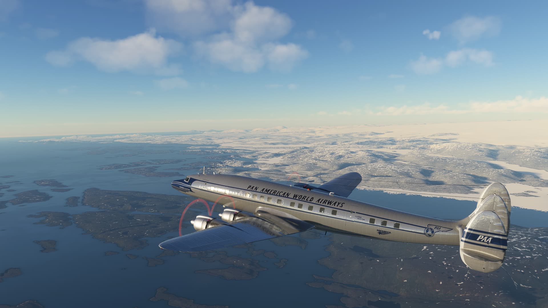
With a much shorter leg length and plenty of gas, I level off at 12,000ft for the initial cruise and cycle through the Connie’s systems.
All consumables look pretty good, especially the oil this time!!!
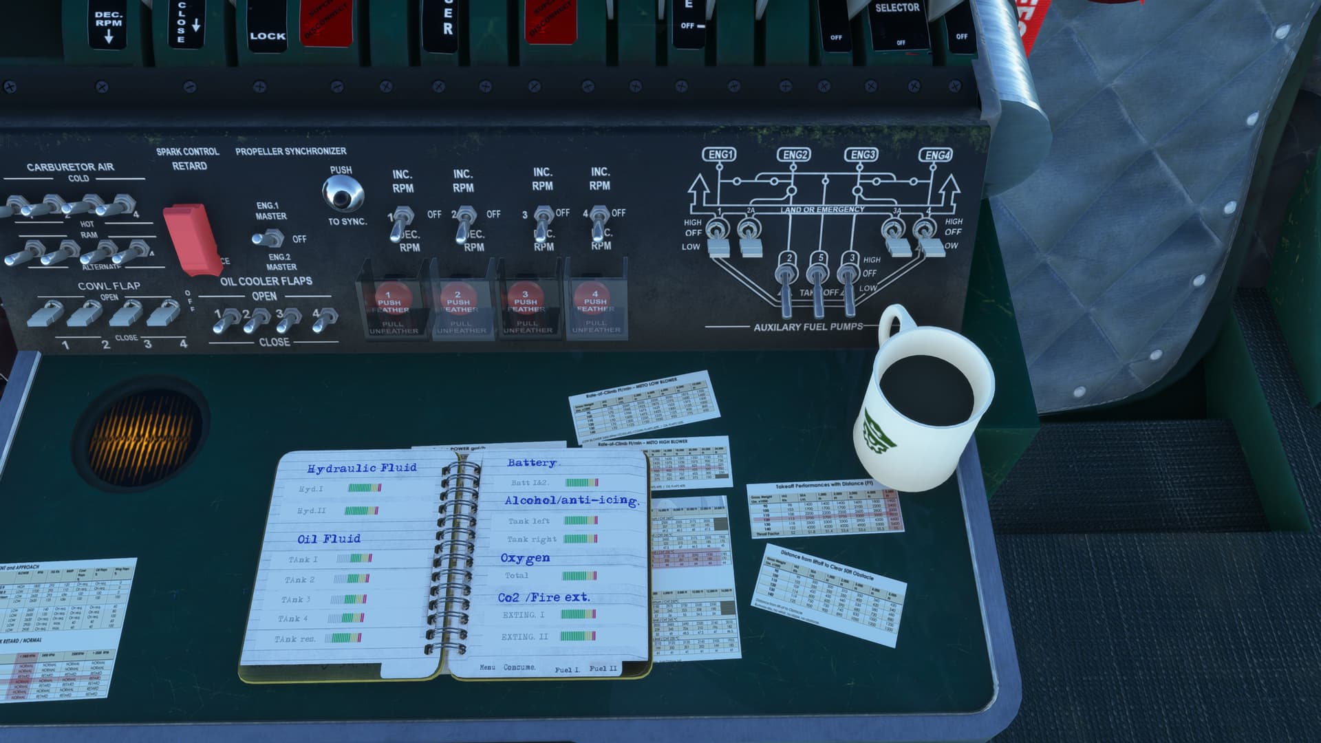
Fuel configuration looks, uh, good. I guess.
OK, I’m pretty much taking Flight Engineer Stevie Sideways’s word on this, were I to be honest. ![]()
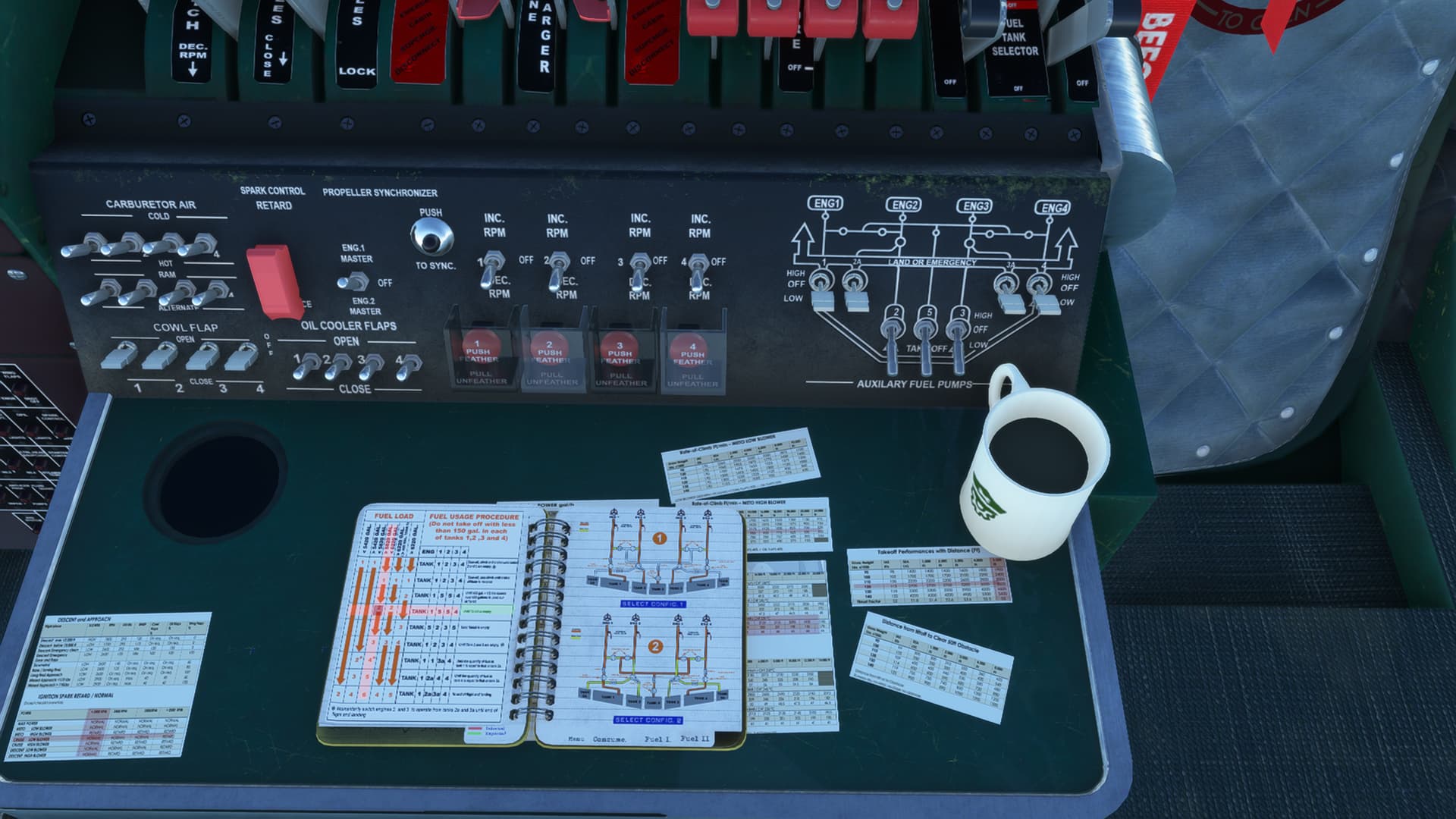
And I particularly wanted to see how the supercharger behaved this time. Over the South Pacific, Stevie shut them down. I guess from overheating, even though the gauge stayed right in the middle the entire time.

Now, nothing to do but look out the window and watch the whitecaps on the stormy North Atlantic.
In less time than I would have thought, the point of Cape Harrison comes into view in the thinning cloud deck. At least in my book, there’s something reassuring about being feet dry again, even if there is no place to land.

Webeck Island, and the edge of the ice for me. I’ve wondered how the ice in MSFS compares to real life. Certainly most of the sea south of the fjords in Greenland is liquid, I assume from the salinity and the currents.

But Lake Melville and the entrance to Goose Bay is all water, which makes me wonder a bit…

I was looking forward to a mostly clear arrival into Goose Bay. The local weather had other ideas. There is definitely some terrain down there judging by the Grid MORAs, so I don’t want to descend too early.
But, I’m picking up some ice and I don’t think Copilot Hairy is operating the deice equipment properly.

Sure enough, the airspeed and VSI drops to zero. Not great timing.

Rather than flying around in the ice and hills while I wait for the deice to work, I decide to fly by deck angle instead. Houses get too far up, I’m fast. Houses get too far down, I’m slow.

The autopilot works pretty well, especially considering that I didn’t give it the best intercept. But I kick it off when it starts to get too squirrley.

The touchdown goes fine. Still not a lot of feel in this aircraft. I have definitely picked up some icing.

Which, entertainingly, gets worse the longer I sit on the ground. Must be a high Dew Point!


In any case, any landing you can walk away from…
I’m back on my home continent and in the home stretch for this year’s Christmas trip.
Only a few more legs to go.
12 Likes
A bug from FSX times at least.
A cracking report as always ![]()
2 Likes
I suspect that the pitot static system actually was simulatedly being iced.
The issue was that I had the auto FO going, and I don’t think he turned the AI stuff on which, considering he wouldn’t know “visible moisture” if it bit him on the diode, should probably have not surprised me.
But, you know, it did. ![]()
4 Likes
Yes, you are most likely right.
Only when that happens IRL, the IAS ‘freezes’ at its current value and does not default to zero. VSI reading 0 is correct though.
I do not have yet this experience in MSFS but if it behaves like you described, it is as wrong as it was in FSX.
4 Likes
Ah yes, I reckon you’re right about that. Shows ya how long its been since I studied the AIM! ![]()
2 Likes
Ya know, I wanted to read up on this as I vaguely recalled a zero airspeed failure mode and there is one


But it doesn’t address the zero VSI issue, which might have been the case if the static port was also iced over. However, since the altimeter was still working, I think that rules out that failure case.
Plus, I don’t think this special case of the drain hole being unblocked was what Asobo/MS was going for.
I think you’re just right in that they’re just wrong. ![]()
Always good to revisit this stuff on occasion.
1 Like
True. I have just learnt something new ![]()
1 Like
Yay! Me too. And with the length of my memory, I’ll get the chance to learn it again in a couple of years! ![]()
2 Likes
Sumburgh to Inverness…
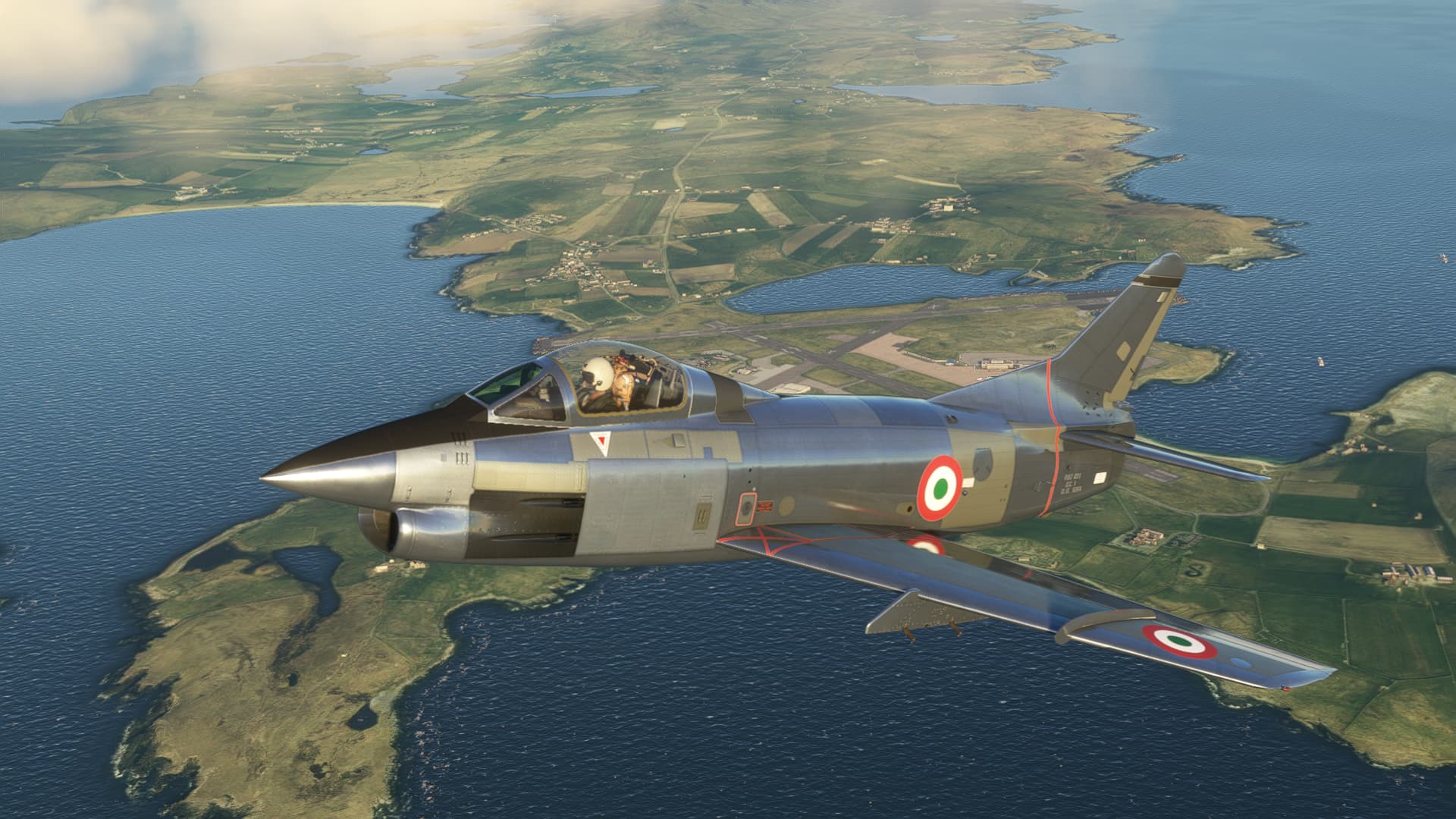
For this leg I pulled the SimSkunkWorks G91 ‘Gina’ out of the hangar…
I really like the prototype livery…all that bare metal and it’s patchwork of panels… It just looks like it will be fun to fly (actually it is an unforgiving little airplane)…

Lined up and ready to roll…

Turning out toward the south west.

At about the half way point I pass Scappa Flow, which was a major Royal Navy base during the first and second world wars. I guess you could call it the British equivalent of Pearl Harbor except it’s nowhere near Hawaii ![]() . There are a couple ships down there, maybe from Aerosoft’s new North Sea package.
. There are a couple ships down there, maybe from Aerosoft’s new North Sea package.

Coming up on mainland Scotland…John O’Groats is just under the right wing.

Passing John O’Groats.
Starting my descent into the Inverness area.
On final…keeping my speed up because when she stalls, she drops a wing with little to no warning and if you are dirtied up with gear and flaps, there is little chance of recovery. I keep it at 150 knots until I’m about to cross the threshold.

Fortunately, the drag chute is quite effective, and has the added advantage of stabilizing the airplane on the roll out.

Parked on the ramp…

I’m not sure where I will head to next. I’m within easy striking distance of my final destination, but it seems a little early to end my trek.
11 Likes
Great report. I’m so often tempted by that plane.
1 Like
If you are quick, it is only $12 on OrbX right now. It has it’s quirks but for $12 you can’t go wrong.
1 Like
Agree. I bought it some time ago, and it is decent for that price. I still hope they improve it a bit over time, as it is relatively basic.
1 Like
Inverness (EGPE) to RAF Valley (EGOV)…
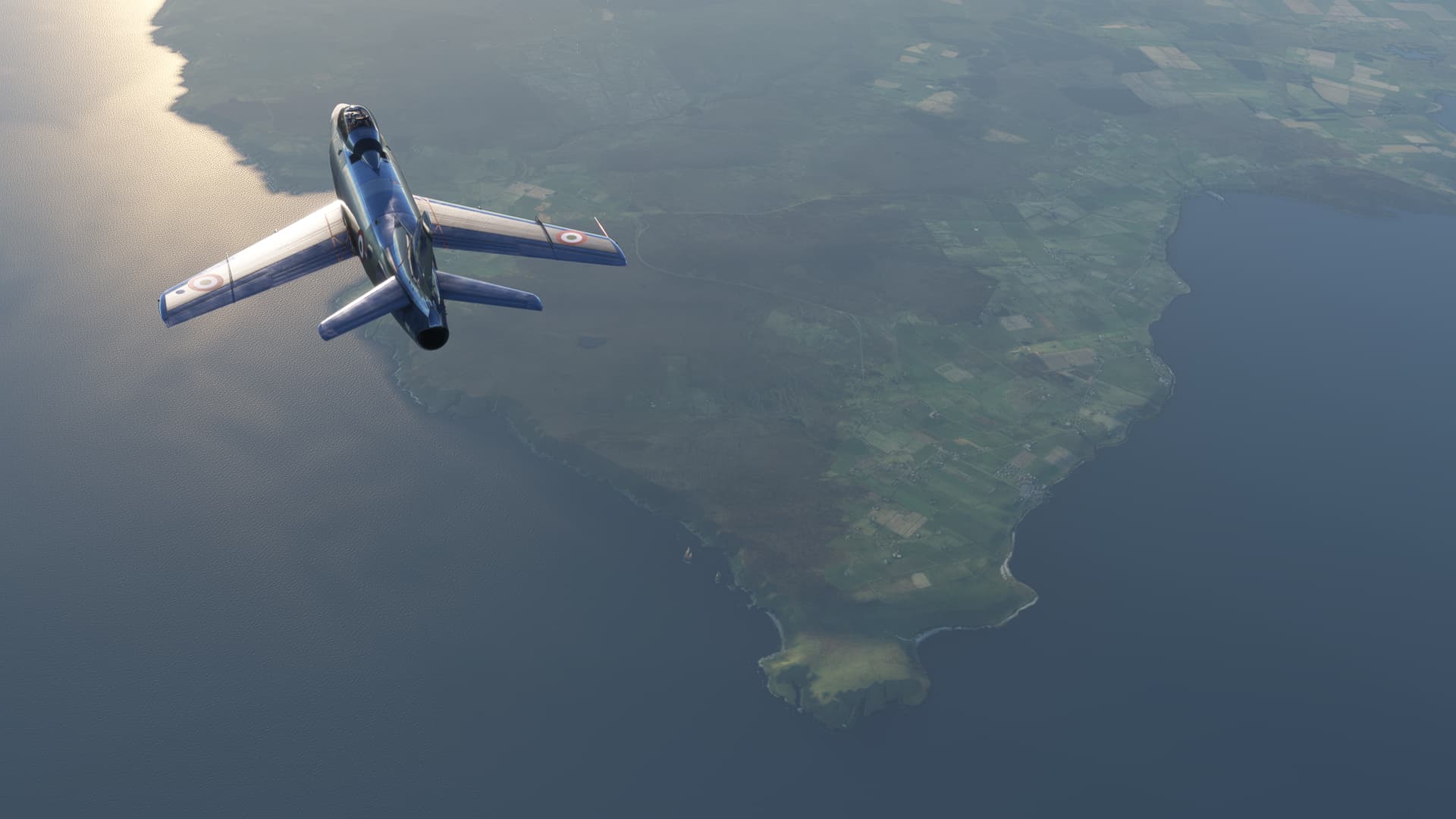
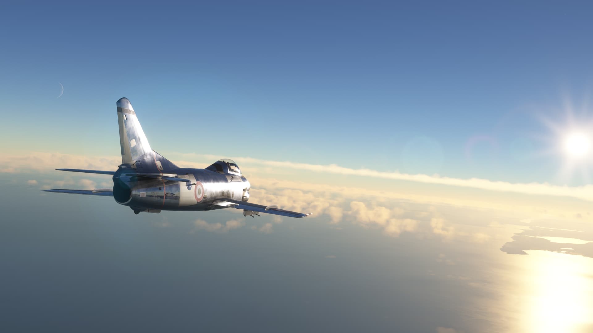
For this hop, I thought I would take the excellent freeware Hunter for a spin…
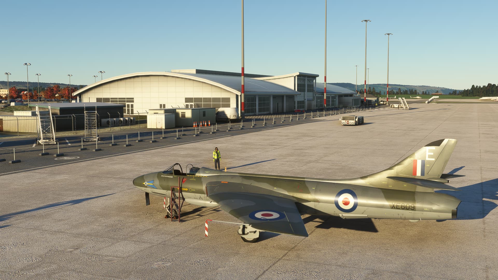
Final checks complete…

Climbing away…

Inverness is at the northeastern end of a rather famous body of water… No sign of Nessie today though.

Popping up at the end of the Loch and turning south.


Coming up on the Isle of Mann

Passing over Holyhead


From Holyhead you just follow the coast for a short distance and RAF Valley comes into view.

Setting up on a left downwind, losing some airspeed.

Turning final…
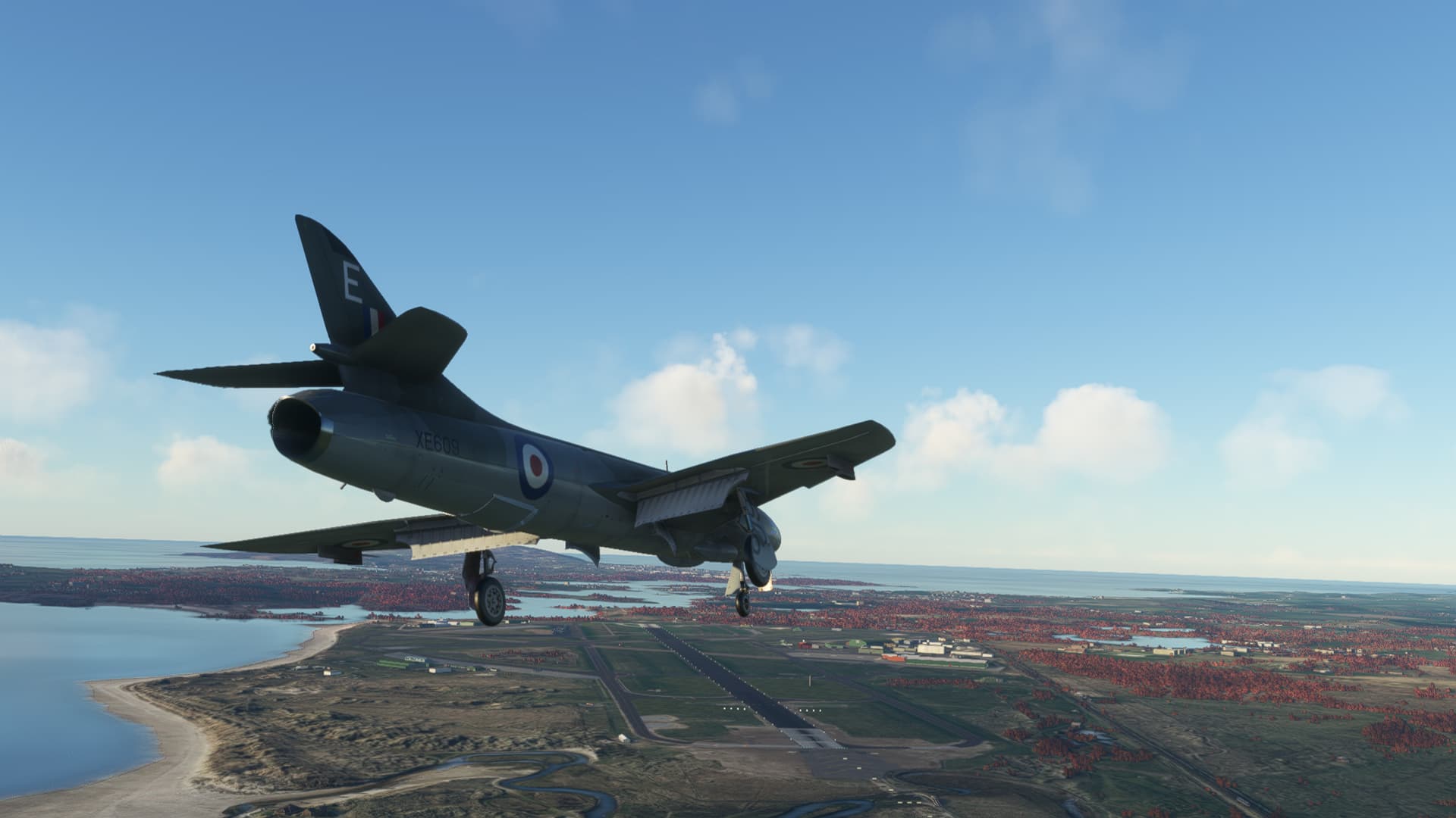
Down safe, and taxiing in to the ramp.


Parked at my favorite spot.

Where to next?
11 Likes