Official 8th Annual Mudspike Christmas Flight 2022 Discussion and AAR Thread

so I will open it up!

I just wanted to test flight PS5 controller and it ended up as start of my holiday flight. well then, flying backwards last holiday flight. will definitely visit different locations.

part of my cool plan is to complete this track with PS5 controller. thats the benefit of notebooks and sofa flying. I finally got there @jenrick :+1:

Port Stanley SFAL → Rio Grande SAWE

as mentioned elsewhere really looking forward to XP12 what it will bring in regards to scenery. XP is a great simulation platform but MSFS with its ortho scenery is really hard to ignore.

you can see I didnt settle yet on sim or plane, its going to be fun :slight_smile:

Rio Grande SAWE → Punta Arenas SCCI

11 Likes

Awesome! Thanks for starting us off.

Good luck everyone!

6 Likes

OK, here we go. I’m about to do something stupid, and there’s no sense in waiting!

Leg 1: Philadelphia International (KPHL) TO Altoona-Blair County (AOO)

My original plan was to head west to Colombus, OH. The aircraft I chose is the old Boeing 247D in Pennsylvania Central Airlines colors. I had always intended to try “radio range” navigation and this seemed like a good time to start.

Luckily, the weather was good…

I prepared with my usual thoroughness (i.e. none at all), but I did plot out a course using the charts kindly provided by Wing42.

Well, this looks straightforward enough (mishap pilot was heard to say :wink:)

Off on a lovely August morning, trailing oil smoke.

The first thing I’ll say is that radio range nav is harder than I thought. If it had been IMC and I hadn’t spotted the Susquehanna River, I’d be in Cuba by now.

Ah, Harrisburg!

(10 minutes later…)

Wait. Isn’t that 3 Mile Island ahead?

Ah, Harrisburg! :upside_down_face:

I wandered back and forth quite a bit trying to tune my ear for the “AN” tones in my headset. I was weaving over some of the very interesting narrow mountain chains near Cumberland, when I began to lose power.

It looks like I’ve lost oil pressure on number 2. Don’t know why. Understanding that I’m no expert in the 247D, I had really tried to baby the motors.

I must have pushed something too hard. :man_shrugging:

Luckily, I looked over my nose and saw Altoona Airfield. Might as well drop in and call dispatch.

Some, but not too much, yaw out of this one. The right engine failed on rollout.

Think there’s a Jiffy Lube in town?

And so ends my first leg. Lost. Engine failure.

Seems about right for me on the Christmas Flight! :rofl:

13 Likes

The 247 is a fickle beast. There are some issues with he oil temp or pressure gauges (I forget which)… so you have to keep a close eye on whichever one works to figure out a safe power setting. I lost both engines on my first flight with it. Flying using the Range is a fun exercise. It makes you appreciate just how good we have it today!

2 Likes

ha, nice. was thinking exactly about that ship to fly here and there, but realized that it is too ‘fragile’ for the rough conditions down south :blush:

on the other note, never had a engine failure with her, some power lost here and there, but somehow always was able to keep them running till the landing on the few flights on the air race we did ( have to finish it one day :smile: )

1 Like

I’m still not quite good enough to really find the beam. It always sounds like I’m hearing one side or the other.

I think for most mortals it is a case of zig-zagging a bit left and right of the centerline.

Yeah, “a bit”, that’s it. :joy:

Awesome! The race is on, thanks to you guys :slight_smile:

I didn’t know you could get radio range stations in MSFS, that’s very cool.

1 Like

So, thinking about how to get across the South Pacific Ocean in the DC-6 with my limited skillset.

Pondering follows!

The max fuel range in the DC-6 is 4100 NM and cruising speed is somewhere in the 250kts region. It is radio navigation equipped but the plan would be to leave the GPS at home. I haven’t yet tried my hand at celestial navigation but open to giving it a go (although I am intimidated and confused after watching a video or two haha!)

Because I’m not a navigation expert, I’m struggling a bit to visualise in my head the shortest distances in the high polar latitudes…but it seems that the shortest route from NZ if going the high southern route would be from Dunedin (NZDN) to one of the airfields along the Beagle Channel in southern Argentina, probably Ushuaia airport (SAWH). That’s a 4,082 NM trip, not exactly a lot of spare fuel at landfall.

You could, however, stop at Chatham Islands and shorten the leg to 3,861 NM. That’s arguably within range, although you’d want to be pretty confident that the winds aren’t against you.

Speaking of winds, taking the high latitudes would mean being able to benefit from the Pacific trade winds, which would help quite a bit given the cruise speeds we’re talking about:

Having said that, we’re still looking at a very, very long flight…somewhere in the 8+ hour region, I think. The less fun part is, if anything at all goes wrong, that’s pretty much it, we’d be freezing with the fishes…there’s nowhere to divert to really. The barren Antarctic coast is the closest land for the most part, and even that’s some 600NM off course…and there are no airfields or bases that I can see.

Flying to Fiji, American Samoa and eventually Hawaii would probably be more sensible and potentially more fun…but let’s see. I’m somewhat tempted by the opportunity to ride the trade winds and push the DC-6 to it’s limits.

5 Likes

Have you considered McMurdo?

5 Likes

Now there’s a thought!!

I need an actual physical globe to get my head around these polar regions :smiley:

1 Like

We spent so long growing up with paper atlases using Mercator projection maps, that sometimes it takes a bit to visualize a route correctly. Kids today, who are brought up with Google Earth probably won’t have that problem :wink: .

2 Likes

Absolutely. The route is so obvious when you spin Google Earth, heh.

I assume there’s some interesting stuff to understand when navigating that close to the pole…but this route has quite a bit going for it, I think! Thanks! :grin:

3 Likes

star wars GIF

7 Likes

I am not entirely sure whether I will make it all the way to KCLT this year (time is a scarce commodity for me now) but I will try to take it as far as I can. Let’s see…

Time to get moving!


This is my house as depicted by the MSFS 2020. Interestingly enough, the brick facade is spot on :+1: and you can even make out the driveway to the garage (the hole at the edge of the road). I also like the fact that in the sim it appears larger than it actually is :laughing:

Good bye!

The features on the way are easily recognizable to the point that I was actually giving right of way on the places I always do :slight_smile: Though other than that, there is probably a reason why the MSFS 2020 is a flight sim and not a racing sim.

Some 2 clicks from the airport I got to this place:

So I made a 180 and found an alternative way. Useldange is fortunately a little town which we visit regularly for a medieval festival so in no time was I arriving to the airport (ELUS).

For my next hop to the northernmost airport in Luxembourg I decided to take the slowest aircraft from my hangar. With some 45kts it was this one - can you tell which one? (check all the engine indicators)

I was not even half an hour to the adventure and someone has already stolen my car :astonished:

The thing does not only fly very fast (that I knew already) but also not very high.

This is a camp in Liefrange where I spent some quality time with a friend and our kids (no wives though!).

City of Wiltz.

And finally my destination for today - ELNT.

12 Likes

First leg, from Malden glider field, which is about an hour on the bicycle from where I live, in a little bush plane to Leeuwarden air base, where I intend to grab a fighter jet and make my way across the pond.

This is it. It has a big screen up front instead of steam gauges, but somehow I never figured that out. Well it shows a pink line on the map for me to follow, so that’s nice. I either misunderstood it or it lacks autopilot, as all that button ever did was switch the plane from highly unstable to almost stable. I hand flew it all across .nl because of this, and had a hard time figuring trim out too.

Climbing out eastwards over Groesbeek.

Looking down at the farm in Persingen where I have my crews homebase. It’s not a 100% correct, but impressively close to reality.

Heading north, looking over my shoulder across the river Waal (lower part of the Rhine) at Nijmegen (where have always lived), the Maas-Waal channel, Weurt (just as you cross the locks by car there’s a graffiti of the microsoft Word icon. Hilarious.) And Beuningen, where I currently live. All my life’s stomping ground in one aerial shot from low level. Heh.

Crossing the former coast of the Zuiderzee. The land you see in front is the Flevopolder. The zuiderzee was dammed and large partsof it were diked in, pumped dry and are now used for industrial agriculture. Polder is the Dutch word for land that’s been pumped dry.

Huh. So there is a button labeled trim on the stick. Then why won’t this b’stard plane not stop porpoising like a drunk?

Looking across the Noordoostpolder (the polder that was done a bit earlier than flevoland) towards the Ijsselmeer (former Zuiderzee). When the Afsluitdijk (closing dike?) was closed, the water salinity quickly changed as sweet water replaced the sea water.

The Frysian lakes. This region is very nice for boating and sailing. There’s lakes and canals and a whole lot of places where you can moor and have a drink :wink:


Pretty old country. Farmed hard though. That soil is pumped so full of nutrients that the spillage is causing all kinds of problems for the ecosystems surrounding them.

A nice little town called Sneek [snake]. The Frysians call it Snits. Once every year it becomes a pretty close impression of gomorrah when the boating people have their races and a week of partying imaginatively called the sneekweek.

Fighter Town Leeuwarden, home of the Frisian Flag and one of the two remaining active fighter bases in .nl. No vipers present in MSFS tho.

Plonking it down. Doing this gracefully and with style is easy in VR in a swanky simpit with MFG pedals and a centermounted 25cm virpil t50cm2. Not so easy with an xbox controller. Big screen is glorious though.

And that’s my first leg in. This time I will see it through!

11 Likes

@apollon01, that is way cool! Might this be the first time that a car has been part of the Holiday flight?

I’ve been busy the last few days; trying to make hay while the sun shines. In the interest of space, I’ll try to put it all in one post…

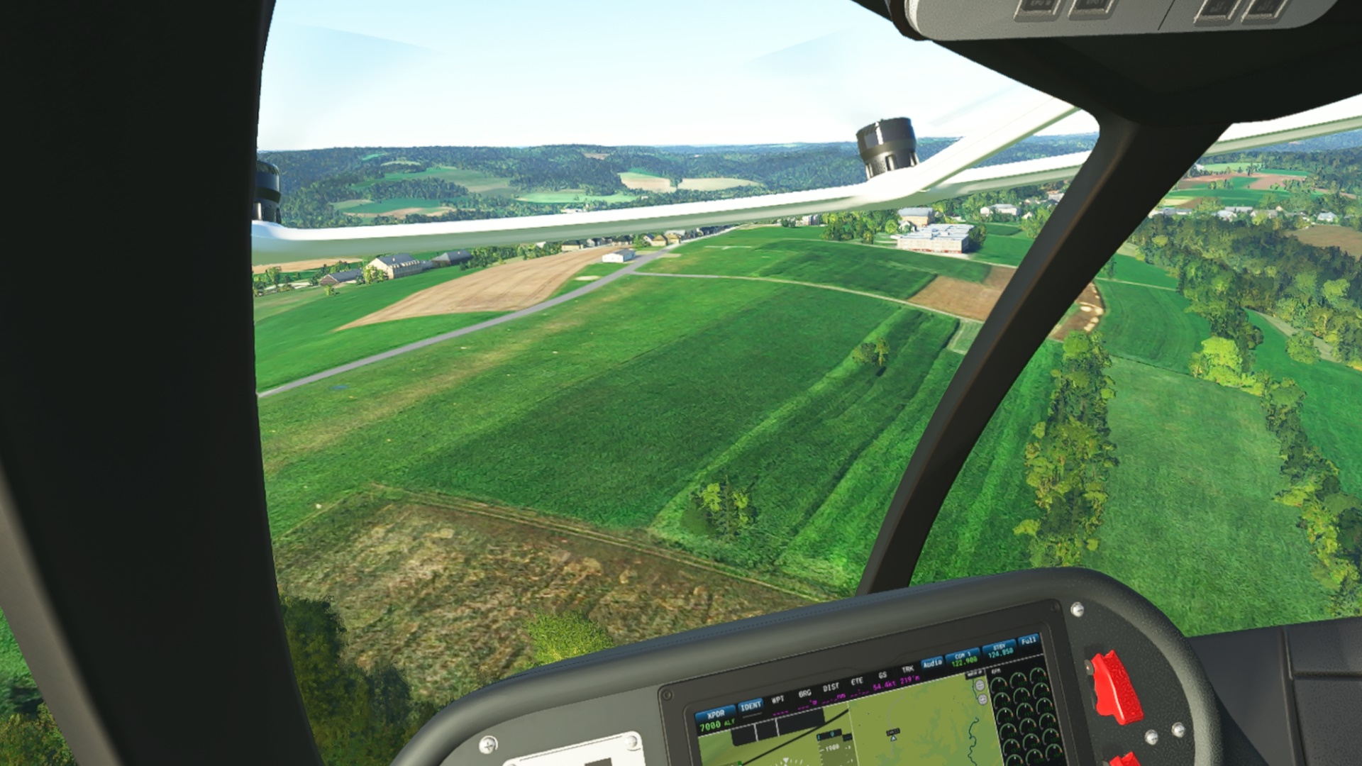
Leg 2: Altoona-Blair County, Altoona, PA (KAOO) TO Newark-Heath Airport, Newark, OH (KVTA)

With a new oil seal (and a quick fine paid to the EPA for the cleanup), I am off again pointed westward.

I am still absolutely butchering range navigation. Thank God for VFR!

Plus, listening to that tone for hours on end makes me wonder how more navigators didn’t wind up on multi-state chainsaw sprees! :laughing:

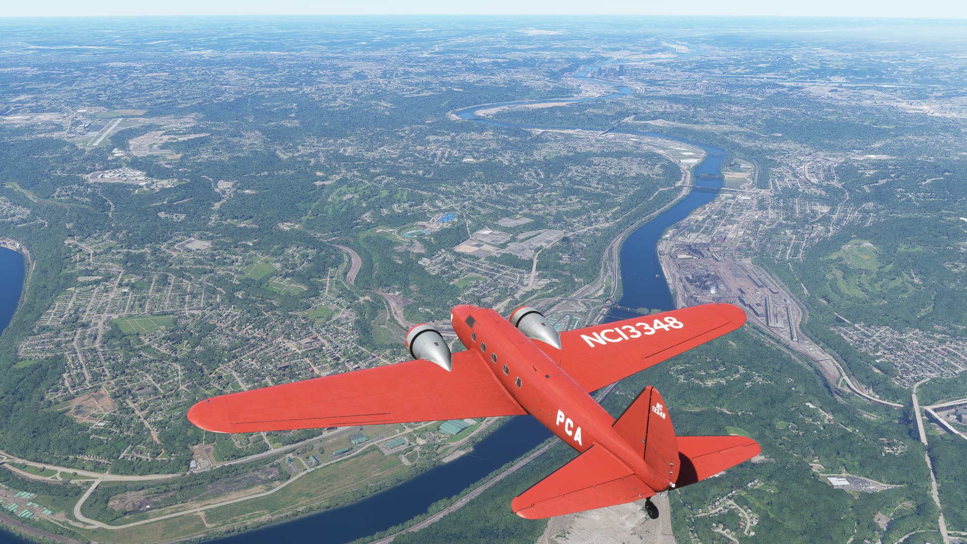
With some assistance from my Mk 1, Mod 0 eyeball, I did manage to find Pittsburgh, right up the Monongahela River.

Though the site of the old Pittsburgh AN radio station actually looks to be further south, by the Allegheny County Airport; at least according the “cone of confusion”.

In my case, the cone of confusion is usually situated within about a 2ft radius of my head. :smirk:

Not too long thereafter, I roll onto final, runway 27 at Newark Heath on a clear summer afternoon.

And squeeeeeeeeze onto the ramp.

Left a Philly Cheeseteak for @BierRunner. You might not want to wait until Christmas to eat it.

Leg 3: Newark-Heath Airport, Newark, OH (KVTA) TO Louisville Muhammad Ali International Airport, Louisville, KY (KSDF)

Took off way too early the next morning in the Beech 18, MCAS El Toro livery by Bomber_12th. This has got to be one of my favorite paint jobs. The detail work Bomber_12th put into it is really amazing.

But, we don’t get to see that yet. In fact, we don’t get to see much of anything yet. In one of those interesting flight sim vs real life moments, I can’t find most of the rheostats to turn the lights on in the cockpit. :grin:

Notice especially that dark hole under the attitude gyro…that’ll be important later.

It took an hour or so for the sun to come up. In addition to fighting a little with the Beech’s autopilot, I couldn’t for the life of me find any sort of HSI on my side of the cockpit. What a weird omission!

God bless the dawn!

As the cockpit got a little brighter, I noticed that the black hole beneath the attitude gyro is in fact a combined HSI and CDI.

A marvelously designed instrument. Except for being pitch black at night! :rofl:

(I’m sure that there must be a knob for that thing somewhere)

After about two hours, my two dogs started looking wistfully at the expensive carpeting in the Beech. In the name of historic preservation, I decided to duck into Louisville. I wouldn’t have had the gas to make it to my ultimate destination for the day anyway. Plus, I love me some bourbon!

A little fog over on the Indiana side of the Ohio river. Not uncommon actually. That river leads to some pretty dramatic differences in the weather between Indiana and Kentucky.

But the weather looks fine over SDF. Between the parallels, you can see some of the massive UPS facility and Churchill Downs at about 2 o’clock.

A quick gas and go here, and I should be on my way!

Leg 4: Louisville Muhammad Ali International Airport, Louisville, KY (KSDF) TO Sugarland Regional Airport, Houston, TX (KSGR)

OK, tanks topped off. Fire hydrants peed on.

Taking off to the south with the Louisville skyline in the background.

My original intent had been to fly Victor routes down to Texas. But, after my autopilot troubles, I wound up floundering around a bit and chose to go magenta eventually. I’ve already abandoned my last year’s trip resolution of no GPS, no cheats while teaching myself to fly the range on Leg 1.

This year I may just have to play for the experience. :upside_down_face:

Anyway, a sim reset and watching a few YouTube tutorials seems to have addressed most of my AP issues, though the Beech has one of those autopilots that works oddly enough to make you wonder if it works like this for realz. :thinking:

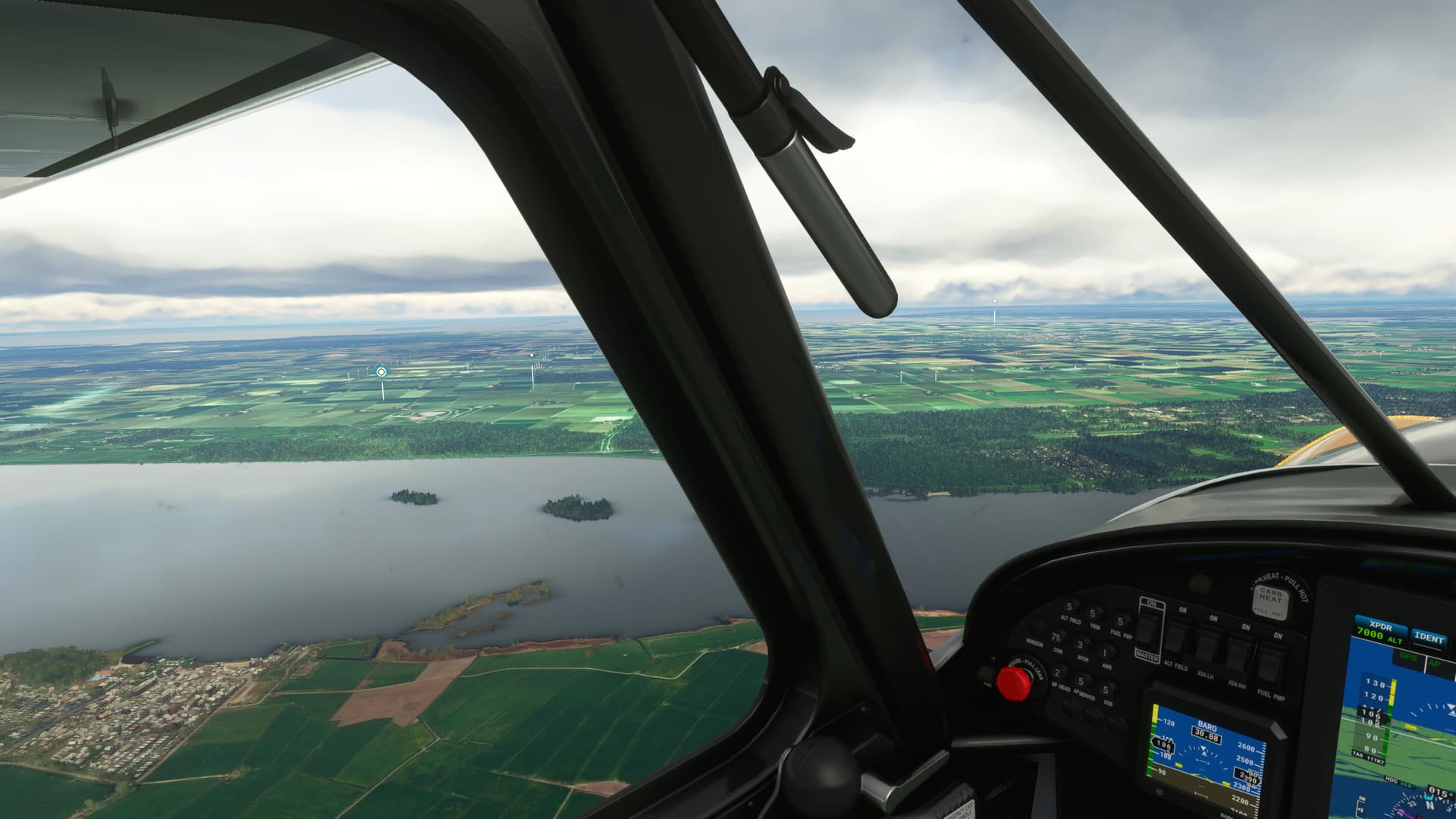
Climbing out over the Ohio. I also seem to be having mixed results with Live weather in MSFS recently. Sometimes it matches the METAR. Sometimes the skies are incongruously CAVU.

Passing over Rough River State Park just west of Louisville. This is a popular fly in destination for the Louisville crowd.

By the time I reach the Land Between the Lakes, intersection of the Tennessee and Big Sandy Rivers, it’s clear and a million!

Originally the MSFS range circle on the World Map showed me just shy of the gas to make it to Houston. But the Beech is really sipping the stuff thus far. Still, I don’t know how accurate these gauges are.

I’m getting uncomfortably close to the bottom of my 78gal main tank. But I’m within 100NM of SGR and I still have 25 in the Aux. I switch over so that I don’t get any surprises on final. :astonished:

The weather is clearly not correct for the Houston area. So, I manually draw some in based on the local METARs. The Houston Metroplex pokes its nose out through the clouds.

Is it just me, or does the PG scenery sometimes look a little post-apocalyptic?

Abeam Sugarland.

And a shamefully deep turn onto final! LOL!

Well, here we are. Houston.

And a box of Buckeyes for @guod.

Leg 5: Sugarland Regional Airport, Houston, TX (KSGR) TO Austin Exec Airport, Austin, TX (KEDC)

This was a fairly short one.

Took off on a sweaty AM from Sugarland in the lovely H145. They’ve really done a marvelous job on this thing.

My ultimate destination was west of here, but I had a stop to make in the other direction first.

Houston skyline on the horizon.

Took a bit of looking, but finally found at least part of it. Johnson Space Flight Center.

Houston, we have a problem. There’s some idiot hovering in front of my windshield!

OK, better get out of here before someone writes down my N number. :grin:

Passing the Astrodome heading back across the metroplex.

I don’t know if it’s something to be proud of, but I think I violated the Class B of every major airport in the Houston area.

Houston in the rearview.

A brief hour or so of NOE flying brought me to the great city of Austin and Austin Executive on the northern outskirts.

Now to shut this thing down and remove all the identifying plates, before Walker Texas Ranger shows up. :shushing_face:

And for @PaulRix, some space ice cream. This one can probably keep until Christmas…2034.

R

Well, that’s it. All caught up. Now comes the hard part…

12 Likes

@Deacon211 : It looks like you pulled every ticket out of the hat for the Secret Santa destinations! You certainly put some miles in already! Just for future reference, being down here in Texas, I feel I have to inform you that we eat Blue Bell brand ice cream down here… and pretty much no other brand. Back in 2015 they had to shut down for an extended period due to a Listeria problem… Texas, to all intents and purposes, stopped eating ice cream during that time. The freezers were empty. :crazy_face: .

@apollon01 : What a great way to start the trip!

@schurem : For some reason all I am seeing where your pictures are posted is XBox Cloud Gaming. Looking forward to seeing the screenshots when you repost them. :sunglasses:

6 Likes

Hey, who makes that Beech 18? It’s a nice one. Almost as good as ice cream.

1 Like