Ok. I think that I have it. If I fly from my home field to Charlotte in a small helicopter, I have a VFR route with roughly 24 50nm segments in it. That’s relatively quick flights and a bit of a scenic route that I can always make shorter. I am trying to stick with small helicopters but I may swap to small GA aircraft as time and weather permit ![]()
6 Likes
Time to get started with my trip. I will use the C-17 Globemaster mod for FS2020 and try myself against a northern route via multiple short hops, barring the Atlantic crossing. I don’t have a detailed flightplan and so far the only constants are ETAR/Ramstein start airpot, then I want to visit Iceland and continue my way down the east coast to Charlotte.
I don’t have much experience with either C-17 nor FS2020, basically my last experience was … Christmas flight 2021 ![]() But the readme for the Globemaster reads that it’s quite a versatile aircraft for it’s size and capable to land and take off from relatively short strips. We’ll see…
But the readme for the Globemaster reads that it’s quite a versatile aircraft for it’s size and capable to land and take off from relatively short strips. We’ll see…
My first leg will bring me to Hamburg. And why not do some industrial espionage and land at the Airbus facility there, with my Boeing aircraft?

But before we start, important goods need to be loaded into the cargo hold:

Fear not, there’s room for plenty more in the C-17!
The scenery around Ramstein airbase, the Sickingerhöhen in the background rise over the basically flat westpfälzer Hochmoorland ![]()

After taking off I pass my hometown of Kaiserslautern. Fortunately real life pilots take a detour and we only usually get the less noisy landing traffic over the city.

On my way northward I pass Bingen, at the junction of the rivers Nahe and Rhein. Being born there it’s nice to see it from the air!

No particular events happen on the flight north.

Toying around with the external cameras I have to say that this looks kind of mean!

Newbie as I am I use GPS navigation, but even there I manage to miss my flight path slightly. Blame the screenshots!

Over Niedersachsen some clouds appear.

I start my descend into Finkenwerder way too early. I lay the foundation for what becomes a really borked approach…

The position on the tarmac might give away my final struggle when landing. Luckily the C-17 is very forgiving, or is this FS2020 property? Anyway, I can walk away from the landing and that’s what counts, I heard. Hopefully the bottles in the cargo hold survived too…

Now I either go further north to Norway, then Iceland, or maybe via Ireland to Iceland.
Cheers,
TeTeT
13 Likes
Nice one TeTeT! Great shots!
Leg 7 (I’ve already messed up the numbering! ![]() ): Los Cabos International Airport, Baja California Sur, Mexico (MMSD) TO Nuku Hiva Airport, Marquesas Islands, French Polynesia (NTMD)
): Los Cabos International Airport, Baja California Sur, Mexico (MMSD) TO Nuku Hiva Airport, Marquesas Islands, French Polynesia (NTMD)
This one turned into a bit of a can of worms, but what Christmas Flight would be complete without one?
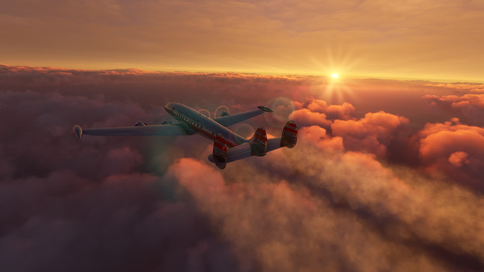
Originally, my plan had been to make my way across the South Pacific to Tahiti. With one proving run to prove that it would do what it needed to, I decided to take the Redwing Constellation, with the added range tip tanks (here in TWA livery by paulteisco). Looking online, the range specs are all over the place. The Redwing manual says that the range is 3,500NM on average. It doesn’t distinguish between variants.
I don’t quite know how that figures with tip tanks, but filling her up to the brim in MSFS showed me this…
Yeah, maybe that’s a little thin, but what’s the worst that could happen?. ![]()
And, since what good is insult without injury, I also thought I’d dip my toe into Celestial Nav. Inspired by @Bearhedge, and faced with a 14+30 hour flight, I figured that I’d try at least one sighting to see how close I got.
I mean, how hard could it be?


Turns out, pretty damn hard! ![]() The first obstacle was that I had to do a lot more flight planning than I normally do in MSFS for these trips; and by that I mean any.
The first obstacle was that I had to do a lot more flight planning than I normally do in MSFS for these trips; and by that I mean any.
So, I set to work digging through the included planning charts to figure out where I would be when in order to take my sun sighting. But there was an issue. My innate understanding of the hidden workings of the celestial spheres told me that, if I wanted to determine my position by means of the Sun, it would have to be during the day.
(Take that NASA! Bet you’re sorry that you ripped up my application now, aren’t you?)
That meant that I not only had to determine when it was going to be dawn in Tahiti, but also when I would have to take off in Mexico in order to be at the sighting fix on time, 14 hours later, several time zones away.
In fact, it took me so long to figure all that out and then fill out my celestial precomputation form, calculating Greenwich Hour Angles and Dome Corrections for the Computed Altitude on my Meridian…

…sorry, that I had to abandon the project for the night. That meant that the next morning, when I started my 14 hour flight, I had to take off yesterday in Mexico so I could get to Tahiti today when all my calculations were, um, calculated for.
And this was for one sighting.
This will be ironic later.
In any case, yesterday morning there I was, taking off today so I could get to Tahti tonight. Oh, you get the idea.

My first, and last checkpoint, Cabos San Lucas where people were still partying like it was yesterday.

I had chosen 16,000ft as my initial cruise altitude for direction of travel and to give me a little cushion at my maximum weight. As Cabo dropped behind, all I could see were the blue flames coming out of my exhaust stacks.

The AFE seemed to have the situation well in hand. I felt better that I wasn’t going to have to run this panel by myself.

Obviously, I had a lot of time on my hands and not much to look at. As the hours ticked by, I began to notice a few interesting things.
The first was that the Airspeed Indicator seemed to be showing a little less than I had planned for. Over the long term that might become a problem .
I pulled up the GPS (yeah, I’ve accepted that I’m cheating this year ![]() ) and it appeared that my Indicated Air Speed was the same as my True Air Speed. That began to make me wonder at what speed all my endurance and range figures were calculated. I didn’t have a lot of slop here. If the speeds were off, I was going for a swim.
) and it appeared that my Indicated Air Speed was the same as my True Air Speed. That began to make me wonder at what speed all my endurance and range figures were calculated. I didn’t have a lot of slop here. If the speeds were off, I was going for a swim.

As the hours passed, the picture failed to improve. Without any higher math, I could see that I had burned almost 40% of my fuel.
But I had quite obviously not travelled over 40% of my route.
I began to consider turning around before I passed the point of no return.
And then, as if in answer to my prayers, things got worse. ![]()
Triggered by nothing I could see, my airspeed began to decay. The AFE was in charge of my power settings, so I was reluctant to start fiddling with them without knowing why he was doing what he was doing.

I descended down to 14,000ft. The airspeed began to recover, but within a handful of minutes, it started to creep down again. I looked all over the FE panel but could see nothing in the red.
What the Hell was going on?
I began to descend hoping that the thicker air down low would get me some power back. Besides, since altitude didn’t seem to have any effect on my TAS, it wasn’t hurting my (underwhelming) progress anyway.
Eventually, I noticed that the Supercharger handles were back in Low Blower. The FE was supposed to (and had) advanced them to High Blower passing 10,000ft.

I looked at the Supercharger Temps. There was no indication that it had overheated. I had no idea what had happened but couldn’t turn it back on without firing the FE. That seemed like throwing a drowning man an anchor.
I stopped at 5,000ft, overrode the power settings enough to get my cruise speed and fuel flow back and pressed on as the moon began to set.

It was at this point that I noticed Nuku Hiva, on the Marquesas Islands; a shovel full of sand set in the middle of the Pacific Ocean to save me.
If I played my cards right, I’d have just enough fuel to make it.

Fuel. But maybe not oil.
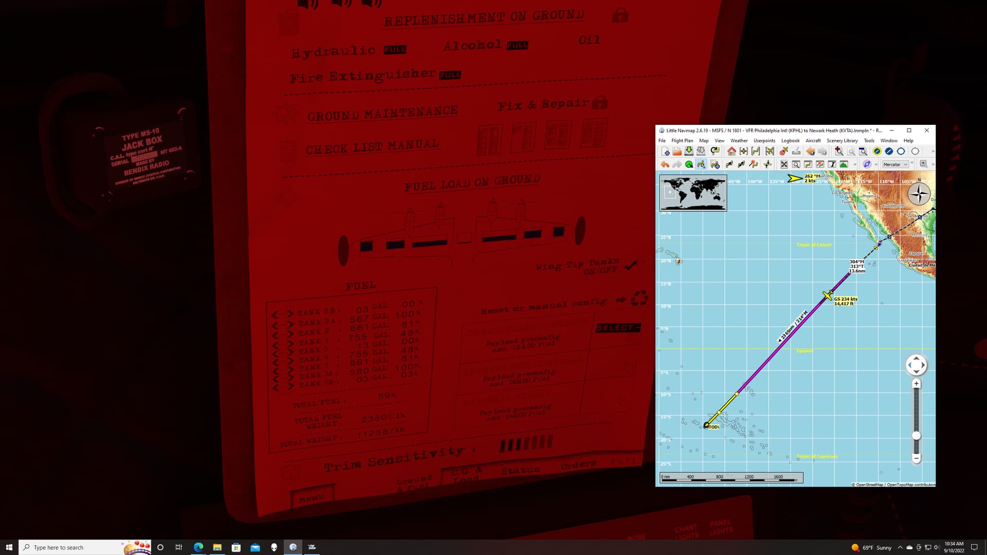
The Redwing Connie has several nifty features available to tell you the health of your craft. As I was paging through the manual available on the FE’s desk, I began to notice a worryingly red indication on the oil levels. If that wasn’t enough, the little fuel tracking chart just to the manual’s lower left has a fuel and oil endurance estimate.
My oil was estimated to run out in 3 hours.
I was going to get to Nuku Hiva in 4.

As the Sun came up, I now had a plan. And there’s something about having a plan, even a bad one, that makes the sharks I could see below me look less hungry.
Plus, I’m pretty sure I can outswim the copilot.


And so, as the oil tanks wound their way down to E, along with the remaining fuel bladders, Nuka Hiva finally came into view out of the morning mist.


Coming around for the visual approach I was high because, of course I was.

I can’t help but feel that the Connie needs a little more bounce in the landing gear. This is the second time that I couldn’t tell if I was down or not…and I’m not that good! ![]()

Here’s the FE panel as we parked. The top row of empty gauges is the fuel.
The bottom row, the oil. ![]()

And so, after a bottle of scotch and a good cry, we filled the tanks, serviced the fluids (including the bar) and prepared to continue on our way.

Hey, wait a minute, I hear you say.
What about all that Celestial garbage? What happened to all those forms, and calculations? What about the Dome Corrections for the Computed Altitude on my Meridian…
Sorry.
Yeah, my planned sighting point was well beyond Nuku Hiva.
All that crap was worthless! ![]()
10 Likes
Awesome report! Flights that go exactly to plan don’t make for good stories. ![]()
It’s unfortunate that when Cygon Parrot left us, the Celestial Navigation article we wrote ended up getting pulled . Some time ago I dabbled a bit with Python and managed to get a version of Casper’s (@TheAlmightySnark) X-Plane to Stellarium app working with MSFS, but I have to admit I got sidetracked and eventually lost interest.
4 Likes
Thanks!
It’s fascinating stuff. The CelNav app for MSFS looks like it should work just fine.
I’m just very slow at paging through the Almanac! ![]()
I’d love to have read that article!
1 Like
What an exhilarating report ![]()
![]()

How come the oil was sufficient in the end?
3 Likes
At a guess, it was because that was an estimate. The gauges were almost, but not completely on E when I landed. The estimate also appears to only be in whole hours.
So, the minutes may have saved me!
There does also appear to be a single reserve oil tank. I have no idea if its manual or auto or how long it would last with 4 engines gulping the stuff down. ![]()
3 Likes
Late to the party but i am in. I promise to do better this year honestly ![]()
I got as far as spain the year before last after spending hours compiling orthos tiles .
2 Likes
Sounds like we have a volunteer test pilot. ![]()
Great report… I’ll be getting started this weekend.
2 Likes
Aren’t their always openings for test pilots? ![]()
2 Likes
Back from holidays. Time to press on. So far I got only to the north of Luxembourg, some 50ish km from my home ![]()
The idea was to get to Amsterdam and fly the published VFR arrival to the GA-dedicated runway of EHAM. The arrival is fairly simple: approach from south-east, follow the three reporting points and then land.
I also planned to arrive in style, so the natural choice was…

Yes, it is what you suspect it to be:
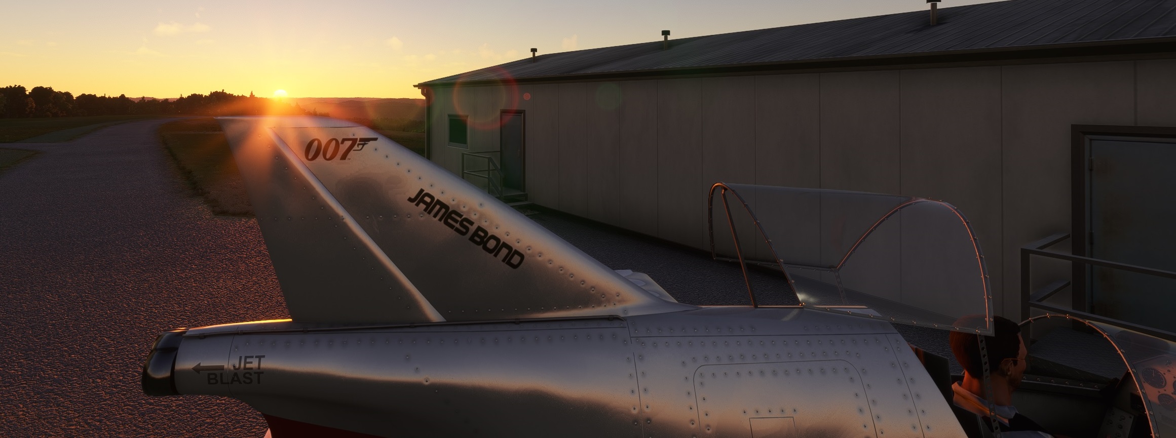
The Bede BD-5J starring in James Bond: Octopussy in 1983

(btw it was in a good company of the twin top-left; is it a Beech 18 or Electra perhaps?)
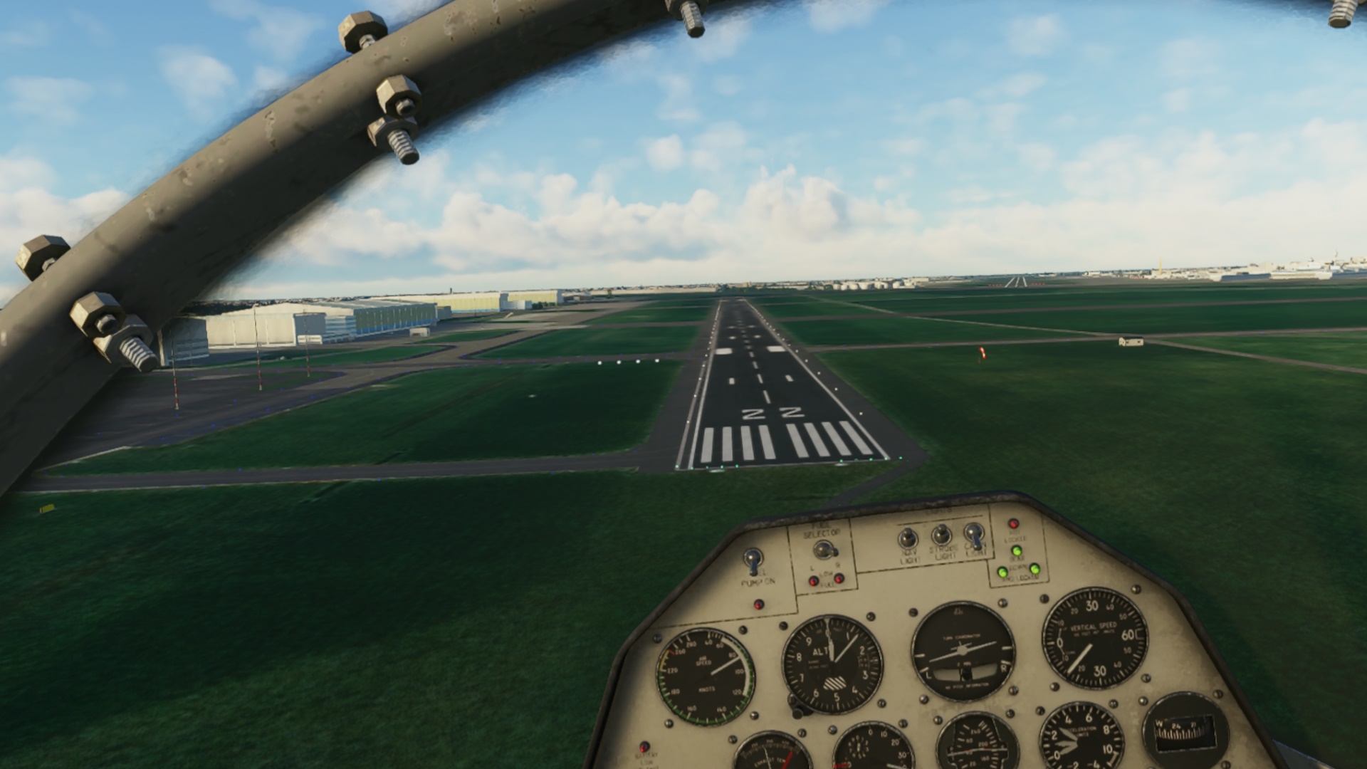
The manual of the BD-5J is quite light so I was rolling in no time.


Ready for take off! James Bond looked different, I reckon.

Climbing out.

At this point it is fair to say that this thing has ZERO nav equipment with the exception of a whisky compass. So I decided to go IFR, of course.
The first one was the A26 which took me up to…

…Liege in Belgium.


From there I took the A25/A2 to Maastricht in the Netherlands.

One of the key moments was to pay a good attention to all the crossings and pick the right motorway. Here, I am making sure I am following the A73 towards Venlo.

Initially, I planned to fly to Amsterdam following the same route I usually drive to Leiden to visit a friend. That is to say: my hometown - Liege - Maastricht - Eindhoven - 's-Hertogenbosch - Utrecht - Leiden. However, having read some of the AARs here (one in particular), I decided to change a bit the route.
Once past Venlo, I was still followin the A73 to north-west towards Nijmegen.

This is the reason resulting in a change of plan.


So @schurem, get ready and collect the packages on your way back. Not sure though about the beer I am about to drop now…


Cool. With that done, full throttle and head to the north to Arnhem.

There I needed to pick the A12 towards Utrecht.

Utrecht on the horizon. The first reporting point - V - is near a lake north-west from Utrecht.


From Victor, I was supposed to fly heading 308M towards Alpha and Bravo. While I was able to fly it visually, I have to say that it would help to have a mark of the current heading on the compass!

Amsterdam.

It was difficult not to see EHAM. What was a bit difficult though was to pick the right runway ![]() The landing was a bit hairy but fortunately the BD-5J stops on a dime.
The landing was a bit hairy but fortunately the BD-5J stops on a dime.


Time to relax.

Unlike from the last year, I have no fixed plan for this year’s Christmas flight. Next, probably, I will fly to London City just to enjoy the steep descent with great vistas over the city on the approach (there goes considering the wind factor as I ABSOLUTELY want to fly over central London).
11 Likes
Awesome dude!
3 Likes
Love these reports!
Still figgering mine out. ![]()
2 Likes
A third hop in this year’s Christmas flight brought me from Amsterdam (EHAM) to London City (EGLC).
The idea was to check out the Beech 18, follow the old school navigation (so no magenta line), fly the approach to rwy 09 at EGLC and if possible during the sunset.
The Beech 18 a beautifully looking aircraft. Almost as the Electra ![]() Both are also visually stunning in the MSFS. I had no previous experience with the Beech 18, so I fired up JayDee’s checklists that work perfectly in VR and which got me running in no time. I can only recommend that mod
Both are also visually stunning in the MSFS. I had no previous experience with the Beech 18, so I fired up JayDee’s checklists that work perfectly in VR and which got me running in no time. I can only recommend that mod ![]()


Since this is a VFR flight, I decided to leave EHAM vie the VFR route in reverse order. Here I am turning right towards Bravo, Alpha and Victor.


Climbing to 9500ft. Some clouds ahead and light icing already showing on the windshield. Time to look around the cockpit for some anti / de-icing goodies.


One of many Dutch oil rigs. Flightsim.to is a very good source for populating North Sea with traces of human activities. The offshore wind parks are also depicted.

Just cruising. Just having fun. Just trying to figure out how to trim this bird properly. It seems that the trim goes in rather big increments. I need to check whether this can be changed but I suppose the files are encrypted.


UK. About to reach Clacton VOR and track towards Lambourne VOR.

London! I can already make EGLC. I used to frequent that airport quite a bit in my previous work. A crowded place both for passengers as well as aircraft. There is a video on YT that is a time laps showing nicely the fast turnaround of airplanes on the apron of EGLC.


There are two instruments in the cockpit which are not lit. I am not sure whether that is true to life or just an omission from the devs. The first one is the clock and the other one is the HSI. I hope it will not get too dark during the approach because the dark hole in the center of the panel might become an issue… Just in case, I tuned the ILS 09 also on the NAV2. Fortunately the VOR2 has also a glideslope needle ![]()

More sightseeing. But to be honest, during the approach and landing I did not have much time to enjoy the views ![]()


OK, now comes the steep approach to EGLC. For someone used to usual VFR or 3° ILS glideslope, the EGLC’s 5.5° glide path looks indeed a bit weird.


Even with all available things sticking out of the aircraft (landing gear, flaps, cowl flaps and my left hand), I had to glide with the throttles completely closed. Not sure whether the engines liked it but hey, this is just a sim to no damage done.
A sight to behold ![]()

With everything shut, it was time to leave. I could see that everyone has left already (check the waiting lobby up in the screen) so no-one would object me taking the No Entry door I suppose ![]()

12 Likes
Beautiful report apollom01. Did you have to slip the beast to rein her in? Glad that the VOR works. Would like to bring the Beech along for a leg or two. Such a looker.
2 Likes
Let’s just say that at that part of approach I was not exactly ahead of the plane and was just a spectator. I was then happy that the rather ineffective brakes made me stop before I ended up in Thames.

6 Likes
Yeah, that HSI is a bit of a head scratcher. I took off in the dark and spent an hour flying cross cockpit! ![]()
Great report!
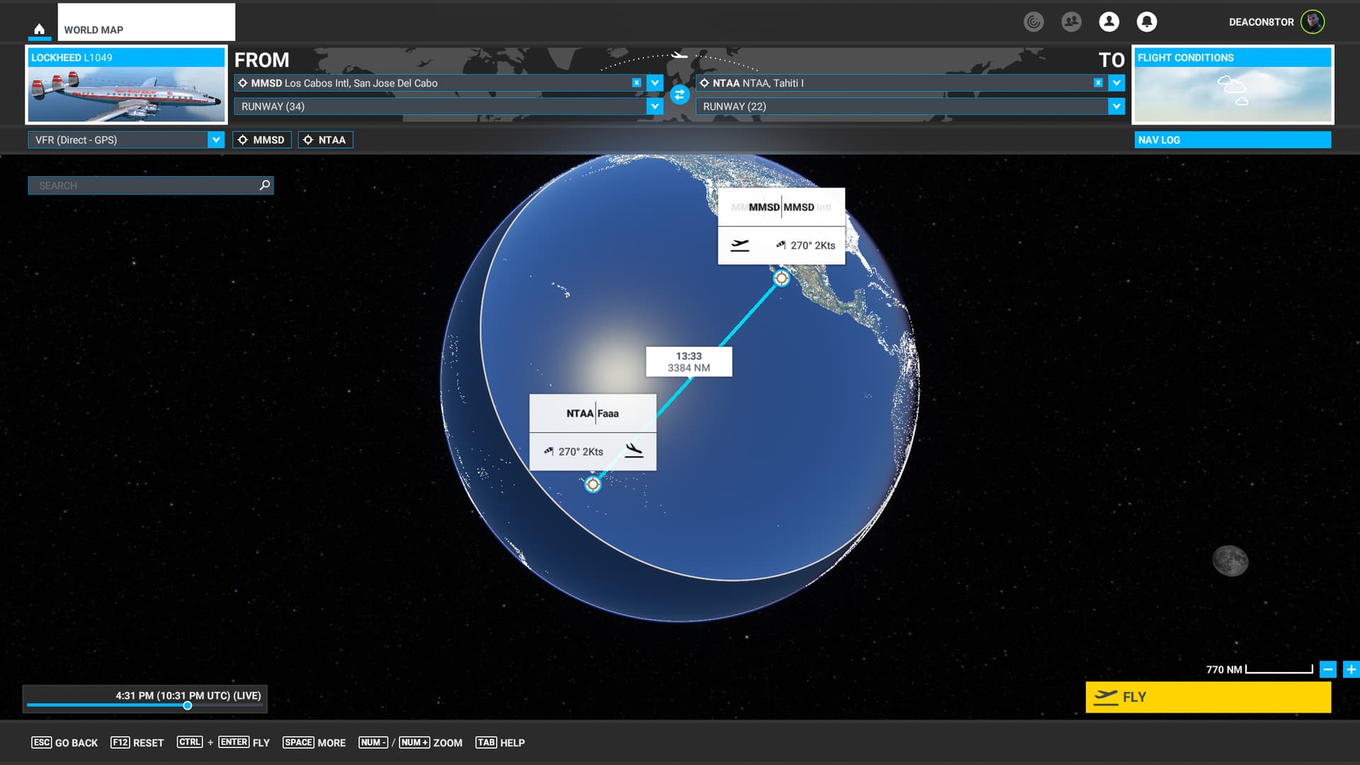
Leg 8: Nuku Hiva Airport, Marquesas Islands, French Polynesia (NTMD) TO Tahiti Faa’a Airport, French Polynesia (NTAA)
After a stern talking to about the virtues of aviation fuel planning, I was sent back on my way to Tahiti. I had originally planned to cross the Pacific in one or two big swell foops. ![]() but things haven’t quite worked out that way. These old recips, while lovely, aren’t exactly rocket ships.
but things haven’t quite worked out that way. These old recips, while lovely, aren’t exactly rocket ships.
Unless you mean this kind…

Just a short puddle jump in the big scheme of things today.

OK, whammishe bammische, danke mamishe, here we go!

I’ve been running REX Weather Force since my MSFS has given up displaying any Live Weather.
Beautiful, but brings my system to a crawl with the slow draw in selected. So, pop in it is!


I’ve spent quite a lot of time looking at clouds and the ocean.
Still, any version of the Connie is worth more than a little oggling!

The first land in hours looms out of the clouds, the island of Manihi. Amazing, and there’s an airfield to boot!

And right on the other side, Ahe.

Just when I was feeling all sad and lonely, a Live Traffic Air Tahiti flight passes the other way going to Nuku-Hiva

Rangiroa sprawling off to the right. I’m flying through waves of these atolls. It’s bizarre to see them sitting amidst miles and miles of empty ocean.

Speaking of which, Makatea Island.

And Cado’s Place. Seriously, is it only me who wants to go here?
I hear they have a drink they call “The Rixter” (Limit one per customer please).


As I finally approach Tahiti, the clouds fill in. I suspect that this is more a case of micro weather being drawn in over the whole area by REX.
But it looks cool as Hell!


Thick though. ![]()

I do break Tahiti out finally. Glad I wasn’t mucking about in the clouds around here…there’s some Cumulo Granite about!

Ah, the lights of Tahiti. Might need to find something “broken” on the post flight… ![]()

Here we are. Taxied over to the ramp and offloaded the passengers. Heading to the bar! G’night!

A pretty easy trip compared to my last leg. Still a lot of ocean to cross however.
13 Likes
“Off the wind on this heading lie the Marquesas…”
Crosby, Stills, and Nash approve of that flight plan! Whew! Talk about exciting- you always seem to have the most interesting (mis)adventures on the holiday flight. Looking forward to the post-leg analysis lessons learned session.
4 Likes
I FINALLY got a first leg in yesterday, which is good, seeing as I have a proper hike ahead of me.
2 Likes