Official 9th Annual Mudspike Christmas Flight 2023 - Discussion and AAR Thread

Great shots @NEVO, @BierRunner, @TeTeT! And great reports.

Man, the quality of the screenshots that I’ve seen here from everyone has really been impressive. That goes for everyone who I didn’t get a chance to compliment earlier.

Really beautiful stuff. :+1:

4 Likes

crossing the Iceland in two hops

first hop from Raykjavik to Akureyri, then to Egilsstaðir

not nice

but as we climb, we are working on the presets, we didnt pay to see nothing :slight_smile:

we are happy, we nailed the landing on this one

and we are ready for another crossing of the deep blue skies and waters :slight_smile:

10 Likes

I love this thread. SO much good stuff. I don’t think I’ll ever learn celestial navigation, but much respect to those who did, like @Deacon211. Great photos all.

5 Likes

@Deacon211 While transferring fuel did you get a chance to do any Fishing? :thinking:

2 Likes

I have re-read this AAR multiple times. With MSFS screenshots I am usually focussed on the ‘scenery’ but with this portion of your journey I can’t help but notice…

The French surely can build beautiful aircraft can’t they. That would have to be one of the only Flying Boats that looks like it was meant to fly?

4 Likes

… I’m also ashamed to say that I ony just noticed and read aloud the Registration code?

If that is custom/intentional :rofl: and is a story you must share.

1 Like

I am afraid I am just looking down the rabbit hole. It is deep and it is dark :grimacing:

Scared 3D GIF by Sam Jack Gilmore

I watched some tutorial videos (some of them multiple times) and still trying to wrap my head around it.

The good thing is that in MSFS it is sort of scalable:

  • either you can do it the difficult way (almanach, full blown math, filling the sheet, plotting), or
  • automate a big part of it via some tools.

I am just reading the USAAF booklet which is a part of the CelNav v4 by ElectronVolt on fs.to and it is a good period read to get introduced to CelNav :+1:

@Deacon211, what tools do you use? Are you using the v3 or v4 of the CelNav mod?

5 Likes

CHAPTER 5

THE DYING OF THE LIGHT

Honolulu International Airport (PHNL), Honolulu, HI TO Henderson Field (PMDY), Midway Islands (Insular Area), USA

28 October 2023 1200L (2200Z)

1137NM. ETE: 6+00

A bit frustrated by how the last leg had gone (again), I goaded myself into continuing on. The cognac helped…

At a little over half the length of my last leg, I was not overly concerned about the distance to Midway. What I was concerned about was its size. At 2.4 square miles, I was less than certain that I would find it, if I didn’t up my nav game.

Luckily, wiser minds than my own had considered this (not the poor quality of my navigation in particular…that would have been creepy) and had come up with a solution.

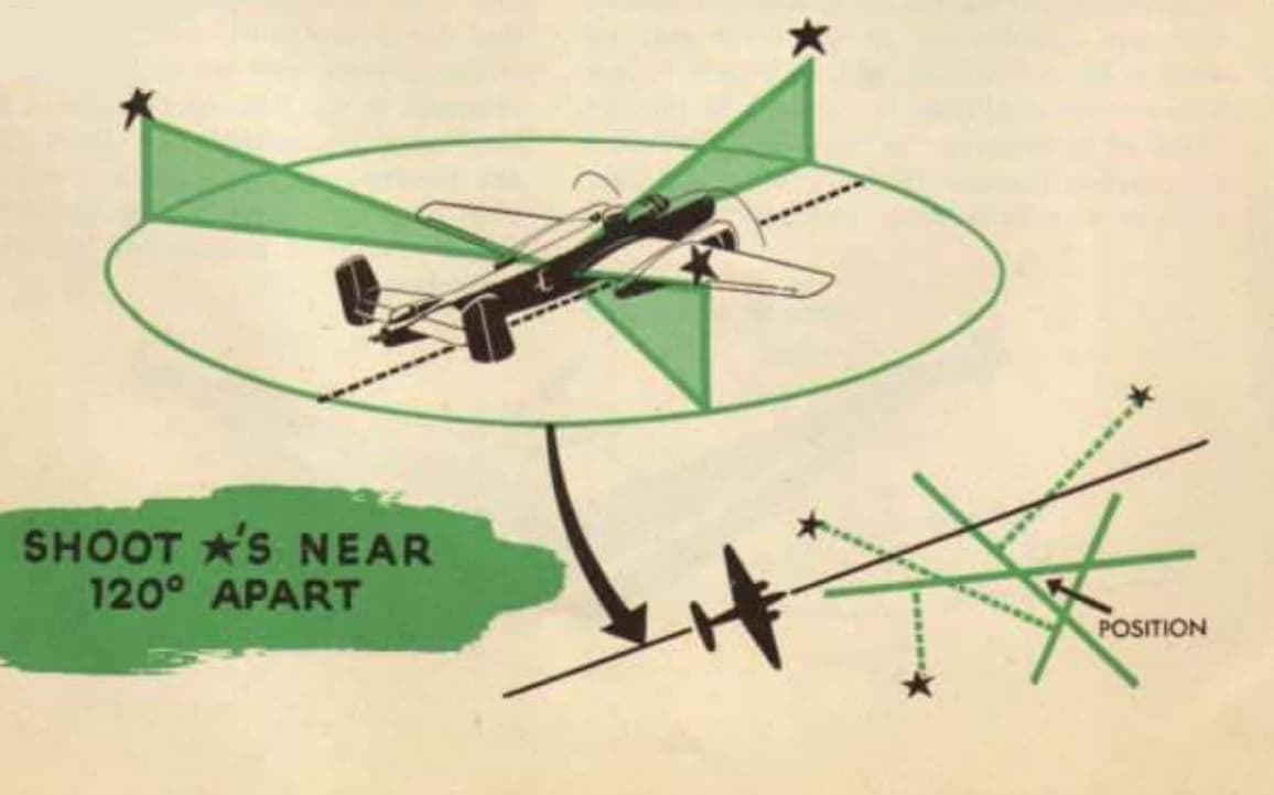
The previously mentioned Landfall procedure. In theory, this was no different than the kind of offset technique that you might have learned in basic land or air navigation. In execution however, it was a bit more complicated than that. Finding the point at which you had reached your Offset Line of Position (and upon which your destination lay) required a series of rapid-fire sightings and furious plotting.

Done correctly, you would be placed on a direct line to your destination. Done incorrectly and you could easily fly right by, never having seen it.

(From the materials provided by the Cel Nav App)

The reason that I’m telling you this (as I will never get to accomplish it) is for what I’m about to say next.

The Landfall procedure works best when the celestial object you are sighting is either in front of or behind you.

When using the Sun, this would be at dawn or dusk, obviously.

This will also prove to be ironic later.

24fe2c2bc7629ba6075ad0bca3d4500b

But that was “future me’s” problem.

At the time, “current me” was casting off the lines from the anchor buoys and starting the engines off Waikiki Beach. Judging the arriving traffic, I had intended to start her up, taxi east parallel to the neighboring runway, then take off to the northwest. This would ideally play along with my goal to take off almost directly on departure heading, minimizing any initial lateral errors…or so the theory went.

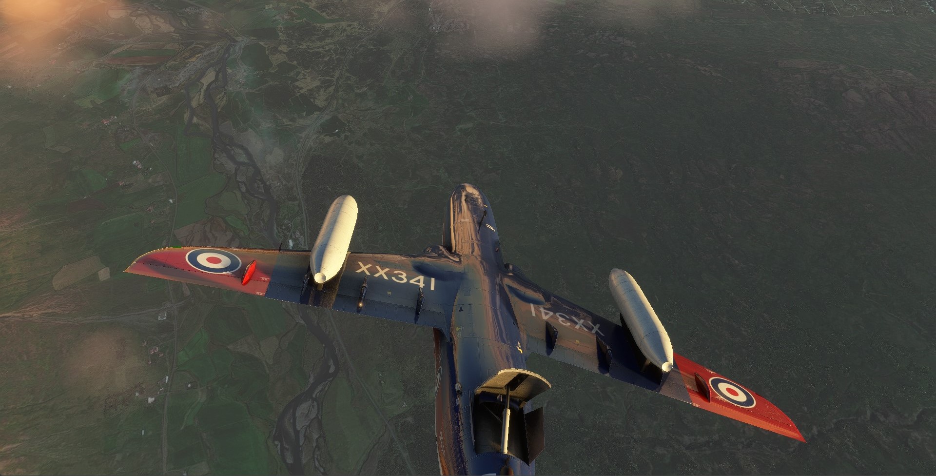
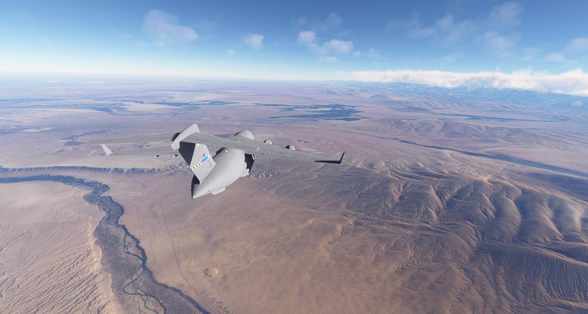
With six 14 cylinder Wright Cyclone engines roaring next to me, I taxied into position, ran up the throttles, and, after a disquietingly long take off run, lurched into the air.

Well before I once again reached my 2750m/9000ft cruising altitude, the island of Kauai crossed beneath me.

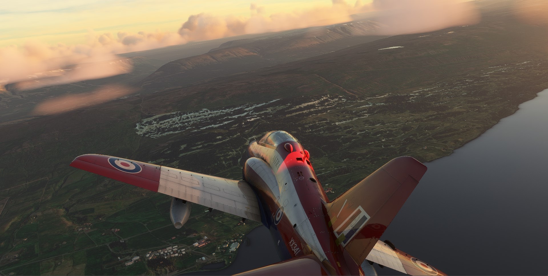
And soon enough I was feet wet proper, and out to sea.

Once I levelled off, I went through the now familiar litany of setting myself up for cruise and checking my engine instruments.

Still French…la perfection!

I had really wanted to get my navigation right this leg, so I was looking forward to a good first sighting.

Perhaps as an opportunity for growth then (as well as a lesson in humility), the sky gods instead chose to freeze Cel Nav up on me, and I missed the shot.

Having had just about enough of that from last time, I decided that I was done with just waiting it out!

So, I advanced to chapter 3 in Celestial Navigation for Dummies and vowed to figure out how to adjust my sightings to times other than on the full hour (the table method almost requires a number of limitations in order to have been practically contained in a carryable number of books. Listing data for whole hours is one of them).

To maintain the ragged vestiges of my sanity though, I chose an advance to the half hour as being, doable.

That gave me a whole 30 minutes to teach myself how to do it. Well, 28 minutes actually, but who’s counting? I guess we can file that under, not getting the navigational problem you want, but getting the navigational problem you need.

I of course duly thanked the sky gods for offering me this portal into their wisdom, using all the appropriate gestures! :rofl:

It was somewhere in here that I got my first (well, first pleasant) surprise of the flight. Nihoa Island.

Back when I was planning this leg, I couldn’t help but notice the string of little islets, spread like stepping stones, all the way to Midway. I had even briefly considered just Dead Reckoning my way there, using the islands as turn points and skipping Cel Nav entirely. Inevitably though, having no idea how big these islands would be, or how easy they would be to spot, I resigned myself to another day spent under the Astrodome.

Sighting these then was just unexpected good fortune!

One of the things that I had come to appreciate about this year’s flight was that I had had to consider things that I had often taken for granted when flying the Sim: good Dead Reckoning, winds aloft, the availability of daylight, the precision of time, and now, the visibility of a few heaps of rock in the middle of the Pacific Ocean.

Clearly, this trip was good for me.

Maybe that’s why it was going down like Castor Oil… :laughing:

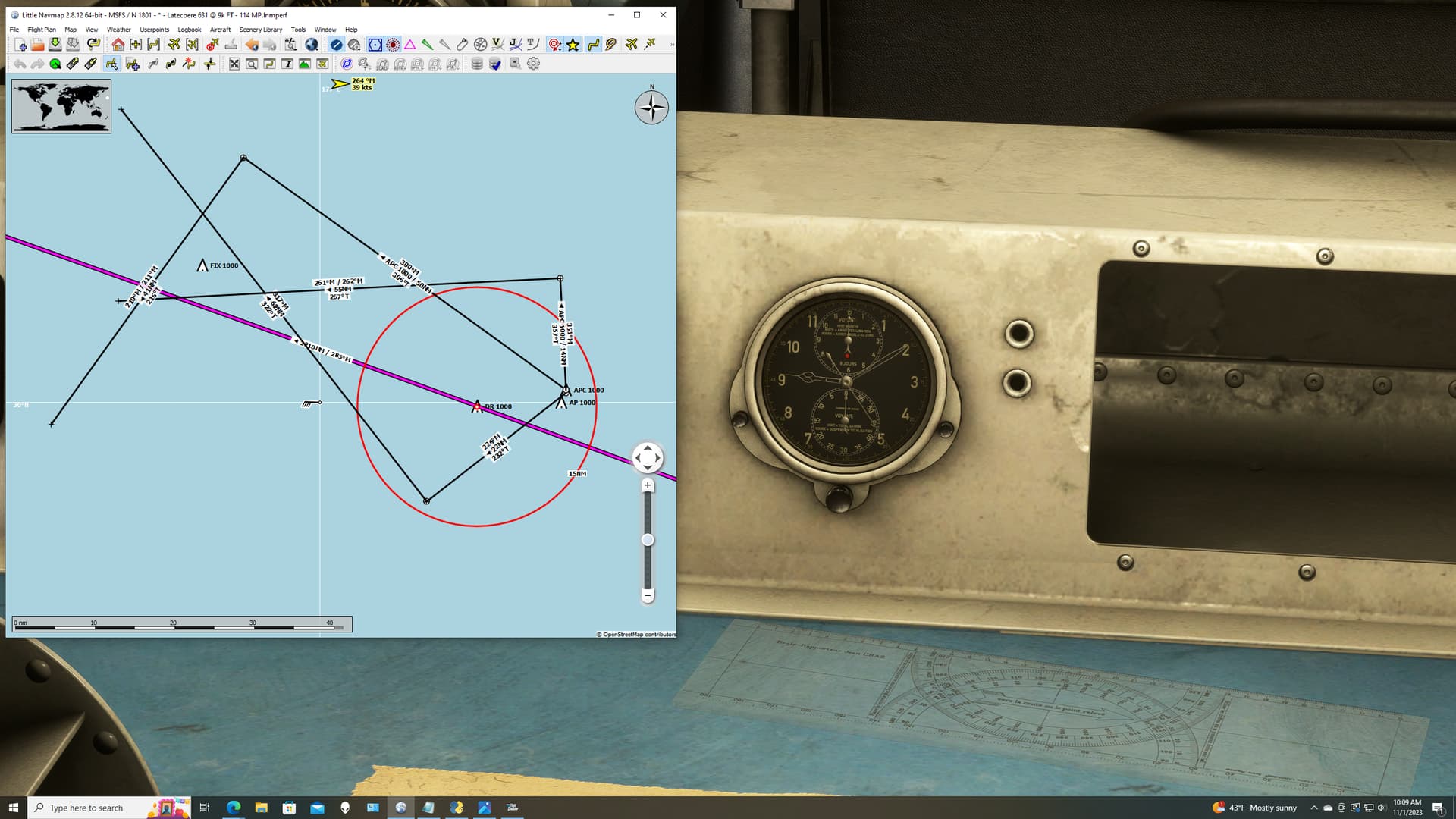
In any event, spotting Nihoa gave me an excellent checkpoint to adjust my drift and speed calculations. I hurriedly corrected my DR position and reran my numbers as I passed abeam.

My first position then turned out to fall within the 10% circle of error of my DR plot. That felt a little more as it should be.

As I proceeded northwest: taking plots, running calculations, making sightings, I continued to be surprised by all the small islands I could see…and took full advantage of each of them. Here, Necker Island, about 32NM off my port wing.

Some so small, I’m not even certain they had a name.

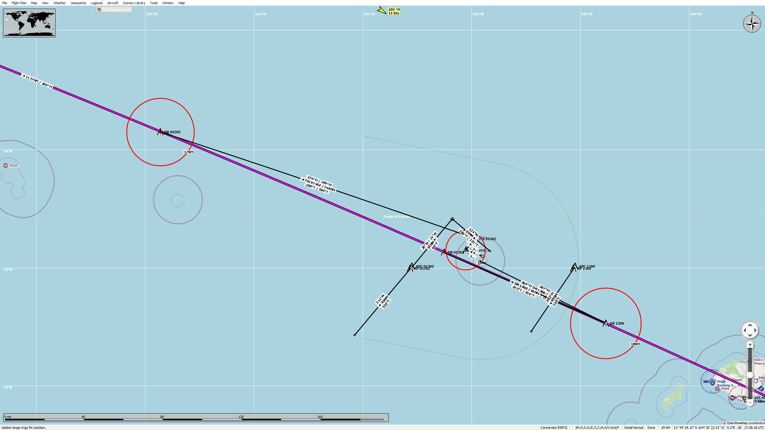
In time, I finally came to the point where I would have to break off for the Landfall procedure, about one hour out. I had already set up everything so that I could rapidly grab the info I needed from the Nautical Almanac and sight reduction tables, those eye tests that I showed you earlier.

The Sun had lowered to the west, giving me those fore/aft sight lines that I had hoped for.

I prepared for my last fix before the turn. And got this…

DirectVibrantAmericanriverotter-max-1mb

OK. Did not see that coming.

Well, nothing for it. No time to look for another copy of the almanac. No time to do it later. If I turned then, without knowing when to turn back, I could have easily missed the island entirely.

My only option was to continue, and hope that I got close enough to see it.

Which brought me to my next problem. The ironic one.

The only reason that I took off as late as I did was to get the Sun in front of me, and in front of me it was. It was, in fact, speeding towards the horizon…

I needed to find Midway. And soon.

As I watched the Sun race visibly away from me, the seat cushion really started to creep up into my tighty whiteys. The ocean looked big, and, as my Estimated Time Remaining began to dwindle, no more ready to give up her secrets.

That’s when I spotted something out the First Officer’s window. A speck, no more.

According to the map, there was some sort of land or reef, just shy of Midway. It was a long shot, but I groped for it like a life preserver (or an armoire, if you’re Kate Winslet) in a storm-tossed ocean.

I heeled the aircraft over to approach them.

Then swung back to put them on my tail and Henderson, hopefully, on my nose. It had to be close.

But my ETA came. And then went. And nothing appeared on the horizon…except the Sun.

Well, I gave it my best shot.

And then, like something out of a sailor’s dream, a small, dark smudge took shape in the gloaming.

Midway! But still, so far off. The Sun had already been half swallowed. So had my seat cushion.

Right! No time for niceties then, I left the power up and raced against the dying light.

No point in making it pretty either. I flopped, chopped, and dropped…and came out of the sky like crap from a tall moose.

I raced in over coral reefs that I hoped were deeper than they looked.

With way too much speed and way too little sea room in the small lagoon, I set her down gingerly and hoped the water would provide me with some much needed drag.

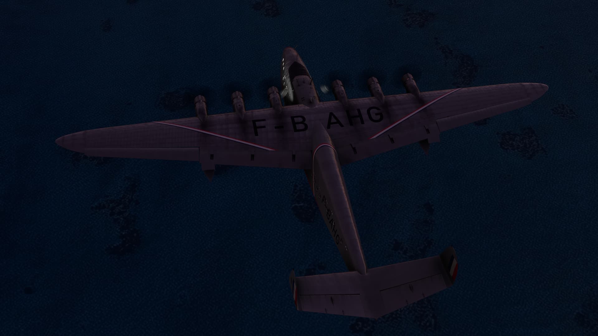
By the time the tug came to get me, the light had gone out of the sky. Only the Moon remained behind to welcome me to Henderson.

Finally, I reached the small seaplane facility. The stars littered the tropic sky like diamonds.

So, how did I do? Quite a bit better than last time. I can’t claim all the credit however. The distance was certainly shorter and there were just enough islands to keep me honest.

In the main though, I definitely noticed that my fixes seemed substantially closer to both my course and my actual position than they had been on the last leg. I still don’t know what I did differently. But I’ve already shared with you my suspicions.

After that one, I could definitely make use of a little, “Captain’s Courage”!

Pro-tip: If you want to keep your sanity, don’t try to type “French toasts” into a search engine when you are looking for…French toasts.

À votre santé!

9 Likes

Sorry, for the late reply guys! I preload my reports and I’m never certain if I can also reply to other posts without dumping the whole mess! :rofl:

I think this was still V3. All these trips took place before Nov 7 IRL. So I don’t think that I knew that there was an updated version.

After the second leg, I’m only using Cel Nav for the shots and the turorial that comes with it to fill out the forms via Nautical Almanac, ho249(or whatever it is!), etc.

Actually, once you do it a couple of times, it all begins to make sense. It’s really not that hard.

Hell, I did it…mostly! :wink:

I may throw up a quick tutorial just to tell a few things that wish I had known at the start, if there’s an interest.

Oh, there was something in the water, and something was looking to eat something. I’m just not sure it was in the the relationship that you’re expressing! :laughing:

It really is beautiful. I didn’t post any shots of the full flight deck, but it’s magnificent! The cabin is quite something too! :money_mouth_face:

I confess, I missed the code. But that is indeed a historic livery.

Maybe the designer had a story to tell! :crazy_face:

6 Likes

Yes Please GIF by MOODMAN

A full blown tutorial is not necessary but some tips, to-do and don’t-do would be great :slight_smile:

I mean, I already hate you for making me burn my time with the CelNav instead of doing something else (not mentioning my hesitation whether to buy the Latecoere as well…) so if you could make my suffering a bit more bearable… I would definitely appreciate it :smiley:

5 Likes

dont we love this? :grin:

5 Likes

I am also aiming for smaller and smaller land here, Greenland, Iceland, Faroe-land

crossing the deep blue, in yellow dip

up up and beyond! this never gets old. its always great to have such unique frame simulated

F-104 pilot in full flight suite … ‘relaxing’ … as the ETA came … and went :wink:

strong crosswind from SW shifted the ship up N. but all good in the end

11 Likes

Love the 104! What great shots.

5 Likes

Onto China now! With the C-17 I fly from Dushanbe to Hotan. Little do I know of my surrounding here, but it’s further east, so will eventually lead me closer to the destination of this trek.

Take-off from Dushanbe is quite spectacular, I use the route via downtown once more.

In the air I stay at 20k feet for most of the time, even those mountains are high!

Eventually the mountains give way to a desert, probably a cold one.

Some 30+ nm out I’m crossing the 10k feet mark - but the airport in Hotan is not at sea level at all!

Changing the descent level I slowly lose height now. Passing by some settlement with what must be an artificial lake/pond.

Time for the landing configuration over the somewhat featureless landscape. Time to read up on where I actually fly to in wikipedia. Hotan is actually the base the Chinese like to test their new fighter jets. So I guess my NATO C-17 is a very rare sight over there :slight_smile:

Eventually I figure out which of the long rectangular shapes is the runway and aim for it.

Time to leave the runway!

Let’s hope this place is reserved for “special guests” from abroad …

Time to grab some Dim Sum!

11 Likes

CHAPTER 6

KONBANWA ARIES-SAN

Henderson Field Airport (PMDY), Midway Islands (Insular Area), USA TO Tokyo-Haneda International Airport (RJTT), Tokyo, Japan

1 November 2023 2000L (2 November 0800Z)

2210NM. ETE: 13+46

As I sat in Henderson, I faced yet another choice. On the one hand, my initial (but now mostly abandoned) plan had been to fly the Pan Am Clipper on traditional Clipper routes. But that meant several legs, albeit shorter, through Wake, Guam, Singapore, and finally, Hong Kong…and a lot of hours sitting behind the Navigator’s desk.

On the other hand, I could proceed more directly, through Japan. It would save time, but meant 2200NM of open water, with the longest ETE I had flown yet, at almost 14 hours. The trip would also use up almost 95% of my available fuel, even at one of the Latécoère’s more abstemious power settings. That would leave little remaining for wind, diversion…or general jackassery.

In the end time won, driven in part by a real-life deadline that might clip my wings for a while.

This led me inexorably back to concerns of daylight. This, my experience on the last leg, and the fact that I generally just can’t stand to leave a bear unpoked, led me to try night navigation for the first time. And so, armed with literally minutes of preparation, I boarded up the Latécoère and prepared to launch.

Not much one to wait for problems, I decided to find my own, as I began drifting repeatedly into the mole abeam the seaplane ramp. I was trying to take off exactly at 2000L, and that meant setting up a few minutes early. But, for the life of me, I couldn’t stop this thing from being blown back into the pier.

I tried slowly water taxiing. I tried using the tug. But every time, the same result.

Eventually, in a fit of frustration, I decided to change the time of day and see what was happening.

R

OK, that just seems intentional.

That little wrinkle (see what I did there?) ironed out, I once again ran the throttles up and took off from the lagoon into the pitch black night.

As I climbed up to my old familiar 2750m/9000ft, the Moon emerged from the ocean to accompany me.

Auto pilot on, props back to Cruise, Mixture to Auto-Pauvre.

Engine instruments? You guessed it…still en Français.

Navigating by the stars is a little different than by the Sun. With more than one celestial object available, using your Dead Reckoning plot for a sort of a poor man’s resection is no longer necessary, which I was pretty happy about.

Instead, three sightings are taken, separated by exactly four minutes each. These provide three circles (represented by short line segments as during the day) which, when intersected, triangulate your position. A bit like this…

(From the materials provided by the Cel Nav App)

The only problem is that, very shortly, your chart begins to look like you’ve been watching too many conspiracy theory shows.

giphy (3)

Just to give you an idea, the red circle below is (as it has been) my DR position surrounded by a 10% circle of error estimate. The point just north of east, with the three lines emanating from it, is my Assumed Position. Those three emanating lines are my Azimuths, each in the direction of a star. Those Azimuths end at the Intercept distance (with the correct sign this time!)

So those lines perpendicular to the Intercepts are small segments of the enormous circles that I showed a drawing of earlier. And the intersection of those arcs (lines) represents my position, somewhere within the triangle.

And, if you’re asking, “Which triangle?”

Exactly! :rofl:

Just kidding. In this case, it’s the triangle to the west, marked in the center with the label “FIX 1000”.

I could bore you with more shots of my landing lights (which I’ve left on solely so I’m not boring you with shots of nothing) or of multi-hued spaghetti thrown at blue wallpaper, but I won’t do that to you. Suffice it to say, the night passed, watch upon watch, as I made my way across the Pacific. Fuel was transferred and so the engines kept running, while I waited for dawn…and (perhaps poetically) the Land of the Rising Sun.

After many hours, a faint glimmer of light appeared, reflected off the propellers. In short course, the glimmer turned into a blaze of nautical twilight. I’m not going to lie; I was glad to see it. After 11 or 12 hours, I was starting to get pretty punchy and had already begun to make math errors, resulting in at least two garbage fixes.

I was ready to be there.

With indifferent majesty, the edge of night set over the far horizon. But, even in the sim, I felt refreshed to see the dawn.

At the Navigator’s station, it became too light for stars. At this point, however, I was confident that I could at least find Japan.

The only question was, where would I come ashore?

Once again, it was time to get back in the pilot’s seat and set a visual watch. And once again, staring out the window and willing the land to rise from the depths, was a ponderous occupation.

Then…there! A spit of land penetrated the morning mist. Cape Nagasakibana, I think.

At a guess, that put me right about on course. I’ll take that!

Then, another welcome sight. Mount Fuji, warmed by the first rays of the Sun. I went Feet Dry for the first time in 2200 miles.

From there, the rest of the flight was anticlimactic, though I was eying that building cloud layer. Remember, there were no Navaids on this bird whatsoever (at least in the sim), so it was the visual or nothing. I set myself up on a long, descending base to Tokyo Bay.

And turned final with Tokyo off my starboard wing.

At this point, I was heading straight for Haneda, so there was no time for messing around. If I landed long, it would take a Helluva’ lot more than full power to taxi! :grimacing: :wink:

But she nestled nicely enough once I got her down onto the water.

And that was it. What would probably be my last Cel Nav leg for this trip.

Here’s the work.

And the result. Overall, I have to say that triangulating stars at night is, paradoxically, so much more reassuring than that averaging business you do during the day. That may be maligning it a bit though. Over time, my day technique had improved and even the sun sighting method seemed to work well enough. It just feels like there’s less guesswork at night.

And for this, you know what’s coming.

In what will be my last French toast (and not $%&*ing French Toast), may I offer what I feel appropriately sums up my trip thus far:

“L’échec est la mère du succès”, or “Failure is the mother of success!” :wink: :clinking_glasses:

11 Likes

Great job. That C-17 has some impressive climb rate!

2 Likes

same for me. initially planed for UK but then decided for more direct route via Norway. the date is high already.

and lets put those winds into some good use now, shall we? 70kts at FL390

I know I have lot of fun with this sleek girl, but be assured that it is taken care about presents too

smoke on!

climbed through the multilayered cloudgates

there is always sunshine above the clouds

it was ok-ish at FL400 but there was that FL800 calling again :sunglasses:

zoom climb didnt go exactly by the books so had to fight her for a while

then I saw some interesting clouds below and went down to surf a little

then the inevitable came in the form of message ‘missing scenery, continue with water only?’.

so restart and download it was.

but before that happened I decided to descent through the murk to see how high is the base of the lowest layer. fortunately it was 2k ft alt and I dropped from the clouds over relative flat island. some ground lights were still rendered despite no scenery.

after restart, happy that I didnt kill myself in that descent, I approached my destination with tailwind so it took me few attempts in the rising dark to hit the land.

fortunately third approach worked out :slight_smile: Ørland

10 Likes

this is actually great!

we have Latécoère at one side of the globe scud running and we have Starfighter on the other side of the globe stratosphere running.

plus it was almost the same distance from Mid-way and Nor-way to the destination :slight_smile:

and initially I thought that I will skip this years Annual XMas Flight, glad I didnt!

great flights all! :+1:

8 Likes

Impressive. Your CelNav skills improved quite a bit :+1:

How did the fuel thing go? Do you recall with how much fuel you landed?

I mean, if the thing I can see on this screenshot is indeed some 40kts tailwind, you had an important invisible pusher helping :grinning:

4 Likes

I think I was down to 1/4 main tanks, Aux empty.

The problem was that this was the first half! :rofl:

@NEVO

I’m still loving those Starfighter shots! So, that is XP12?

5 Likes