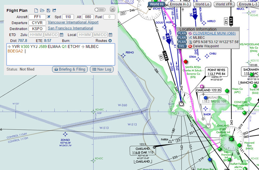
So I am getting a bit better at all the SID/STARS stuff I am learning. One outstanding question is how to easily pick the ‘right’ STAR? If I’m headed down to KSEA Seattle from the CYVR then do I just use Flightaware IFR and see if they list a STAR I recognize? Do I just pick one like this because it looks like it deals with things travelling down from the North East ish?:
I guess another way of asking is does a map like skyvector etc show the typically used STARs from the various directions towards an airport that are used, or is this something that gets preplanned as part of a company route and/or ATC assigned when within the area?
You basically just have to look for one that makes sense when you are coming from a particular direction. If you are RNAV capable then ATC usually will assign you to a RNAV STAR. I try to file a route that think ATC will want to leave me on. “Cleared as Filed” is much easier than having to take a hatchet to your beautifully entered flight plan in the FMS.
Also, It is not unusual for ATC to put you on a different arrival once you get closer to your destination.
I think I just need to plan my flights a bit better and get some things up and ready. Unlike proper flights I don’t tend to prepare my plates etc up-front and just flick through them at planning stage. The mental step for me is to work out that my ‘end’ fix of my flight plan is lining up with the start/transition of a STAR and was wondering if I missed an online tool to help me on that bit.
…it isn’t obvious which are good coming from the North. Like you said, where I don’t use real ATC it is sort of discretionary / arbitrary anyway and all good. I also miss out on the fact that I’m guessing while a lot of the time people in charge of flying of other people would have well-known routes that they are very familiar with.
The procedures part is really interesting though, it tickles my brain in a good way I was surprised at. Amazing the stuff we have to play with really.
Yep, that’s the huge gap for me, in that I’m just getting used to training wheels flights where everything is predictable. I’m a long way away from doing anything resembling reality where the true ability and skill is being able to react to changes quickly. I’m treating the FMC like a big ol FisherPrice playset so far.
Honestly, it’s that way designed because well… pilots. Keeping their attention to a subject for more then 5 seconds is horrendously difficult! That’s why everything is rattled of so fast by the ATC; In the hope that one or two words get through. Not a lot, just enough to make sure they stop banging into eachother
When you look at a STAR chart the first thing to do is find the airport (which with the government charts is not always obvious). With the airport located, you can easily see from which direction the STAR caters to.
Airport, direction of approach, specific fix. That’s the order I do. I never use atc mostly because xplane atc sucks and I can’t be bothered to do online because I can’t guarantee I won’t have to pause or get up.
Also in the EU (at least the uk anyway) the stars don’t even take you to a fix that lines up with the runway and there aren’t always that many options anyway. Some places just have a north and south type orientation for the stars a d you just have to deal with that.
Also…many RNAV STARS have specific fixes or spurs that are to be used depending on the landing direction. Typically, the center controller will issue a clearance for the STAR or DESCEND VIA the STAR with an advisory of the landing runway or direction. For instance, in Charlotte, we typically get assigned the IVANE5 and then they will either specify landing North or South. That is how you’d program your FMC to fly the correct segments toward the end of the STAR…
So I follow the LNAV/VNAV the FMC gives me and I’ll end up at BRIXX going a heading of away from LOZIT at 140. I then expect ATC to vector me to finals.
For the last bit in FSX/P3D/XP10 do I just pick an active runway from ATIS and then either visual or ILS it in? As in the FMC is over at this point, right? I guess I would manually insert the ARRIVAL point 19 or 28L/R etc, as on the Airbus it tunes in the localiser etc. Altitude is 11000/3600*, is that between?
So say, I pick something popular and imaging the weather is using 28R, I’d browse this:
and pick out something like this?
…and then go to the IAF? Which is back at ARCHI or I guess maybe I-GWQ DUMBA? Or do I just to try to capture the localizer sooner than that? The important bit of the plate seems to be the altitudes at the various fixes.
This is where fsx and xplane differ, because the default FMC in xplane is basic. If you’re using the GPS it’s easier as it takes approaches. In xplane I have to plot the course manually on the FMC (each waypoint of the entire path including Sid and star). As I get closer and decide on rwy, then I manually insert the approach fixes. So kinda like you describe above.
With the GPS the star would generally be the end then direct the arrival airport, so I’d either need to move to heading on the ap, or disconnect ap, or select an approach in the GPS and activate it which will then insert the approach procedure automatically and all will be hunky dory.
Edit: long story short I’d say you’ve got a good handle on it. I forgot to mention the altitudes. Beach or someone will have a better answer on this. I forget what the altitudes you are referring to mean. I think the more bold ones are the ones to follow (that’s what I do anyway). So corrk at 11000 (not above not below unless assigned by atc) and at 250kts (again no deviation unless assigned by atc). This matches with the arrival route description in the bottom left. You’ll note some have lines above/below or.both…when above, it means not above, below means not below, and both means at.
Typically yes. At big airfields you will rarely fly a full approach from an IAF - more likely you will get vectored into a sequence outside the final approach fix. If you are going to a smaller airport at night, when there is no ATC or radar services, then you would file and fly the entire approach if it is IMC.
Yes. I’m not sure how the airliners do it…but many of them prefer to fly the approach from outside the FAF. They do shoot visuals though…particularly Southwest… LOL (at Vne)…
The 11,000/3600* is the usual altitude for the transition (11,000’) and the MOCA (Minimum Obstacle Clearance) - if you fly at or above 3,600’ - you won’t hit anything.
CAT II and III are special aircrew and aircraft requirements…with lower than standard minimums. I’ve only ever flown CAT I minimums…and never been in an aircraft that met CAT II/III requirements. Taken to the extreme I guess, CAT IIIC is autoland capability…
Given the lack of good ATC, you wouldn’t be wrong in cheating and using the map to vector yourself to the final approach course. For the approach you listed, depending on the direction you are coming from (likely a 140 heading based on the exit from the STAR) you could always put the intermediate fix in like ARCHI or ZILED to give you enough room to make such a radical turn. That is where ATC would set you up better.
Just to further beach, if there’s a big gap between the iaf on the approach from the star I use skyvector to locate interim fixes. There may be something between the star and archi that gives you a better entry (less sharp turn) as beach indicated. That happens a lot on approaches with only 1 fix left or right of the first fix leading to the runway (like 10-12nm out).
Yeah…and a lot of RNAV approaches are set up with a bit of a T profile that will take you around and get you established inbound…you could always cheat a bit and load an RNAV to the same runway and then use your own vector prior to the last turn, go “green needles” and fly the ILS.
I only picked that one as I was curious about the A320’s ability to do everything for me with that CATIII autoland. What with the Aerosoft co-pilot switched on I have hardly anything to do but look out the window