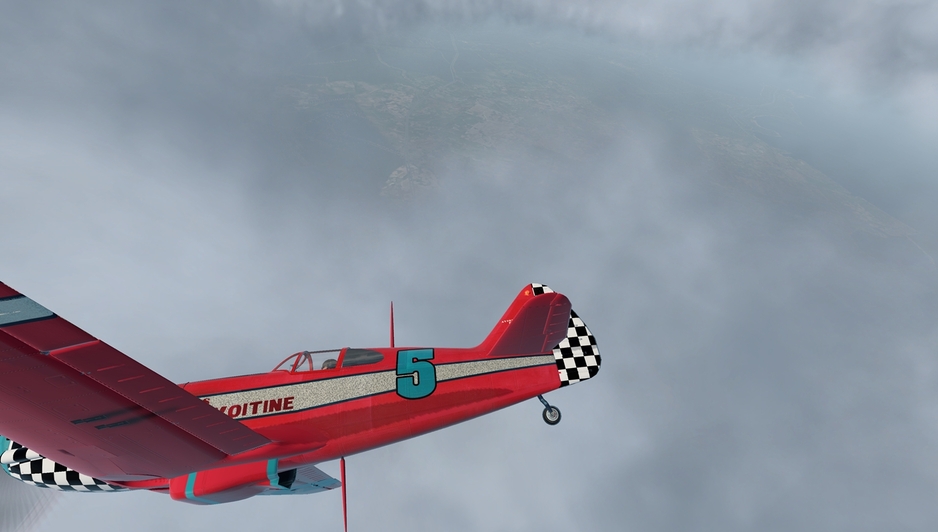
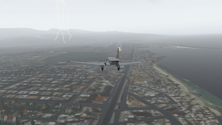
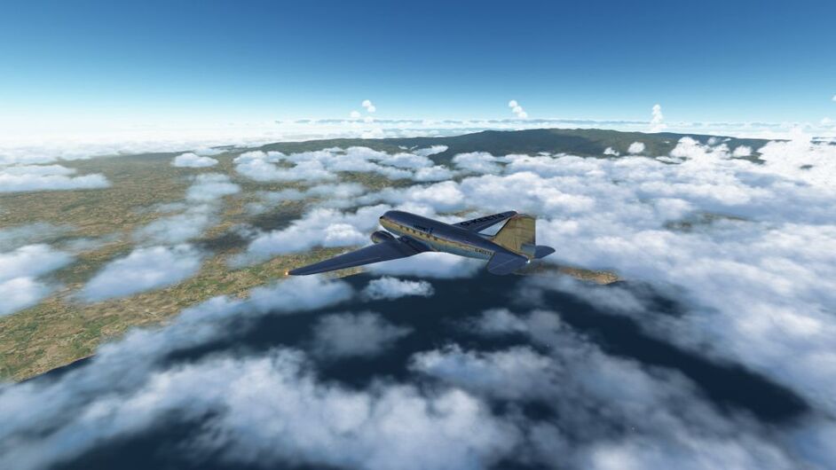
Made it to Aleppo but what a hairy flight ! ![]()
3 Likes
G’day all Porko here,
well its been a long flight, left Greece, crossed over Turkey and arrived in ALEPPO in SYRIA, just as it started to thunder and lightning. I must say that real world weather adds another dimension to flying. Got a bit lost trying to get thru the island chain, as all islands look alike. But we are here. Tonight will do my homework on figuring how to get to BAGHDAD. Ciao Porko.
4 Likes
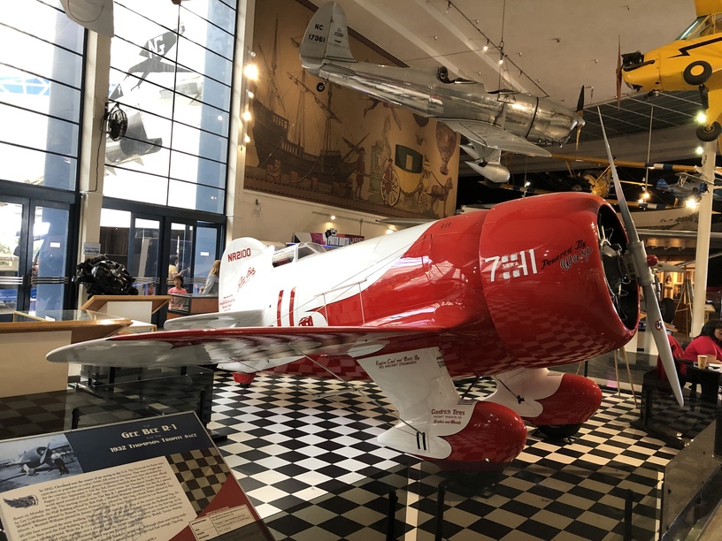
Really liking the Gee-Bee! I was at the San Diego Air & Space Museum a couple of days ago and they had this beauty on display (a replica of course but she looked great) :
3 Likes
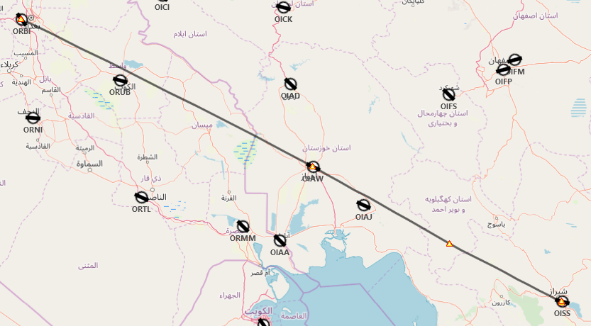
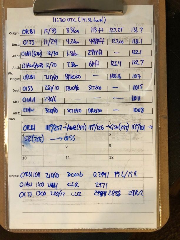
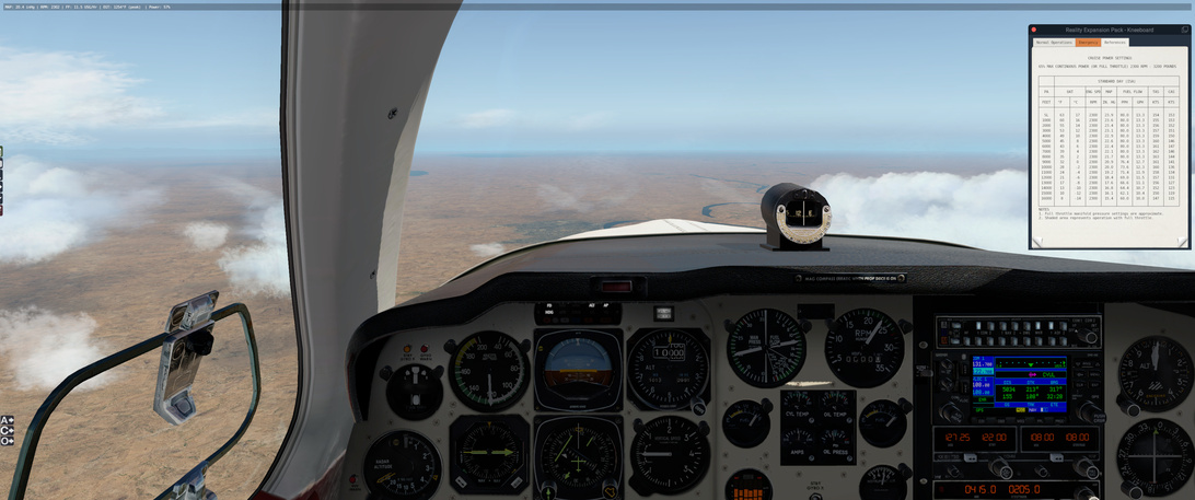
Leg 10: ORBI to OISS via Rivers and Lakes, AWZ, GSN and SR NDBs
Aircraft: Carenado Beachcraft Bonanza F33A w/ SimCoders Reality Expansion Pack;
Addon: FSFlyingSchool 2019 for X-Plane 11
Addon: ActiveSkyXP;
Date: 20 April 2019
Weather: Historical 20 April 2019@ 11:30 UTC (14:30 local)
Takeoff: ~ 11:38
| Leg | Total | |
|---|---|---|
| Planned Distance | 484 nm | 3178 nm |
| NDB Beacons Tuned | 3 | 39 |
| Weather ‘Situations’ | 0 | 6 |
| Duration | 03 H 01 M | 17 H 00 M |
Location: منطقه هوایی شهید دوران, Shiraz, بخش مرکزی شهرستان شیراز, Shiraz County, Fars Province, 71557-13876, Iran
Flight track is missing, so instead, please accept this flight plan ![]()
Briefing Notes:
Maybe the bug is in the X-Plane 11 time selector on the main screen but if I use the Instructor panel, I can change the time and it all makes sense ![]()
I will be departing into some weather but it should clear up enroute.
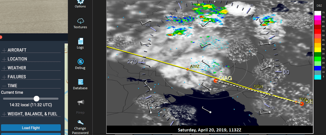
So I am looking forward to an uneventful trip.
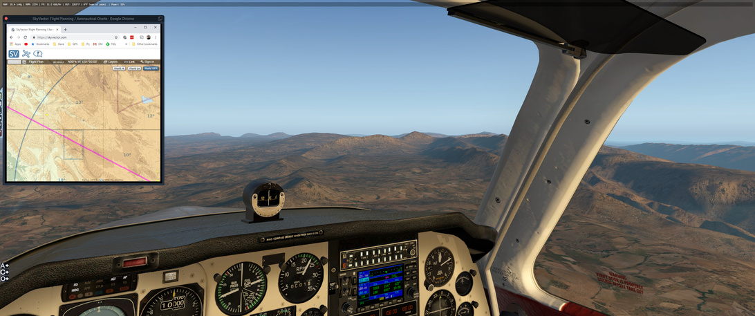
I am being a little be aggressive with this leg. I had originally planned on travelling along the coast of the Persian Gulf but instead, I am going to try to cut the corner across part of Iran. This is agressive from the point of view of the weather and navigation - if I encounter low cloud over the maountanious areas of Iran or the target airfield at OISS, I am going to have a serious problem avoiding terrain. Luckily the weather looks promising and I won’t have to divert to the coast.
Other Media and Notes:
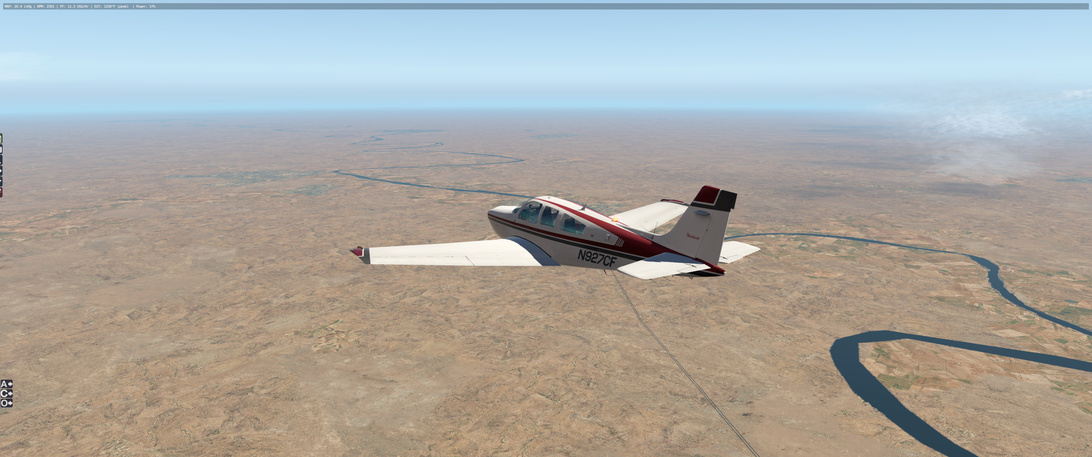
I decided to stick with the Beachcraft Bonanza F33A for a few more flights at least. I had been having problems with the oil level (I had to replace the oil after every flight) and I wasn’t sure if it was my flying or something wrong with the code. I was/am also having a problem where I have to enter my license key every time I start X-plane for the day. Which is annoying.
During my layover in Baghdad I decided to get the Bonanza some colour. I found a local mechanic who knew a gal, who knew another gal who could outfit me with some colour. Looks great!

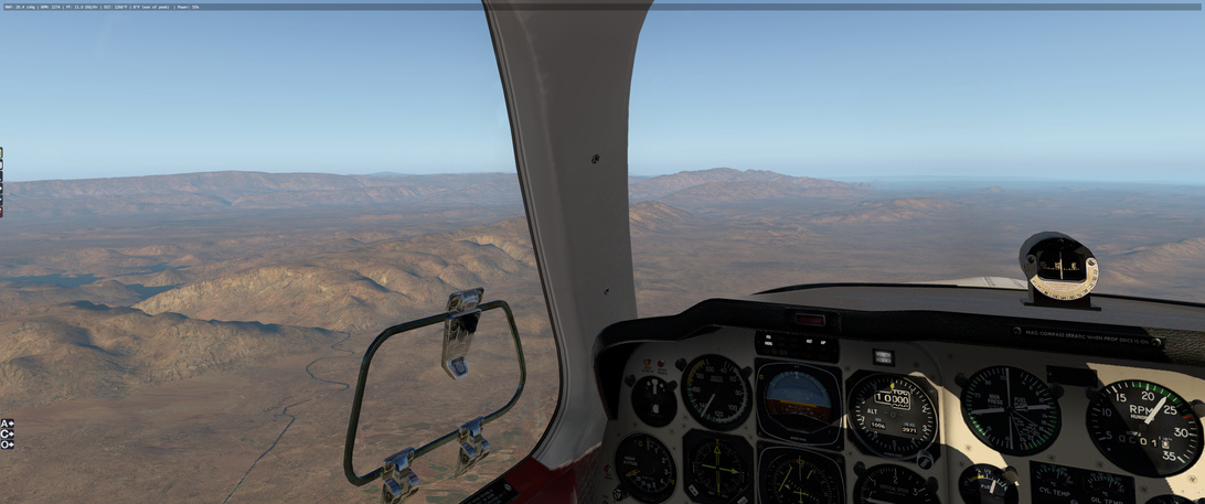
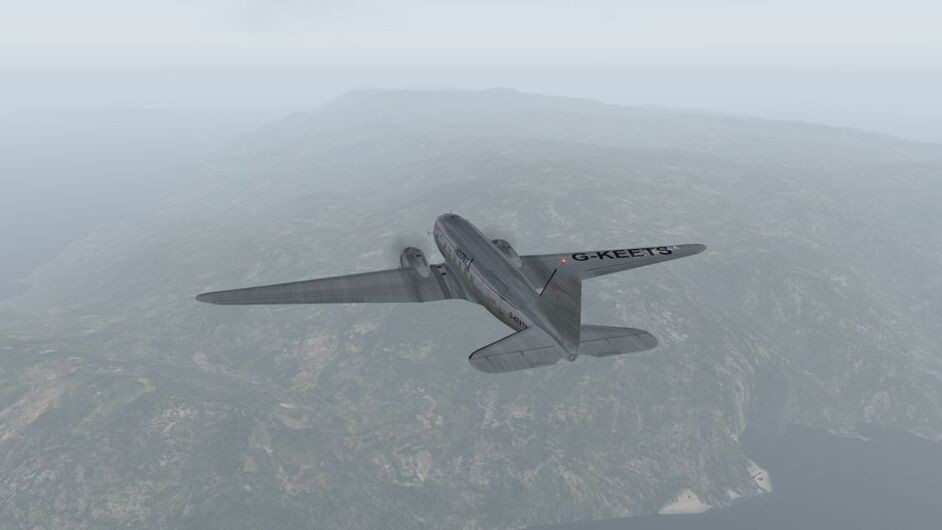
I run into some of the clouds that I expected, another period of turbulence…
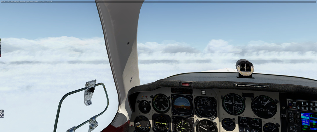
And I come out the other side without any issue.
Looks like visual navigation is going to be good.
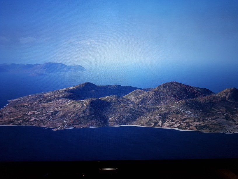
Not sure which lake this is as it does not appear on Google Maps but I imagine that the little white triangle down there is a sail boat and someone is having a great day!

I hit another patch of cloud but come out of it fine. I take a look at the Tigris river below me and it seems like I am a bit north of where I want to be.
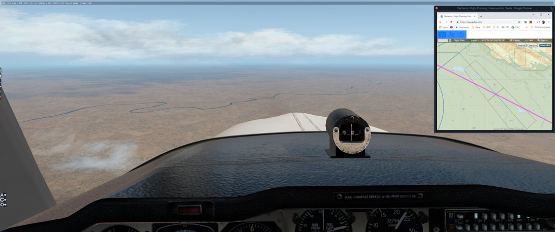
I turn to follow the river for a bit but I enconter some clouds again and decide to get back to my original heading (I can still hit the NDB in cloud, but I can’t get that fix on the next lake in it ![]() ). I get glimpses of the lake through the clouds, though I have to descend somewhat from my planned altitude.
). I get glimpses of the lake through the clouds, though I have to descend somewhat from my planned altitude.
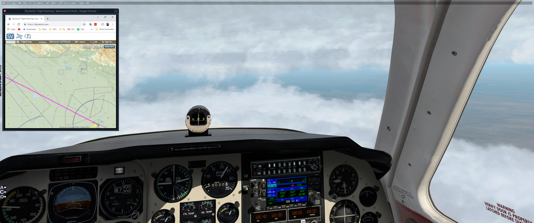

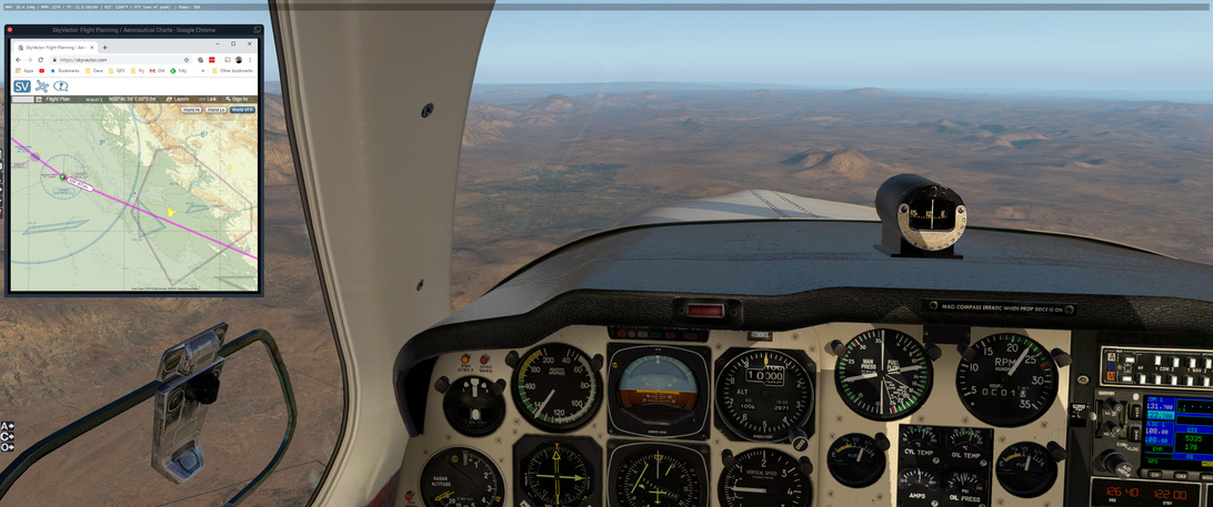
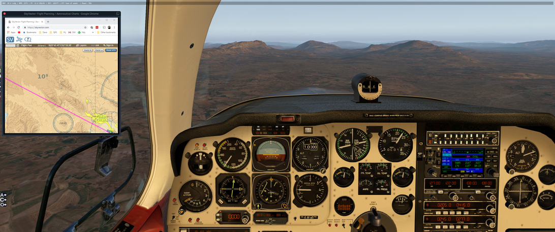
Soon enough I am out into the clear. I pass over the AWZ NDB without incident and proceed on to GSN. Weather is cooperating perfectly! The terrain for this area is nice!
I spend some time trying to match the terrain to the VFR chart on SkyVector before I realize that I have an old version of the flight plan loaded in there and I am not looking at what I should be looking at.
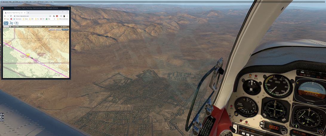
This seals it for me as the city I see with the airfield does not match the VFR chart.
Once I adjust it, now it makes sense.
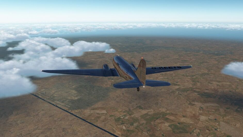
The terrain keeps coming up to meet me. I spot a city off to my left - and adjust my course to the left for 20 degrees or so. My plan is not to follow the NDB signal straight into SR/OISS as that would take me over some of the higher mountains in the area. On the VFR chart, if I go north of my track a bit, I can fly over some smaller mountains.
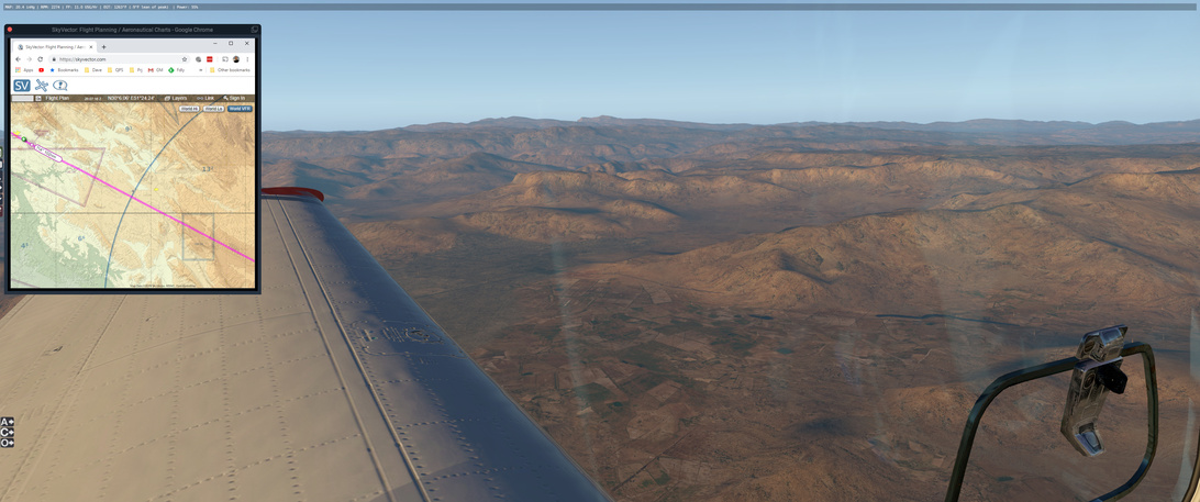
If I had taken the right hand side of the next picture, the valley there would eventually take me to the cost and not OISS. My intent is to head inland toward those three peaks in the distance. I don’t know it here but it is exactly the feature that I was looking for.
I can go down the valley between either of these but I choose the left one to give me a little space from the destination airport.
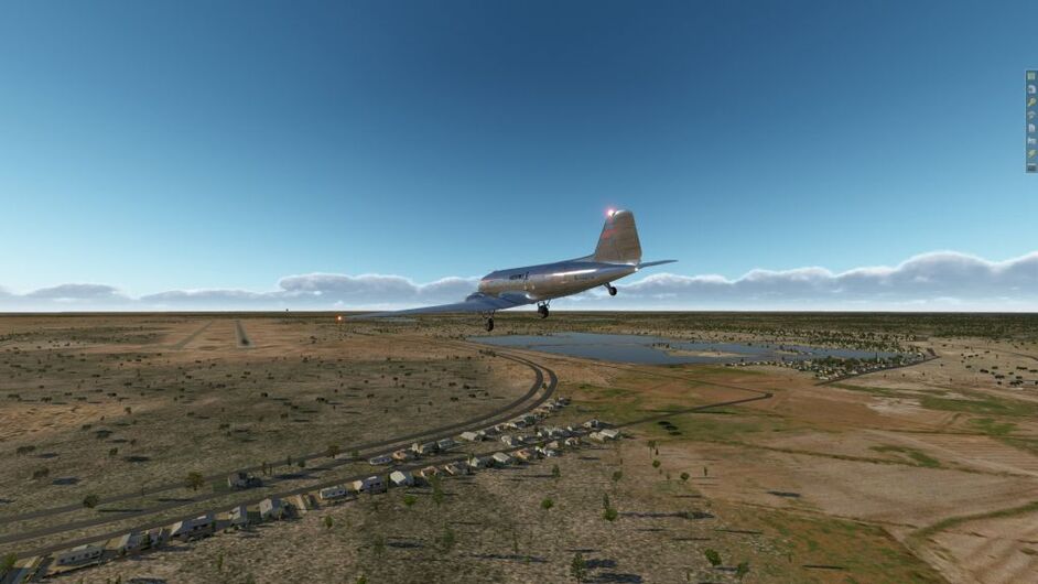
And there it is: Shahid Dastgheyb Shiraz International Airport!
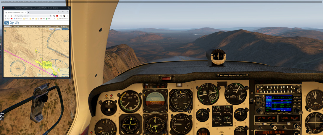
The terrain and scenery here is amazing!
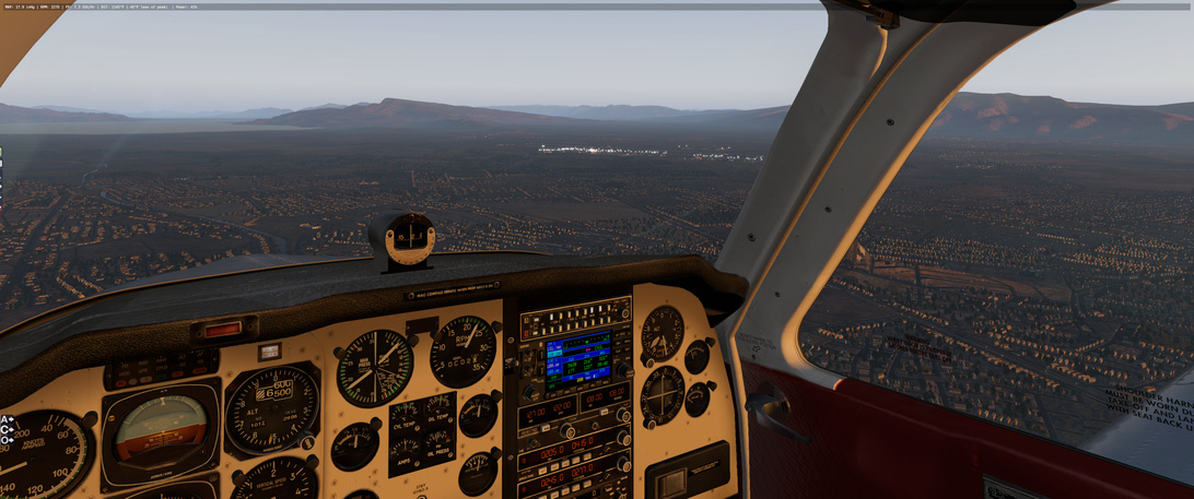
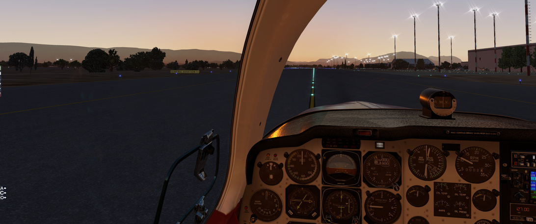
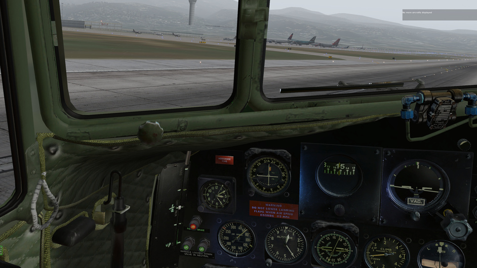
On final. I choose the wider of the two available runways due to the cross wind. I will also be landing at half flaps (instead of full) and it does seem to make a difference. Stopping distance on the 4km runway is not going to be an issue ![]()

This is a really helpful sign ![]()
And doing the post-flight walk-around … I have most of my oil still! nice!

7 Likes
LTFE (Mulga, Turkey) - OLBA (Beirut, Lebanon)
Distance 475.5 nm
Duration 3:14
Pass first checkpoint
Approaching Cyprus as my 2nd checkpoint. Color of some tiles look really off.

Weather held up pretty well so far, in spite of some clouds. When approaching Beirut, the sky fell. I tried to take screen shots quite a few times when in VR. Not sure why none showed up. This was taken during replay, when I was trying to descend. See the AI and the VSI. The VS was downward…
Approaching, for the 3rd time. Got a lot of lightning and heavy rain. The rain does not really show well in these screen shots.
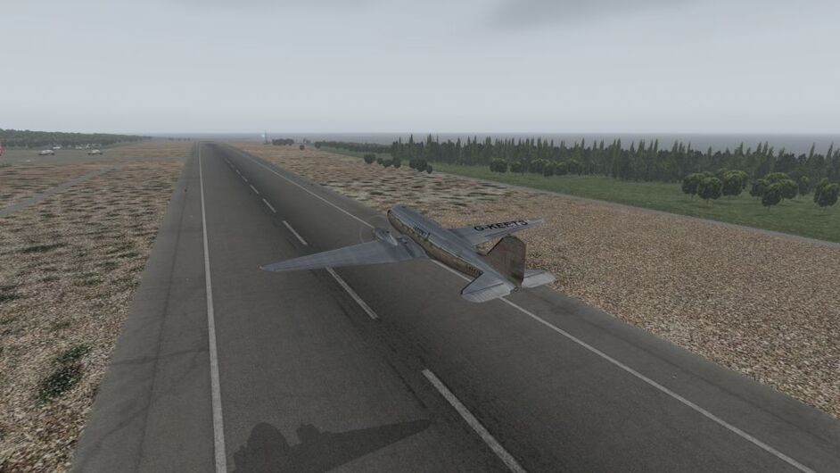
Crabbing, lots of crabbing…

I didn’t kick the rudder back when touching down, and the plane swirled 120 degrees out of the runway
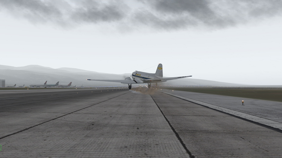
Seen from the cockpit. So off center.
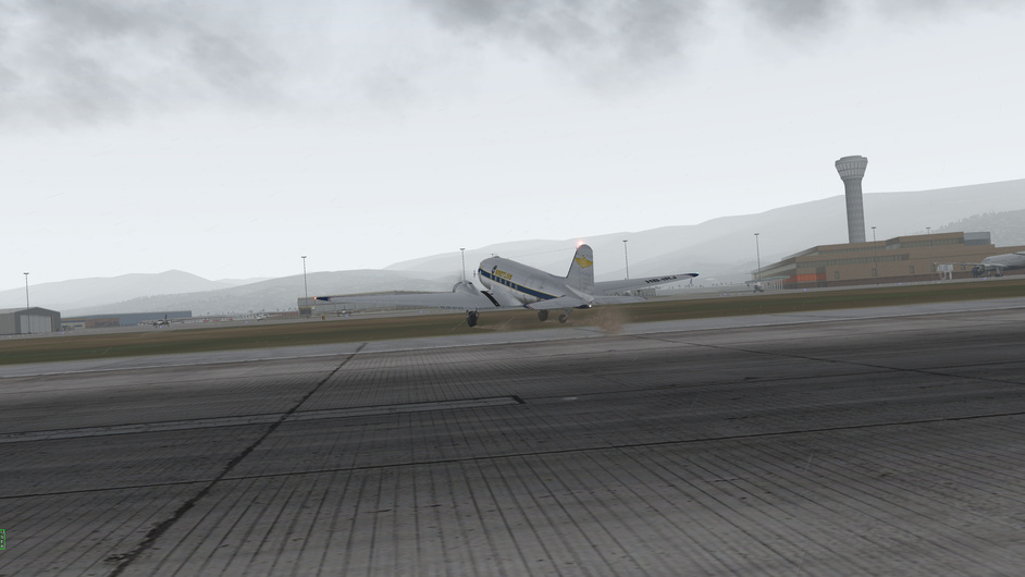
Seen from the tower.
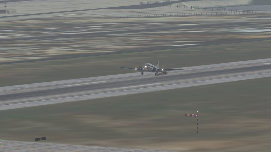
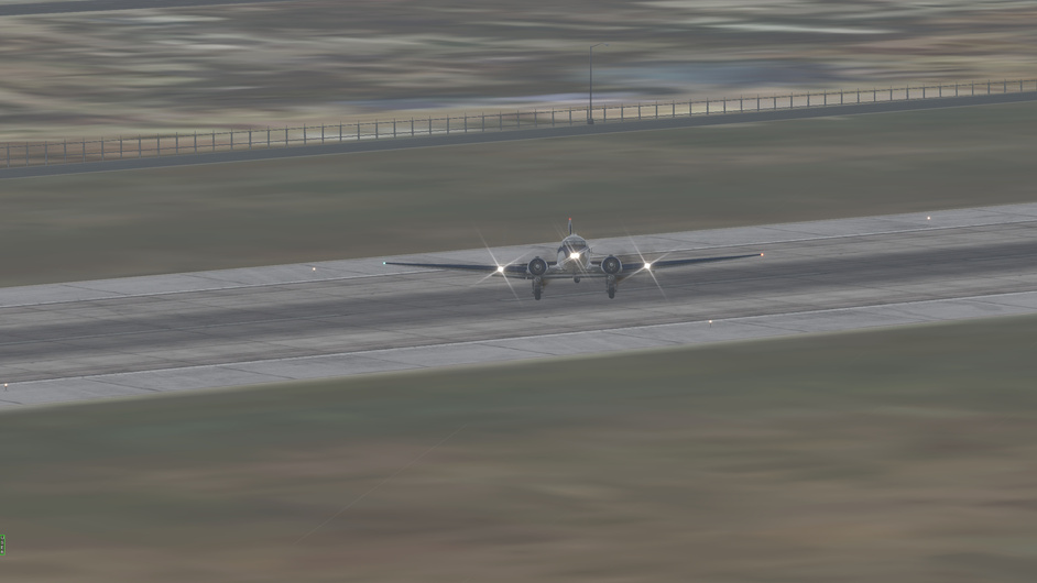
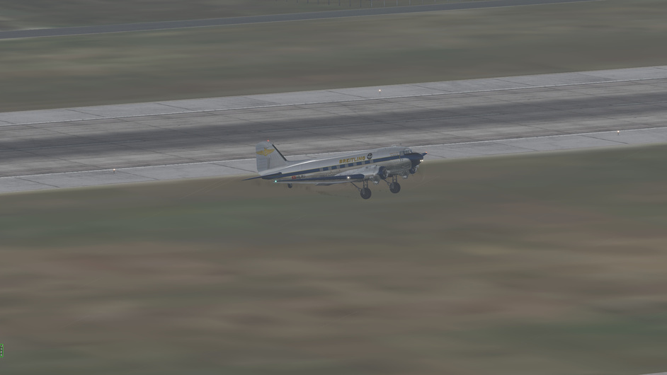
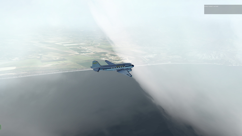
I’ll take it. At lease I am still in one piece, thanks for the strong landing gears of DC-3.
7 Likes
Any landing you can walk way from!
I actually thought about taking a flying boat on this trip, and just do it in 3-4 legs lol.
2 Likes
Take off: 0803 local
Touchdown: 1106
Distance: ~ 670 NM (planned ~590 NM)
Average Speed: 220 knots (caught a lucky tailwind!)
Total Flight Time: 22:18
Total Distance: ~4455 NM
Average speed: 200 knots
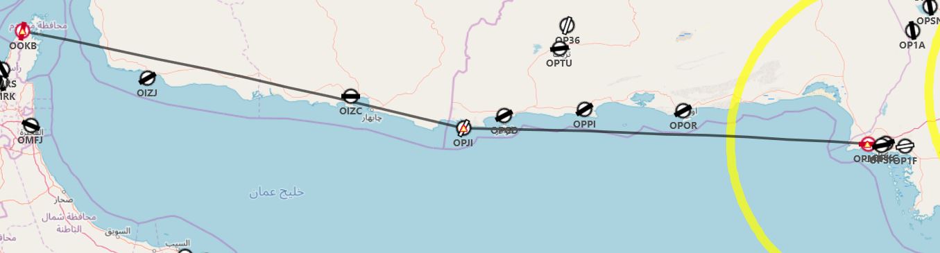
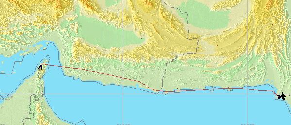
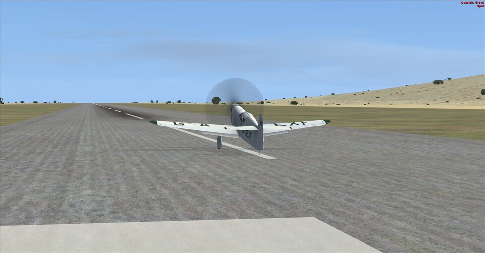
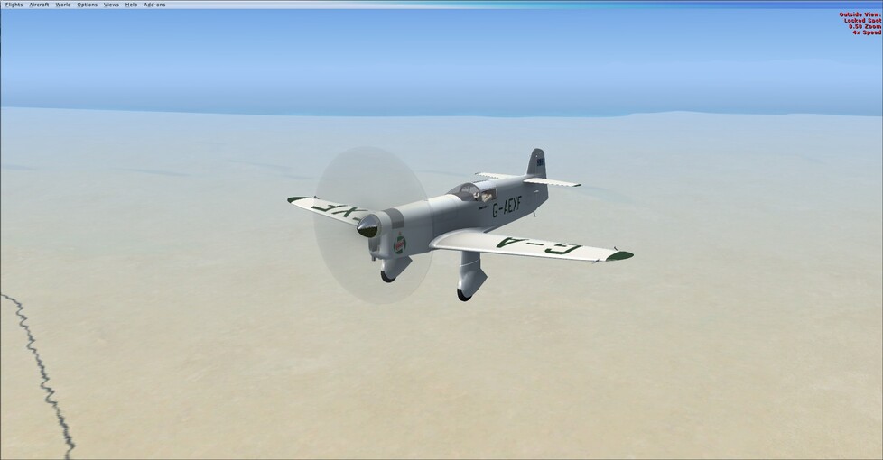
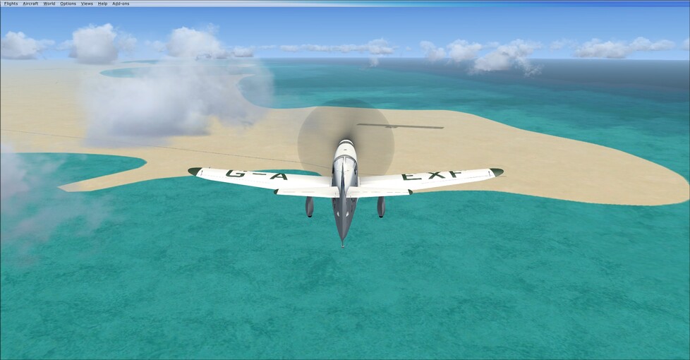
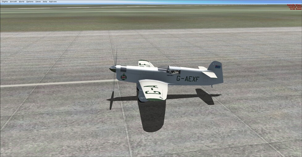
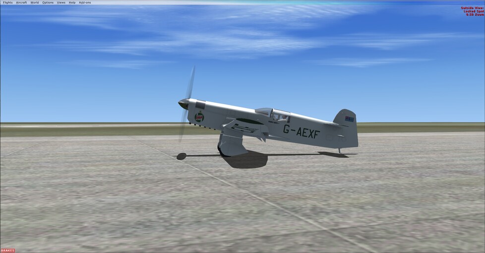
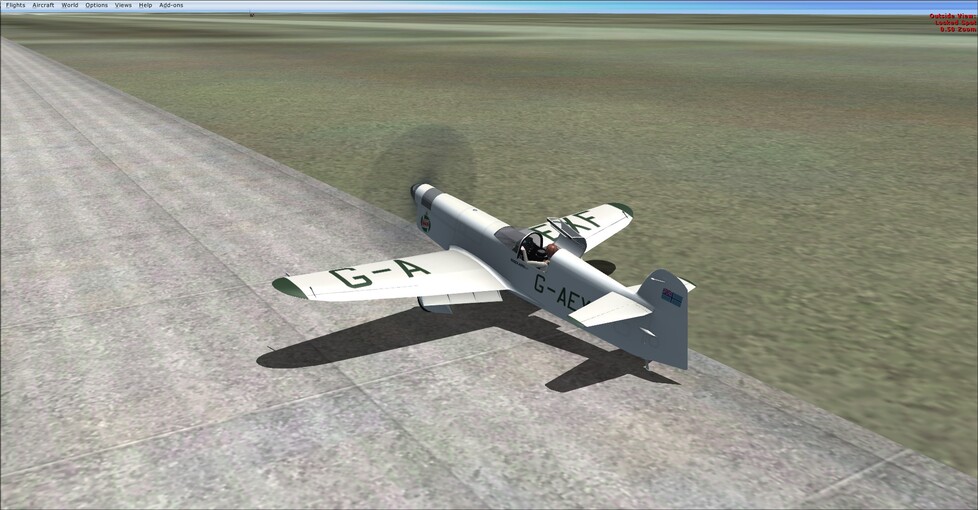
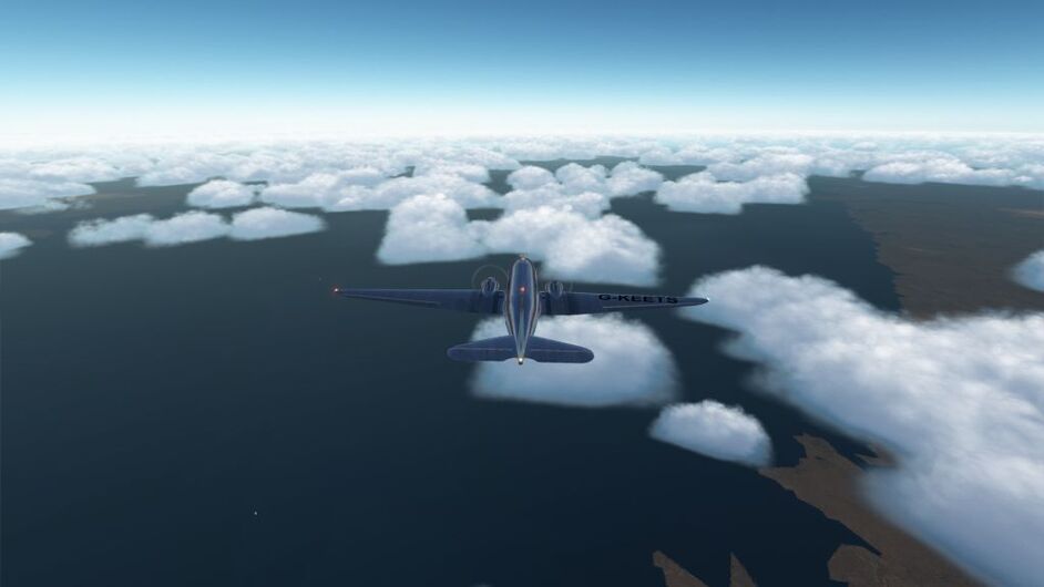
So with a fairly short (well for this event at least lol), trip across the Gulf of Oman and Arabian Sea in good weather I figured a plane that was fun to hand fly and with VFR only instruments. The Percival Mew Gull came out of the hangar again. Once you burn down the aft tank, it handles nice and stable.
Navigation was simple, with plenty of bays and inlets to keep the navigation simple.
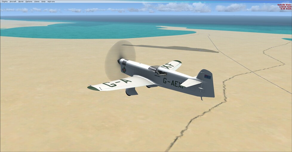
Passing Konarak
Passing Jiwani
Now that we’re back over land, weather is going to play a much bigger role in navigation if there aren’t any NBD’s handy. Next up Allahabad!
5 Likes
Some reading for those not flying
at the moment
1 Like
Nice progress, team! I’m grounded in Baghdad for the week with the local authorities / bureaucracy. Some issue relating to this falcon statue I legitimately bought in Valletta…long story.
3 Likes
Thank you
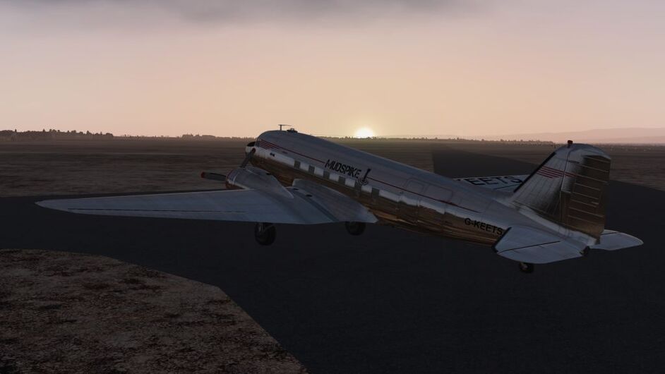
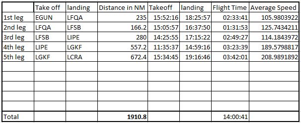
Leg 5: LGKF (Kefalonia Airport) - LCRA (RAF Akrotiri)
Report for last week’s flight.
Getting a replacement engine fitted, we got underway as soon as possible to take advantage of the favorable winds.
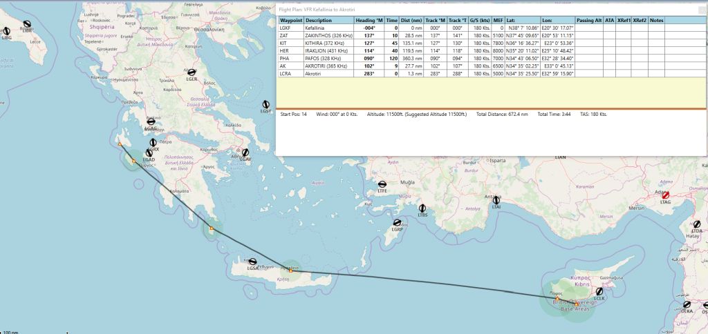
Take off was slightly delayed from 15:30 to 15:34.
Lift off.
Its all Greece to me
Learning from the previous trip where I’d lost the starboard engine, I kept a close eye on the temperatures. En-route to Crete I noticed the port engine was dropping revs.
I played about the pitch and mixture for that engine but it still wouldn’t maintain the same revs as the new starboard engine.
I decided to press on and could put down on Crete at Heraklion airport if necessary.
“Revvin up your engine, listen to the cough & splutter…”
Reaching Crete, the problem hadn’t got any worse, so decided to press on through the Danger Zone. ![]() So long as the engine help up for the next 100 minutes I’d be ok.
So long as the engine help up for the next 100 minutes I’d be ok.
Cyprus hill - Forest fire
Descending over Cyprus, there was a forest fire blazing away. I’ve never seen this in X-plane before, but didn’t want to chance the engine quitting so headed direct to Akrotiri.
RAF Akrotiri
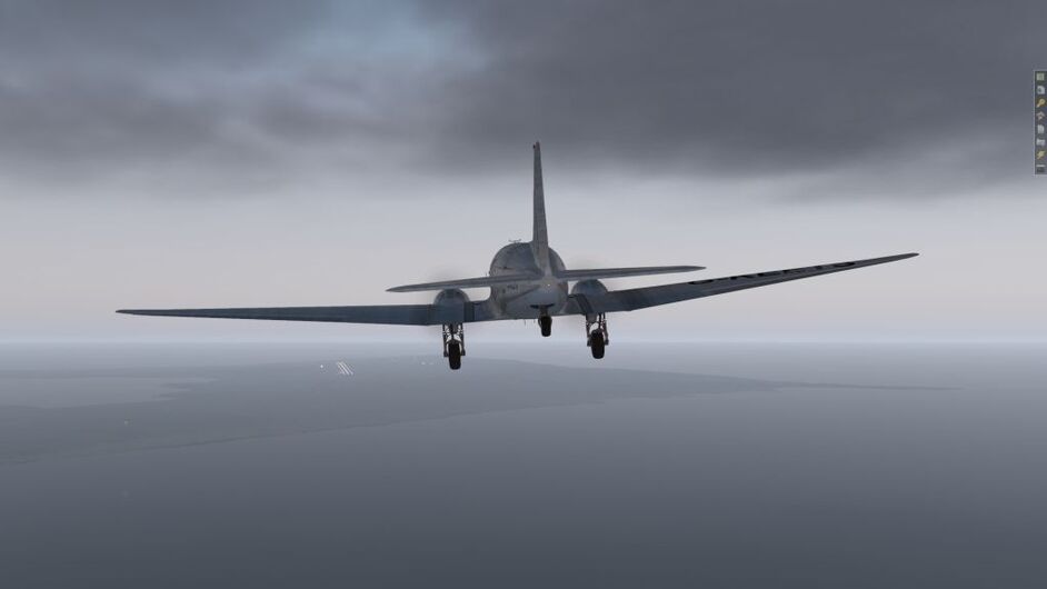
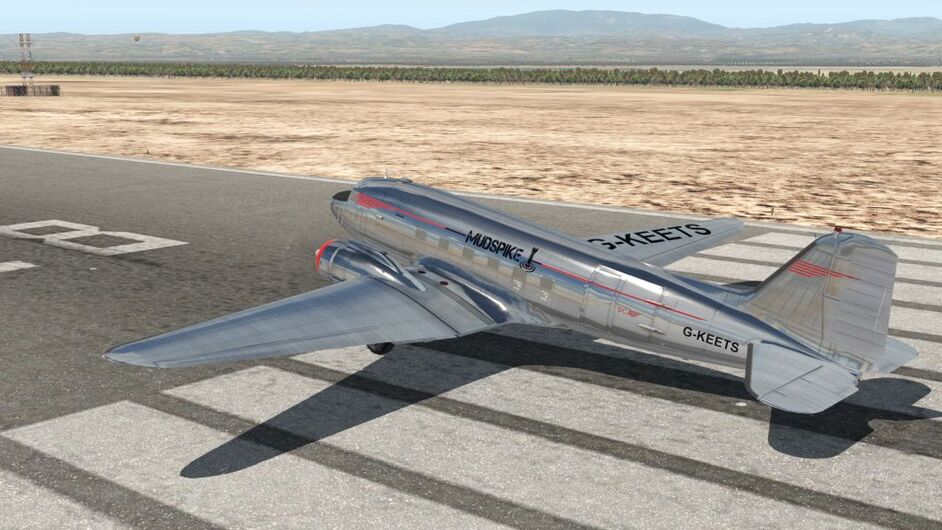
I throttled back the engines as I crossed the threshold for a nice touchdown, hoping the RAF boys had a spare engine. Alternatively I could drop them a case of beer to swap one out of @PaulRix DC-3 which was parked over by the hangar. ![]()
Nerd log - stats show a higher average speed than expected, which I’m attributing to the winds.
A nice flight, though I’m not sure what happened with the engine and didn’t get to the bottom of it. Does X-plane accrue wear and tear through flights? I have the MTBF set to 1000 hours, so not sure if that is something to do with it or whether its just random.
4 Likes
Thanks. I didn’t know better LOL.
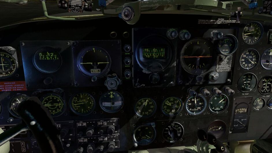
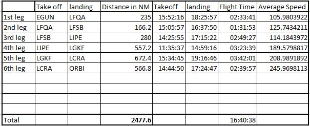
Nice! You’re using Aeroworx DC-3, right? I’m using the same, but haven’t noticed the two needles in the MP gauge. And how did you tell rev of each engine? I can’t really tell if your guage got two needles.
I’m going to try the MTBF setting, whatever it is :). Seems fun (or not)
There’s two needles on the same gauge, one with a “1” the other with a “2”. In ideal operation they overlay each other so you can only see one of them.
If you use your mouse in game and reduce one of the throttles you’ll see the second needle. ![]()
2 Likes
There is a party in Bagdad ![]()
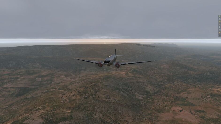
Leg 6: LCRA (RAF Akrotiri) - ORBI (Baghdad International)
With a fair bit happening over the long Easter weekend I have fallen behind, fortunately I managed to steal a couple of hours today to get to Baghdad.
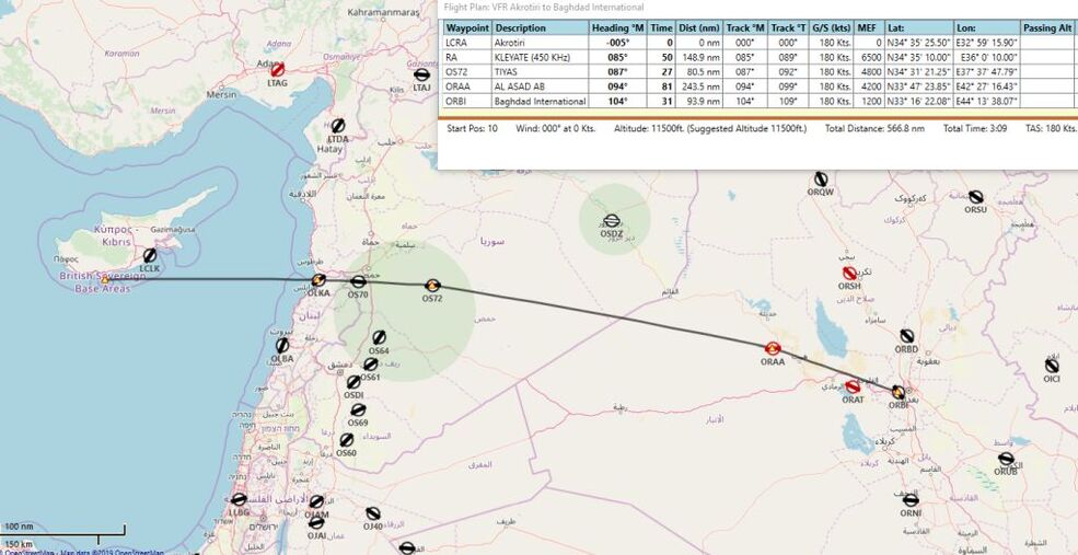
Route planned - a bit sparse on the NDB’s
Running up for Take off
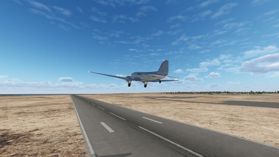
And we’re away.
Hopefully the second new engine wont give me any problems this flight.
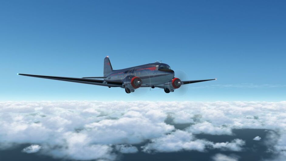
Climbing up to 12,000ft
“The Lebanon”
Crossing the coast of Lebanon somewhere north of Tripoli, I made a small course adjustment heading for Syria where the winds look faster.

Just desert
Tuning the Kariatain NDB I approximated my position, though not sure how far north of the beacon I was.
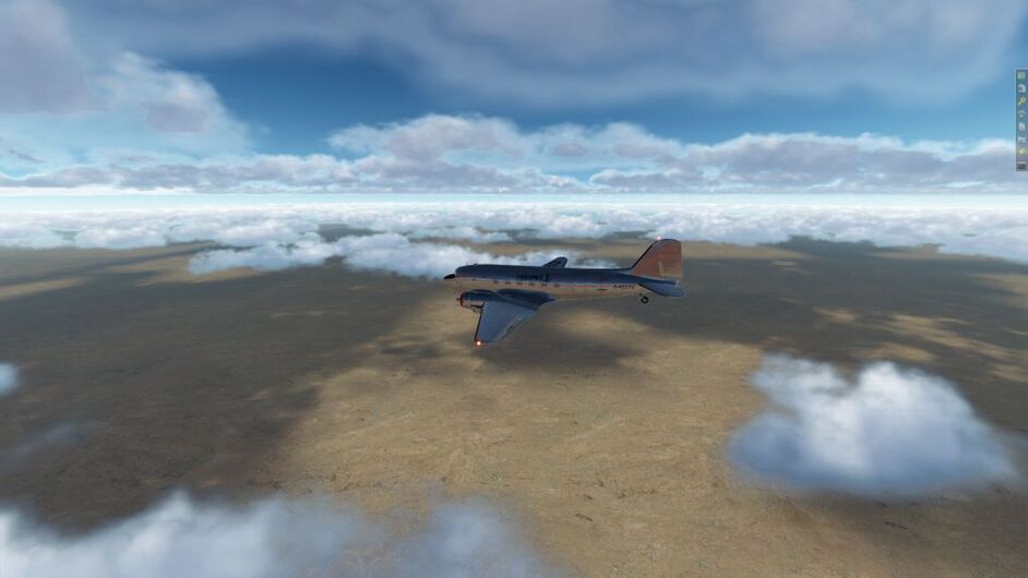
Still just desert
Everything was looking the same. Looking at the map, I reasoned that if I could hit the river Euphrates somewhere between Qa’im and Ramadi I would be able to DR to Baghdad.
I picked up the river somewhere, but couldn’t pinpoint because of the cloud. Looking out the windows, the bends in the river seemed to match multiple points.
Eventually I came across the huge Therthar lake.
Therthar
From there it was fairly easy navigation to Baghdad, though the airport was very hard to spot in the textures.
Baghdad international at 1 O’clock.
Whilst I’d been crossing the desert, a helpful message from X-plane had popped up informing me “You have burst a tire”. I’m not sure why this happened and I couldn’t have prevented it. I’m going with small arms fire from local tribesman.
On finals - steady
Turning downwind and descending, the wind gusts picked up with the poor old DC-3 being blown around like a leaf.
Touching down I wasn’t sure which tyre had blown, but expected the swing round when it came. Safely down though, so I headed off to the bar to find the party.

Burst tyre
Nerd log shows the impact the wind had on the average speed. Racing along.
First checkpoint done in 16 hours 40 minutes.
@ffly - dropped the port throttle and took the screenshot below for you. You can see the two needles on the Manifold pressure.
5 Likes
The latest auto update states you can have engine fires if you advance your throttle to quickly, I wonder ?
if damage can be caused also, but not a fire. Did you swap out your engine?
Porko
G’day all,
well your all heard of ‘The Gulf’ I’m sure, well I’m about half way down on the East coast at a little place called ‘BERSHIRE’. Certainly a big streach of water.
…Yes , I do check for scenery on .org to get a bit of variety, but for some reason, here we are in Iraq and Iran and everywhere there is western style houses… hmmm.
Cheers Porco
3 Likes
Thanks! I will check it out tonight.
Welcome aboard Porko…! Hope to run into you along the way…or at least cross paths!