Given that our current area of operations is focused around the relatively lumpy PNW - it might be a good idea for everyone to become a little familiar with IFR altitudes as depicted on charts.
First - you can find VFR and IFR enroute charts on Skyvector - a fantastic site that I use to input departure and destination airfields for analyzing enroute obstacles and determining useful Victor Airways or other navigation data. You can use the Flight Plan button to drop down a menu for inserting basic flightplan data.
Specific to IFR operations - you may want to know what some of those symbols and altitudes are on the Enroute High and Low charts - this article covers some of the basics:
Have a piston aircraft? For general guidance - consider this document that is still the source from Lycoming on proper procedures. Though dated 1994, this document is STILL the guidance published on Textron/Lycoming’s website. There are dozens of other articles on the internet with a bunch of different techniques and arguments over rich of peak, lean of peak, and using all manner of measurements (EGT / CHT) but this is a good basic starting point.
For Continental engines - guidance can be found on page 27 of their guide:
Though not specifically needed for flight simulation - adherence to NOTAMs is actually supposed to happen when we fly in our official recurrent training. This was actually something I learned a couple years ago when our FAA POI (Principal Operations Inspector) had a pow-wow with our company check airman, who actually had stumbled across the reg somewhere and presented it to the POI like a cat who had brought home a bird. Thus, if the JFK VOR is NOTAM’d out of service in real life, you are not supposed to use it in the simulator either (I know…it makes no sense).
BUT - if you want to fly realistically - check NOTAMs for your destination. The big gotcha’s are:
No lights
Runway closures
NAVAIDs out of service
FDC NOTAMs that alter approach procedures and minimums
Temporary frequency changes
Nice to know stuff like TFRs, complete airport closures, and airshows
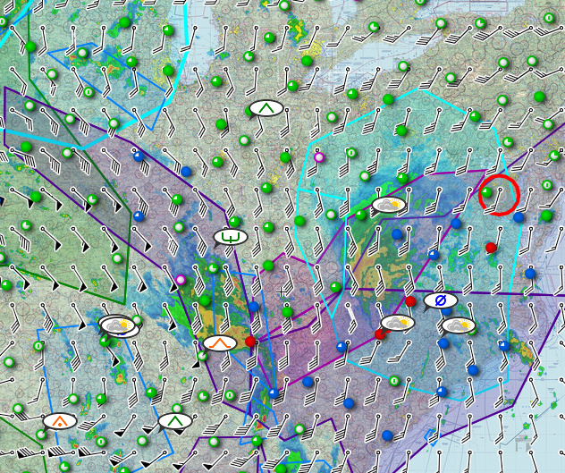
A ton of great radar depiction pages exist out there. Some are terrible. Some were good, but are now terrible because The Weather Channel and some other awful companies have taken them over. The site I use in real world flying is actually imagery from a Panama City, FL news station that has a link to a fantastic full screen radar. It initiates in the viewership area of the Florida Panhandle, but you can widen out the view. It has great resolution, and a long loop (that can take a bit to load) to really allow you to see the trends and zoom in all the way to the airport.
I would think so in that it probably pulls the data directly from the encoded National Weather Service database. As far as it being an official source of weather - I seem to think that the FAA only deems official weather sources as those provided by the government agencies (NWS / NOAA) OR sources that require a login because those sources record your activity and whether or not you actually received a weather briefing of some sort.
Examples of those would be FLTPLAN.COM or through ForeFlite…
So while you may get the same info from Windy, I’m not sure it would count by the letter of the law. But I love their winds depiction…particularly as a windsurfer…
I do love the visualisations on their site! It’s one of the reasons I like to use it and it does seem to marry up with the weather imported via Active Sky.
Thanks for all the info you have added to this thread so far!
Having trouble finding that farmer’s field or dirt road that is supposed to be an airstrip? - the Washington State Airport Guide might help you out. Some great visualizations and information in this one:
I have not ventured into learning IFR procedures at all yet, really…I need to change that, I think!
Otherwise I’ll end up in trouble before long in this hauling business…and I can’t let pesky weather stop people from getting their chicken nibbles / drugs / microchips.
Doing a lot of VFR flying for MAD? Before you click on the autopilot and go grill a hot dog - make sure your cruise altitude is going to clear all the obstacles ahead. VFR charts have a Maximum Elevation Figure printed in each lat/long quadrangle. As well, the highest obstacle or terrain in that quadrangle is bolded. Be aware that in some cases the MEF can be as little as 100’ above the highest obstacle. I like to plan for at least 500’ above the highest MEF along my route of flight. If winds or tracking might be an issue - take note of surrounding MEFs that parallel your route. A much higher MEF can exist just over the border of the quadrangle.
Also - keep in mind MEFs don’t guarantee obstacle clearance on extremely cold days, do not provide any guarantee of VHF radio reception, give no buffer for emergencies, turbulence, or NOTAM’d obstacles (hey…someone built a temporary 100’ tower on top of that hill…!). Basically, MEFs should only be used as a guide toward MINIMUM obstacle/terrain clearance.
Know your turbulence! As with many things in the real world - experience can make observations somewhat subjective. Turbulence is one of those things. I’ve flown in everything from light chop to severe turbulence. Anything more than light turbulence is uncomfortable. Severe turbulence will make you rethink your career choice. Thus far, over Washington and Idaho in Air Hauler using Active Sky - I’ve probably hit some light / borderline moderate turbulence but it is hard to judge without the feedback of the strain on the seatbelt.
The official guidance is below. Keep in mind, an encounter with severe turbulence may require your aircraft to be grounded and inspected prior to return to service (it does for my company).
Updating the radar imagery link. WJHG changed the format of their weather radar page and it isn’t as nice as what they used to have. So I found a KY3 (Kentucky) news station that has a link directly to their nice Doppler radar page. It is the same presentation that WJHG used to use: