I’m a copycat, so I flew to the Matterhorn just like @PaulRix did.
However I wanted to do it a bit differently, so I started my flight at Courchevel (LFLJ) and ended at Aosta (LIMW)
In fact I contemplated flying to Mont Blanc from there, and then to the Matterhorn, but I guess that would have been a bit too long of a flight.
The plan turned out to be like this: Fly east, gain some altitude, hop over the Col de Palet, past the Pointe de Calabre, follow the Aosta valley to the town of the same name, then head north to the Lac de Places de Moulin, and use the ridge lift near the steep slopes of the Dent d’Hérens to get to the north side of the Matterhorn. Climb, climb, circle it if possible, and then head back to Aoste and land.
Discus 2c, July, wind 320 at 6 knots, few clouds.
Sadly I didn’t take a lot of screenshots until I was already north of Aosta, because I flew the whole thing in VR, and frankly I was too busy surviving and looking at all the graphical awesomeness to take screenshots.
It was absolutely mind-blowing. I feared that I would get nauseous but I was fine. Sweaty though. Flying near those huge mountains is no joke when you have no engine.
If you have the sim you definitely have to check out the Alps.
Here is Lac de Places de Moulin
My first glimpse at the Matterhorn.
Closer…
Now directly north of it. The wind blew right up there, felt like an elevator ride.
…aaand above it. Magnificient. That must be the largest Toblerone I’ve ever seen.
I switched to 2D to take a few pretty screenshots.
This is the Matterhorn from the east. Dangerous when the wind is coming from the northwest. I made sure to stay above the ridges, but I was sinking drastically there.
The summit as seen from the southwest (while sinking with 7m/s or so). A lot of people died here. Since it was first climbed 150 years ago, 587 people didn’t make it. I am glad that I am in a plane.
Back on the north side, and several meters lower.
The Zmutt glacier.
I think the tallest mountain over there partly hidden behind the clouds is Mont Blanc.
Breuil-Cervinia
And back to Aosta at high speed.
Descending into LIMW. I had a lot of altitude and speed. I damaged the plane on descend while switching from VR to 2D, I guess I oversped or something. There was a weird sound and then the GPS was gone.
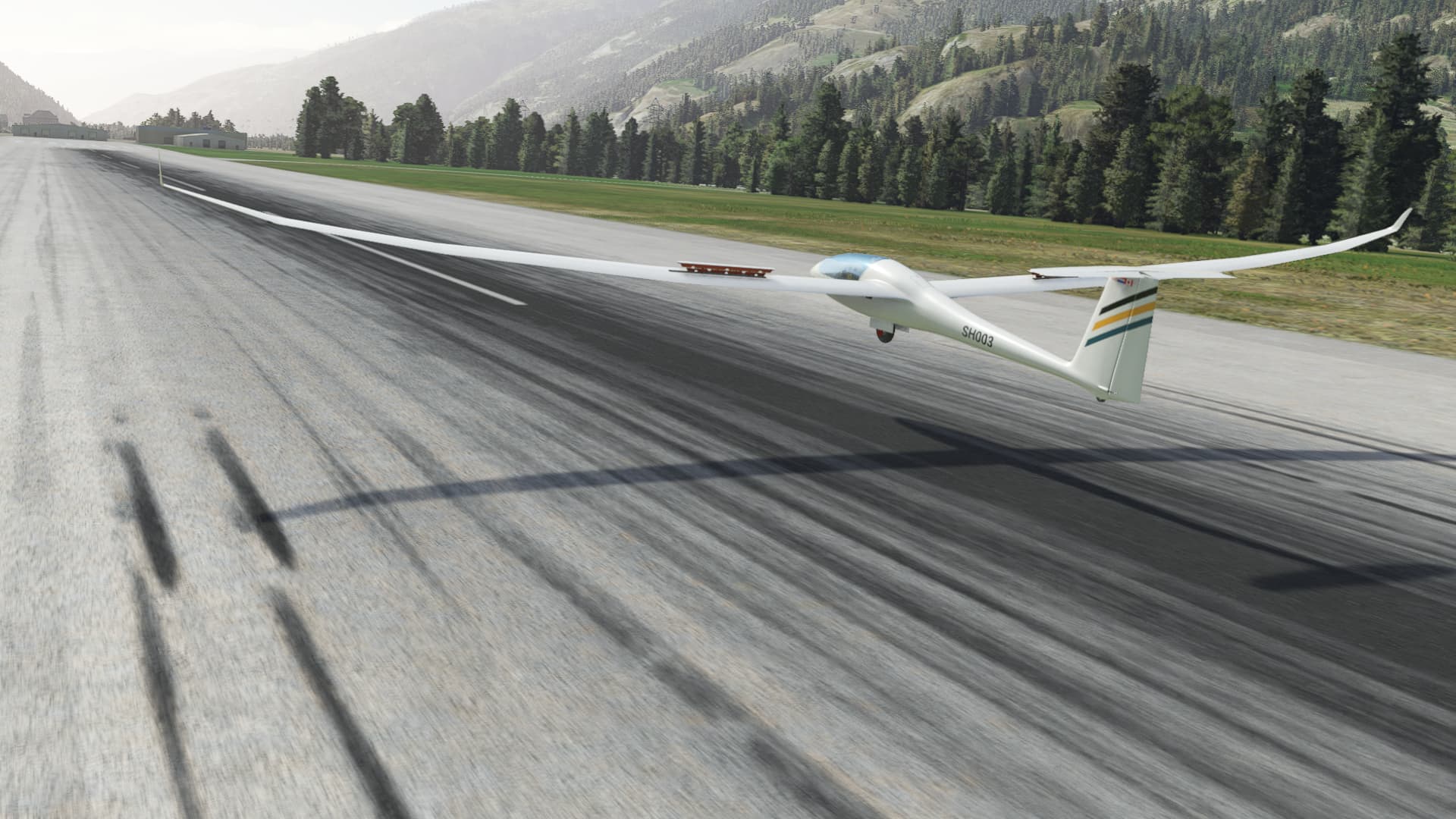
On final.
And down. 1h35min and around 85nm if you don’t count all the circling. I also flew over three countries (France, Italy, Switzerland) in the process.
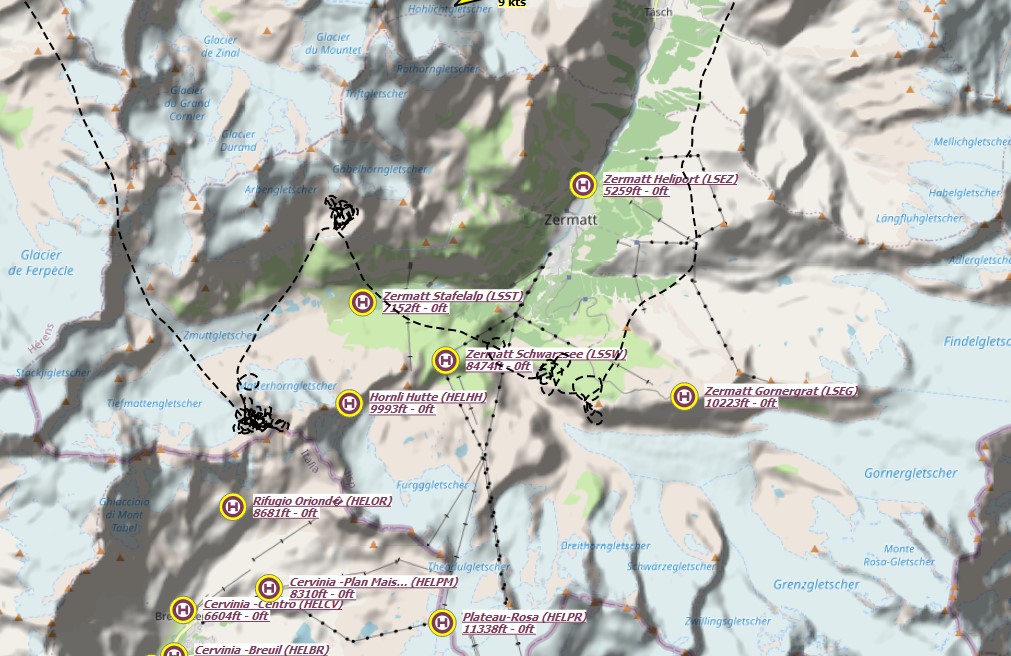
Here is the track.
Time for a Toblerone!