What installation process? ![]() You just go here …
You just go here …
download their app and away you go!
What installation process? ![]() You just go here …
You just go here …
download their app and away you go!
Oh that’s new! Ages ago when I checked that same site the instructions all said to put folders in various places.
Ya, you can register there for free. I think I grabbed the $10 membership way back for faster downloads and grabbed their whole landscape collection. Well worth it as I now have about 1.3 TERRABYTES worth, ha!
I finally got around to try the DG808 and Kinetic Assistant once more, and I am pleased to announce that I just had a short but lovely flight in the Alps (winch start from Füssen, went to Neuschwanstein and a bit further, then flew back, launched again and did another short hop around the field) with the plane.
Still acts a tiny bit weird in stalls (I think. I don’t know the real plane, I just cannot believe that it is that hard to recover from a stall), but perfectly flyable.
Soaring is back on the menu!
Thanks @thealx !
Nice to read about flying soaring planes in FS2020.
Any VR soaring pilots on this forum?
I have tried in VR some time ago, but I get nauseous quite quickly so I haven’t flown a lot in VR.
I have Quest2 but same problem here - using it for cockpit tests only.
no issues here in VR gliding in MSFS with Reverb G2
No problems here either. It is a long time ago I did some soaring though.
Just in case you missed
https://news.flightsim.to/discus-2c-by-got-friends-previewed-freeware-release-following/
Good!
I am pretty happy with the DG808 but a little bit of variety is always appreciated. ![]()
I joined the club with the 808. Took a while to figure out the Kinetic Assistant app. Finding locations that have enough active thermals, especially with FS2020’s poor weather briefing, is tough. I’m hoping they have hotspots in Japan so I can soar in the local area.
Managed a 45-minute hop from LSPO to LIIF…wherever those are. Can’t find any Google info on 'em. Found a thermal right after launch and climbed to about 8,000 then bounced a couple thermals on my way there.
I need to tweak my VR. Framerates are smooth, but the audio is choppy and my resolution will often drop to 240p, making the gauges unreadable.
In a pinch you can add your own thermals in a CSV file and load them into KA.
The other trick is setting a custom weather, with a wind layer at ground level, 10-15 knots, that blows roughly in a perpendicular direction to your mountain ranges. That will create nice ridge lift.
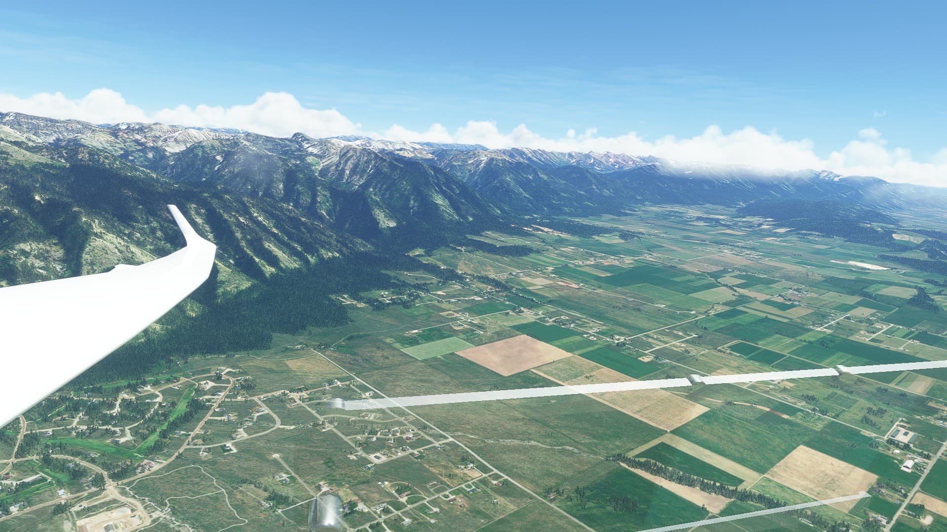
I was a bit tired of soaring in the Alps, so I went over to the USA, set the month to July and the weather to something suitable for soaring, looking for a… Rocky Mountain Way.
https://www.youtube.com/watch?v=tjJnyvu9x70
So Lone Pine Flying Ranch, Wyoming it was. (WY64)
I let the winch drag me to 1200ft AGL and headed east.
Soon I was in the mountains and flew south along the Wyoming Range, around 20nm to Afton, WY.
That mountain over there is Red Top Mountain (3,177m / 10,423ft ASL), as seen from below.
You can probably guess why it is called that way, but I wanted to take a closer look.
So I searched for some updrafts and circled around a bit, always keeping a lane open toward the west so I could divert to KAFO in a pinch.
Eventually I made it up high enough that I figured I would make it. This is 3nm north of Red Top Mountain, you can see it in the upper right corner of the picture.
Yay! 11,000ft ASL.
I had now managed to do what I came for, but… man, that high ridge to the east sure looked interesting, maybe I could take a look while heading back north?
Mount Fitzpatrick et al.
This shot of Swift Creek Lake almost killed me. I caught a serious downdraft while taking the screenshot. I still made it to the other side of the ridge where I got plenty of lift again.
Corral Creek Lake. By now I had to avoid clouds now and then.
Over Mount Fitzpatrick (3,325m / 10,909ft ASL)
Ok, enough altitude now. Flaps full negative, convert all lift to speed. 130 knots in horizontal flight, not bad.
Plenty of altitude to get me back to the field, in fact I was still 4000ft AGL when I got there so I flew a few turns with the brakes out.
Great mountains, perfect for ridge soaring.
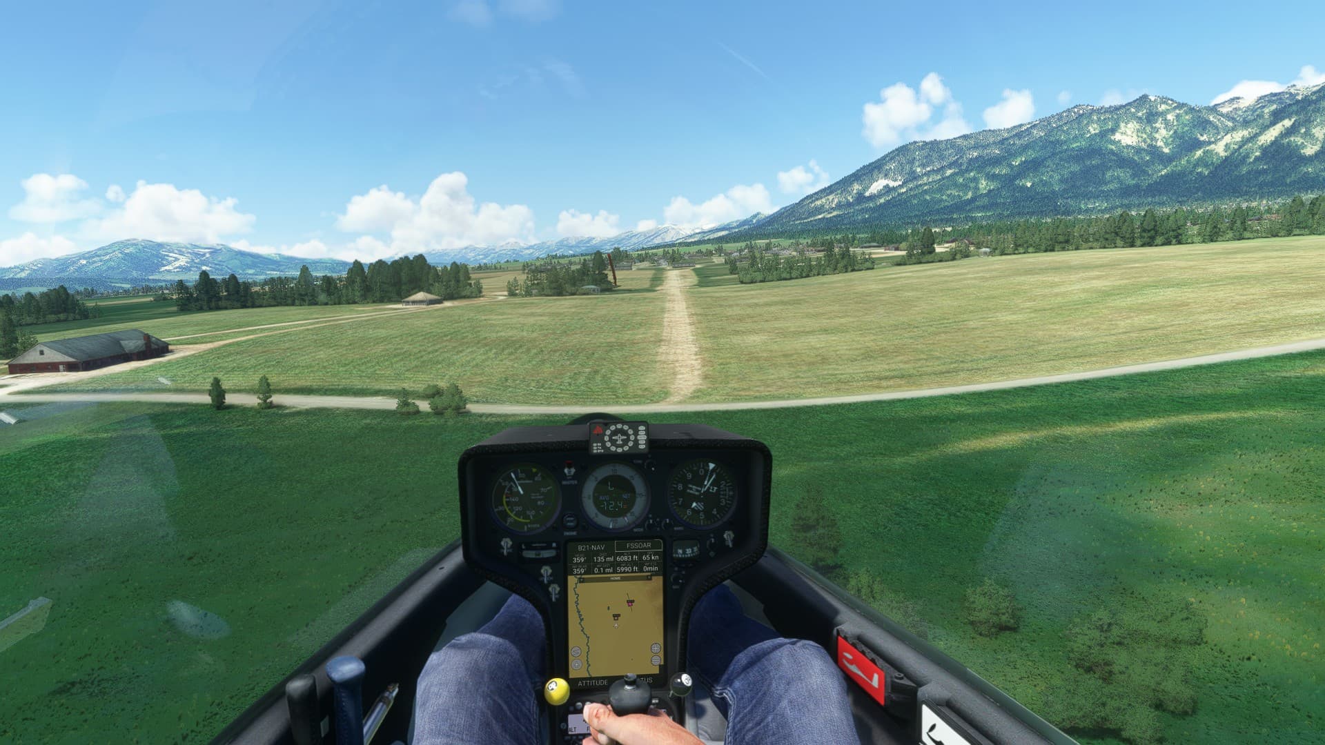
On final. There was some crosswind but nothing too severe.
Done. All in all I flew around 120nm in 1h 20m.
That one fooled me so badly that I had to do a double take and confirm it was actually a screenshot and not the real deal.
Wheels
I was in the mood for soaring again today, but this time I went to the Appalachian Mountains, the Blue Ridge Mountains to be precise.
Belcher Regional Airport (57KY) to Middlesboro-Bell County (1A6), around 90 miles.
I went for my usual weather setting, but it almost felt like cheating here since the ridge is so straight. I added some turbulence and decreased the wind strength in order to not make it too easy.
After I disconnected the winch cable I headed south toward the ridge. I had some lift over those hills, but I had to zig-zag a bit to avoid losing too much altitude. There aren’t many safe spots to land in those narrow valleys.
My first waypoint, Elkhorn City, Kentucky.
A quarry and/or coal mine. There are a lot of those here.
I found the sweet spot for the lift near the ridge, and started to climb.
Another quarry/mine. The other side of the ridge is Virginia. If I have to divert I have to go over there, since this is Letcher County, Kentucky. I am trying to not land in a Dry County. ![]()
My next waypoint, Jenkins, KY and the Pound Gap.
Coal mines. Like in Kentucky there are parts of Virginia where mountaintop removal mining was done. Sadly quite destructive for the environment.
By now I had gained so much altitude that I chose to go for speed. Barreling along the ridge at 150 knots is quite nice.
A gap near Cumberland. But not the Cumberland Gap. That’s somewhere else. Mildly confusing.
Bledsoe, KY. The US Highway 421 crosses the ridge here.
One of my divert fields, Tucker-Guthrie Memorial Airport (I35)
I overflew the northwestern part of Harlan County, Kentucky quickly, and reached Pineville, where I turned south.
Cannon Creek Lake, with Middlesboro already visible.
Now THIS is the Cumberland Gap.
The road isn’t used anymore though, there is a 4600 feet long tunnel through the ridge a bit to the south, built in the early 1990s.
I turned back to the northwest though, to land at the airport.
As always I was a tad high, but it is always easier to lose altitude than to gain it. Especially in a glider.
On final. I landed on the runway but rolled onto the grass so I wouldn’t damage the plane.
And that’s it!
Nicely done. I downloaded the Discus today. It will be great to fly a glider in VR again as I have missed it since I shelved Condor2 (just until they implement OpenXR).
Ooooh, was the Discus released?!? I missed that, thx!
Definitely a plane I want to try and see if I like it even better than the DG808
woah! epic post ![]()
Delighted to hear the Discus is released too
Thx!
I tried it a few hours ago, winch launched it three times, circled a bit in thermals, stalled it, and landed it.
Works fine, flies very nicely, and is a lot less likely to spin compared to the DG808 which can be a handful when you get slow.
The only thing I really miss compared to the 808 is playing around with the flap settings. The Discus doesn’t have flaps. That means less workload, easier to fly. But… man I love using them, finding the perfect setting for the situation and so on.