Mudspike Rio Olympics 2016 Fly-In AARs & Screens

Alrighty…got my next leg planned out for reasons I’ll explain later…

Going to depart Grand Strand (KCRE), pick up V1 - CRG - V51 OMN - V3 - TRV. Gonna have to hug the coast since I don’t have a raft onboard and can’t wander more than 50nm off… :wink:

BeachAV8R

2 Likes

Flying along the coast is more fun anyway. :slight_smile:

2 Likes

Well, I’ve finally gotten underway. We had some threatening weather move in the area just before departure, but I was able to launch before things got nasty. Very gray for the departing shots unfortunately. Once airborne the fricken autopilot seemed to be possessed by the devil, so after flying for about 10 mins like a drunken sailor, I finally just mashed the big D button and entered Opa-Locka (KOPF). Then the next thing was trying to figure out how to get the A/P to follow the V Nav. It blew past my programmed altitude with a vengance, so I’ve finally rained in Mr. King to hold what I’ve got. Yesh. Do I ever need some dual time with @BeachAV8R. 269 miles left before a cold one.

N404DB happily skipping steer point one…

1 Like

Good to be back in Fla. again. Lou Reed Walk on the Wild Side is playing on the mp3 player through the David Clarks. 196 to go. Man am I thirsty!

2 Likes

Alright… no screenshots 'cause I could not get Shadowplay to cooperate with X-Plane but I did fly from CYFC to KBOS relatively issue free. I had one crash (X-Plane, not me) on the way and I restarted with a slightly more powerful aircraft … the PC-12 from Carenado and X-Plane.org.

I was using real world weather and luckily I had relatively clear skies, so no ILS challenges at the end. Oh, and I managed to get a route loaded into the GPS so that made things a lot easier as well.

The default scenery in my area is … meh. CYFC is a concrete/asphalt pad in game and the surrounding scenery was generic at best. I did grab some updated stuff http://www.alpilotx.net/downloads/x-plane-10-hd-mesh-scenery-v3/ but I am not really sure what impact it had … or if I even have it installed correctly :slight_smile:

Anyhoo … next leg will be from BOS to MIA and I hope that is not a premonition of my end state during that leg :slight_smile:

EDIT: I was also using this site on my other monitor to view airport info and other juicy things bits.

2 Likes

Nice job @Aginor getting the Citation X loaded and getting yourself back in the saddle. That should be a very nice trip indeed. Please snap a photo of the panel if you have time

@Fridge, I thought about taking the PC-12, but all of that water kinda made me nervous, uh huh. I will be a nice ride for sure, especially with the 530 upgrade over the B200’s 430 Garmins. Mesh simply defines the terrain elevation, so will not change the look of the stock scenery other than add elevation changes at a higher resolution. It does add dimension and depth to what can be flat scenery otherwise. The eye candy is what is painted over the mesh in colors, details, and 3d objects. If you don’t already have it, there is a fantastic freeware KBOS.

1 Like

Nice - good to see the King Air in its element. Good on ya’ for keeping the ITT down there below redline too. We typically run ours at 720-740 max and if we are at lower altitudes we tend to set around 350 lbs/hr. on the fuel flow. See ya’ in Florida!

1 Like

That’s a beautiful airplane (both Carenado’s version and real life). Even though I’m a pretty die hard King Air fan, if I were an owner/operator interested in cost effectiveness, I’d take the PC12 over the B200 for my personal aircraft. And yeah, SkyVector is a fantastic site…

BeachAV8R

1 Like

Guess it is time to get out of CRE before the weather closes in…

Live progress here as usual - http://xfsd.ansorg-web.de/fsdmap/

Flight planner says 2+10 hour flight down there to Vero Beach…

1 Like

Familiar area here around Charleston, SC - I used to fly fire patrol over this area in the summer and vector fire-fighters in with their ground units to stomp out fires. The lumber companies used to hire us to do that…

2 Likes

I was able to set a pin at my location. if that helps.

There was a lot more red when it passed over my place! I had thunder and lightning for about 3 hours. Good times!

I was just going to recommend that! Mister X has some awesome freeware!

@Fridge Here is a good freeware KMIA also. KMIA Miami International Airport - Scenery Packages - X-Plane.Org Forum

Got my Pre trip flight planning done. Ill be doing 6 legs, well 9 if you count the return, But the fly in is to Rio so i will focus on the 6 legs that get me there.

Leg 1 Statesboro GA(KTBR) to Savannah GA(KSAV) flying the C208.
Leg 2 Savannah GA(KSAV) to Miami FL(KMIA) flying the 727
Leg 3 Miami FL(KMIA) to Punta Caucedo Dominican Republic(MDSD) flying the 727
Leg 4 Punta Caucedo Dominican Republic(MDSD) to Maiquetía Venezuela(SVMI) flying the 727
Leg 5 Maiquetía Venezuela(SVMI) to El Alto Bolivia(SLLP) flying the 727
Leg 6 El Alto Bolivia(SLLP) to Rio Brazil(SGBL) flying the 727

I plan on starting my trip sometime Wednesday the 20th of July. If all goes well I should be in MDSD Wednesday night Thursday Mourning. There is a good chance that Ill be in Rio next Friday!

Loving everyones pics and stories so far!

1 Like

We had two turning and daylight was burning, but the company brought us out a late goodbye gift, a cooler full of Trader Joes (thanks for the heads-up Beach!) Chipwich ice cream cookie sandwiches.

So long Downwind cheeseburgers for a while.

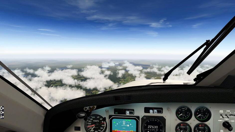
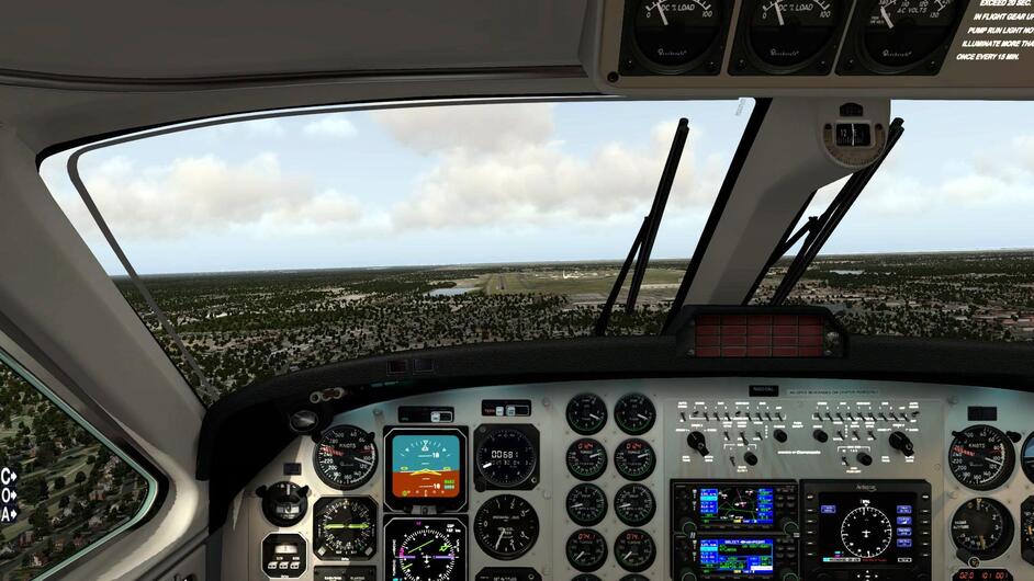
We would need sympathy food having to fight the AP for the first 15 mins of our leg. However, eventually we threw up our hands, mashed the big D, and set the AP for NAV and ALT, no that it respected our programmed V Nav in the GNS 430. It did follow the route well though. By the time we had finished our first Chipwich, the scud was beginning to break up, and it looked like mostly blue skies ahead.

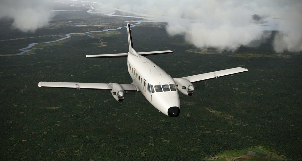
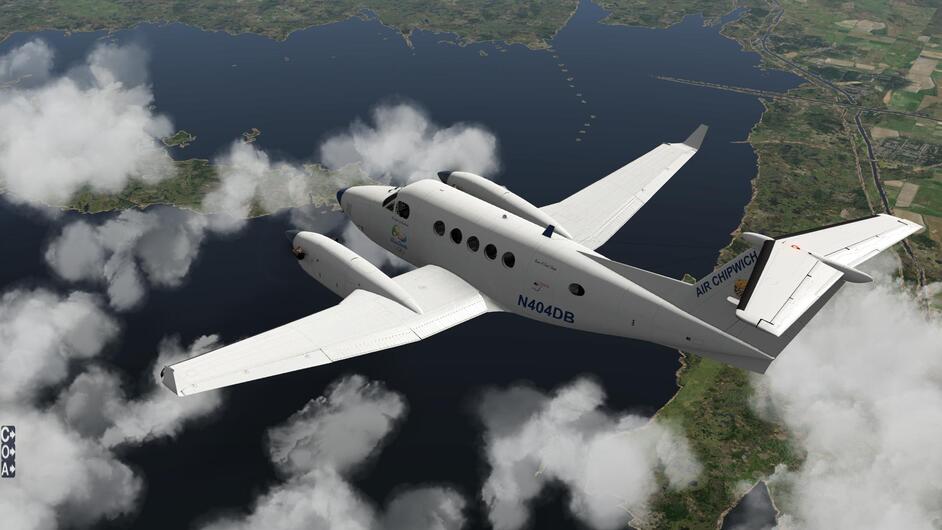
With an IAS of around ~180 knots, the B200 was showing a ground speed of 275 mph! Yeeha. I wondered how the poor bastages were doing down there on I75. We actually paralleled that route until around MCO. Mickey lives down there.

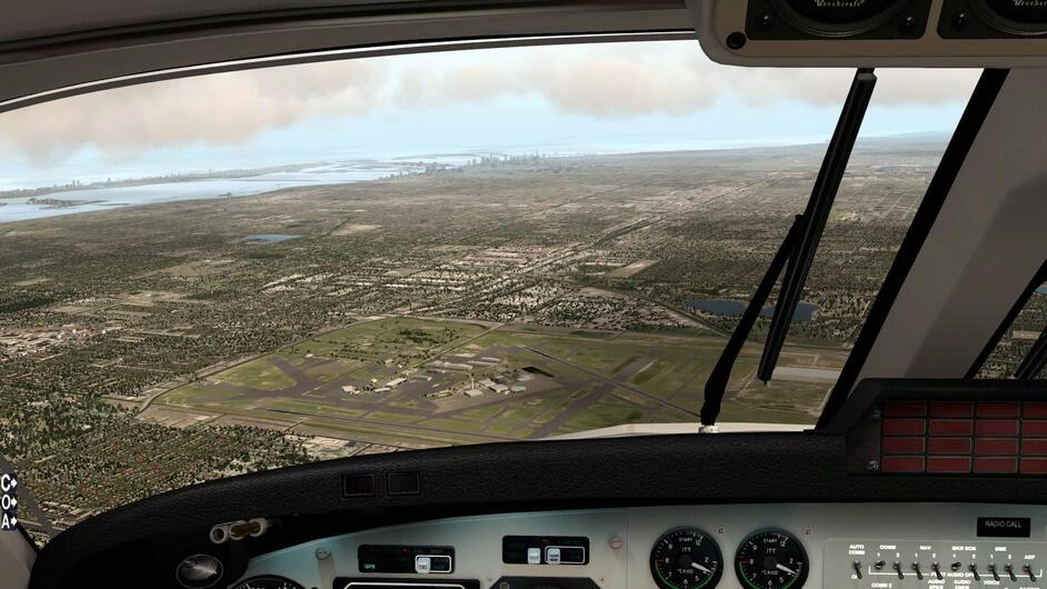
When you get to lake Okeechobee, you begin to start thinking about letting down. Actually, what I really was wondering is if we had remembered the life raft and survival gear. On the south end of the lake at Clewiston, is a great little drop zone with a Cessna 195 and King Air. Well, at least there was one back in the mid 90s when I was jumping out of questionably maintained aircraft. The 195 looks ancient, but theirs had the bigger radial and could climb ferociously. A big old alligator would sun himself by the canal that bordered the east end of the field. With our feet hanging out of the door, we would wave to him as left on another jump run.

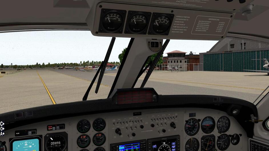
OK, I waited a bit late to start down. “Opa-Locka tower, 404 delta bravo’s in the break.”

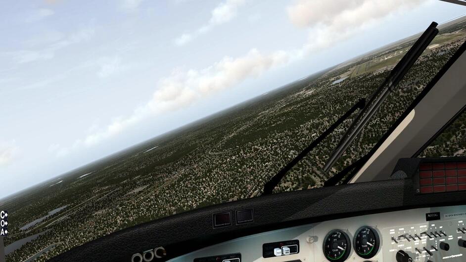
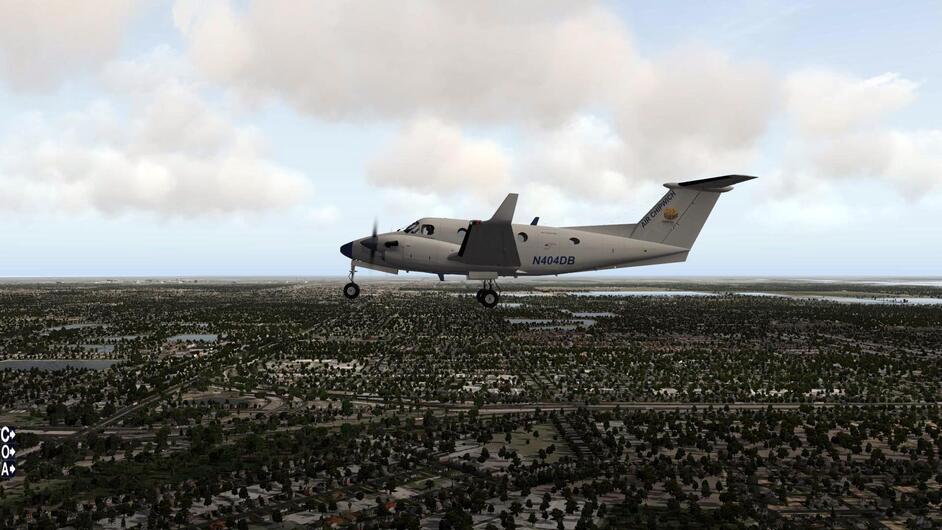
Took it 270 and got a nice right hand for 9L.

Make mine a Cigar City Brewing Jai Alai.

Not bad for “a one eyed fat man”.

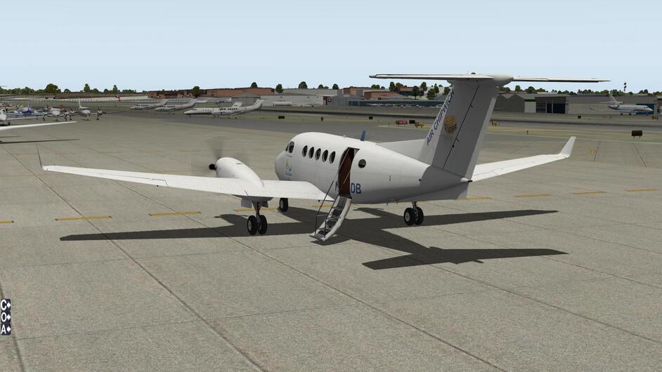
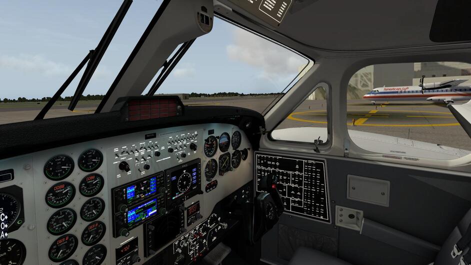
Parking with the big dogs.

Short arrival vid.

X-Plane add-ons used so far:

2 Likes

I’m taking American Airlines back from Rio… :wink:

That looks like a good plan. Good luck…and remember…a $100 bill can do wonders with sticky customs and problems with paperwork with the comandante!

1 Like

Mmm…they have a blackened fish that is really outstanding too. And that turkey sandwich with potato salad. Oh yeah.

Great trip report…and enjoyed the commentary and the video there at the end…!

Me - I’m descending past Vero Beach and changed my destination to KFPR - St. Lucie…

1 Like

Alrighty…arrived safely in St. Lucie - gotta shove the plane in the hangar and let the third shift workers do a bit of work on it tonight… :wink:

BeachAV8R

1 Like

When I watched your video - I noticed Carenado still hasn’t fixed the wrong reading on the AC volts/frequency meter. That should be reading 115v throughout the flight - for some reason they have it modeled reading zero. I’m guessing if you hit the button it probably pops up to 115v, but it should read 115v whenever an inverter is on, and when you press the button, it should bump slightly and indicate 400Hz.

But they did a really nice job of replicating most of the B200 and the feel and look for sure…

Anyone flying along the east coast of the United States - be aware of the restricted airspace today for the launch of the Space X rocket. I love the TFR boundaries - surface to FL18000 - LOL…guess the FAA wanted to be sure (=1,800,000’)

5 Likes