Nice flight with some complex clouds…all went well, full report later…

6 Likes
OK - on the road (or sky as it were) for a short hop from Mountain Air, NC (2NC0) up to Hot Springs, Virginia (KHSP). A bit of weather to contend with…not super low, but enough that I’ll get to shoot an approach into Hot Springs.

Firing up the Garrett engines in Mountain Air…so much for that peaceful mountain morning!

Plugging the route into the GTN 750…

Taxiing to the edge of runway 14…you don’t want to go off the end here…


Smoky Mountains indeed!

About halfway to Hot Springs I input the ILS approach into the GTN, although I’m going to do a green needle approach by flying to Montebello VOR and fly the transition to the ILS 25…

Love, love, love the GTN for the convenience. Need to get an AWOS frequency? Just click on the airport on the moving map, pull up the frequency tab, find the AWOS, click on it and it sends it directly to the flip-flop COM1 window. Really useful stuff…


Heading for the VOR now…

Some beautiful scenery peeking through the clouds…

Intercepting the Montebello transition to the ILS…at 8,000 on this segment…

The ridgelines run in rows out here in southwestern Virginia…

Switching to the ILS and capturing at 6,000’…we’ll bump down to 5,100 prior to the final approach fix…


We break out pretty early and spot the field. The reason I wanted to come here is that I landed at Hot Springs a couple of years ago in the winter, at night, and it was pretty memorable. The turbulence over the ridges was pretty bad…and at night you can’t see all the terrain around you and it is a complete black hole. It is also interesting reading the airport notes with a mention of wildlife, including bears, are to be expected on the airport property… ![]()


Nice leg in some enjoyable weather…
10 Likes
Nice! I will start from KATL, and had planned to go through NC06 following your last report. If you keep pulling interesting airports/approaches like this, I might as well just follow all your steps.
It’s all fun and games until…

2 Likes
Yeah…I’m not actually headed in the right direction…LOL…I think I’m flying a 4,200nm DME arc around Casco Cove at this point…

1 Like

1 Like
I don’t even have a plan whatever. My tracks will probably end up like some random lines with no particular direction
2 Likes
Seriously contemplating ditching the Squirrel jet and getting Beach’s plane with the GTN…hmmmm ![]()
EDIT: Hey @BeachAV8R…isn’t this about where you are flying ![]() …albeit not that high.
…albeit not that high.

1 Like
I’d caution that the GTN is only really usable in 2D - the VR integration doesn’t fully work for clicks. I’ll double check that though…I could be wrong…
That’s about right. That system is supposed to really get wound up today…
Not to divert the thread (too much). That is an interesting point. I have found that most of the GPS in VR are “twitchy” - trying to “turn” the dials is pretty daunting. Fortunately if you click on the screen in VR, most will pull up a 2D window on the monitor and one can slide the VR hood back and use the regular mouse to make the changes. If this can do that, I’d be satisfied. What I’d like to do is get kit in my Carenado Do-228. ![]()
1 Like
OK…they might have changed something…it worked for me.
I got the GTN 750 and added it to my Do-228 (it as a spot already for it). Loaded everything up and I had a 2D popup Windows in the center of my vision in VR. Using the mouse (but not the controllers) I resized it and stuck it off to the side (like you can do with that mostly useless iPad map thing) thinking it will come in handy.
Then I noticed that I could click on there VR version in the cockpit…in fact you can do just about anything (except control the volume knob) - everything works. Its a bit hard to see since its on the copilot’s side of the center console but the quick zoom zoom helps.
I think I need to figure out how to get this installed in my 727. ![]()
2 Likes


Is it me or does the RXP GTN 750 slow FPS to a slide show in VR?
Friday Oct 11, 2019
Leg 2
previous report | teaser shot for this one | next report
The next leg on the way to Santa took me to another of the Nordic (but not Scandinavian!) countries: Iceland!
(Here’s some Icelandic music to listen to while you read this report)
I picked a destination airport in the northwest of the country, which probably carries the @BeachAV8R seal of approval: Ísafjörður Airport
")
Starting this leg in VR (with my new virtual nav charts tablet), I finally appreciate all the attention to detail that went into the cabin of this aircraft: I usually find this exorbitant and unnecessary. In VR, however, it really adds to the immersion.


Look at those prop spinners while we’re taking off from Vagar. For this leg, I dialed X-Plane time back from real-world time by one hour so I took off around 16:30. This leaves me with the required 480 nm / 220 knots =~ slightly over 2 hours needed until sunset.


Most of the route is over sea and clouds again, sticking to FL150 for the unpressurized cabin.
I did have one little mishap, where I was wondering why I hadn’t found any fuel boost pumps after switching on all of the electrical system, internal and external lights, and heating. Turns out they are on the separate fuel panel. I discovered this at cruise altitude, where I had enough energy to buy me the time needed for the fuel boost pumps to fill the feeder tanks.

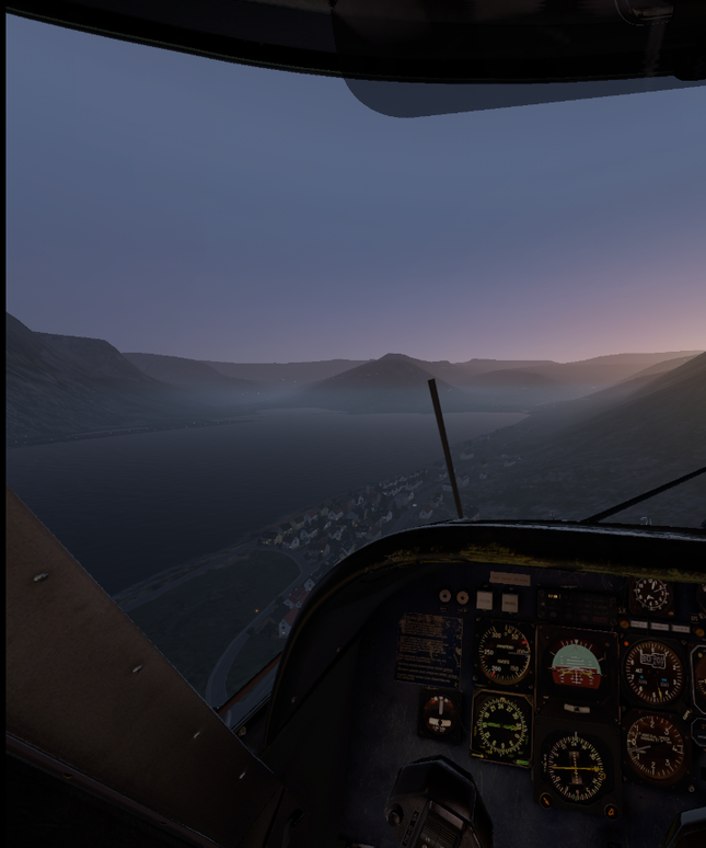
The mountains of Iceland are coming into view.

The route from the Faroer Islands to northwest Iceland has me flying very close to Hvannadalshnúkur, Iceland’s highest peak, which itself is located on the largest ice cap in Europe, Vatnajökull. It is the largest both in volume and area, and there are about 30 outlet glaciers flowing from it.
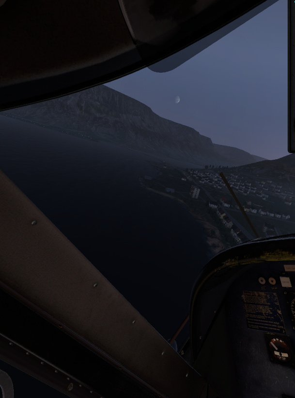
I was happy to just get a glimpse of the peak in the dying light of the sun.

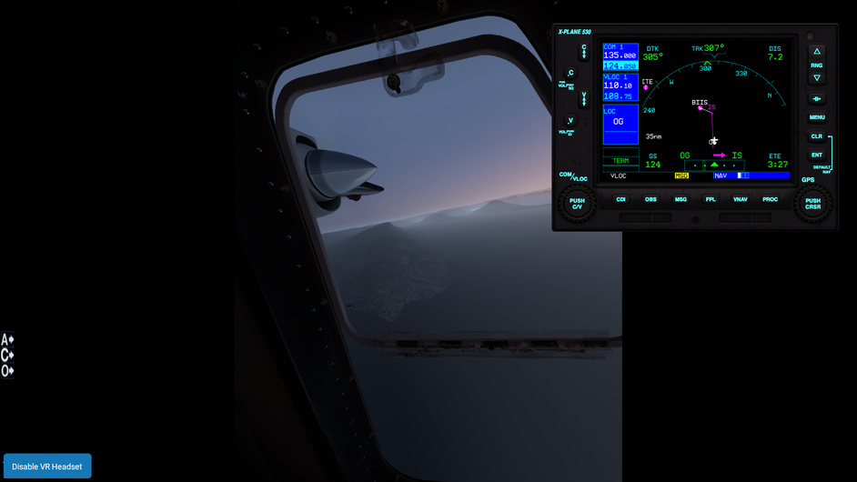
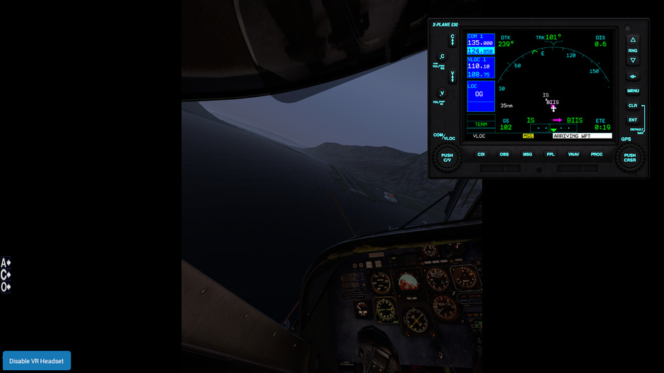
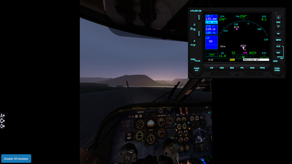
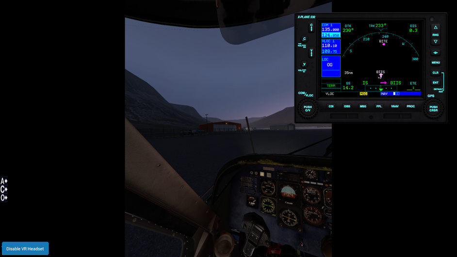
I was very lucky to leave behind all the cloud cover above the northwestern fjords of Iceland. I had carefully planned the approach and was setting everything up to fly it by radio, trying to ignore the GPS as much as possible. The easiest way to set the switches on the GPS to VLOC and check the frequencies is when still in 2D, using the pop-up panel.

The thing is that when I switched to VR, the pop-up panel was still on my monitor and thus is a part of all the screenshots I took during this wonderful sunset approach and landing into Ísafjörður.
There really are a lot of screenshots, and you can choose (I couldn’t) if you want to see the full picture (unedited) or the ones where I removed the parts of the image on the right, below the pop-up panel. They obviously look a lot better, but you are missing the right part of what I was seeing there, so that’s why I included both underneath the next spoiler tags.


Same but edited to remove the 2D G530 popup from the VR screenshots


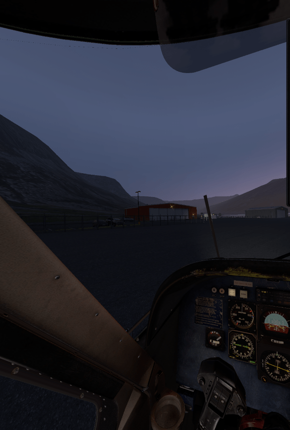
The typical Nordic red adorns the main hangar
After landing, and shutting down the engines, I just sat there, enjoying the empty cabin that still smelled of the Vikings I had just brought up here, watching the last light slowly fade behind the mountains. Oh how I missed those mountains in ‘le plat pays’.
And how I love VR. I’ll drink an Icelandish whisky to @PaulRix tomorrow!

11 Likes
Having failed with every long distance flight since the first one I took part in 3 years ago, I’m not going to plot my intended route, but just going to head in the rough direction and see how far I get.
Due to a house move (last years xmas flight failure excuse) my starting point will no longer be from Blackbushe airport (EGLK), but a very small farm strip (Lane Farm) labelled (XEG7LF) in XP11.
So to, kick off, here’s leg 1 of my “heading west towards where everyone else is headed, but I might not get there” flight which happens to have an ending time of Christmas.
Leg 1: Lane Farm (XEG7LF) → Cardiff International airport (EGFF)
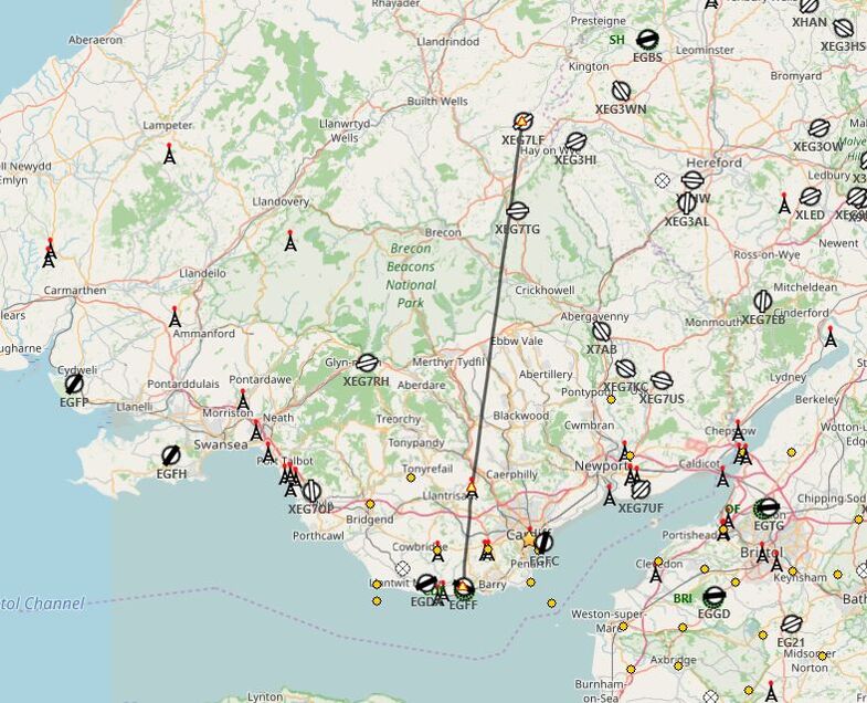
Leg 1 - middle of nowhere to Cardiff
Takeoff was scheduled for earlier in the day, but driving rain across most of the west of the UK all day and with the weather forecast to improve made a later start more appealing.

Sure enough by the time I started at 5:45pm, the sun was out and the skies clear.
I picked the Aerobask Robin to get me to Cardiff because it seemed in keeping with the rural nature of the grass strip. It’s also free. ![]()

Off we go.

Its a fairly direct VFR flight planned. Turning south after the climb out.
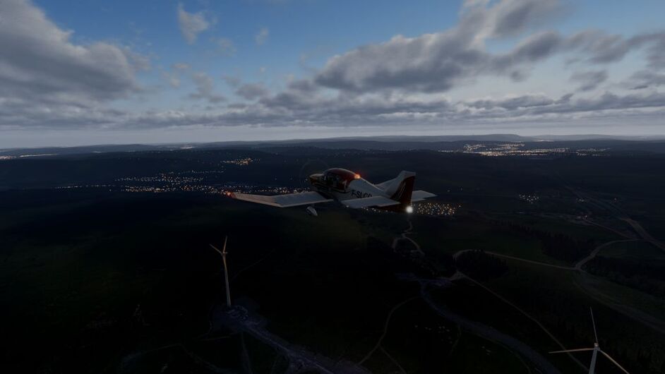
Levelling out at around 2-3000ft to clear the Brecon Beacons and the wind farms in the area.

Cardiff in sight off the left. The airport is dead ahead.
I overflew the airport out to sea to approach over the Bristol Channel.

Turning on to finals

Just about bang on

Touchdown
Leg 1 complete. A nice short 30 minutes to check my install and all the updates I needed to install. I really enjoyed the Aerobask Robin, a nice aircraft to fly short hops like this and you can’t argue with the price.
Now what to choose… something with longer legs.

Its unsupported, far too complicated for my meager aircraftsmanship. I’m likely to crash it and/or mismanage the fuel.
Its going to be perfect. ![]()
13 Likes
Whoosh. If only DCS looked like that at night!
2 Likes
Last year was New Year’s Eve…which I got to a day early by heading east and crossing the international data line. ![]()
1 Like
Another leg in the books! It gets dark early so high up north, but I managed to land in daylight again! This time using real-world time!

Report to follow (hopefully not a week late again)
6 Likes
Hilarious! Oh man what a riot! too soon?
6 Likes