I wonder if that’s an old fashioned turbojet with a spool up time measured on a calendar…not helped by altitude I’m sure.
Nice job pulling your bangers out of the fire!
I wonder if that’s an old fashioned turbojet with a spool up time measured on a calendar…not helped by altitude I’m sure.
Nice job pulling your bangers out of the fire!
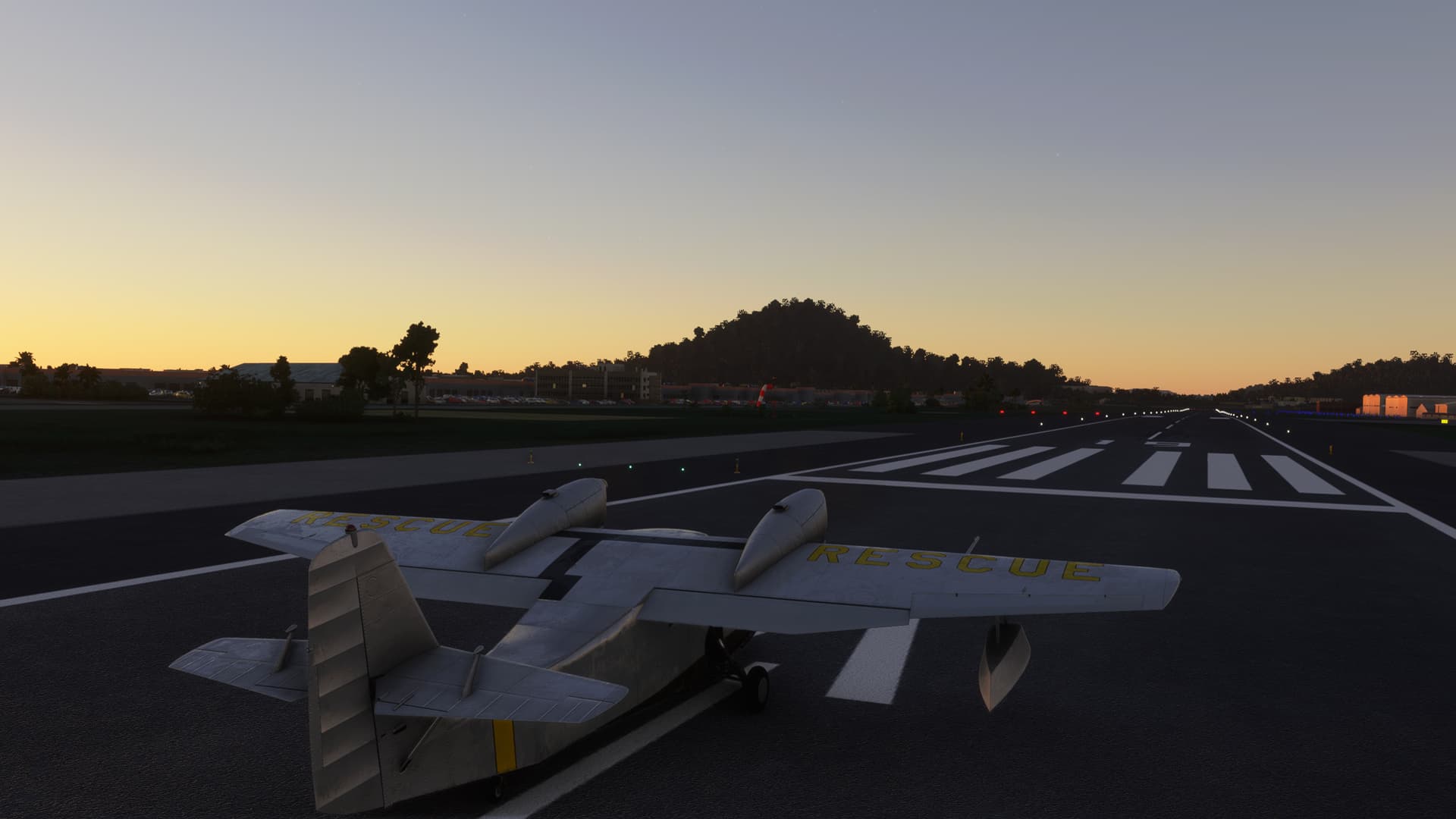
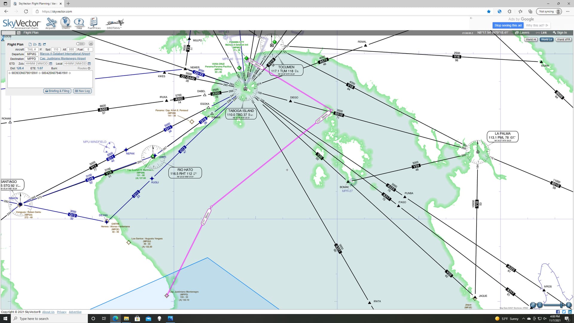
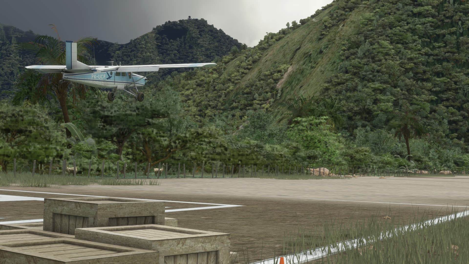
Leg 16: Panama City (MPMG) TO Pedasi, Los Santos (MPPD):
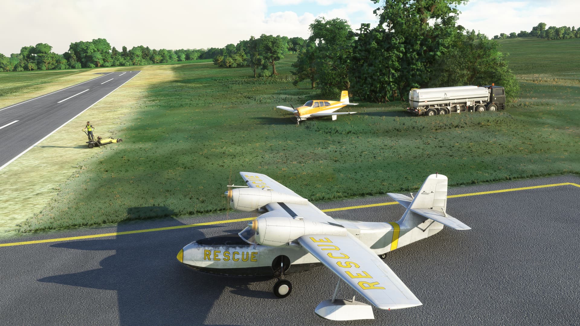
OR Operation Boomerang
After buying the SAR guy who pulled me from the wreckage of my last aircraft a few Mojitos, I convinced him to let me borrow his plane.
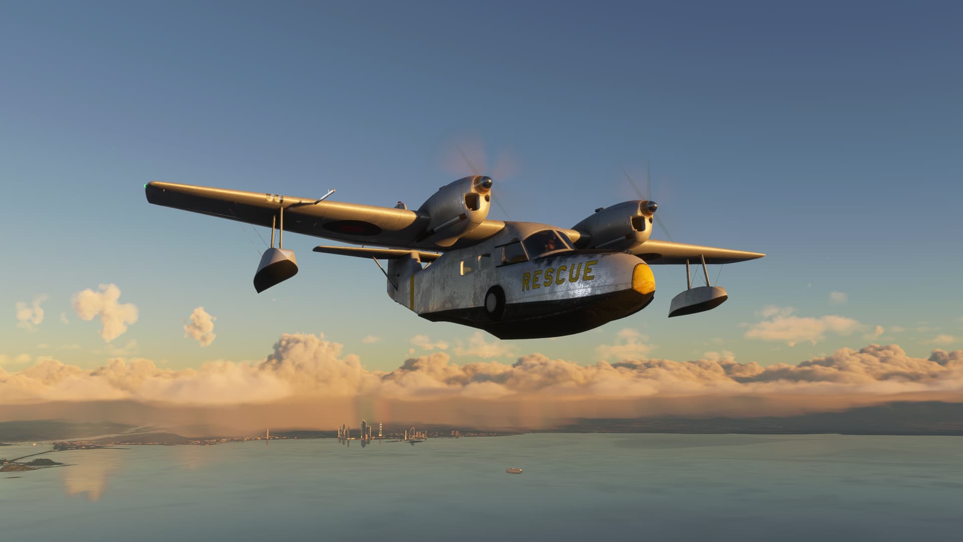
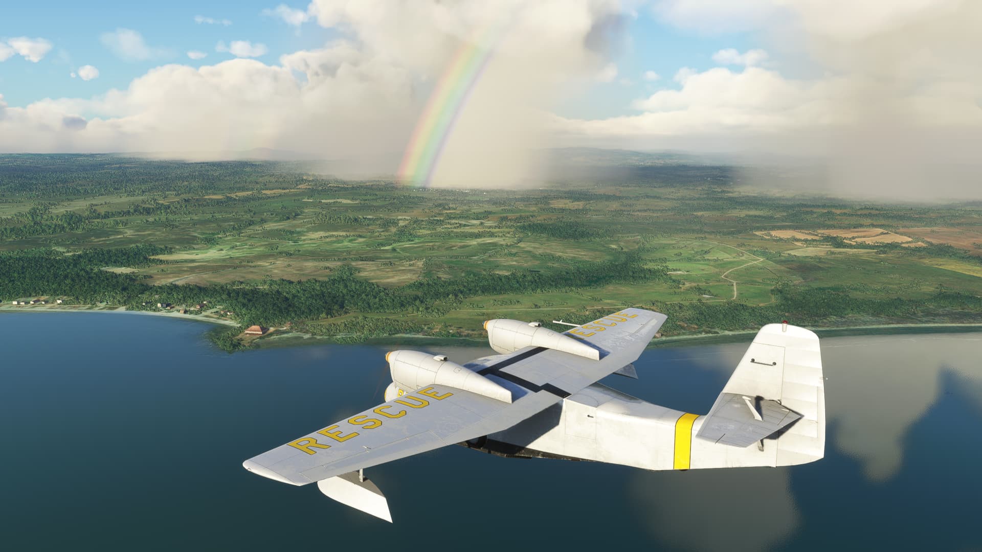
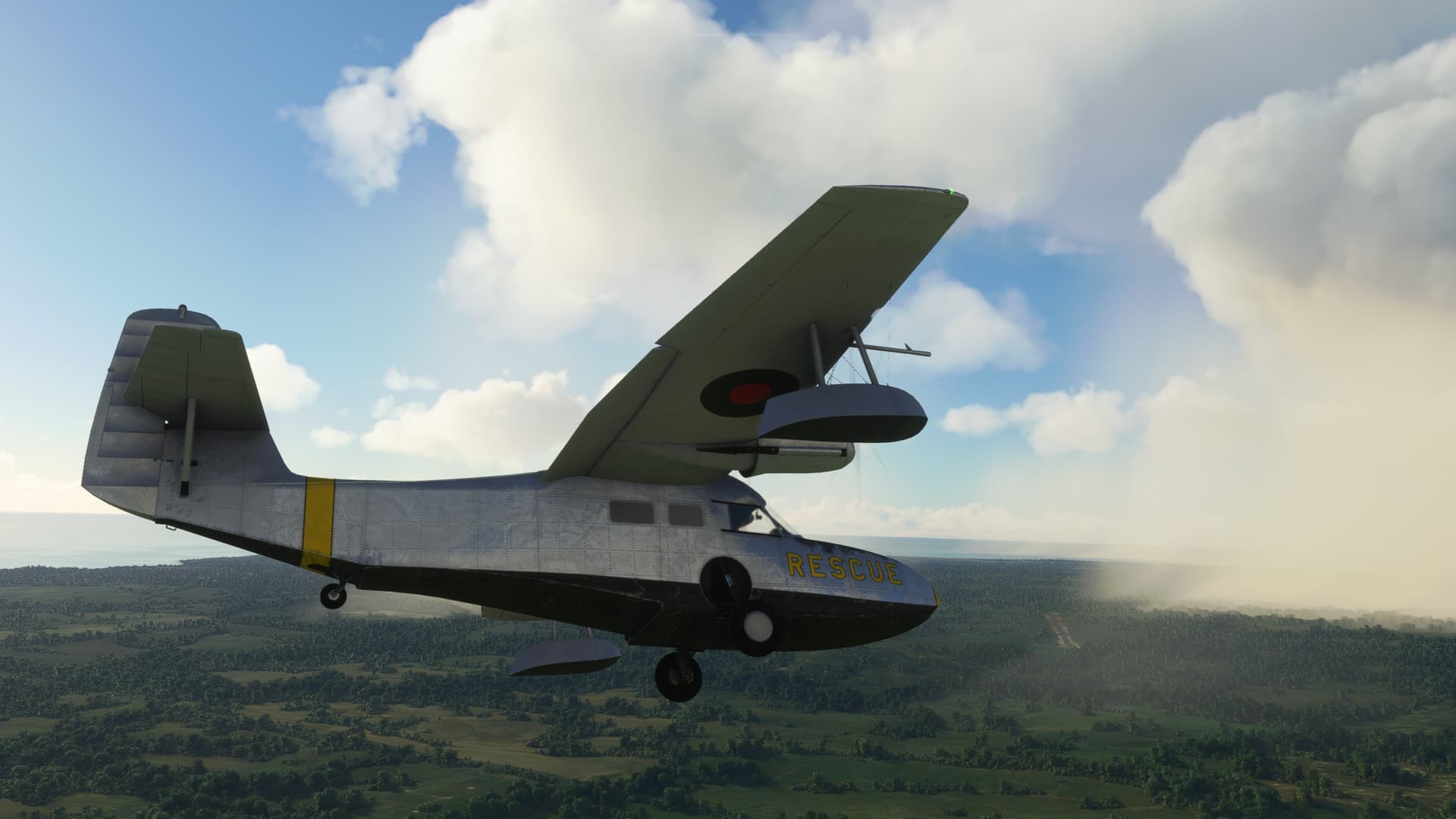
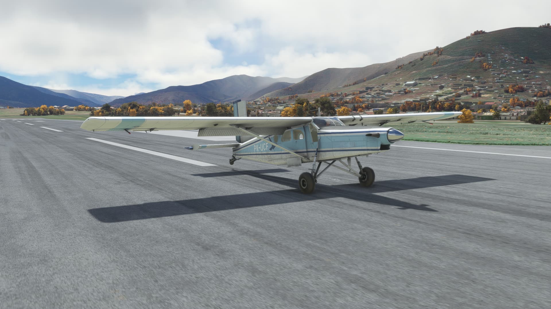
Back to the Widgeon. Much like @Bearhedge , I like the word, “RESCUE” printed in large, friendly letters all over the plane. “It’s the first helpful or intelligible thing anybody’s said to me all day” so sayeth Arthur Dent.
Although in my case I’m not certain whether it’s an offer, or a request.
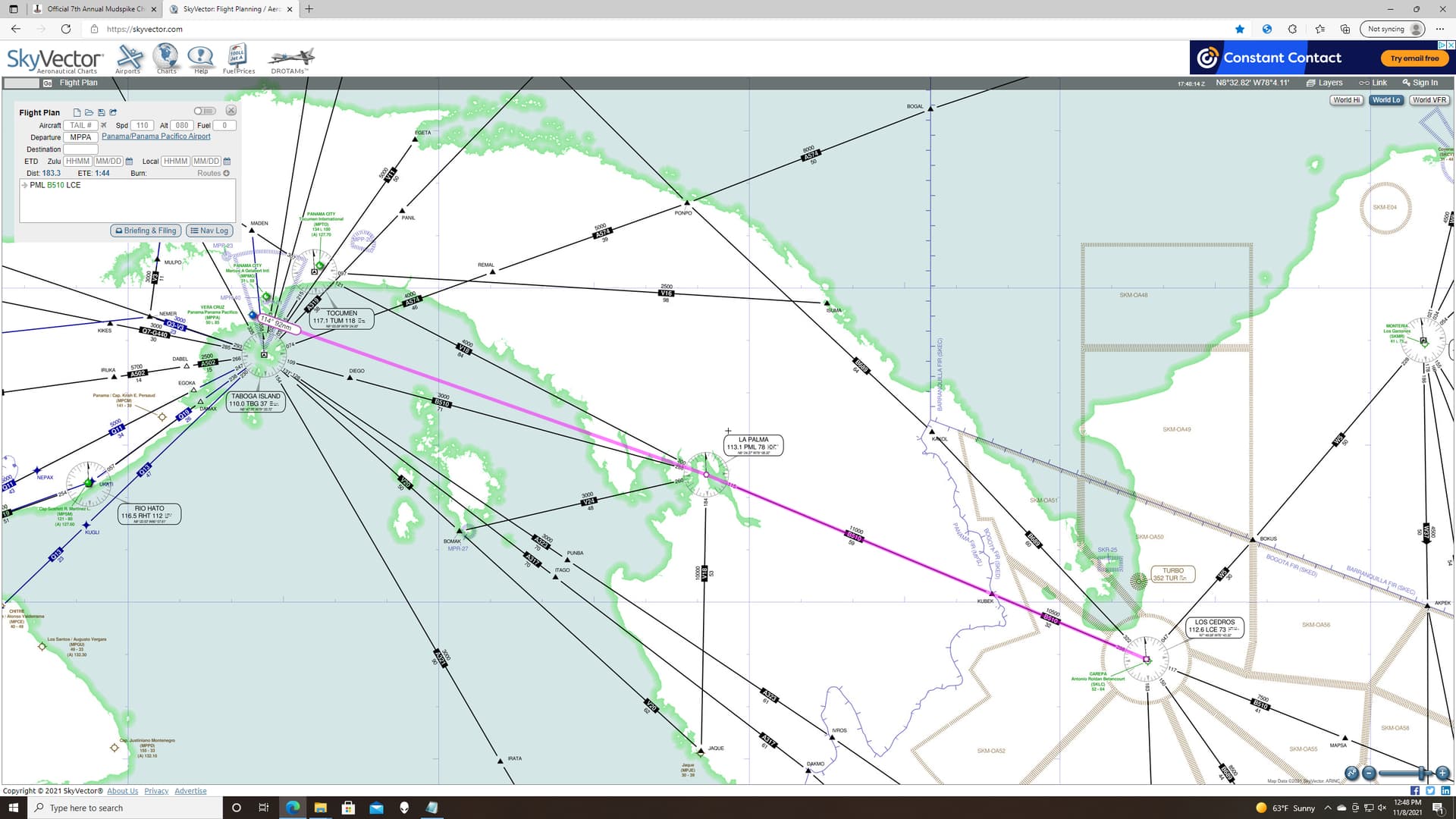
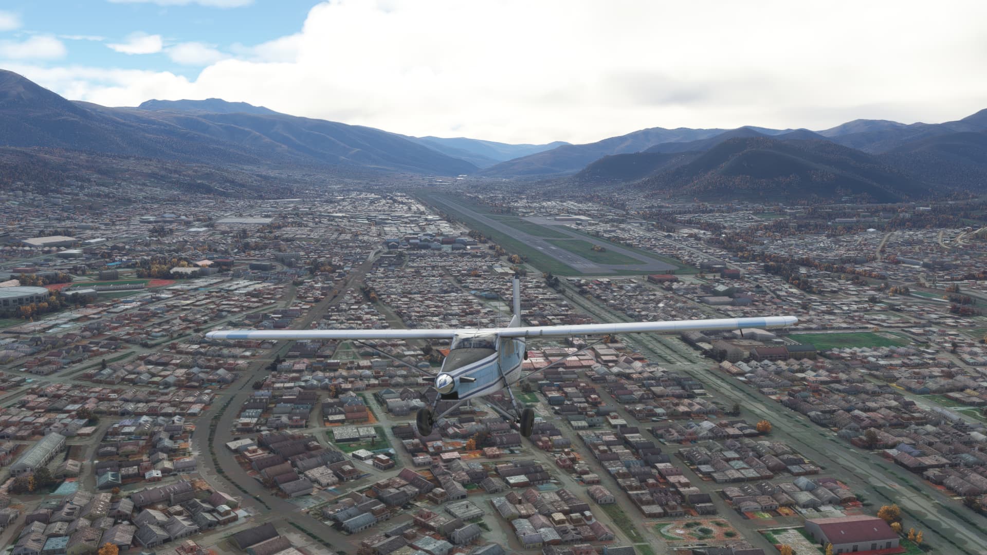
My plan for today was to make my way from Panama to somewhere definitively no longer in Panama.
Colombia seemed reasonable.
Were I to be honest, I had lost a little of my joie de vivre in picking airfields after the last leg. But after some cross-checking, SKLC, which sits at the base of the Gulf of Uraba seemed like it had a reasonable likelihood of being there when I arrived.
You know, which is nice.
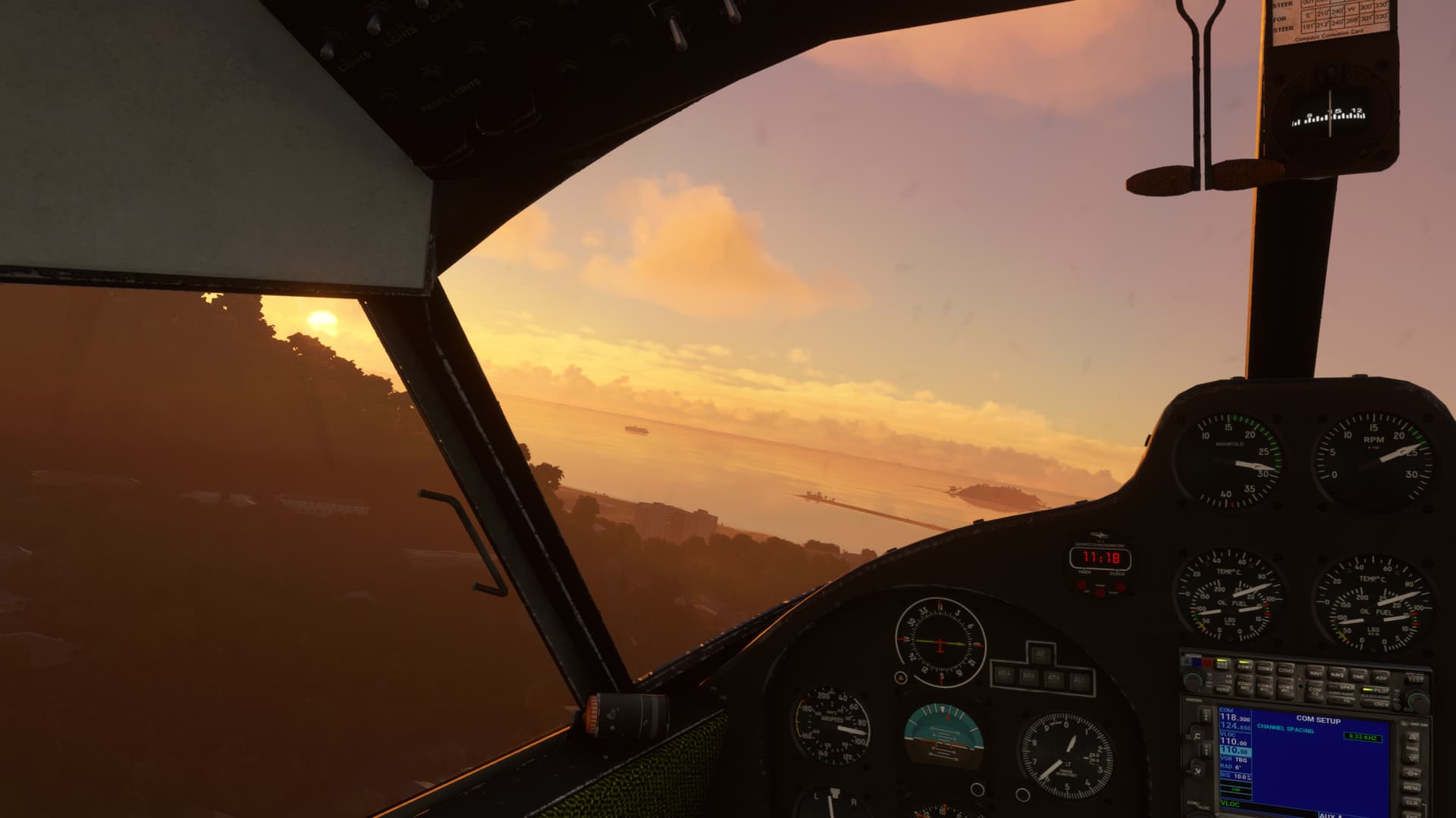
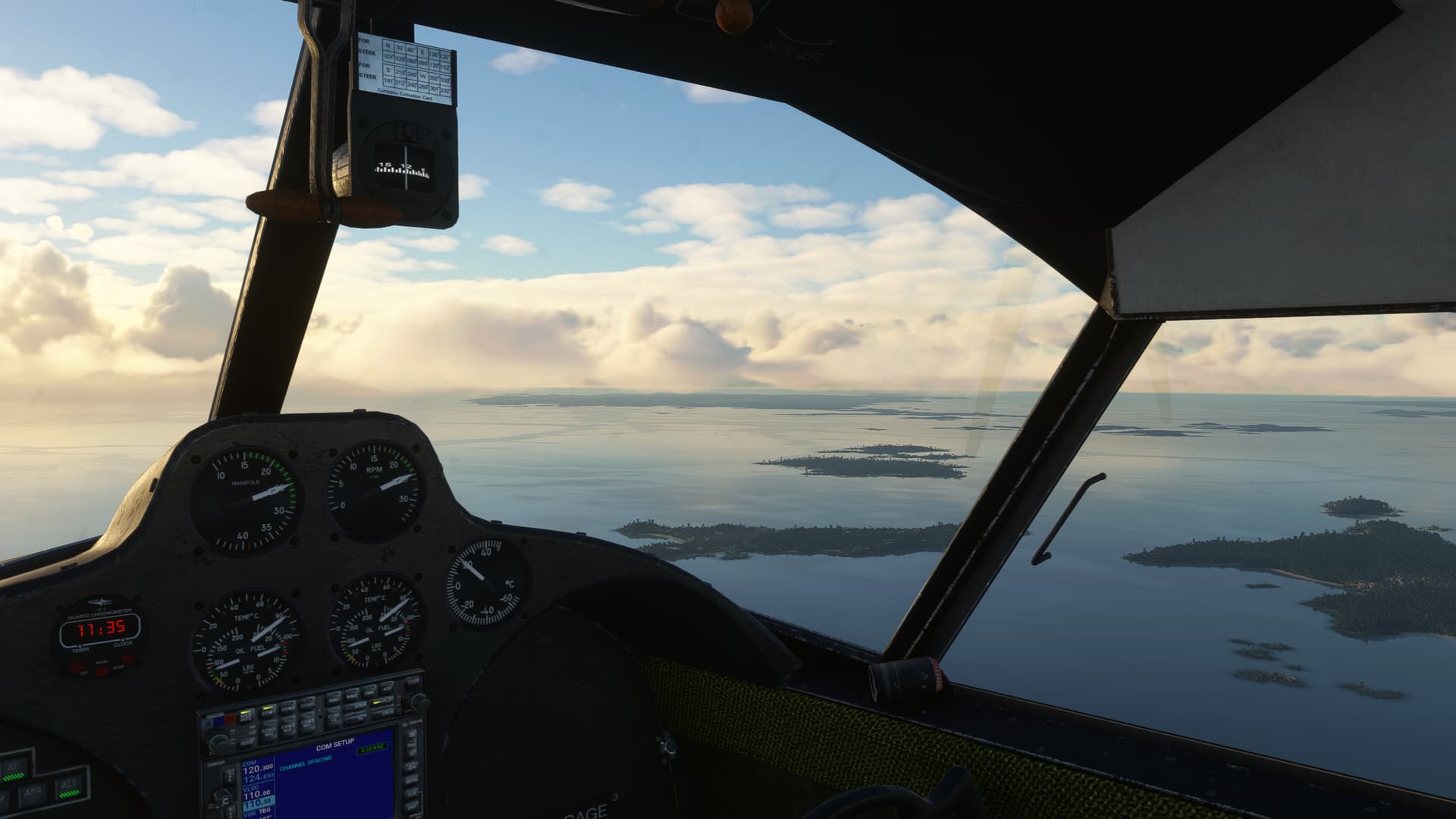
So, off I went on a cloudy coastal morning hooking a left hand turn around around Quarry Heights, just to the left of my departure course.
While it certainly makes sense, I guess I didn’t realize what a sprawling metropolis Panama City was. Remarkable.
I left the coast behind me and set a heading to pick up B510 south of TABOGA ISLAND (TBG). Now with working CDI!
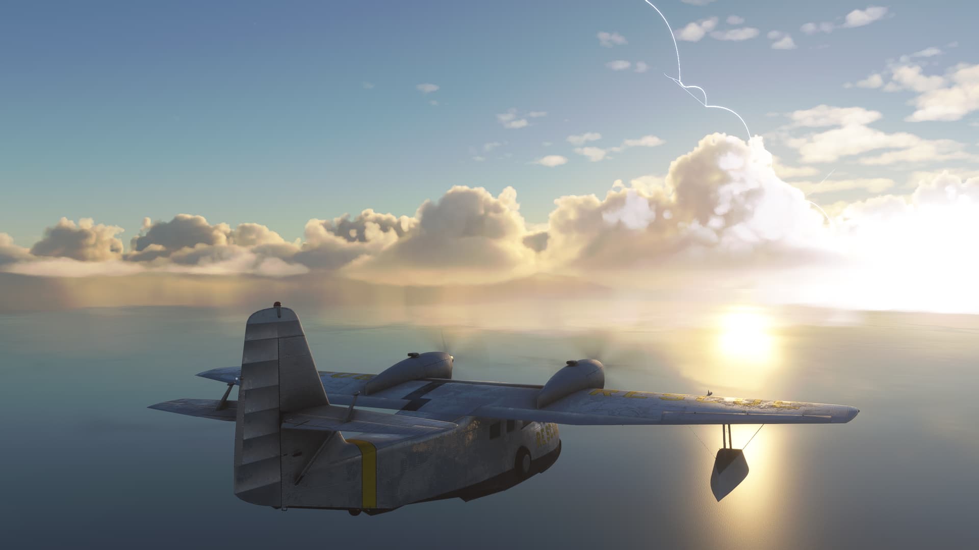
Looks like more storms in my future.
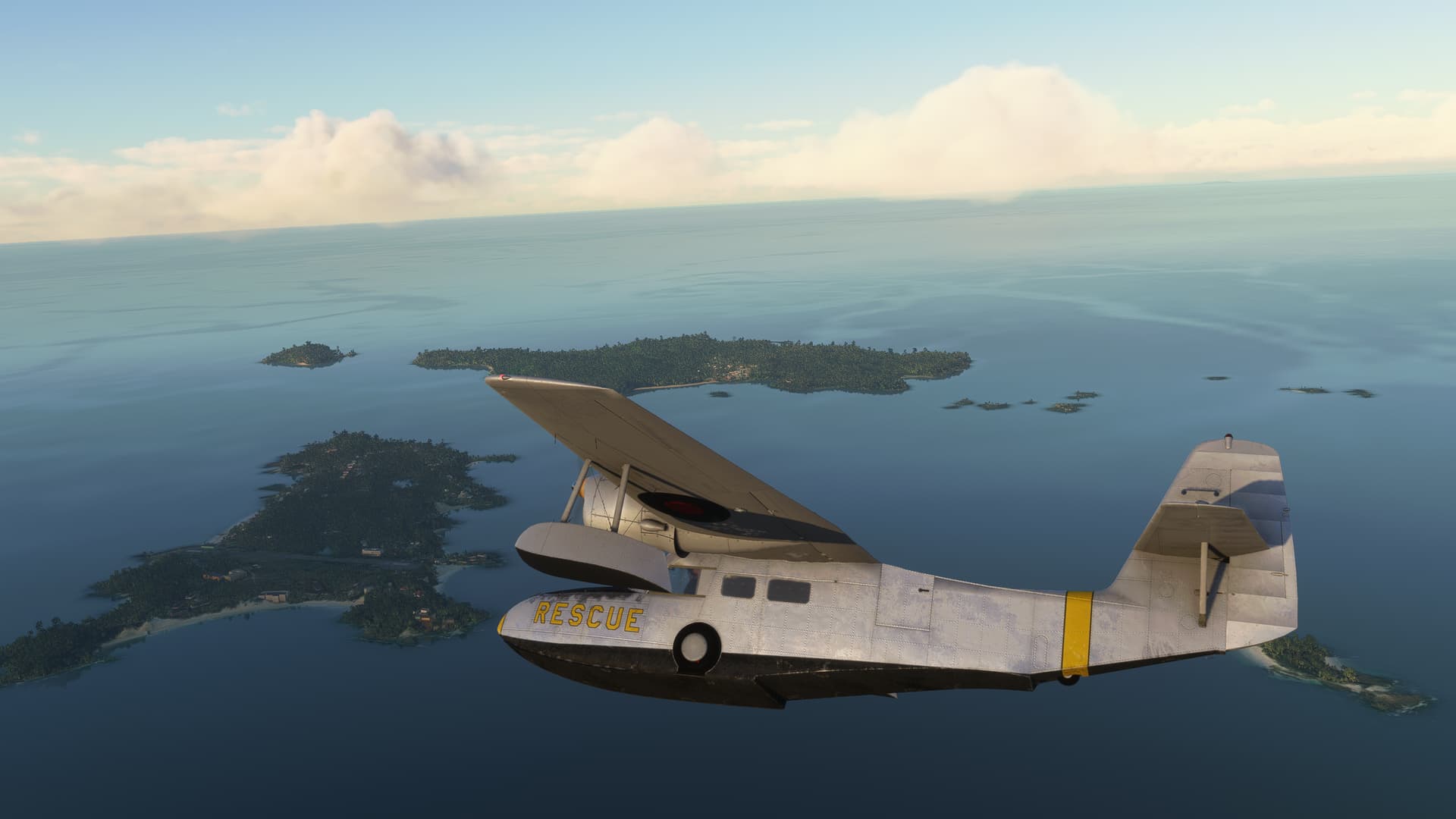
It was right about the time I hit Saboga in the Gulf of Panama that I began to wonder (I think we’ve seen how this movie generally plays out)…
“Hey, arent’t the Galapagos 'round here somewhere?”
I checked out Skyvector. As it turns out, yes. If you consider 800 miles, “'round here somewhere” then yes, the Galapagos are.
It was too big of an opportunity to pass up, but I was pretty dubious that the Widgeon had the legs for it. So I quickly decided to double back and find a fuel stop somewhere along the Panama coast.
Yeah, I know that it would have been technically shorter to fly down to Equador, then over. But this seemed like it was at least sort of on the way (Don’t give me that look).
And round she goes. Where she stops, nobody knows. Heh, if I had a nickle…
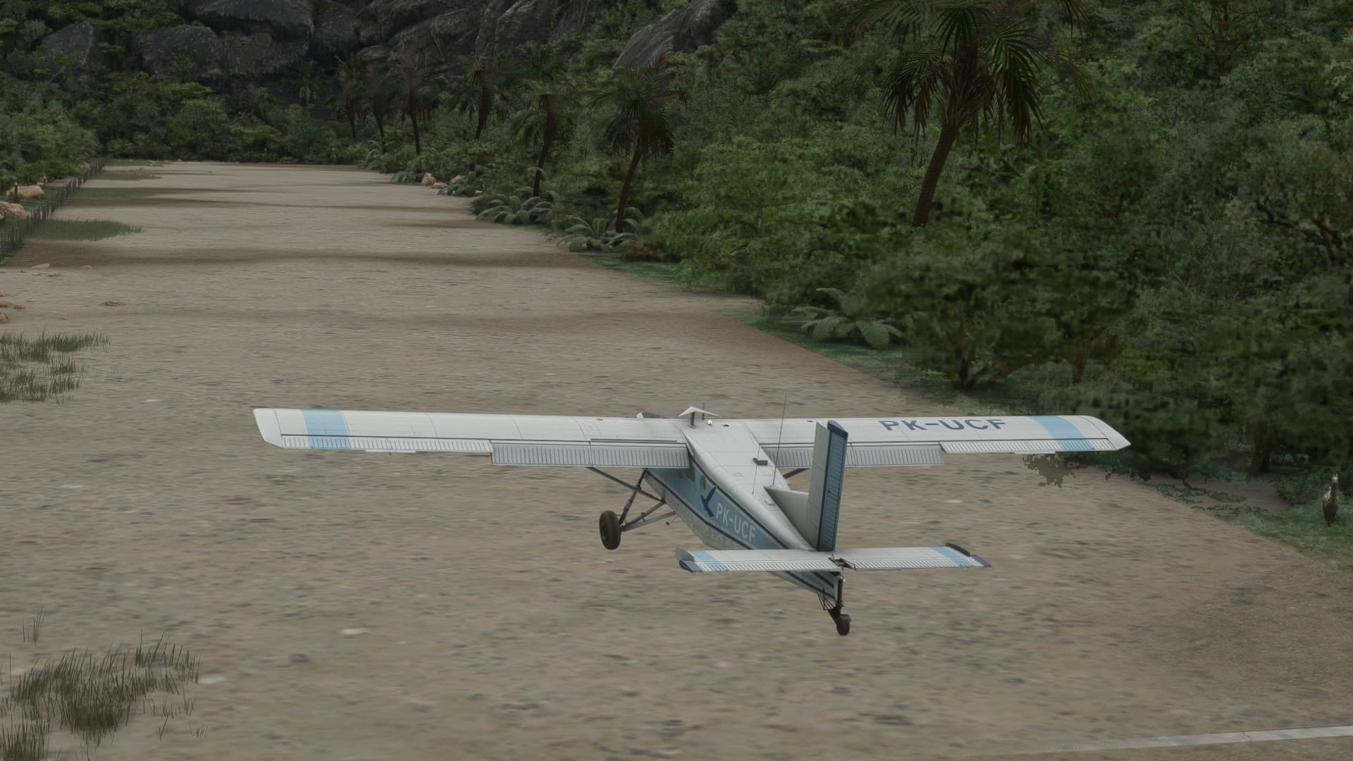
I hooked a southwesterly heading to intercept my best guess course from TBG to Cap. Justiniano Montenegro (MPPD) in Pedasi, Panama. My new destination.
This kind of violated my new rules for MSFS airfield selection and this one was not a major airfield, so I just hoped that it was there. And VFR.
Which wasn’t looking exceptionally promising…
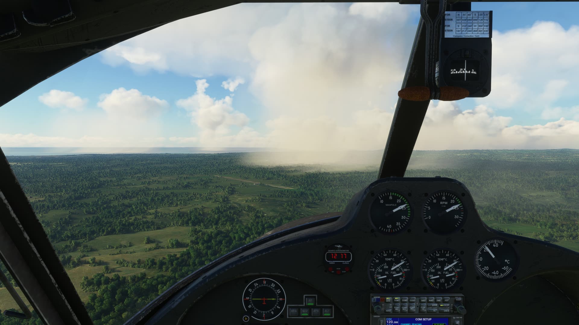
But, this time the rainbow did bring good luck. Other than the wandering shower, the coast was clear. So to speak.
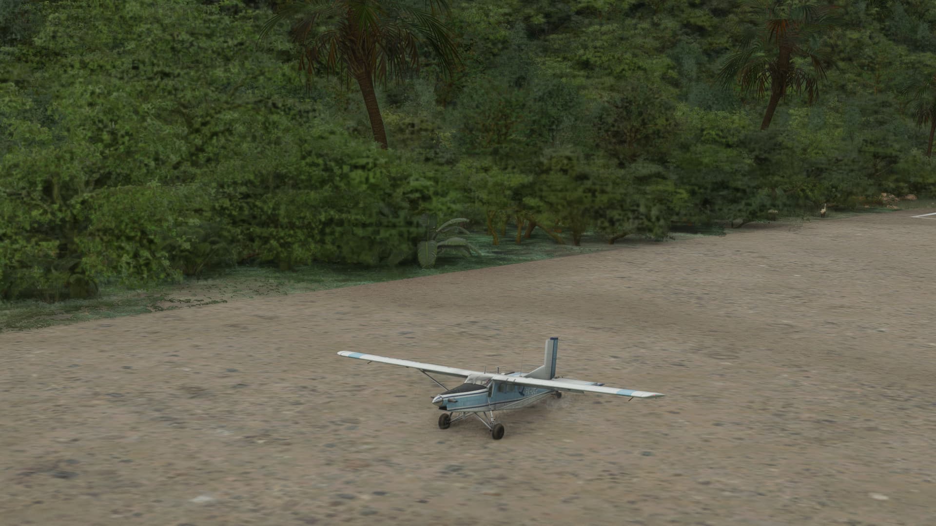
The field looked a little short, which concerned me. The only plane that I had with sufficiently long legs to reach the Galapagos, comfortably, was the DC-6. Not sure if this runway is going to be long enough.
Well, I guess we’ll see.
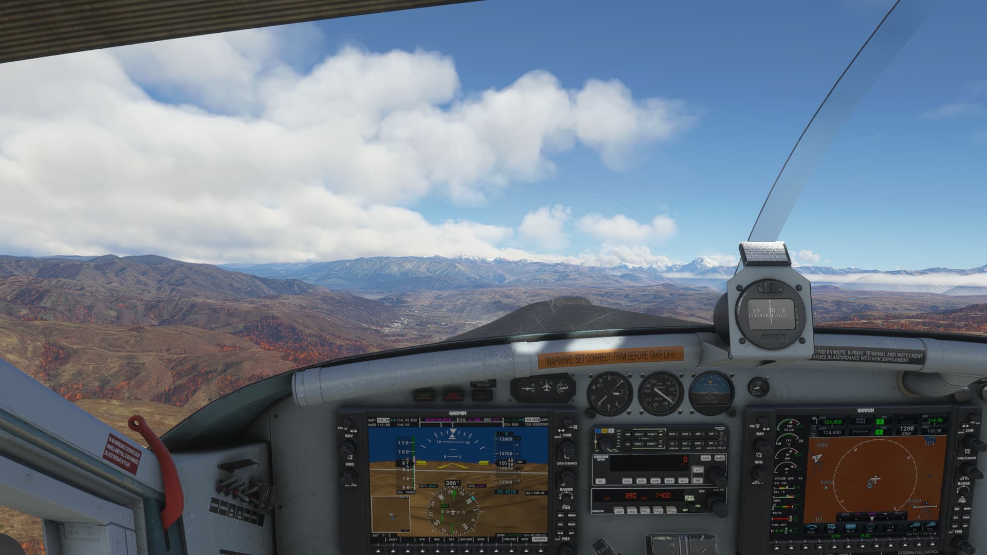
The G91 is a late 50’s design, with a Bristol Siddley Orpheus turbojet…so, it does indeed take awhile to spool up. I should have kept the power up on the base to final turn… a rookie mistake if I ever saw one (or maybe I am just spoiled)… ![]()
Leg 17: Pedasi, Los Santos, Panama (MPPD) TO Baltra/Seymore Airport, Galapagos Islands (SEGS)
OR I shot a Douglas into the Air…
“I’ve got a good feeling about this”.
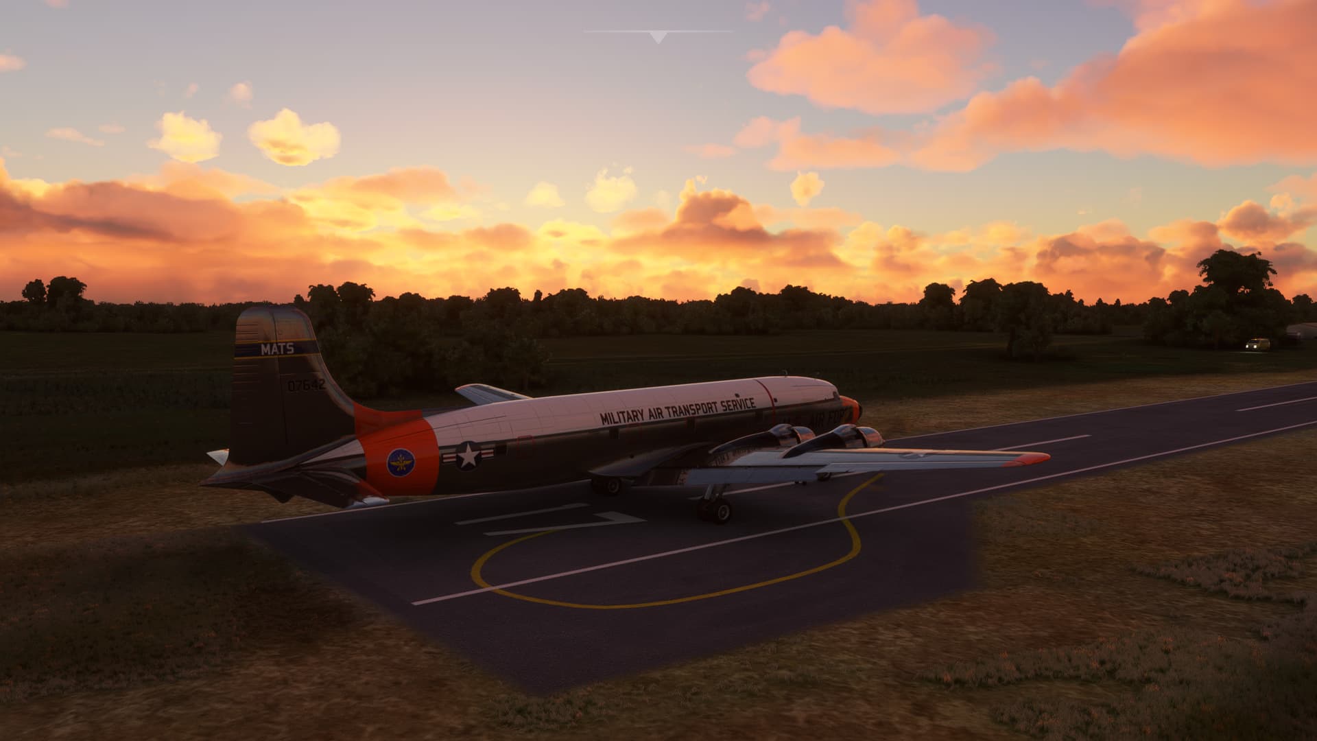
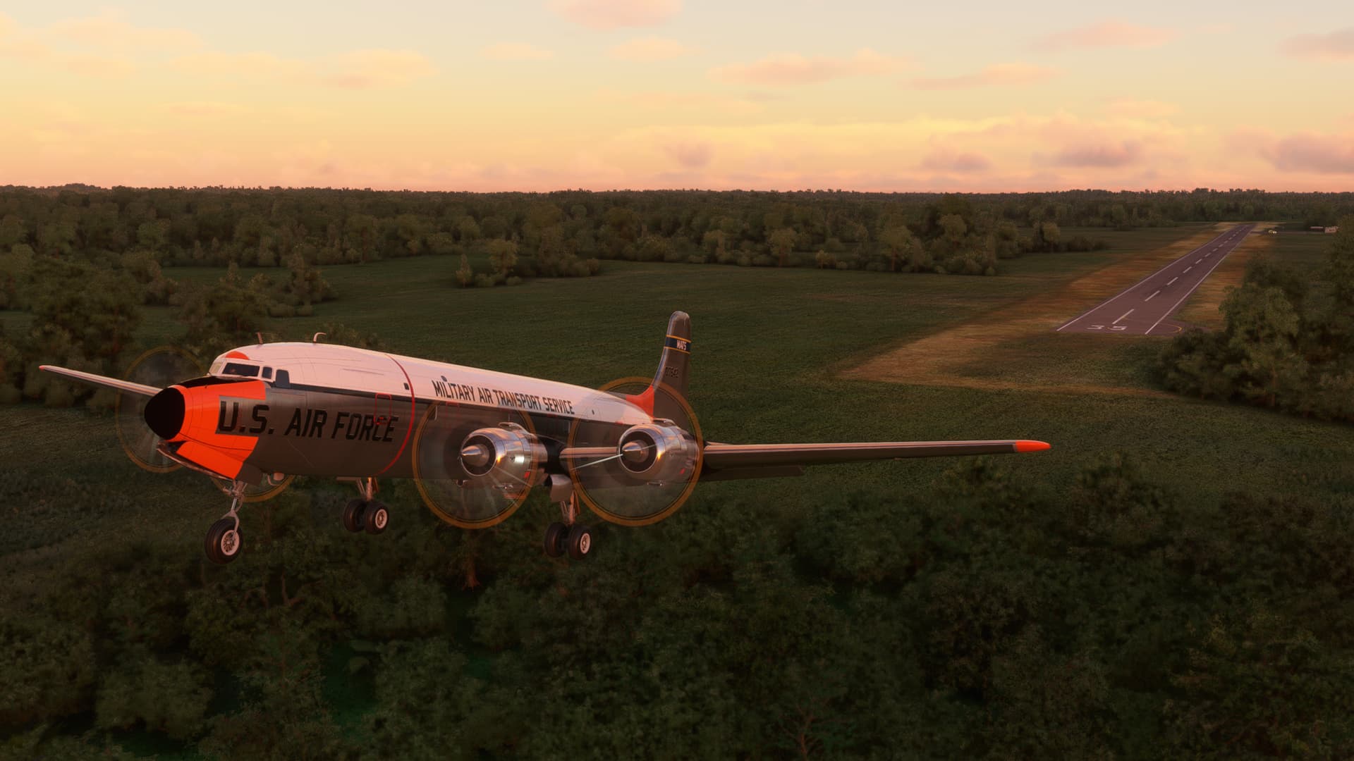
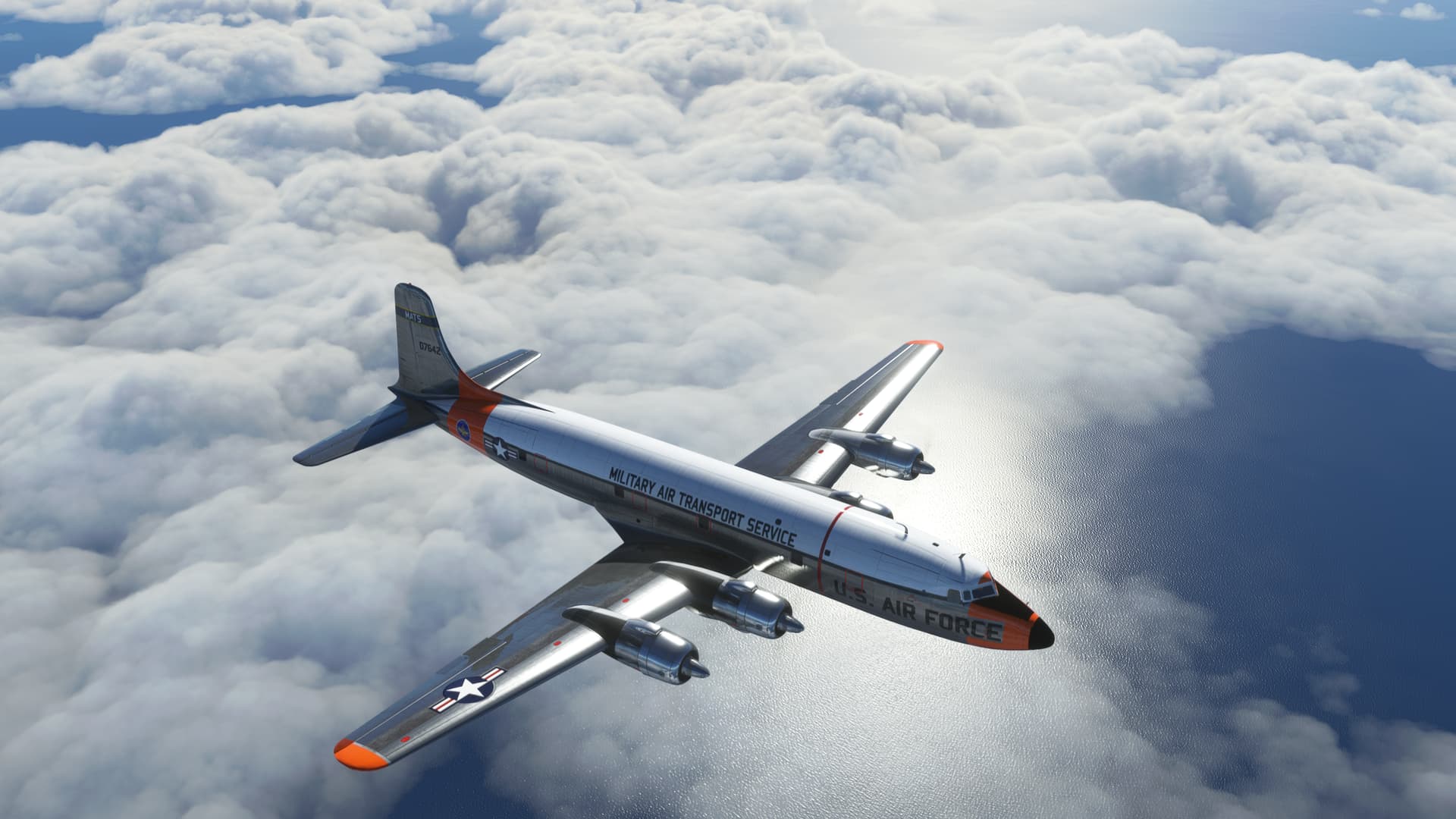
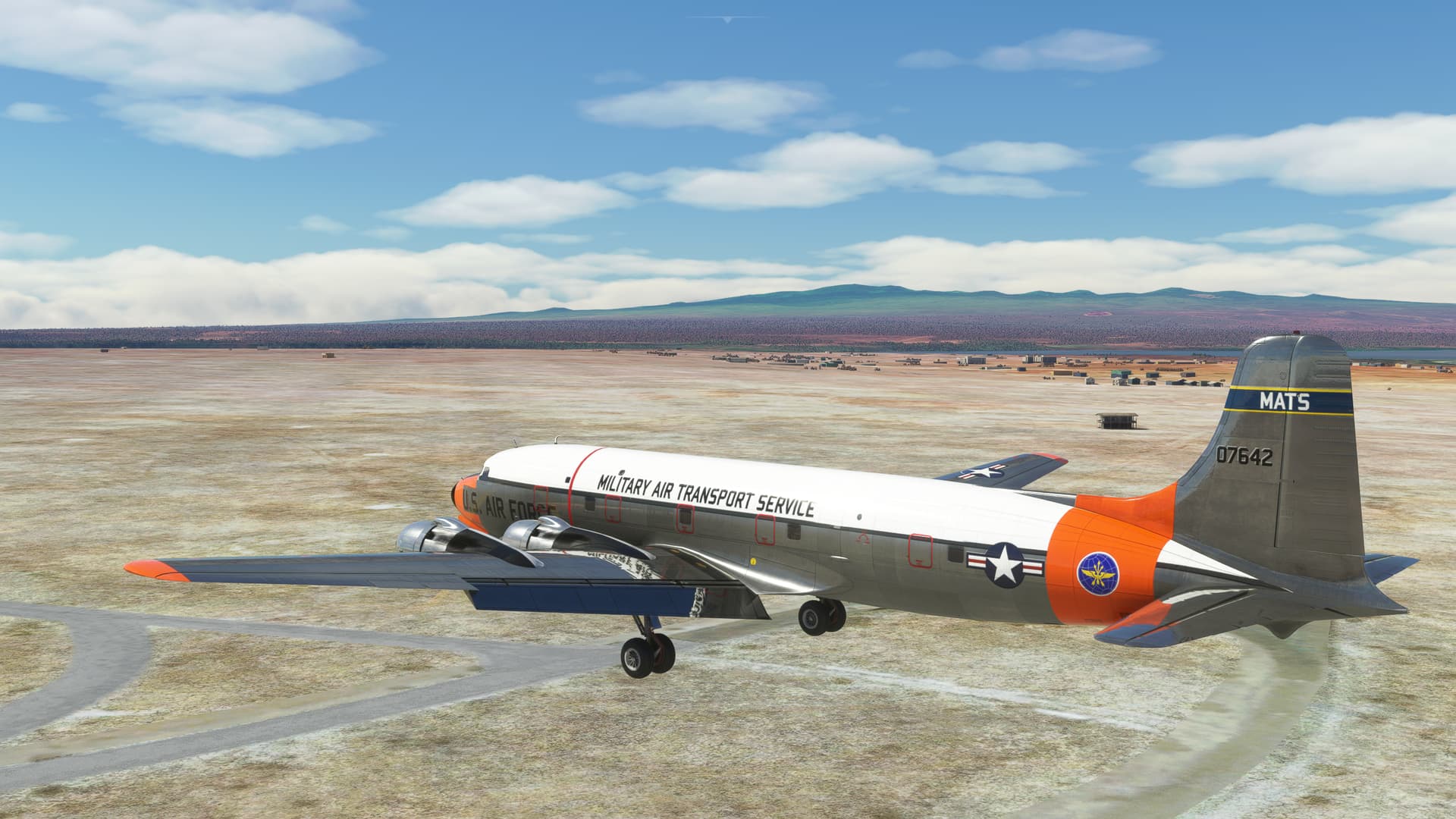
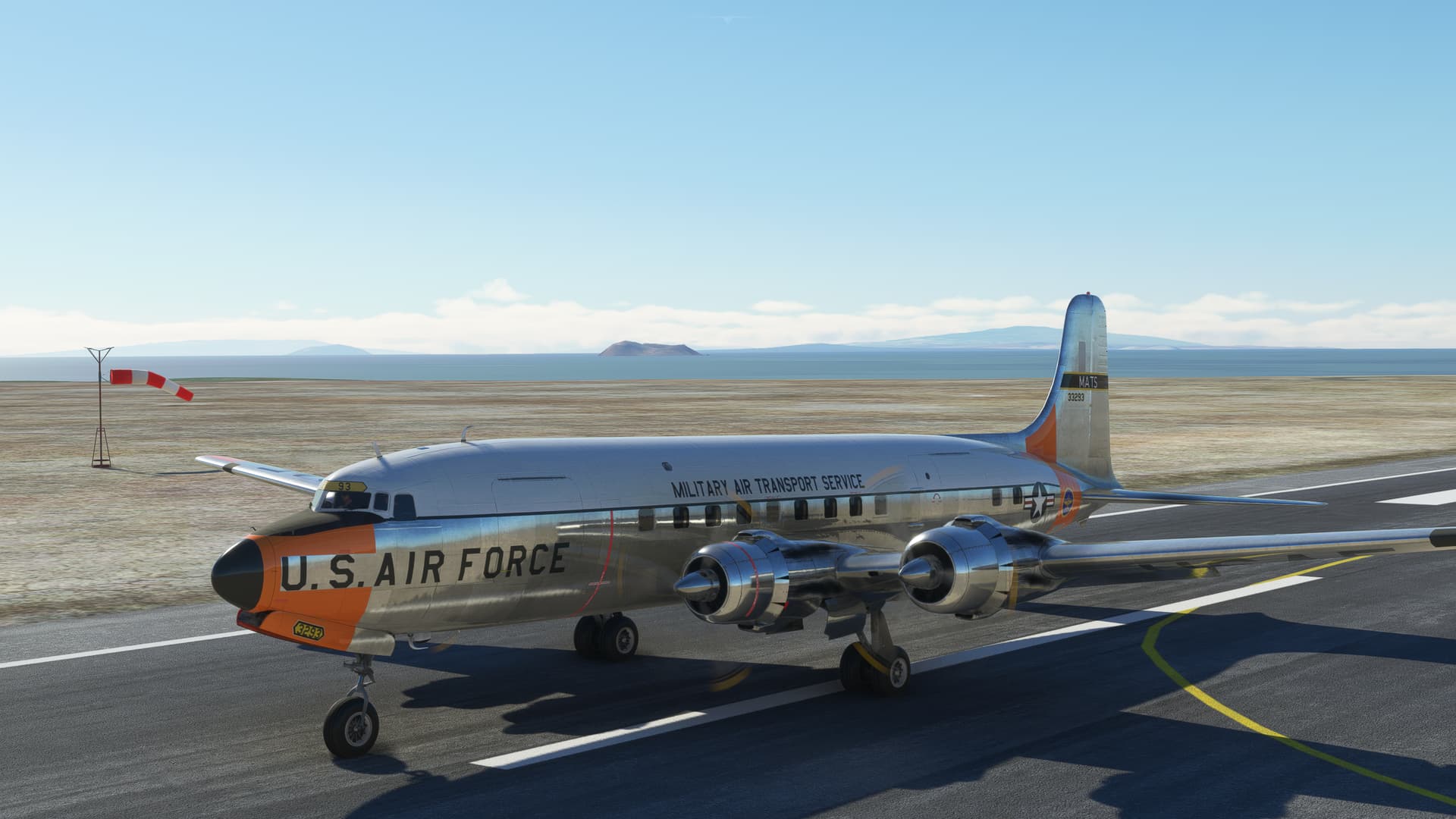
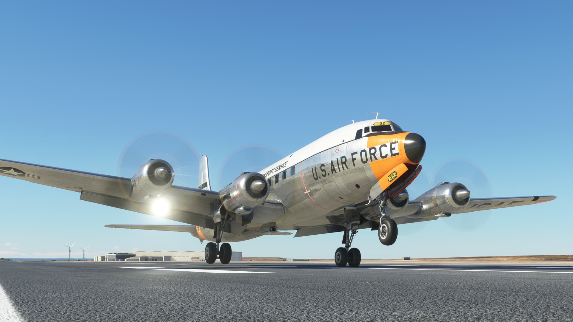
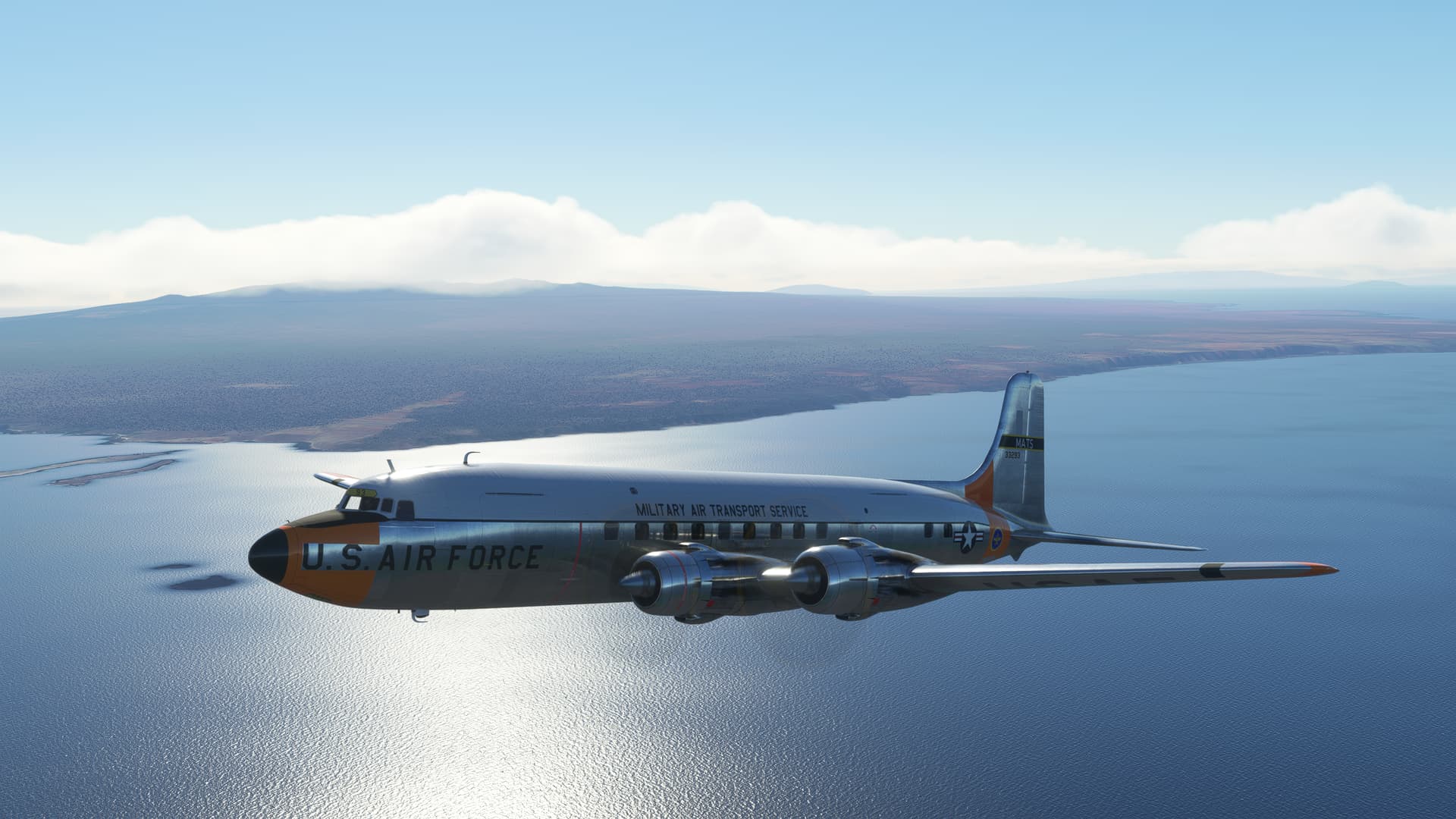
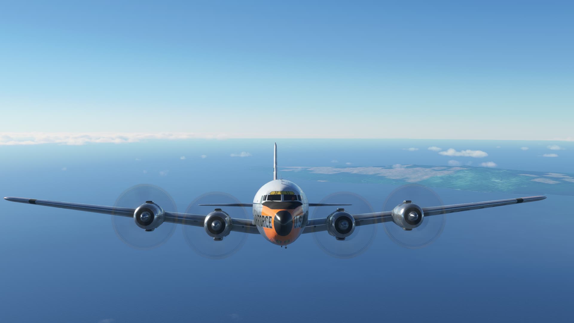
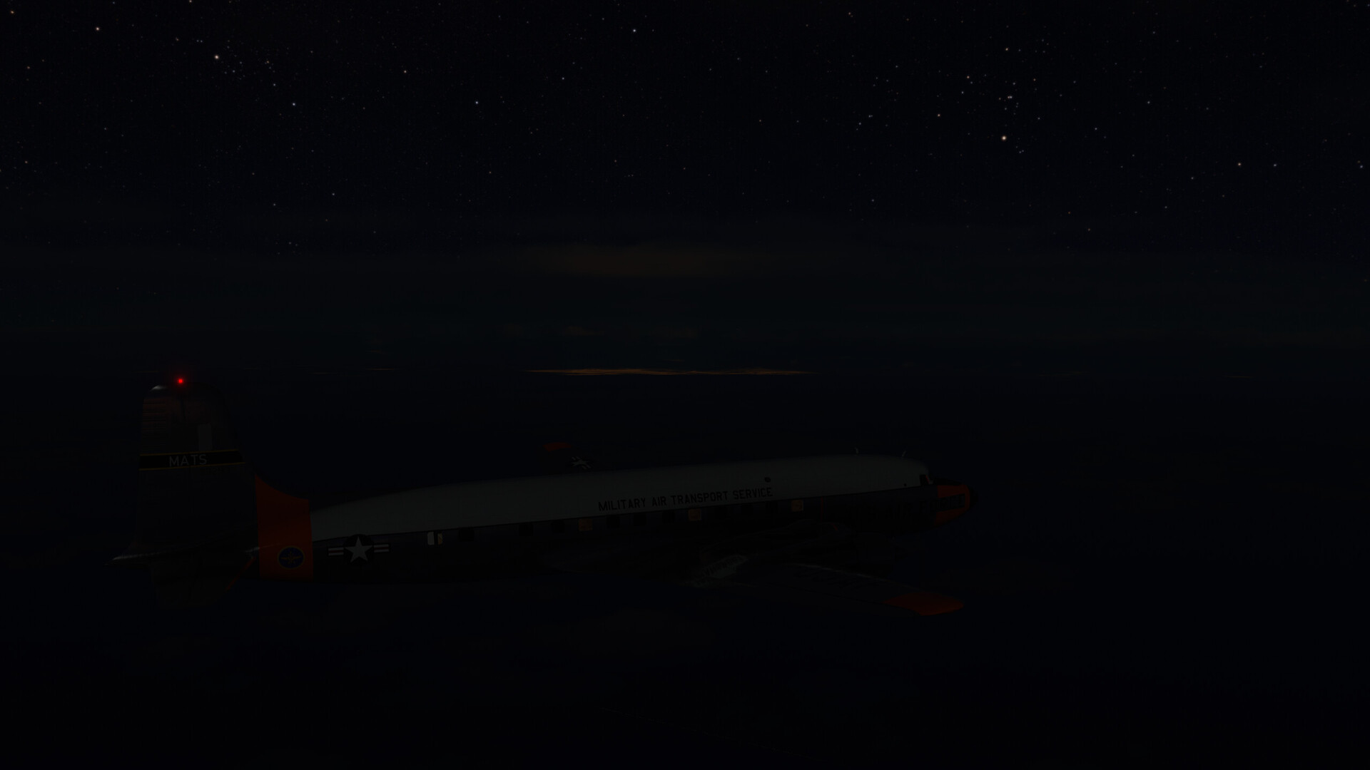
As I said, I really had only one plane that was going to hack this flight. It was the DC-6, now in the livery of the Military Air Transport Service (MATS) by VFR_Sword. I thought the orange might come in handy.
Not sayin’. Just sayin’.
The runway was only a little over 3,000ft, with trees at the end. This was going to require some cypherin’. I needed enough fuel to take me the 770 odd miles to the Galapagos. But not so much that I wasn’t going to be able to clear the trees at the end of the runway. I didn’t even consider reserves. This was going to be Blue Water ops all the way.
Here’s MSFS trying to kill me (again ![]() ). Nice try!
). Nice try!
That’s better.
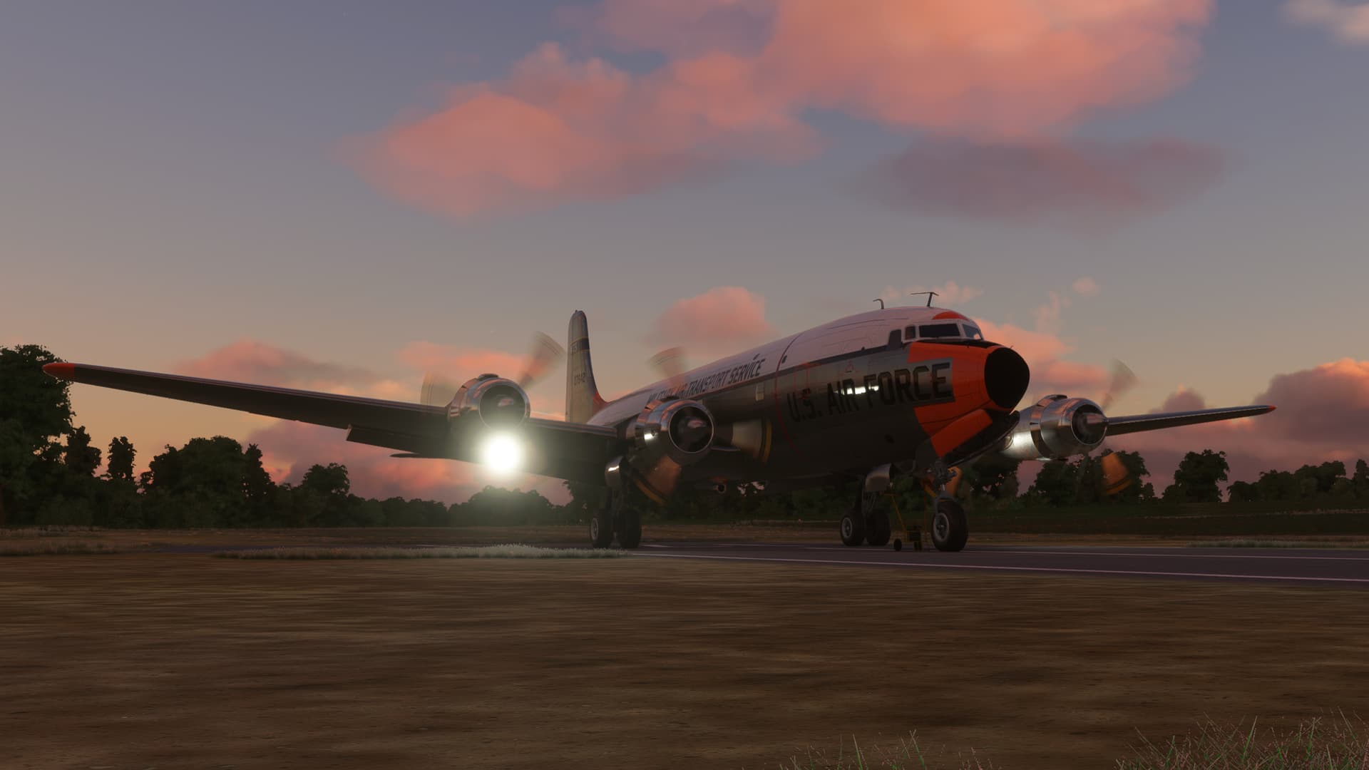
Hmmm, I’m not sure that dragging the GPU is going to help my climb gradient!
I kept waiting for the sound of limbs snapping, or harp music, or something. But apparently I made it.
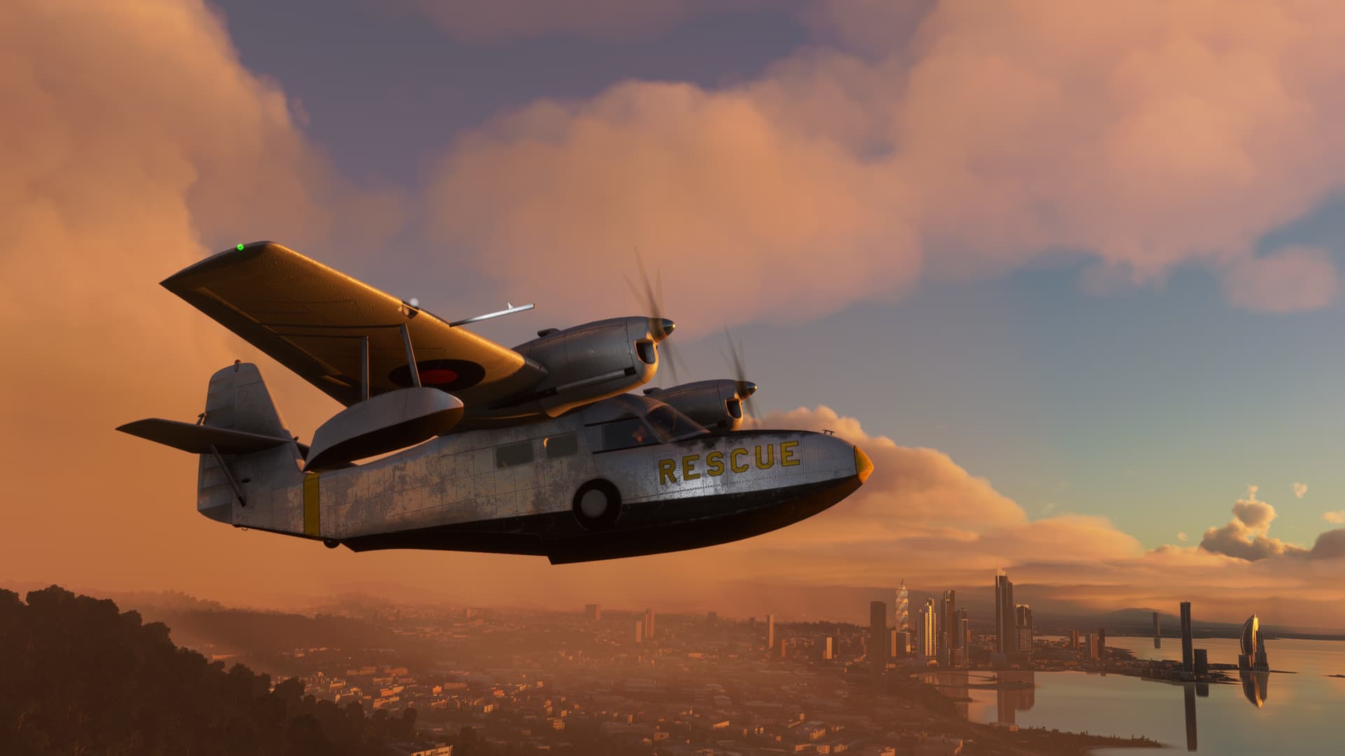
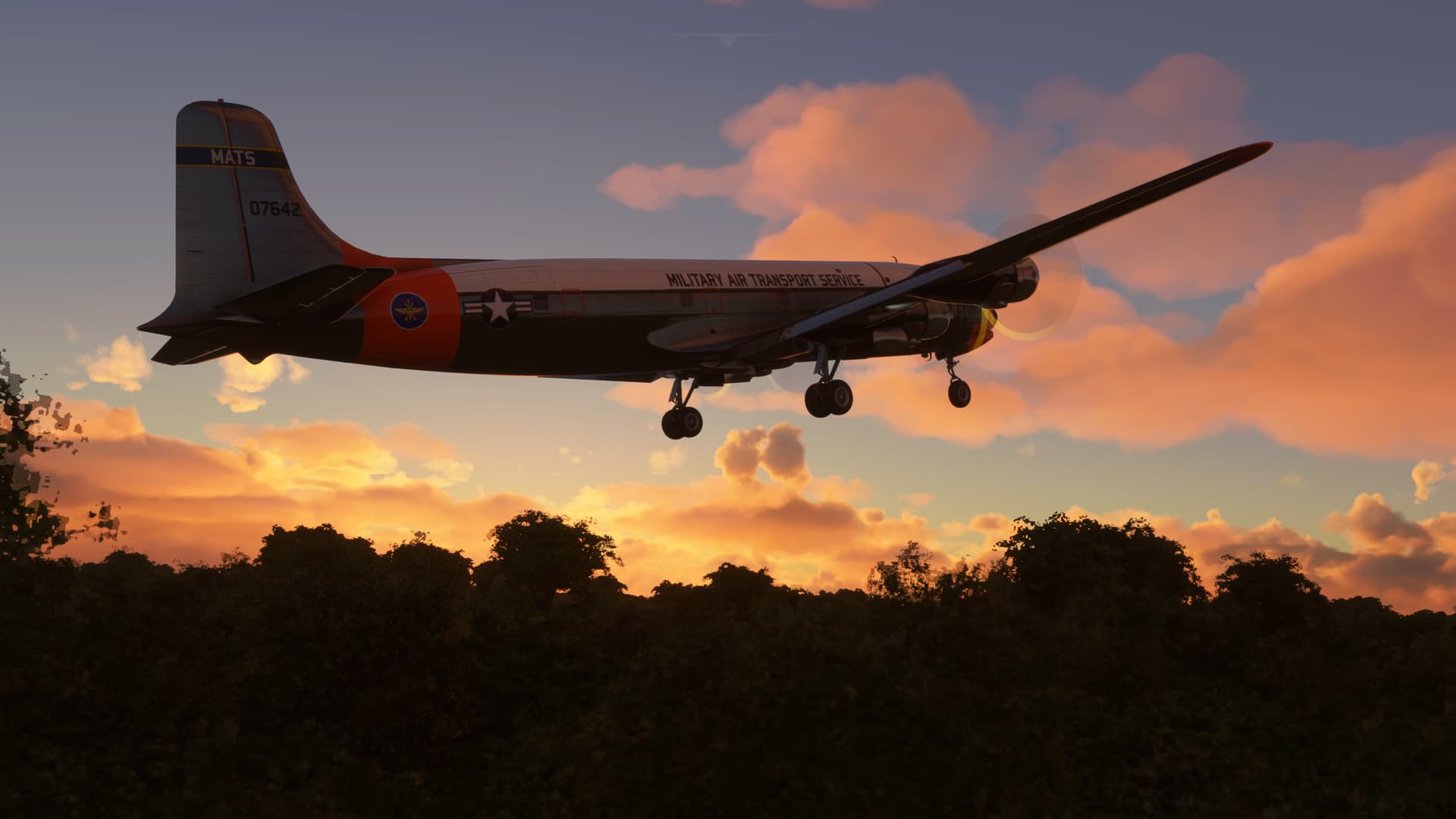
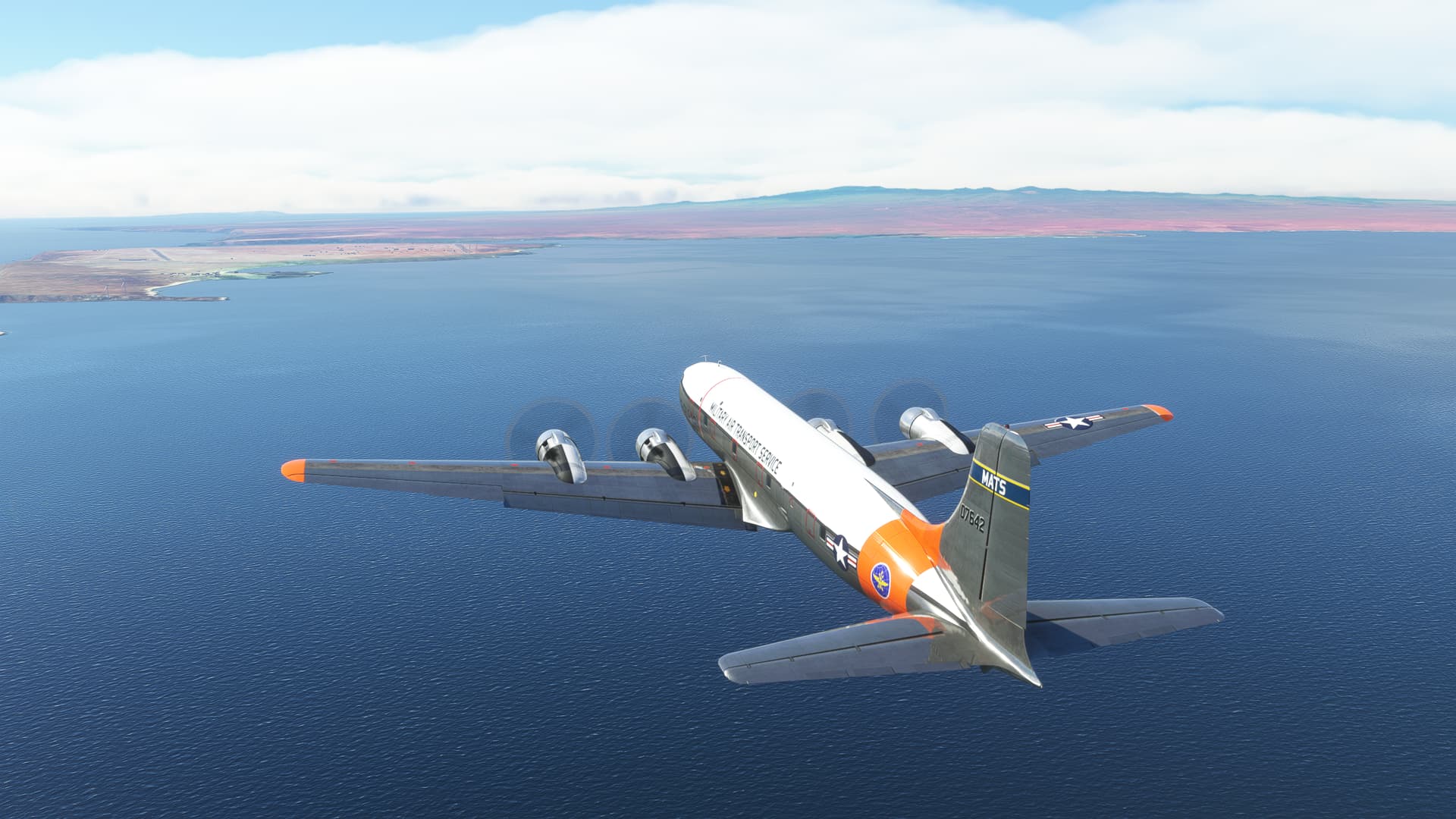
Leaving Panama behind.
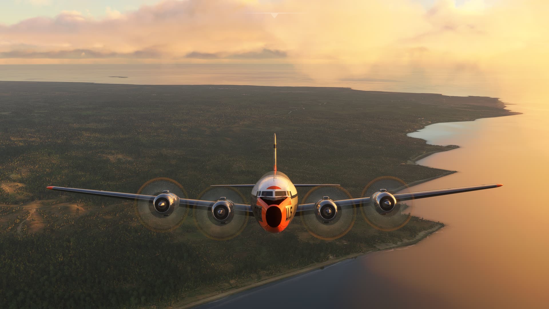
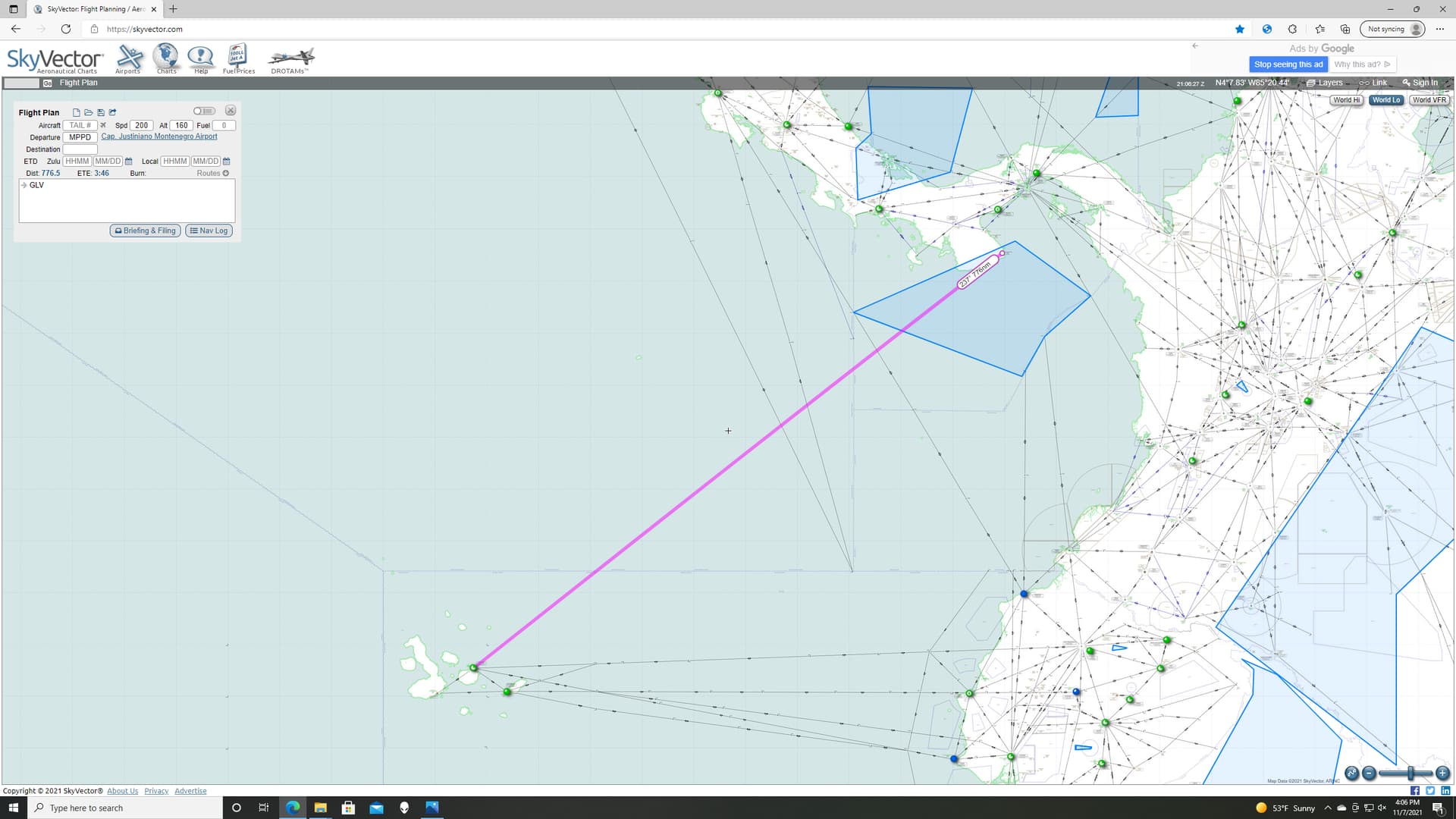
This was also going to be radio only Nav. The best service volume I could expect was going to be 130NM, although over the ocean I might hope to get somewhat more. Also, there was no VOR in Pedasi. So it was going to be best guess heading and hope that I pick up GALAPAGOS VOR (GLV) before I go lost at sea.
Well, I DID preposition the rescue ship! ![]()
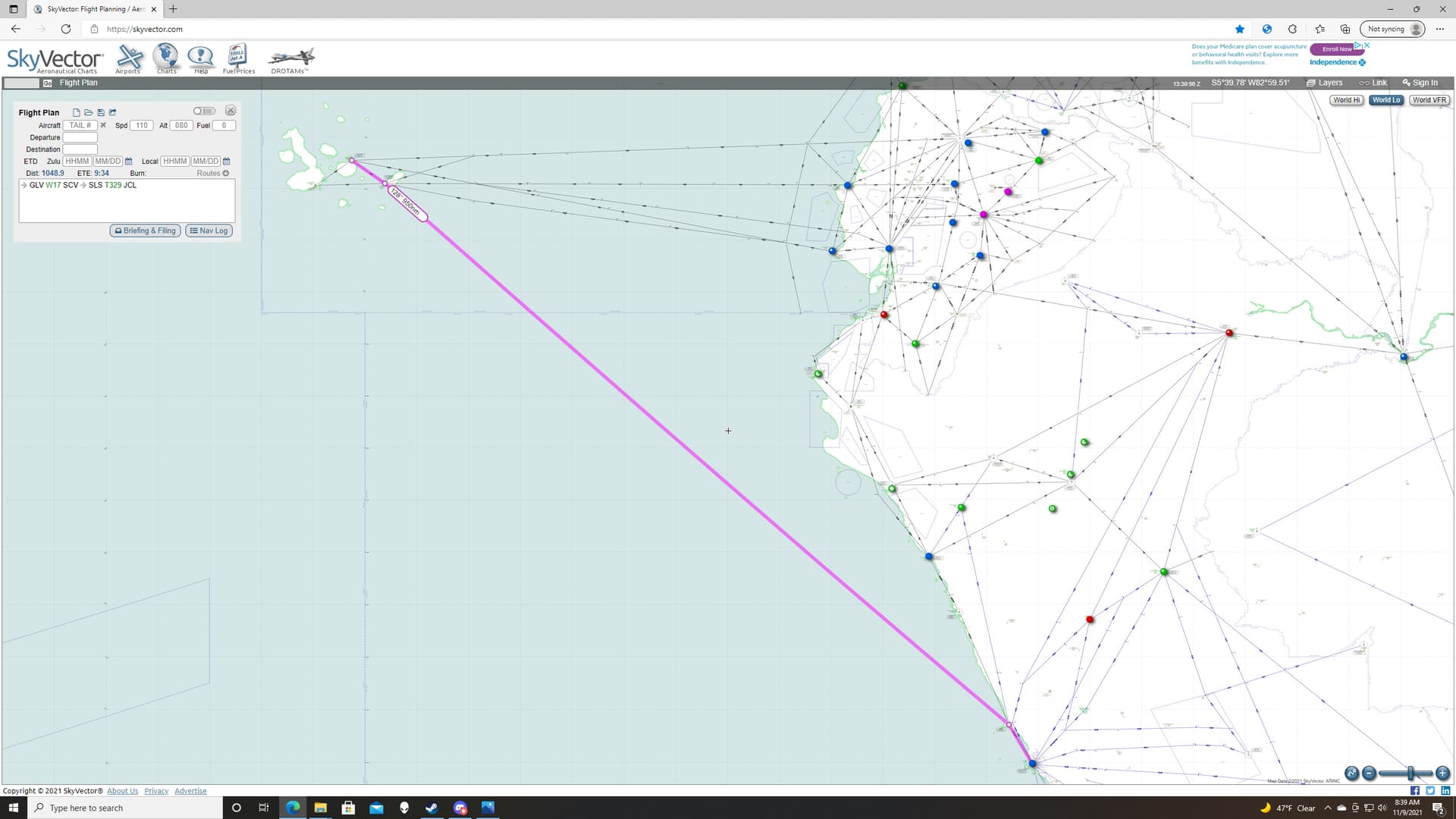
I tried to find a good winds aloft chart for the region but didn’t have any luck. Besides, I wasn’t entirely certain how MSFS really handled weather outside station reports. I could easily wind correct my way off towards Pago Pago. So, I chose the pure Skyvector course. No great circle route for Mama Deacon’s baby boy.
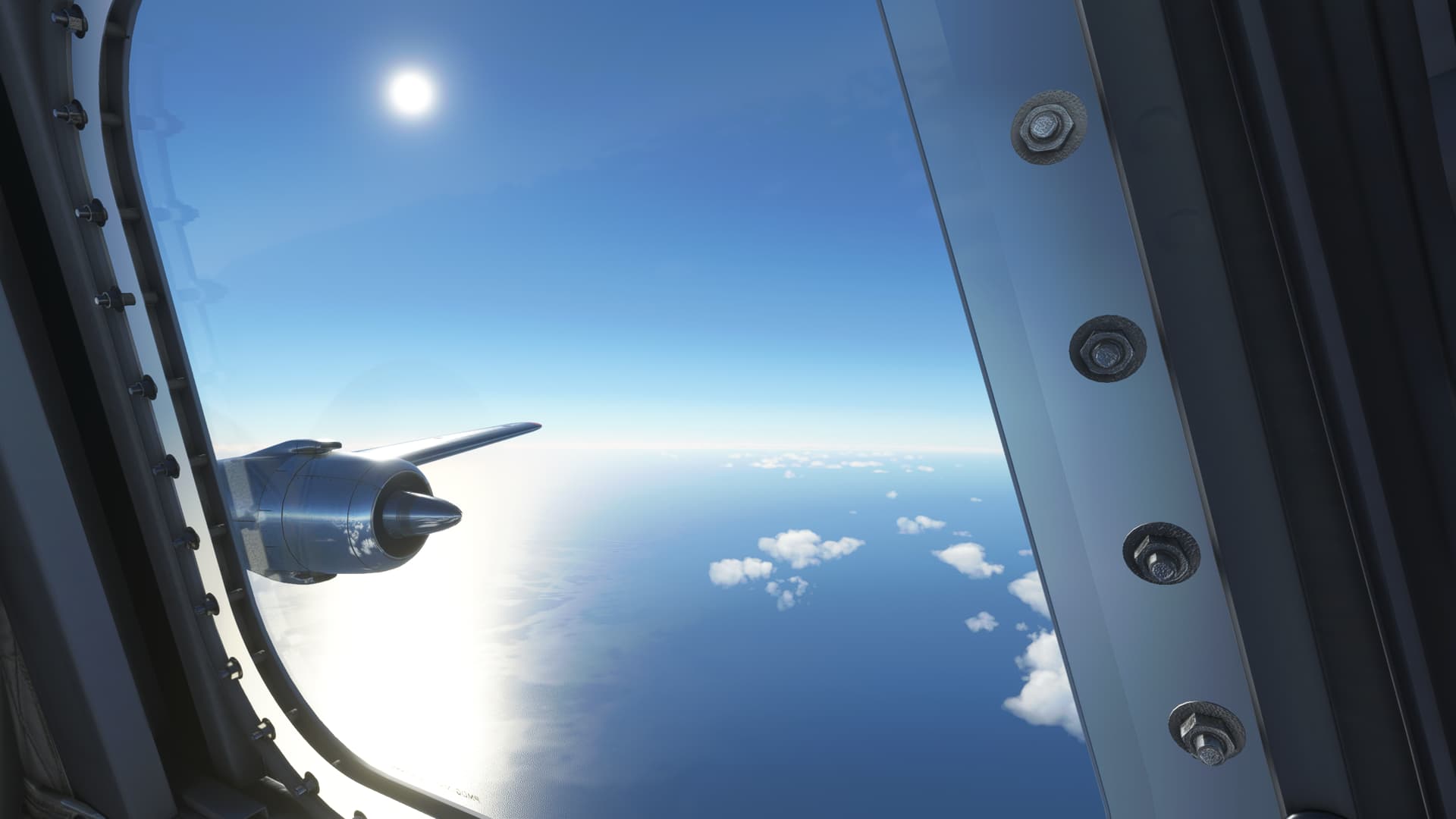
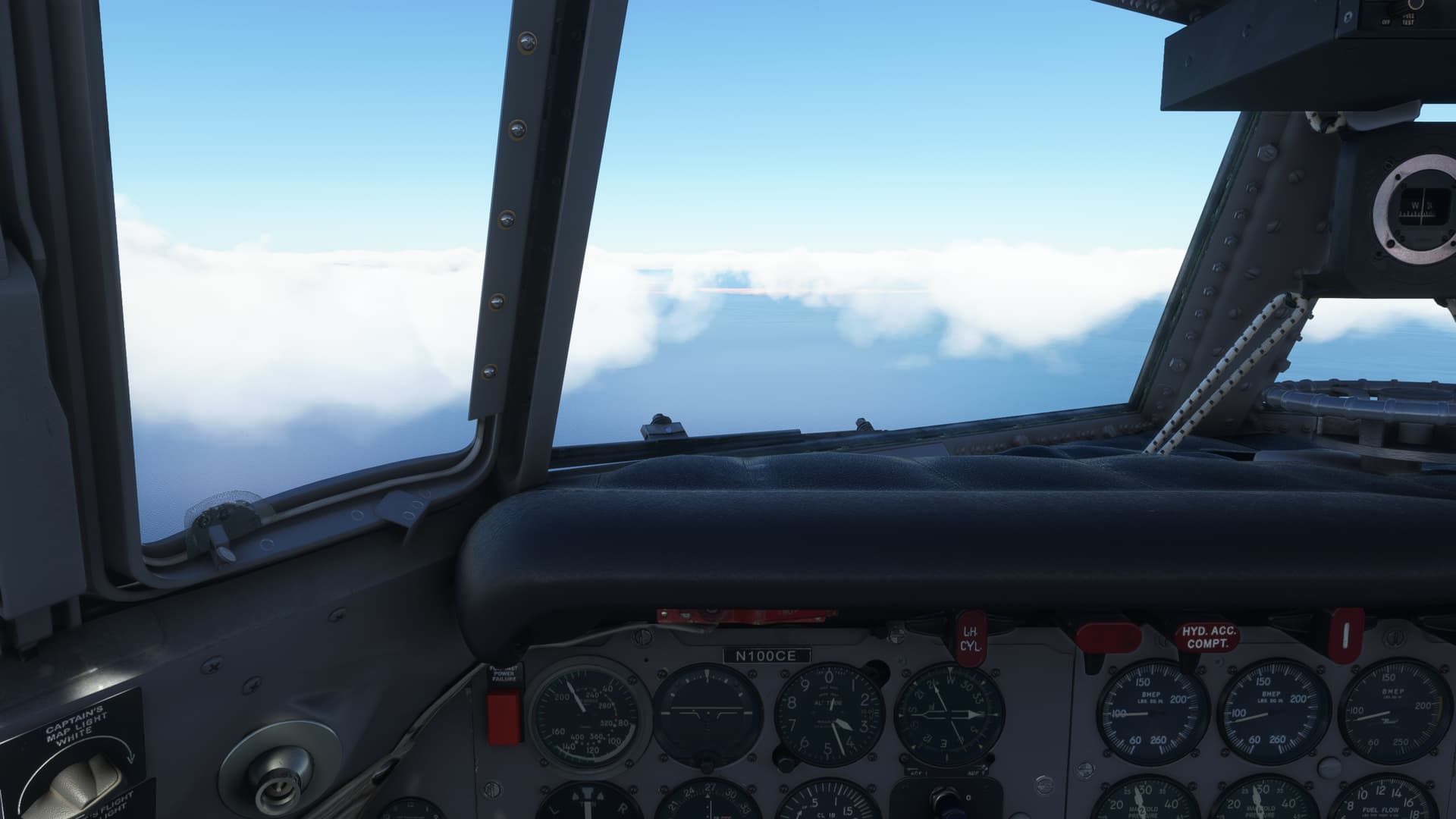
This is when you realize exactly how large the ocean is.
It was a sweaty 3 hours or so before the GLV VOR needle came alive and swung to about Left 20 degrees relative bearing…I’ll take that!
The clouds start to thicken again as the island came into view.
I set up for the arcing ILS RWY 14. I still haven’t entirely forgiven my Copilot for his previous…enthusiasms. But we’re working through it.
In all seriousness, I do appreciate the Automated Flight Engineer (AFE) function of the PMDG DC-6. But I don’t entirely understand the choice of defining the phase of flight for him by reference to power setting, rather than something more common like airspeed/configuration. It results in the pilot adjusting the flight profile to accommodate the CP’s power settings, rather than the other way around IMO. I think I might get my single pilot certification on this one in the future.
That aside, um, aside, I turn onto the DME arc, poorly.
Ugh, my Radio Instruments instructor must be rolling over in his grave right about now.
A little low, a little slow I turn onto final.
I guess I always thought that the Galapagos were flatter.
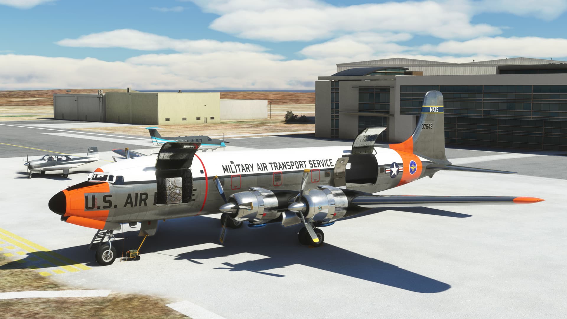
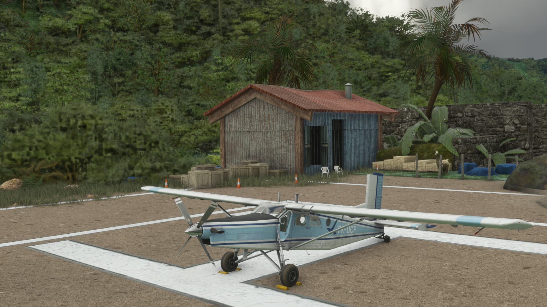
Loading more presents at the ramp.
See I still have the GPU attached.
Just kidding. I scraped the last one off in the trees on takeoff.
OK, not wholly unsuccessful. Pretty happy I didn’t have to ditch on this one. Maybe I’ll do a little sightseeing before I head back to the continent.
No. If you want to see some rookie mistakes, read my flight reports! ![]()
Nicely done getting that old girl airborne out of such a short runway!
I was at Baltra earlier this year….for about 45 minutes. We dropped our pax and they wanted us out of there straight away (just a short hop to San Cristobal island). So, did you land with enough fuel to make it back to the mainland? Refueling is not available over there. When you land, one of the first questions you are asked is “how much fuel are you carrying”. I’m sure that they must have some emergency fuel available, but I would guess there would be a tongue lashing and a mountain of paperwork involved ![]() .
.

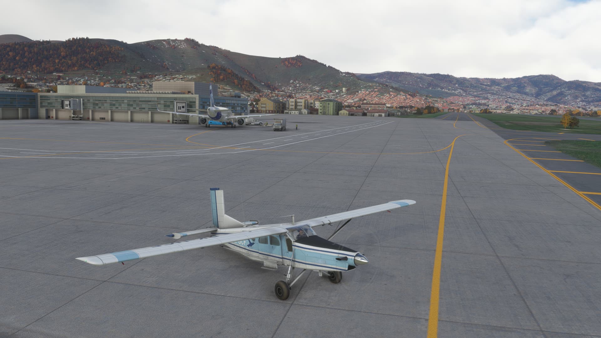
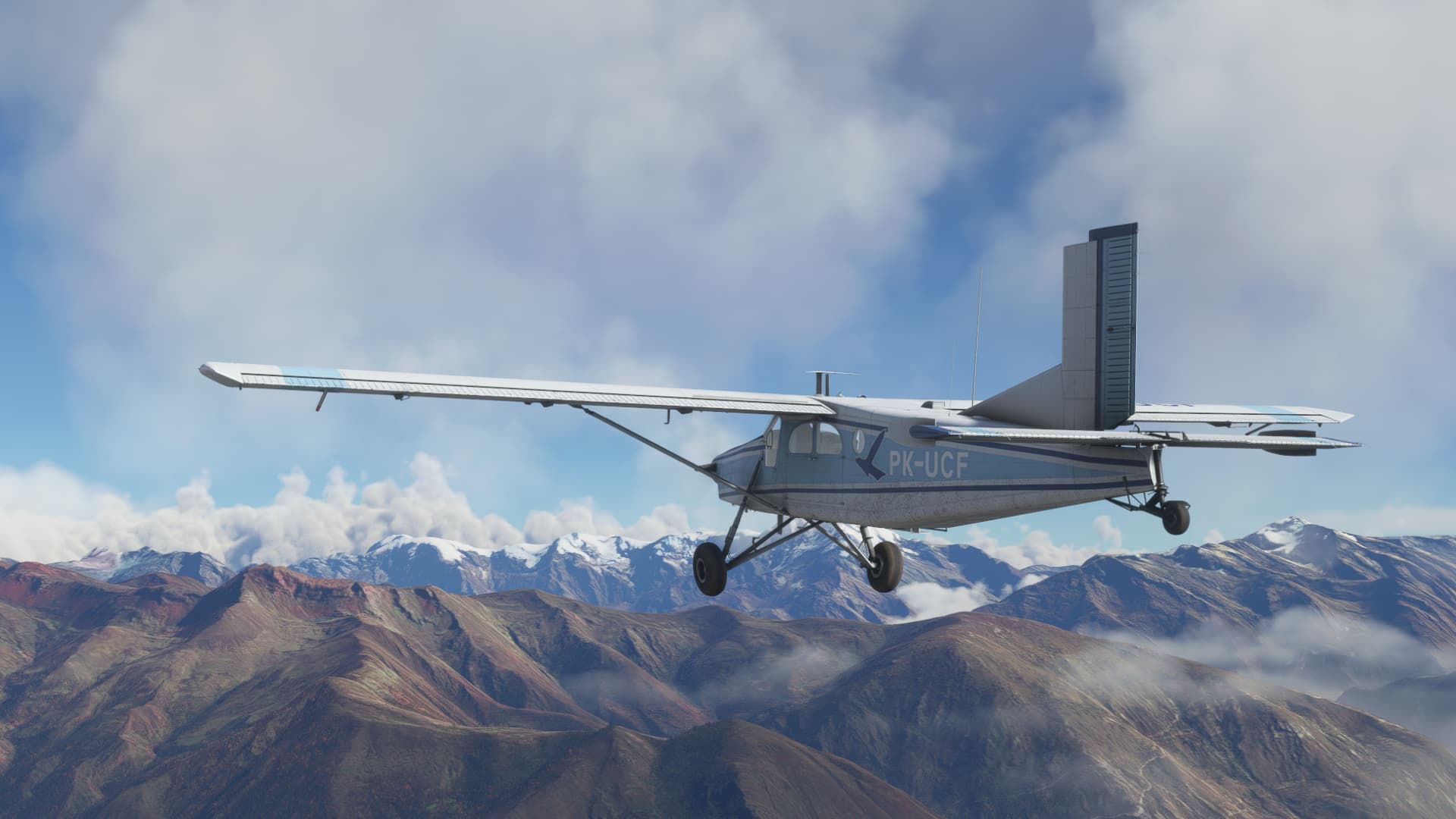
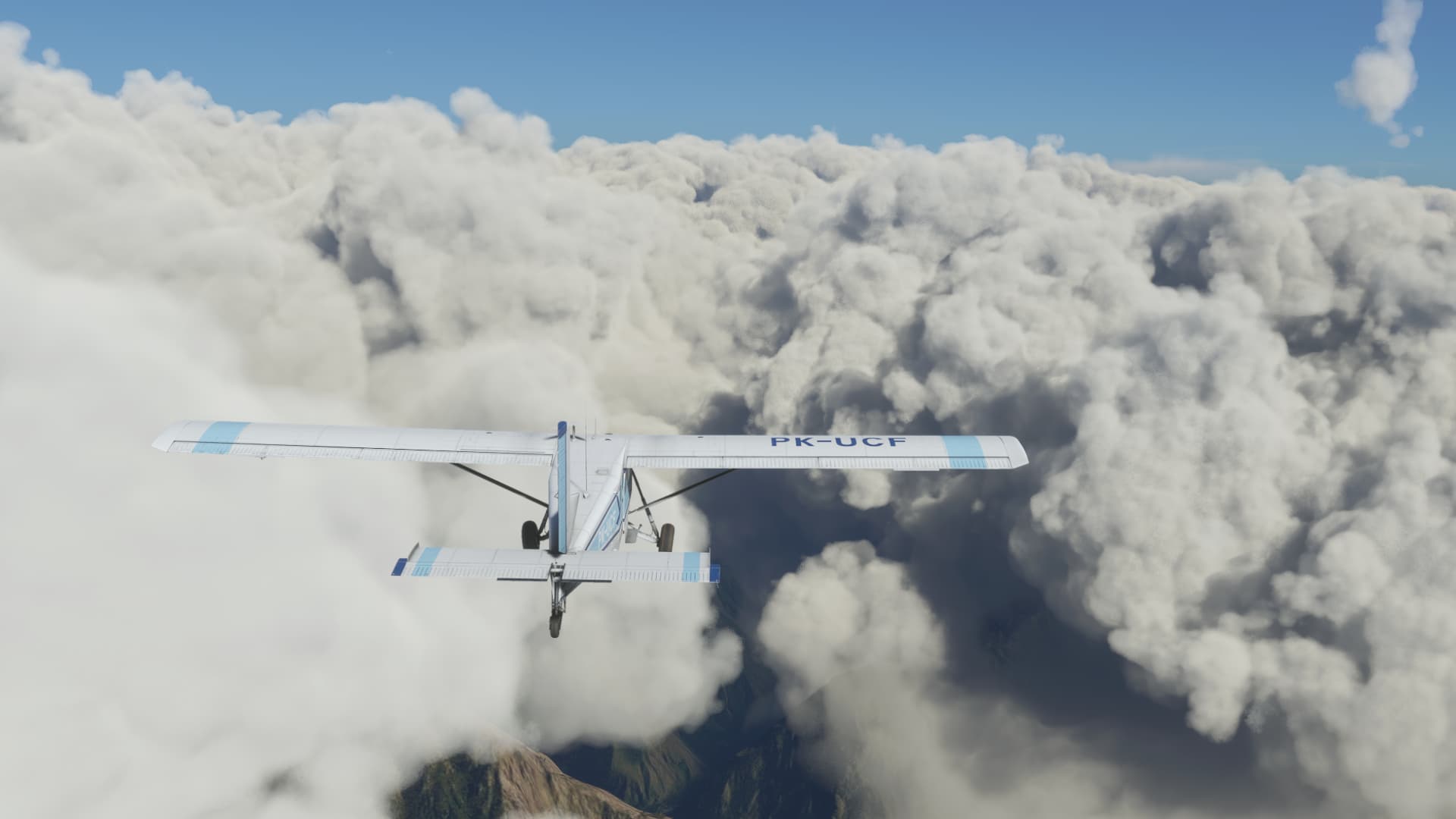
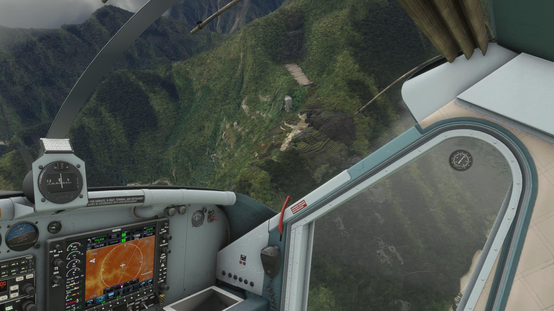
The reason I flew to Cusco is because I wanted to to do a quick excursion… I have the perfect aircraft for it too… The excellent MilViz PC6 Turbo Porter.
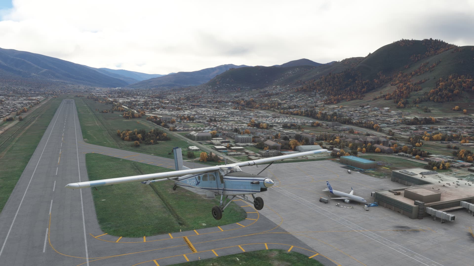
Departing Cusco…
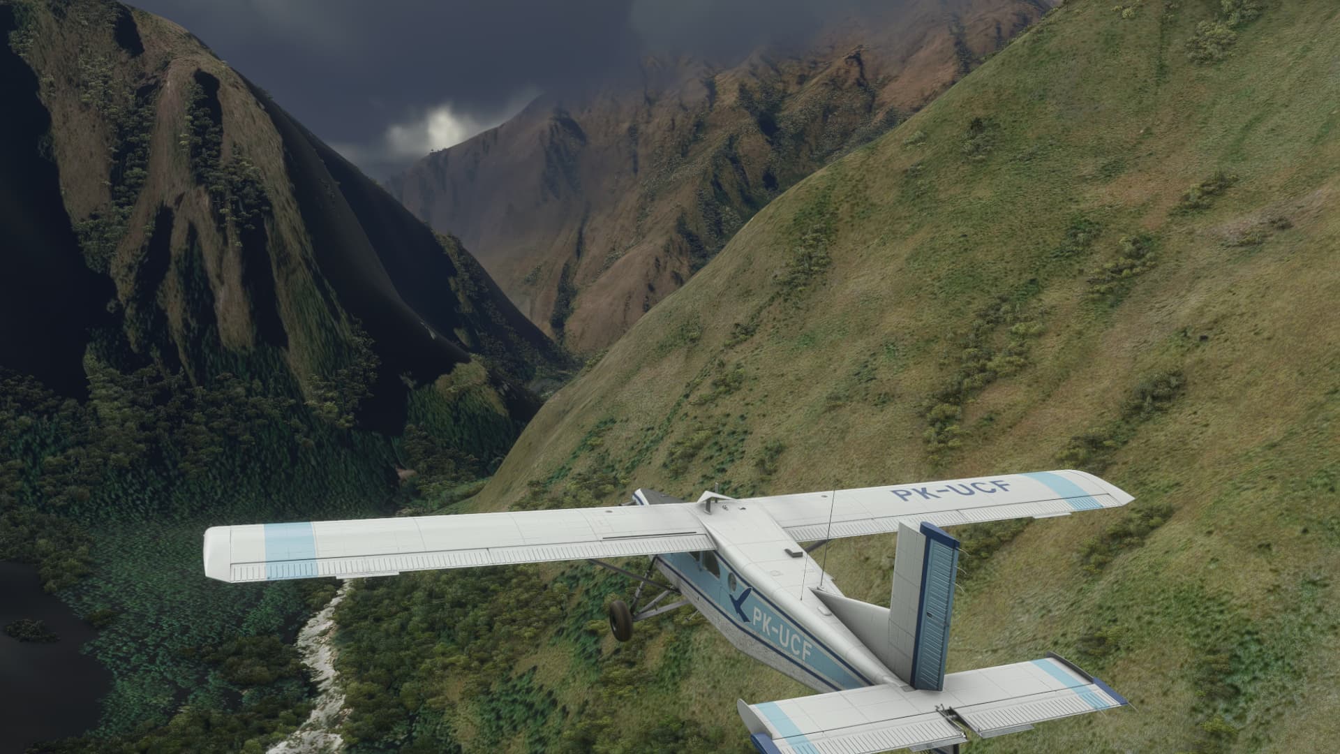
The high elevation made the climb out a rather sluggish affair.
Climbing out looking at some pretty high terrain up ahead.
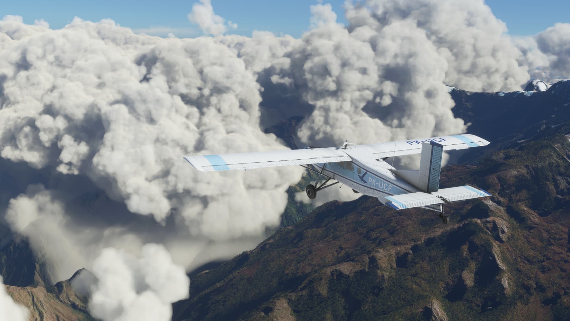
Once again, I am amazed at the stunning visuals of this sim…
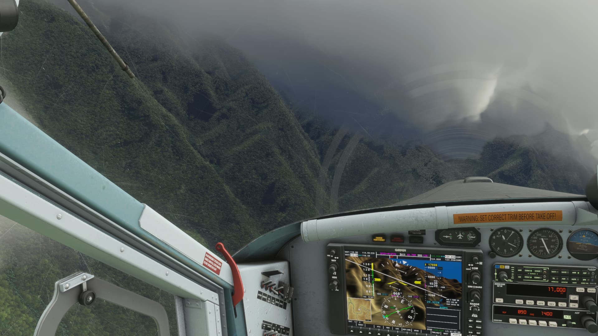
High terrain and cloud up ahead…that’s not a great combination.
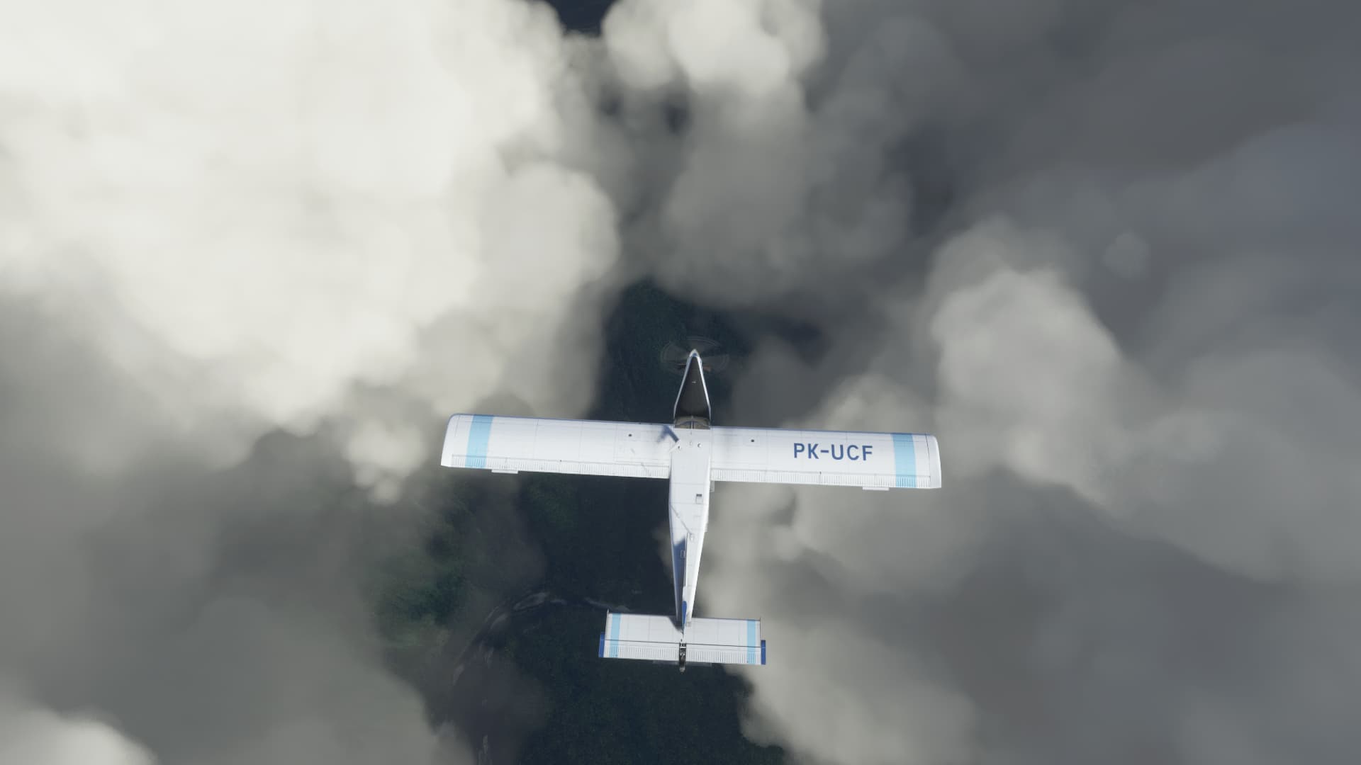
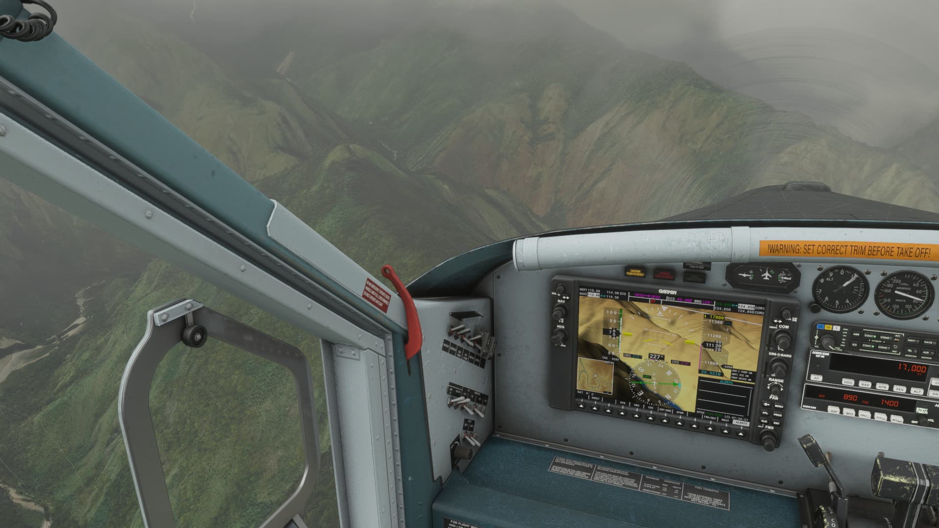
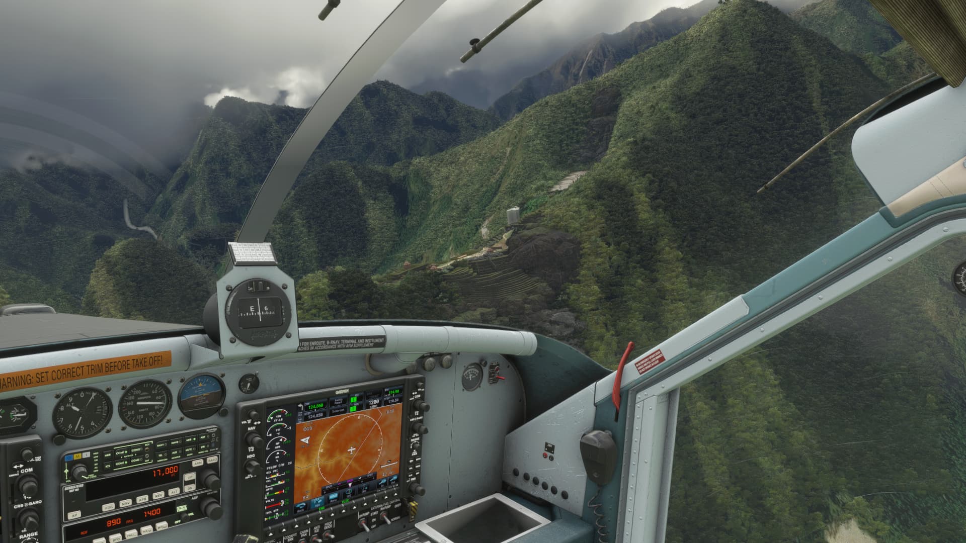
When I reached 40nm from the ZCO VOR on the 310 radial, it was time to find a hole in the cloud layer and carefully descend. The synthetic vision of the G1000 made that a lot easier, but this is not how we would do this in the real world… Thankfully the consequences are a little less severe in sim world.
Breaking out below the cloud layer…to find some most impressive terrain.
Not a whole lot of room under the clouds…
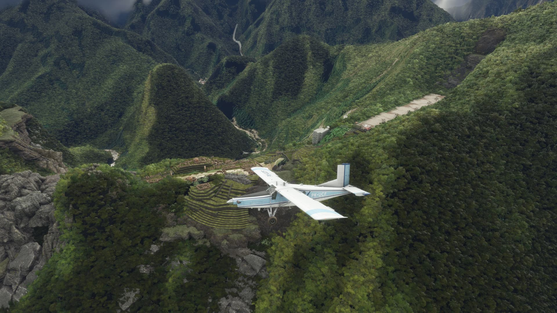
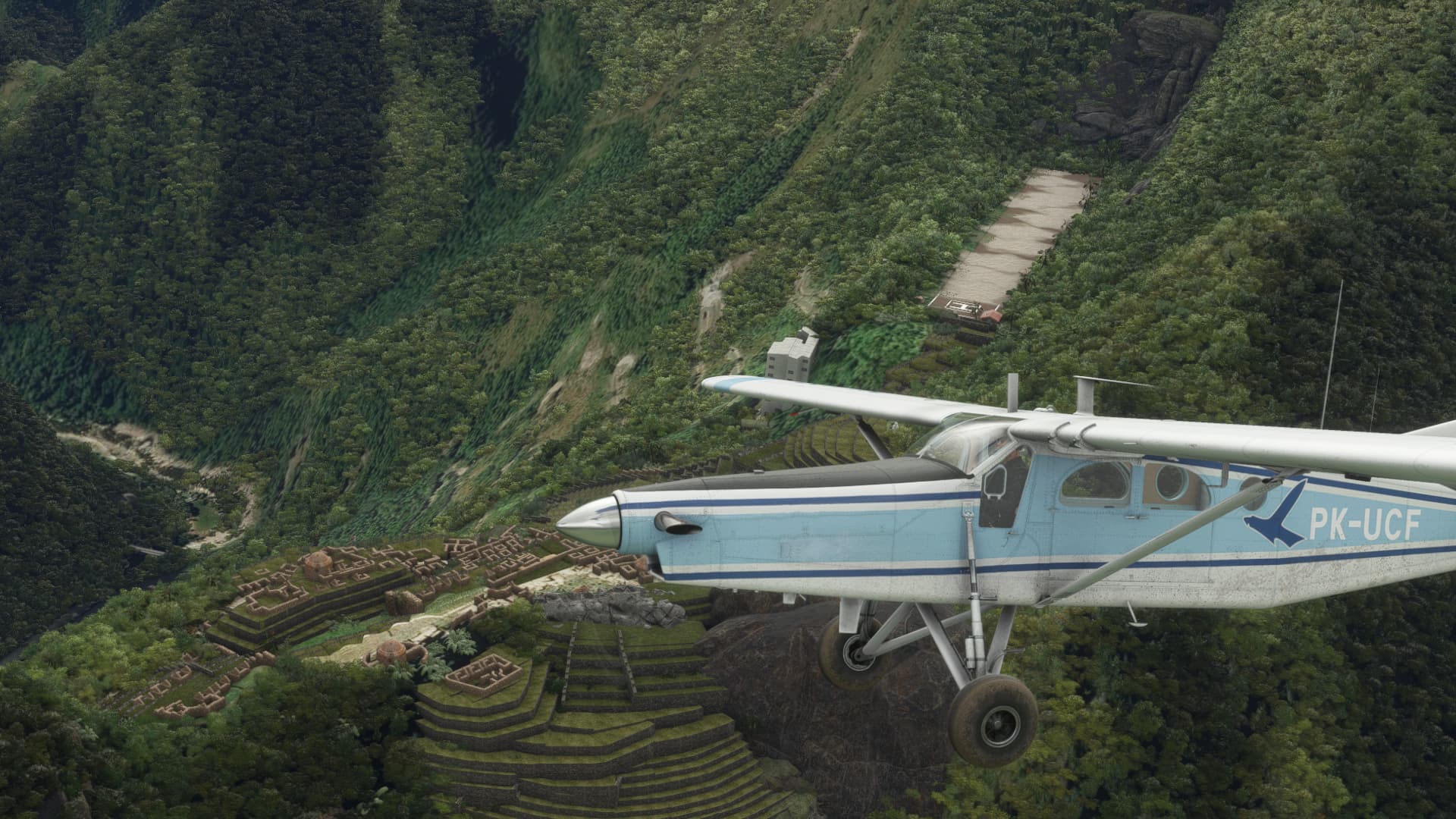
After some careful exploring of the area, I eventually found what I was looking for…
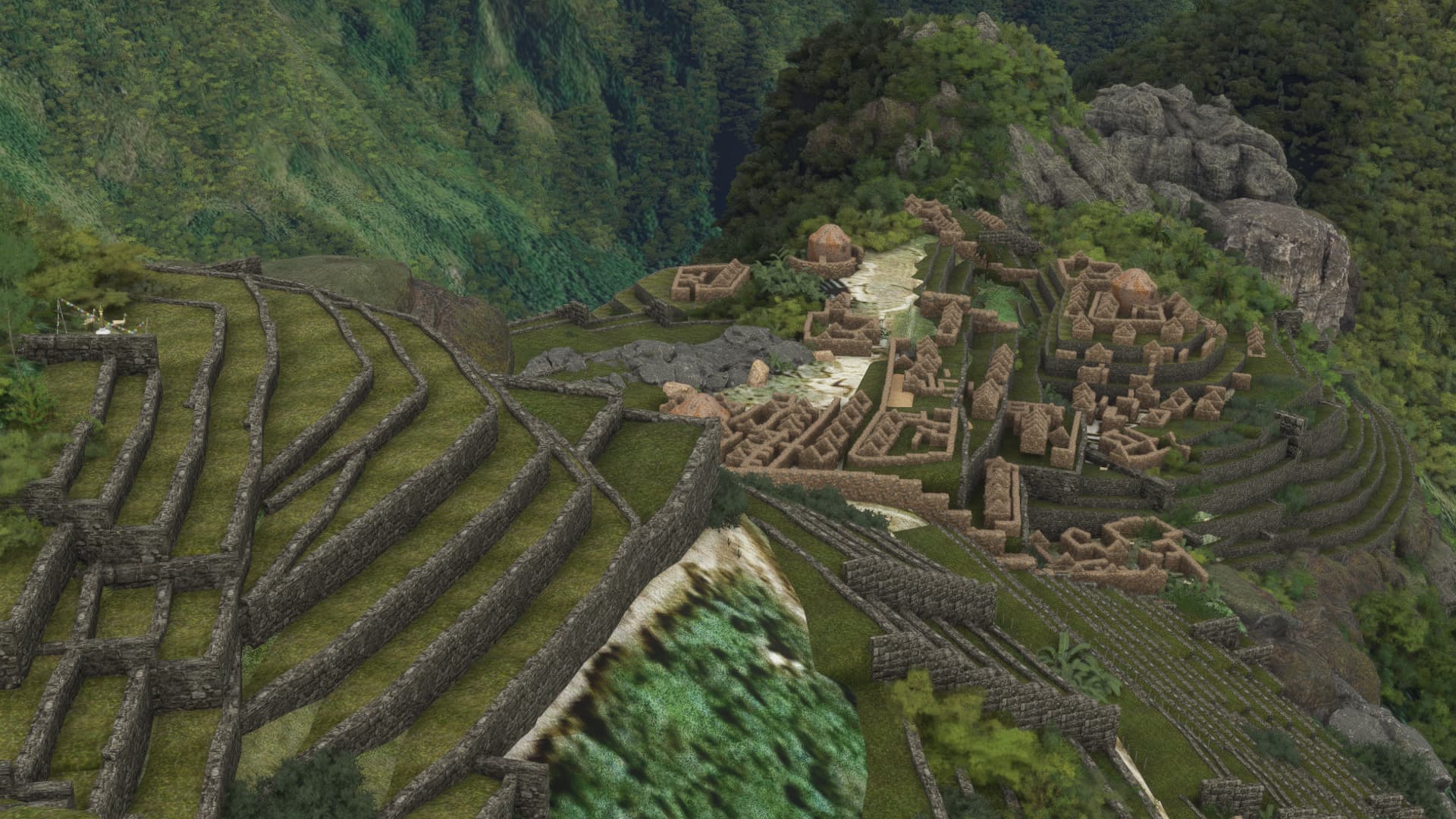
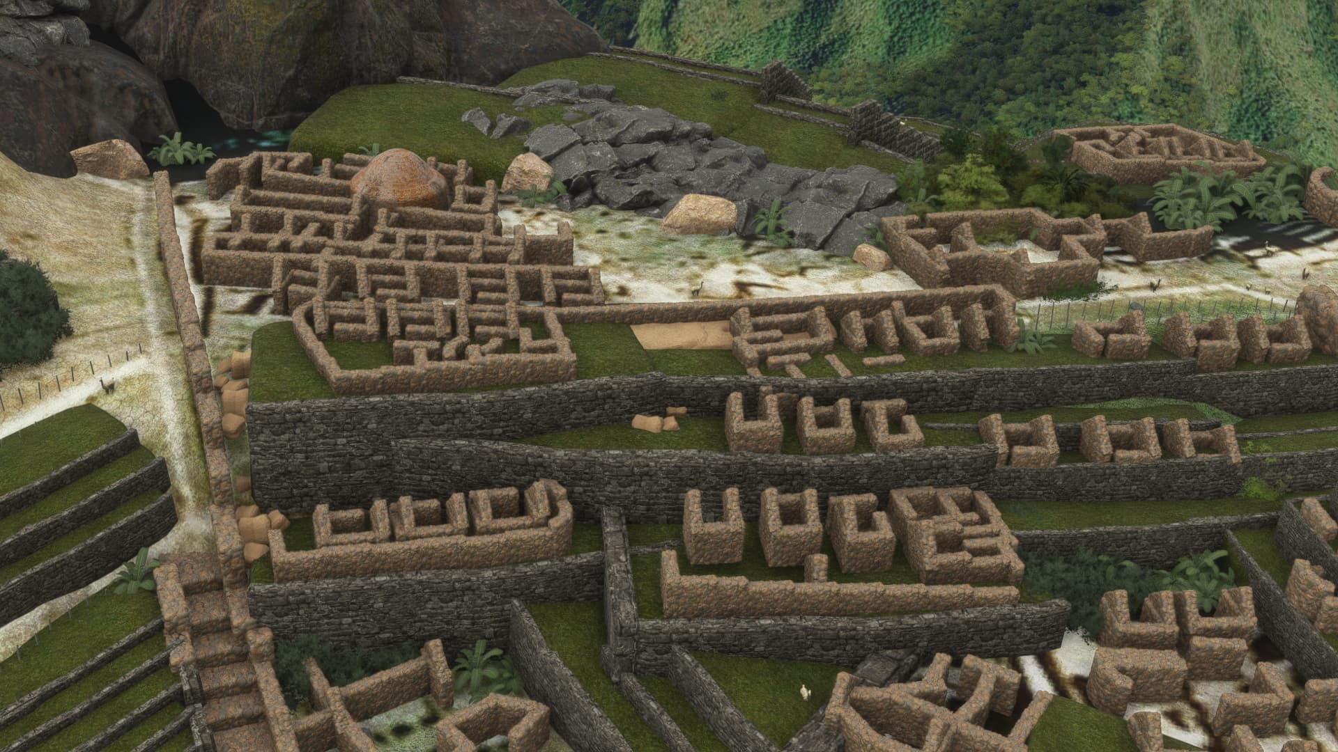
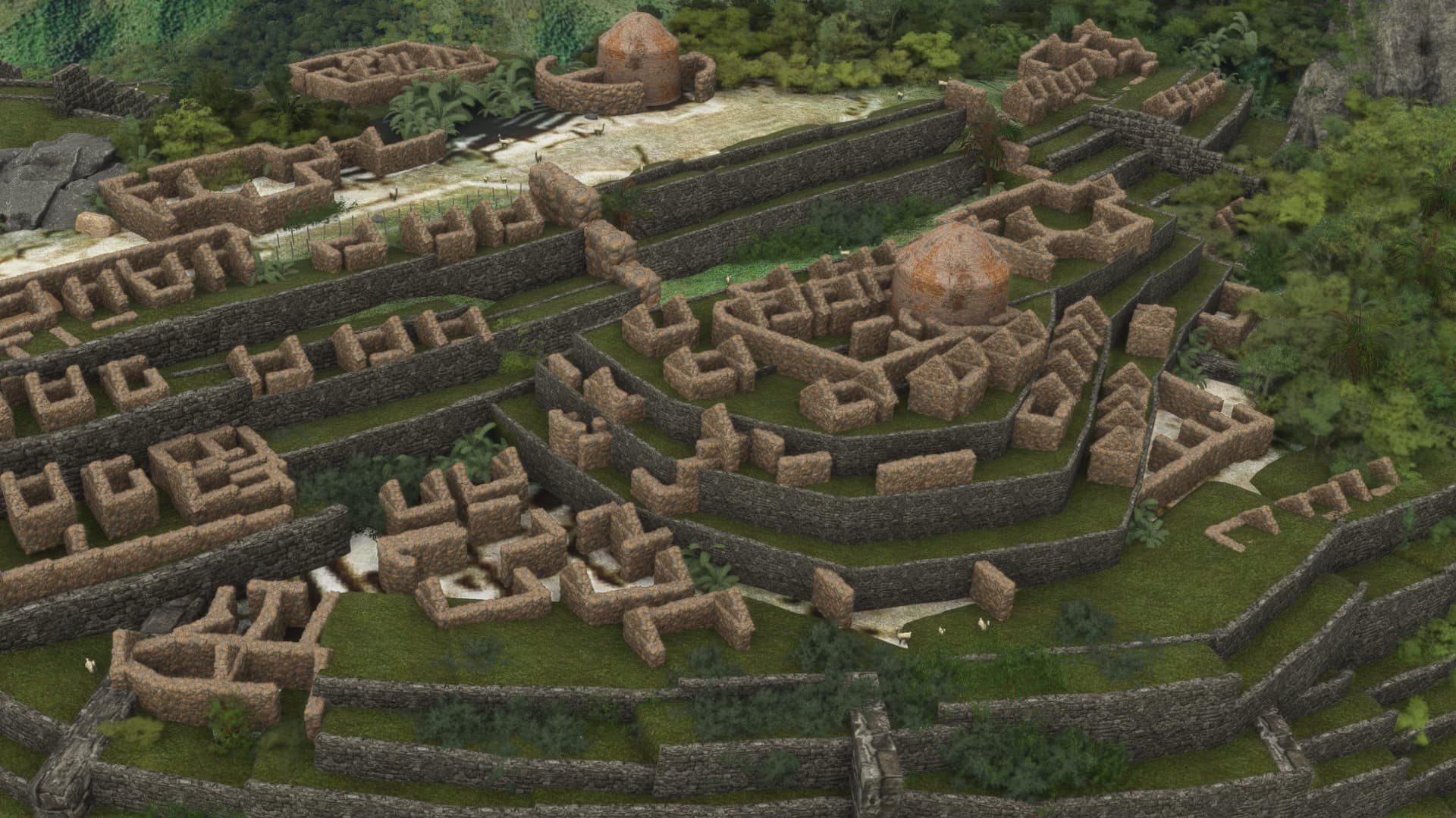
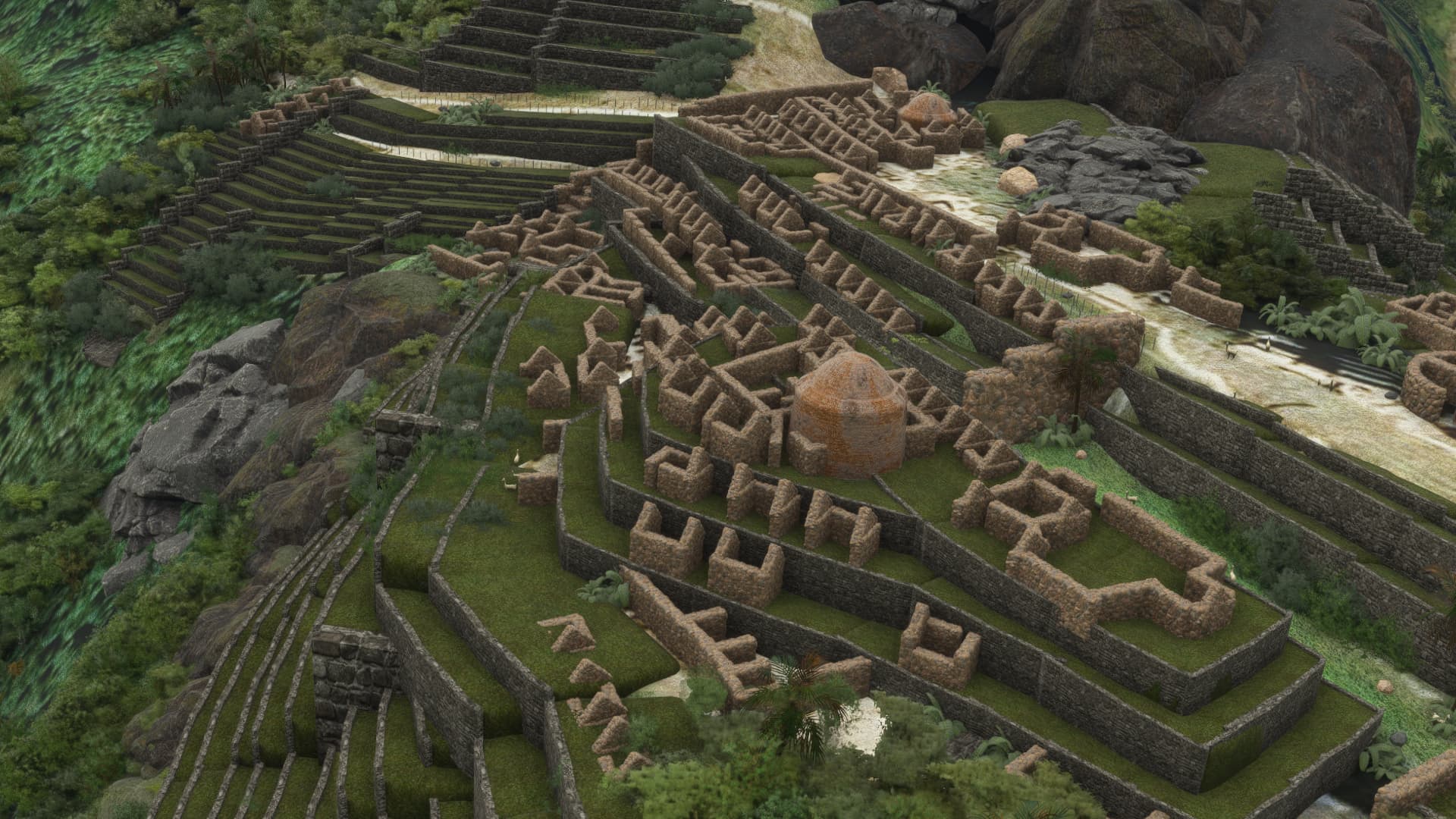
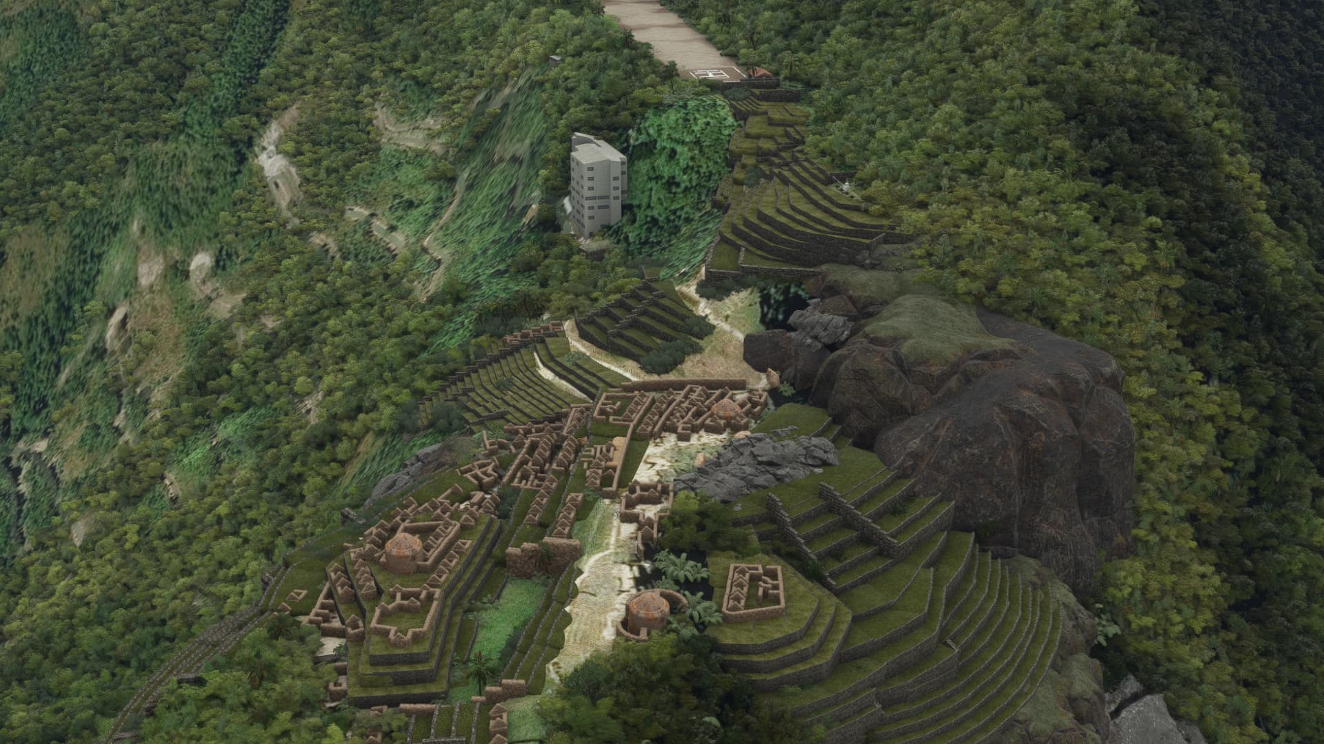
Machu Picchu, which was an Inca citadel. I have to admit I had not heard of it before watching “The Long Way Up” which documented the trek Ewan McGregor and Charlie Boorman took on electric motorcycles from the southern tip of South America all the way up to Los Angeles. One of the places they visited was Machu Picchu.
The scenery is part of the payware Project Coastline package, which focuses on the Italian coast in the Tuscony region. I’m not sure why Machu Picchu is bundled with it, but it is a nice bonus. The airstrip is fictional, but seeing as it is there, and we are in a Turbo Porter…hold my beer please.
No room for error here…at this point you are pretty much committed.
Touchdown…
Parked on the Helipad…
While parked, I took some drone shots of the site… The large modern building is the visitor center from what I can tell, and is probably just a single storey building in the real world.
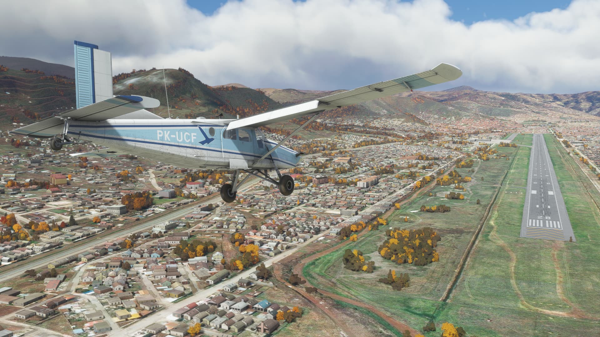
After doing the tourist thing, it was time to head back to Cusco…which was a bit of an adventure in itself.
So I am back at Cusco, not a single mile closer to Stanley ![]() .
.
I’m thinking La Paz, Bolivia will be my next port of call.
Kermit Weeks is your alter ego
Awesome! I was hoping to find that myself.
I’m guessing that there is nothing there without the add on scenery?
Kermit’s collection is a little bit more expensive though…![]()
Default scenery is just the Bing textures on the mountain. You can see that there is terracing and the outline of buildings but it isn’t great. I picked up the Project Coastline package because it includes Manchu Picchu, but I justified the purchase because I have flown into Grosseto in the Challenger.
Awesome! I figured you’d be heading there after I saw your landing at Cusco previously.
Roger.
I did find this.
Machu Picchu » Microsoft Flight Simulator
Not as nice as your fully detailed model, but free if anyone wants to fly there since you’re in the neighborhood.
When I was a young man, with little regard for the consequences of my actions, I spent a few summers traveling with a brother on skydiving safaris. One of the drop zones we frequented was at Perris Valley, CA, where often a guest DC-3 jump ship in attendance. In the desert heat, that thing used all of the displaced thresholds at each end of the short runway, causing us to suck our gonads a little deeper with each departure.
The jumpmaster was a crusty old dude named Claud, who sat by the open door until all of the jumpers were out. One of his favorite tricks, especially during the first few loads of the day, was to sneak a tree branch on the airplane. During takeoff roll when most of us strained to look out the window at the trees going by, he’d reach outside of the door, and bang the fuselage (not that we needed the parasitic drag). He’d follow this by holding the branch high for all to see, swearing at the pilots. Although unheard by most over the P&W radials at full power, it was quite funny for the jumpers sitting nearest the door, in the Fandangoesque fatalistic manor that one must assume when enjoying such pursuits.
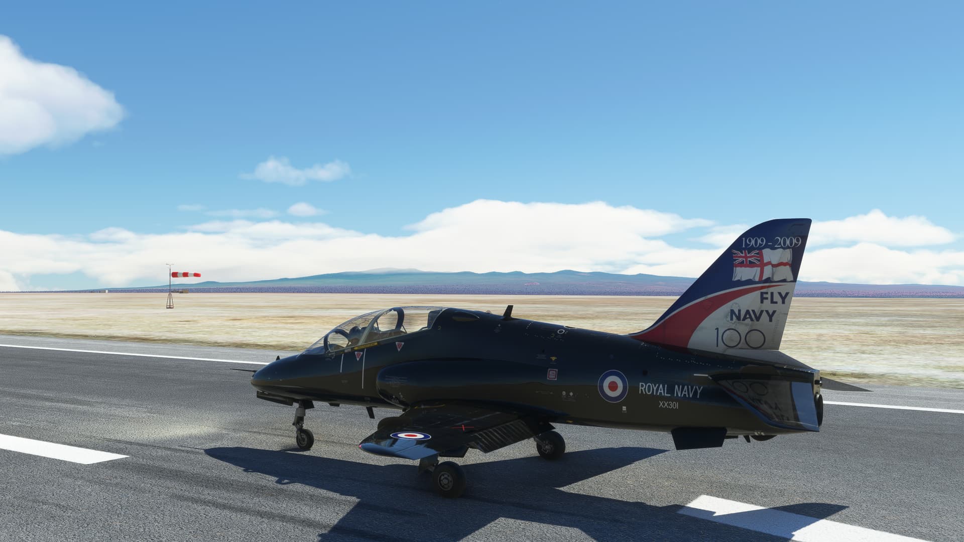
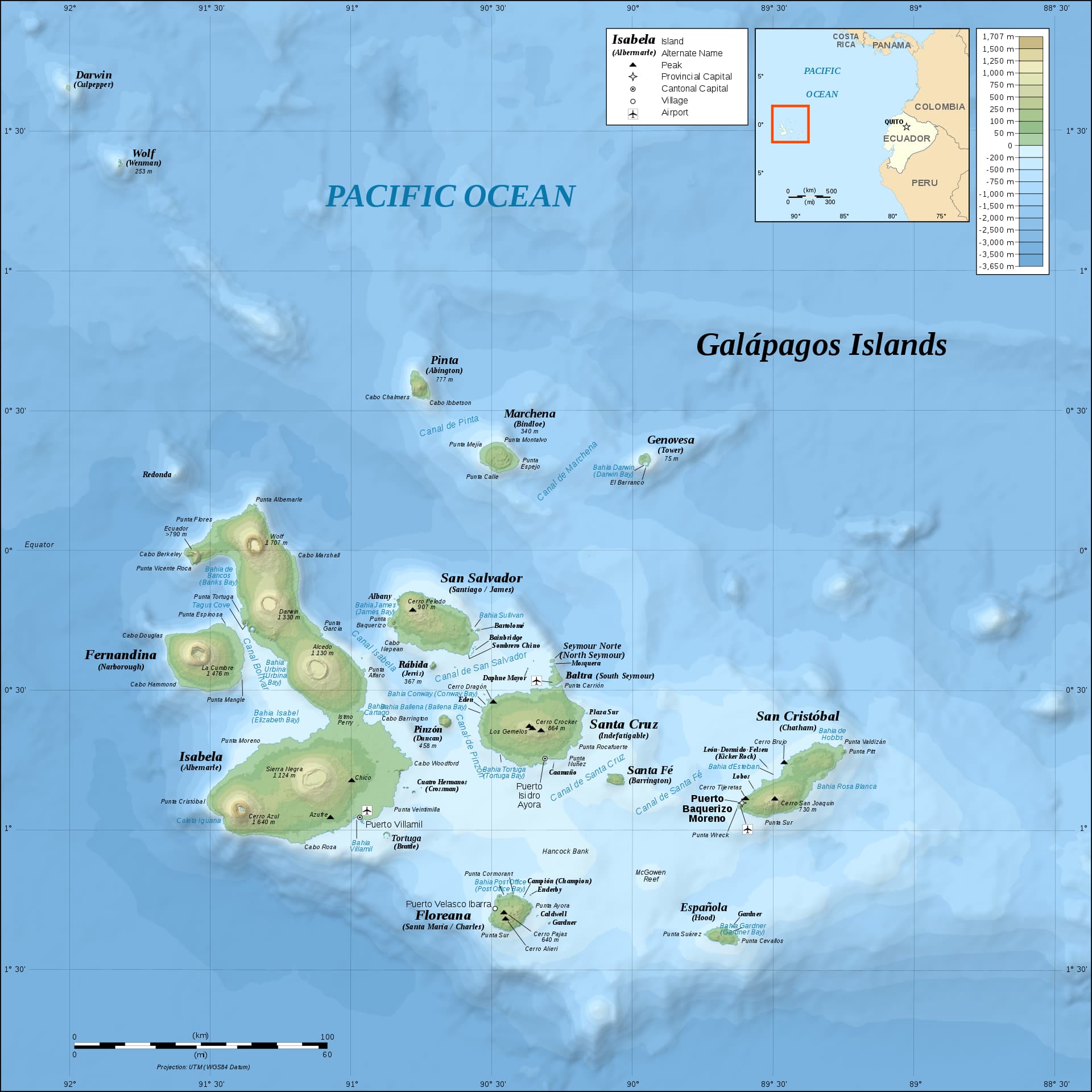
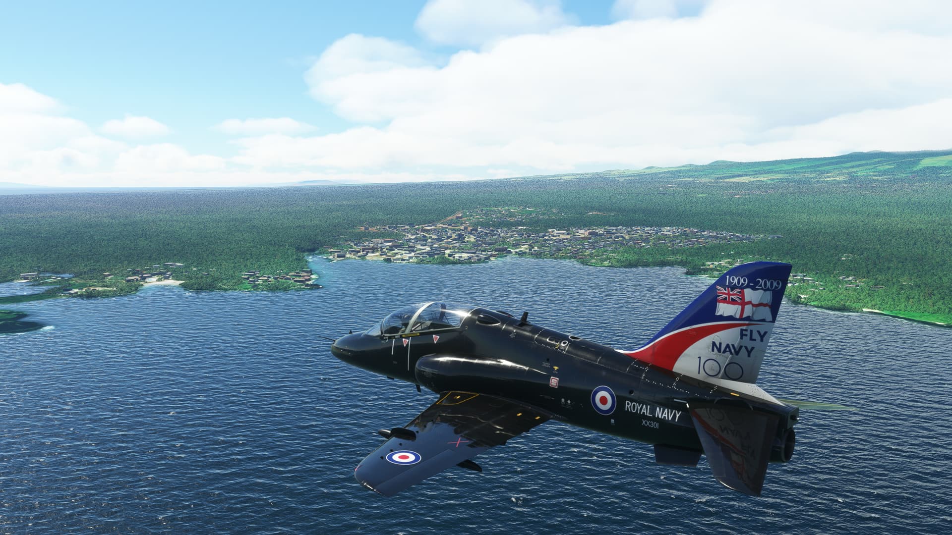
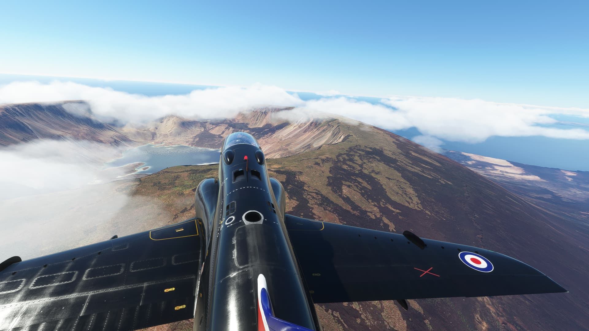
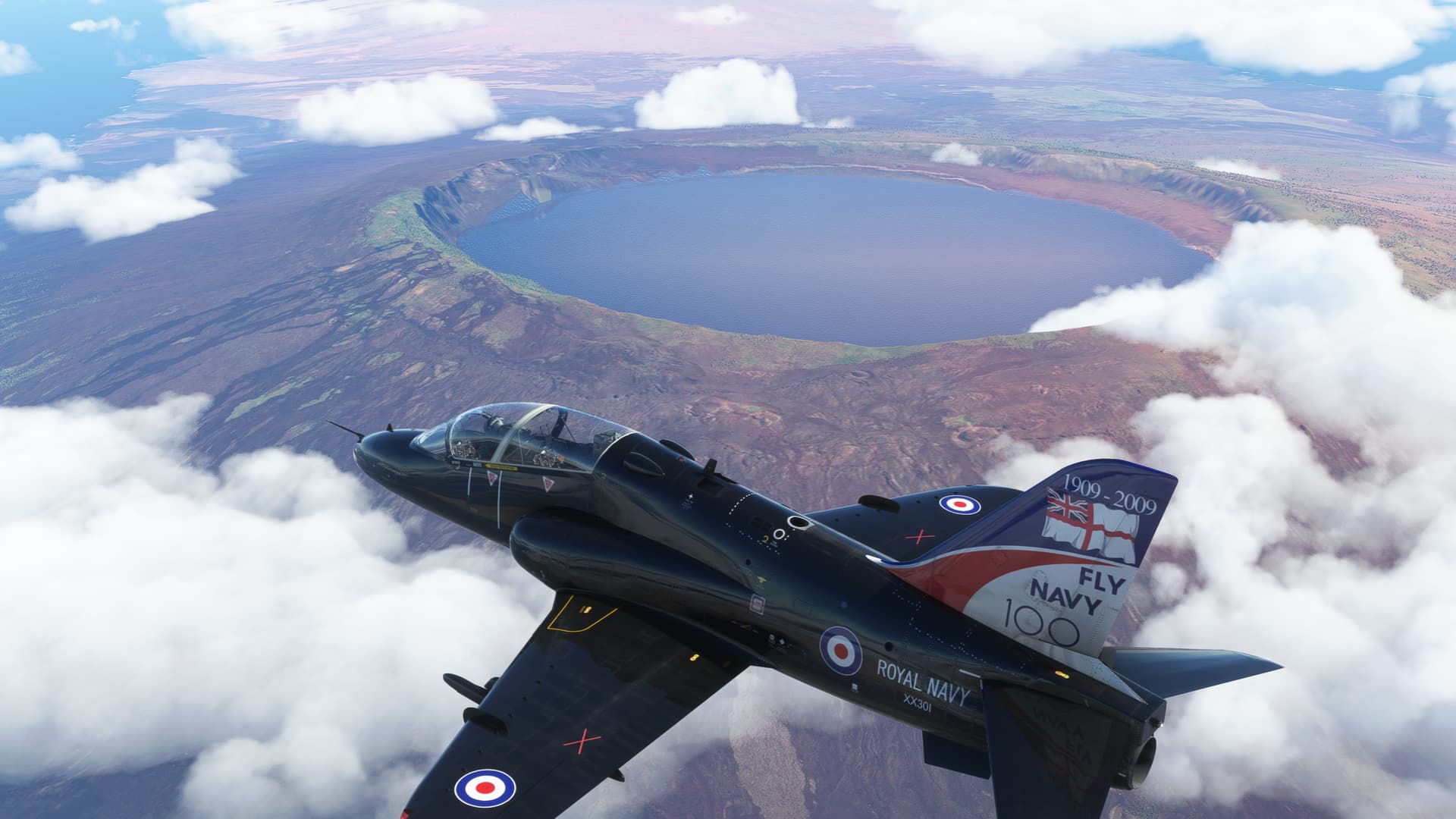
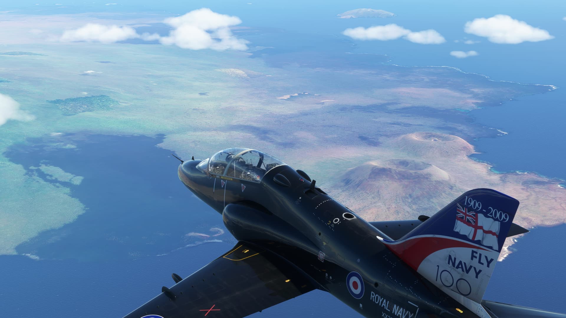
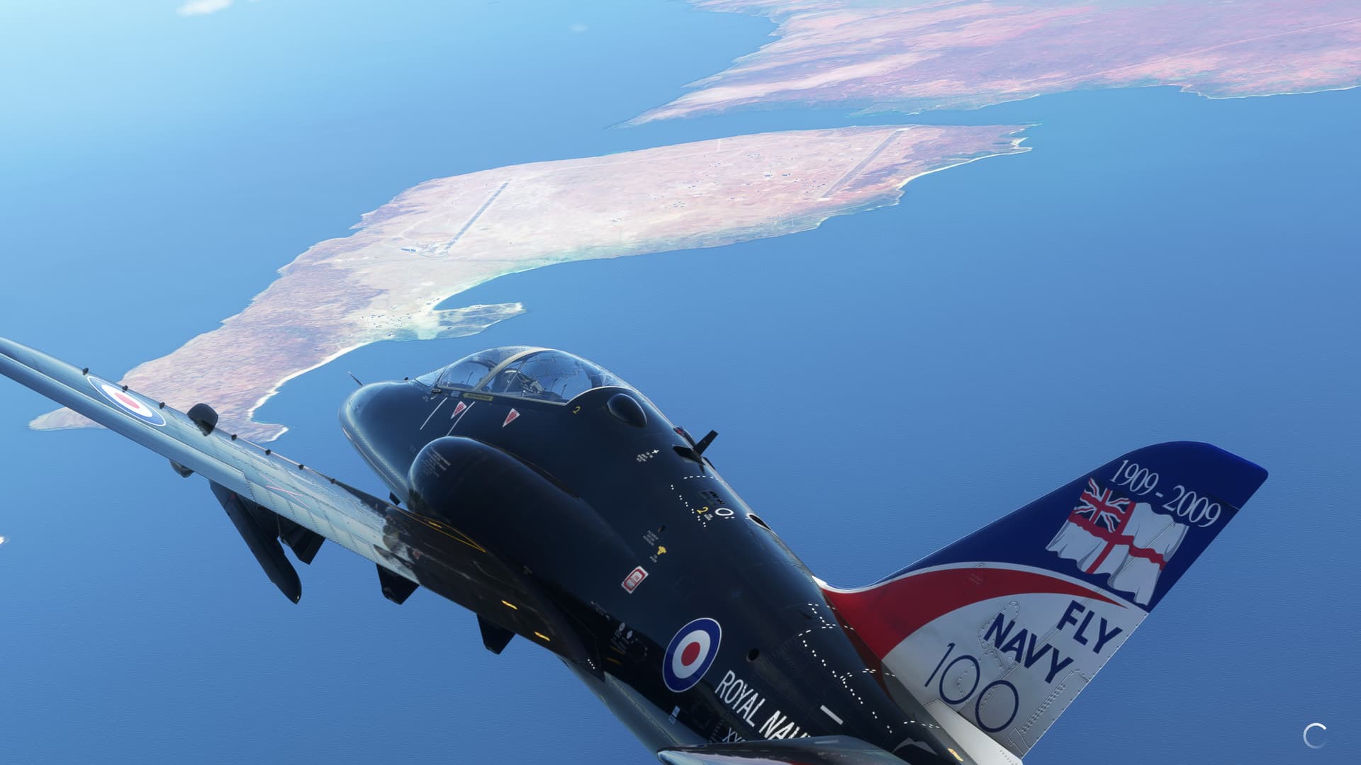
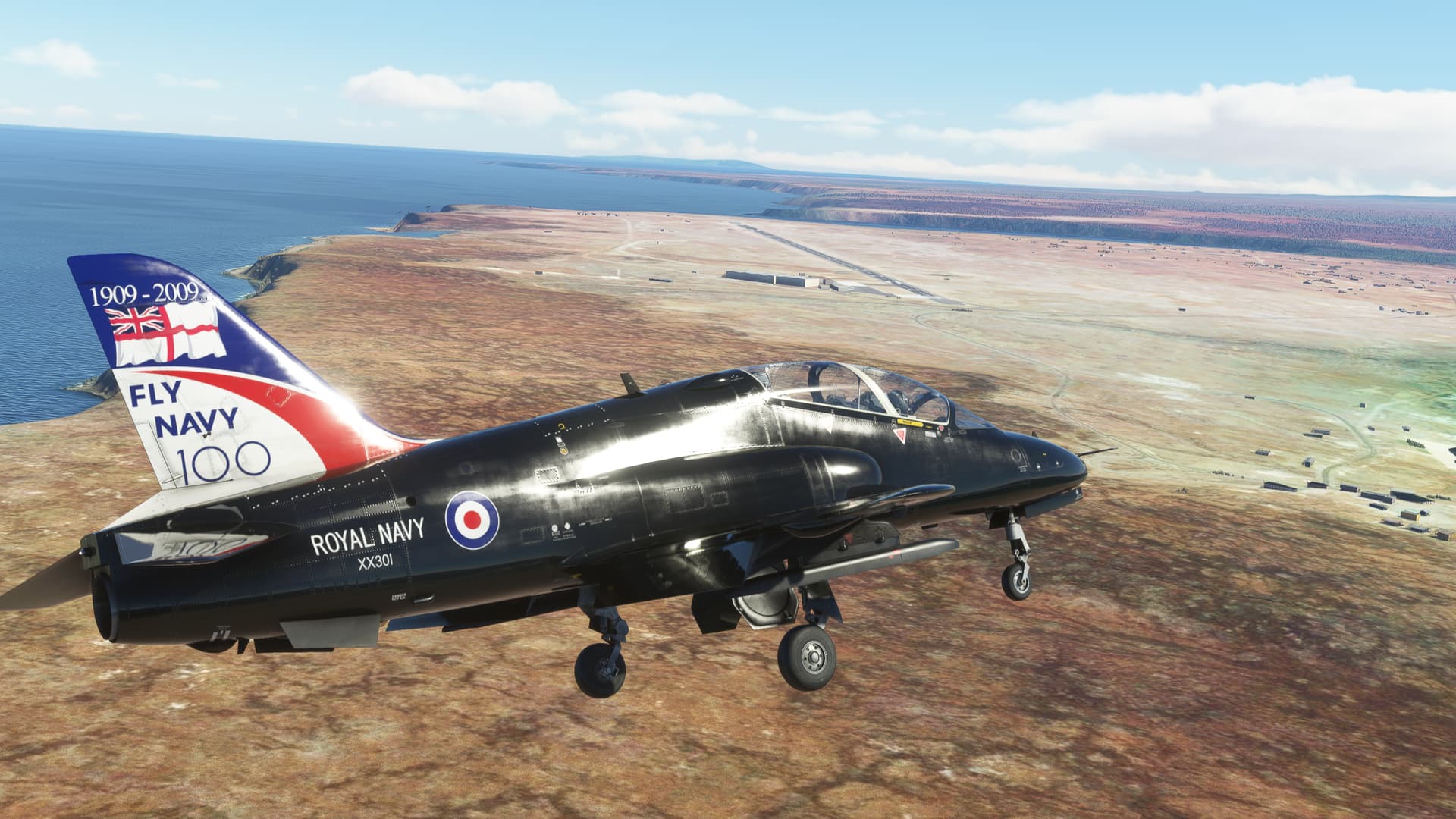
Leg 18: Galapagos
OR LAND OF THE LAVA LIZARD (and apparently the convenient aliteration)
OK, we all knew that this was coming…
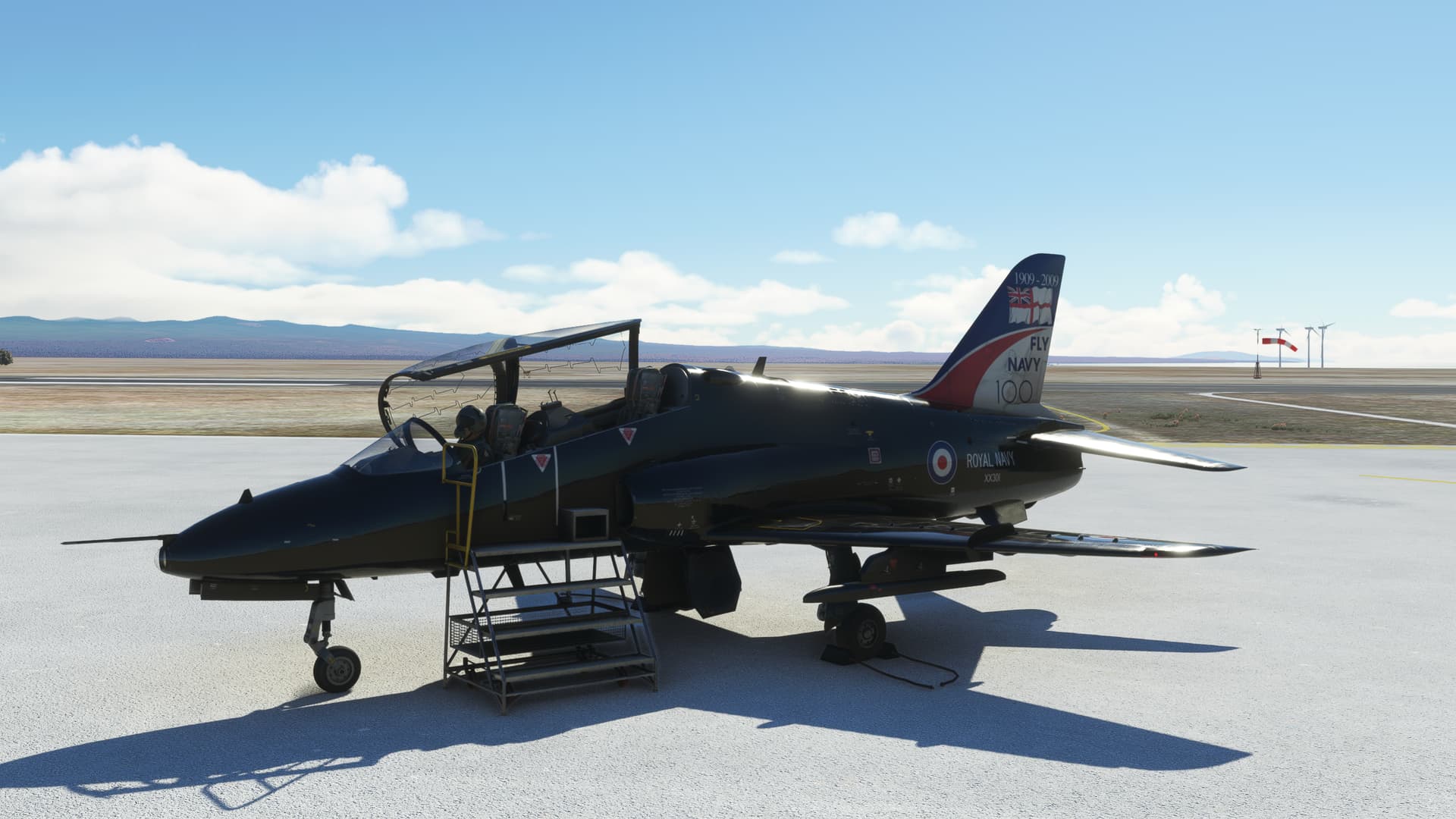
Just Flight Hawk in Royal Navy colours ('cause “colors” wouldn’t be proper), courtesy of Donka.
Well, I surely didn’t fly all this way to leave without a selfie. But “Time is the fire in which we burn” and all that. So, it’s time to step on the loud pedal!
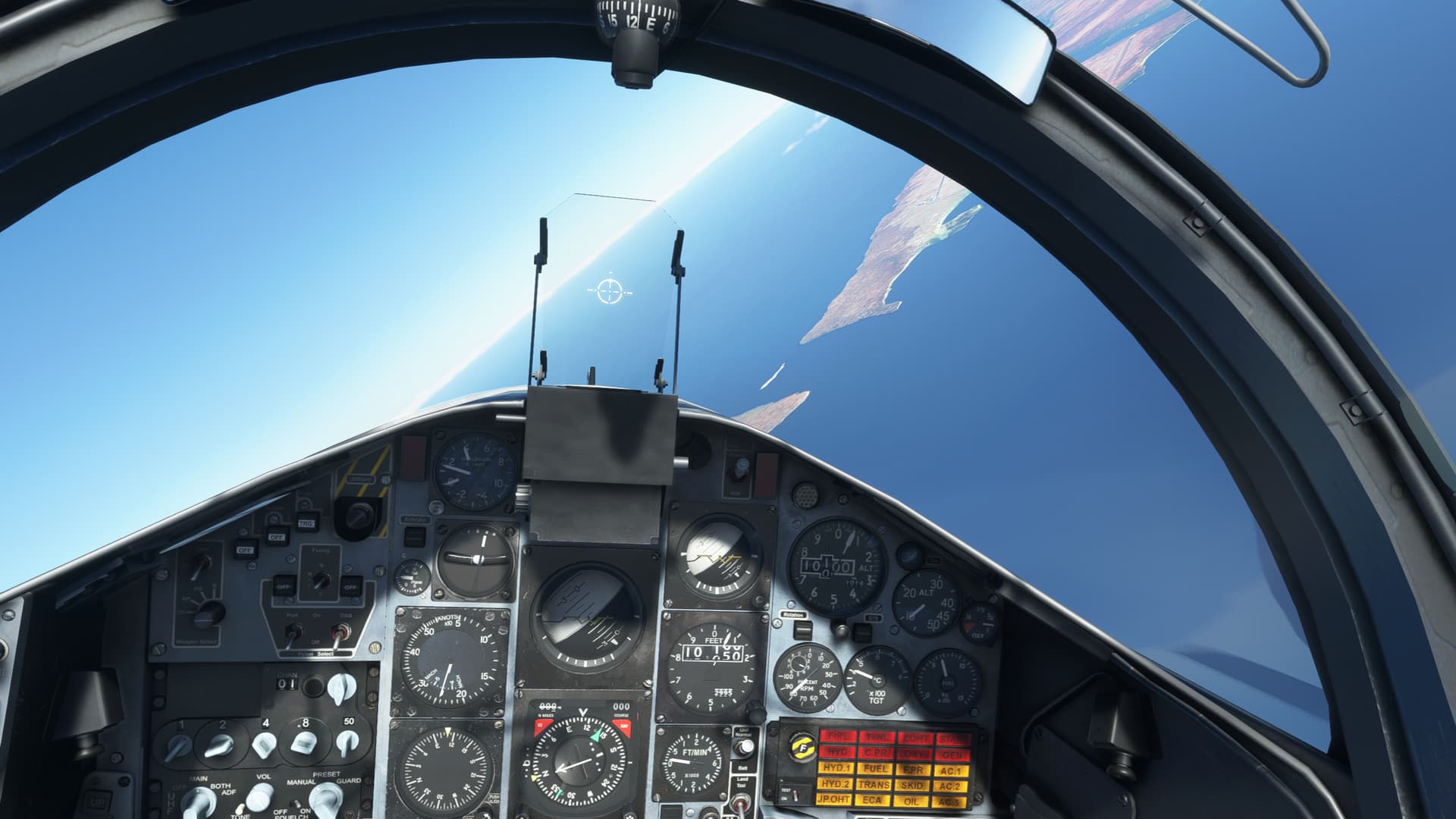
As I prepared for this flight with all my “usual” thoroughness, I had no idea how much gas the Hawk was going provide me, nor how to set the NAV radio. So, it was going to be a whirlwind tour in the hope of not getting lost and going for a swim.
“Minimum Climb Gradient” this!
Wow, that felt good.
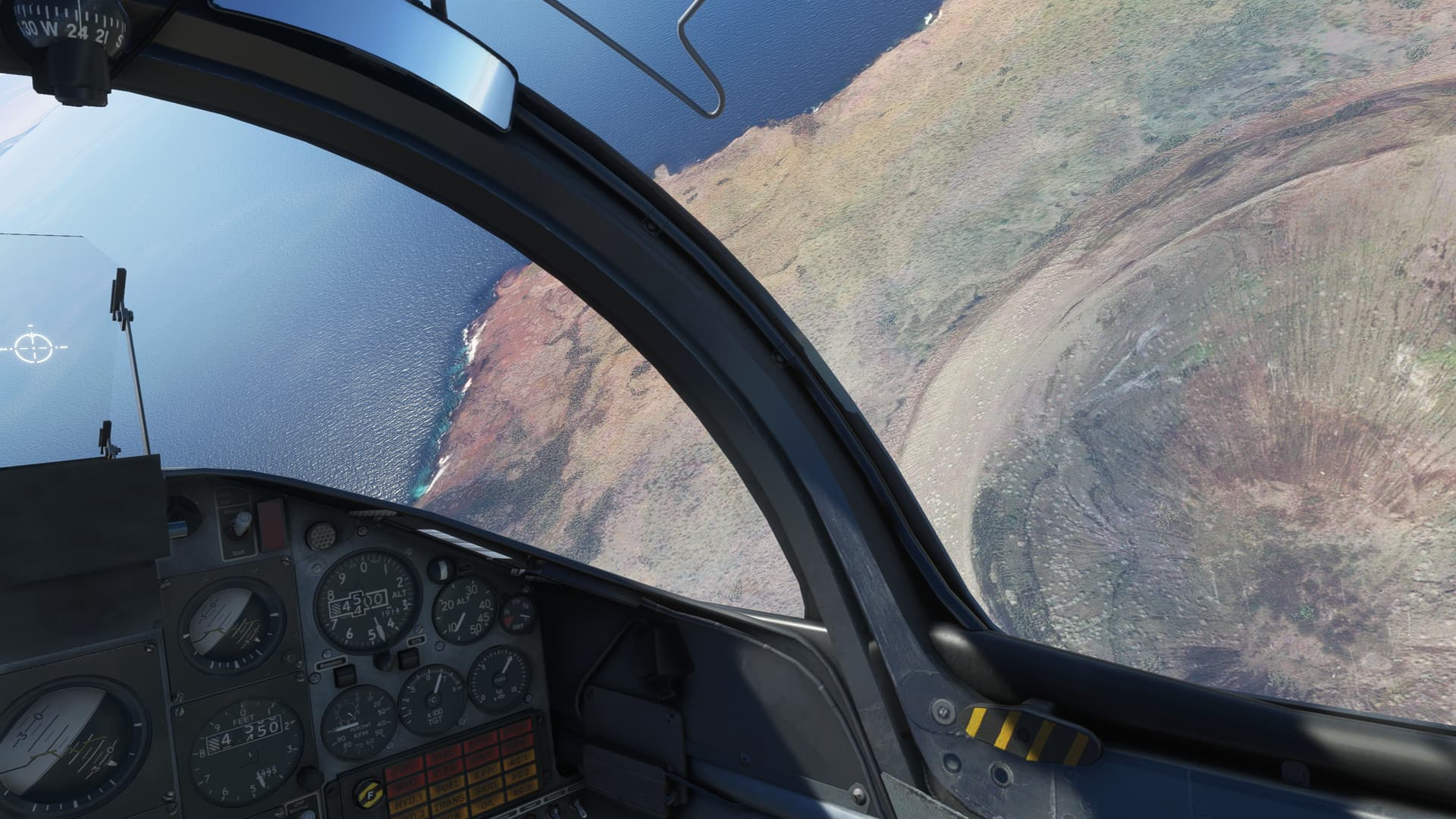
For lack of a better plan, I started flying clockwise around Santa Cruz Island. My intention was to stick to the coast in the hopes of spotting some fauna. But nothing. No Blue-footed Boobies, no titular Lava Lizards, not even a Heffalump.
I didn’t even allow myself the hope of spotting a Tigger…after all, there’s only one!
Eventually, I did spot an unusual species. Non-native I believe however. Puerto Ayora.
I then blasted north towards the neighboring island of San Salvador. The terrain is truly impressive and I must admit, I did not realize how substantial this archipelago was.
Of course, anything volcanic seems otherworldly (which it clearly isn’t), and is thus rendered “Smashing”, in the Queen’s Good English.
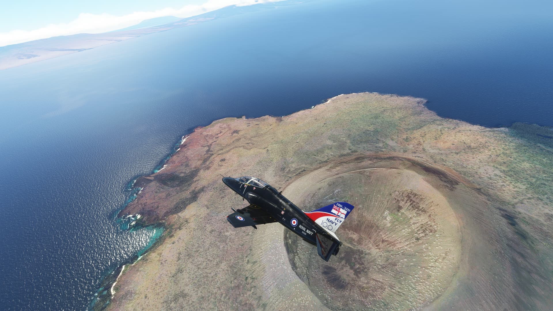
The majestic terrain kept calling me on, even as my fuel gauge steadily unwound.
And so, Discretion being the better… “Hey! Look at that cool mountain over there!”
Where was I? Ah, yes.
And so, Discretion being the better… “Holy crap! Where’d all my gas go?”
I cranked my jet around in a 4G turn and started heading back the way I came, maybe?
That was La Cumbre on the island of Fernandina, BTW.
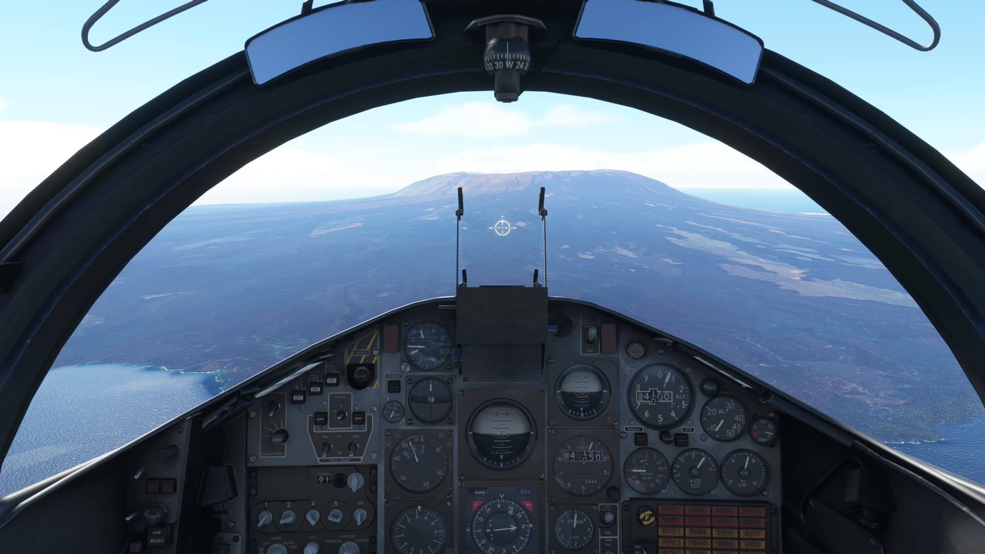
I’m calling out these sites like I really had a plan going into this flight. I didn’t. And, despite their majesty, they really start to look all samey at low altitude, making VFR navigation problematic.
Luckily the Hawk sips gas. I recall landing in the T-45A with fuel levels that would make most pilots (including this one) suck up their seat cushion in any other aircraft.
Still, it’s not a Prius.
In retrospect, this turned out to be Mount Alcedo, on the Island of Isabela. Quite a sight.
There are the small volcanoes I flew over previously. My field was on the other side of the island. Piece of Pie!
Whoops! I forgot. Those two volcanoes were on San Salvador. The island with the airfield is across the bay. Easy as Cake! (Name the movie?)
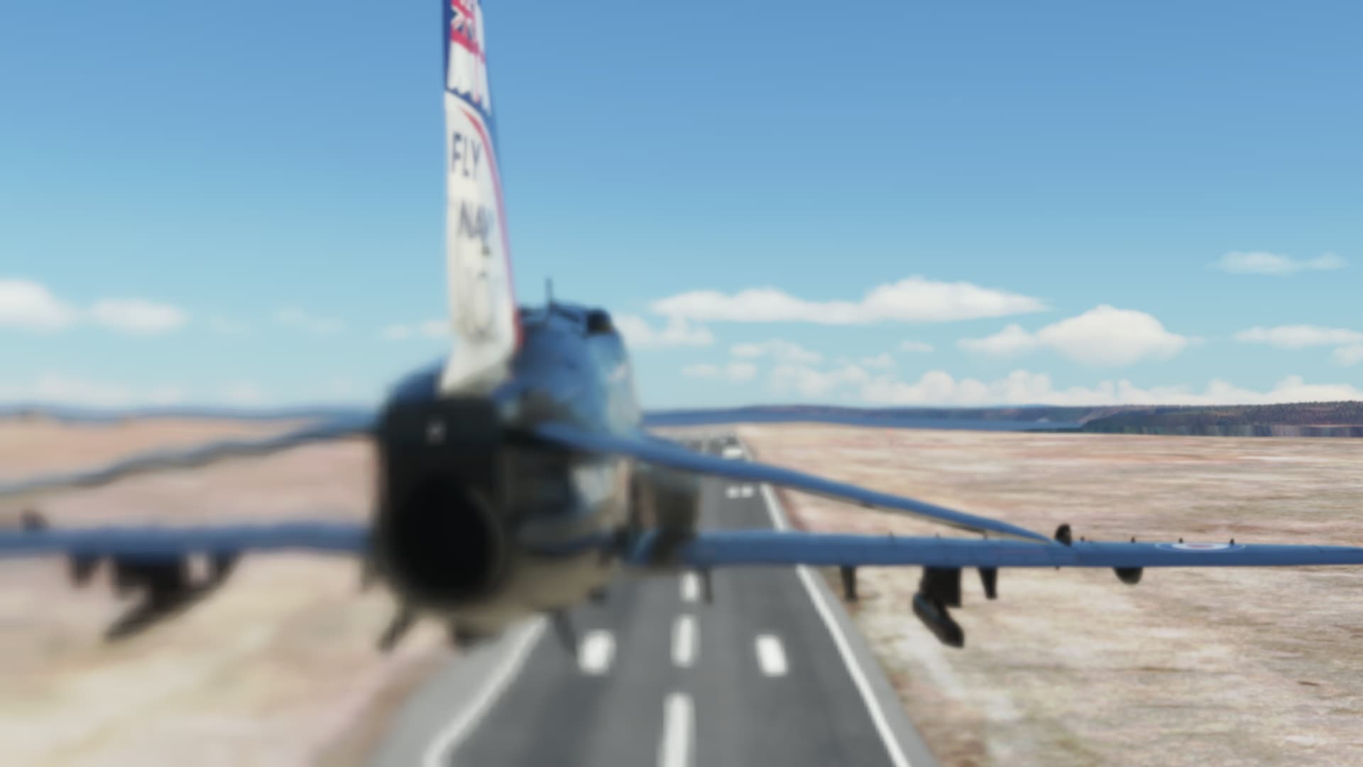
Well, I haven’t crashed in at least two legs. Time to buzz the tower!
…the blurriness means it’s fast. ![]()
Ok, so a little “Long In groove”.
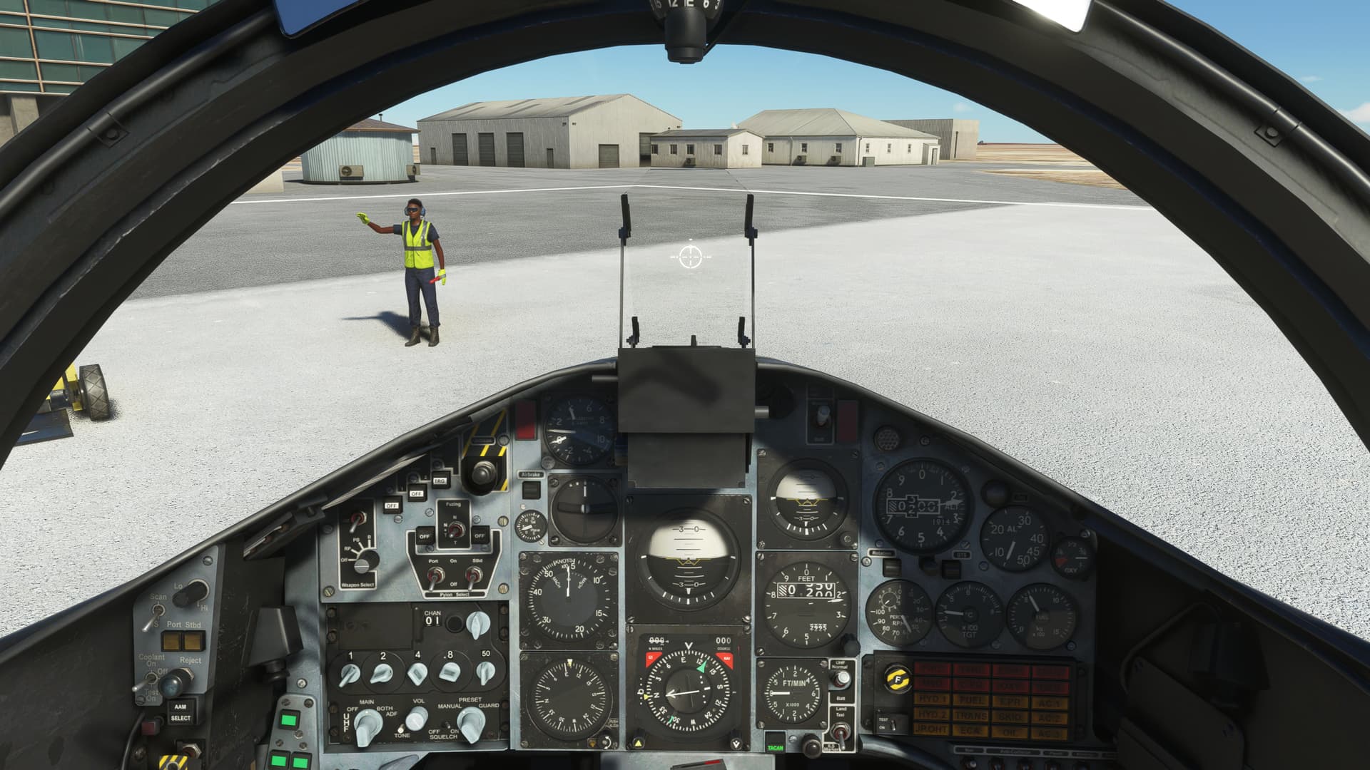
It makes me sad that these guys can’t afford two wands…what is aviation coming to?
All I have to say is that, in the T-45, you climb down the integral handholds to get out of the jet.
Would you look at the steps they have for the Hawk?
They really treat these guys, (snicker ![]() ) like royalty!
) like royalty!
LOL. that’s awesome!

I’m sorry, but some of these screenshots are outrageously nice. I can’t believe where we are with the hobby…
Excellent Recce, @Navynuke99!
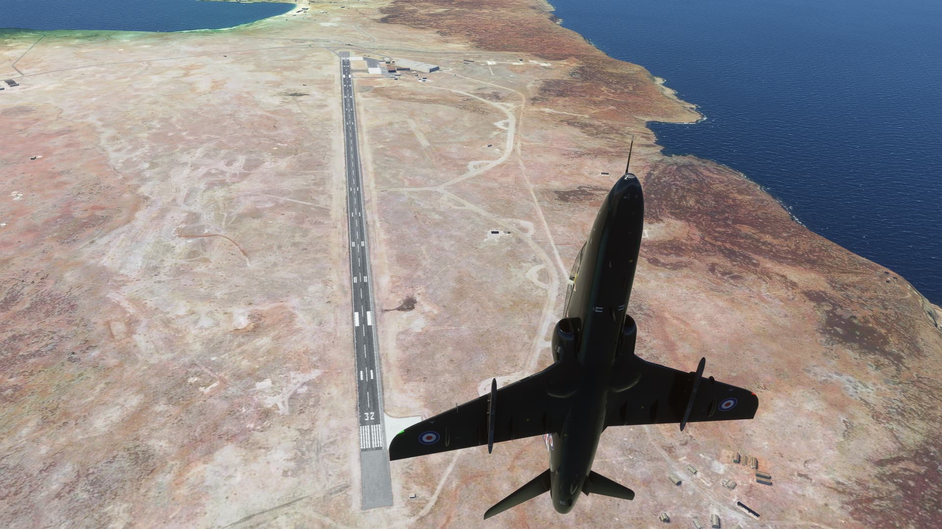
Leg19: Baltra Seymore, Galapagos (SEGS) TO Jorge Chavez Int’l, Lima, Peru (SPJC)
OR “Huh, what do ya know, they DO model winds at altitude!”
Alright, enough fooling around. Back to work.
It was now time to get back on course. My initial plan was to hop the airways back to continental Ecuador. But, part of my justification in diverting to the Galapagos was that I would cut off some coastline on the way back.
I hope I don’t miss anything as a result of this decision.
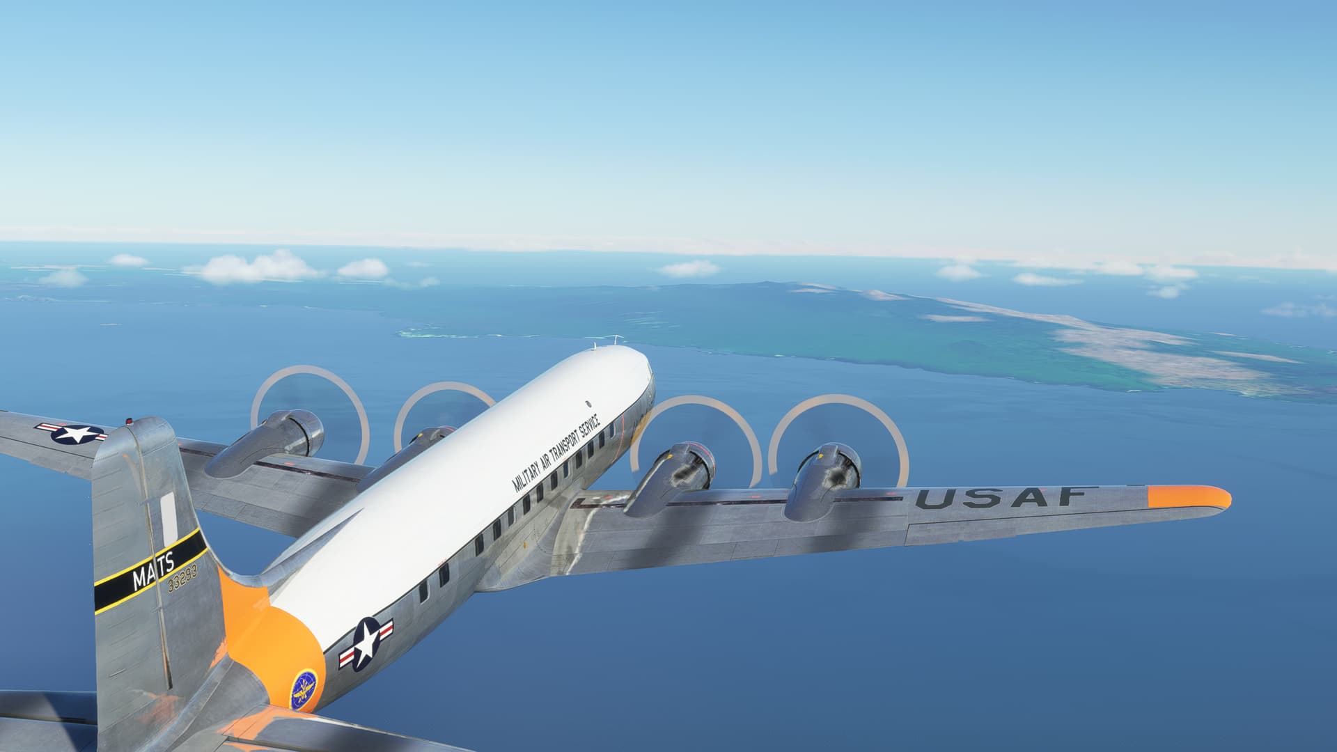
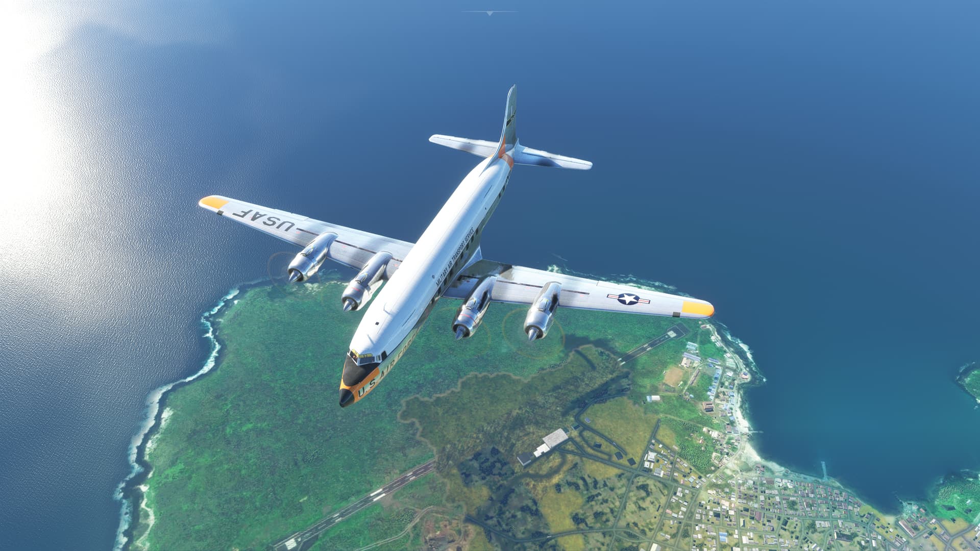
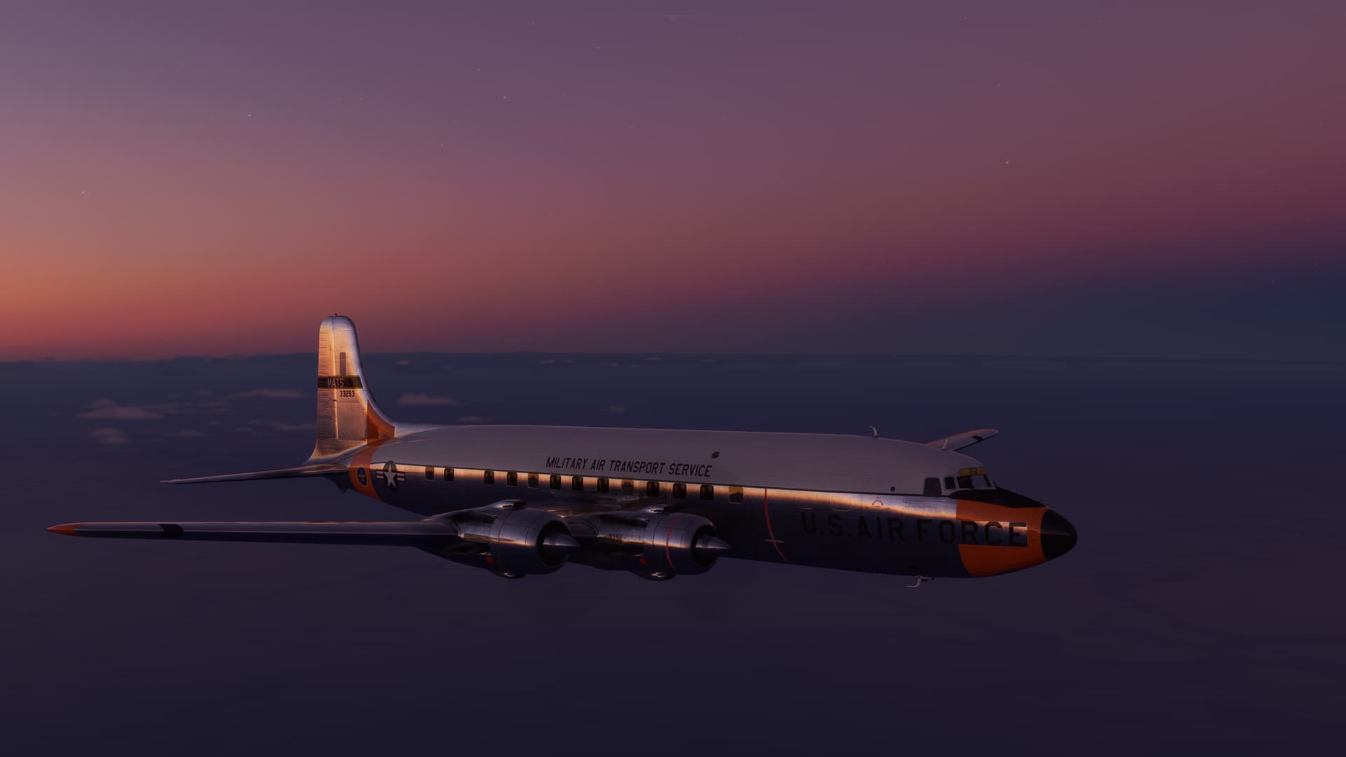
Back into the DC-6 with a later era MATS livery by SteveDra
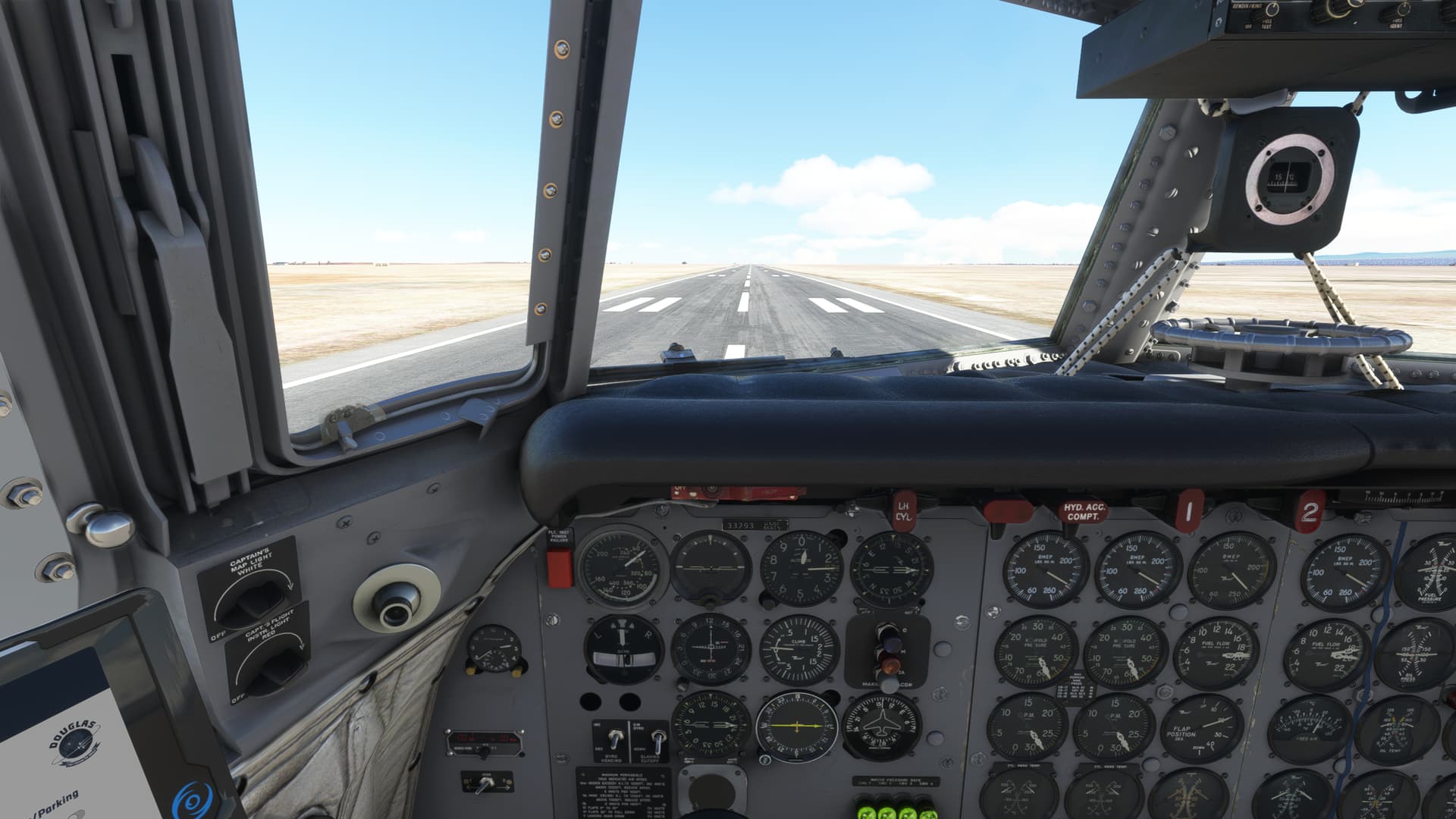
I am determined to learn how to fly this thing. I’ve changed my intended flight profile after rereading the manual (Hey, what else you going to do on a 13 hour overnight at Das Airport Hilton?). Let’s see if I can figure out how the devs want me to fly this bird.
I’m pretty full of gas, pax, and trash. Wet Takeoff again this time.
Still a goodly amount of wind which I allow to skip me across the centerline a bit.
I let the CP do his thing to the maximum extent practicable. It flows more smoothly this time. I think I was climbing out just slightly slow and it was failing to trigger the CP to move on previously. It really is a flat climbout.
Bye Lava Lizards!
As I climbout, I pass over San Cristobel Island. Last land for 900 miles, give or take.
San Cristobel airport. No, it’s not! Nothing to see here!
I’m sure there must be a good reason why MSFS almost, though not quite completely, entirely fails to successfully hide airfields which it chooses not to put in the sim.
But, I can’t help but be reminded of this:
And, while we’re on the subject of things British. Back when I was wandering blindly through torrential rains over Cuba in the Spitfire, I decided to change my callsign. I was tired of being called “Generic” or some other such nonsense, and found the screen on which to change it.
Well, I guess I just never got an ATC call on that flight, because I never heard it.
But, because I keep forgetting to change it back, I have been “Rabbit Leader” for at least seven legs now! ![]()
OK, enough hilarity for the moment.
When last we heard from our hero, he was leaving Galapagos in the rear view.
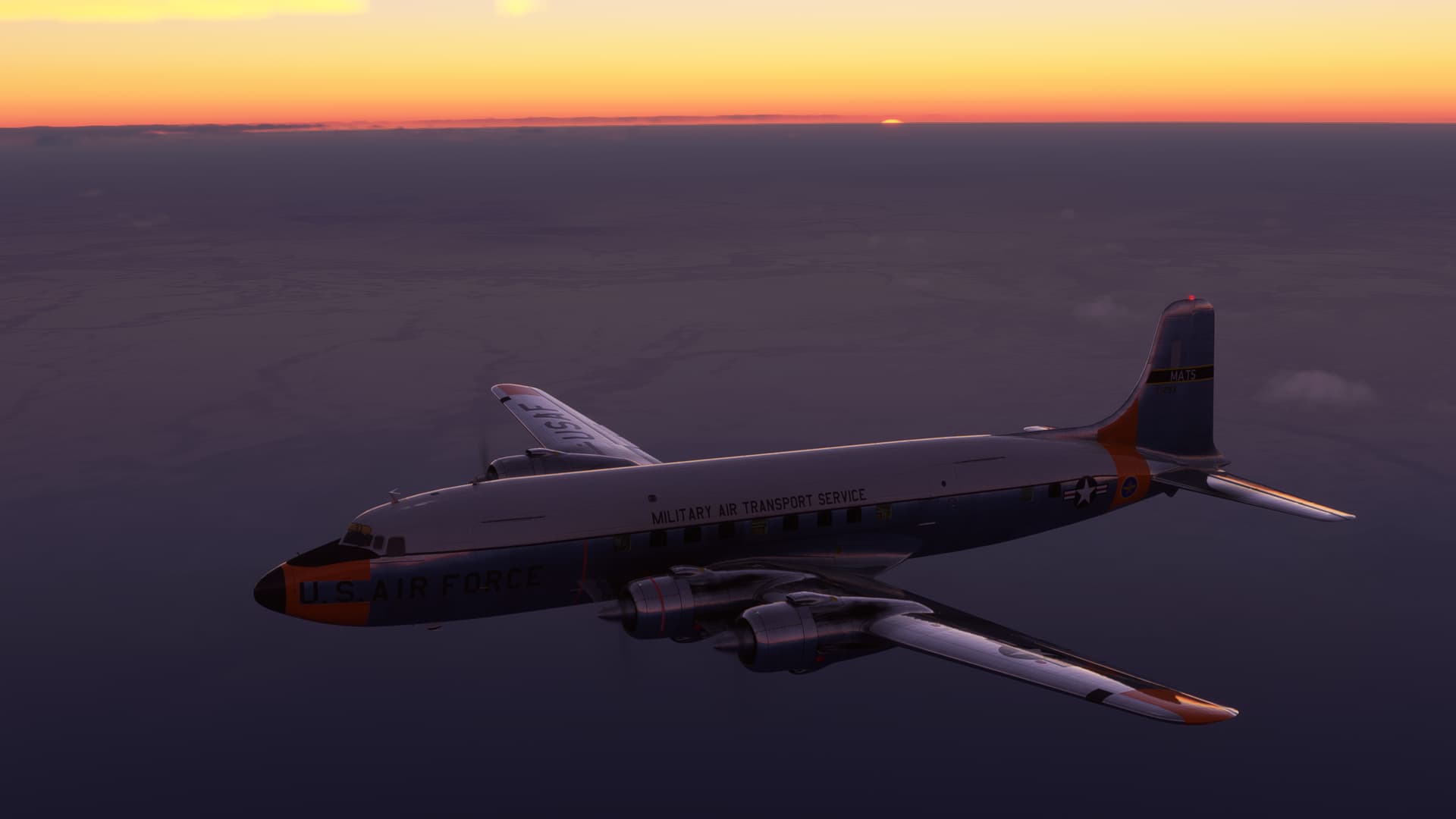
And it was fully a reflection of the utter lack of careful planning and forethought that I had put into this flight when I found my self surprised that the Sun was setting.
“Huh, I did not plan for this.”
Pretty though.
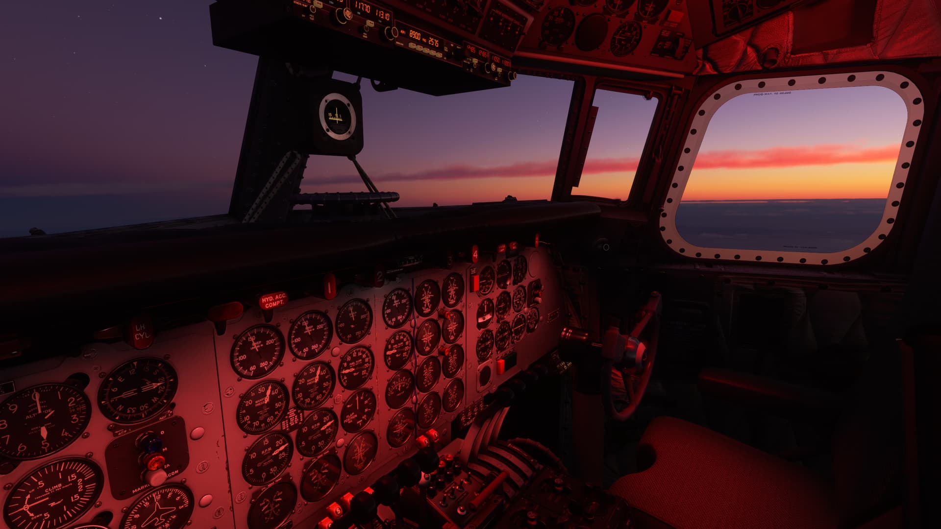
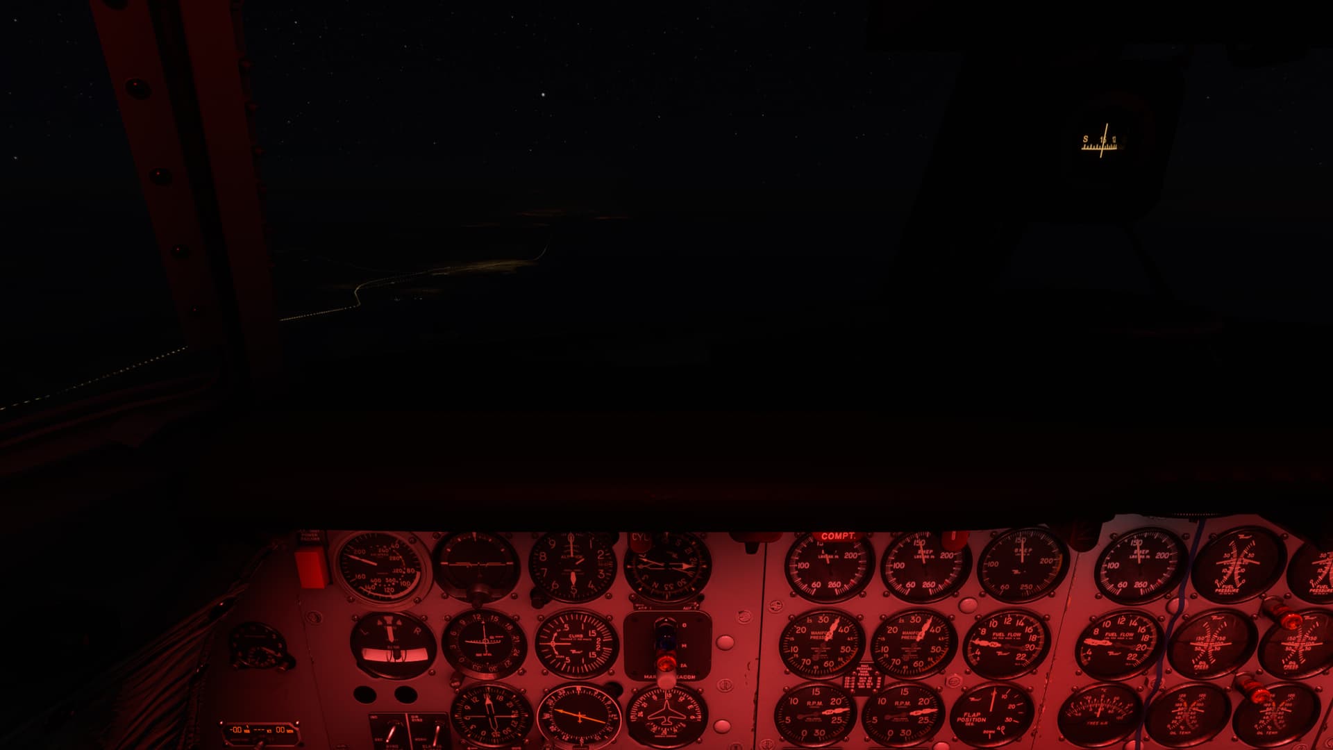
I apologize for the underdeveloped photo. But, at this point, I had been cruising out of NAV range for several hours. I found myself just staring at the RMI, willing some radio station to come in and tell me where I was.
So I was pretty relieved, at least in the general sense, when I just began to pick up coastal cities glowing off in the distance, their lights illuminating the clouds above like an old 1920’s navigational aid.
Originally, Skyvector showed the South American coast pretty socked in, with Lima reporting OVC021. Thankfully that was incorrect. Well north of Lima I found myself crossing the coast which I could only tell by virtue of sighting the coastal highway. As I alluded to in the title, my question as to whether or not MSFS took upper level winds into account seems to have been answered. I was considerably left of course by the time I came ashore.
In fact, if the undercast had been solid, and without any locks onto even the nearest Navaid, I’d have shortly found myself wondering what that Alpaca was doing up here in the clouds!
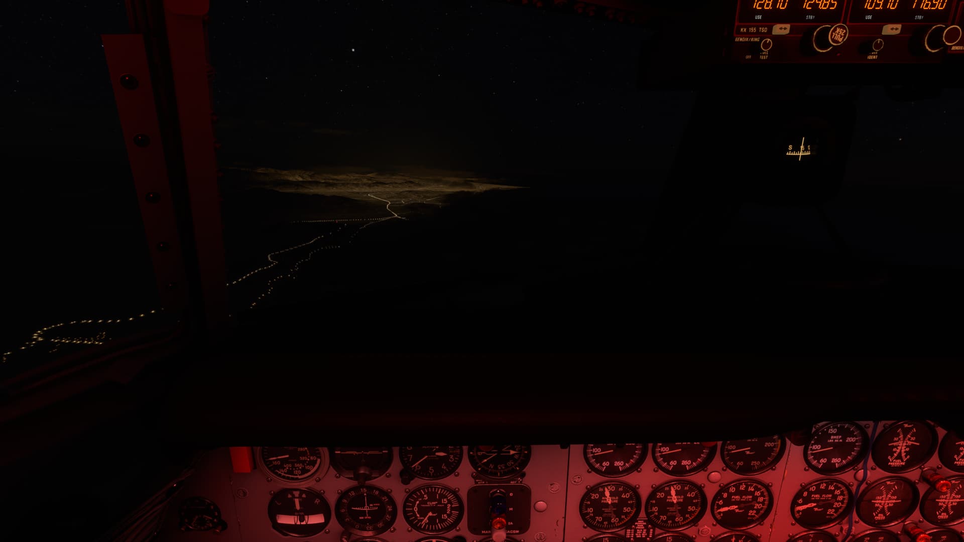
Here you can see my light lifeline to Lima (hey, that’s my second alliteration of the day!)
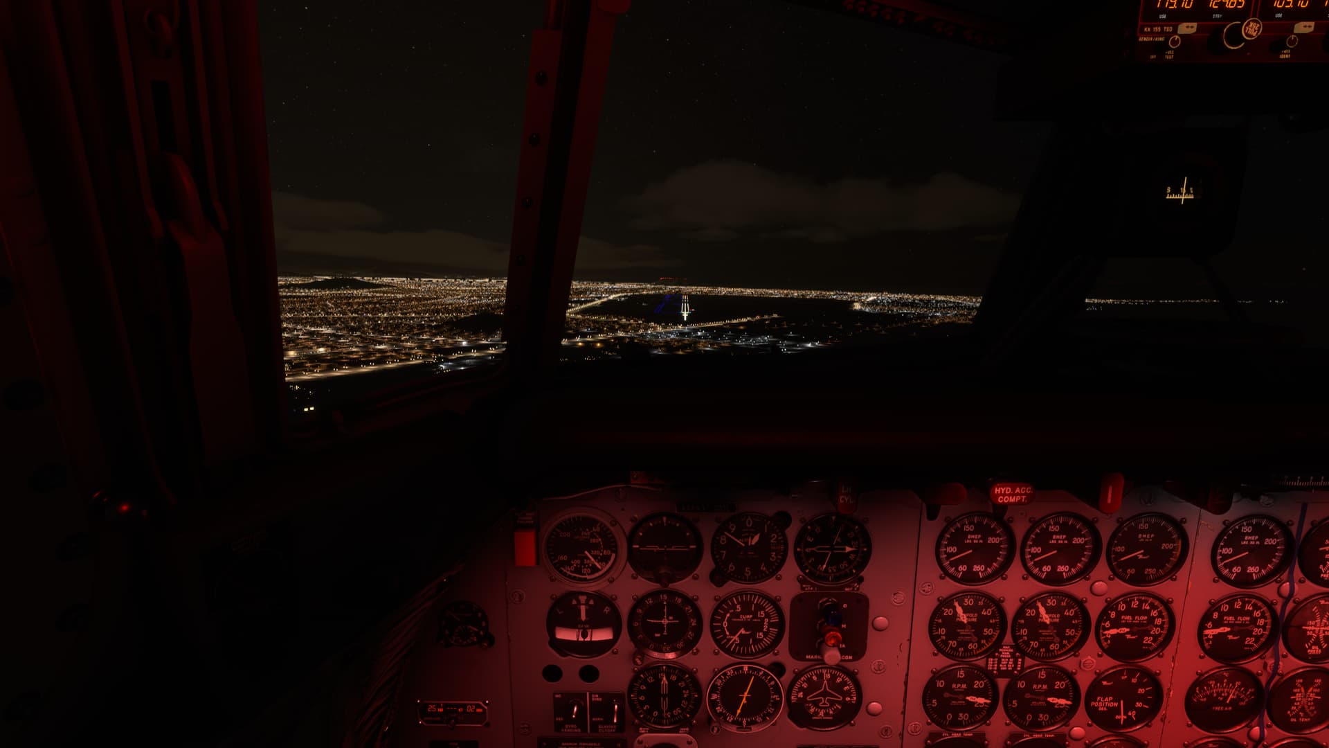
Finally, I picked up Salinas VOR (SLS). But no DME, which was going to make descent planning more difficult. I eventually got station passage, which finally narrowed down my position, roughly defined as way too high for my descent profile.
So, I spun it twice and finally got down on a reasonable glidepath.
The view out the window was surreal and a bit disorienting. I can’t tell what of that is mountains, what is clouds, and what is city…but it’s beautiful!
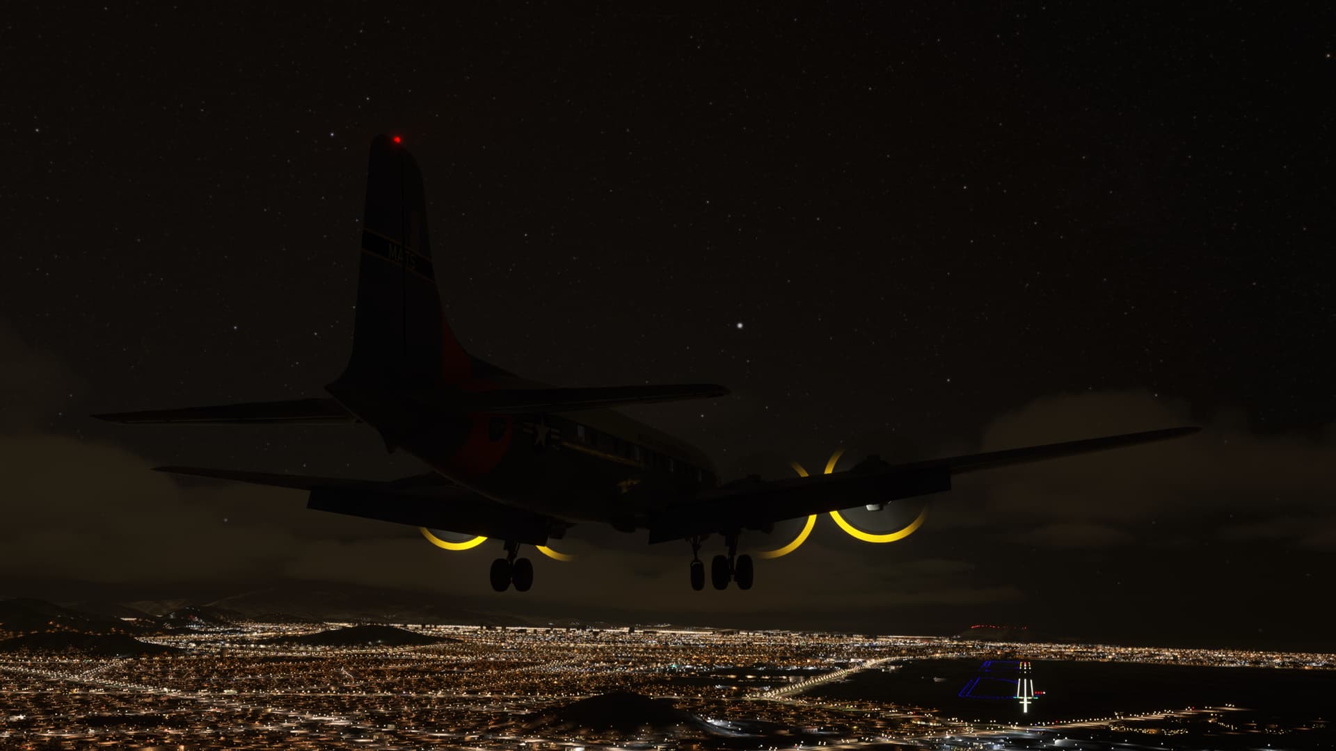
I am still figuring out the AFE and this time it almost worked. But, from a reasonably stabilized approach configuration, clicking on Before Landing turned my nice approach into a bit of a dumpster fire.
But, with the requisite questioning of the Copilot’s parentage and having explored the possibility of his eating paint chips as a child, we managed to get the bird onto the runway.
Safe(ish)ly.