Congratulations @Harry_Bumcrack for completing the Christmas Flight and sharing with us the AARs. I am, for one, happy you took the Vulcan ![]()

Congratulations @Harry_Bumcrack for completing the Christmas Flight and sharing with us the AARs. I am, for one, happy you took the Vulcan ![]()
congrats @Harry_Bumcrack !
peace on you too ! ![]()
![]()
I voted for the peacefull Cirrus but this Vulcan was great ride also, especially with what you have delivered!
Congrats @Harry_Bumcrack ! I’m myself still a few legs away from the final destination in China. The next leg with the C-17 brings us from Baku to Ashgabat, the capital of Turkemenistan. A fact I hadn’t known before. Something can be said about learning by doing these Christmas Treks ![]()
I climb out this time to a whopping 30k feet, which is unusual for my flights. If the weather is fair, I prefer to stay at 10k and do some sight seeing. But first there is the Caspian Sea, and then I have no idea what expects me.
Autpilot switched on, still on the climb. I like that I can easily see the status of engines and control surfaces with a glimpse to the center console, though the virtual horizon is hidden by the nav system in the screenshot.
I tried my best to take an in-flight picture of the cargo hold content, but ultimately that’s the best I could get. There’s probably some camera that will reveal it, but I haven’t figured that out yet. Anyway, I somehow screwed up my autopilot while trying the camera and dove quickly towards the ground. Luckily I was high enough to catch this and besides a bunch of overspeed warnings, nothing happened.
Feet dry and the weather cleared up, looks a bit like I imagine the moon?
Over the destination airport the weather went foul and solid rain and clouds prevented any sight landing. As I started my approach 10k feet higher than usual, my calculations were all wrong and I passed the airport at 10k feet first.
I turned around and luckily got clear sight of the runways for my visual approach.
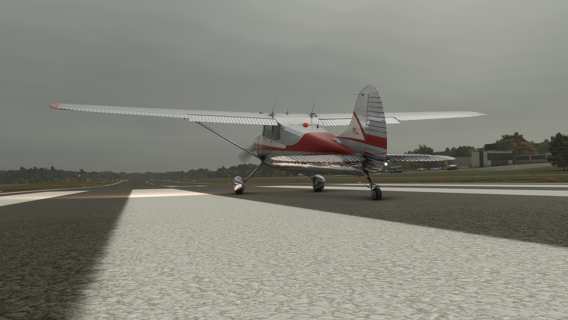
Some planes parked at the airport can be seen here.
I could not fully figure out how to get there, so I called it a day at this position.
I estimate that I will need 4 more hops to arrive in Daocheng, so the end is in sight. Maybe I should take a lesson in ILS starts and landings though ![]()
Let me add my congratulations @Harry_Bumcrack!
That Vulcan is amazeballs. I really enjoyed seeing you fly it. ![]()
Arrived as well!
Not smoothly, though. This is how it happened.
Prepping for this last leg from one high-elevation airfield to another, I soon realized that landing the DC-6 at 14k+ ft airport is not exactly the same affair as taking off from one.
The density altitude at my departure was not much different from the field elevation of some 14k+ ft but it was a bit windy and the placard below did not say anything about V-speeds for my loadout (relatively light at 75k pounds) at this altitude ![]()
Moreover, after the last flight the engines were not in their top conditions either… ![]()
And given that the AFE (automated flight engineer) refused to cooperate with me the last time I should probably have stayed in the hotel room.
Anyway… the engines fired up with no hiccup so off we went.
Did I mention it was a bit windy?
OK so here we go:

When the AFE called maximum power and I saw this on the dials (check the MP gauges)
I understood why we were rather sluggish in picking up the speed when rolling down the runway.
Flipping the blowers to high mid-way helped to get airborne but then the wind kicked in and… you know.
So one crash later there I was again at the rwy threshold ready to go… only now with the blowers in high position from the very outset. Later I found it was actually the right procedure when flying out of high-elevation airfields.
Here we go.
Flying over Tibet, I was quite surprised about relatively frequent signs of life.
Cruising at FL021 with the terrain dangerously low.
This is what the Hump pilots called the High Hump. Only they saw it from the other side.
Getting closer to my destination.
I calculated the descent profile in such a way that with the help of a GPS (no traditional navaids here!) I would arrive overhead at some 3000 ft agl and then decelerate outbound from the field.
Slowed down and turning loooong finals.
This time, to avoid messing up again with my AFE, I called him to run through the In Range checklist when overhead the field and then Before Landing checklist when starting the 3 degrees descend towards the runway. It worked well.
Windy again. The landing was far from being a smooth one.
Safely down nonetheless and taking a moment to digest the experience.
This Christmas Flight is OVER for me!
What a journey! I learned a bunch of stuff, had fun flying and reading your AARs and already am looking forward to the next year outing ![]()
Thanks for your attention and feedback and
Awesome job @apollon01 . Welcome to China, sorry I couldn’t hang around but I have a Rally in Finland to attend (the chance to drive a Group B car was too good to pass up). I did put some money over the bar before I left, just tell the bartender that you are with the Mudspike crew ![]()
I think you may have also given me my inspiration for next year’s personal challenge - Pistons and Props only?
Well, you asked for it!
I just wanted to start by saying how much I’ve enjoyed reading all your trip reports this year.
I myself have, “lived in interesting times” these last several months. So, it seemed appropriate that this year’s destination was China (I know, I know. The saying is apocryphal. But, still… ![]() ).
).
I had a bit of a time getting started this year, because…reasons. So much so that I wasn’t at all certain that I’d make it. In the end, I just decided that I’d do what I had the gumption for and save the trip reports, if any, till the end.
It’s been a Hell of a journey.
Well, with Chinese wisdom misquoted and disclaimers complete, please accept my version of…
DEACON’S TWELVE…

…TEN, TEN DAYS OF CHRISTMAS…FLIGHT
CHAPTER 1
THE JOURNEY TO NOWHERE
Wings Field Airport (KLOM), Blue Bell, PA TO La Guardia Airport (KLGA), East Elmhurst, NY
24 September 2023 1025L (1425Z)
70NM. ETE: 1+00.
If I was ever going to make it to China, I’d need to start somewhere. An aviation amuse-bouche, if you will. Philly to New York sounded doable. Besides, I always think of New York City when I think of Christmas, old timey aviation, and particularly both. Maybe this might just get me in the mood.
Plus, I had a harebrained scheme that I had wanted to start (and nearly wound up finishing) there.
Might have picked a better weekend though…
As it turned out, Tropical Storm Ophelia had displayed the poor manners of coming ashore right when I was trying to give the world a much needed zero, ah, I mean, hero!
Might have picked a better aircraft, as well.
Having jumped into the cockpit of my venerable C-170, my eye was immediately drawn to the dark patch on the CDI…where the glideslope indications might otherwise have been. So, no ILS then. Actually, looking at the approach plate, I also noticed that there are no DME or crossradial fixes outside the Final Approach Fix at all. Not that I have DME. But at least a crossradial would have given me some idea of when to descend.
I therefore did what any safe and sane pilot would do in this situation. I went anyway.
Once I had taken off, my plan was to run the scud all the way to LGA, if I could.
But, as the hills rose to meet the overcast, I found myself in the soup, and far sooner than I had hoped.
The winds weren’t exactly helping matters either. Harbinger of the coming storm no doubt, it meant that I was crossing New Jersey at the speed of a rampaging parade float. Still, with obdurate slowness I eventually clawed my way onto the inbound radial to LGA.
Once I was fairly certain of not taking a mountain to the kisser, I gave into the temptation to sneak down for a little looksee.
The Swinburne and Hoffman bastion islands (guardians of the Hudson River) materialized from the mist like ships in the fog. The Verrazano Narrows Bridge kept watch in the distance.
I was close.
By the time I reached the neck of Long Island, I had made it into the clear. Unfortunately, rain showers were still blocking any sight of La Guardia. This would not be the last time on this journey that I’d find myself desperately peering through the Perspex, like a medium through a crystal ball.
Luckily, a helpful (but likely astonished) 767 pilot showed me the way. Let’s see a medium do that!
Following my new friend to the field, I touched down on Runway 04 without further drama. My 80kt approach speed was, I’m sure, entirely appreciated by my fellow pilots. At least, I assume that’s what all those transmissions were about, I wasn’t really paying attention. ![]()
In fact, the controller was so impressed that she gave me a phone number to call once I got on the ground! And they say New Yorkers aren’t friendly. ![]()
Well, it looks like I’m back in the game, Lads and Lasses.
I am about to go to bed, but this can’t wait until morning.
About time you showed up ![]()
![]()
Latest version of Gimp and a lot of googling left and right. This software is pretty capable. And freeware too!
Great choice if you ask me ![]() Only a bit slower than the Vulcan
Only a bit slower than the Vulcan ![]()
Well, thank you. You’re very kind.
I was living vicariously through you all! ![]()
hmmm, hate gifs bigger than 1MB ![]()
and this was also strange
fortunately we spawned allright for this leg
all the flights up here on the North are always race against the sunset
race on
seems like all the very rough terrain is concentrated on the SW part of Greenland
sunset is near, but we are almost there at this point
just few minutes before the dark, and at that point I still didnt know how to turn on the cockpit lights ![]()
BGKK Kulusuk
CHAPTER 2:
THE EASY WAY
La Guardia Airport (KLGA), East Elmhurst, NY TO San Francisco International Airport (KSFO), San Fransisco, CA
27 September 2023 0520L (0920Z)
2236NM. ETE: 9+10.
Where I went from here had been a splinter in my mind’s eye for quite some time; at least since PILOT’S released their Boeing Clipper last spring. I had always been inspired by the tales of the “Clipper Skippers” and had said that one day, I would (virtually) follow in their footsteps.
And this year’s destination was China. Hmmm…

The big factor in my decision of whether or not to go was time. Some of these legs were 10, 12, up to 14 hours long at Flying Boat speeds. And Celestial Navigation meant hourly sextant shots, a crap ton of calculating, and (as I understood it) no pausing.
The struggle was real on that second one. The last time I had tried filling out these celestial forms it had taken me the better part of an hour. Each. Due to some physical…ahem, opportunities to excel let’s say…sitting for 14 hours doing sums was going to be a tall order for me.
And so it felt like a bit of divine intervention when I stumbled upon a series of YouTube videos offering an ”easier” way to do it, by using a web-based sight reduction tool.
Easier. That will be ironic later.

La Guardia. 0520 Sim Time.
Time would truly be the fire in which I burned this year, and in more ways than one. At this point, I only knew how to take Sun sightings, and even that (as you’ll see) was debatable. The problem was that, with these speeds and distances, keeping the Sun above the yardarm was going to be no mean feat. And it was only going to get harder as the year grew older.
Moreover, I didn’t only need the daylight to navigate, I needed it to find my destination once I got there. This wasn’t necessarily going to be a huge factor this leg…hopefully. Surely, even a mediocre pilot should be able to find the west coast from the east. But, if I ever intended to venture beyond the west coast, the land would only get smaller and the ocean bigger. So, this seemed like the kind of thing that I best figure out early.
In what would become a perennial hunt for daylight then, I chose to take off at the first hint of twilight, with the hope of reaching my first sighting position at dawn.
Finally, and as you’ll note, I am not in the Boeing 314. Aside from some issues I was having with the Clipper, I also decided that I’d be better served by taking a known entity up on this, my first Cel Nav flight. Besides, the extra groundspeed of the DC-6 (AA livery by jamespejam) would shave at least a couple of hours off what was unavoidably going to be a long day (but still hopefully give me some sense of how to “time” the Sun).
I chose a wet takeoff as LGA was a little short and I was a little heavy (to say nothing of the plane ![]() ). Once airborne and cleaned up, I set my initial course to San Fran, incorrectly as it would turn out. Somehow, with my virtual head craned in that particularly weird position necessary to keep both the HSI and the autopilot turn wheel in sight, I induced a ten degree heading error. So, I was off to the races right out of the gate.
). Once airborne and cleaned up, I set my initial course to San Fran, incorrectly as it would turn out. Somehow, with my virtual head craned in that particularly weird position necessary to keep both the HSI and the autopilot turn wheel in sight, I induced a ten degree heading error. So, I was off to the races right out of the gate.
Apparently, I really like to put the “problem” into “navigational problem”!
What was worse was that, preoccupied with setting up for my first fix, I didn’t even recognize the error until somewhere in the vicinity of Cleveland, whereupon I made out the southern coast of Lake Erie to my right. Instead of my left.
It would also appear that I was too clever by half in taking off at first light. Both my first and second hourly sightings yielded the dreaded, “Sun is below horizon” message. As a result, I wound up fully a third of the way across the US before I could take my first sextant shot. Though I had hoped to avoid it, I gave in to the temptation of determining my position via VOR…mostly because I couldn’t stand not knowing where I was for three hours!
However, the Sun, as they say, also rises.
Hour three. I finally resolved my position by the Sun.
21NM. Not bad. I knew that I had been holding south of my plotted course, but I had wanted to find it (and fix it) through Cel Nav. That’s what this leg was about after all!
There was one small problem with my shot, and you’d be forgiven for missing it. Without going into a big explanation, I’ll point to the important part of the Sight Reduction Calculator. Those last three lines on the bottom right of the light grey box below. Those are referred to as the Azimuth, and the Intercept.
Basically, and as is shown on the map, I apply this Azimuth (direction, in degrees True) and Intercept (distance, in NM or Km) to my Assumed Position to find my location according to the Sextant. Notice that, in this case, the Intercept is negative.
Now in forty years of land and air navigation, I had never heard of a negative vector before.
Apparently, neither had the video’s author. Because in his examples he plotted the negative as positive, disregarding the sign.
So. Trust is a funny thing. It’s hard to gain, easy to lose. And in my case, hard to replace as I had no “alternate” celestial navigational method. And the clock was ticking.
After a brief, but heated, internal debate, I chose to dance with the one that brung me. 21NM at 093 degrees True. Just south of Chicago. My first position plot. Ever.
Finally, I was in business.
Somewhere over (what I thought was) Cedar Rapids, I took my next Sun shot. And I began to notice three things. The first was that my Intercept was again negative. The second was that it was also increasing. The third was that it was over 40 miles!
So, I don’t know if you’ve ever had that feeling. You’re all in, cards on the table, Rubicon crossed, marching on Moscow as the first snowflakes hit your face, only to begin to suspect that the guy who you’ve been taking advice from…might just be full of crap.
But that was the feeling I was beginning to get.
Coming up on my sixth hour, there was only one way to confirm what I was seeing. Up to that point, I had been adamantly opposed to displaying my present position (PPOS) in Little Nav Map. But I was increasingly concerned that I was trying to learn a new language by taking tests…without an answer key.
Much as I hated to do it, I turned PPOS on at the next fix.
My plotted celestial position was down on the southeast end of that black line, near the center of the map. At this point, it’s 129NM from my Assumed Position. My actual position at the time was the yellow airplane symbol to the northwest. Almost exactly 180 degrees opposite. And, almost the same distance away…
I think that the tutorial author, and by extension I, had been incorrectly plotting that negative sign.
I guess that technically made me lost. Or, at least lostish. But, once I corrected the plotting error, as well as the induced Dead Reckoning error that came along with it, I began to slowly make my way back onto course. My positions still didn’t feel agreeably close, but at least they were in the ballpark, and the error was decreasing.
Luckily, as I wandered further west and south, I passed into more familiar environs. With fairly unmistakable landmarks, like the Great Salt Lake, my plotted position and my celestial position collapsed like a singularity (and about as violently) into the same point.
In time, I made my way into the San Fransisco Bay area and took over visually to fly the Quiet Bridge Visual RWY 28R.
Weary, I landed, with relative grace, and taxied into the gate at SFO.
This is the map of my route. I don’t know if it’s a limitation of Little Nav Map or just a setting I’m missing, but the trail only goes back about 1500NM. It’s clear to see how and where I started plotting the Intercept backwards and the effect that it had on my navigation. You can also see that my path becomes increasingly accurate once I figured this out.
Later, I would come to learn that a negative Intercept is entirely normal and logical when you understand what it is actually telling you. In the end, the discovery of the “easy way” was a mixed blessing for me. On the one hand, I think that the YouTuber just made an error in his videos and didn’t catch it, but that certainly did not make this the easy way.
On the other hand, faced with the amount of work involved with kicking it Old School, I’m not sure that I would have ever gotten up the motivation to try, without the offer of the (theoretical at least) hand up that these videos promised.
Now I had a few decisions to make…
Hats off for having the guts to go with the celestial navigation.
When I first came across this black magic in MSFS I rejected it the same moment I saw it.
![]() Me too!
Me too!
It’s been sitting in my corner giving me dirty looks for quite some time now.
Up until this year, I’ve always successfully managed to ignore it.
And it’s only going to get worse from here on out!
I tips me lid to you sir.
Everytime I have looked at celestial navigation; my eyes glaze over, I start making incoherant noises like “na, na, na, na…” and find myself curled up in the foetal position on the floor.
I think @PaulRix did a flight several years ago using Cel Nav and I followed along somewhat successfully using the old FSX bubble sextant gauge. I’ve been meaning to try out the MSFS one and see if I remember any of it, but haven’t taken the time to do so yet. Sadly our former multihued and curved beak member left the forum and took down his posts, but CP had some really excellent adventures in celestial navigation.