That’s a textbook procedure turn! Love it!
3 Likes
what a great AAR! That plane is gorgeous! I can tell you care about the realism in your hobby. Great job!
1 Like
I feel your frustration with that bird @apollon01
thats why I decided for the JF Hawk and skipped all those famous fliers. they are really great priced but cant see the value in them.
here moving East. departing Mirage in full traveling outfit

no pics from this leg. there was nothing much to see. lot of missing satellite scenery.
destination for today CYWK Wabush Lake near Labrador City

next we will teleport our selves way South to CYZV Sept-Iles so we can enjoy more of the satellite scenery.
btw was in external view at one moment while I reached speed of sound. that sonic bang did jump scare me ![]()
7 Likes
departing Sept-Iles


its great when the scenery works …


… did some cloud surfing …

… low level buzzing …

… and then hurry down with the sun

next time less photographing, more flying, that landing was ugly!
CYBX Lourdes de Blanc Sablon
CYHR Chevery

12 Likes
Almost there!
But not yet. Chabua in India to Changdu Bangda in Tibet (China). This airport serves a city of Qamdo and it is just a shy lower (about 200 ft) than the Daocheng Yading airport which I will fly to next.

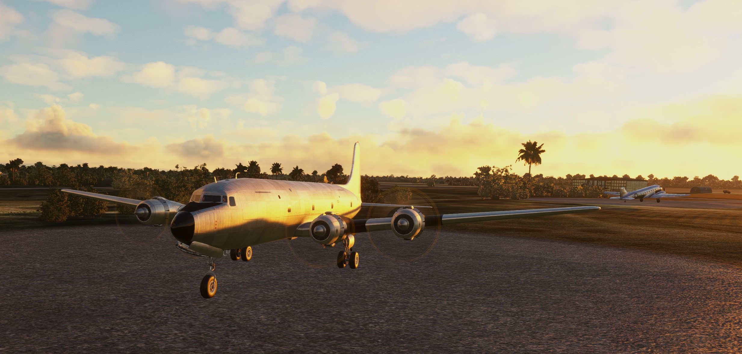
As you can see from the map above, for the last two legs I have chosen the DC-6. It is still going strong and receives updates so it worked flawlessly… unlike the AFE (automated flight engineer) but more on that later.

The DC-6 also hits the sweet spot in terms of the right number of radial engines and the right number of steam gauges in the cockpit ![]()
Early morning sun in Chabua. The weather is good and should be fine along the way too.

Climbing towards Sadiya NDB. As you can imagine, there are not too many useful navaids in this part of the World. The plan was to overfly Sadiya NDB and then track towards the Bangda VOR and use this VOR-DME for approach and landing.


Looks like we are carrying some cargo too ![]()

Sadiya airport. From here I turned towards the Bangda VOR-DME (out of signal at this point) and climbed to 23k ft. The terrain here is pretty high.

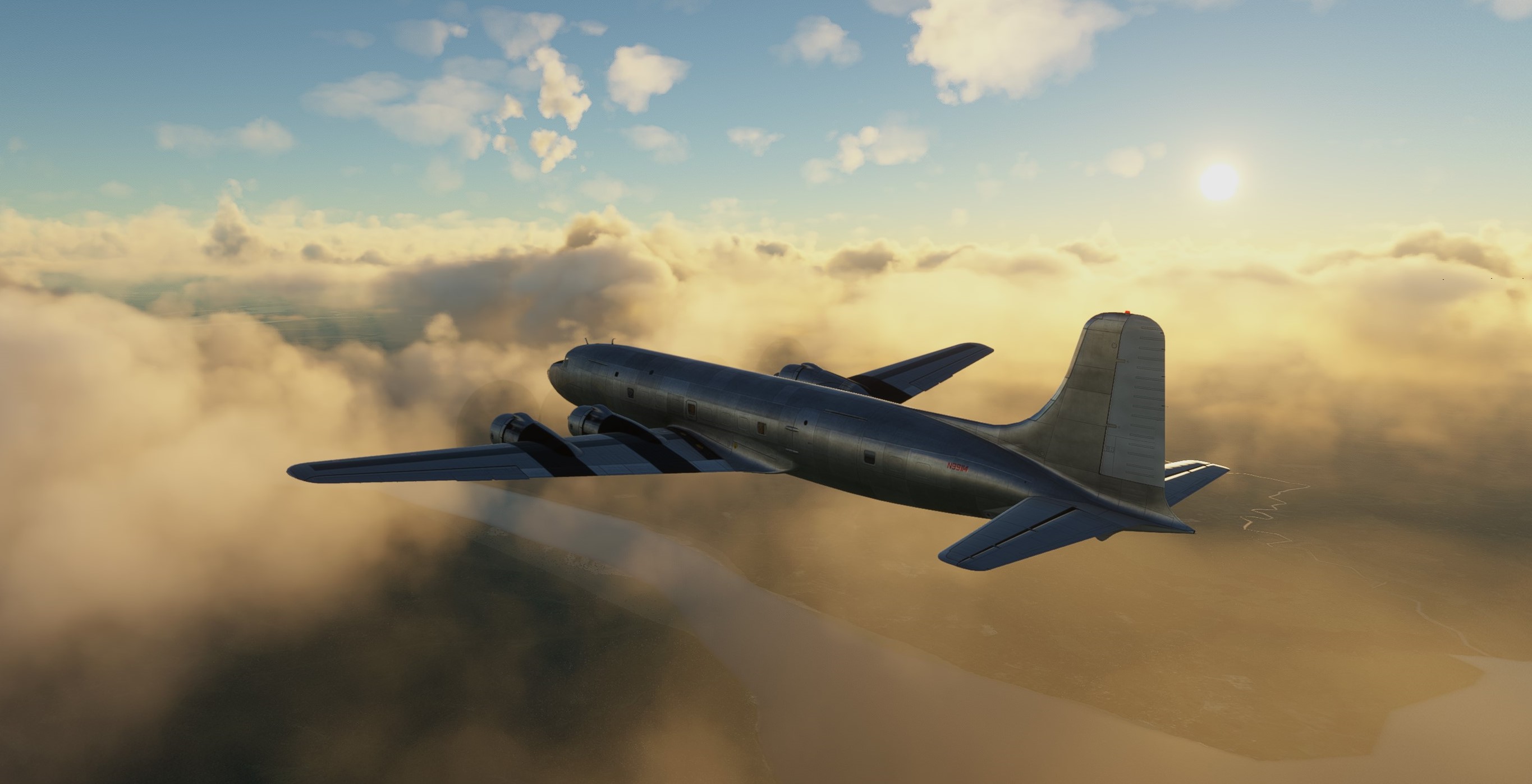
En route screens. I think they do not need any comment. Just enjoy!


Snow slowly fading away.

I stitched some prep-screenshots from Rob Randazzo’s YT tutorials ![]()

My destination for today: Changdu Bangda airport, 14208 ft.

Until now, the AFE was cooperating nicely. I took the throttles from him during the climb as I needed to switch to high blower and he took them back when descending. All OK. However I somehow missed the right procedure of having him ON and OFF for deceleration (as I needed to operate the flaps myself) and approach. He still had some job to do - In Range and Before Landing check lists - but was always messing up my power and flap settings ![]()
That’s why there is only one screenshot from the approach segment. Sorry ![]()

In the end once I let him run through the Before Landing check list I ordered him not to touch anything. He must have gotten pissed because after landing he refused to perform the Parking checklist. Dunno why.


By placing the wind sock in such a place, you make sure the pilots would definitely see it!

The next leg will be the last one of this Christmas Flight. I am keeping the DC-6 not only because it is a great aircraft but also because:
- I need to learn how to sequence the AFE in the flow properly
- I want to see whether all the engines can make it; after landing they all indicated a yellow exclamation mark signalling some problem… maybe? We shall see.

Stay tuned.
10 Likes
it was only short stop at Lourdes de Blanc Sablon.
EDIT: yes it was, but first things first. first we had to depart Chevery for Blanc Sablon ![]()

this was the culprit of the borked last landing


and here we have the approach to Lourdes de Blanc Sablon

/EDIT
then, we had to position ourselves for better spot to cross the water eastward. heading for Newfoundland northernmost airfield St. Anthony.
Switched to XP11 cause no joy with MSFS. No St. Anthony airport there.
this is short hop


Lourdes de Blanc Sablon in the background

and CYAY St. Anthony


10 Likes
Leg 4.

The original plan when I set off this year was to get to about where I am now and then fly a ‘freedom of navigation’ flight through the South China Sea and Taiwan Strait, with a stop over in Taipei…
At my current rate of effort, if I did that then I won’t get to Daocheng Yading before Christmas so next stop is Hanoi and from there I reckon I can be there in two, maybe three more hops?
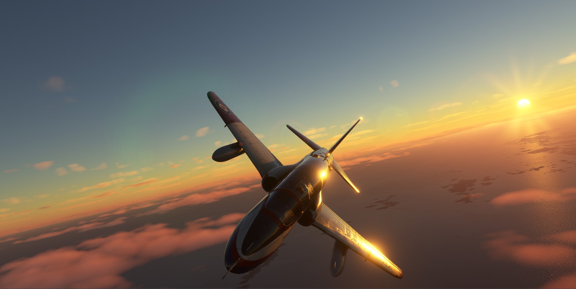
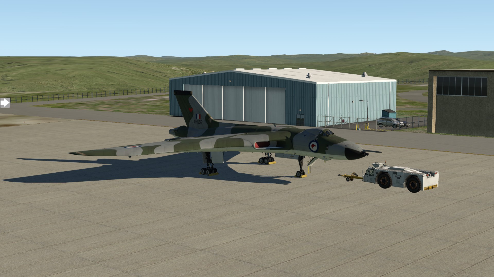
Departing to the South. From what I can gather, the last time a Vulcan was seen over the city was probably around June 1966, When 9 Squadron returned to Cottesmore from Tengah following the end of the confrontation. For this leg I have had the bird repainted as XM600 (No. 9 Squadron, RAF Cottesmore).


Apologies for this image, but it is the only one I could find of XM600… and that landing is representative of my better efforts ![]()

Crossing the coast as planned, just on the Vietnam side of the border with Cambodia.

First waypoint. Phnom Penh

Unfortunately I couldn’t find any (free) HD textures or ortho for this part of the world and I’m too much of a gumby to do it myself, but that is the Mekong just behind me so it means I have crossed into Laos.

Next waypoint. VVTX (Tho Xuan Airport).

Beginning my descent into VVNB (11R).

Too busy concentrating of taking an external photo on finals and only just managed to get back on the power before spudding in short of the threshold.

Which meant I was a tad fast and definitely need full brakes and the chute…

Now to think about where to head next?
13 Likes
iirc you can find some ‘Whole damn world’ ortho in ZL14 for XP somewhere on the interwebs. lot of GBs but you download once and you are good.
and regarding taking photos in XP, you forgot that XP has neat replay feature unlike MSFS.
that Vulcan does look great on that second pic!
2 Likes
I probably have a few too many irons in the fire right now and am a ‘bit’ time poor, looking for and downloading scenery for XP-11 at the moment would probably mean that I was still in Darwin… ![]()
After Christmas is over I plan to take the time to teach myself how to do it properly ![]()
It has a what now?
I’m thinking my life (as a virtual Vulcan pilot) just got a whole lot easier. Thank you.
If anyone is on the fence, I think this is a must have for MSFS ![]()
5 Likes
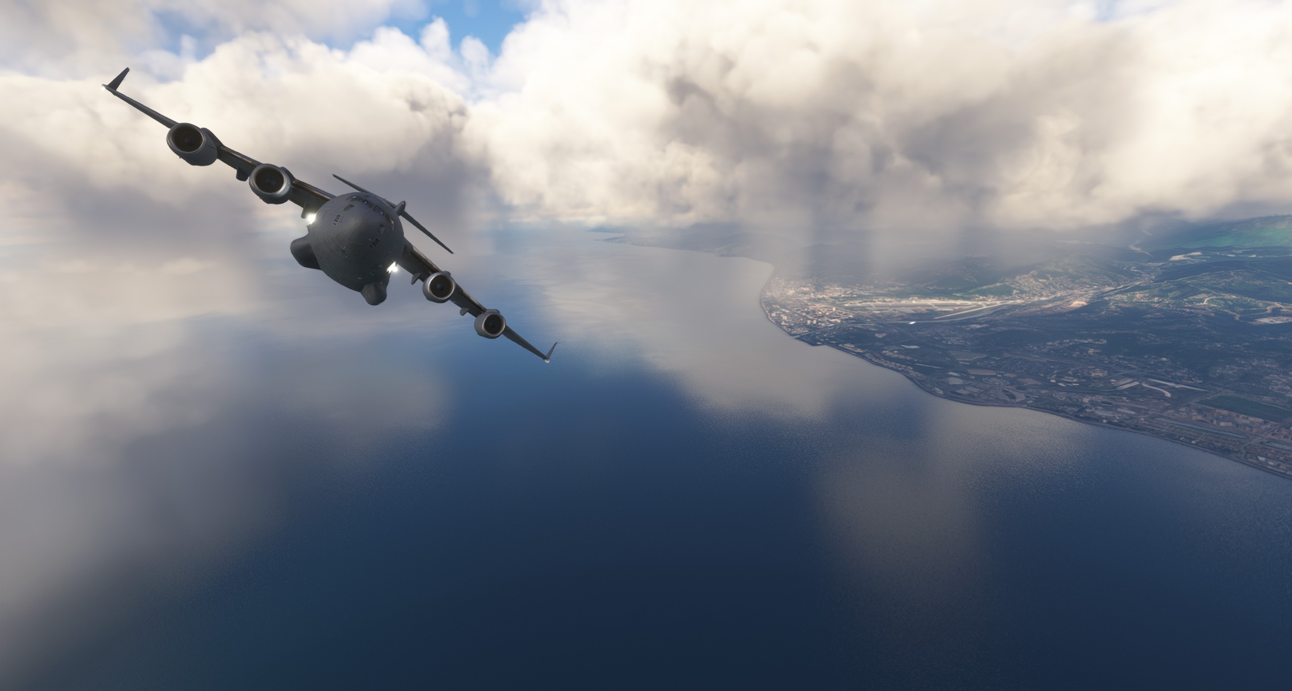
Time for another short hop! This time we leave Sevastopol and head for Sochi, over the trusted DCS terrain, but this time in our C-17 in FS2020.
Weather from the start is outright horrible. Zero visibility.

I take off from Sevastpol and instead of relying on the autopilot, I do some hands-on flying. With help of the virtual horizon I manage to keep the plane away from the ground. But the utter loss of orientation is felt throughout the more or less accurate turns to the east.
Eventually the clouds give way to a bit of blue sky at least. At around 20k feet I continue my journey, this time with autopilot engaged.


Ensuring that the blinds are in the correct spot ![]()

Night falls and the sun shows its last trays over the horizon.
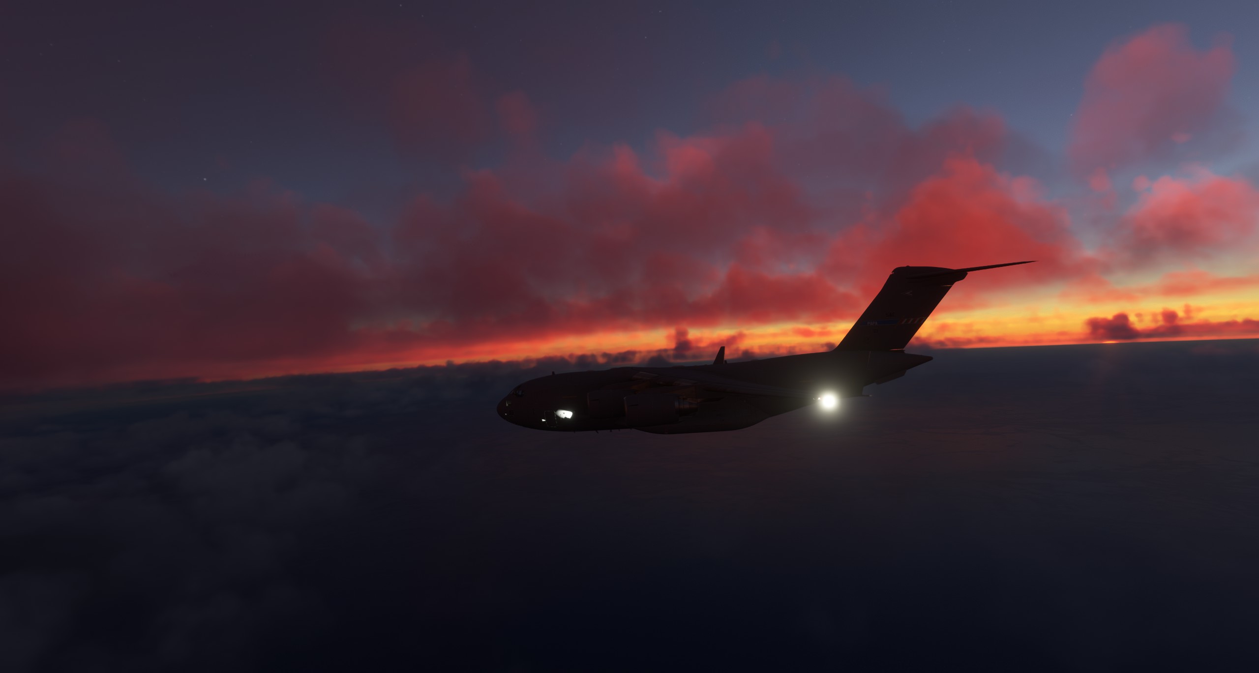
After a more or less uneventfuel flight, but with a lot of clouds to look at, I arrive in Sochi. The landing was more like a diverted dive bomb attempt, as I came in too high. I guess I’m used to fly at 5k to 10k feet in good weather and then 20k feet altitude left me unprepared.

We made it and when exiting the runway I hit the escape button. Enough action for a day ![]()
Next will be a daylight flight from Sochi to Baku. As I write I’m 376 nm away. Let’s see how this one will go ![]()

10 Likes
Next was to make the jump from Edmonton to Anchorage. However, a little math told me that was a bad idea so set my sights on Juneau. Also, threw in a stop at CYYE (Ft. Nelson) for good measure.
My departure at dawn to get as much daylight as I can:

Next, a quick touch at Ft. Nelson. I’m not sure there is actually any fuel there but I did “refuel” anyway.

Headed West over the Mountains and learned how to use the autopilot (thanks for the coaching Deacon):

This next part, unfortunately, has no photo accompaniment. As I descended from the Mountains to Juneau, I realized that the airport was completely fogged over. I diverted to PAYA:

As you can see, PAYA is not nearby. In my panic, I looked for a “Direct 2” that I could program in while flying blind. I was also painfully aware that I needed altitude back before I flew into a mountain. After white knuckling through that I had to suffer through the idea of running out of fuel. By the time I had figured that out I was committed to PAYA (and there was no way I was going back into that fog).
Let’s just say I was very light when I landed in PAYA. I need a beer!
11 Likes
Well done @BierRunner

7 Likes
Leg 5

Hanoi to Lanzhou Zhongchuan International (ZLLL). I can’t find ZUDC on Skyvector, but I reckon this is close enough to find it via a bit of dead reckoning and luck ![]()
The guys in Singapore didn’t do a great job with the paint, it was already peeling by the time I got into VVNB. Fortunately one of the hangars there said they could fix it up for me.
Unfortunately, they didn’t tell me beforehand that they didn’t have any grey or green, but apparently had heaps of white paint. So…

Apparently this livery belonged to a Squadron that is famous for some reason ![]()

I now understand why they gave bomber pilots a joystick in the Vulcan. This never gets old.

Speaking of never getting old. Even with the basic terrain textures of vanilla XP11, I will never get tired of this cockpit in VR.

Not too far into this leg and I am officially in Chinese airspace.

I think the Vulcan is one of the best looking aircraft ever built. It looks good from any angle but from head on it is also as mean as cat’s pee

Oh, yeah in anticipation of The Phantom arriving in DCS, and the fact that no self-respecting V-Bomber pilot would be without one; I have shaved down to the 'stache.

Even though I’m at FL32, judging by how close those mountains look I must be getting close?

Surely that can’t be it. But a quick check of the GTN… Yep it is. Bugger, I have a heap of altitude to lose real quick.

One thing that I have learned flying the Vulcan is that short of stalling, it doesn’t want to (cant?) lose altitude quickly. Kinda makes sense really, afterall it is just one great big wing.
Even with full air brakes and steep descending S turns there was no way…


Nothing for it but to clean her up and go around.

Feeling a bit lazy I decided to just extend, turn around and land on Rwy 36 instead.
Rookie mistake, I had only made a note of the ILS freq for 18 so had to rely completely on the PAPI.

Parked, at what looks to be a deserted airport in the middle of nowhere?

Next stop ZUDC… If I can find it ![]()
13 Likes
Congratulations, You’ve officially done something America hasn’t. Landed a bomber in Hanoi and taken back off again. ![]() #murica.
#murica.
4 Likes
Back into the C-17 Globemaster, this time we go from Sochi to Baku. For a change, the weather is fair upon departure and will stay ok until we land.

Over the Black Sea and leaving Sochi behind.
It’s a great scenery, the sea, the hills, and later the mountains.

Quick check on the panel and it looks ok to me, at least no red flashing lights.

Finally over the mountains!

After a short while Baku appears on our right.

Seems the radio is not implemented for the airfield I plan to land. Or they ignore me.
Who knows?

On approach Baku is on the right.

The great visibility helps me a lot to align nicely for the landing.

Taxiing might be improved a bit still ![]()

11 Likes
Nah, C-17 is designed for rough field operations. Taxiways are advisory only ![]()
6 Likes
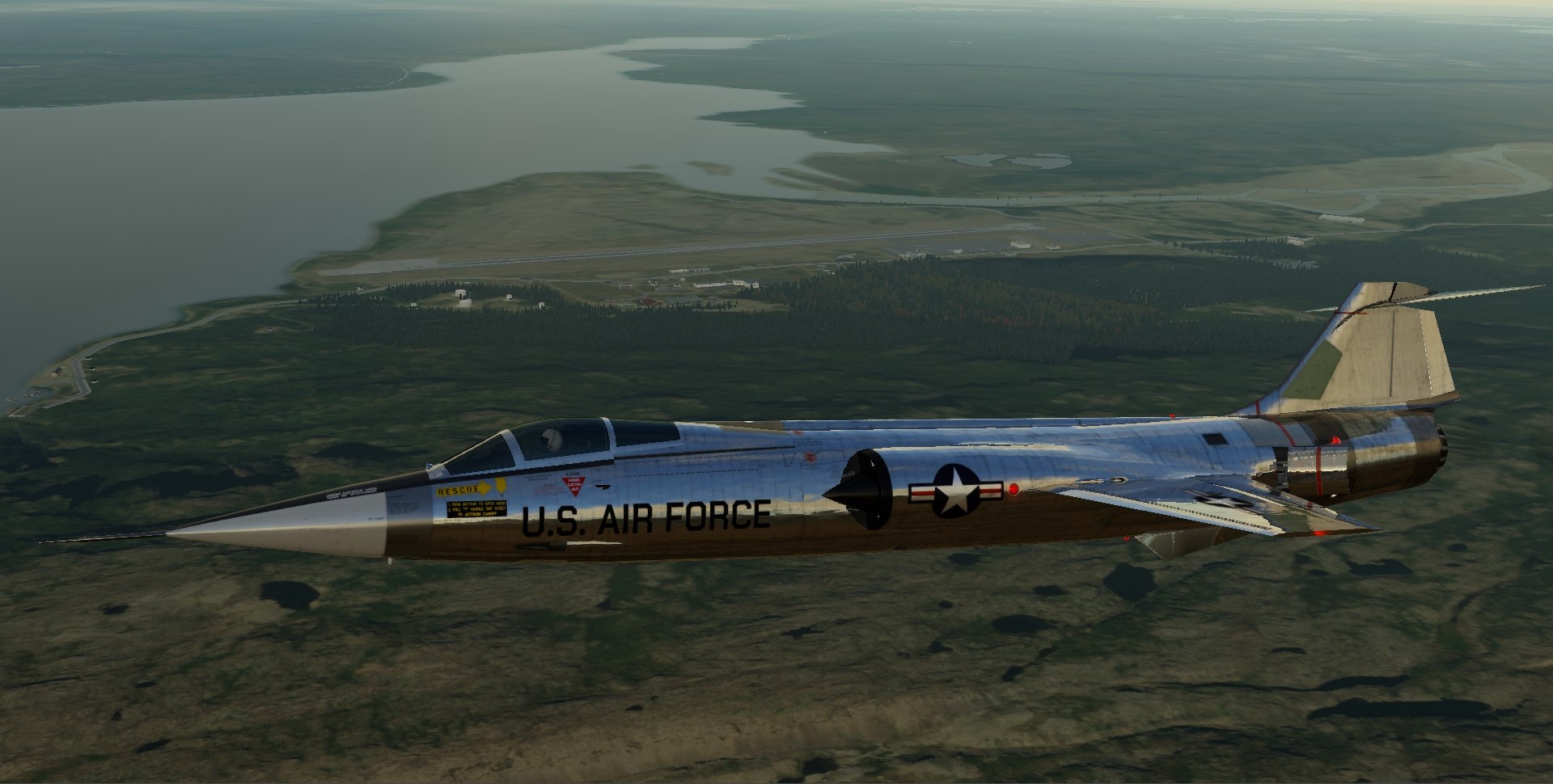
no time to waste at St Anthony. weather was good so lets take the ‘rocket with wings’ and cross the dark blue waters in one speed run ![]()
I am aiming at BGBW Narsarsuaq, Greenland

getting the beast ready

zoom climb and acceleration at FL500+ is the way. it just never gets old


how about some dead reckoning at FL600 ? after many long minutes ![]() got lucky. land ahoy!
got lucky. land ahoy!

recognized as Ikkattut island, so only few miles south as planned


quite rough terrain around here, expected something little more welcoming ![]()

civilization, Qaqortoq


from there it was only a short moment to the pattern
unfortunately there was small glitch in the ortho4xp scenery and all the surrounding of the airport was flat, no mesh.
anyway it was great fun!

8 Likes
X Plane 12? Surprisingly (for me) beautiful ![]()
6 Likes
Leg 6.
Well now, this is embarassing. First thing to do is backtrack from ZLLL to ZUUU

Then fly this.

Don’t tell them that I could have been there yesterday. ![]()
Also, the paintshop at Hanoi didn’t do any better than Singapore and after only being outside in the weather overnight it has all peeled away and I am back to my original livery…

It is great that Just Flight have included this one. Makes me happy to be a Kiwi ![]()

So, after realising my navigation error and smashing togther the info from multiple sources, two different ‘charts’ and entering the co-ords for ZUDC manually, our route today looks something like this.

OK. So I need to head South, but…

I had to take off to the North. Doesn’t matter if you are in a large aircraft that thinks it is a fighter, getting back on track doesn’t take long…

Remember on the previous leg I was flying over some mountains and mentioned that I must be close?
Well, it turns out I was probably closer to my final destination than where I was heading ![]()


Nearly there

On Finals

Good thing this is a nice long runway.
As an aside. I might put together some notes on my experience with the Just Flight Vulcan? But for now, I have learnt a lot about ground effect and flying wings… I think? You should see my 2023 blooper reel ![]()

And Parked
Big shout out to my navigator for this journey, Mr Garmin ![]()
Also, @Freak for forcing me to put the Vulcan to a vote… “Screw Pooh” won me over, but you owe me ![]()
And, thanks to those who voted for the Vulcan (but the Cirrus would have been so much easier).
Too all the participants. You surely kept me motivated with your AAR’s
Last, but by no means least, @apollon01 for suggesting this year’s destination and keeping the Christmas Flight going this year.

Merry Christmas Everyone
Remember at the start I said that I had 14,300 pounds of Christmas cheer to distribute?
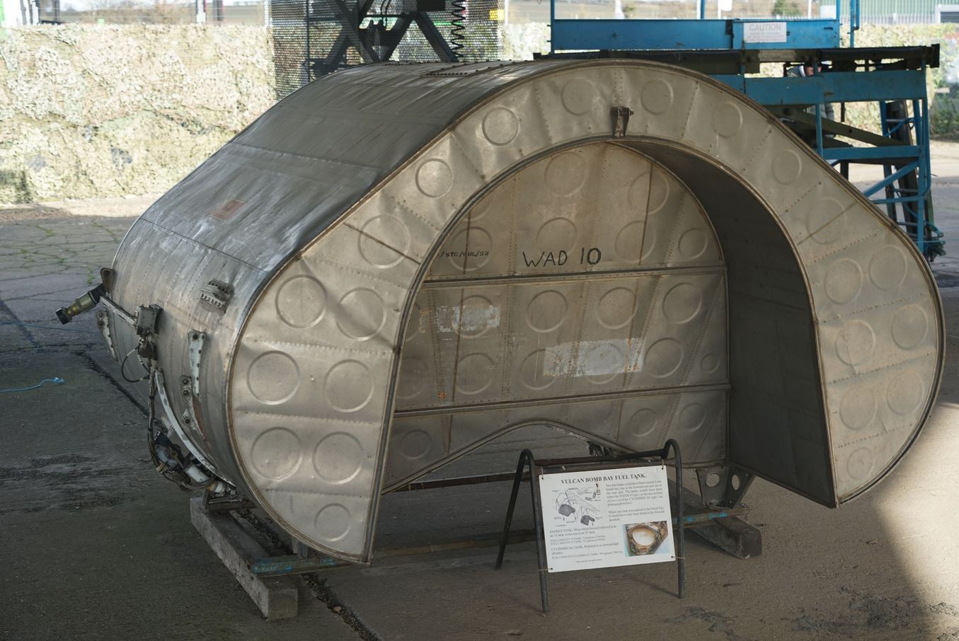
I didn’t decontaminate, fit and then fill the bomb bay saddle tanks with beer and (Tasmanian) whisky…
And. Before you start saying that I am going to have to hand in my ‘Aussie Badge’ for not bringing booze to a party.
What I have brought is something that IMHO has been in short supply around the globe lately:
Peace on Earth and Goodwill to All.
12 Likes
Thanks for flying the Vulcan, it made for some great screenshots and reading!
I’m sorry for putting you on the spot like that, but it was well worth it in the end.
Great choice for the ordnance, we can definitely use some of that!
4 Likes