I used real-time the whole way. I don’t think time compression should change the fuel consumption, though I could be wrong.
My trip took almost 10k pounds exactly - took off with 19.8 and landed with right around 9.8.
I used real-time the whole way. I don’t think time compression should change the fuel consumption, though I could be wrong.
My trip took almost 10k pounds exactly - took off with 19.8 and landed with right around 9.8.
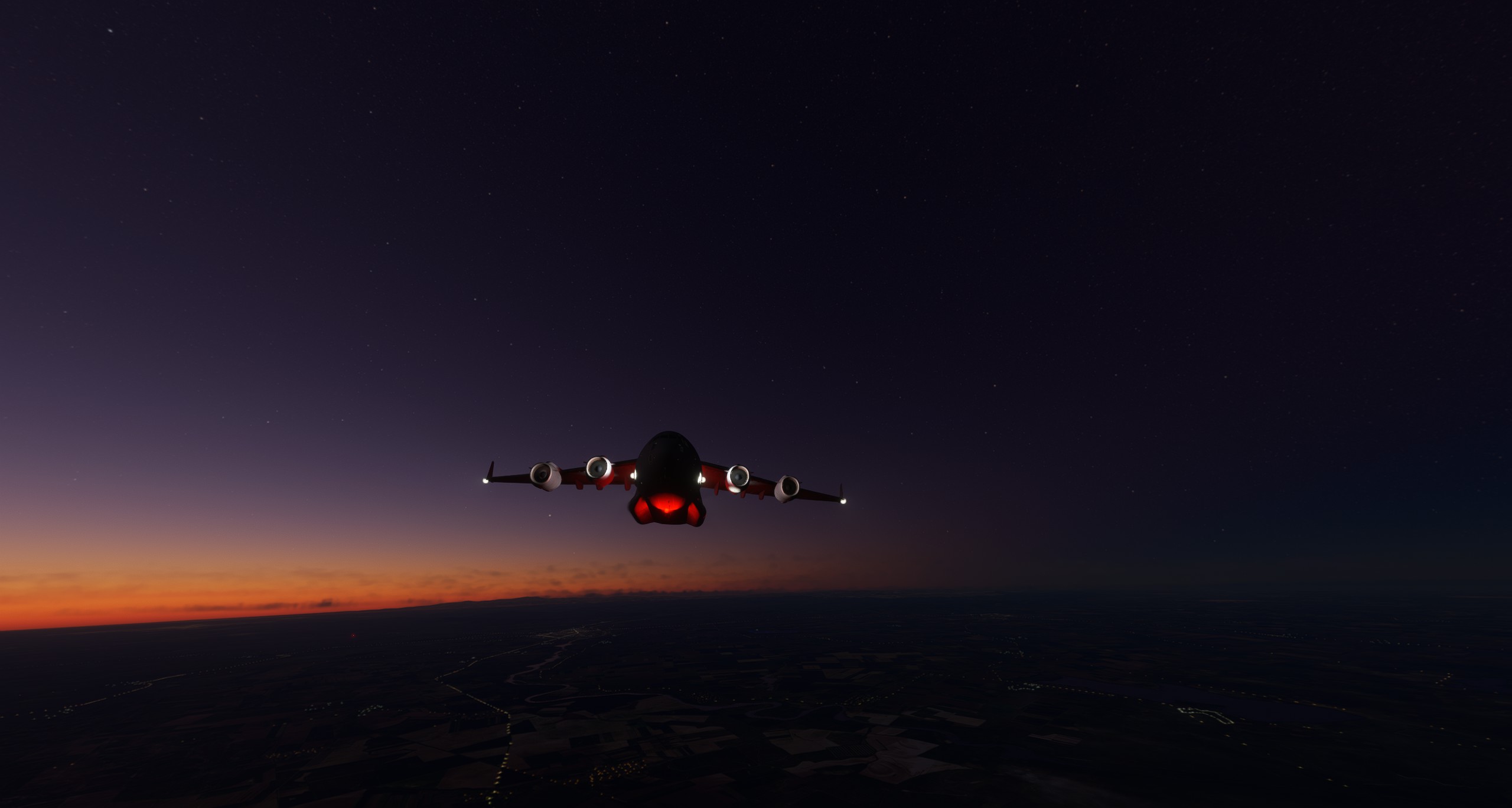
I started with 45,883 lbs of fuel and zero internal cargo. Landed with about 22,000 pounds of fuel. I used 6x speed for about half the ocean crossing. As soon as the weather started changing, I went to 1x. So, maybe it was the correct burn after all. ![]()
I don’t know about XP12, but IIRC in XP11 there are two different time acceleration choices. One speeds up ‘game time’ and the other speeds up ground speed & I think it defaults to the one that doesn’t use the proportional amount of fuel.
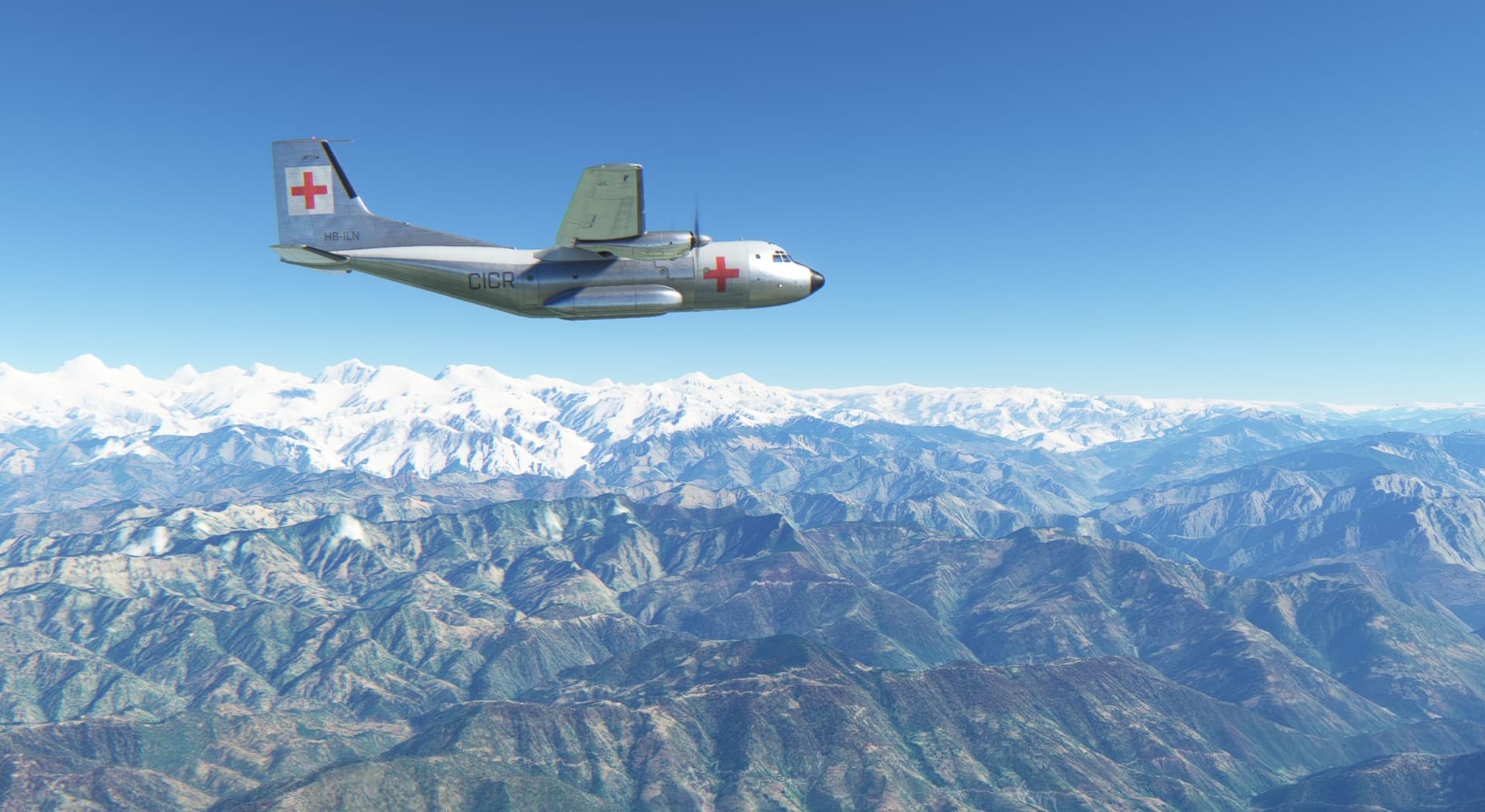
The Transall just got a hefty update and the next leg from Skardu in Pakistan to Rudraprayang in India seemed like a good excuse to check the new features out.
Let’s start with the FMS which is now capable of some advanced IFR planning. It is not quite there yet as one can select departure, en-route waypoints and arrival but can’t select approach. AzurPoly claims, to their own surprise, this is true to life so I will take their world for it. There is also some less intuitive switchology involved to get it all run well (which, unlike to my test flight, I messed up) so RTFM is essential.
Also, now one can take passengers! With the right balance when it comes to race but not so much when it comes to gender ![]()
Climbing out on a cold & clear day.
Quiz question - what peak is this?
This is K2, at 8,611 metres (28,251 ft) above sea level, it is the second-highest mountain on Earth, after Mount Everest at 8,849 metres (29,032 ft). It lies in the Karakoram range, partially in the Gilgit-Baltistan region of Pakistan-administered Kashmir and partially in the China-administered Trans-Karakoram Tract. [Wikipedia]
While planning, by mistake I made a waypoint over K12 instead of K2 - I blame my aging eysight - so I made quite some sightseeing over Karakoram.
Leh, my waypoint towards my destination. Here, the FMS was still successfully guiding the autopilot. I do not know what happened then but for the rest of the flight I had to use heading bug to steer the autopilot.
Surfing the edge of snowline.

The Transall now got a working HUD. It is simple in the sense that it gives you heading, speed, altitude and some other info, though I decided not to use it as it was obtrusive a bit too much.
When I found the gentlemen in the back did not have valid tickets, there was only one way to deal with the situation:

I was busy taking screenshots and forgot to descend in time. No problem in the Transall - one can drop like a brick with the speedbrakes deployed.
A steep approach is also possible with the brakes out if needed, which was not the case here.
Just need to get over this little ridge in the way…
Safely down. Next leg will bring me to Pokhara in Nepal.
Stay tuned.
great progress apollon01
I am lagging behind as my sim time now is with beta test of F-104 FXP in XP12.
wondering, I probably can take it for ‘around the world’ beta test ![]()
Next leg, Cairo(HECA) to Dubai(OMDB) For this leg we will be in the F-15E
Next Leg we would go from Dubai(OMDB) to New Delhi(VIDP) in a 739
2 more legs to go, Next leg gets me in China.
I see what you did there! Nice job with the local time
it works both XP11 and 12.
One is ‘ground speed acceleration’ (Alt+T by default) which increases ground speed so you can fly eg. 200kt or 400kt instead of 100kt with normal controls responses.
The other one is ‘sim rate acceleration’ (Ctrl+T by default) which accelerates all the sim processes.
Interestingly both these accelerations increase fuel consumption.
Second to last leg, New Delhi(VDIP) to Chengdu Tianfu(ZUTF) Didnt realize until about 300’ from touch down that i didnt have scenery loaded for ZUTF. Hit a tree as i crossed the threshold. Still able to land, just no turn offs,
Up next, my last leg ZUTF to ZUDC with airport scenery this time!
I’m continuing my trip eastward, flying from Prague to Constanta in Romania. Due to bad planning from my side, I arrive after dark - never did a night time landing in FS2020 before…
The C-17 mod dev version seems to get updates quite frequently and it’s nice to see the module being developed further and further.
Leaving Prague behind me.
The cargo hold seems to have some Apache helos in it … if the small window gives enough of a hint. Not sure why we fly them to China, but there might be … reasons.
Not sure what I like better in FS2020, the clouds or the plane ![]()
The tablet in the cockpit is functional and you can browse the manual while flying.
The overhead panel sports the fuel levels and it seems I have more than enough aboard for a 2 hour flight.
I guess I could care about these messages, but the flying is fine and maybe I prefer the sight seeing aspect…
In the cockpit there’s a blind on both window sides, which can be moved and folded away. Pretty nice detail.
Well, the sight seeing comes to an end in this cloud layer. At only 10k feet I’m in and out of the clouds all the time.
Darkness approaches and the scenery looks quite spectacular with the low clouds.
More than enough fuel aboard, yikes. Should have spent a minute planning! But we’re on good track following the magenta line…
But oh my, another borked approach by yours truly. I’m way to high, decide to risk a landing anyway, of course I overshoot the runway and park the C-17 Globemaster in the grass …
Now I have to decide how to cross the Black Sea. Northward to Sevastopol, southwards via Turkey, or just watch the sea for a few hours ![]()
Cheers,
TeTeT
Haha… I like these what can go wrong AARs ![]()
I think it’s just honest. We’re playing at a hobby, of course things are going to go wrong. I think it adds to the fun when we admit “I didn’t plan and totally cocked this up.”
Rudrapray in India to Pokhara in Nepal. A nice scenic flight.
With nil wind, I naturally opted to take off in the direction of my destination. An early climbing turn in these narrow valleys might not end up well ![]() Hope the foothill in the climb out sector will not be a problem.
Hope the foothill in the climb out sector will not be a problem.
Gear up pretty much right after lift off, throttles firewalled and eyes closed.
Made it!

Climbing away and more importantly - above the peaks.
Enjoying the cruise.

As in the last leg, I had a little plan in mind. I suppose the gentlemen I dropped off on my way to Rudraprayang are still walking to the base, but this thing - if not dropped anywhere close to the drop zone - should get there faster.
Surkhet airport in Nepal - my drop zone.
Slow down, some flaps, open the cargo ramp… and off we go!
Probably miss by a fair margin ![]()
Anyway… clean the airframe, cruise throttle setting and turn towards Pokhara.
It was rather a short hop and I did not want to mess up the descent… so…
Pokhara does not have any published approach. But as it has a VOR station, I tuned it in and flew inbound radial to place myself on long finals. Only due to terrain - unsurprisingly - there was a hill right on the approach path.
Though the airport was were it was supposed to be ![]()
On the apron. Next leg will bring me further to the East and most likely to Lamidanda, perhaps with a stop over in Lukla just for fun. I think I will need a different aircraft, though.
Stay tuned.
Final leg ZUTF to ZUDC in an A320.
Runway was longer than expected. I also deployed full flaps accidently and messed up my auto throttle settings. Overflew my approach and had to do some interesting maneuvers, but I got it lined up and down .
Good trip! Beers are cold
I’m curious, did you have any navdata going into ZUDC? I did my final leg today and had nothing in the FMS in the 737. I even downloaded the navdata file below and still nothing.
https://flightsim.to/file/33947/zudc-daocheng-yading-airport-navdata-naip-free-navigraph-version
Congrats for completing the trip!
I used that too but it didn’t work. I also downloaded the scenery from the first post.
Simbrief dose not recognize ZUDC either. So I used MSFS in game route generator and the A320.
this was my route
ZUTF N0120F260 MUM09D LADUP UGILO KDJ ZUDC
No approach data, I started my decent to 17000 feet about 40 miles out. Did a overfly of the airport and set up for a rwy 34 visual.
After the picturesque arrival I had in Japan, it was time to start my journey south. First stop would be RJTT in Tokyo.
For this flight I was using the newly released UFT on the PMDG aircraft. To be honest, the UFT is, in my opionion, fairly underwhelming considering the time it took to get it to the jet and it is far behind what I would consider industry standard for a tablet these days.
That being said … it is nice to finally have the ability to import routes, winds, etc, direct from Simbrief into the FMC.
For my next leg, I take a slight detour to the east to check out Hachijō-jima.
Pokhara to Lamidada and Lukla, all in Nepal.
As I already made an experience trying to land the Transall in Lamidada where I discovered that a runway length of 1700 ft at an elevation of 4000 ft is perhaps on the short side for an aircraft that needs more than 3000 ft of runway to land at that particulate weight, I decided to go for the Caribou instead.
Which it was a great choice. Look how great the Caribou looks with the Himalaya as the background.
2D screen does not do a justice to this screen. It is only in VR where one can fully appreciate the depth of the scene and magnificent scale of the mountains.
Enroute to Kathmandu VOR station.
Kathmandu.
I am in love with the Caribou’s cockpit - check the crazy detail of the throttles.
No one joining for the flight today. I wonder why?
Enroute to Lamidada.
Lamidada has a NDB station that gives me a bearing to the field but no distance. Conveniently, the Caribou sports a GNS 430 which can provide me such info.
This is Rumjatar airport which I considered as an alternate destination to Lamidada.
Approaching Lamidada.
Just look at what the light does with this cockpit ![]()
Checking the wind at the field - kind of impossible in the absence of a windsock ![]()
Traffic pattern and landing at Lamidada.
After a short stay in Lamidada I departed towards Lukla.
Lukla poses a number of challenges to the pilots: difficult terrain, sloped one-way runway, no option to go around, elevation… you name it. I guess there is no Mudspike member who has not landed at Lukla at some point in time ![]()
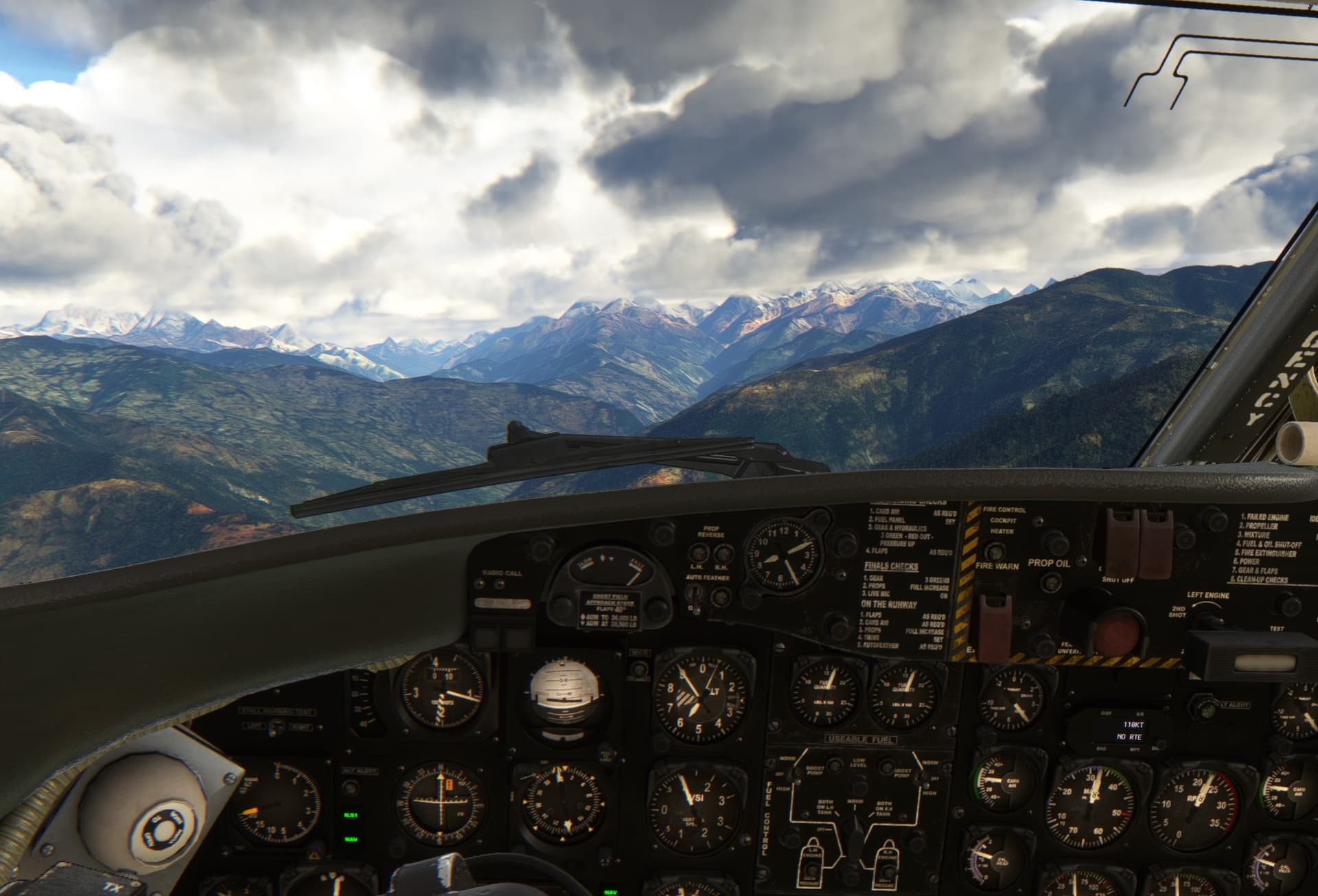
Climbing to 10400 ft. Dunno why but I found the Caribou’s climbing performance less than stellar. It should have a ceiling in the excess of 20k ft so I wonder what did I do wrong?
Lukla to the right.
I have not realized that the field elevation on the map is for the apron which is located at the top of the field. The runway threshold is considerably lower. Combine that with the Caribou being still pretty slippery even when in landing configuration and you can see the potential problem…
…which materialized few seconds later in the form of slamming the Caribou hard on the runway ![]()
Resting in Lukla.
Of course I could not resist and took the Caribou towards Mount Everest.
Did I mention I had hard time to climb? I took this screenshot at some 12500 ft shortly before I stalled and crashed. Need to figure out what went wrong. The Caribou should be capable of more than that.
Next one? Paro in Bhutan. I am looking forward to it.
Stay tuned.