Official 9th Annual Mudspike Christmas Flight 2023 - Discussion and AAR Thread

Great AAR again!

As for the altitude problem: you being an experienced pilot tells me that I can probably rule out improper mixture settings on your part, but maybe it is a bug?

If you cannot lean the mix properly that could absolutely cause problems at that altitude.

Have you checked the manual if there are any special procedures for high altitudes?

4 Likes

The Caribou being a Local Legend, there is no manual :slight_smile:

You are probably right at focusing on mixture. There is a number of aircraft in MSFS where the mixture is a problem - usually not changing much fuel flow. I can hear the engine rpm change when leaning but there is nothing to stick to as for the procedure. Also, in real Caribou, there are mixture detents for full & lean which are handled automatically but the mixture in the MSFS rendition behaves like a conventional one.

There is maybe a bug in the aircraft systems. Dunno. The Caribou is great but it still has unaddressed issues so this may just be one of them.

I asked a question on the MSFS forums so maybe someone will chip in.

EDIT: Tried again in ISA condition and lightly loaded following the recommended climb settings of 35 / 2250 and targeting speed of about 105 kts.

…at 500 ft CLIMB power is selected (35" and 2250 RPM) and the aircraft is settled in to the climb at 105 knots…

I got it to some 20k ft and then lost patience as the climb rate was really low. It could go higher still… so for a MSFS model I would say the performance looks fine.

5 Likes

To Paro in Bhutan.

Paro is one of these airports that always come up in “The Most Dangerous Airports” articles or videos. Let’s check out why.

In Lukla I got back into my increasingly familiar Transall. As I mentioned in one of the previous AARs, it’s got a FMS overhaul which now supports flight plans including SIDs and STARs. Sadly, it does not allow for approaches so I decided to put the approach waypoints to the FMS manually once in the cruise.

Let’s go.

A Transall in Lukla is clearly an artistic license :slight_smile: It looks like I trimmed a few trees (and houses) during the take off run.

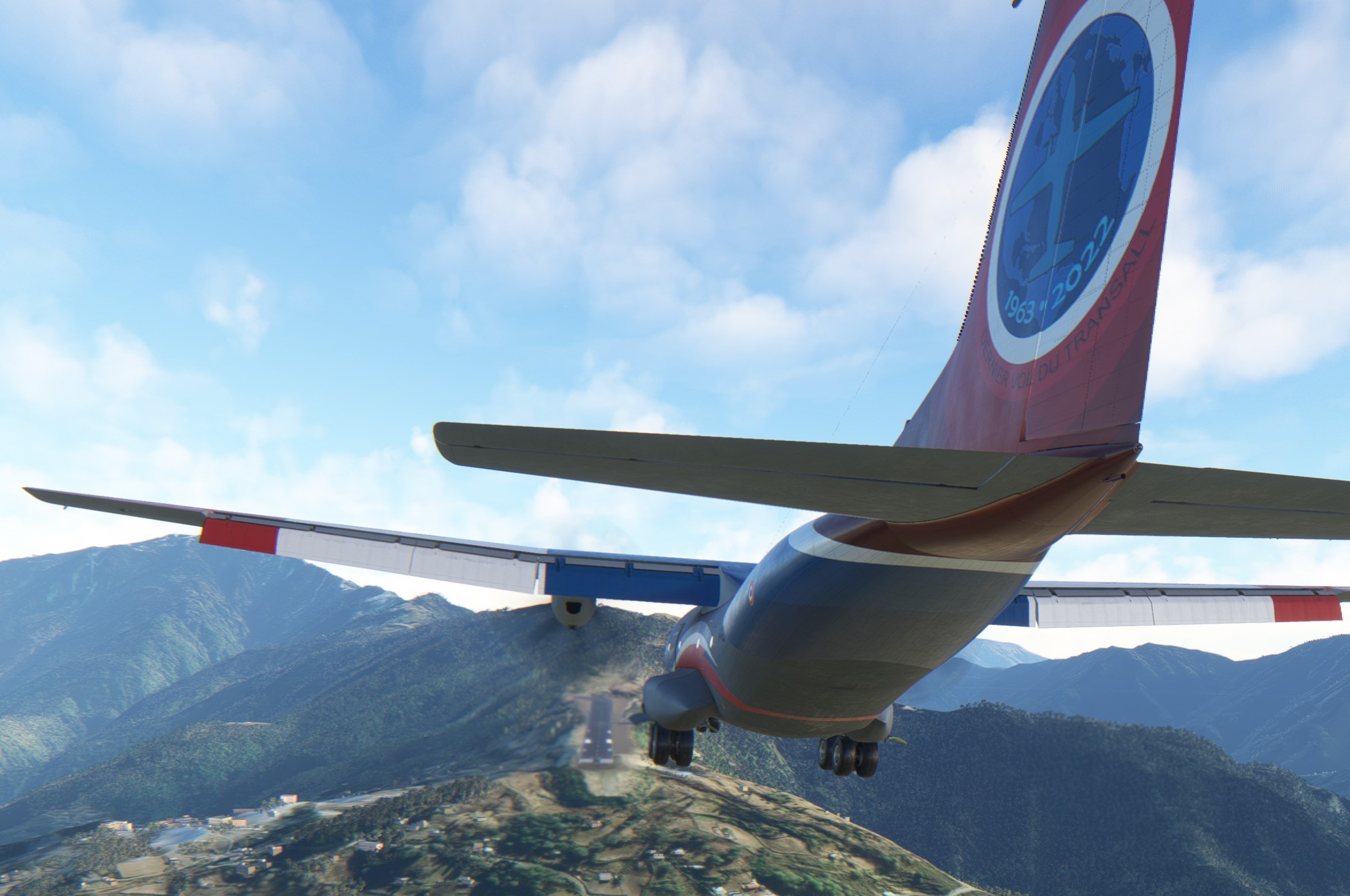
If you wonder where is the runway then be informed that it is actually above me.

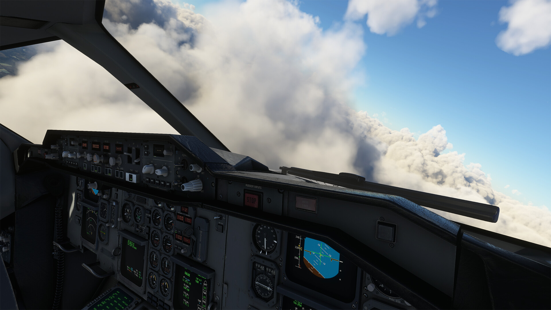
Climbing towards Pakyong VOR, my enroute waypoint.

I got a repaint which includes light grey cockpit textures. Dunno whether this is true to life but I do like it :+1:

Lhotse and Mount Everest in the far back.

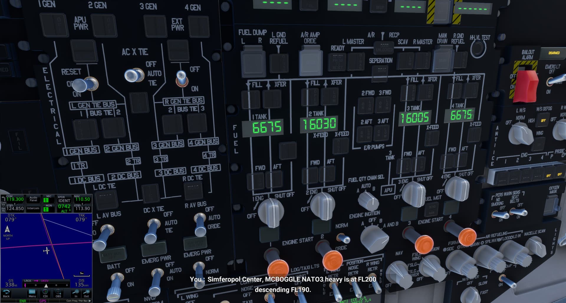
Comfortably settled in cruise. Time to work on the FMS and approach waypoints.

While the FMS usually gets the job done, it has some quirks. In this very case it was few waypoints which the FMS wanted me to fly around the globe in order to reach them. The work around was simple - just delete the “corrupted” waypoints.

One last view of the Mount Everest.

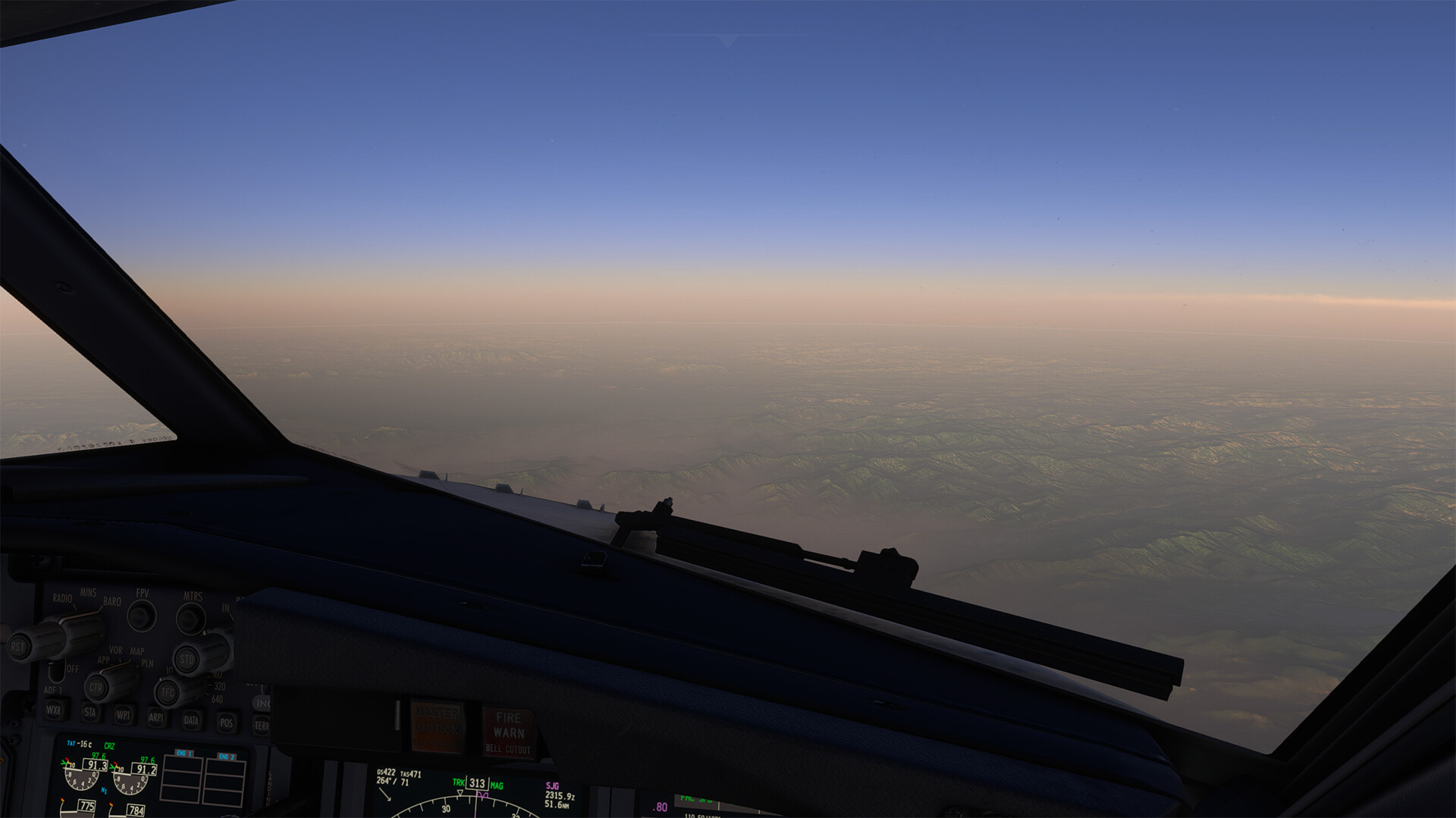
Some seriously looking rivers flow down the mountains to the lowlands. This is only one of many such rivers.

Past the VOR station and beginning the approach.

I have to confess I have not studied much the approach itself. I noticed that the last altitude information of 13800 ft is provided for a waypoint some 12 nm from the Paro airport. The airport elevation is 7323 ft which with a help of some quick & dirty math means a descent rate of 1250 fpm at a speed of 140 kts.

Figure It Out What GIF by CBC

Which I did not fly.

Disappointed Let Down GIF by NRK P3

Here I was way past the waypoint mentioned above and not really descending as fast as I should have.

Here I was still hesitating to help the descent with the speedbrakes.

So when I eventually saw Rinpung Dzong (to the left) from this perspective, I KNEW I should have been in a different place :grimacing: (check the airport to the right)

By this time the speedbrakes were fully out and the Transall was nearly falling out of the sky (did I hear the stall horn going on at times?)

Taxing to the apron and taking in the experience of this chilling approach and landing.

These are the Kings of Bhutan. Interestingly enough, if you search for the billboard IRL, the portraits are different :slight_smile: I did not do much research but it seems like the third portrait from the left is the current King.

Next on the agenda is Yongphulla airport in Bhutan a short hop from Paro. I have never heard of this one but when searching for hand made airports in this part of the world on fs.to it came up and it looked well done and quite challenging. We shall see!

Stay tuned.

13 Likes

Continuing my journey through Japan, I opted for an early morning departure out of Tokyo. Not too much else to say about this leg, just pretty pictures.


Parked at Hachijojima RJTH.

Next flight will take me down to Nagasaki, RJFU.

12 Likes

continuing my journey up north.

decided to have some fun along the way

at this point I started to be little suspicious. where is the airport, there should definitely be one near the village of ᐅᒥᐅᔭᖅ / Umiujaq

what can we do, we pressed on, and were awarded at least by the atmospheric conditions

looking for the final destination for today here ᐃᓄᒃᔪᐊᒃ / Inukjuak meaning ‘The Giant’

but at this point we realized that something is off and there are no more airports up here. so landing on the frozen bay it was

pulled the maps and started to wonder, was it just me not noticing and the msfs terrain had no satellite imagery north of some specific latitude from the beginning? I guess I will have to reconsider my planned route.

10 Likes

Is this default scenery? Great AAR!

Very nice pictures!

Gutsy move! I still love that you’re taking the tweet!

1 Like

Where would one find the T-37?

1 Like

I am pretty sure this is where I got it.

https://flightsim.to/file/52043/cessna-t-37b-tweet

2 Likes

Yes it is. It is one of the hand crafted airports available in all MSFS versions.

There is also a mod st fs.to adding bunch of stuff and correcting layout but I did not use it.

3 Likes

Still in Bhutan, just moved to Yongphulla.

Yongphulla is not very far from Paro and it is an airport that sits on a ridge with not only beautiful views all around but also a rock wall at one end of the runway thus making it a perfect stop on my way to China.

Maybe I was a touch too heavy and maybe I did not use the right flap setting. Either way, this was yet another hairy departure.

I wanted to make an early turn towards my en-route heading but changed my mind as soon as I realized this was a dead-end valley and I was still a bit too low :grimacing:

Climbing out and en-route. The terrain is still pretty high. An beautiful.

This is Bothpalathang airport whose NDB served as a waypoint to Yongphulla. For MSFS it is an uncharted airport… but clearly visible on the ortho :slight_smile:

This being the last leg flown with the Transall on this Christmas flight, I have naturally chosen the “Fini” livery of the Armée de l’air. Nice detail on the vertical fin and rudder.

Today’s cargo.

All quiet in the cockpit.

As usual, I calculated the TOD and descend profile in order to position myself nicely for the approach. This time the results called for descending at some 2000 fpm some 5 minutes from the airport at the speed of 240 kts.

As usual, it kind of worked but was not perfect. Initially I wanted to arrive at 1000 ft above the airport and fly a traffic pattern but during the descend decided to make it a straight in. Thus ending up too high & too fast (sounds familiar already? :slight_smile:).

This is the reason why you do not want to overrun the runway.

The setting is just fantastic, n’est-ce pas?

OK, I will leave the Transall here and take a different bird for the next leg. Last glance over the cockpit…

…and then shut the door from the outside.

The next flight will take me not only to Tezpur in India but also some 80 years into the past.

Stay tuned.

10 Likes

Starting from Constanta in Romania I decide to take the northern route along the Black Sea, heading to Sevastopol now. I’m halfway tempted to change the C-17 Globemaster versus alte Tante Ju-52. When I was much younger I read a short story by Heinrich Böll on some German para who flew into Sevastopol during the Russian siege in WWII as reinforcement. A great read, but oh so depressing.

Anyway, I decided to stay modern an take the C-17 out of the hangar. The weather greets us, quite violently.

After take-off I climb rapidly to get out of this mess, and it doesn’t take long to see the sun - hidden behind more clouds.

The nav system tells me I’m south of my magenta line, but everything else looks like it’s in proper order now.

The massive clouds over the Black Sea provide a landscape of it’s own, very nice to look at.

This time I reduced the fuel load considerably, but we’ll still have plenty.

Finally some clear sight of the sea below and the sun above!

After a very short while the peninsular with the landing strip is in sight.

I go low and fast, but manage to reduce airspeed in time and touch down. Nothing to report about. Really nothing! :wink:

10 Likes

What happened? Runway overrun or touch down too early? :slight_smile:

1 Like

It was a borked landing as one can imagine. My thinking went behind the plane, so when I touched down I thought about thrust reversal NOW, couldn’t figure it out in the split second, then tried to convert to a touch and go. Ultimately the landing runway was too short for my slow thinking there and so I took a bath.

Cheers,
TeTeT

8 Likes

Great AAR and Beautiful pictures! I’m looking forward to the next one.

It’s a C-17 mate, not a P-8. :rofl:

7 Likes

AYPY (Port Moresby) - WAJJ (Jayapura)

I feel a bit miffed about not having had the time to enjoy PNG low and slow…alas, that’s real life commitments for you, so instead I bought some new shoes at a moment of weakness:

Hello pretty! It’s the PMDG 737-600…my first modern airliner. It’s a pretty good deal at the lower price point, and I personally don’t mind about the fact that it’s not one of the popular tube lengths.

I did a cold start following a guide and managed to put some waypoints in the FMC, but couldn’t get the autopilot to follow them…so I just used speed and vertical speed modes. Something to work out in the future.

It was getting late so I decided to cut across the island as opposed to following the planned route.

It’s fair to say this version of the 737 is quite a bit more modern than my XP11 737-200. I hope we’ll see an MSFS conversion / modernisation of that module…it is lovely.


I descended with the last of the sun.

A little bit closer! Let’s see how far I get this year :smiley:

14 Likes

Good on you.

I never found enough courage to dive into the modern airliners :+1:

2 Likes

Alright, I’ll be making a couple posts today. I arrived last week at ZUDC but I’m always a few flights behind on screenshots.

I’m leaving on a real-world trip and will be away from my desktop for the remainder of the year so I’ll be dumping the rest of the pictures today.

First flight was from Hachijō-jima to Nagasaki.


On approach to Nagasaki, it certainly did not disappoint.


Originally I had planned to do some island hopping with the TBM to some of the fields south of Japan but ultimately decided to skip those in favor of wrapping up the trek. ROKR and RORS look pretty interesting if anyone else is swinging down through that area.

I opted to go straight from Nagasaki to RCTP in Taiwan, this time taking the Fenix A320. I was hoping to do some of these flights with their V2 aircraft and IAE motors but unfortunately their next update is on hold while they squash some fairly major bugs.


The lighting in this engine really is something special.


I simply cannot win when it comes to winds on this trip.


Shut down at Taoyuan International Airport. Next AAR will be a classic airliner into a classic airport.

13 Likes

Gorgeous shots, as always!

On to my final two flights for this year’s trek!

For the first leg, I flew the iniBuilds A310 into Kai Tak. Admittedly I could’ve used a bit more prep for the approach into Kai Tak but I made it work. As nice as it is to have it be a default, hand-crafted airport, I would love if Navigraph would incorporate it into the nav databases and release a couple basic charts … but so far they have refused.

I was able to trick the FMC a bit and get a (mostly) working route. Essentially I was able to plan the leg with simbrief and import the flight plan through the FMC, fixing some of the issues I was seeing with trying to load it in manually.


High, and I believe long, on the approach. You can just make out the checkerboard out in front of the aircraft.


For the last flight out to ZUDC, I hopped back into the PMDG. I ran into similar issues with navdata due to ZUDC being a Chinese airport. Ultimately I planned a flight from Kai Tak to VYPT, passing over a rough lat/long for ZUDC, then just subtracted out the extra enroute fuel. Far from a perfect solution but it got me in the ballpark.


Without an airport to select in the FMC, the jet was yelling at me thinking I was about to fly into the ground. Selecting GPWS TERR INHIBIT silenced the terrain alarms.

I was also seeing interesting issues with the cabin pressurization schedule and having an arrival at such a high altitude.


Somewhere, between the two rainbows, is the runway.

2023 journey complete!

15 Likes

Yo Kai Tak!

Congrats!

2 Likes