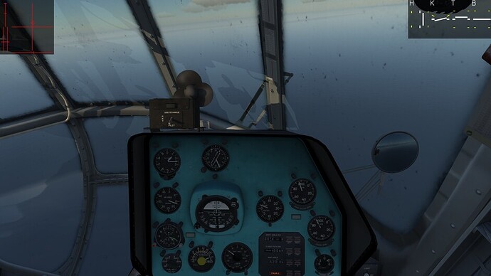
First leg in the DCS Mi-8.
Let’s see how far we get in DCS before firing up the good old X-Plane 8.
For real-time weather, there’s all kinds of mods, but I always seem to manage to break my install with things like that, so I use this instead: http://www.accuweather.com/en/ru/krasnodar/293686/daily-weather-forecast/293686
with some imagination for the exact cloud and fog settings. I’m lucky, 10 degrees C with mild intervals of clouds.
I want to try the first leg over the sea, hope I won’t have to divert. Let’s see.
THIS was the most Christmas-like skin I could find:
Tuning in the NDB markers of Batumi and the first destination, Gudauta. I can’t pick up Gudauta’s marker yet, so I dial in the course on the doppler radar nav system ( see the excellent tutorial by @EinsteinEP HERE ).
Notice the KO-50 pre-heating, after all this is a Christmas flight. We’re not going to let our passengers suffer in a cold and empty cabin: the auxiliary tanks are filled with gluhwein and the heater will be up and running in a minute. 
I’m still not familiar enough with the Mi-8’s radios to properly contact ATC, right now I am just hoping the radio navigation will be successful (which I learned from @RedBravo65, check out THIS CLIP, he made a great mission just to learn radio nav in the Hip).
While taking off I notice that 29 km/h is quite a strong crosswind, luckily the Mi-8 has ample fuel, with about 1000 liters in both of the “external” tanks that are always attached to its hull, and another 400 and something filling up the service tank, which directly feeds the engine ( real life Mi-17 mechanic AlphaOneSix posted an extensive description of the Mi-8 fuel system on the ED forums.
Check those smoke stacks! 29 km/h!
After take-off, I enable the Doppler system. The course, 320 degrees, is a rough estimate: 327 in the F10 map, minus 6 degrees for magnetic or something? Not sure, whatever, I’ll just dial in 320 and by the time I get there (some 180 km) I will pick up the marker beacon or just visually spot the airfield. The advantage of the Doppler system is that whatever you do, however out of control you fly, it will always keep track of where you are. This is even easier when you leave the course at 0, as Einstein explained, since that gives you a grid position.
Don’t forget to set the switch right of the drift angle gauge from land to sea!
As I’m climbing out, I notice the crosswind is really too much at altitude, so I enable the remaining autopilot functions (heading and altitude) to stay at 1400 meters and trim her out. There’s really not much flying to do after that, except for kicking the rudder pedals every once in a while to adjust the heading according to what the Doppler nav says about drift.
Still no signal from Gudauta? Weird, I’m sure I should… Oh. It turns out Gudauta’s NDB is at 395 kHz, not at 295. D’oh!
At least I can relax now that I’m receiving the beacon signal.
With the sun this low around this time of year, some of arae instruments are getting covered in shadow and I don’t like shadow. Let’s turn on the lights:
This one too! It really took me too long to find out about these. Who puts one button behind the copilot’s head and the other hidden between wiper and Doppler system switches?
And finally, we have a visual on Gudauta! Did I mention this is only my second flight in the Mi-8 since I got TrackIR? It’s wonderful, the cockpit feels much more alive and 3D, even on a 2D screen.
The landing was not really a breeze, as the cross-breeze was still very strong. After landing, I had slightly more than half of the fuel in the external tanks. I’m gonna refuel before the next leg, just to have some margins. The Doppler reports I was about 10 km off with my guesstimate of 320 for heading.
**As you may have noticed, I’m using Devrims English cockpit mod, which integrates seamlessly in DCS 1.5.2, link HERE It really makes learning the Mi-8 so much easier! Maybe I’ll revert back to the Russian cockpit after I’ve learned all the systems.
![]() . Thanks for the invitation to join in!
. Thanks for the invitation to join in!![]()
![]()


