![]() 45 kts!
45 kts!
It’s not often that aircraft get overtaken by the Goodyear Blimp but I think in this case she’ll give you a run for your money ![]()
![]() 45 kts!
45 kts!
It’s not often that aircraft get overtaken by the Goodyear Blimp but I think in this case she’ll give you a run for your money ![]()
You have my attention until the Hind comes out for DCS, after that I can make no promises… Hmm might do this in a helo that could be fun.
Great! Starting at Pittsburgh is entirely optional, as is finishing the route. Lets call this trek started… looking forward to seeing some screens and AAR’s!
Ok, let’s start this show!
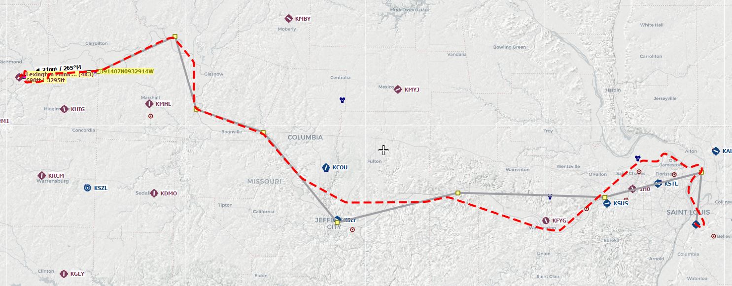
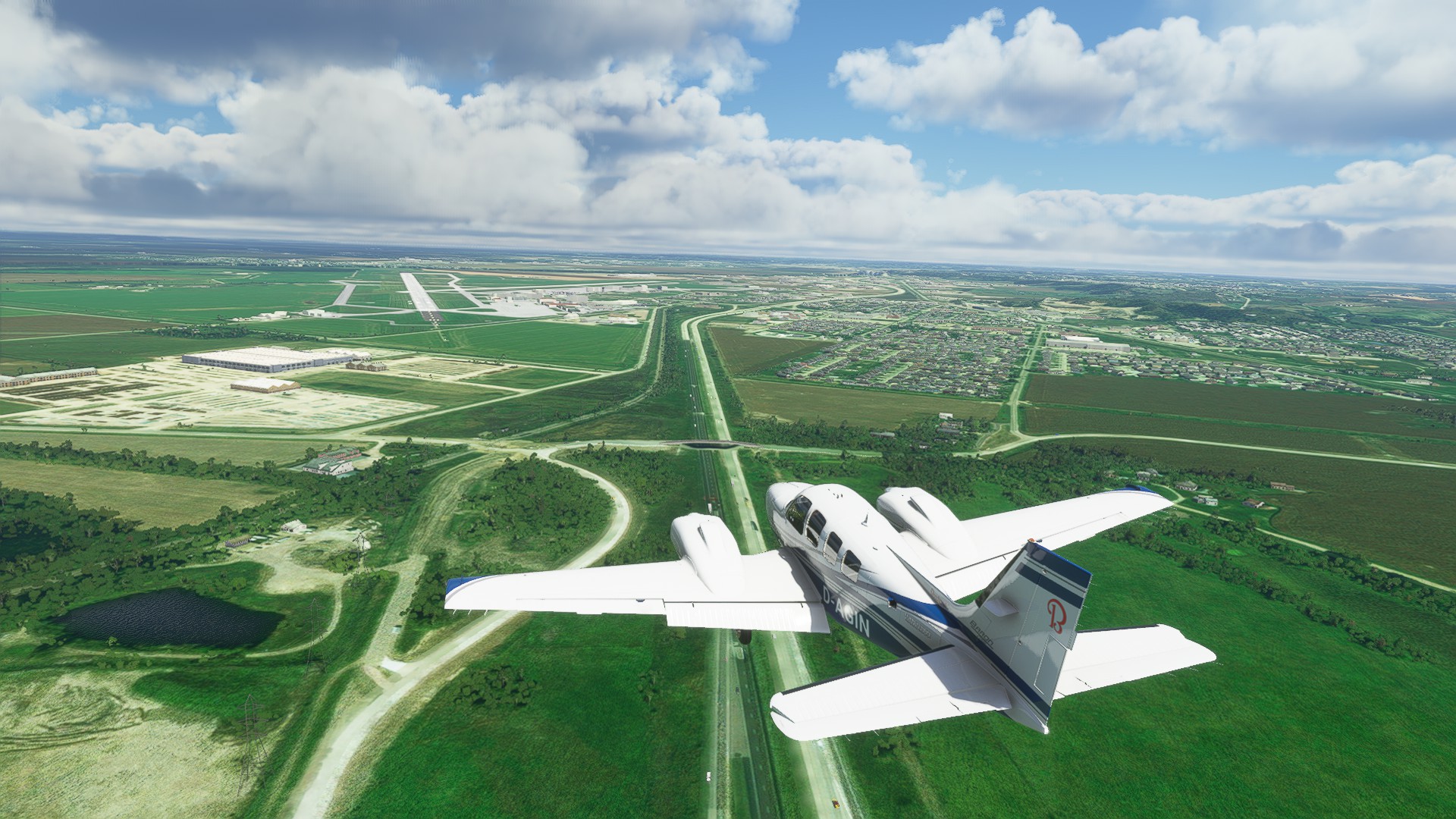
I could not decide on which plane to buy, and I didn’t want to fly something too slow or I won’t ever finish the trip, so I decided to fly this in the stock MSFS Beechcraft Baron 58.
Here is my first leg of the flight, St. Louis Downtown (KCPS) to Lexington Municipal (4K3):
A nice day for flying. I flew with everything set to live (weather and time) so 0800Z and clear skies.
In reality this would probably have been stressful, but there wasn’t a lot of traffic over St. Louis. I took off and followed the left side of the river, not being too careful about the airspaces. Technically I took off in Illinois but most of the flight took place in Missouri as the Mississippi River is the state border here.
There’s the Arch. Shortly after that I turned west and started following the Missouri River. We will do that for quite a while actually.
KSUS, looking kinda sus. ![]()
Into rural Missouri. I chose a cruise altitude of 5000ft although 10,000 would of course be more efficient. But I want to see the ground and the range of the Baron is so high that fuel doesn’t matter at all.
Jefferson City.
The Cut-Off Lake near Brunswick was one of my waypoints. The Grand River mouth can be seen in the background. As the name says it was once part of the river, and was cut off due to the phenomenon called meandering. Since I had a geology class in university I can tell you that this is called an oxbow lake.
I am not quite sure what these structures are, but they look cool. The picture shows the Grand Pass Conservation Area.
Another shot of rural Missouri.
Near the end of my first leg. The airport is not very visible. (above the right wing on the other side of the river)
On final, continuing the tradition of taking screenshots and messing up the approach in the process.
That’s it. Next up: sneak past Kansas City and fly to Sioux City.
Nice job @Aginor ! You should knock this out pretty quickly in the Baron.
So, here goes…
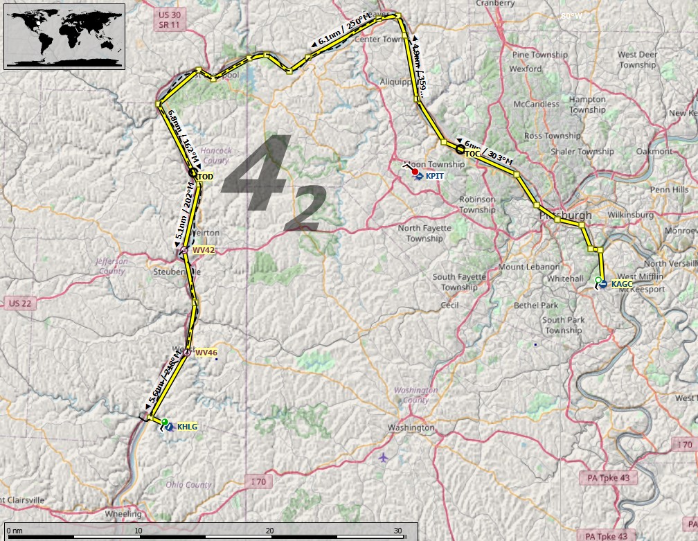
I kicked off from KAGC Allegheny County airport in Pittsburgh.
Just a couple of minutes later I joined the Ohio river, which I will follow all the way to the Mississippi.
Coming up on downtown Pittsburgh…
The city looks great but unfortunately photogrametry and bridges don’t seem to mix too well.
Not the prettiest area… but its amazing how real it looks!
The office…not much in the way of instrumentation…RPM, a compass and a fuel gauge.
Monaca, PA…
Wheeling airport is just off to the left so I decide to end the leg here…
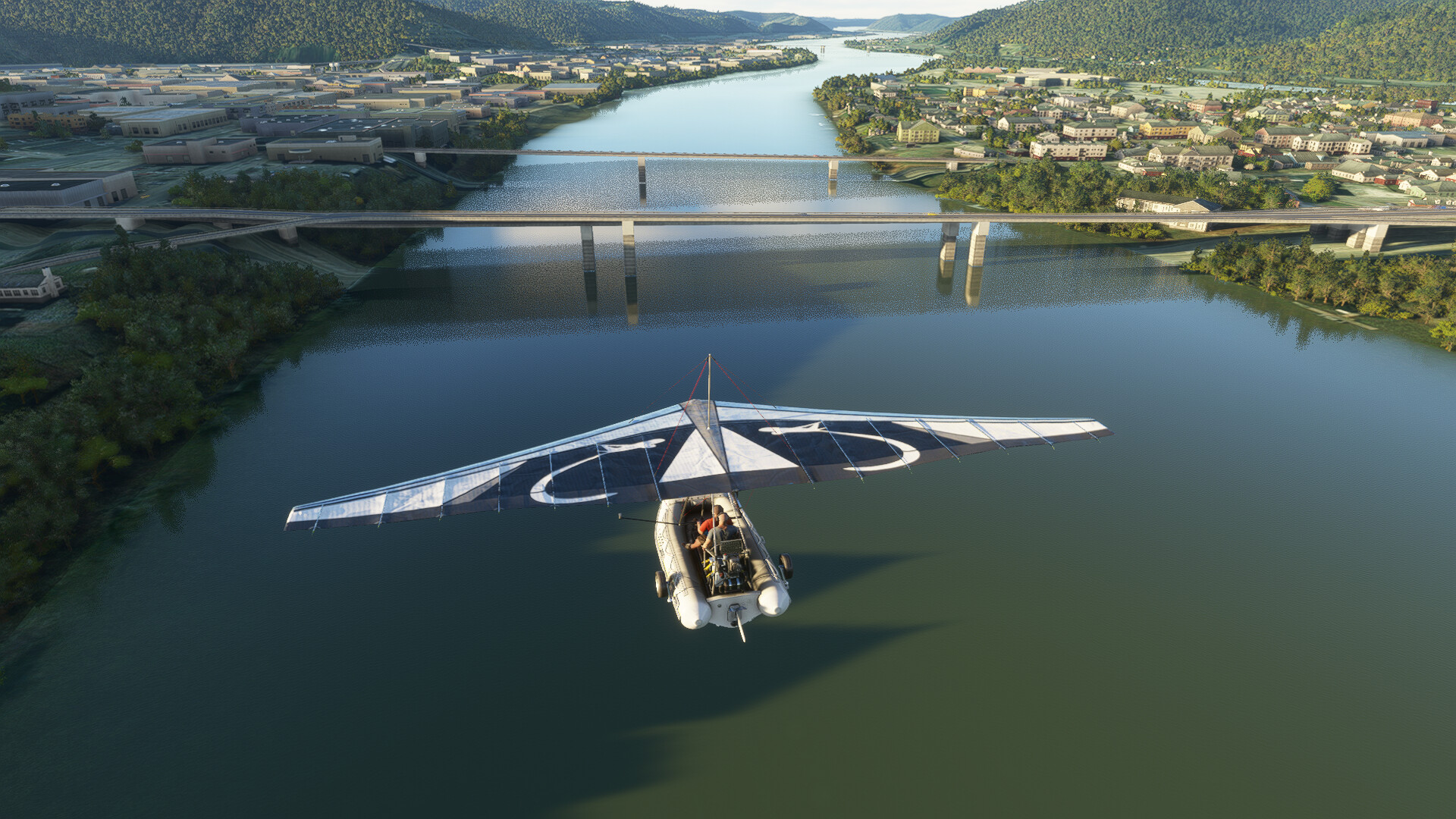
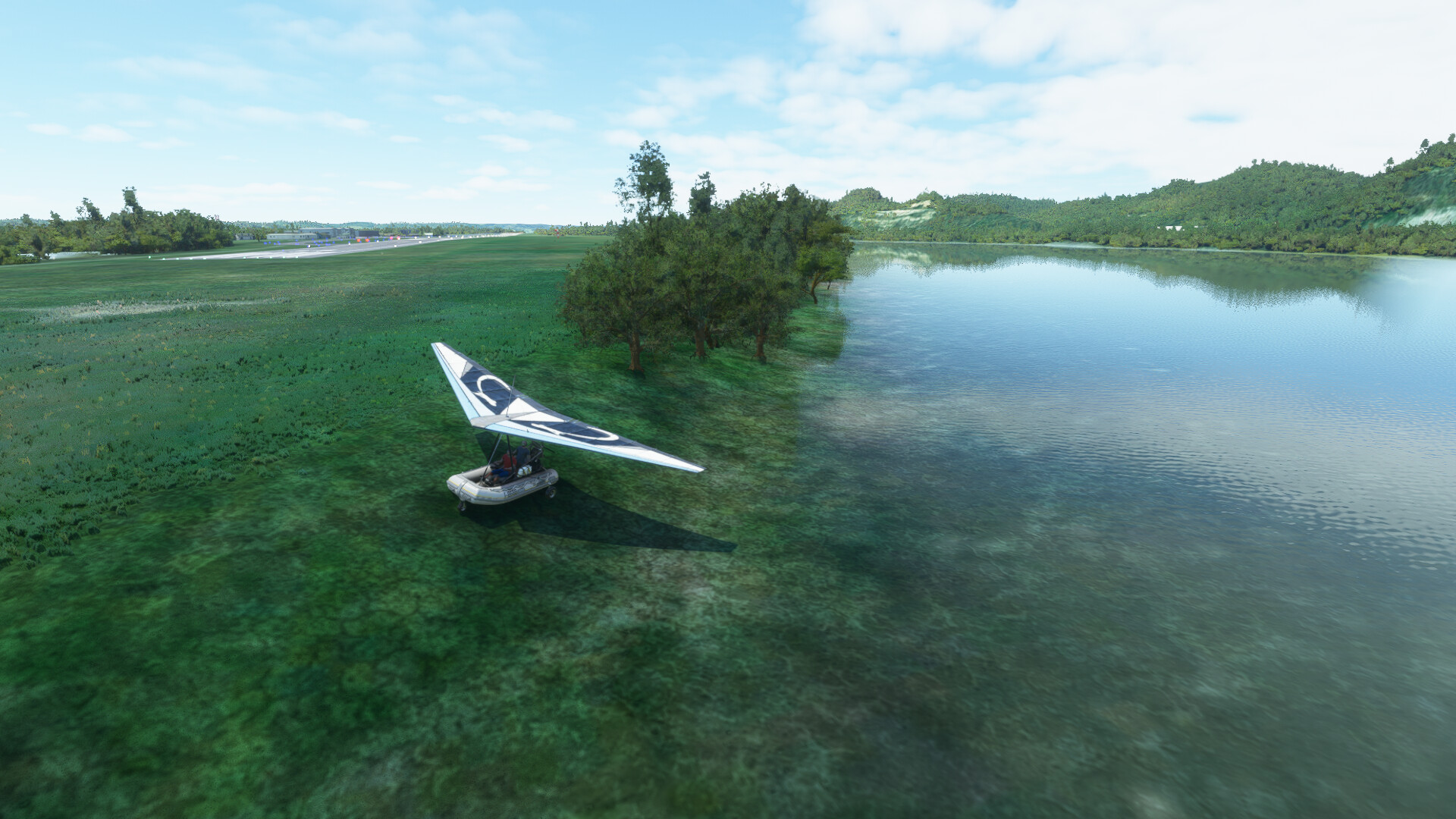
Splashdown…minus the splashes. The water itself looks good though, as do the reflections.
I pull up on the west side of the river at the golf course you can see two shots above.
The next leg takes us down to Marietta and Parkersburg.
Edit>. Worth mentioning is that this flight took me a couple of hours in the flying rubber boat. Lewis took a week to get to Wheeling from Pittsburgh.
Congratulations @Aginor and @PaulRix for beginning your epic journey. It appears that you chose an excellent day to launch, judging by the weather.
I’m so torn. Too much work and family in my life right now to engage in another project - yet this story is by far one of my favorites of all time. Such a monumental achievement in so many ways.
Essentially, it’s irresistible.
Thinking about which aircraft to fly. Bush or amphibian. That’s really a tough one.
I hope you make the journey Dan, but definitely family and business first. I’m glad to hear you are getting busy at work!
I’m in the same boat; I’d love to take part in this, but with everything currently on my plate, I’m looking at taking as long as the real expedition to finish this. Still, it IS tempting, though I know it won’t be nearly as pretty in XP11…
Wheeling, West Virginia to Marietta, Ohio.
Stephen Ambrose’s book states that Lewis described Wheeling as “a pretty considerable village of fifty houses”. He stayed there two days before continuing downriver on September 9th 1803. He made better progress on this section of the river and made it to Marietta (some 78nm as the river flows) by the afternoon of September 13th. Chugging along at about 45 knots, I made it in a little over an hour and a half.
Pushing off from the golf course where I had stopped at the previous leg. Due to the limitations of MSFS, you can’t simply drive off the land into the water without getting stuck. Slew Mode allows you to work around this problem. If you want to move from water to land I stop, shut down the engine and select gear down (it wont deploy in the water)…then slew onto the shore and the gear will drop. Exit slew and you are set. Do the same procedure in reverse to get back in the water. Just an FYI.
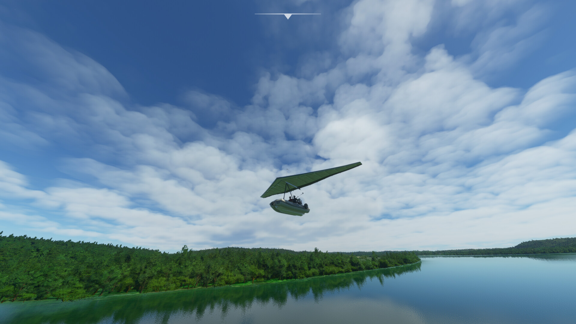
The flying Zodiak doesn’t need much of a takeoff run…
Wheeling on the left, Wheeling Island on the right and a little off shot to the right is Bridgeport, Ohio.
Wheeling in the rear view mirror.
Paden City on the left.
Taking the final bend with Marietta visible in the distance. Off shot to the left we are close to the Parkersburg airport. I used to fly in there occasionally when I lived in Zanesville, Ohio.
Approaching Marietta. I decide to set down just beyond the bridge which is where the Muskingum River joins the Ohio. If you follow the Muskingum it will take eventually take you to Zanesville.
Not a bad landing …
Shut down and pulled up on the beach.
From here we are about 200 miles from Cincinatti where Lewis stopped for about a week. I’ll try to get there by tomorrow night and then I have to head out on the road for a few days, so it will be a fitting place to pause my journey.
I was hoping to make it all the way to Cincinnati today, but that was maybe a little optimistic. Still, I did manage to get half way there, knocking out over 100 miles.
Marietta Ohio to Ashland Kentucky.
It was an easy flight. The weather behaved and the scenery was nice.
Departing Marietta:
This is Parkersburg, just downstream from Marietta.
About an hour later I came to Point Pleasant. No sign of the Mothman though. ![]()
Huntington West Virginia. This is the town where the story behind the movie We Are Marshall happened. Back when I was flying King Airs Huntington was a regular haunt for me.
Continuing past Huntington, I finally get to Ashland, and just to the north of the town is the Ashland Regional Airport. After two and a bit hours, I figure it is time to stop, and here is as good a place as any.
Setting down in the river adjacent to the airport.
I spotted a nice place to come ashore near the end of the runway.
Shut down and safely ashore.
Cincinnati is still a good 2 hours away, so I think I will leave it here until I get home from my work trip.
I will join you guys, but this time only as a reader of your great reports as my spare time is limited.
Keep em coming! ![]()
I’m going to have to be there with @Nevo, in spirit rather than in flight. Learning to fly the AH-1 in Prairie Fire is just too much fun ATM. Now if someone would put out a good quality MSFS Cobra add-on… well two birds one rocket pod kind of thing there.
Got in a leg this morning. I am using the Bell-47G at the moment, which is a challenge to fly. Doing it in VR as well, which makes taking screenshots impossible ![]()
Had to cut the corner there at WP13 as I was starting to experience some turbulence or wind gusts that was making flying interesting. Also lost the radio for some reason. No idea why.
Today I flew my second leg, Lexington (4K3) to Sioux City (KSUX)
Just for laughs I tried live weather, but there was a huge thunderstorm directly over the KC area, so it wasn’t fun. I want to see the ground.
Here are two pics anyway, I flew to Kansas City and landed there. The sim can look so great even in bad weather.
I reset everything and changed the weather to something less severe.
Let’s go!
I kinda like this kind of weather, dodging clouds makes flights more interesting.
Kansas City ahead.
I took a little detour to look at KC. Here is Arrowhead stadium, home of the Chiefs (and next to it the Baseball stadium):
Downtown KC:
That’s quite a big cargo station right there.
And there’s the Kansas Speedway.
My little detour also gave me a nice look at some parts of rural Kansas. The lighting is so great.
Saint Joseph.
Shortly after that I entered Nebraska and played around with the camera. Took this shot of Indian Cave state park.
I’ll split this post up, I don’t know what the size limit is. Next part in a few minutes.
After I had crossed the Missouri to the other side I noticed something funny on the map so I took another detour.
This is Hamburg! A bit smaller than I remember it, and there isn’t a huge port here either, weird. ![]()
Plattsmouth, and, well, Platt river’s mouth obviously. ![]()
I assume the banks aren’t that steep in real life, so if y’all get there you might want to try this mod (or one of the other Missouri fixes you get on flightsim.to) :
https://flightsim.to/file/4022/elevation-fixes-for-omaha-nebraska-area-koma
Peyton Manning voice: OMAHA!
And I’m not saying it was aliens, but… it probably was aliens. ![]()
They have a lot of long, straight streets here.
Lewis and Clark state park. There’s a lot of stuff near this river named after those guys, I wonder who they might be… ![]()
Sioux City ahead! This time the final didn’t look too dire.
Ready for my next leg. In this one I visited four US states (Missouri, Kansas, Nebraska and Iowa). Next time I’ll fly into South Dakota, to a city called Pierre. Thanks for reading. ![]()
EDIT: Here is the track I flew:
I got back from my work trip last night and managed to get from Ashland, Kentucky to Cincinnati. It took me about 2 hours and 15 minutes.
I used realtime weather as always, but set the time of day to early morning. Very misty and atmospheric!
You can almost feel the damp, still air.
Forward visibility isn’t great here, but at 45 knots it is more than adequate…I just had to follow the river!
After about 10 miles I broke out of the weather, for awhile at least.
Approaching Portsmouth, Ohio. I was surprised to see a nicely modeled suspension bridge.
Leaving Portsmouth behind.
Not too far downstream I found a crashed airliner in a field…or maybe just a Bing maps anomaly. I’ll let you decide. ![]()
The weather was patchy for much of the way. MSFS models this very nicely.
‘Sunken’ Lunken airport shrouded in mist and fog… it is famous for it! Time to set down and call this leg complete.
I pulled up at a marina near the airport and shut down. Lewis spent about a week at Cincinnati to give his men some rest and stock up on provisions
I like the “submerged” boats on the lake
Nice! Another leg for me: PHLG to KPKB.

Cincinnati Ohio to Clarksville Indiana…
Another 2+ hour flight. The weather started off very misty and grey
Very atmospheric though…
Passing downtown Cincinnati…
Eventually the mist and cloud gave way to much nicer conditions…
There were a couple of times where I climbed up so that I could leave the PC for a few minutes. The Ohio stretched out for miles ahead of me.
Louisville on the Kentucky side of the river. Clarksville is on the opposite bank.
Landing adjacent to the Falls of the Ohio State Park. This was a treacherous stretch of the river when the expedition took place. Lewis hired a river pilot to navigate the falls (more like a long series of rapids). MSFS doesn’t really manage to do a good job in this area, but much of the Falls of the Ohio have been dammed to raise the water level with a lock to allow river traffic easier and safer passage.
Google maps shows the section of the falls as it is today. The red arrow points to where I parked up.
Clarksville is where William Clark joined the expedition. Lewis and Clark had served together in the army, but hadn’t seen each other in about 7 years.
As a non-MSFS-owner I can only say, “Wow!”