The problem is that MSFS, while not perfect, looks so darned good that I can’t bring myself to fly my other sims. For bush flying there is no other sim that comes close IMHO. I don’t say that lightly as I sank a lot of money into X-Plane and now it is all just sitting there gathering virtual dust.
5 Likes
Well I don’t wish to distract from this fine thread further. But as a parting shot, there is either going to be an amazing XP12, or there soon will be no X-Plane.
2 Likes
I had some time today so I flew the next leg.
My son was a good co-pilot and called out traffic (on the map so we could look for it).
Flight plan from Sioux City, Iowa to Pierre, South Dakota:
KSUX → 423931N0964147W → 425147N0972310W → 424951N0975300W → 424606N0980248W → 430336N0983332W → 432815N0991821W → 440259N0992702W → 441129N0995516W → KPIR
Planned altitude was 5000ft but I flew with real weather so sometimes I had to fly higher or lower to avoid the clouds and still have the ground in sight.


Let’s go!

The Missouri elevation error is pretty severe here, it ends after Yankton though.

Yankton. There is a sizeable dam here, constructed in 1952. The 25 miles long reservoir lake is called the Lewis and Clark lake. Back then they illegally flooded a lot of land belonging to the two local Sioux reservations. Not cool.

The lake is beautiful though.


All in all there are 18 dams along the missouri, constructed during the Pick-Sloan-project in the 40s and 50s. The native american reservations lost over 550 square miles of land during that time, and most had to give up their villages, holy places, and eventually the way they lived.
Often some of the largest buildings in their towns now (something I noticed while flying over them in MSFS) are the food distribution centers that many people depend on. (for example the blue building in this shot of Santee, Nebraska).
I continued upstream.

Eventually I reached the next dam, the Fort Randall Dam at Pickstown.

The Missouri becomes very wide here.

The Platte-Winner bridge and the Snake Creek Recreation Area.

After passing the White River mound I reached Chamberlain, SD. In real life there are three bridges here, but the railway bridge just south of the newer highway bridge (Interstate 90) is missing in MSFS.

A few miles further north is Fort Thompson and the Big Bend Dam, built in the early 1960s.

This is a geologically interesting spot to the northwest of it. The Missouri / Lake Sharpe makes a huge meander around the Narrows Recreation Area, confined by the rocky hills to all sides.

A few more bends in the river…

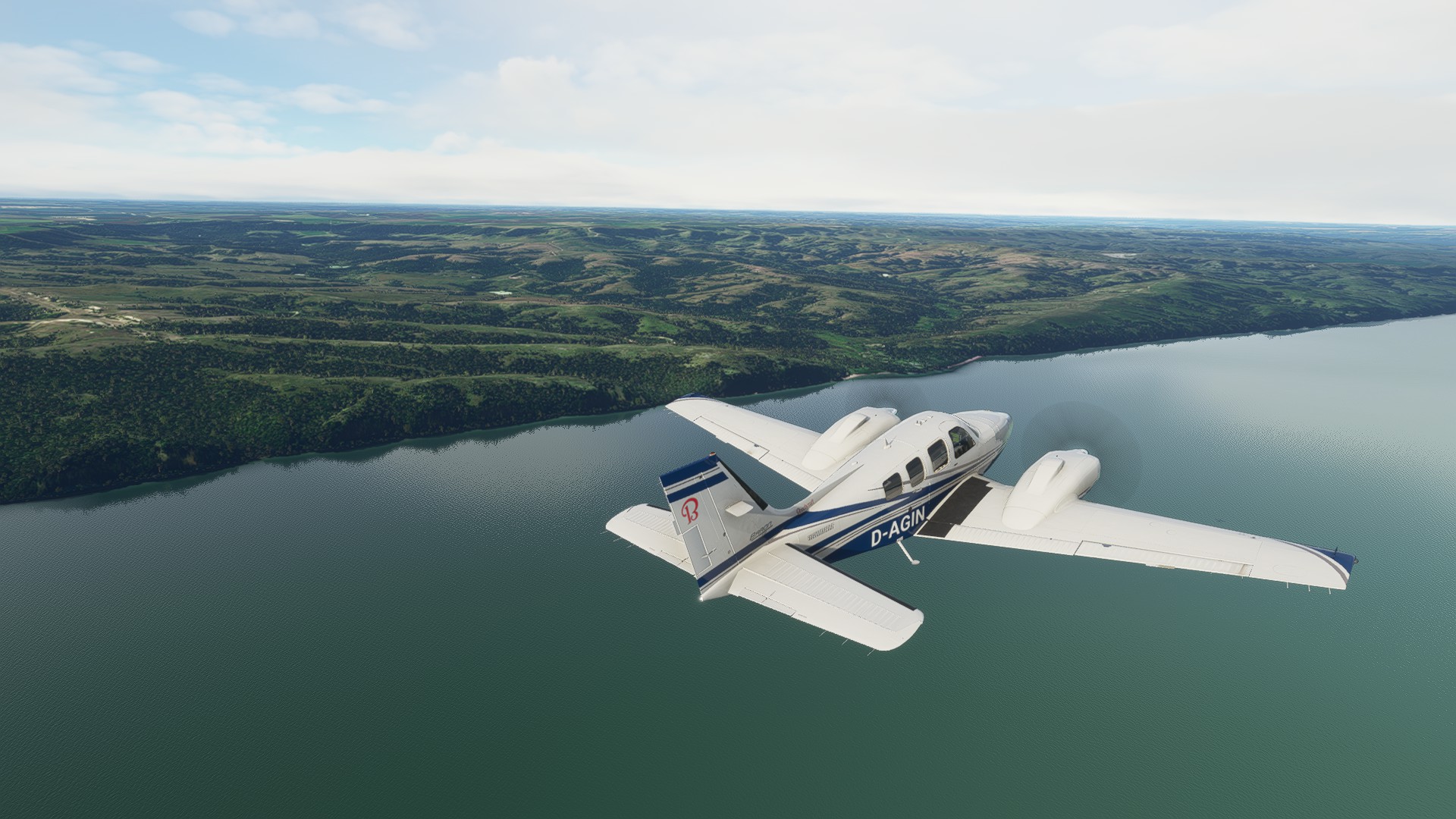
Then I reached Pierre, SD. The airport can be seen on the other side of the Missouri.

Wind was from the south (16 knots) so I took a look at the town on the downwind leg.

On final. 9 knots crosswind but I managed to land decently.

There was a bus on the taxiway, but eventually I reached my parking spot and shut down.
Next up: Fly to North Dakota. Thanks for reading!


Btw., Clark’s journal from 1804 describes a nice meeting with a Native American Chief in this area, including smoking the Peace Pipe.
8 Likes
Nice AAR @Aginor ! One of the things I am enjoying about this trek is learning some of the history both of the expedition and the areas we are flying through. ![]()
1 Like
Sources Aginor? I searched for Lewis and Clark lake controversy, but am only getting hits for the sediment problem, which is predicted to consume 50% of the lake by 2045. I assume that any private land consumed by the lake is subject permanent easement by eminent domain.
Beautiful screens by the way. Love the Baron.
1 Like
The wiki article has a few words about it.
The L&C lake actually was one of the least problematic ones. The dams upstream were much worse apparently.
Here’s some more:
This site has a few good links as well.
https://www.ncbi.nlm.nih.gov/pmc/articles/PMC4699571/
I also noticed that the whole native american displacement part of the topic is strangely absent from many sources. I think I have actually seen more German sources about it than English ones.
3 Likes
If only I could read them while enroute … but the Bell requires ‘hands on’ at all times ![]()
For anyone Interested (and when I get there, I am going to try to remember this): Lewis and Clark Journals Entries - May 14 - 20, 1804 (lewisandclarktrail.com)
6 Likes
Great find Fridge. Thanks for linking.
1 Like
I am really enjoying reading about @PaulRix puttering along the river! I don’t even have my computer set up right now with the newborn craziness but this is a very enjoyable trek to join in spirit ![]()
4 Likes
I finally got my journey underway, a short leg, mostly trying to decide if I wanted to use a sim focused flight planning tool, or stick with what I usually use, which is something that would work for full scale flying, FltPlan Go on my iPad. Seeing professional pilot, @PaulRix and others reports using Little Navmap, I tinkered with that for a while, and came away impressed. I’m just scratching the surface, but putting together a quick flight plan following the many turns of a river, while still having access to the sim’s database of airports and navaids, then send the flight plan to your sim - it’s hard to imagine a better tool, not to mention that it is free. My truncated leg 1, KCPS to 0M08 Sloan’s, a grass strip not far from the Missouri, around 55 nm.

Challenge number two, I initially departed in VR, but after struggling for about a 3rd of the trip with extremely poor frame rate and random headset crashes, I finally bailed and went back to 2D. I found out later that MSFS via a Reverb G2 is no longer playing well with OpenXR. As soon as I disabled that and went back to SteamVR, all was well. But even though the gremlins had been exorcized, the love spell with VR went with it. Flying along at between 300 and 1200 AGL, the ultra settings 2D is magnificent.

Oh yeah, bringing the XCub with custom J3 paint. If I had the financial wherewithal, this would be the first airplane in the hanger. It does bush plane STOL tricks, but has a 132 kt cruise. An awesome airplane in every sense.
Errrr, except you need to manage fuel tanks separately like a Piper. Piece of cake though with a reminder when your tanks are unbalanced. Spent a bit long on the left tank.

I found the grass strip at Sloan’s…

… but decided just to slip it in next to the clubhouse.


7 Likes
Glad you are going to make the trek Dan! ![]()
1 Like
There’s a known issue with the beta of OpenXR. Solution is to use stable. Check the release notes of MSFS.
1 Like
My gods this sim looks impossibly pretty… ![]()
2 Likes
Leg 2 (0MO8) Sloan’s to Jefferson City Memorial (KJEF)
OK, Lewis and Clark, I most definitely am not. When 2 early 19th century dudes with sextants can out navigate me with a GPS, well it’s not one of my proudest aviation moments. It turns out that my domicile for the night was not along the Missouri river, but the Mississippi. Daoh! I must have been really head down last night.
I decided to fly back to the original expedition launch point, St. Charles, and pick up the route from there.

Skipping a sit-down breakfast, but filling my Yeti mug with fresh brewed coffee and grabbing a bagel on the way out, I strode through dew soaked tall grass on the way to the yellow XCub. Preflight completed, I taxied out for an 0800 departure. A turn to SE took me over the clubhouse. I wagged my wings, because that’s what we do ![]()

I crossed the Mississippi, flew on to the Missouri, and turned W and headed to Jefferson City, 108 nm distant.

I decided to drop in here, because I was down less than 10 gallons in both sides. Once topped off, we’d continue NW along the mighty Missouri, until the late afternoon looking for a suitable grass strip for camping.
3 Likes
I knocked out another 126nm, leaving Clarksville and Loiusville, continuing down the Ohio river to Owensboro, Kentucky.

Leaving Clarksville…

The lock system that makes the ‘Ohio Falls’ navigable by modern river traffic.

IFR (I Follow River in this case) seems pretty straight forward.

This stretch of the Ohio meanders back and forth…


Stone quarry alongside the river…


Eventually Owensboro comes into sight…

A decent sized town with it’s own airport. To the right of this shot there is a park at the river’s edge. It looks perfect as a place to pull out of the water, so I land alongside it.


Next, I will push on past Evansville and Paducah for a stop at Fort Massac which was another place Lewis and Clark visited on their way to St Louis. I’m going to try and make it all the way to St Louis this weekend. After that I will have to take a break for awhile as I head off to the schoolhouse for recurrent training next week.
5 Likes
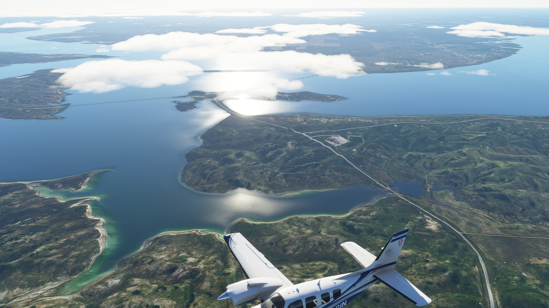
My next leg is in the books, from Pierre SD (KPIR) to Washburn ND (5C8)

The flight plan (most of it flown at 5000ft):
KPIR → 443517N1003819W → 444233N1005842W → 445308N1002325W → 451823N1001441W → 453524N1003401W → 455139N1002315W → 460655N1003639W → 463620N1003420W → 464938N1005243W → 470637N1005625W → 5C8
Real time and weather were no challenge, just a bit of wind but overall nice.
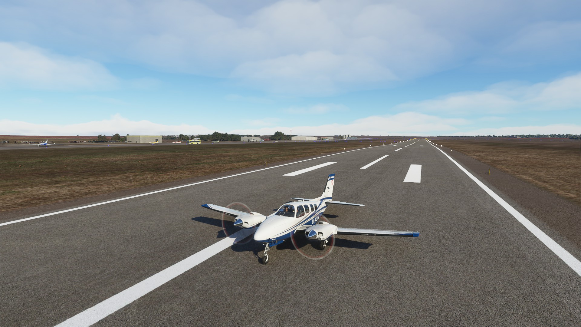
Interesting parking spot in Pierre.

Let’s go!
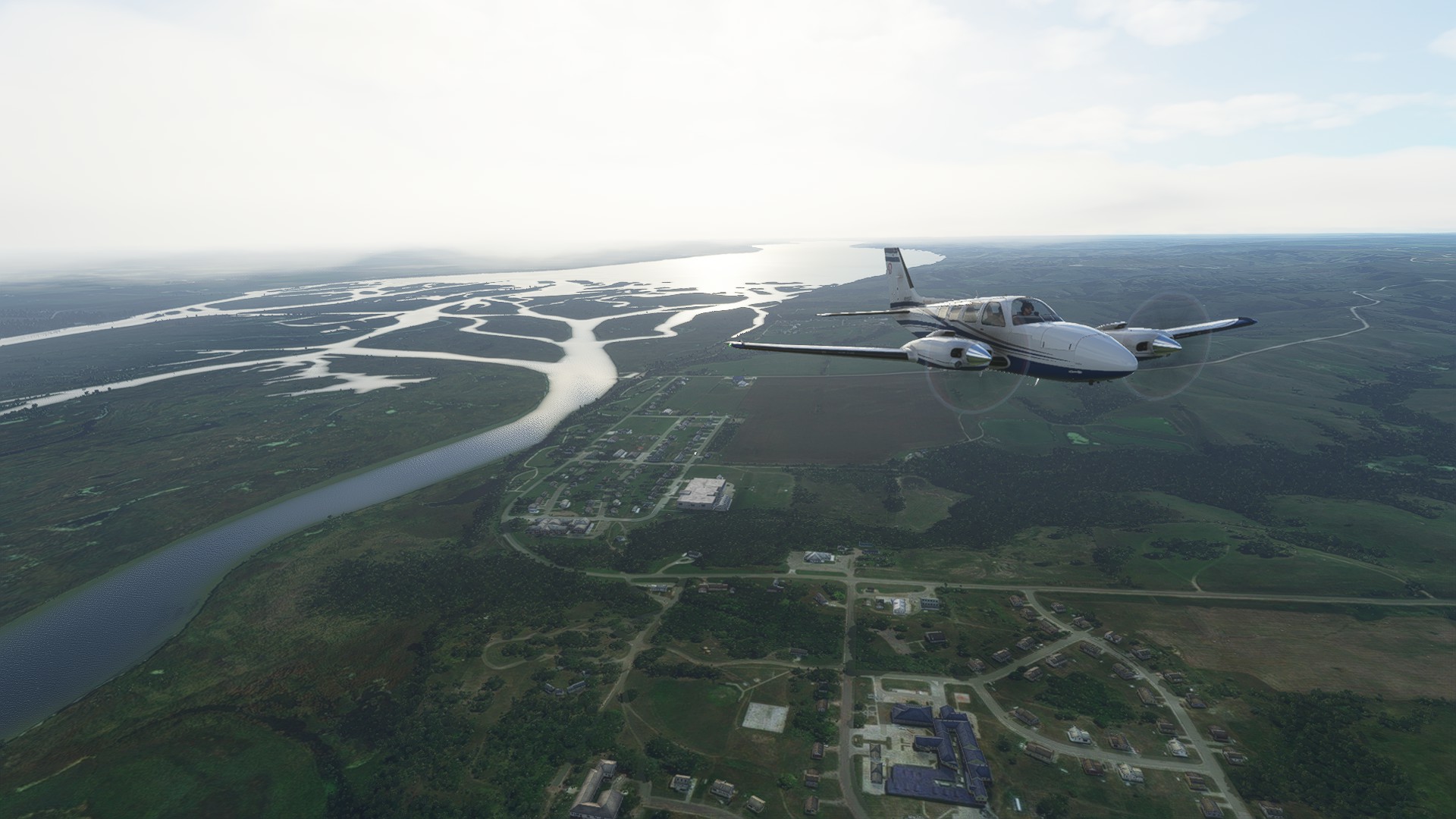
North of Pierre we fly over the next dam, and lake Oahe, the fourth-largest reservoir lake of the USA.
It is pretty massive, we will basically fly over it for the whole 1.5h leg.


Hello, Moon!
Below you can see the Cheyenne River reservation.


A huge bend in the river/lake.

This is near Marksville. Near that bridge there used to be a town called Forest City. Like the farmland of the Cheyenne River and Standing Rock reservations it was given up and flooded when the dam was built (1948-1962).

Swan Creek mouth:

Mobridge.

And there’s Pollock. With that we are leaving South Dakota. From here on we are in North Dakota.

Fort Yates, the capital of the Standing Rock Sioux tribe.

Beaver Creek mouth.

Funny place names here occasionally. This one is called Cannonball.

The reason for the name are the interesting rocks that can be found here:
This is where the lake ends. A little swampy area and then the river has its normal size again.

Bismarck, the capital city of North Dakota.

There are many small islands in the river.

A coal mine. There will be lots more of these further north.

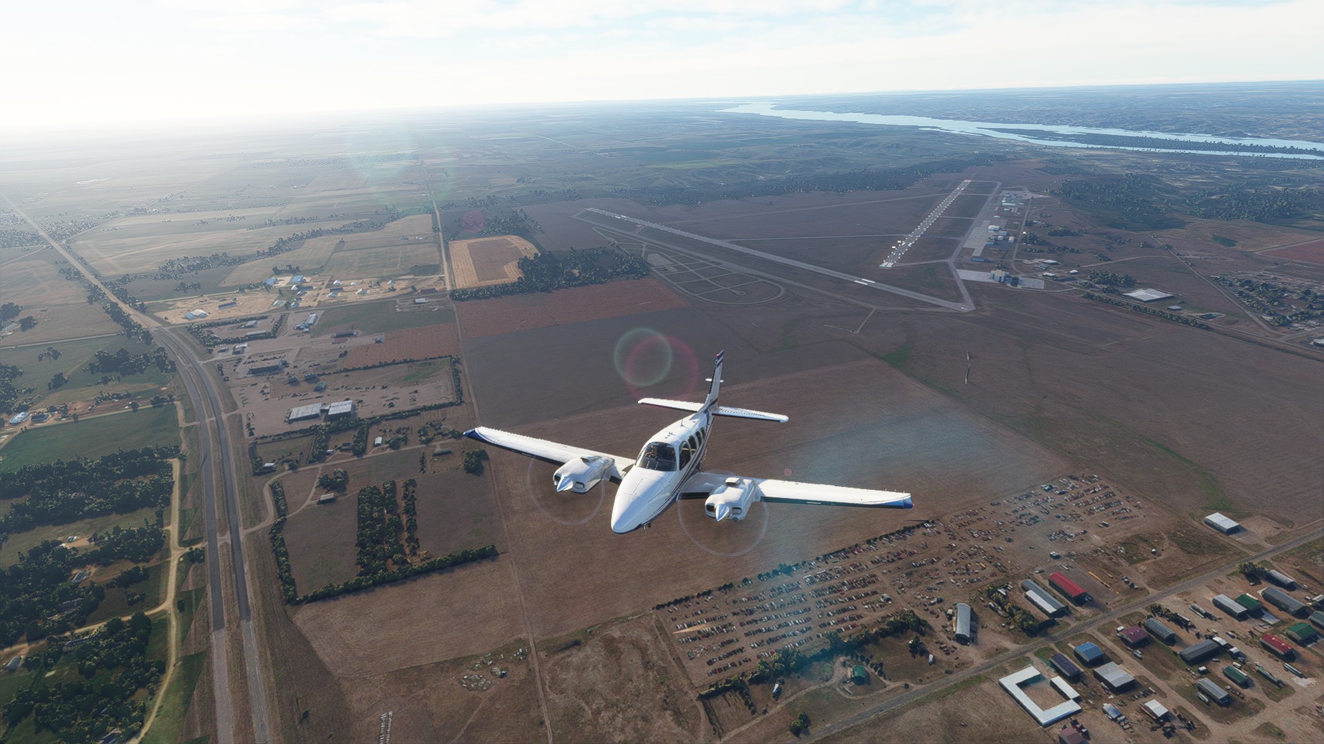
Our destination for today. Washburn ND. There has to be an airfield somewhere down there…

Found it! Thankfully the strong wind was blowing right over the runway. Easy final.

The parking spot wasn’t hard to find, this is quite a small airport.

The Lewis and Clark Expedition arrived at the Mandan-Hidatsa Indian villages on the Upper Missouri River on October 25, 1804 at present day Washburn (the city was founded in the 1880s). They found the Mandan people very hospitable and decided to remain at this wintering site until the spring thaw when they would resume their up-river journey. At Fort Mandan, Lewis and Clark met Sakakawea, the Indian woman who would be essential to the success of the Expedition. For more than five months, Fort Mandan was the site of considerable activity and research for the expedition.
The men of the expedition went hunting and fishing with the Mandan, witnessed the Buffalo Dance, and took part in some other, uhmm… let’s say “pretty interesting” customs.
https://lewisandclarkjournals.unl.edu/item/lc.jrn.1805-01-05
Next up: Go west, to Wolf Point, Montana.
Thanks for reading!
9 Likes
I guess that in some rare cases, it is quite advantageous to be an old man.
3 Likes
![]() indeed!
indeed! ![]()
2 Likes
I began listening to Undaunted Courage again today during my commute. This will be the third time through via Audible, having read the book prior to listening. No matter how often, I learn something new with each consumption. Even so, this time I begin at chapter 10, where Lewis is about to embark at St. Louis, but realizes that he must double the crew in order to battle the powerful Mississippi and Missouri upstream. Imagine doing this all the way to the to the Continental Divide.
A friend of mine went to great pains, but finally secured a personalized autographed copy for his father, who was a passionate Ambrose fan. I believe the cost was an autographed baseball by Bobby Cox, long time and legendary Atlanta Braves manager. Ambrose made out well on the deal, IMO. ![]()
”Of courage undaunted, possessing a firmness & perseverance of purpose which nothing but impossibilities could divert from it’s direction, careful as a father of those committed to his charge, yet steady in the maintenance of order & discipline, intimate with the Indian character, customs & principles, habituated to the hunting life, guarded by exact observation of the vegetables & animals of his own country, against losing time in the description of objects already possessed, honest, disinterested, liberal, of sound understanding and a fidelity to truth so scrupulous that whatever he should report would be as certain as if seen by ourselves, with all these qualifications as if selected and implanted by nature in one body, for this express purpose, I could have no hesitation in confiding the enterprize to him.”
—THOMAS JEFFERSON on Meriwether Lewis
3 Likes
I think I would have preferred the autographed book…but being from the UK, baseball means little to me! ![]()
The expedition was an enormous undertaking…I was thinking as I was flying my last leg that soon I will be hitting the Mississippi and it will be heading upstream from there…every inch of the way from that point would have been a struggle until they crossed the Rockies.
4 Likes