That’s because they drive on the left side of the road. You need to flip everything. ![]()
2 Likes
Also using real weather and real time, flying in So cal in the mornings is fun with the marine layer that is usually present. So Cal and So Florida two favorites of mine.
2 Likes
When I have time, I’m going to hop into the ultralight or autogyro and fly out of Montgomery field, just to do some sightseeing of the Forkboy+San Diego freeware scenery I have, see how well it matches up with memory.
1 Like
That might work…but wouldn’t every update try to find those files and reinstall them?
You have to write the code in Imperial gallons…
2 Likes
I’m all for shortening words…but left and correct aren’t even close to each other Will.
Just write correct next time ![]()
2 Likes
![]()
![]() Yes…actually somewhere around here I’ve got my British Approved, USAF in the UK Driver’s License that I earned after a sitting through a morning class and passing a written test (scored 98%)
Yes…actually somewhere around here I’ve got my British Approved, USAF in the UK Driver’s License that I earned after a sitting through a morning class and passing a written test (scored 98%)
A good part of the class was how to enter and exit round-abouts…no small feat for the uninitiated. They had a 5-way round-about near Lakenheath that you had to go through to pick up you car that had been shipped over…we spent like 10 minutes on just that.
Funny thing. I never goofed and ended up on the wrong side while I was in the UK - even switching from my Brit specs Volvo to our US Ford Explorer. Then one day, a few months after I got to Hawaii, I ended up in the “correct” lane that is not so correct in the US. ![]()
So theoretical question. If I had theoretically purchased all of the California and Washington orbx scenery, that’s everything, including mesh and phototextures? And theoretically I could delete the Forkboy orthos and meshes?
…there may have been Bourbon involved in that decision… Dr. Girlfriend was drunk-buying shoes, I was drunk-buying…my own kind of shoes…
5 Likes
Theoretically, yes you could ![]() .
.
1 Like
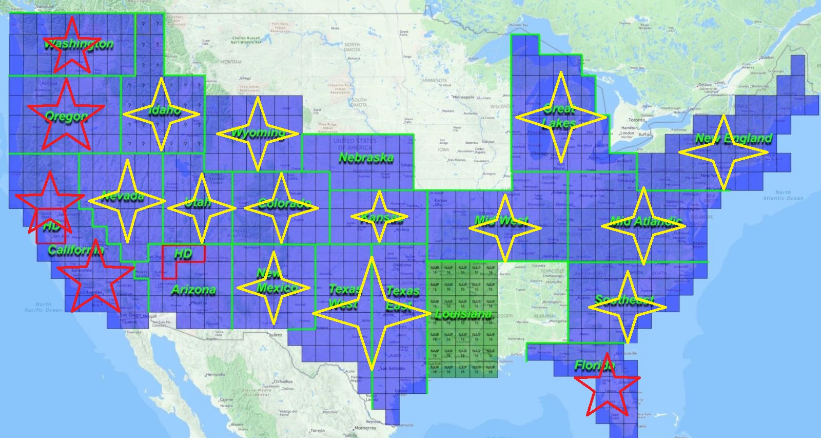
Yes, you could delete the ones for OR, WA, CA… This is my current state of Orthos and scenery for the United States. Yellow stars are Forkboy - red stars are ORBX. I had an old X-Aviation ortho for Arizona that I tried, but now I’m switching to Forkboy…so I’m in the process of converting that.
I’m gonna set my secondary computer to building ortho of British Columbia. I’ve been doing some research and it seems the imagery is not very consistent for that area though…so I wonder how good it will go. I’ve heard ARC data is the best maybe to use…but it could be patchy.
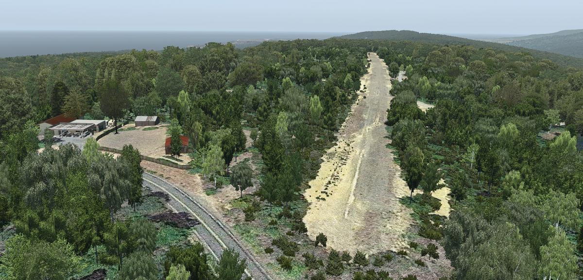
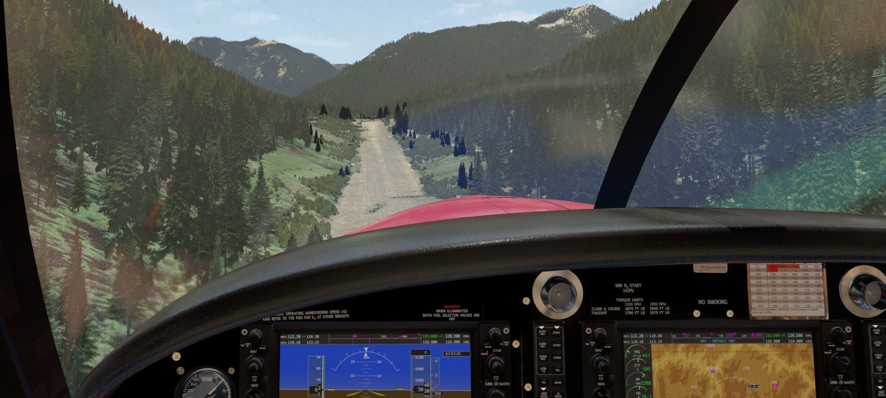
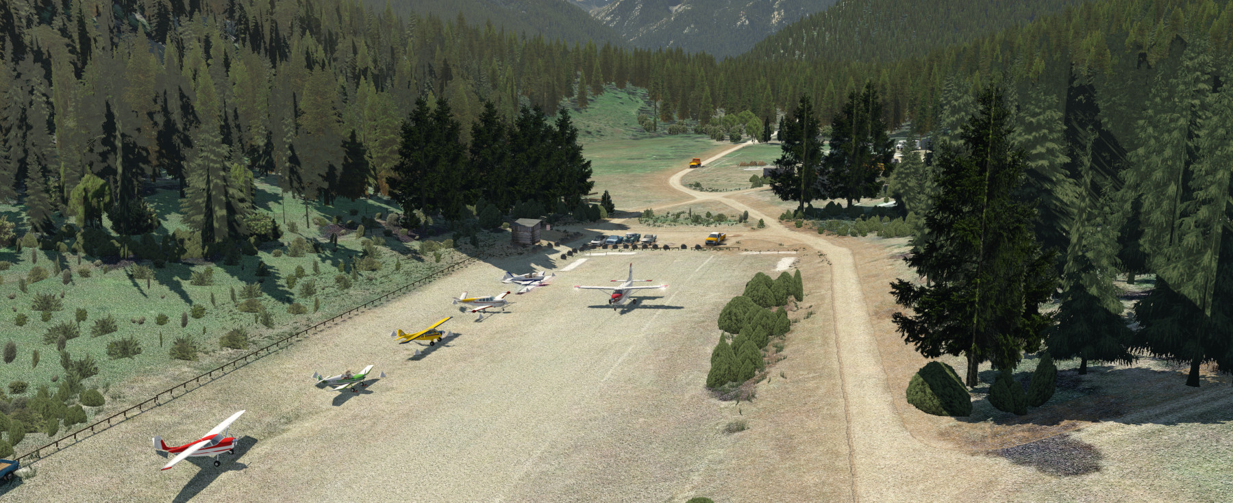
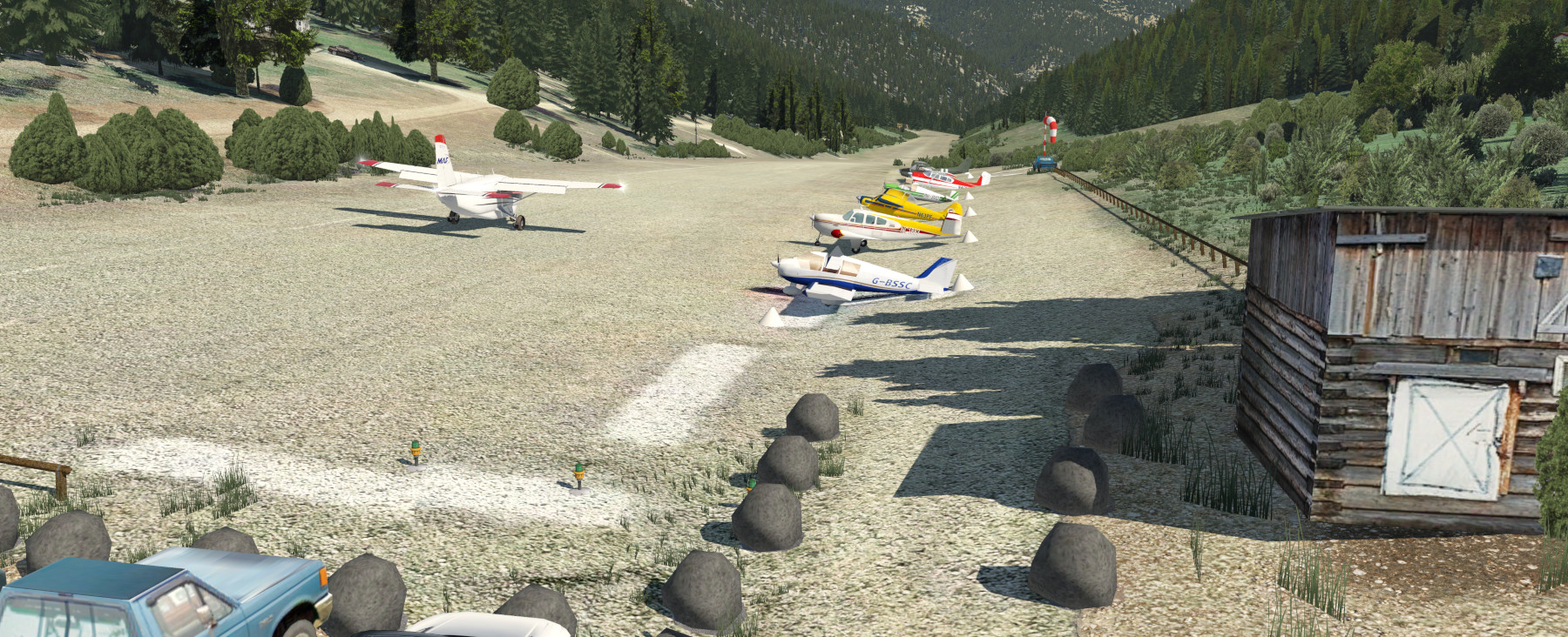
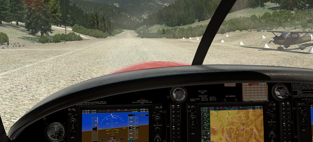
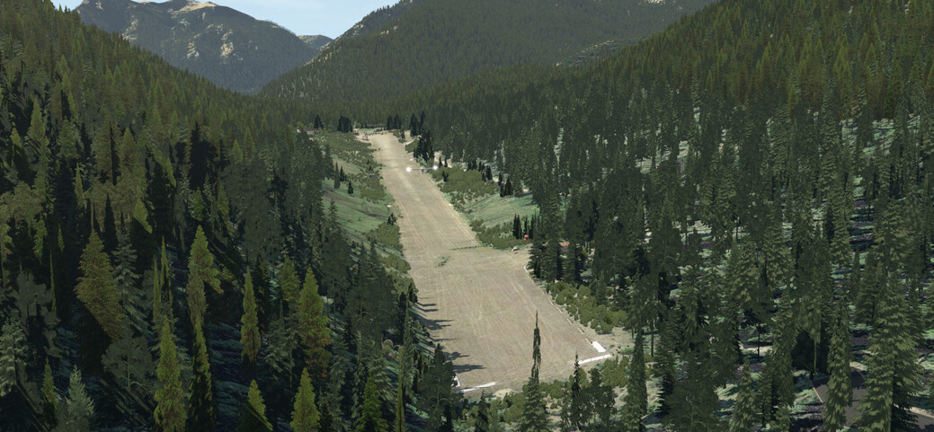
Nice, newly released freeware for U60 - Big Creek, Idaho (right in my type of flying area). This one (authored by Milosanx and his first scenery) is quite a bit nicer than the previous one published by another author, so it is worth replacing it.
I took a spin in the Kodiak to give it a whirl…
Available here:
5 Likes
Here’s one for @smokinhole:
2 Likes
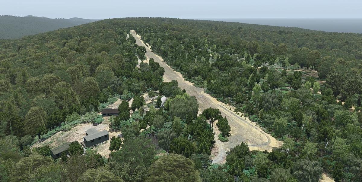
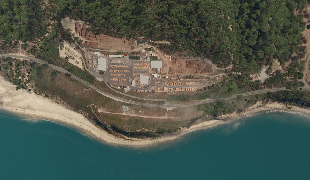
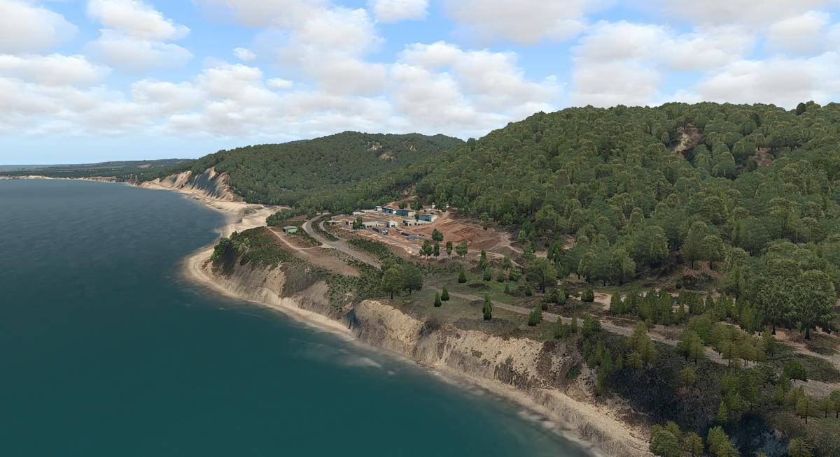
Another new one from one of my favorite designers…Las Trancas, California (17CL)…looks like a beauty…!
“Las Trancas Airport is a 1300’ dirt/grass airstrip approx. 30 nm south of Half Moon Bay (KHAF) sitting right on top of the shore line, with steep drop offs on both ends of the runway. It’s location makes it a scenic place to fly into and out of and is a good place to stop by when travelling up and down the Californian coast. It serves and is owned by the Big Creek Lumber Co right across the street.”
5 Likes
No kidding! Those guys do amazing work.
2 Likes
Nice! I was just flying around there a little bit just- got some weirdness a bit further inland of Santa Cruz, so I think I need to figure out what all can be deleted from my scenery files…
Ours are on a parking program where we get them from storage to give them a short maintenance session. Then we have release to service program that we do before they are returned to service. I presume the planes those crews got on were at the minimum serviceable. Perhaps they were parked at the wrong gates during the usual shuffle these days.
Though there’s usually a big ol’ placard behind the control yoke that ought to give most pilots a clue.
Pretty sure the FMC/FMS knows too right? I’ll have a looksy if you really want to know Beach!