
4 Likes
WOW!! This Map will be Massive…I’m gonna need to get a lot better at refueling
1 Like
This map is supposed to be 3.2 million sq km. Question is, is that more of Chile and Argentina to the north or empty ocean to the south/east to make that size.
They’ve been teasing this map for months now. I’m expecting it’s close to release so hopefully we find out more soon.
3 Likes
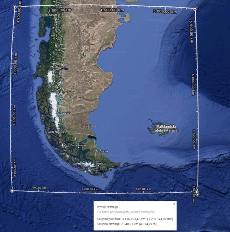
In the interview some post up here they started with the (IIRC?) exclusion zone* but then added area to the west more and more until they included the whole Argentina and Chile ‘spine’ as Razbam calls it.
*EDIT: Yeah, Total Exclusion Zone.
EDIT2: Like this.
6 Likes
That post with the map screenshot is from last February. In the recent podcast and the preview video from yesterday it was said the new map size is 3.2 million sq km and it will be the largest map ever produced for DCS.
My guess is it will be mostly ocean filling the map. Although the region is extremely sparse so the lack of objects (buildings, trees, etc) could allow for a larger land size.
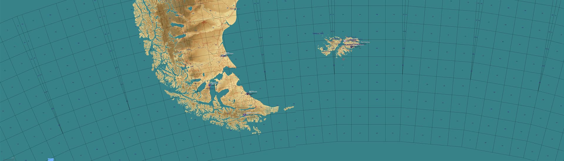
Considering what Razbam said in the interview (more of the Chilean ‘spine’) it appears something like this. (image not mine)
I want to believe
2 Likes
All those mountains in the videos are definitely in the far west or southwest, so we know they have those.
2 Likes
I really hope that’s what the map turns out to be. The airfield at Puerto Montt, Chile appears to host F-16s so it would make sense to include that.
1 Like
Related
2 Likes
No ascension island ![]()
1 Like
Yeah well, holy ship- how many TB of HDD would it require to make a map that big?!
On the other hand- I was hoping the orientation of the map would have been “landscape” instead of “portrait” as to thus include South Georgia islands…
3 Likes
Thats what i thought they would do. South Georgia would of been cool.
2 Likes
Some RAZBAM and Falklands conflict stuff.
The Air Combat Sim podcast has a long interview with the South Atlantic team and Ron (founder) on the South Atlantic map, assets included and in a potential upcoming asset pack and-on. TLDR, it’s coming soon, will have some assets, though not as many as speculated. As someone stated here, the SHAR gets a pass due to some elements of the Fox Radar still being classified, but a flyable Gr.3 is coming. Ron also mentions that they are in contact and working with Falklands vets, including Dave Morgan.

Jello hosts none other than former 809 Squadron CO, Tim Gedge on the Fighter Pilot Podcast.

4 Likes
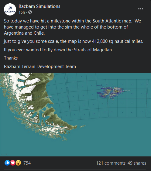
It turns out the map will be mostly water to reach that 3.2 million sq miles. This was posted on the DCS forums.
7 Likes
Works for me.
Imagine two opposing navies each on either side of that spine of land… Playing hide and seek. ^-^
5 Likes
My only complaint would be the lack of airfields and infrastructure in the region. The terrain looks stunning though. Maybe they will expand it after EA like Ugra has done with Syria. On the positive side I suspect performance will be excellent with this map.
4 Likes
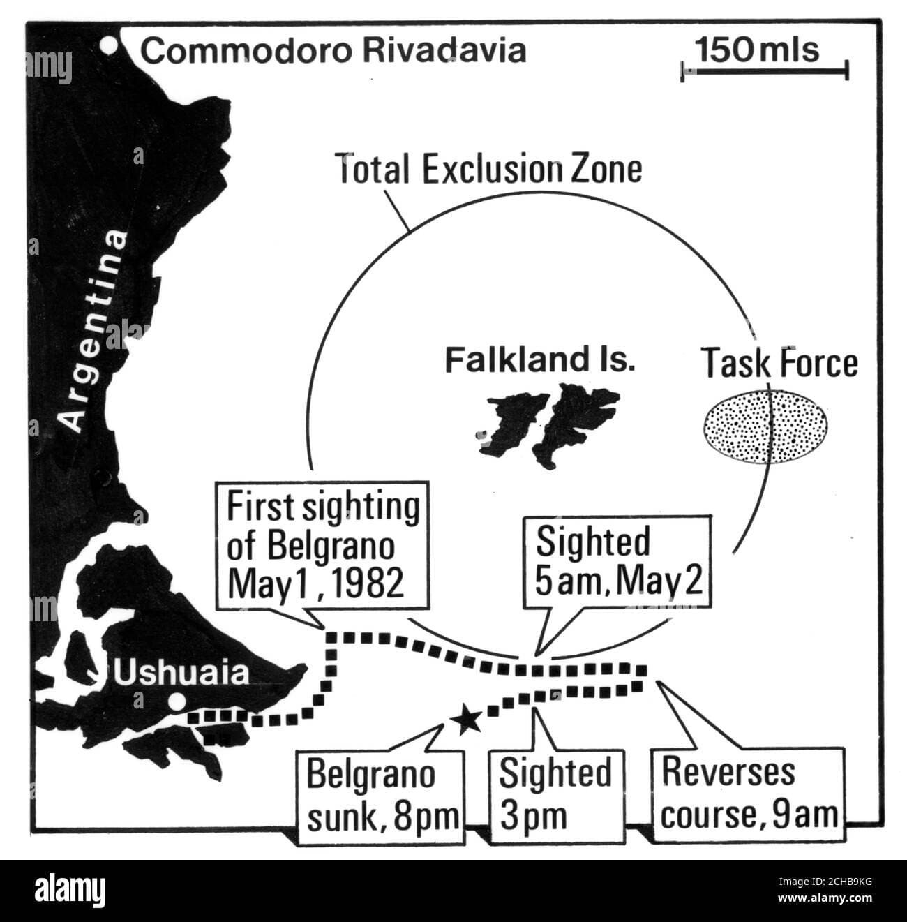
I am a bit sad that the map doesn’t reach further north, especially near the Falklands themselves.
The map just barely covers the Total Exclusion Zone of the Falklands war (200 miles) if I see that correctly.
One of the suspected Argentinian attack directions was from the North.
(Didn’t the May 1st recce flights come from the north for example?)
Anyway. It is an interesting map for sure.
2 Likes
“In all my years I’ve never seen the like. It has to be more than a hundred sea miles and he brings us up on his tail. That’s seamanship Mr. Pullings. My god, that’s seamanship.”
10 Likes
Nice to see a Patrick o brien quote slip in ![]()
5 Likes
