Yeah at first I thought ED was crazy to release this on the same week as MSFS, but from reports and screens I’m now thinking my limited sim time will go in this direction instead.
Perhaps a bit of genius in there after all.
Yeah at first I thought ED was crazy to release this on the same week as MSFS, but from reports and screens I’m now thinking my limited sim time will go in this direction instead.
Perhaps a bit of genius in there after all.
DCS: Vincent Price confirmed!

So, my DCS flying has been severely curtailed just recently what with real flying, X-Plane 11, Condor 2 and now MSFS. I’m getting the vibe that the Syria map is pretty good. I’m thinking about picking it up, although if I’m honest I really haven’t spent much time with the PG map so far, or the Channel and Normandy for that matter. Hmmmm ![]() .
.
Flying the Syria map so far has been better than the PG. It feel a lot more “alive”. However, I have yet to fly missions over this map. So far just cruising in the Hornet scouting for some mission locations, and general sightseeing.
It is probably the best map they have to date. I dont think you will be disappointed. And curtail your real flying so you can spend more time simming ![]()
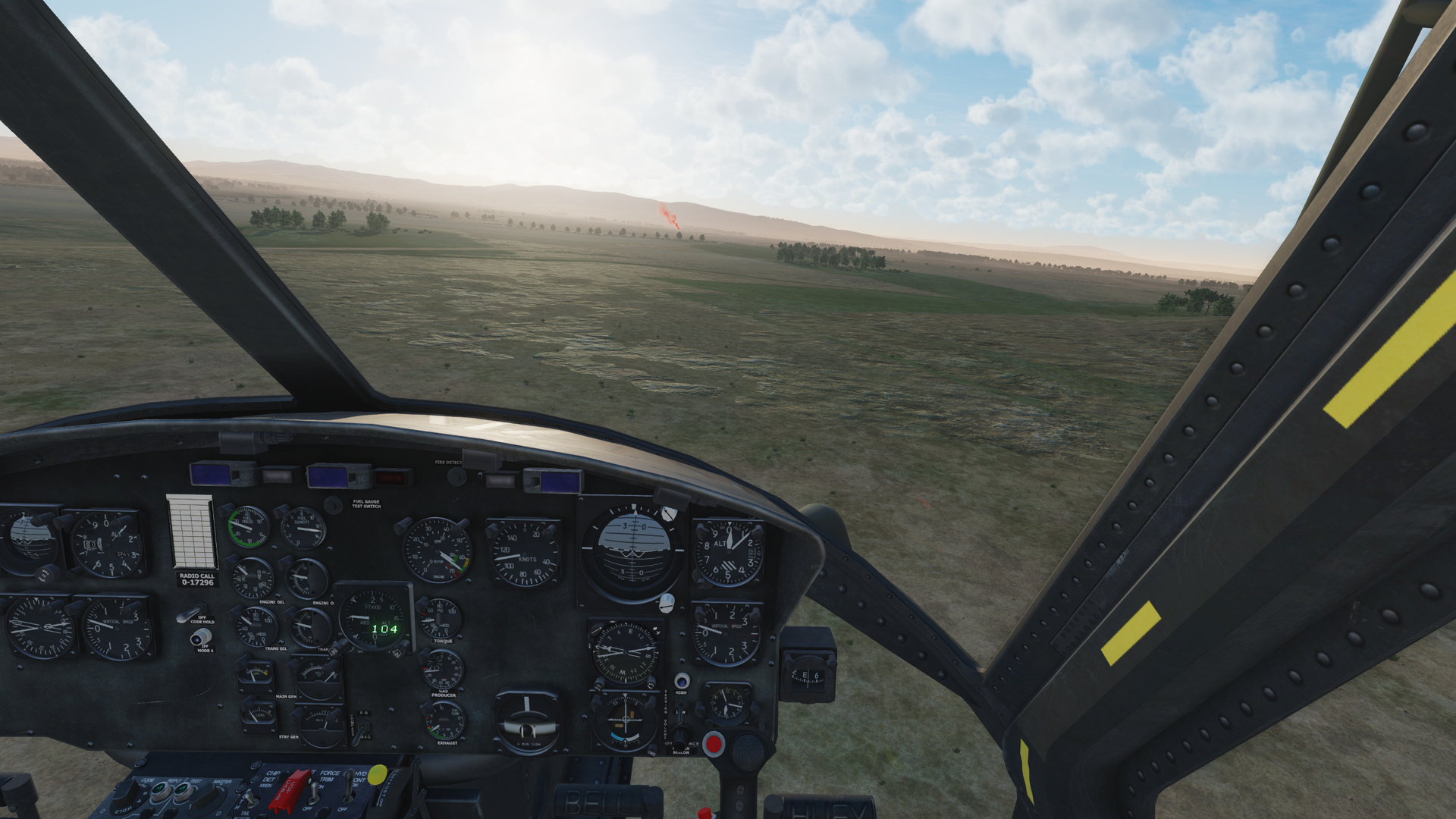
I’ve been flying a few missions today on a (soon to be persistent) map one of my squadron mates has been quietely working on during the last two weeks (he’s on EDs tester team). It’s a lot of fun. First we carried troops to the frontlines using the Huey, then I provided CAS in the good ol’ Warthog until I got too cocky and a manpad got the better of me. I plan on flying some SEAD in the Hornet later this evening.
It looks so much better than anything other in DCS (apart from the Channel but that’s WWII), it’s not even funny.
Huey:
A-10:
Incirlik with some static objects:
This is what I’d call a target rich environment:
So in an attempt to increase my disappointing performance on the Syria map (a quick cross-check on the Persian Gulf map still showed good performance) I went ahead and lowered terrain textures from High to Low.
Side-by-side screenshot comparison show now difference. To me both modes look identical.
RAM usage on the Syria map went down from around 25 GB under High to just 16 GB under Low.
Fps in 2D (generally between 100 and 200 fps depending on situation) also generally seem to be the same under High and Low.
Fps in VR low over Beirut increased significantly from lowish 25-35 fps to acceptable 45-55 fps.
What is most important though is that the micro-stutters are gone.
There seems to be some issues related to the terrain textures setting and the new map. For now I have reduced it to Low for a significant performance improvement at no apparent visual quality loss. I still need to check if other maps still look the same under Low though.
I’ve been using low terrain textures for years, and I can’t tell the difference. It keeps VRAM and RAM usage down as well. I still use high textures for everything else, and no problems at all.
I ran both SP and MP in the tomcat with no slowdowns, including Tomcat runs at 500ft AGL at 600kias over Haifa and Beiruit.
I’m running an i5-2500 (OC’d at 3.8) with 16Gb RAM and a 1060 with 6Gb VRAM, for reference.
Having similar results; I too went to Low on the terrain textures and, at least where I’ve been so far, I had to stare kinda hard (make an effort) to see a significant difference, if at all. I think there’s just so much more ‘stuff’ on the ground - that helps a lot.
Trying this out as well for the significant RAM usage drop.
On Syria I could not really tell the difference in the detail areas and outside of them I don’t think it really matters what resolution a barren desert is rendered at.
Sweet Drops Brother ![]()
I love the map.
I have discovered a bit of a time saver in ME. If you uncheck “Trees” in map options, it saves a lot of redrawing time when moving or scrolling. I don’t know if it was redrawing individual trees…perhaps individual leaves and branches? ![]() Anyway, there is a lot of “forest” detail when you get zoomed in - redraw can take while in some areas.
Anyway, there is a lot of “forest” detail when you get zoomed in - redraw can take while in some areas.
The measuring tool in the ME only works with the mouse wheel.
Why are some airfields on the F10 map all white, and the blue ones have 1 or 2 rings around them?
I had messed with turning off User Objects, and then wondered if the map was broken because my new units were not showing up. ![]()
That shows how old the map is. With every passing year, the airfields gain a ring in growth and turn blue.
A little something I found on the Syria map…
Evidently an old Crusader Hill Fortress/Castle. You should be able to read the GeoCoords from the screen.
Looked familiar and was easy to find, it is the
Btw there should be several of those around on the Syria map (like… at least a dozen). Marqab springs to mind, near the town of Baniyas, between Tartus and Latakia.
Edit: which gives me an idea to do a “Crusader Castles” tour in FS2020…
A modern-day T.E. Lawrence !
Only it is quite likely they will not be there ![]()
Well, at least in 2D. Not 3D probably.
I checked out other historical sites that are not super famous (so not like the pyramids) and some were visible on the ortho photos at least (like Abu Simbel for example).