Don’t worry we don’t hold that against you ![]()
2 Likes
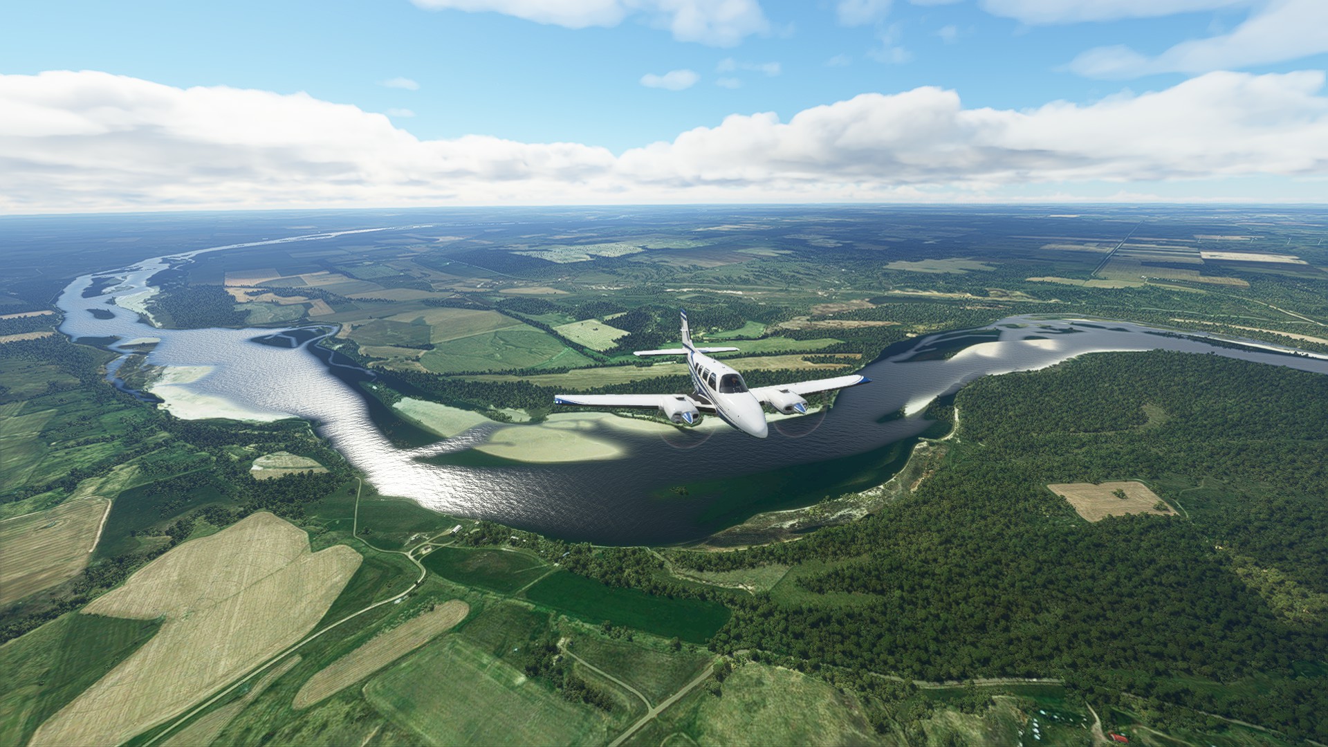
Due to time constraints I had to shorten my next leg. Instead of flying to Wolf Point I only did a short hop of 40 minutes to New Town, ND. (05D)
Flight plan:
5C8 → 471735N1010718W → 472237N1012238W → 473011N1012410W → 473508N1011152W → 473252N1015505W → 473612N1021839W → 05D
I used live weather and time.
Weather was decent, a bit of rain near Washburn. But it was pretty windy, for most of the flight I had 30+ knots of wind, mostly from the NW.

Let’s go!


Flying over Fort Mandan, and shortly thereafter over the Big Hidatsa village described by the expedition in fall 1804.
In this area there were several tribe wars after the return of the L&C expedition in 1806. The Mandans killed several Shoshoni that had traveled with the expedition, despite promising Lewis and Clark the opposite, then went to war with the Sioux and Arikara. So it seems that at least here the admirable peace efforts of L&C were not successful. The divisions between the tribes would make the eventual conquest of their lands by white settlers a lot easier.

A large coal mine in the background. There are quite some of those here, and also some coal power plants.

A few miles upstream we encounter the next dam, the Garrison Dam, constructed from 1947 to 1953.
The little square pools are a fish hatchery.

Remember Sakakawea, the Shoshone woman I mentioned in an earlier post?
The basin lake is named after her.
Riverdale ND. Nice layout.

I took a small detour over the eastern part of the basin which is seperated from the main lake by a small dam. It is called lake Audubon and is a wildlife refuge and recreation area.
Before the basin lake this was hilly terrain, the hill tops form the islands we can see in the lake today.

On this part of the flight I had to steer 15 degrees to the right of my flight path because the crosswind component was above 30 knots. The next picture was taken into the direction of my flight path to show my crab angle, PFD shot below (and yes the altimeter setting is embarassingly wrong, I set it to 29.52 shortly after I took the screenshot).


This area must have looked very different when the expedition was here. Most likely the Missouri was heavily meandering and surrounded by hills. Must have been one hell of a trip, and it explains why the expedition took months to get through here.

The Little Missouri mouth. After that I turned north.

I wondered what the reddish (and sometimes bright) squares were, so I took a closer look using Google Maps. Those are oil drilling sites. The area to the west is full of them.


Near our destination, New Town (very creative name. ![]() But that isn’t an American phenomenon, here in Germany the equivalent of that name, “Neustadt”, is a common city name as well.)
But that isn’t an American phenomenon, here in Germany the equivalent of that name, “Neustadt”, is a common city name as well.)
To the east you can see the western part of lake Sakakawea, called the Van Hook Arm.
To the west of the city is the next river bend, and the lake ends shortly thereafter.

Fun fact: During a training flight in winter 1969, a USAF F-106 from Minot AFB crashed into the western part of lake Sakakawea. The pilot ejected safely but the wreck of the plane sank below the frozen lake surface. It was not located until more than 35 years later, in September 2004, after an extended search by a local surveyors’ group.
On final. That was a challenge, because just before the landing the crosswind suddenly reduced and I had to correct for that.

Landed safely. The large white buildings in the background are huge tanks (probably for oil) in real life, and those bright brown roads are railroad tracks, because New Town is the transportation hub for all the oil in the area.
Ready for my next leg. I am lucky that I don’t need fuel, because there is a building on the taxiway.
Thanks for reading!


5 Likes
Excellent report Aginor. Nice job researching both the L&C expedition and more recent history. As I listen to Undaunted Courage again, it’s hard not to cringe at Lewis’ naiveite in his initial council meetings with Native American tribes, especially his habit of choosing a single village chief as their primary representative, instead of giving equal respect to all of the chiefs among a tribe. That must have been insulting and contrary to his goals, but then I try to put myself in his shoes, in that era. Perhaps his decision to chose a single point of contact was an effort to save time or perhaps how he had been diplomatically educated, rather than arrogance. The “new father” speeches also seem in retrospect misguided and overly assertive. But we are judging him after 200 years of further understanding of sociology and civilizations. No, putting myself in his place, given what he was experiencing and observing, it’s hard to imagine that I would have even a small measure of this man.
Nice flying btw.
2 Likes
Thx!
I feel like I am missing more than a few interesting spots due to my lack of knowledge about the expedition, but I try to sprinkle in a few important things here or there. The rest of it is mostly trying to recognize (and look up) what I am flying over, so that’s where the modern stuff is from. And boy, do I learn new things about the areas I am flying over!
MSFS2020 is great in that regard. It might not show everything in enough detail to instantly recognize it (such as the coal mines or the drilling sites) but it is good enough to get an impression of the area, and then easily look it up in Google/Bing Maps.
1 Like
Leg 03 Jefferson City (KJEF) to Carrollton Memorial (K26) / 117 nm

For this and perhaps a few more legs, I decided to swap the XCub for the Optica, an airplane seemingly perfectly designed for this part of our journey.
I also gave the Navigraph moving map a try. My impressions are mixed. While having a more detailed moving map and charts are helpful, having to login each time I launch the sim is not. That requires that you either login to the Navigraph site and enter a code, or easier, use your mobile phone to scan a QR image. The later method is easier, but the results may not be worth the effort. The moving map has no aviation related information, only your aircraft’s location over an open source map. While there is more detail that the default VFR map, helping you identify towns, it should offer more IMO, given the expense of Navigraph data and Charts, especially if you are flying 2D. I’d almost rather have my iPad running FltPlan Go as I would be IRL, since it will overlay your aircraft onto a VFR sectional or other aviation chart. YMMV.


Anyway, back to the flight and the Optica. I have to say that our first hour was not a cozy one, but by the end of the leg, a missed approach, landing, and a little bit of pattern work, we are doing just fine now. Dislikes: with the engine right behind the cabin, it’s loud. I can imagine IRL that I might double-plug. In other words, use both my David Clarks and some squishy ear plugs. It feels like the Lycoming is strapped to your back, which in a way, it is. It also needs a lot of nose up trim on t/o. There are flap and pitch trim position indicators on the console between the seats. What worked best for me for t/o is to put the trim indicator between the T and R of the the word TRIM, while using the default 10 degrees of flaps.
You will need a lot of runway, so be careful where you set down. I almost dropped onto a nice looking sandbar along the way, then remembered that I would be marooned there. It’s not a bush plane by any definition.

Speaking of landing, a 90/80/70 around the pattern works well, but unless you have lots of runway, use full flaps and keep a little power on all the way to the asphalt. The short landing gear take some getting used to since you feel like you are setting her down on her belly about the time the rubber chirps.
At Carrolton, the color of the grass was fine. I was just running out of runway. I suggest when doing a go-around, if time permits (CFIs will shoot me for this), get rid of all but 10 degrees of flaps. They have massive drag, putting you between a rock and a hard place.

Otherwise, she is a blast to fly, because you really do get the feeling that you are in a Bell, but without all that shaking going on. The view outside is probably unmatched outside of an ultralight. It’s the perfect way to explore the river banks as we travel NW.


What is this ballast thing they speak of? Note the ignition key placement.

This thing is silly with flaps. You will need them at a short field.

The door latch is not the ones at 9 and 2 o’clock. Look down and the bottom of the door frame for another latch to set you free.
The flight was unremarkable, other than cruising along the Missouri at 300 AGL in the Optica is a blast, that left me wondering how much the river bank appers like the one in 1804. Much of the land beyond the river banks have been cleared of trees for agriculture. How much is natural or untouched is a mystery, although one can’t help but wonder.
6 Likes
Nice AAR’s @Aginor and @chipwich ! Great choice of aircraft there Dan. It’s perfect for this trek, and faster than my flying boat! I’m hoping to get back at it next weekend. Work will keep me busy until Friday, at which point I hope to push on to St Louis.
1 Like
I am tempted to buy that plane as well.
Nice view from the cockpit.
1 Like
Yes, it’s pretty amazing flying along in that bubble. A very magic carpet sort of feel to it. Watching this video, 2 differences in the Orbx and real versions were apparent. One, the distinctive ducted fan sound is missing in the sim version, and the takeoff roll seemed a little quicker in the real aircraft IMO. Otherwise, they nailed it.

2 Likes
Leg 04
Carrollton, Missouri (K26) to Kansas City Downtown (KMKC)
Distance: 70 nm
Lewis and Clark timeline: 16 June - 26 June, 1804
MSFS and Little Navmap flight plans: Leg04.zip (2.4 KB)

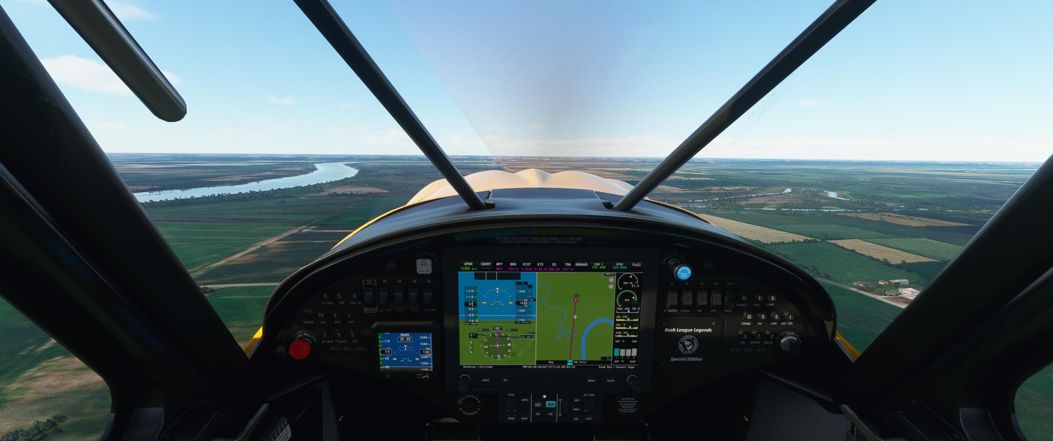
I don’t remember who Thank you @Fridge for linking the Lewis and Clark Trail Journal pages, where I made a great discovery researching this leg. On the legs in the state of Missouri, there is a link at the top of the applicable journal page to a PDF map, so that you can follow along as you read. Dates and campsites are also shown. For instance, I was thrilled to discover that near today’s departure airport lay two campsites. Using the journal map, I begin creating user POIs in Little Navemap and decided to investigate them in MSFS. To that end, I pulled the XCub out of the hanger, knowing that I would want to plop down and see a few up close. As good as the Optica is for sightseeing, it doesn’t do STOL and rough terrain well.
Here just a few miles from my departure airport are two campsites, for 16 and 17 June, 1804 respectively. I created the POIs by comparing the journal and LNM maps. On the beforementioned ADV rider site, there is a digital guide book available with the coordinates of all known campsites and Garmin GPS tracks. But it’s $50 and the files are Garmin GPX and AnyGPS format. I couldn’t find a way to import those into Little Navmap, which does import Garmin GTN files. If I were driving or riding the L&C trail, that guide book would be a must-have, and still might invest. But for now, I’m going to try to use what’s openly available.
Tip, if you use Little Navmap and download my flight plan above, you will see my POIs for campsites along the river. I’ll make a best effort to continue plotting the campsites in LNM in Missouri. However, if you discover another source for campsite GPS coordinates, please chime in and we’ll try to figure out a way to get them in LNM for the rest of the virtual journey.
I made up 5 digit designation for the campsites POIs so that they might be later exported. Someone needs to go back and do the same with the earlier legs. Any volunteers? Since the flight plan waypoints would hide the POIs if using them for navigation, instead I set the flight path adjacent to them so that I could more or less turn 90 off of the river and hit the campsites.

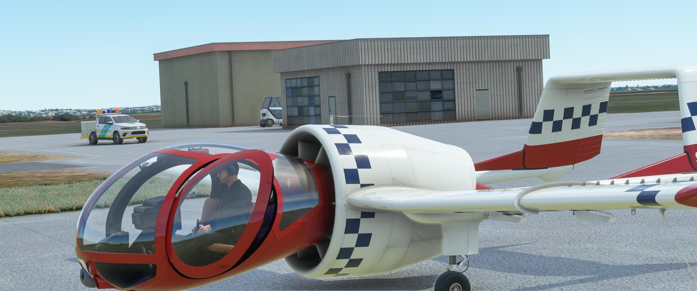
While flying the Optica leg, I had the boys at Bush League Legends install a very useful cargo pod ![]()

I pushed the throttle at the usual 0800 local headed out for the most anticipated leg yet. The first couple of miles were parallel to the Missouri as she turned south.
Hmm, the first campsite POI was a disappointing blotch of worn vegetation.

Referring back to the ADV rider L&C thread, I discovered that many of them are unmarked and largely forgotten, sometimes even by the land owner.

Onward.


20 miles into the leg, the 19 June '04 campsite looked interesting in that it was in the middle of a big left hand bend. About 5 miles before this campsite, Clark mentions passing Tobo Creek which you can easily find on Little Navmap near my WP8.
“after fixing the new oars and makeing all necessary arrangements, we set out under a jentle breese and proceeded on passed two large Islands on the S.S. leaving J. Shields and one man to go by land with the horses passed several Islands & Sand bars to day at the head of one we were obliged to cleare away Driftwood to pass, passed a Creek called Tabo. passsed a large Creek at the head of an Island Called Tiger River on the S.S. The Island below this Isd, is large and Called the Isle of Panthers, formed on the S.S. by a narrow Channel, I observed on the Shore Goose & Rasp berries in abundance in passing some hard water round a Point of rocks we were obliged to take out the roape & Draw up the boat for 1/2 a mile, we came too near a Lake of the Sircumfrance of Several miles Situated on the L.S. about two miles from the river . this Lake is said to abound in all kinds of fowls…” -Clark
I could not find a lake named Circumference.

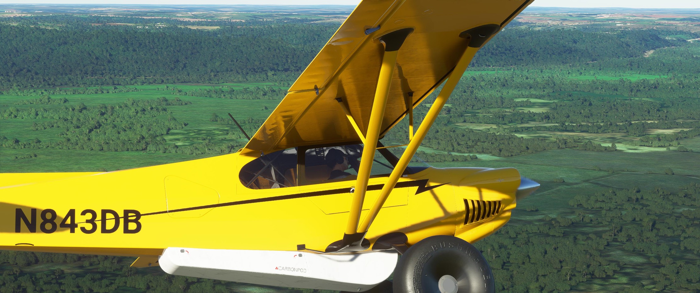
Deciding to land and picking my spot at the last moment, I decided to slip in, because that’s one does in a Cub. My direction of flight is parallel to the crop rows.


I fast-taxied around checking out the probably campsite a bit before departing not wanting to get the infamous MSFS stuck aircraft syndrome.

After departing, I wondered if some of the Corps hiked up this hill, if it existed, for a better look at the surrounding landscape.

I flew on towards Kansas City, checking out from the air, but not stopping at the 3 campsites along the way, knowing that the big Kahuna lay at the end of today’s leg.

After getting the airplane and my mind into the L&C trail for a few days, I can’t say that the urban sprawl was a welcome sight.

However, what I really wanted to check out was Kaw Point Riverfront Park, where the expedition made camp 26-28 June '04. It is situated on the NW side of the point where the Kansas River terminates at the Missouri River. My flight path shows a turn about point before entering the pattern at KMKC.


Of special interest are marker stones for each member of the expedition, including Seaman.

Approaching 19 with a right front quartering crosswind of 17 kts.


Taxiing to my tiedown, I was greeted by a welcoming sight. It seems that these North Kansas City folk have good taste in airplanes. As much as I love the XCub, I haven’t figured out how to open the door!

A cool geeky thing happened on the leg down. Since my POIs were not showing up on the navigation screen in the aircraft, I frequently ALT-TABed back and forth between MSFS and Little Navmap. With Navigraph Simlink running, you have a moving map in LNM, that would be the bomb if it would display in a window in the sim, especially in VR. I usually run AI traffic and too my surprise, could see the other aircraft going about their happy way in the moving map. Shortly after my flyby of the overlook above the 19 June campsite, in LNM I saw a Cessna about to cross my flight path, but about 4k higher. I looked up trying to see it, but failed on that bright, mostly clear day. But damned if I couldn’t see its nav lights and strobe.
4 Likes
Nice report!
I also have LNM running when I fly, usually on my second monitor. The integration via simconnect is indeed quite qood.
1 Like
Owensboro to Fort Massac near Metropolis, IL.
I flew this leg before I headed off for training, which seems like ages ago now, so I will just leave the screenshots here from the flight…


The expedition arrived at Fort Massac on November 11th 1803. They stayed just two days before pushing on. Long enough to recruit George Drouillard, who was sent off to round up some missing ‘volunteers’ who were supposed to meet the expedition there at Fort Massac.
7 Likes
Love this thread. Great work all.
3 Likes
After a busy period at work, and then the distraction of the amazing PMDG DC6, I got up early today to knock out a few more miles of the trek…
Fort Massac to Cape Girardeau.

Quite a dramatic sky as we take off from Fort Massac.

The Ohio river is almost exactly 1 mile wide at this point… that’s a lot of water heading to the Gulf of Mexico!

From this altitude I get my first glimpse of the Mississippi a bit earlier than Lewis and Clark would have.

Here we are at the confluence of the Ohio and Mississippi… not much to see here really. I have flown over this point IRL and wondered why they decided to define the Mississippi as the major river from this point because the Ohio is much wider here. I think the answer is that that it wasn’t always this way. When the expedition reached the confluence, Lewis surveyed the area and calculated width of the rivers. From Ambrose’s book: “Clark determined that the width of the Ohio before the junction was 1274 yards, that of the Mississippi 1435 yards and of the combined rivers 2002 yards”.

I took a small shortcut to avoid the weather… I’m not complaining as I have been fighting a 15 knot headwind most of the way. My ground speed has been as low as 35 knots.

It was a good decision as the rain moved right over the river…

Double rainbow!

A hole in the cloud shows there is some vertical development up ahead. I don’t really want to fly under that cell. I can see Cape Girardeau’s airport, which looks to be clear, but I stick to the river because of that cell… looks like I’m going to get a bit wet.

The visibility drops, but I only see a few raindrops…

Soon I am through the band of weather and the city of Cape Girardeau comes into view.

The expedition stopped here, and I will do the same.


I mentioned before that once the expedition hit the Mississippi, they were fighting their way upsteam all the way to the Continental Divide in the Rocky Mountains. At this point, it became apparent that they needed to increase the size of the expedition party…they needed more men to row. Their initial progress up the Mississippi slowed to a snail’s pace “In 8 hours of constant rowing or paddling the expedition made ten and a half miles”. It took 4 days to reach Cape Girardeau, which by river was 48 miles (just 25 miles as the crow flies.
St Louis is getting closer!
7 Likes
This afternoon I pushed on from Cape Girardeau all the way to St Louis.

It was still a little bit murky as I left Cape Girardeau behind…

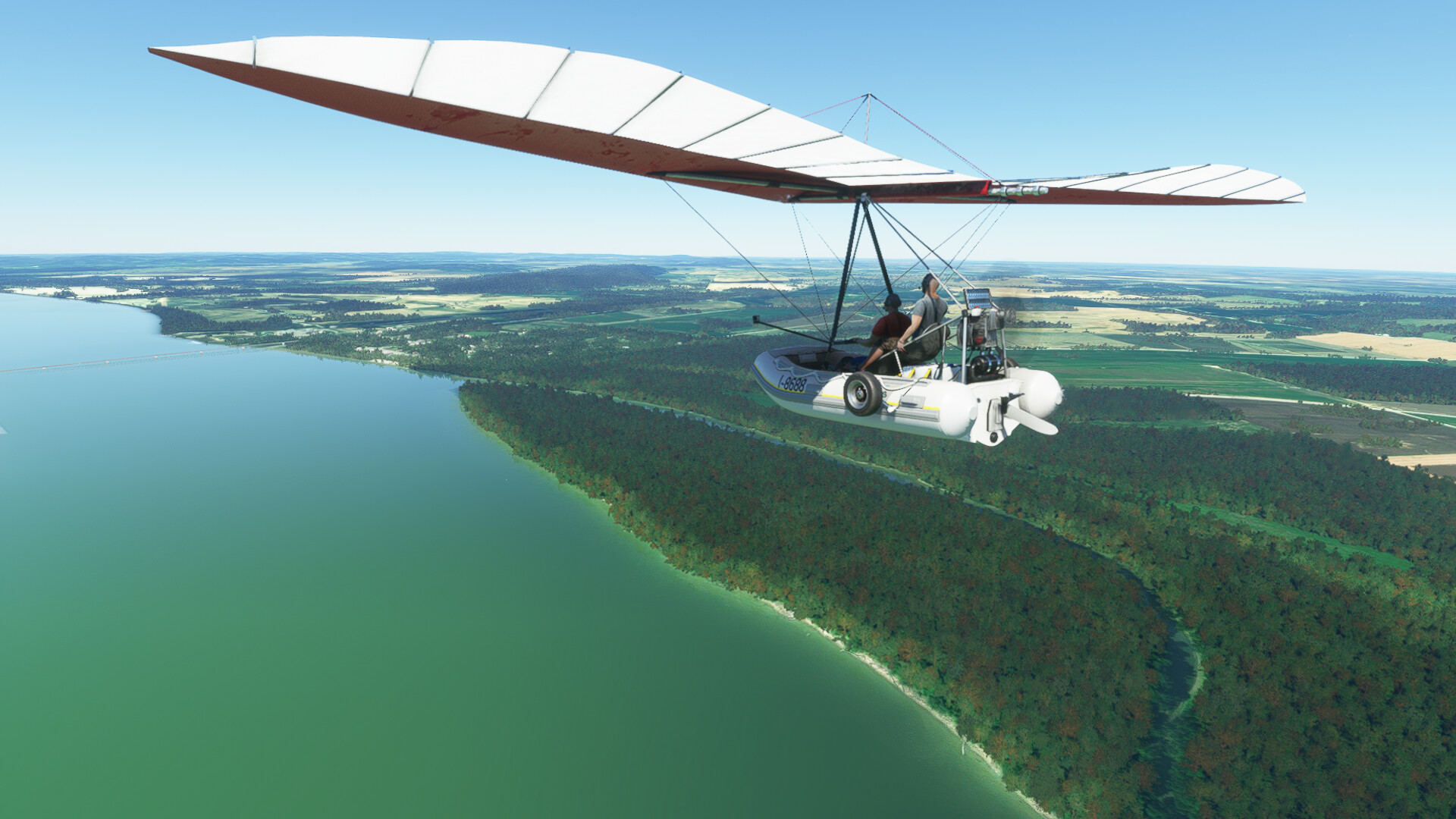
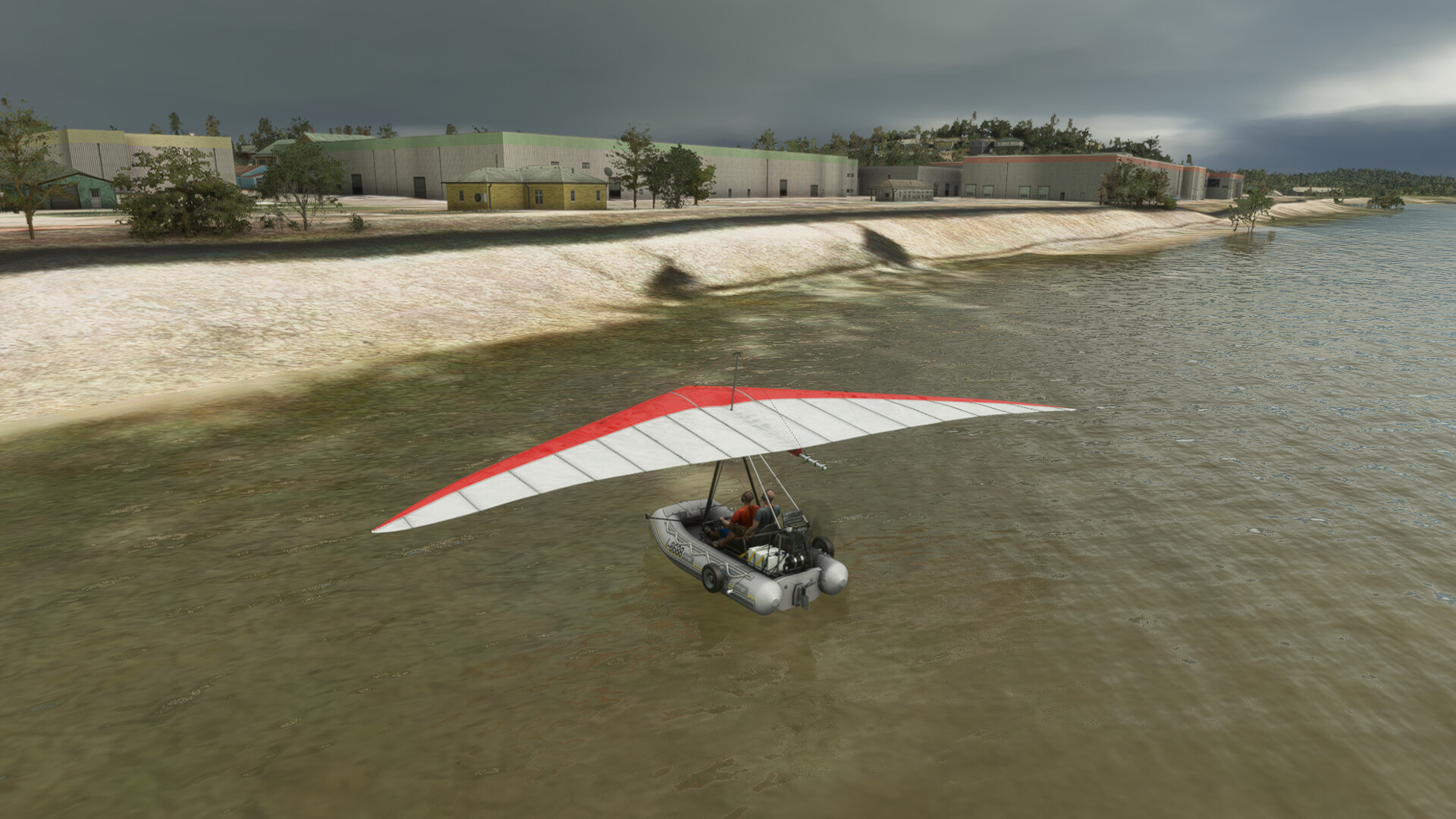
The flying boat is a lot of fun when you are skimming along just a few feet above the water. It doesn’t seem quite as slow!


As I followed along on the map I noticed that the State Line mostly followed the river, but not always. When it devitated though, you could see that the course of the river used to follow the line precisely. The map shows it quite nicely.

Coming up on another place where the State line suggests that the river took a different course back in the day…

I turn to follow the State Line and there is plenty of evidence that shows the old course…

This is the small village of Kakaskia. The expedition reached this point on November 28th 1803. from Ambrose book: " On November 28, the expedition reached the army post as Kaskaskia, on the Illinois side, some sixty miles below St Louis" If the State Line was adjusted to follow the river as it flows today, Kaskaskia would be in Missouri. From here Lewis went ahead of the main group to St Louis while Clark continued upriver with the men and the boats.

Continuing up the Mississippi there was some light precip and I was very impressed to find that MSFS can render a Glory - or at least something like a Glory. The sun was in the right place too (at our back as we view this image).


Hmmm tall buildings on the horizon. We are getting close to St Louis!

As we get closer, the photgrametry kicks in… a multi-level quarry (aka a very big hole in the ground).

The famous arch is in sight!

It felt good to cruise past the arch. It is a very neat experience to go inside it and the view from the observation deck is well worth seeing.

I continued on past the city. The expedition wintered near the confluence of the Missouri river and the Mississippi.

Just a glimpse of the Missouri… I will be stopping close to the island up ahead, but on the East side of the river (the Illinois side)…


Parked up. The road behind us is the Lewis and Clark Trail… Seemed like a perfect place to stop.

Across from where we are parked, on the opposite side of the Mississippi, we see the Missouri river… we will be following that for a long way. From here, the official Corps of Discovery expedition begins.

This is a fitting place for me to put a pause on my trek until sometime next month.
I’m also considering upgrading to something a little faster … I’m not sure yet though.
10 Likes
Wow, it has been a while hasn’t it?
The forum even asks me whether I really want to revive this topic, as it hasn’t been posted in since June. ![]()
Anyway, just for laughs I flew a leg yesterday, using real time and weather. In the middle of winter in North Dakota, in a plane without anti-icing equipment. What could possibly happen? ![]()
![]()
So, here we go. From near New Town, ND (05D) to Wolf Point, Montana (KOLF). A short hop of 130nm if you fly reasonably straight, I was going to follow the river though.
Cold and dark. Quite literally because it was just before 08:00h local time.

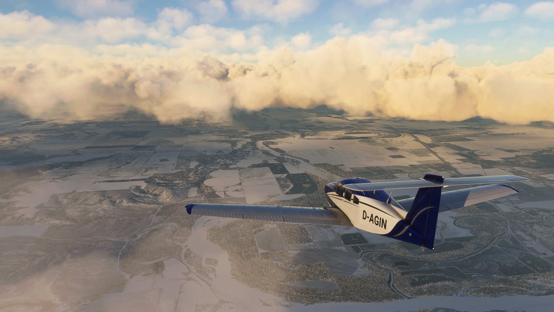
I had to hold the primer a tad longer, the second try started the plane. The runway was clear so I took off in my shiny new Turbo Arrow IV.

The Missouri (still a basin lake here) was frozen. Not sure if that is the case in real life but was in the sim. Looking nice.

Almost…

Yes, sunrise!

I climbed, and cruised along at around 6,000ft. But then I noticed the clouds at that altitude so I made use of the turbocharger and climbed to 10,000ft.
This is near Banks, ND. Down there is a place called Tobacco Garden Creek, a holiday resort. Right next to oil wells apparently…


I reached the end of the lake soon thereafter, from here on it is the gold old meandering Missouri again.
Also the border to Montana, which means a time zone change.

The Yellowstone river mound!
When Captain Lewis arrived at the mouth of the great river in late April 1805 (a few days after discovering that his watch was malfunctioning), he saw a "rich, delightful land, broken into valleys and meadows, and well supplied with wood and water. . . . "
The area is used agriculturally today, but most of the industry is oil drilling.

The cloud tops were dangerously close and I really didn’t want to fly through them, so I climbed to 16,000ft.
A nice side effect of that was the improved speed. 173 knots TAS!

Culbertson, you can see the train station’s tracks. Grain is loaded here. Back in 1805 the expedition killed a grizzly here.

Nice lighting for screenshots.

More clouds, and higher. I started to get a little concerned. But then I climbed. This plane has a decent service ceiling, so why not fly between the cloud layers? 18,000ft, and 176 knots TAS. Nice!


I quickly covered the rest of the flight, and while doing so practiced working with my instruments. I dialed in various VORs and flew a bit using them. Which ended up being a good idea because I almost missed the point where I had planned to descend.
A hole in the clouds was the perfect opportunity. Better now than later when there are no holes anymore. I had light icing during descend but nothing serios, and the ice mostly disappeared when I got down low. This is when the VOR turned out to be very useful, since I could not see the airport.

An iced runway. But my poor man’s VOR approach gave me enough time to adjust everythign perfectly and go straight in.

The landing went well, I landed early and slow, so that I would barely need any brakes in case of a slippery runway.

And parked. While taxiing the plane started to seriously freeze over. I realized that this could have gone wrong horribly. This plane isn’t made for winter.
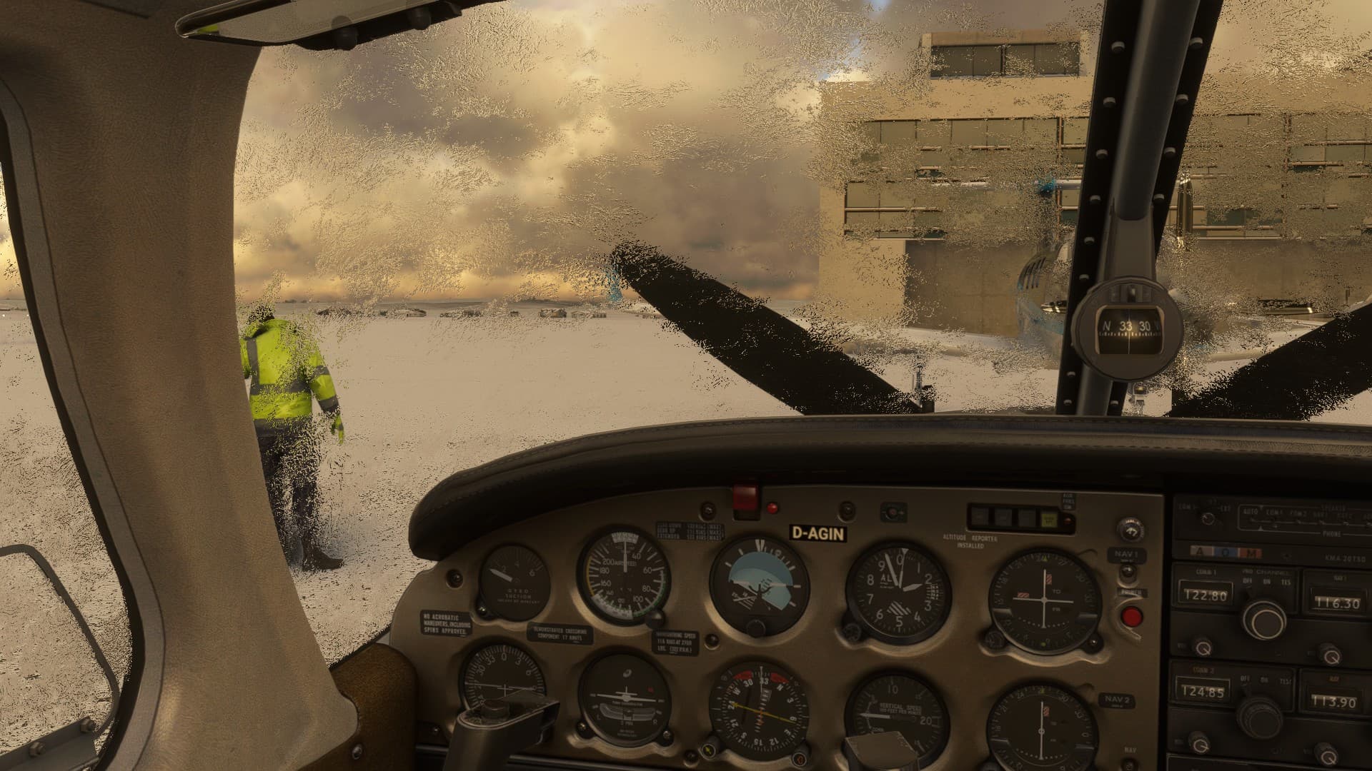
Yep, cold.

I will probably change the time of year for my next legs, because I think the area looks much more interesting when it isn’t covered by snow, and the L&C Expedition also camped during winter.
(They reached this point on May 5th 1805 btw.)


8 Likes
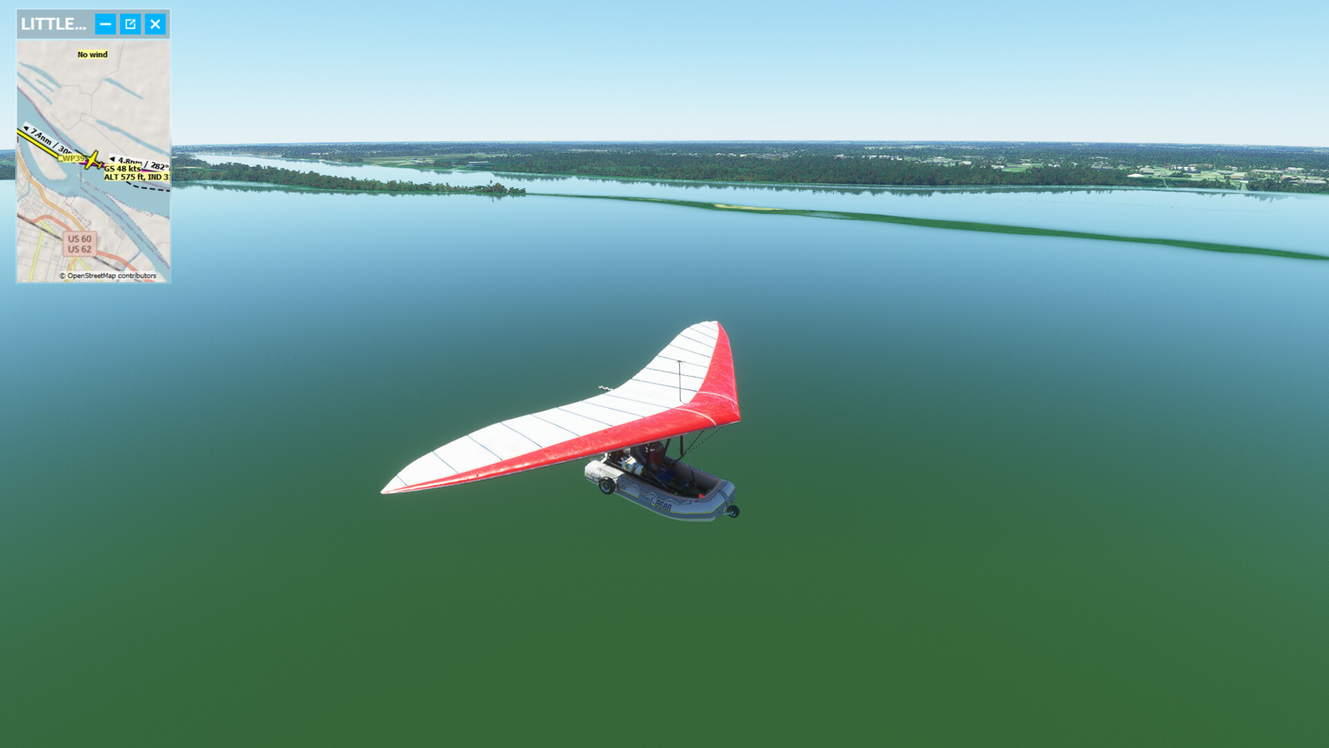
Thanks for reviving the trek! Having flown from Pittsburgh to St Louis with the flying Zodiac at 47 knots max, I’m thinking I will upgrade to something a little faster. I still want to be able to takeoff and land on the river…at least until I reach the point where the real expedition abandoned their boat to continue over the Rockies.
2 Likes
Isn’t there a Grumman Widgeon in the store? That might be a good choice (if it is any good).
The Widgeon is a definite possibility, and it is very good. ![]()
Excellent report and beautiful photos Aginor. She’s a looker as well, even in winter. Nice working navigating and remaining out of the ice.
1 Like
Nice job!
I actually did a little of this just for funsies, but I’m still back near St. louis!
1 Like